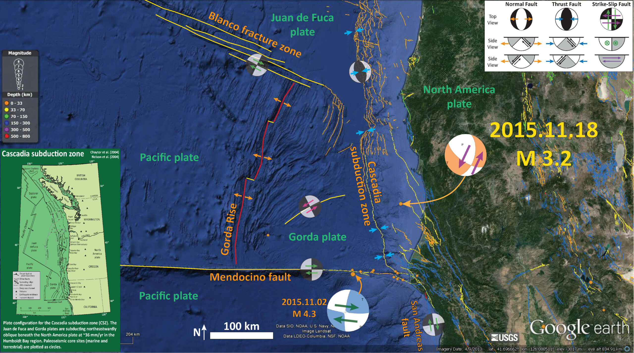
Tonight we had a small earthquake offshore of northern California, northwest of Trinidad. Here is the USGS website for this earthquake with a magnitude of 3.2. At first glance, this earthquake appears to be close to the location of the 1980 Trinidad earthquake.
I placed a moment tensor / focal mechanism legend in the upper right corner of the map. There is more material from the USGS web sites about moment tensors and focal mechanisms (the beach ball symbols). Both moment tensors and focal mechanisms are solutions to seismologic data that reveal two possible interpretations for fault orientation and sense of motion. One must use other information, like the regional tectonics, to interpret which of the two possibilities is more likely.
Due to the internal deformation in the Gorda plate, there are ubiquitous northeast striking left-lateral strike slip faults throughout. There have been many left lateral strike slip earthquakes within the Gorda plate (I list some of them below). Below is the map that I put together for this earthquake. I have placed the focal mechanism for the M = 3.2 earthquake and the moment tensor for a 2015.11.02 M 4.3 earthquake along the Mendocino fault system (a right lateral strike slip earthquake). Here is my earthquake report for the M = 4.3 earthquake. I interpret today’s 3.2 earthquake as a northeast striking left lateral strike slip earthquake. If the hypocentral depth were shallower, it could be interpreted as a northeast striking right lateral strike slip earthquake as the Dextral shear from the North-America/Pacific plate boundary motion does feed into this region. However, that motion would likely only be realized along faults in the upper plate.

I include a map of the Cascadia subduction zone. Here is that map as a single file (modified from Chaytor et al., 2004; Nelson et al., 2004). I present more information about the Cascadia subduction zone on this page, which I put together for the 315th anniversary of the last megathrust earthquake. Even more about Cascadia is posted here.

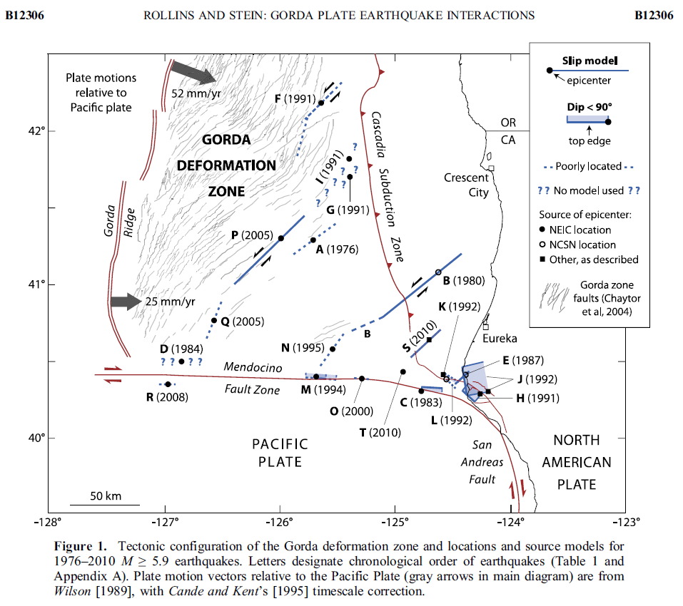
Here is a map from Rollins and Stein (2010) showing the faults and tectonics of the Gorda plate. The 2014.03.29 M 6.8 earthquake is probably somewhere in the right step of the dashed fault labeled “B.” Here is the earthquake report for the M 6.8 Gorda plate earthquake.
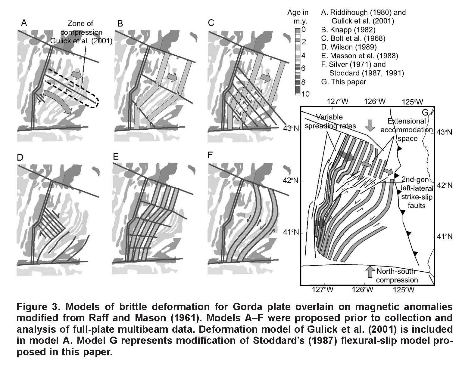
These are the models for tectonic deformation within the Gorda plate as presented by Jason Chaytor in 2004.
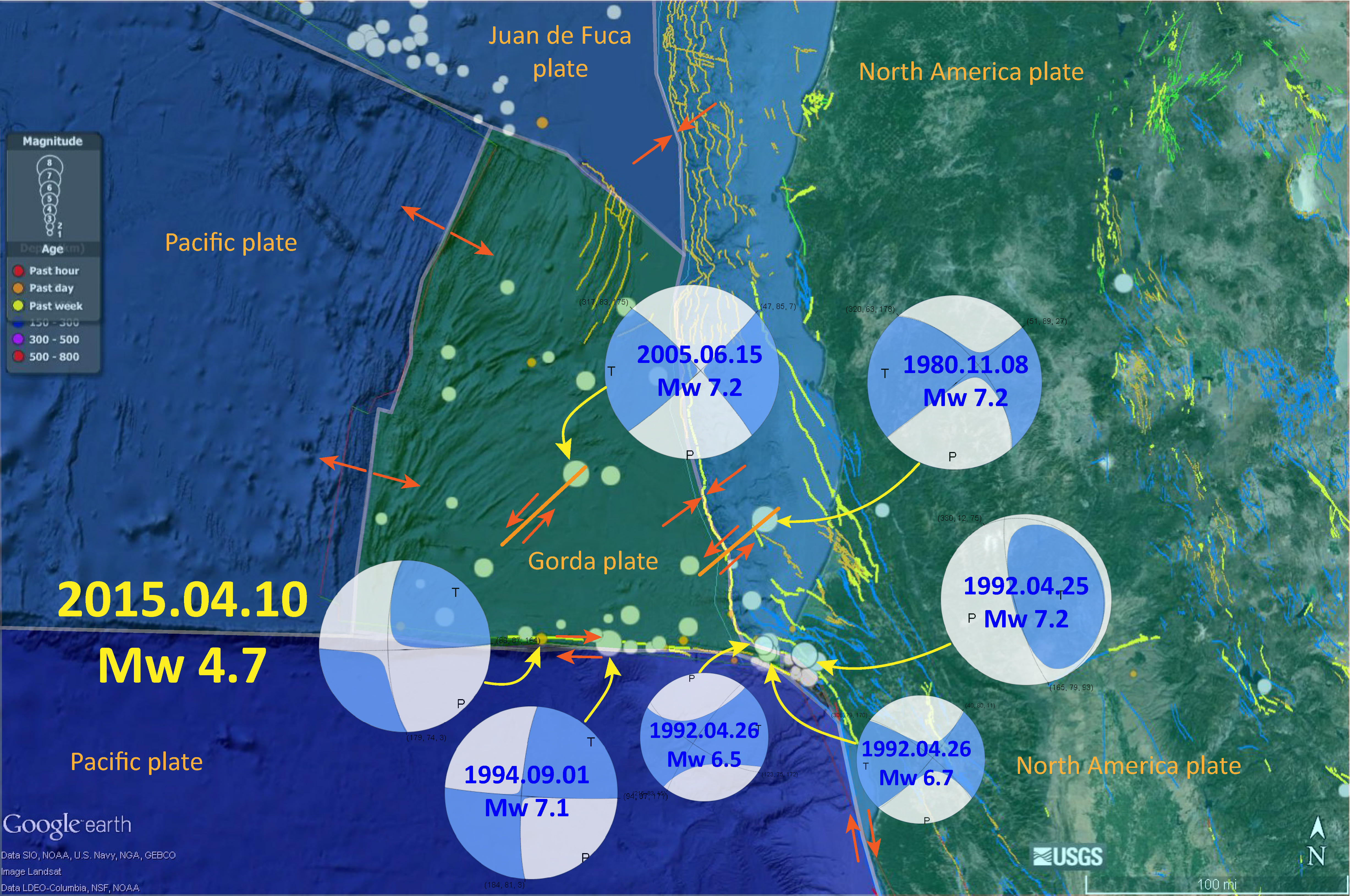
Here is a map that I put together that shows some of the historic earthquakes in the Mendocino triple junction region. Note the Gorda plate earthquakes, the Mendocino fault earthquakes, and the 1992 Petrolia earthquake, thought to be a small Cascadia subduction zone earthquake.
-
Here are some earthquake reports sorted by region and source of seismicity.
- 2014.03.09 M 6.8 Gorda plate p-1
- 2014.03.23 M 6.8 Gorda plate p-2
- 2014.03.13 M 5.2 Gorda Rise
- 2015.06.01 M 5.8 Blanco fracture zone p-1
- 2015.06.01 M 5.8 Blanco fracture zone p-2 (animations)
- 2015.01.28 M 5.7 Mendocino fault
Gorda plate
Blanco fracture zone
Mendocino fault
-
References:
- Chaytor, J.D., Goldfinger, C., Dziak, R.P., and Fox, C.G., 2004. Active deformation of the Gorda plate: Constraining deformation models with new geophysical data: Geology v. 32, p. 353-356.
- Nelson, A.R., Asquith, A.C., and Grant, W.C., 2004. Great Earthquakes and Tsunamis of the Past 2000 Years at the Salmon River Estuary, Central Oregon Coast, USA: Bulletin of the Seismological Society of America, Vol. 94, No. 4, pp. 1276–1292
- Rollins, J.C. and Stein, R.S., 2010. Coulomb stress interactions among M ≥ 5.9 earthquakes in the Gorda deformation zone and on the Mendocino Fault Zone, Cascadia subduction zone, and northern San Andreas Fault: Journal of Geophysical Research, v. 115, B12306, doi:10.1029/2009JB007117, 2010.
6 thoughts on “Earthquake Report: Humboldt County, CA!”