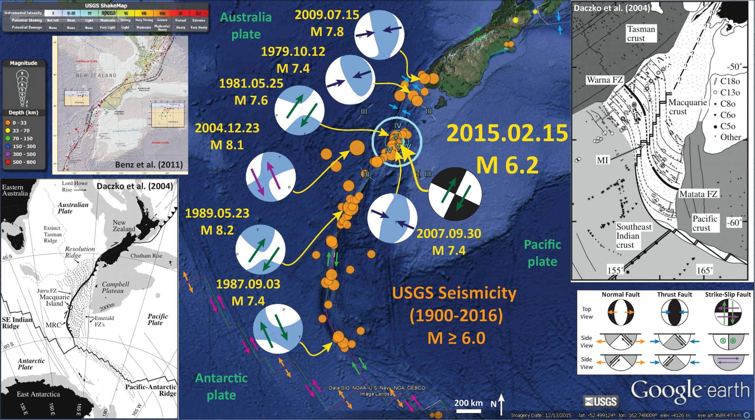
There was an earthquake along the plate boundary between the Australia plate to the west and the Pacific plate to the east, just south of New Zealand. Here is the USGS website for this M 6.2 earthquake. Yesterday on 2015/02/14 there was a widely felt earthquake with a smaller magnitude of M = 5.8 near Christchurch, on the northern end of the South Island, New Zealand. The M 5.8 was in the region that is still rebuilding following the Darfield-Canterbury earthquake series in 2010-2011. Here is my earthquake report for the M 5.8 earthquake.
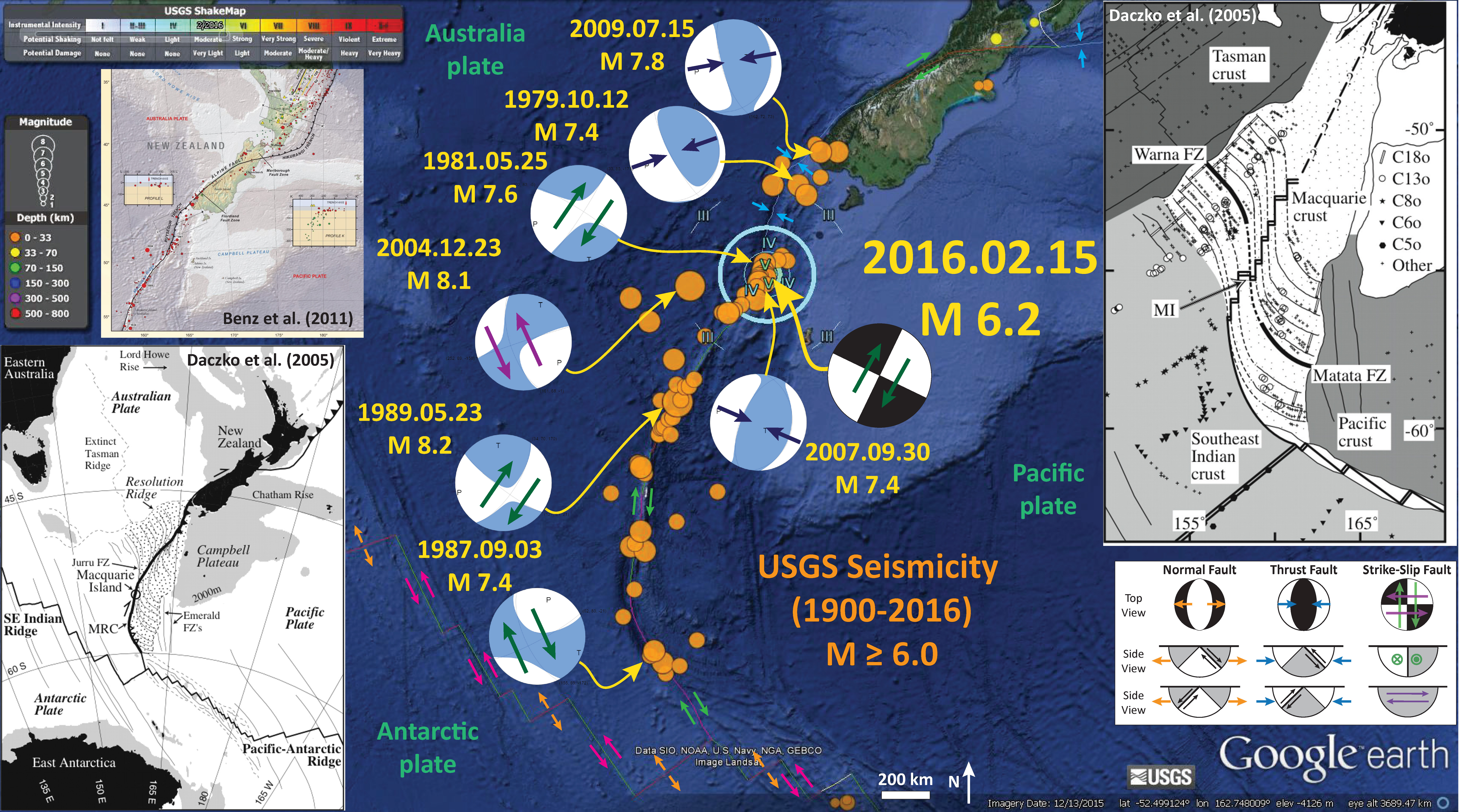
Below is a map that has the USGS seismicity from 1900-2016, for earthquakes of magnitude M ≥ 6.0, plotted as orange circles. Here is the USGS query that I used to make this map. I include the USGS Modified Mercalli Intensity contours, made using this USGS kml file in Google Earth. The MMI is a qualitative measure of shaking intensity. More on the MMI scale can be found here and here.
I placed the moment tensors, that exist (post ~1970), for each of the earthquakes larger than M = 7.0. I include relative motion vectors for each moment tensor, based upon my interpretation from the mapped faults along this plate boundary. There is not a USGS moment tensor for the M 6.2 earthquake, so I place a generic strike-slip focal mechanism and place it in the orientation that aligns with the strike of the plate boundary near the epicenter.
There is a north-northeast striking ridge east of the Puysegur Trench, that trends southwest and turns into the Macquarie Ridge. At this latitude, the Trench to the west is mapped as a subduction zone. The plate convergence is oblique to the plate boundary. The earthquakes that are rupturing in the region of today’s earthquake, that have USGS moment tensors, all have orientations aligned with this ridge. Some earthquakes have strike-slip moment tensors and some have compressional moment tensors. The compressional earthquakes may be along subduction zone faults or simply thrust/reverse faults in the crust. There are no deep earthquakes in this region, so the subduction zone may not be active or existent in this region. The strike-slip earthquakes may be rupturing along forearc sliver faults, possibly there due to strain partitioning from the oblique convergence.
There is a legend that shows how moment tensors can be interpreted. Moment tensors are graphical solutions of seismic data that show two possible fault plane solutions. One must use local tectonics, along with other data, to be able to interpret which of the two possible solutions is correct. The legend shows how these two solutions are oriented for each example (Normal/Extensional, Thrust/Compressional, and Strike-Slip/Shear). There is more about moment tensors and focal mechanisms at the USGS.
-
Here are two examples of earthquakes with similar moment tensors as today’s M 6.2 earthquake.
- 1981.05.25 M 7.6 (NE-SW strike-slip
- 1994.01.03 M 6.1 (NE-SW strike-slip
- 2007.09.30 M 6.6 (E-W compressional moment tensor)
- 2008.04.26 M 6.1 (E-W compressional moment tensor)
-
Inset maps in the above interpretation poster include the following:
- In the upper left corner I include the tectonic map from Benz et al. (2011) which shows how the East Vergent subduction zone at the Hikurangi Trench transforms (pun intended) via the Alpine fault (a right lateral strike-slip fault) to the West Vergent subduction zone at the Puysegur Trench. Fault vergence refers to the up-dip direction of the fault.
- In the lower left corner I include the tectonic interpretation map from Daczko et al. (2004). Daczko et al. (2005) use volcaniclastic rocks on Macquarie Island to interpret the tectonic history of this region as it relates to the evolution of a spreading ridge as it converts into a transform plate boundary. I include the text from their figure below as a blockquote.
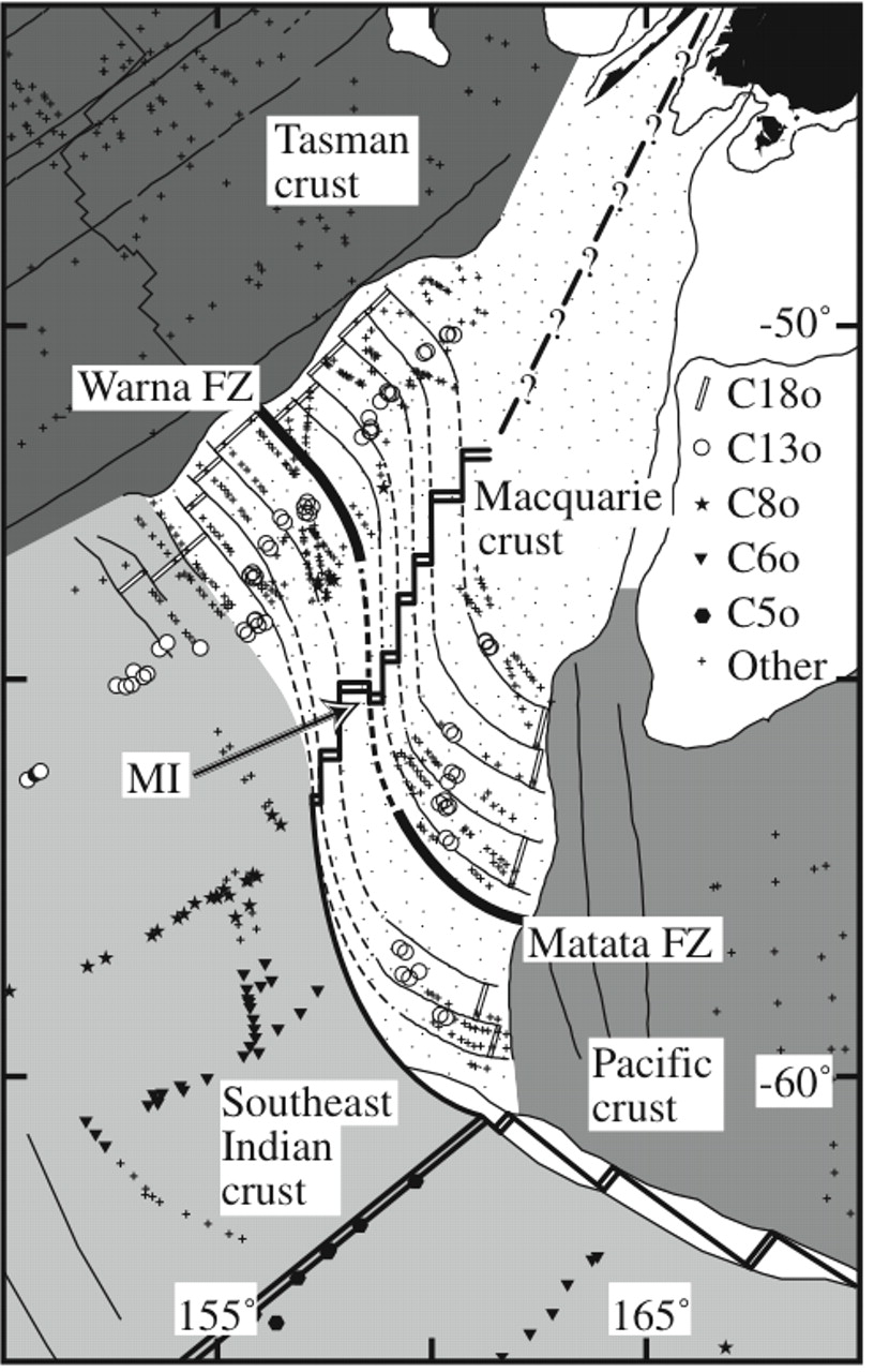
- In the upper right corner, I include the detailed tectonic map from Daczko et al. (2005) that shows how the spreading centers are now oritented in this region. Note that they query how the plate margin converts into the subduction zone to the north (question marks on their map). I include the text from their figure below as a blockquote.
Location map of Macquarie Island and the Australian-Pacific transform plate boundary south of New Zealand. The thickest black line shows the extent of the Macquarie Ridge Complex (MRC). Crust formed by Australian-Pacific spreading along the (now extinct) Macquarie spreading ridge between ca. 40 and ca. 10 Ma is stippled. Filled triangles along the plate boundary are subduction zones; open triangles (in the Hjort region) represent incipient subduction (Meckel, 2003). Light gray illustrates regions ≤2000 m below sea level. Present plate boundaries are shown as black lines. Past plate boundaries are shown as dashed black lines. Fracture zones (FZ) are shown as thin black lines. Azimuthal equidistant projection centered at 60°S, 180°E (after Daczko et al., 2003).
Plate tectonic reconstruction for Chron 5 old – C5o (10.9 Ma). Stippled crust formed at the Macquarie spreading ridge (now a transform boundary), light gray crust formed at the Southeast Indian spreading ridge (still active), medium gray crust formed at the Pacific-Antarctic spreading ridge (still active), and dark gray crust formed at the Tasman spreading ridge (extinct). Magnetic anomaly picks are represented by open circles (C13o, 33.3 Ma); filled stars (C8o, 26.6 Ma); filled triangles (C6o, 20.1 Ma); filled hexagons (C5o, 10.9 Ma); plus symbols (all other ages). Thin black lines are lineaments (continental margins and fracture zones) interpreted from the satellite-derived free-air gravity field (Sandwell and Smith, 1997). Medium black lines are the plate boundaries active at 10.9 Ma (double line = spreading ridge; single line = transform). Thickest black lines are the Warna (Australian plate) and Matata (Pacifi c plate) fracture zones (FZ). These two fracture zones are linked by the only left lateral transform fault within the Macquarie crust as shown by the offset of C18o picks (open rectangles). The dashed lines show our interpreted position of the fracture zones allowing for a minor component of deformation of the fracture zones during Neogene and Quaternary transpression along the Australian-Pacific plate boundary. The arrow points to the inside corner of the ridge-transform intersection where we interpret the crust of Macquarie Island (MI) most likely formed.
-
I also put together an animation that shows the seismicity from 1900-2016 for earthquakes with magnitudes M ≥ 4.0, plotted as orange circles.
- Here is a map that shows all these earthquakes. This is the USGS query that I used to prepare this map.
- Here are a couple links to the file embedded below. Here is a wmv version (6 MB wmv). Here is the mp4 version (78 MB mp4).
-
Something else of note is the M 8.2 earthquake, one of the largest strike-slip earthquakes ever recorded. This earthquake happened on 1989.05.23. Interestingly, this earthquake has some shared characteristics with the 2012 earthquake series offshore of Sumatra in 2012. More on this later as I need to get ready for X-Files. Here are a couple report pages for the 2012 earthquakes.
- 2012.04.11 M 8.6
- 2012.04.11 M 8.6 (update #1)
-
References:
- Benz, H.M., Herman, Matthew, Tarr, A.C., Furlong, K.P., Hayes, G.P., Villaseñor, Antonio, Dart, R.L., and Rhea, Susan, 2011. Seismicity of the Earth 1900–2010 eastern margin of the Australia plate: U.S. Geological Survey Open-File Report 2010–1083-I, scale 1:8,000,000. http://pubs.usgs.gov/of/2010/1083/i/
- Daczko, N.R., Mosher, S., Coffin, M.F., and Meckel, T. A., 2005. Tectonic implications of fault-scarp-derived volcaniclastic deposits on Macquarie Island; sedimentation at a fossil ridge-transform intersection? Geological Society of America Bulletin, v. 117, p. 18-31.


.jpg)


2 thoughts on “Earthquake Report: Macquarie – New Zealand”