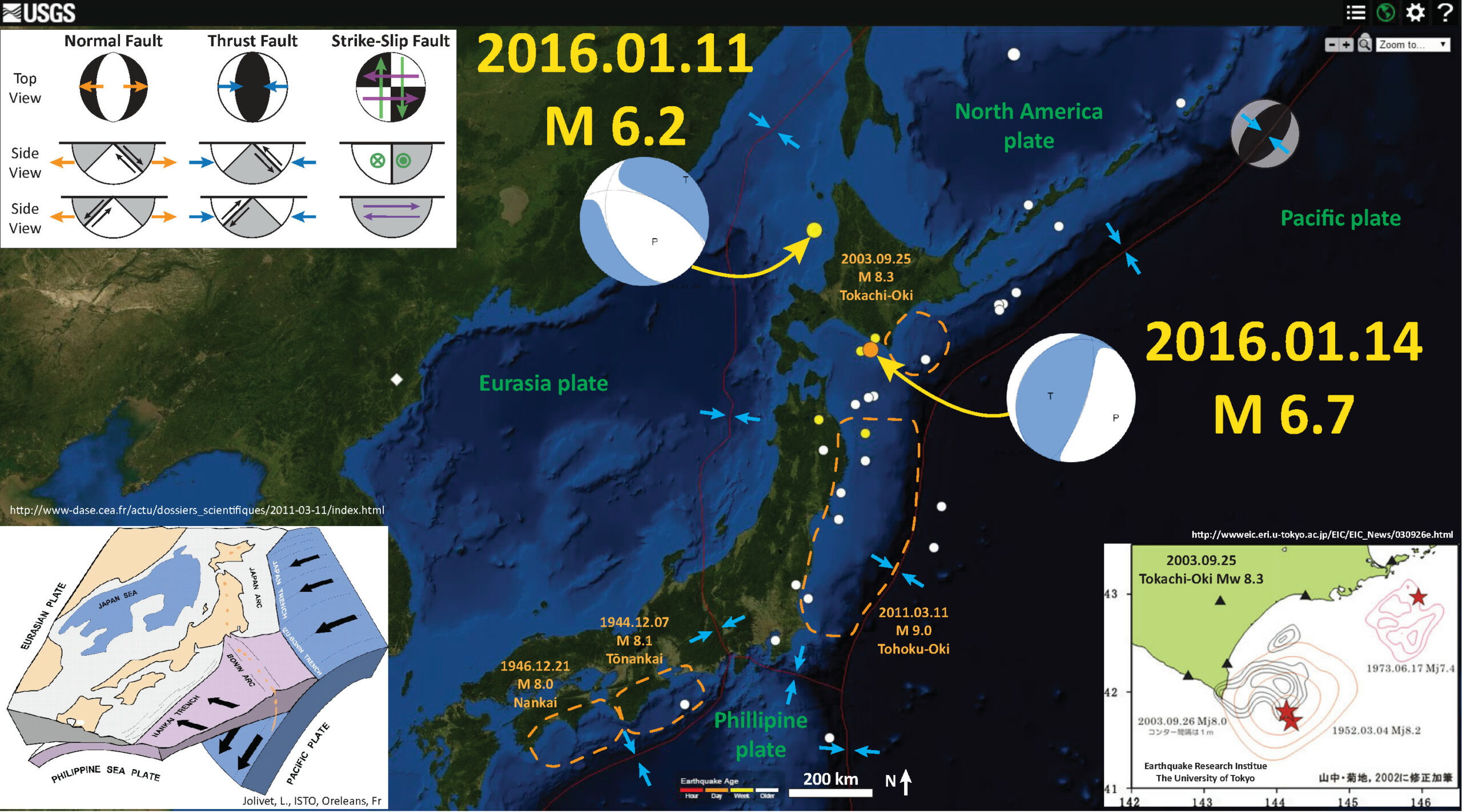
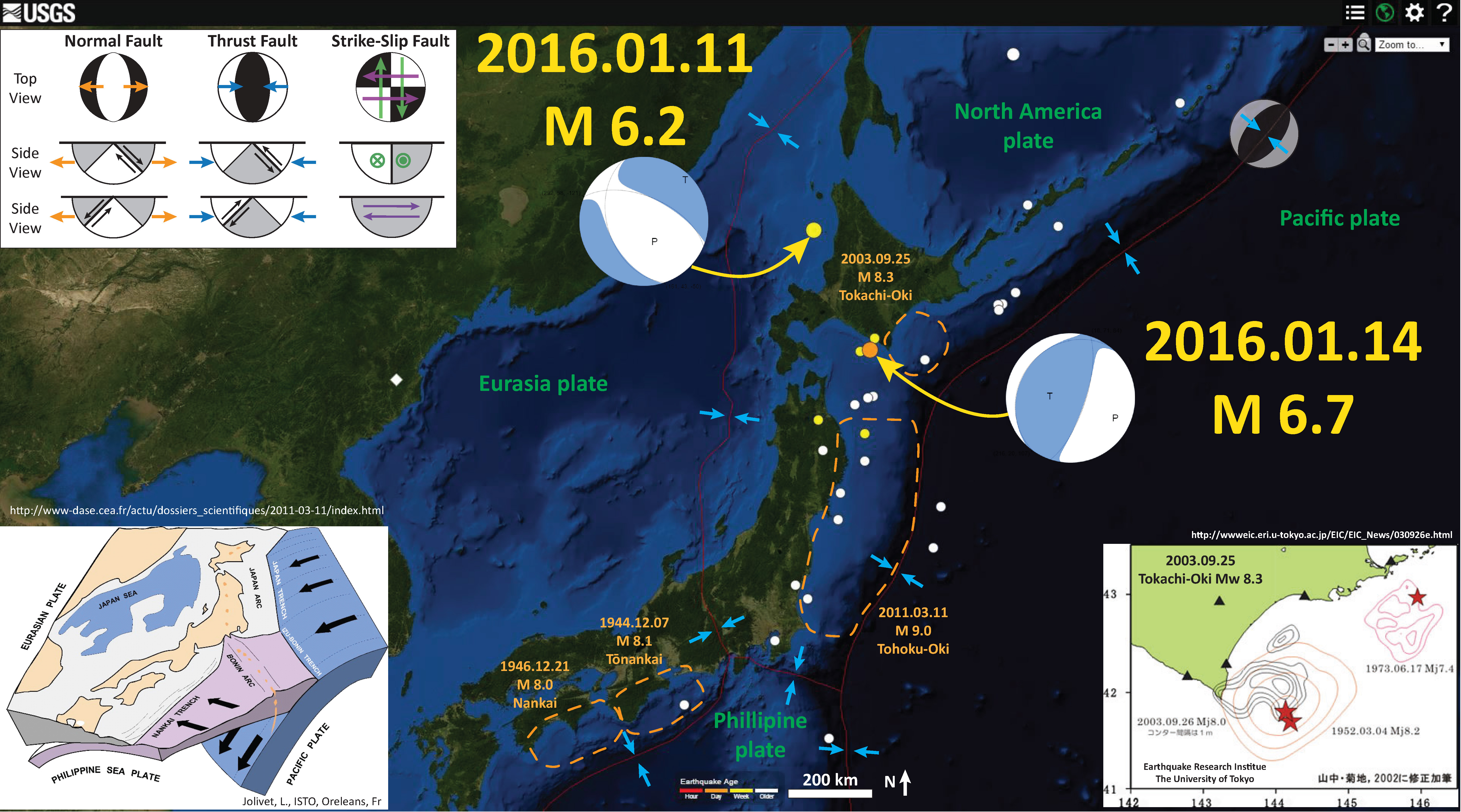
Today we had an earthquake offshore of Hokkaido. This earthquake occurred near the 2003 Tokachi_oki earthquake, a M 8.3 earthquake that is responsible for one of the only direct observations of a seismogenic turbidity current.
Here is my interpretive map. I plot the USGS earthquake epicenters from the past 30 days. Here is the USGS query that I used to make the base map. Here is the USGS web site for this M 6.7 earthquake. A few days ago there was also a very deep earthquake, with a magnitude of M 6.0, to the northwest. Here is the USGS website for that earthquake. The M 6.7 earthquake hypocenter plots where the subducting slab is mapped by Hayes et a. (2012). The M 6.2 plots deeper than the fault, which makes sense as it is extensional and probably not along the subduction zone.
I include dashed outlines for some of the subduction zone earthquakes for Japan. This is by no means an exhaustive survey of historic seismicity, just some of the notable ones that are at the top of my head. I include the 1944 M 8.1 Tonankai and 1946 M 8.0 Nankai earthquakes, the 2003 M 8.3 Tokachi-Oki earthquake, and the 2011 M 9.0 Tohoku-Oki earthquake.
I also include a schematic illustration from L. Jolivet, ISTO from here that shows how the Pacific and Philippine plates are subducting beneath the North America and Eurasia plates.
I include a slip distribution map for the 2003 Tokachi-Oki earthquake from the Earthquake Research Institute at The University of Tokyo here. They also plot the slip distributions from the 1952 M 8.2 Tokachi-Oki and 1973 M 7.4 Hokkaido earthquakes.
There is a legend that shows how moment tensors can be interpreted. Moment tensors are graphical solutions of seismic data that show two possible fault plane solutions. One must use local tectonics, along with other data, to be able to interpret which of the two possible solutions is correct. The legend shows how these two solutions are oriented for each example (Normal/Extensional, Thrust/Compressional, and Strike-Slip/Shear). There is more about moment tensors and focal mechanisms at the USGS.
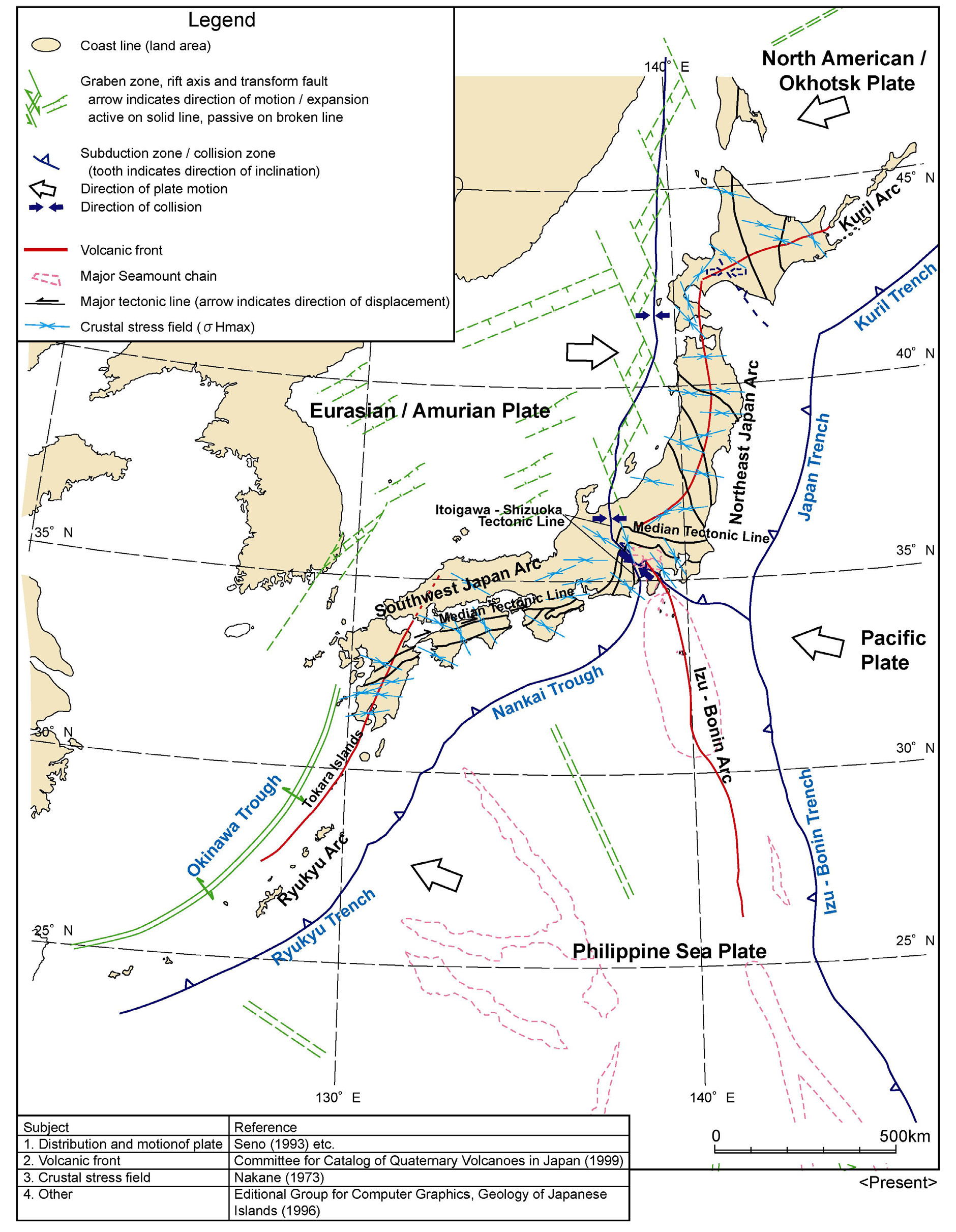
This map shows the current tectonic configuration of this region, along with some inherited features from the tectonic past (e.g. green lines). This is from NUMO’s report: “Evaluating Site Suitability for a HLW Repository (Scientific Background and Practical Application of NUMO’s Siting Factors), NUMO-TR-04-04.”
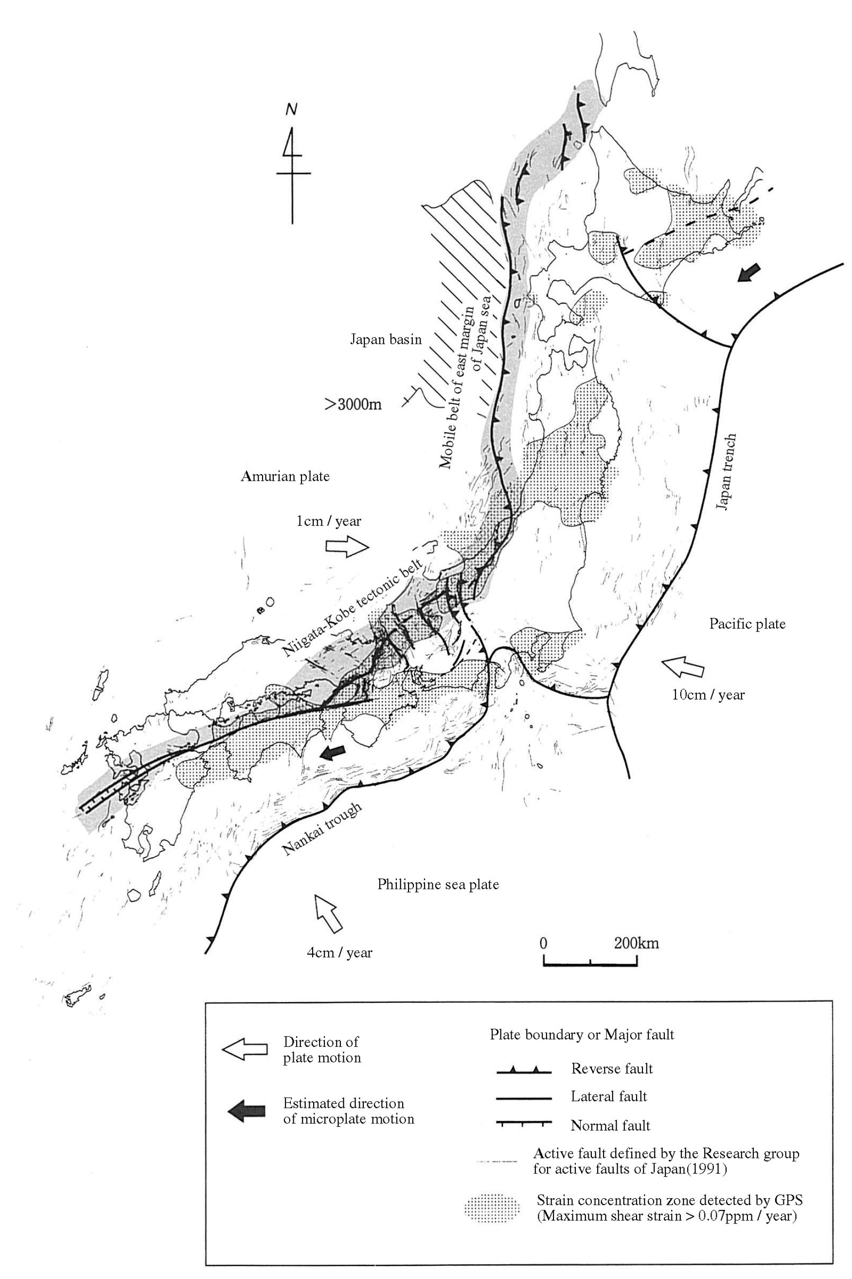
Also from the NUMO report, this shows the Niigata-Kobe fold and thrust belt. In addition, this map shows a northwest striking convergent plate boundary along the southeastern boundary of Hokkaido. However, it cannot explain the interesting orientation of the M 6.2 deep (240 km) earthquake.
I have several earthquake reports for Japan and this region.
Here is a brief report on the 2011 M 9.0 Tohoku-Oki earthquake. Below is the USGS poster for this earthquake.

There are probably a 100 or more slip models for this earthquake, which reminds us that these slip models are non unique. We need to recognize that we do not really know how much any fault slips during an earthquake. We can only take the observations and make estimates. There continue to be aftershocks, which help define the fault that ruptured in 2011. In Feb. 2015 there was a series of M 6.0-6.7 earthquakes along the north east boundary of the 2011 slip region. They happened in a region of low slip. Here is my earthquake report for these earthquakes. Below is a map that shows these aftershocks, along with a slip model from Ammon et al., 2011.
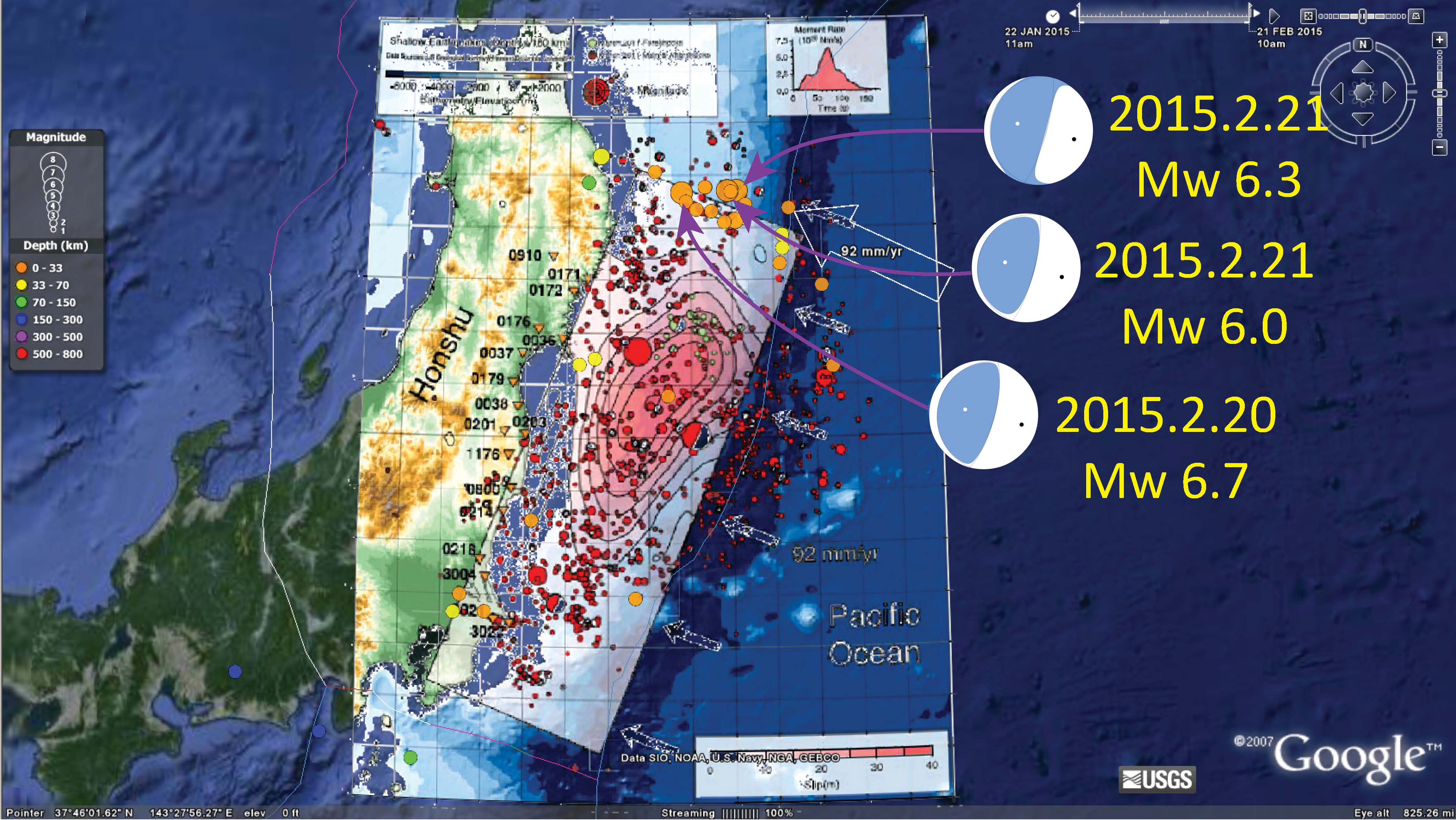
I present several of the better slip models for the M 9.0 Tohoku-Oki earthquake on this page. Below is a figure from Toda et al. (2011) that shows focal mechanisms for many aftershocks as they relate to their slip model. Please check out the page that shows some other slip models. There is more information there.
There was an interesting triggered earthquake (though several years too late, so not really triggered, but related possibly) on 2013.10.25. This M 7.1 earthquake happened in the updip direction from the M 9.0 earthquake. Here is my earthquake report for this earthquake. On this page I discuss aftershocks and how they fit into the big picture (what is an aftershock, how long to they happen, etc.).
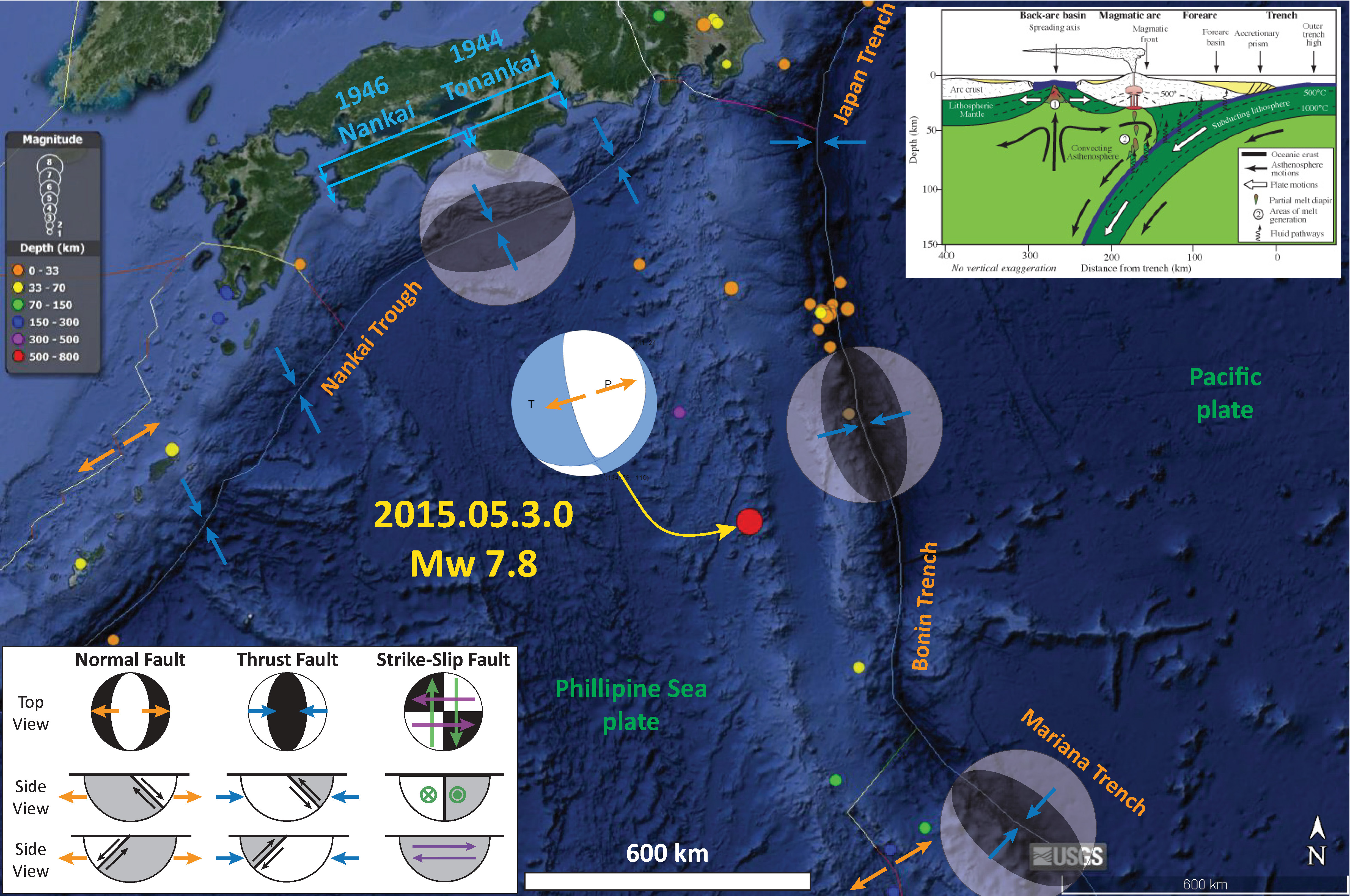
To the southeast of Japan is the Bonin trench and Mariana trench. This region has been quite active lately too! On 2015.05.30 there was a series of deep focus earthquakes, along with some shallower triggered earthquakes (some might call them aftershocks, but they are clearly not aftershocks). Here is my earthquake report for the deep M 6.8 earthquake. Below is my interpretive map.
Earthquake Report: Hokkaido!
