Extensional earthquake in Pacific plate “up-dip” of the 11 March 2011 Tohoku-Oki earthquake.
Here is the USGS page.
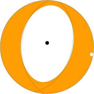
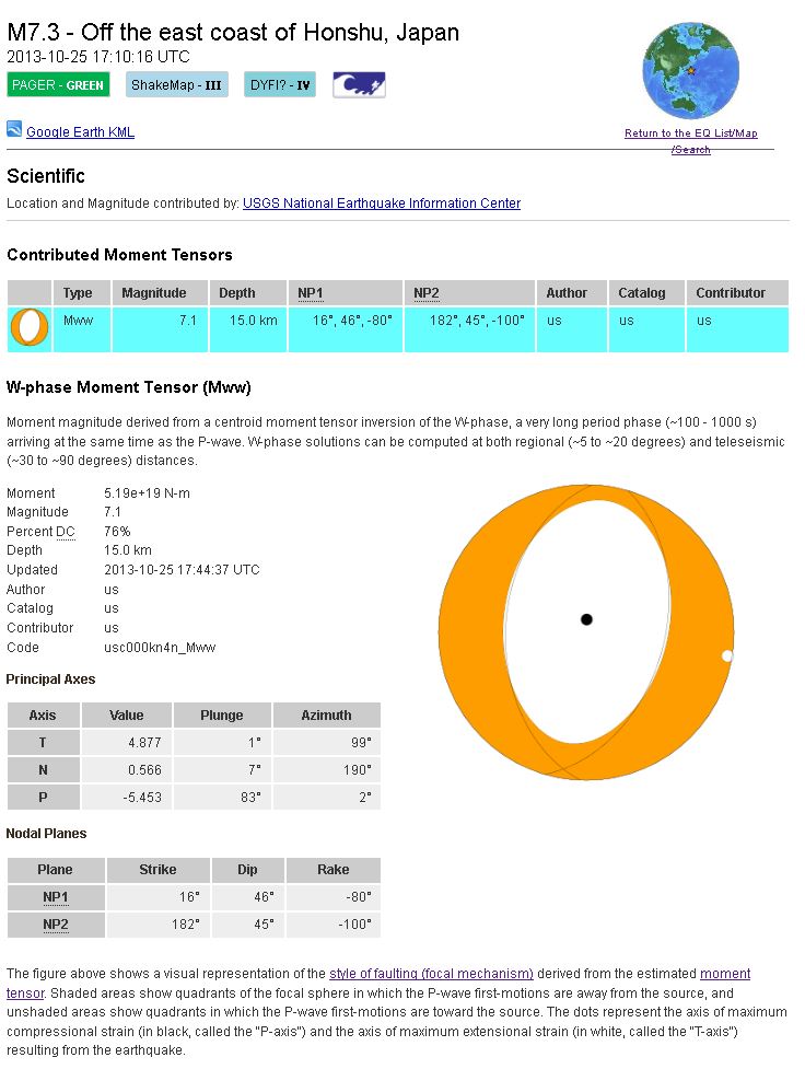
Here is the moment tensor:
Here is a map of the epicenter and Japan:
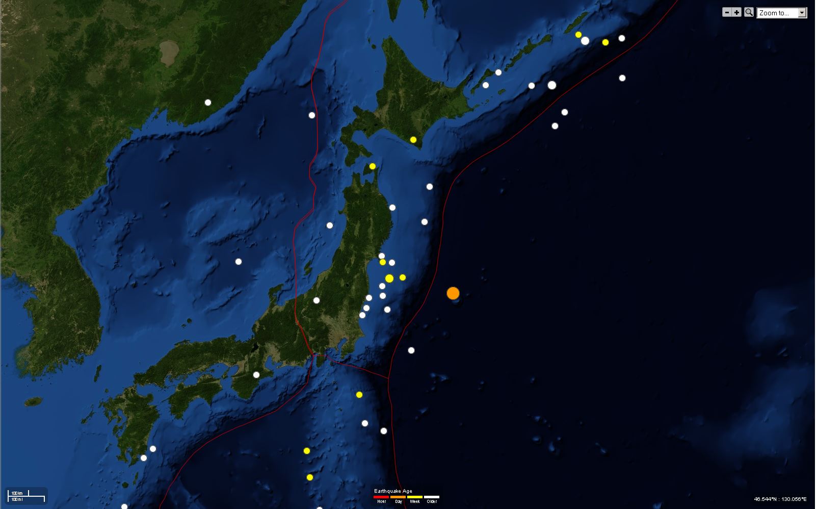
Here is a map of the epicenter and Japan with historic seismicity (dominated by 2011):

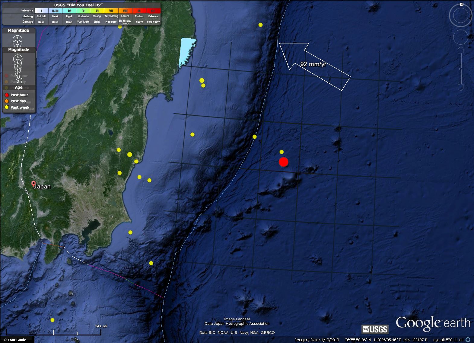
Here is a zoomed in map of the epicenter and Japan with the “did you feel it” overlay on land:
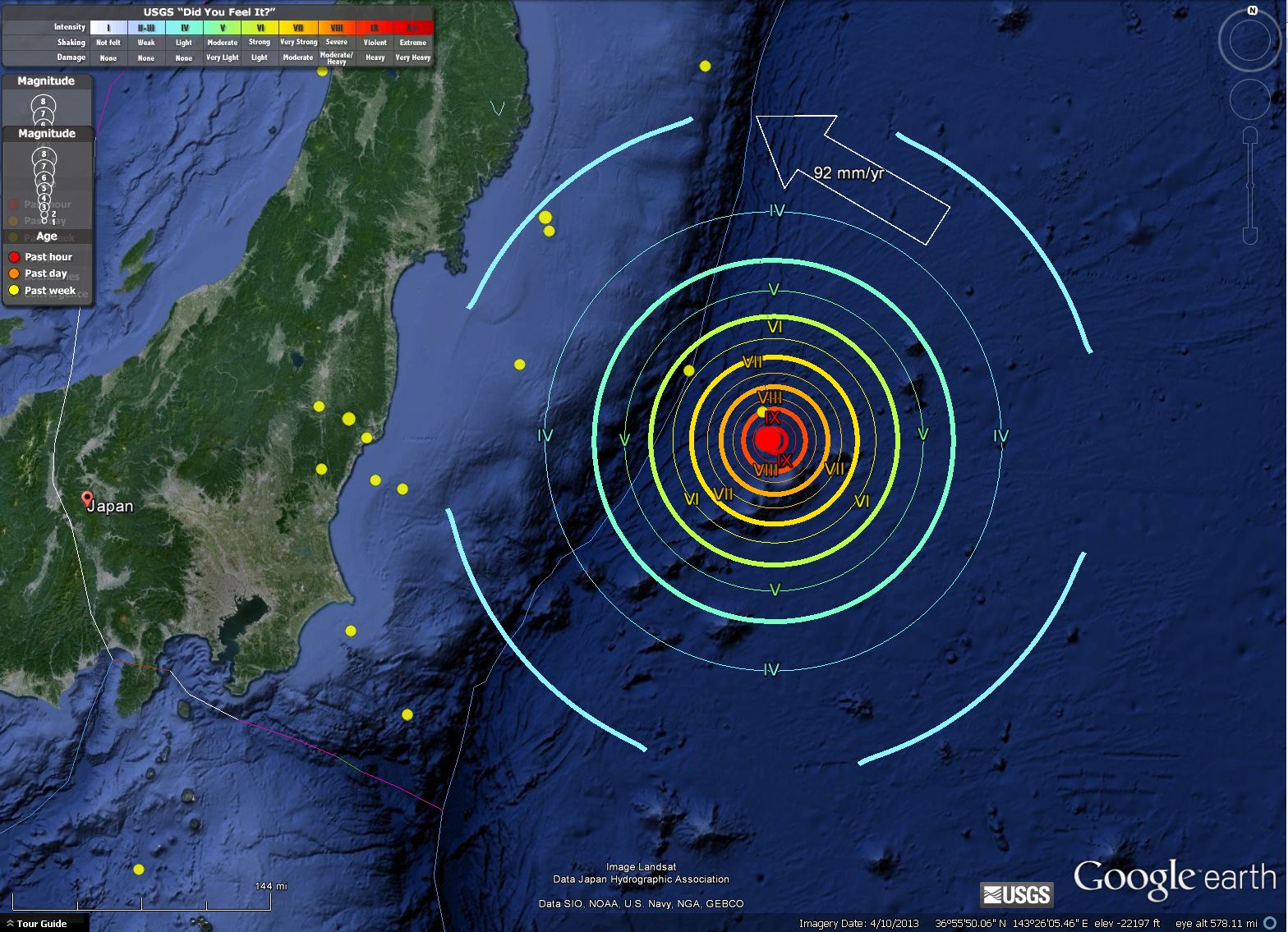
Here is a zoomed in map of the epicenter and Japan with the Intensity Contours plotted:
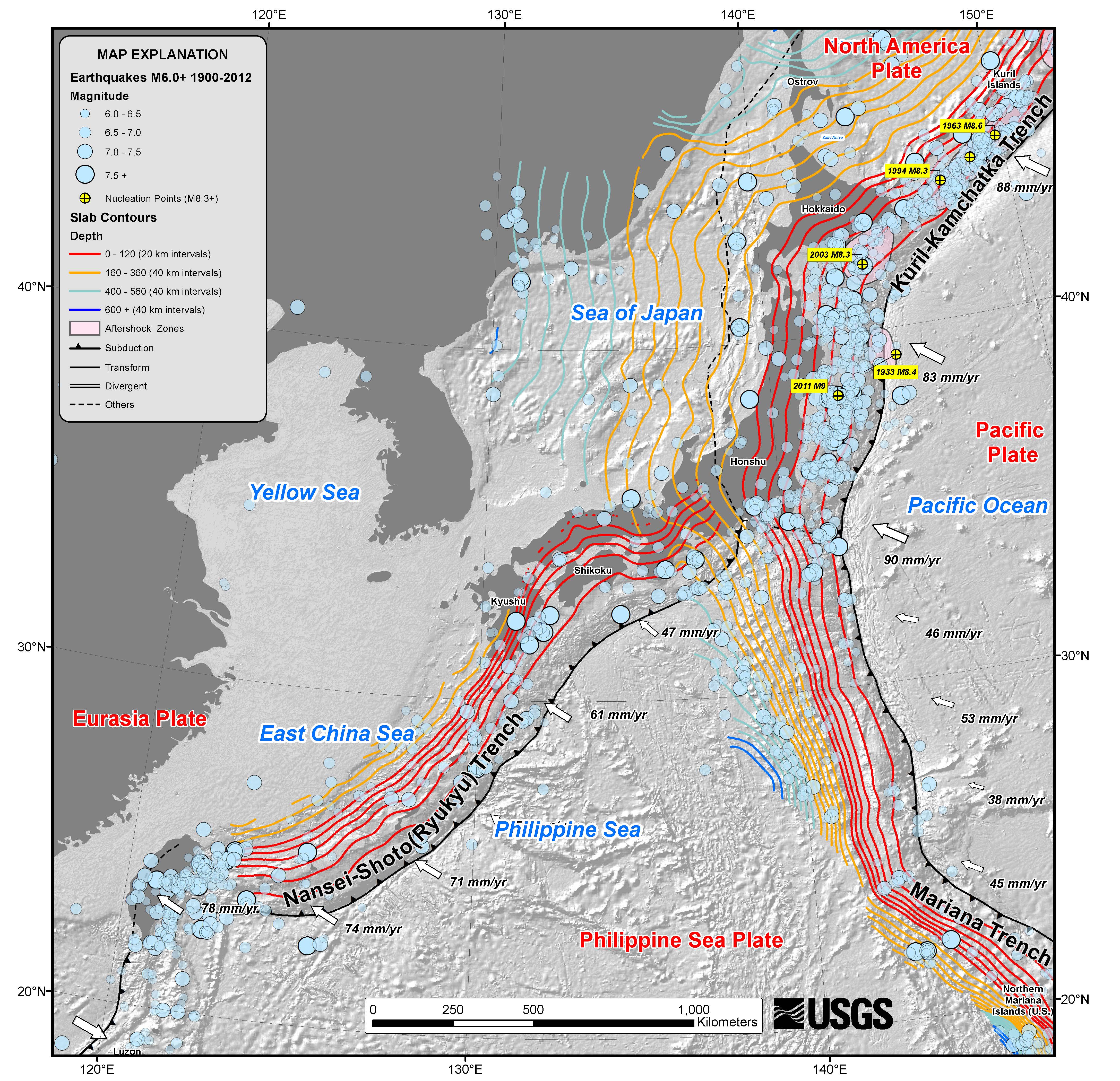
Here is the usgs map for the region:
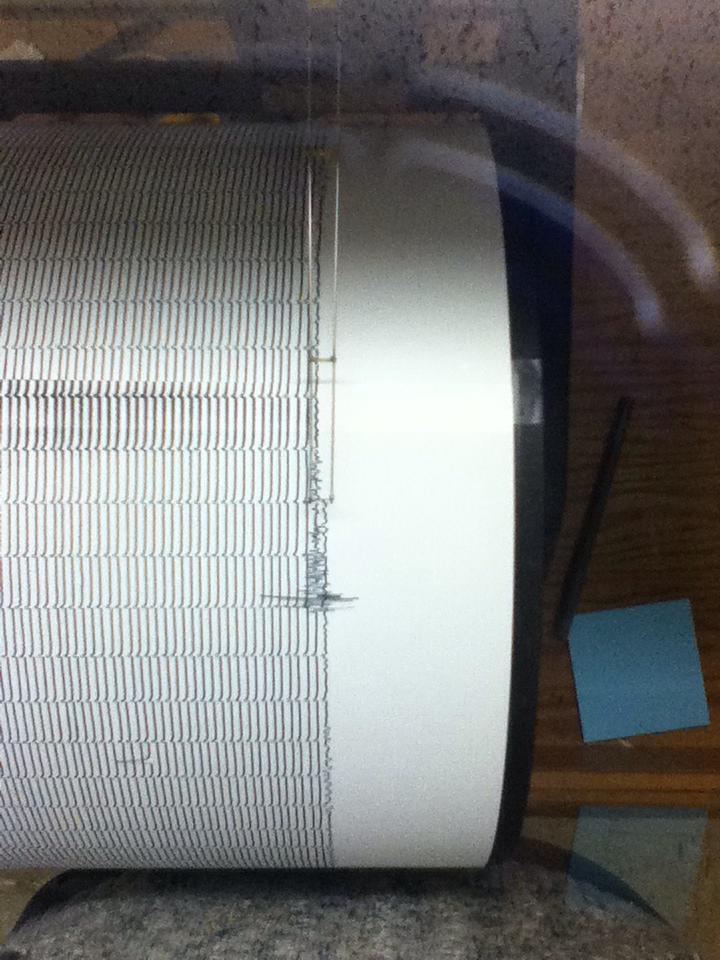
Here is what it looks like on HSU’s Benioff (photo credit to Amanda Admire):
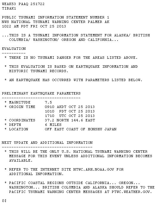
Here is the national tsunami warning center information bulletin:
Here is the Japan Meteorological Society Page
All warnings and advisories have been lifted It appears that small (~30cm) waves were recorded along the coast in Japan.
Here is the moment tensor page:
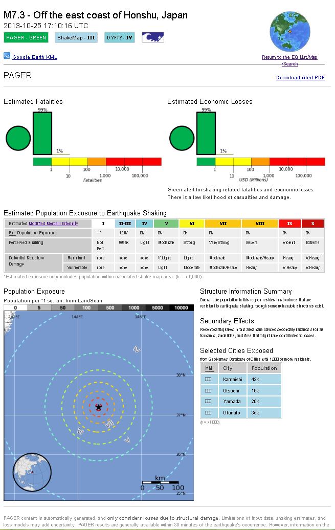
Here is the PAGER page:
1 thought on “M 7.1 offshore Honshu Japan”