While I was away from the office, we had a M 6.7 earthquake near the Solomon Islands. Here is a link to the USGS website for the M = 6.7 and M = 6.0 earthquakes.
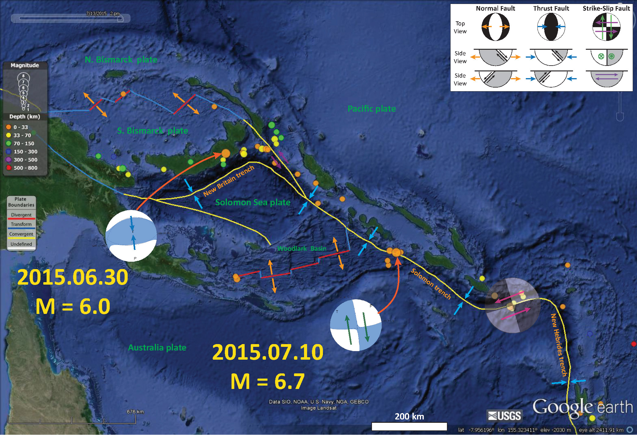
While the epicenter plots near the Solomon trench (a subduction zone), the hypocentral depth does not permit an interpretation that would place this earthquake on the subduction zone. The Woodlark Basin is a region that is extending north-south from oceanic spreading ridges. These spreading ridges are connected by transform plate boundary strike-slip fault systems. The M = 6.7 earthquake appears to have ruptured one of these strike-slip faults.
Here is a map (North is “up” ) that I just put together showing the epicenter from the M 6.7 earthquake, along with its moment tensor. I placed a moment tensor / focal mechanism legend in the upper right corner of the map. There is more material from the USGS web sites about moment tensors and focal mechanisms (the beach ball symbols). There was also a M = 6.0 reverse/thrust earthquake (compressional) in New Britain, along the New Britain trench on 2015.06.30. This entire region is fairly tectonically active, with numerous large magnitude earthquakes in the past two years. I summarize some of these earthquakes below. Both moment tensors and focal mechanisms are solutions to seismologic data that reveal two possible interpretations for fault orientation and sense of motion. One must use other information, like the regional tectonics, to interpret which of the two possibilities is more likely. Based on the orientation of the transform boundaries associated with the Woodlark Basin spreading ridges, I interpret this to be a north striking right lateral earthquake.

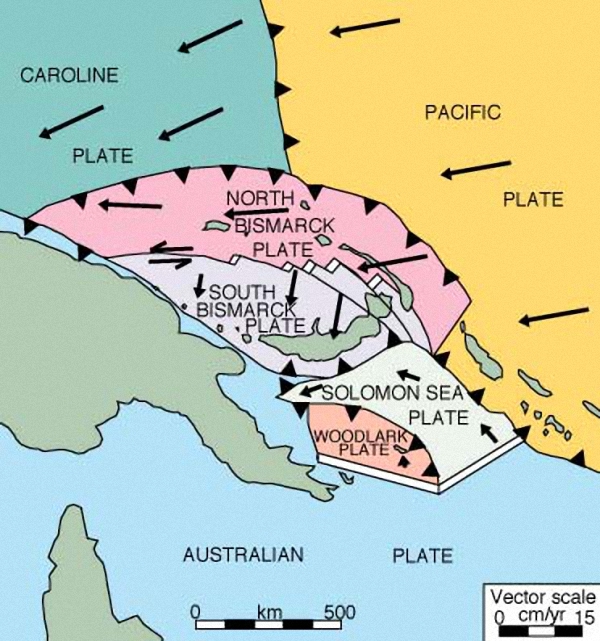
Here is a generalized tectonic map of this region (credit IRIS).
The earthquake actually generated a very small short period tsunami. Here is a plot from NOAA. Note that the amplitude of the sea level variation shows a marked increase half way through the time series.

Here is an animation showing the earthquakes from the last 30 days. Here is the link if you want to download the video.
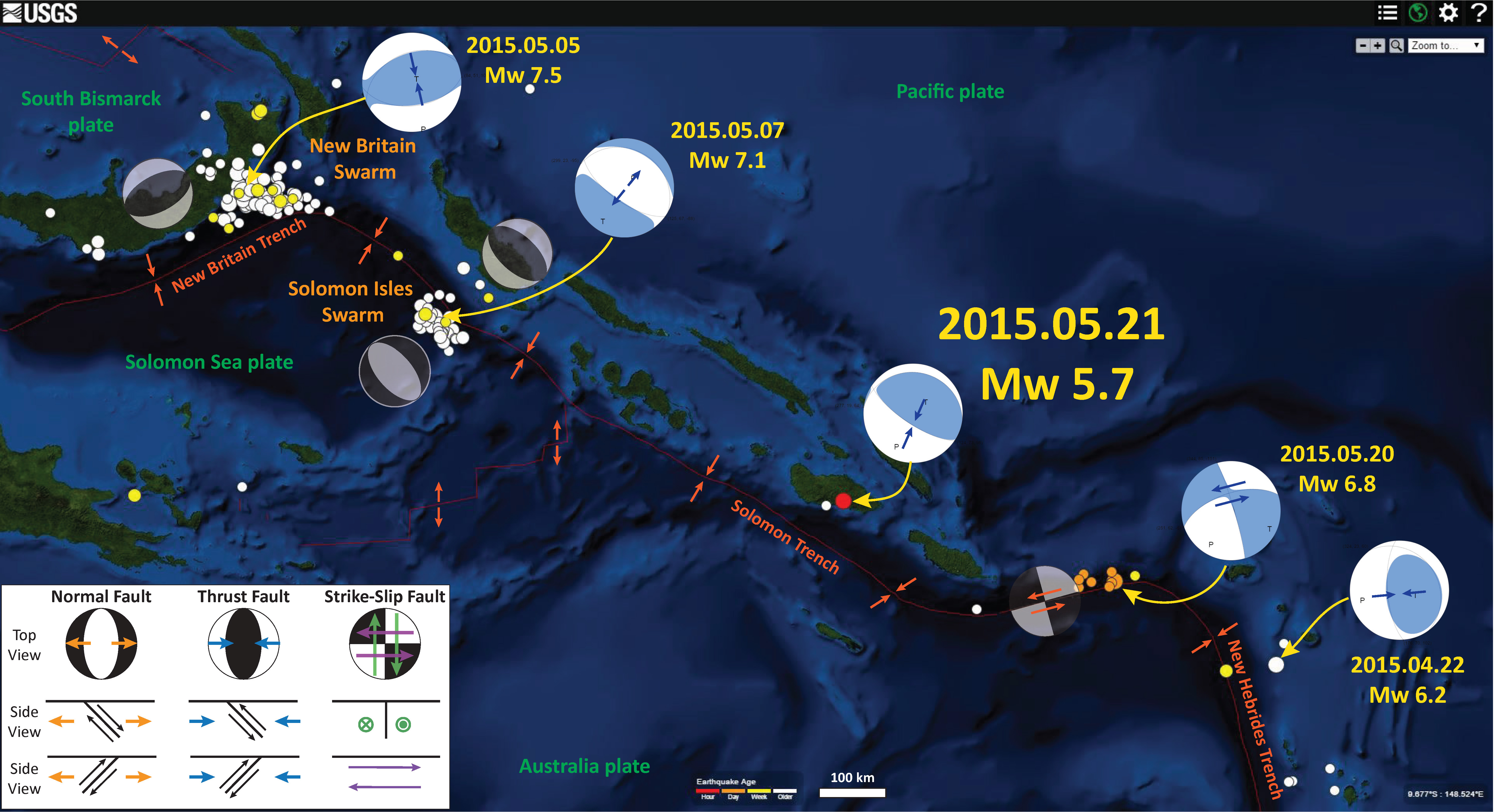
In May of 2015, there was a thrust/reverse fault earthquake to the east of this M 6.7 earthquake. Here is a summary map that I put together with that, along with some other recent earthquakes plotted. The page for the May earthquake is here.
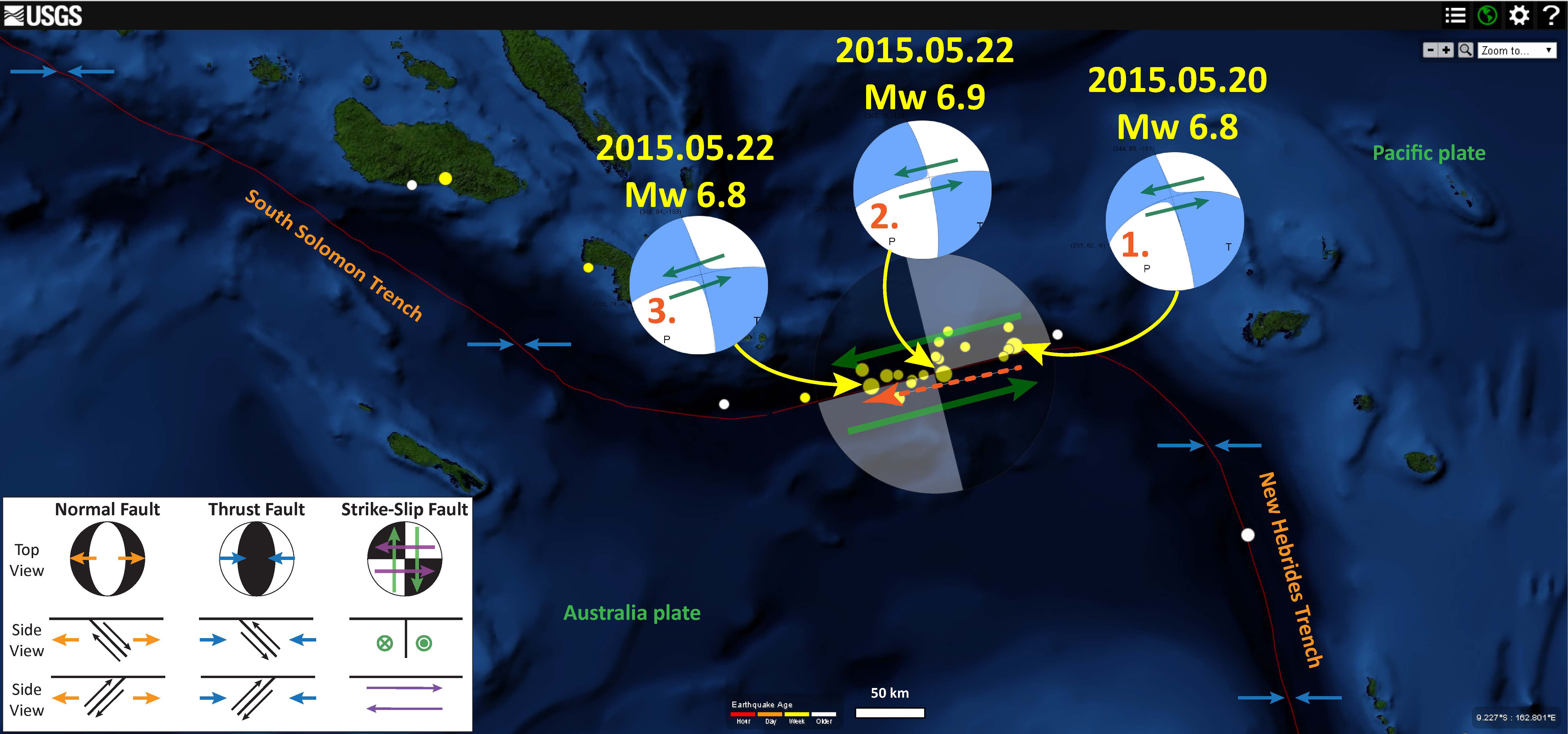
There were also three M = 6.8-6.9 earthquakes further to the south along a transform plate boundary (mapped as a subduction zone by the USGS). Here is a map that shows the location of this May earthquake swarm.
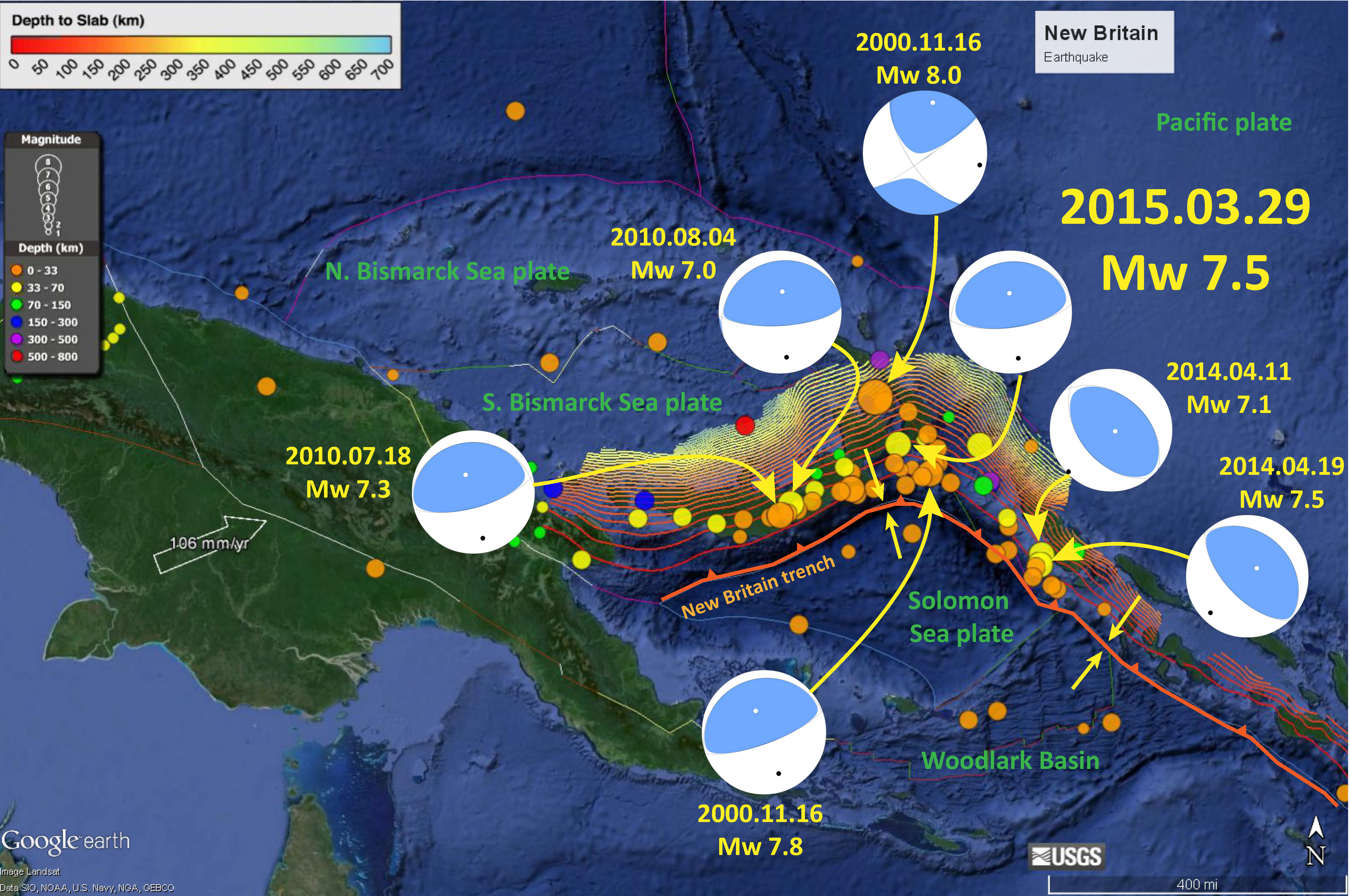
Finally, further to the North, along the New Britain trench, we have had a series of earthquakes since 2000. I plot these in this map and discuss them a little further on this page.
I put together this map to show how the New Britain and Solomon trenches meet. Earthquakes along the New Britain trench have principal stress aligned perpendicular to the New Britain trench and earthquakes along the Solomon trench have principal stresses aligned perpendicular to the Solomon trench due to strain partitioning in the upper plate. I provide more links and explanations about these earthquakes on this page.

4 thoughts on “Earthquake in the Solomons!”