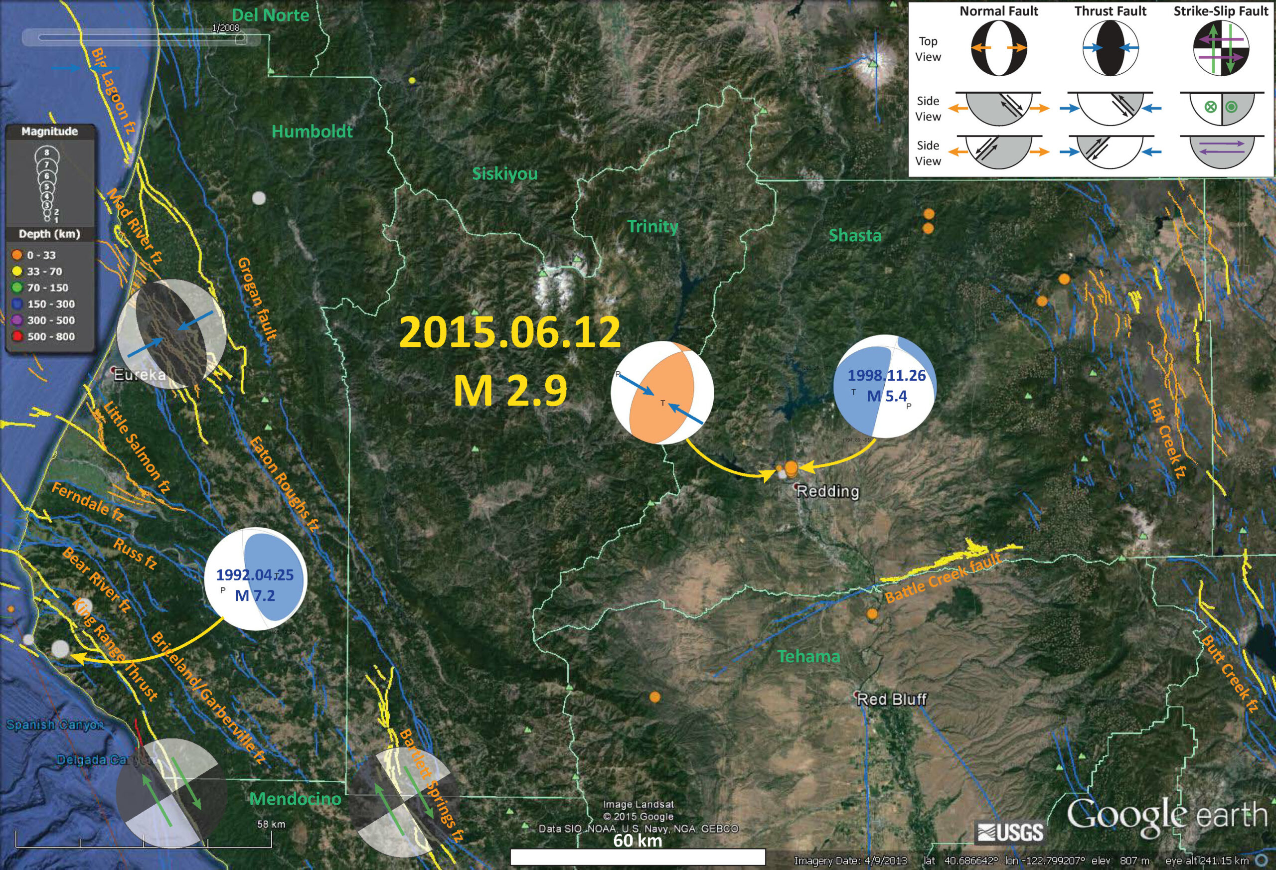
There have not been many earthquakes since 1945 in this region. Below is a map that shows the largest earthquake as a M = 5.4 earthquake from 1998.11.26. Here is the USGS query that I used to create this map. This is the first page that I posted about the M 2.9 earthquake. I also threw in the 1992 Petrolia earthquake in for good measure. Faults and fault zones are labeled. There are also some ghosted moment tensors that show the general relative plate motion across some fault zones.

In 1998, there was a M 4.5 earthquake that was followed in November by three earthquakes.
Redding Earthquakes: 1945-2015
I recall that some of the Redding/Shasta earthquakes in the late 90s were attributed to reservoir loading. I’m not sure how speculative that was. So, perhaps the draw-down associated with the drought is causing seismicity due to ‘unloading’ . How’s that for baseless speculation?
brilliant
We should expect normal faulting for reservoir unloading though. Unless an underground reservoir is being depleted, where the contraction of the reservoir rock puts a compressional stress on the rocks directly above and below the reservoir.
good point.. interesting that the 1998 “dam loading” eq has an extensional mechanism. perhaps that was not due to loading…
Maybe it wouldn’t. I can’t think right now…
a little dutch’l do ya..