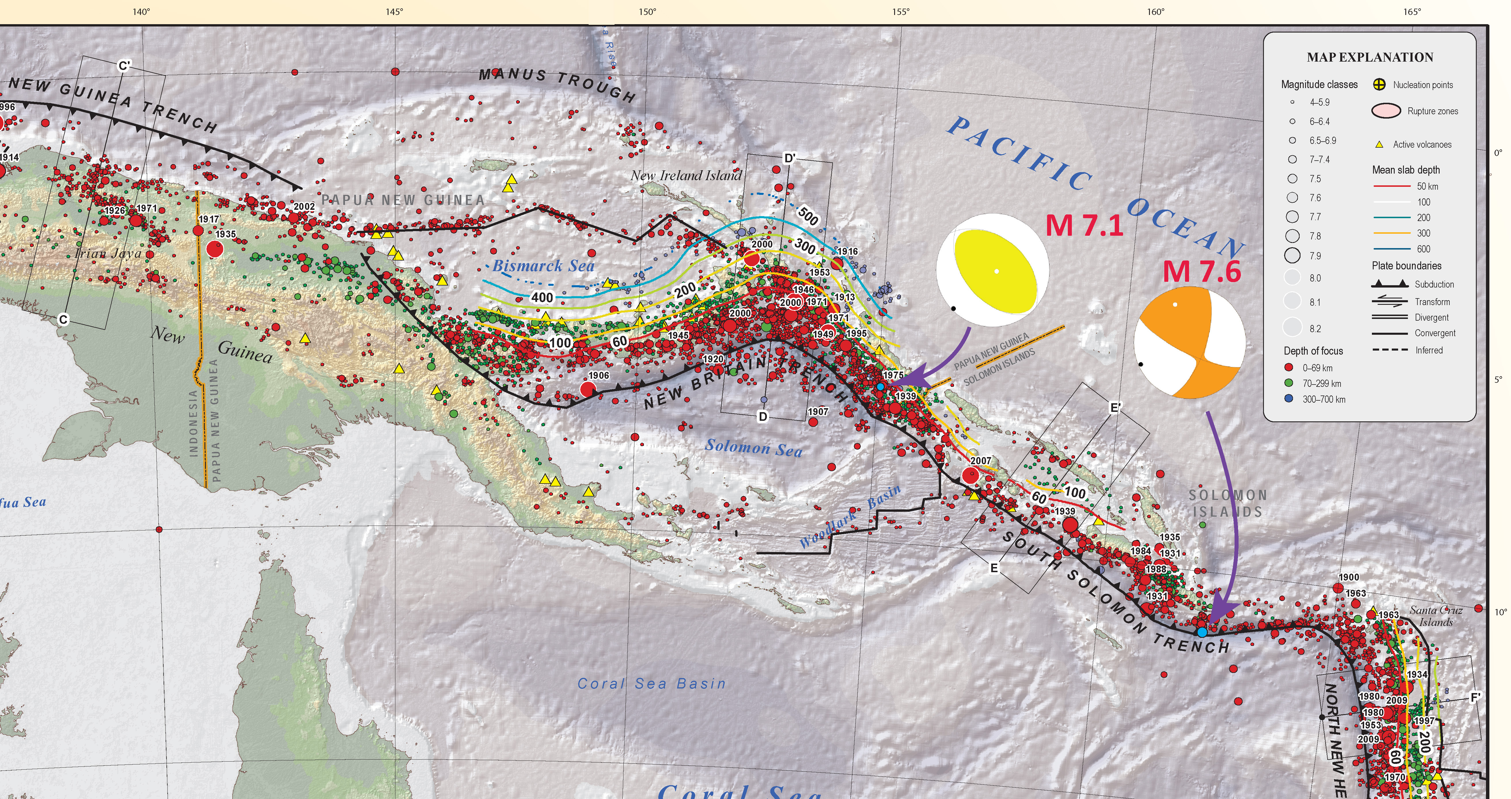
The USGS has presented their moment tensor solution for this M = 6.8 earthquake and it indeed appears to be a strike-slip type of an earthquake, supporting our interpretation that this is a transform plate boundary. Here was my first post about this earthquake. This is the USGS webpage for this earthquake.
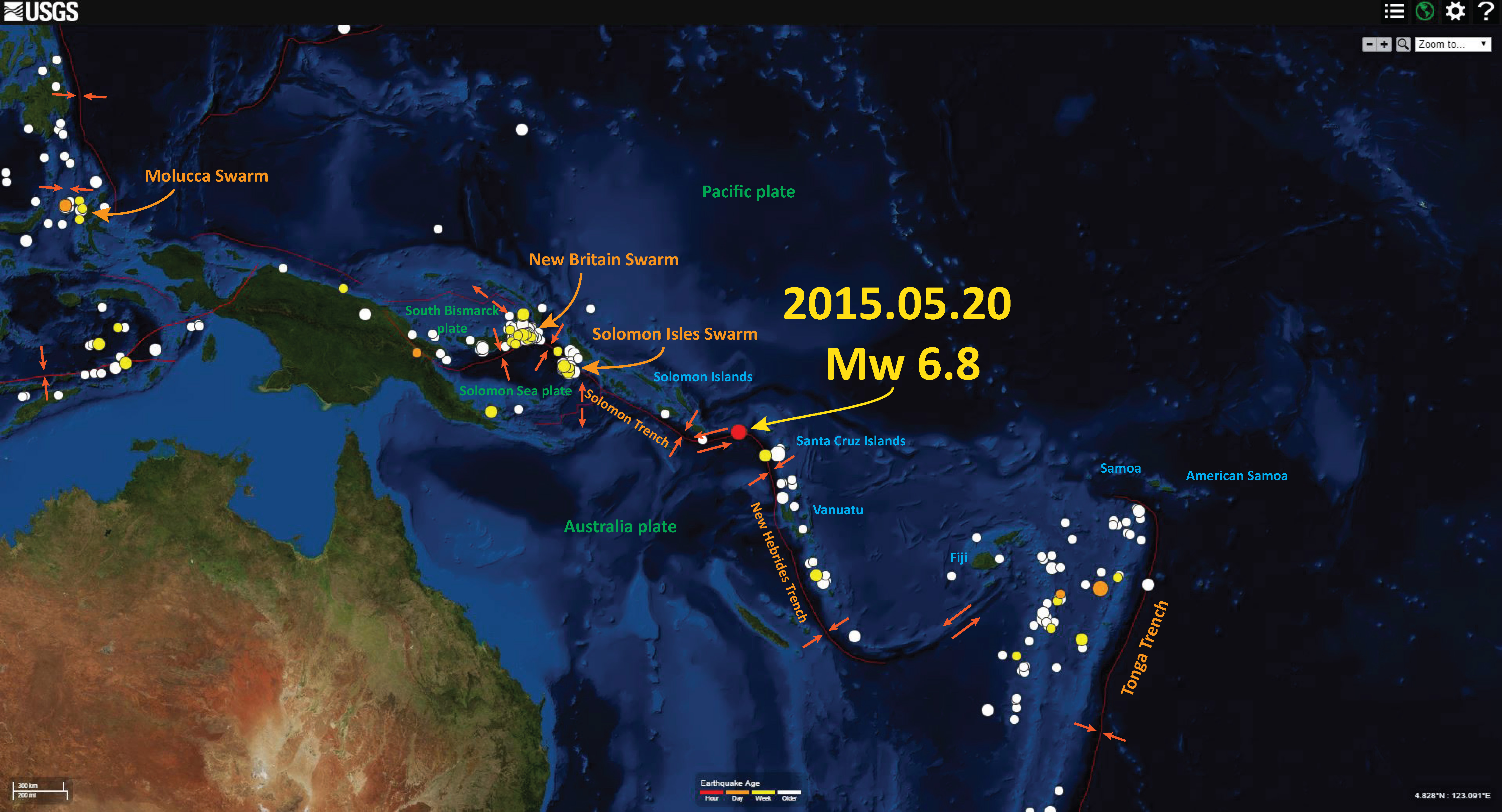
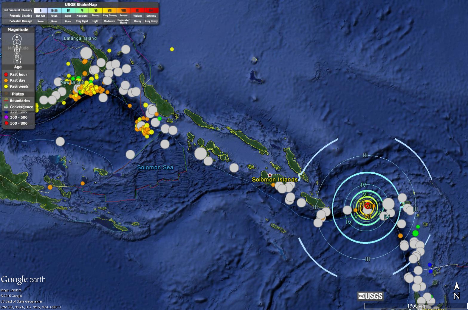
Here is my first map showing the epicenter of the M = 6.8 earthquake as a red dot. I also highlight recent activity along the Solomon Isles (New Hebrides Trench) and the New Britain region (Solomon Sea plate), in addition to the Molucca Sea.
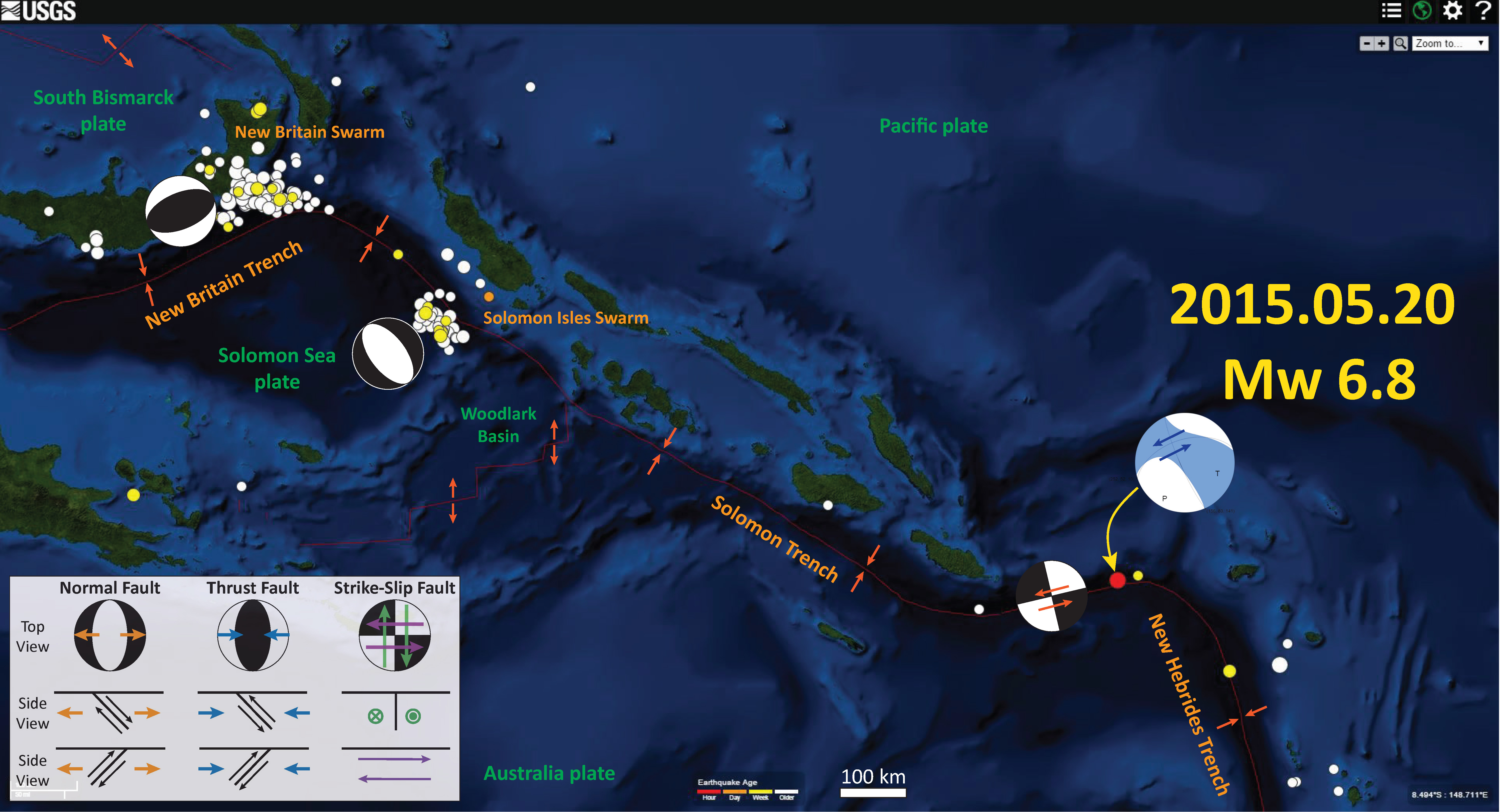
Here is a map showing the last month’s seismicity, with the M = 6.8 earthquake still as a red dot. I place a strike slip focal mechanism over the plate boundary to show how left lateral motion would produce such a focal mechanism. The black quadrants represent compression and the white quadrants represent tension. More can be found at the USGS site here. Note how the New Britain earthquakes are compressional and the Solomon Sea earthquakes are extensional. The New Britain earthquakes are most likely the result of slip on the subduction zone (a convergent plate boundary), while the Solomon Sea plate earthquakes are probably due to the bending of the downgoing plate (causing extension in the plate).
I posted a map that shows two earlier swarms here, the New Britain swarm and a Solomon Sea swarm. Here is one of the maps from that page:

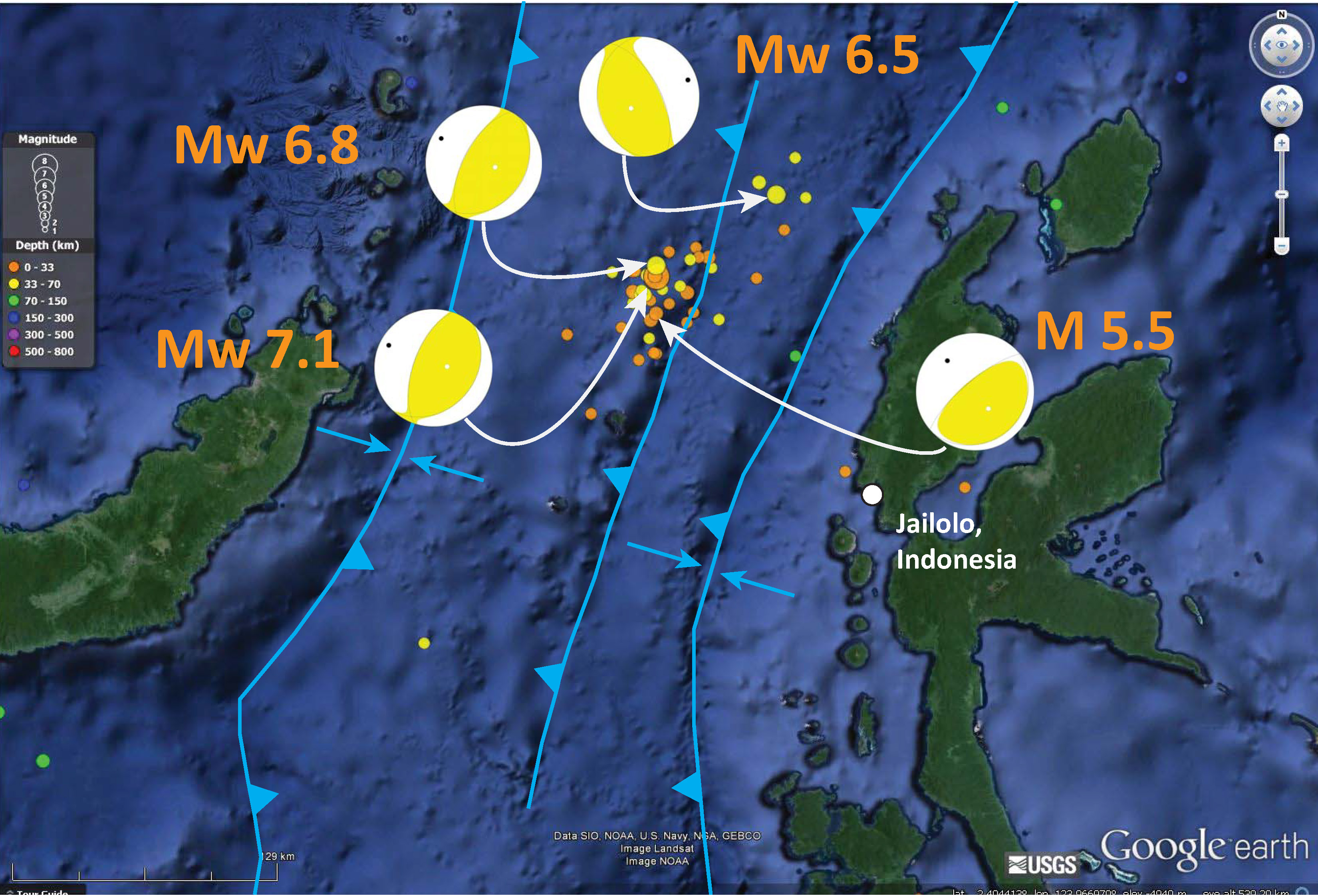
There was also a swarm of activity in the Molluca Sea region in November of 2014. Here I posted about the mainshock, an compressional earthquake with magnitude M = 7.1. Here I post about some of the aftershocks, each matching east-west compression. This is a map showing the mainshock and these aftershocks:
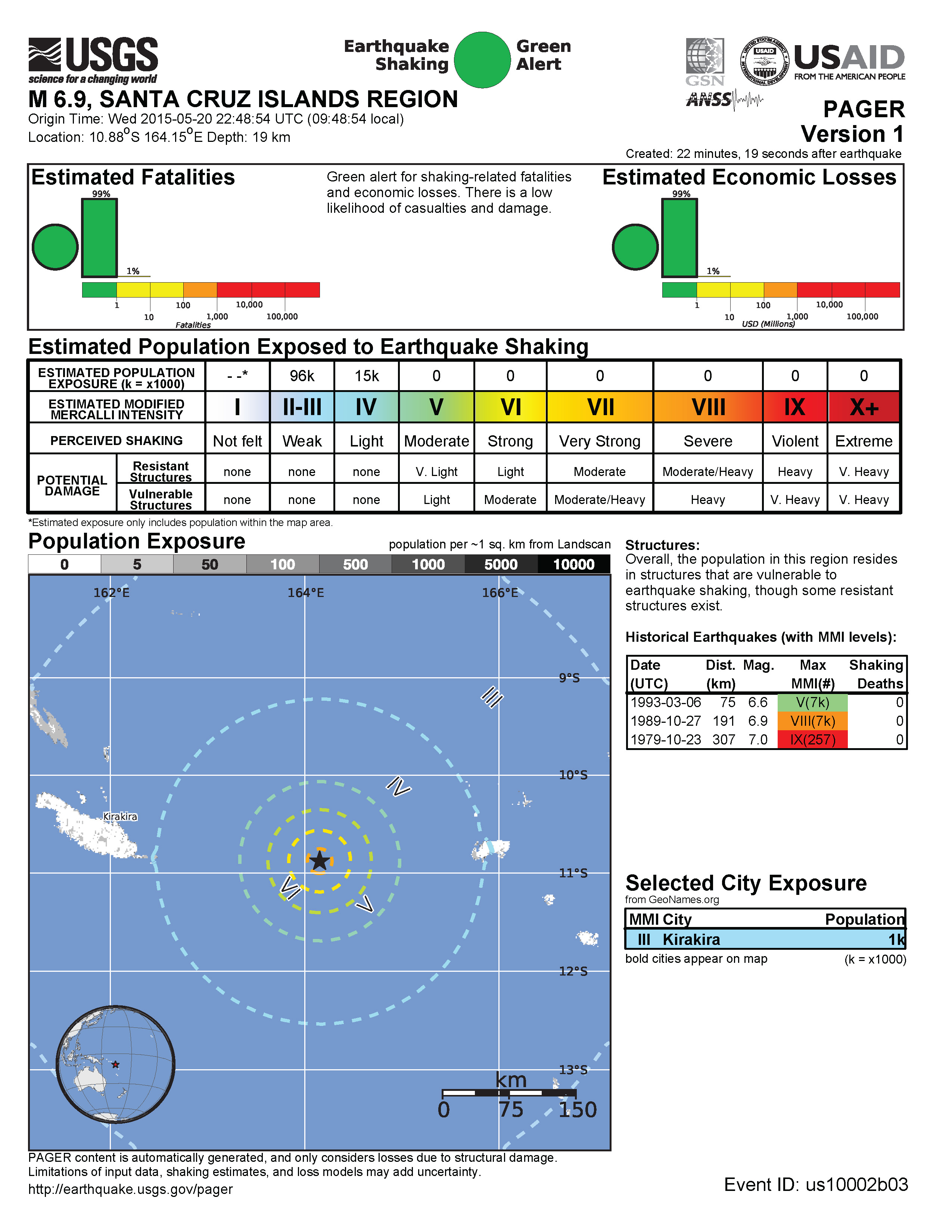
To no surprise, this earthquake is not exposing many people to strong ground shaking (it is in the middle of the ocean). The nearest islands are 2 degrees longitude away (less than 120 nautical miles). Here is the V1 PAGER report. This is an estimate of damage to people and their belongings generated by a computer model.
Here is a map showing these Modified Mercalli Intensity scale contours:
In 2014 there was a strike-slip earthquake about 120 nautical miles to the west. Here is my post about that earthquake. Here is a map showing the Modified Mercalli Intensity contours for the M 7.6 earthquake, as well as MMI contours for a swarm with a mainshock with a magnitude of M = 7.1. Note how the M 7.1 earthquake swarm is east of the swarm that I label as the Solomon Isles Swarm. The Solomon Isles Swarm earthquakes have extensional moment tensor solutions, while the M 7.1 earthquake has compressional. These swarms are probably related! I discuss these earlier earthquakes more in this post.
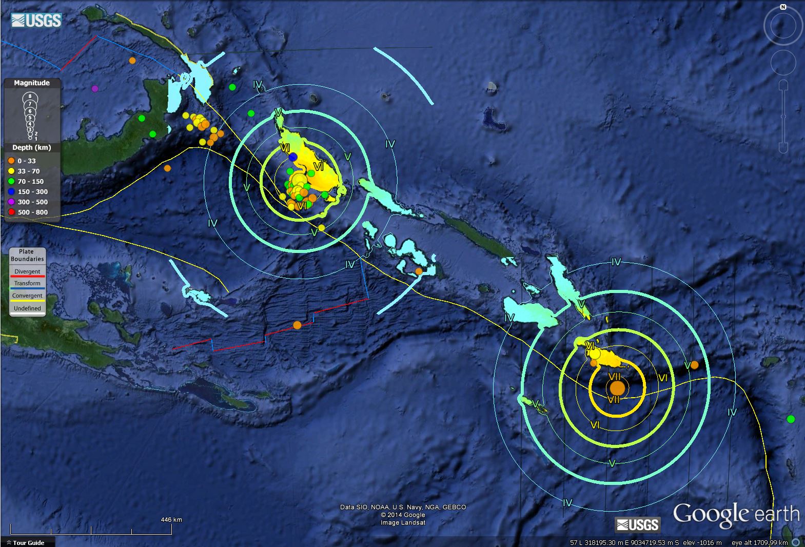
This map shows the moment tensor for the M = 7.1 earthquake and the M 7.6 earthquake.
1 thought on “Santa Cruz Islands Earthquake: Update #1”