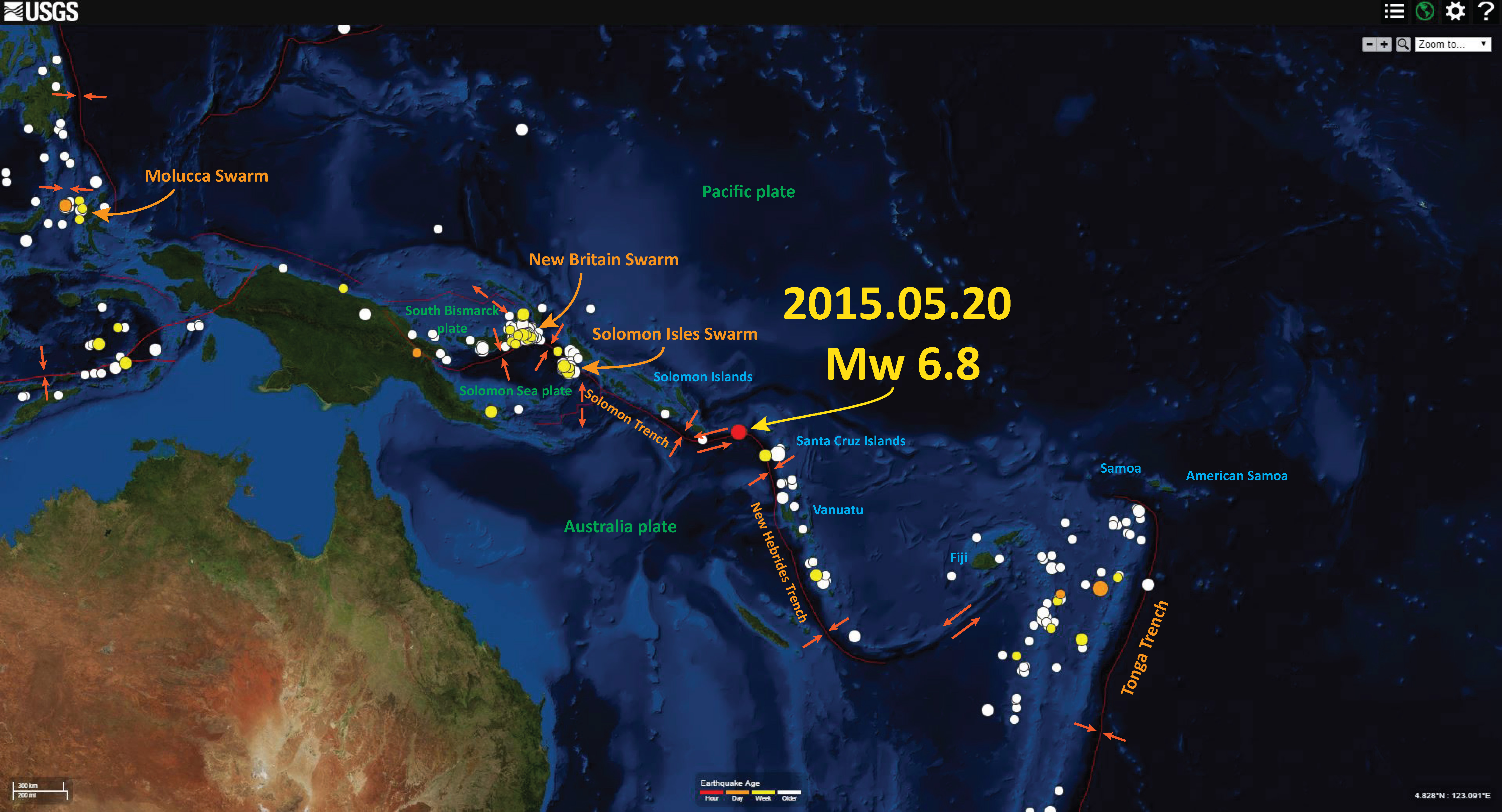
We just had an earthquake in the Santa Cruz Islands region. Earliest reports has the magnitude at M = 6.9, with a depth of 19.9 km. This earthquake appears to align with a transform boundary that connects the New Hebrides Trench on the east with the Vanuatu subduction zone on the west. Some people map this plate boundary as a subduction zone, but recent earthquakes suggest it is transform. There was an earthquake in 2014 April that has a strike slip moment tensor. Here is the USGS page for this M = 6.9 earthquake. This earthquake is unlikely to generate a tsunami. Strike slip earthquakes can generate tsunamis, if there are offsets of topography or if there are triggered landslides.
Here is my first map showing the epicenter of the M = 6.9 earthquake as a red dot. I also highlight recent activity along the Solomon Isles (New Hebrides Trench) and the New Britain region (Solomon Sea plate).
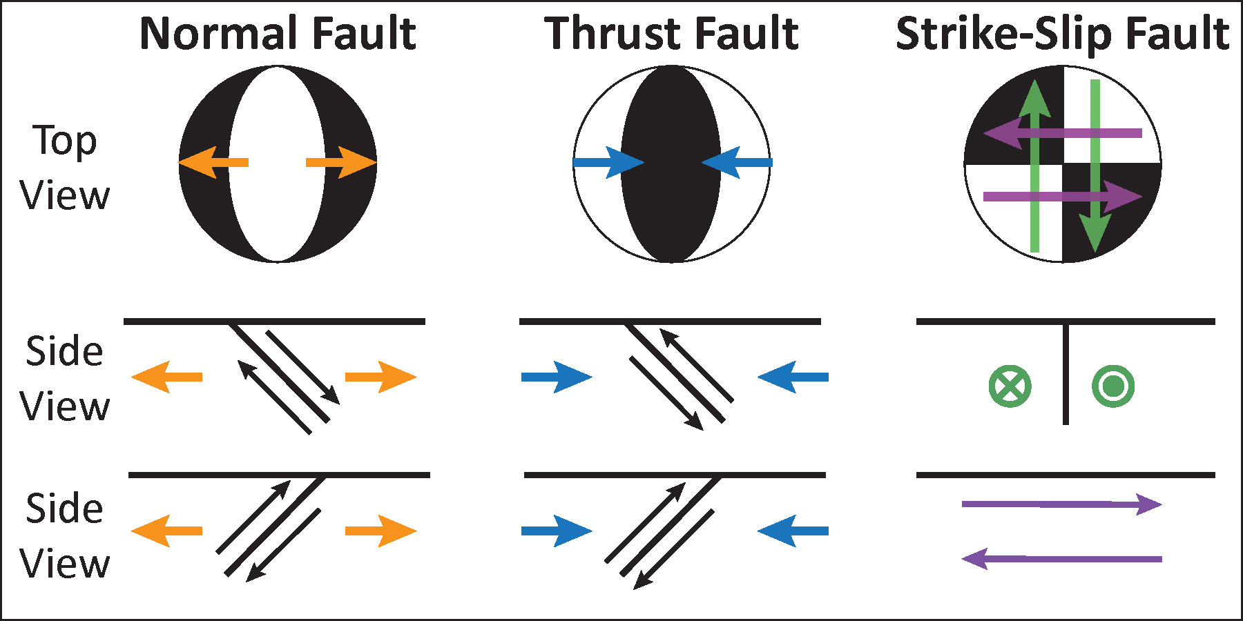
Here is a graphic that I put together showing the sense of motion inferred by the graphical depiction of moment tensors and focal mechanisms. More explanation can be found at the USGS webpage on focal mechanisms.
It freaks me out when the text message on my phone from the tsunami warning center says M6.9 in Santa Cruz Islands….My first reaction is Santa Cruz Island! Yikes. I wish the would say Solomon Islands in their messaging.
yeah, i guess that’s tough…
funny, i used to initially think they were talking about the islands offshore of so cali… when there were actually eqs near santa cruz island in the sw pacific, heheh
gotta look for the “s”