I have updated a couple of these maps and include a figure from a recent presentation given by Roger Bilham at AGU (2011). Here was my original and first updated posts about this earthquake and here is my first compilation post.
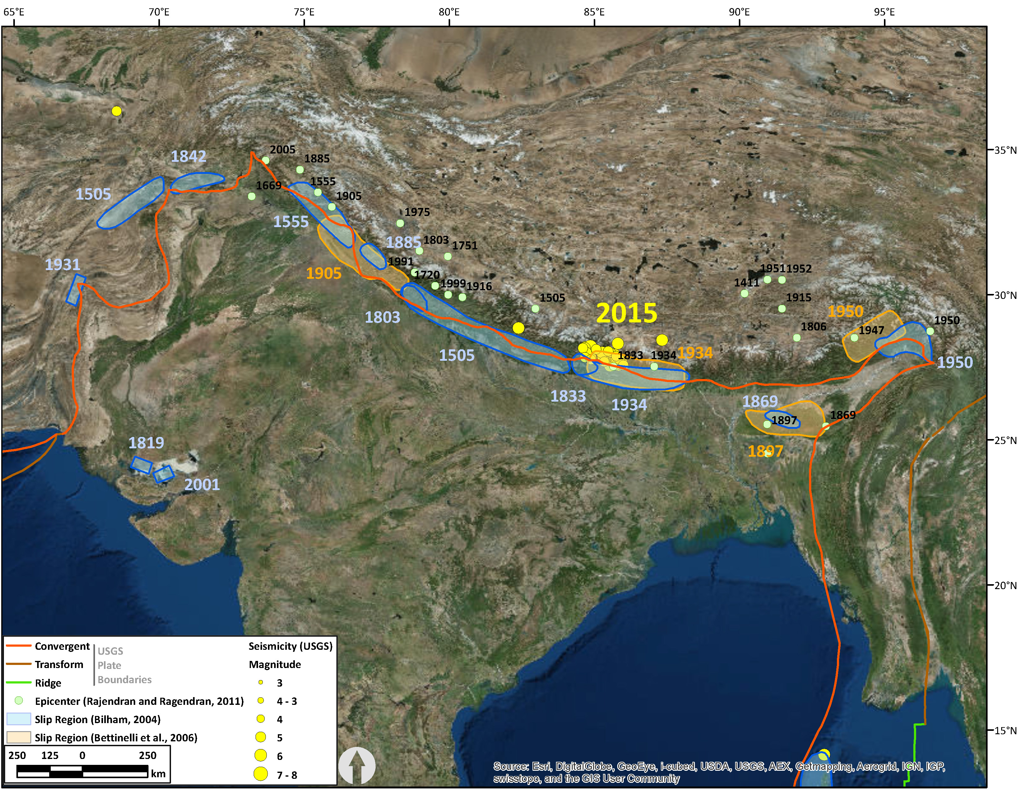
Here is the regional map. I have added epicenter locations from Rajendran and Rajendran (2011). These, in some cases, do not coincide with the slip patches published by others. The Rajendran epicenter locations are probably the ones that may be incorrect. I compared where they placed the locations of cities and I found those to be largely incorrect.
Note how the region that has not ruptured since 1505 is immediately adjacent to the 2015 earthquake activity. Faults in this region possibly are experiencing an increase in stress following the earthquake. I will have to take a looksie at some analogous models (or run my own).
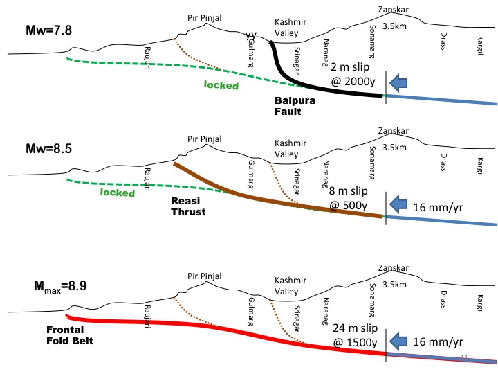
Here is an figure from Bilham, 2011. Note the southern terminus of the epicenters in the map below and compare this with the three proposed slip models in this cross section. Then, compare the magnitude estimates between these three different possibilities. It appears that Bilham et al. (2011) were quite cogent on their magnitude estimate.
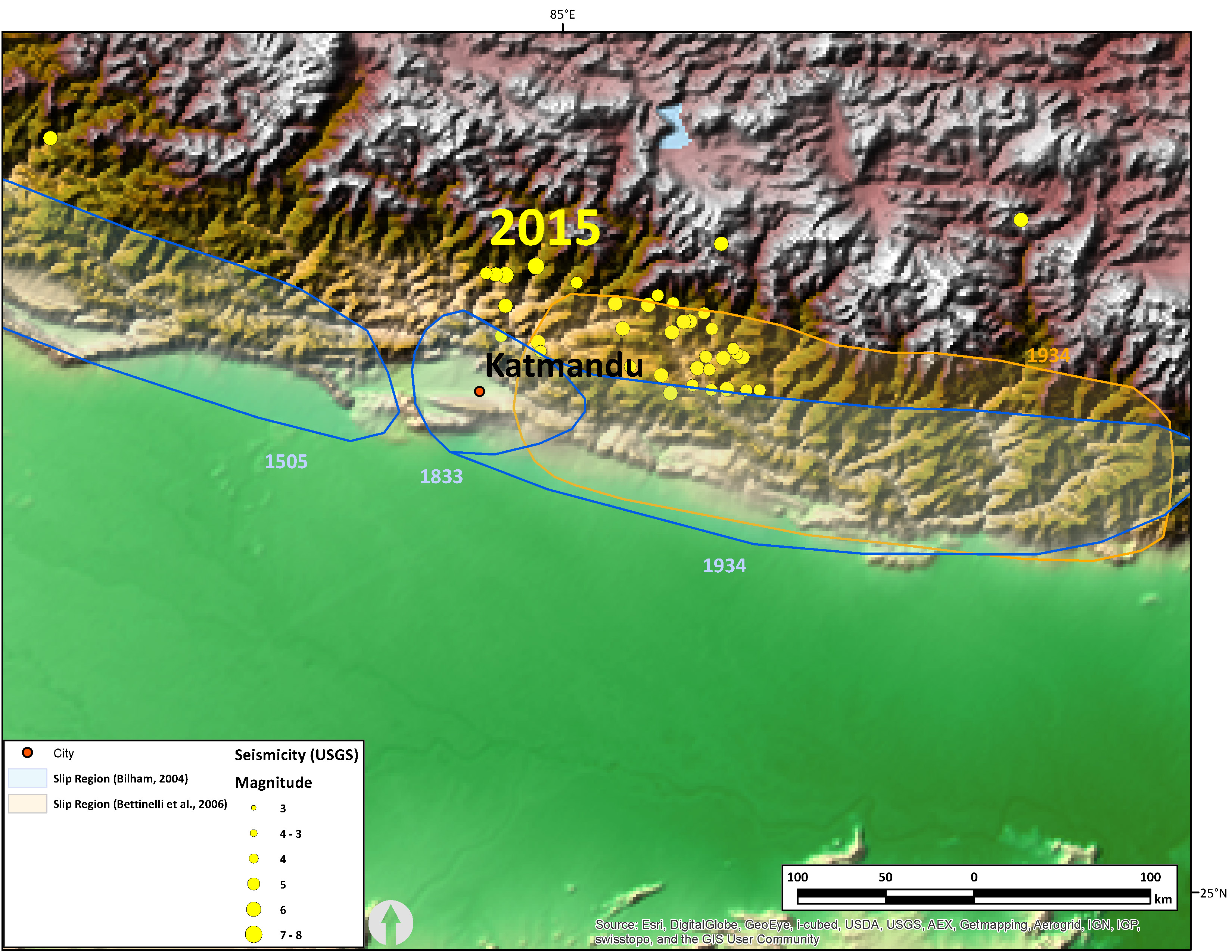
Here is a local scaled map that shows the epicenters, the closest historic patches, and the city of Katmandu.
- References:
- Bilham, R.G., Szeglia, W., Bali, B.S., Khan, A., Wahab, A., and Khan, F., 2011. Velocity Field in the NW Himalayan Syntaxis: Implications for Future Seismicity, Trans.. American Geophysical Union, Dec., 2011.
- Rajendran, K and Rajendran, C.P_., 2011. Revisiting the earthquake sources in the Himalaya: Perspectives on past seismicity, Tectonophysics, v. 504, p. 75-78.
3 thoughts on “Updated Historic and Prehistoric Maps”