Here is an updated map that shows the aftershocks following the devastating earthquake in Nepal. I have tentatively plotted the locations (epicenters) of some historic earthquakes in this region. Today’s earthquake ranks among the largest and approaches the size and devastation of the 1505 earthquake, that some consider the most devastating known earthquake in the region. Here is the post I made early this morning. After class (running late), I will post more material on the historic earthquakes in this region and some links to the human stories.
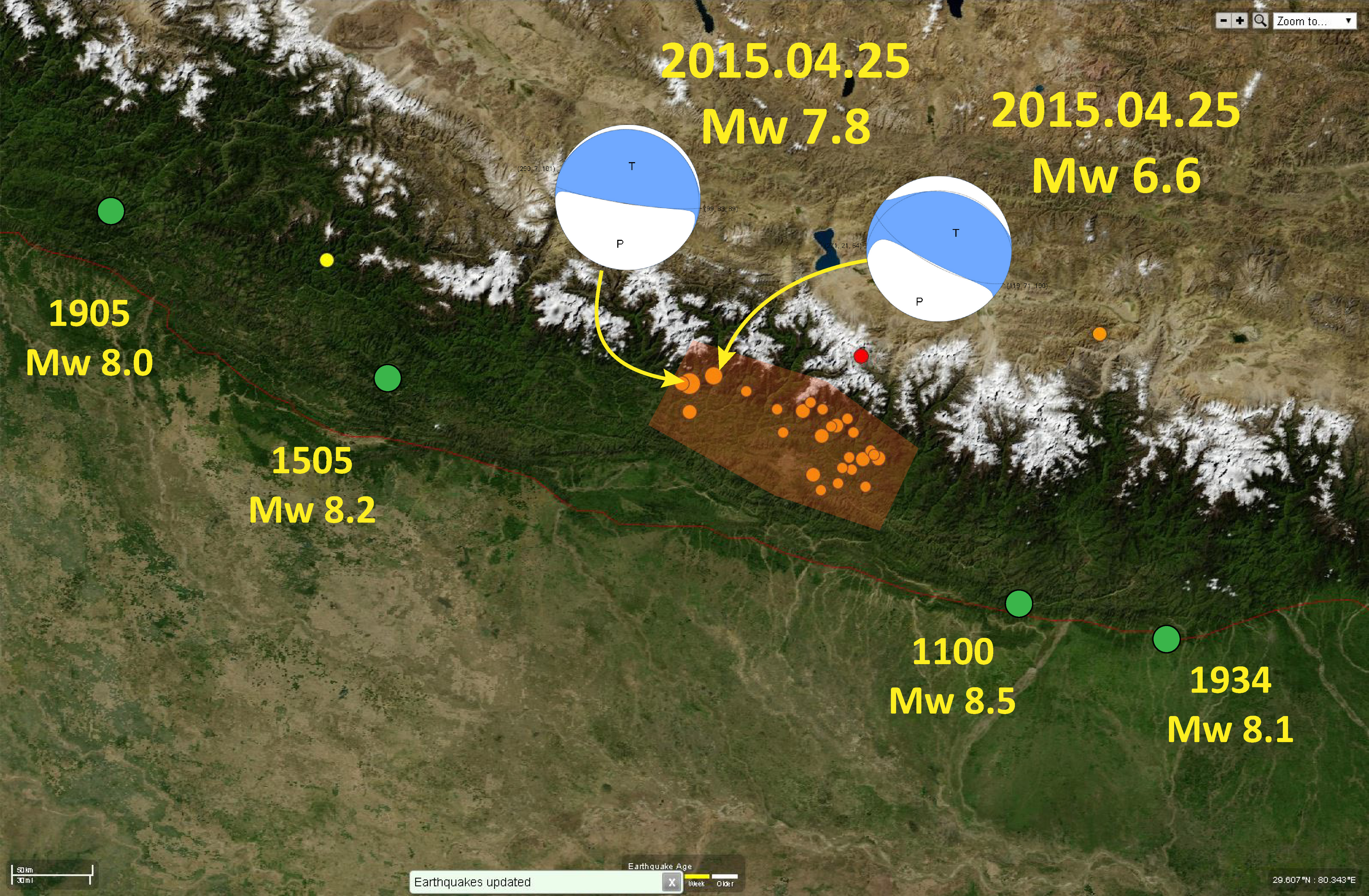
- Here are the two USGS webpages for the mainshock and the largest aftershock:
- Mw 7.8 2015.04.25
- Mw 6.6 2015.04.25
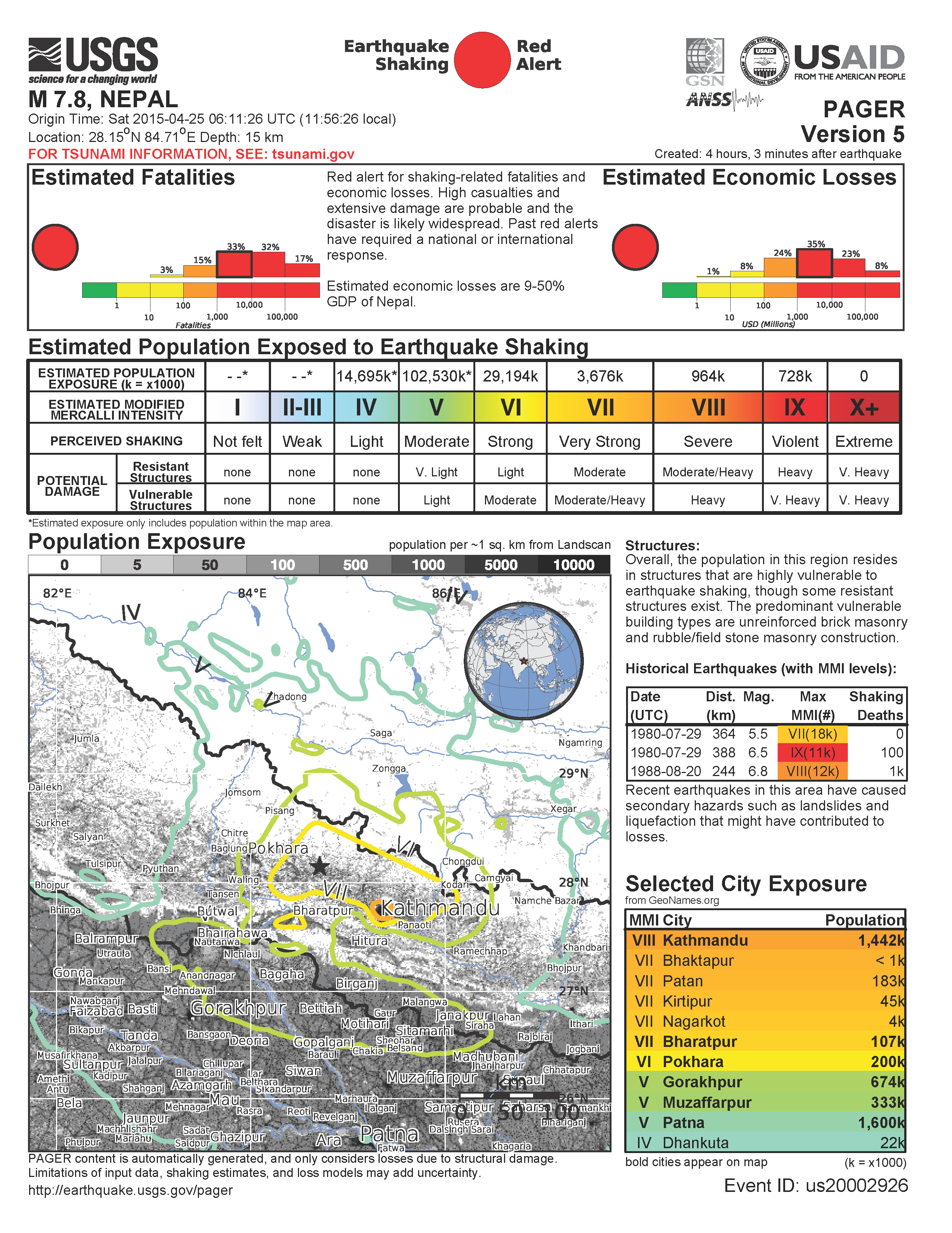
Here is the PAGER. The pager last night was not yet available. This is an estimate of the casualties to people and their belongings (roads, bldgs, etc. ). This is based upon the overlay analysis of two things. First there is a database that includes information abt the spatial distribution of the population and their infrastructure. Second, there is a numerical simulation of the ground shaking intensity. Just like how risk is the overlap of hazard with population, this estimate is the overlay of theses two analyses. Note the likelihood of an extremely large number of casualties. This is quite a devastating disaster.
thanks for posting this information Jay, this is terrifying
Jay, we might be going there in a few weeks. If you hear of any surface rupture please keep me posted!
Thanks for including 1100AD. A certain research group like to forget that one.
1833? Is it off your map?
1833 is not in the paper i was lookin at… ill make a comprehensive map later (hopefully with slip zones in addition to the epicenters)
update here http://earthjay.com/?p=2365
Whoa, interesting stuff you have here…
I look forward to reading more…