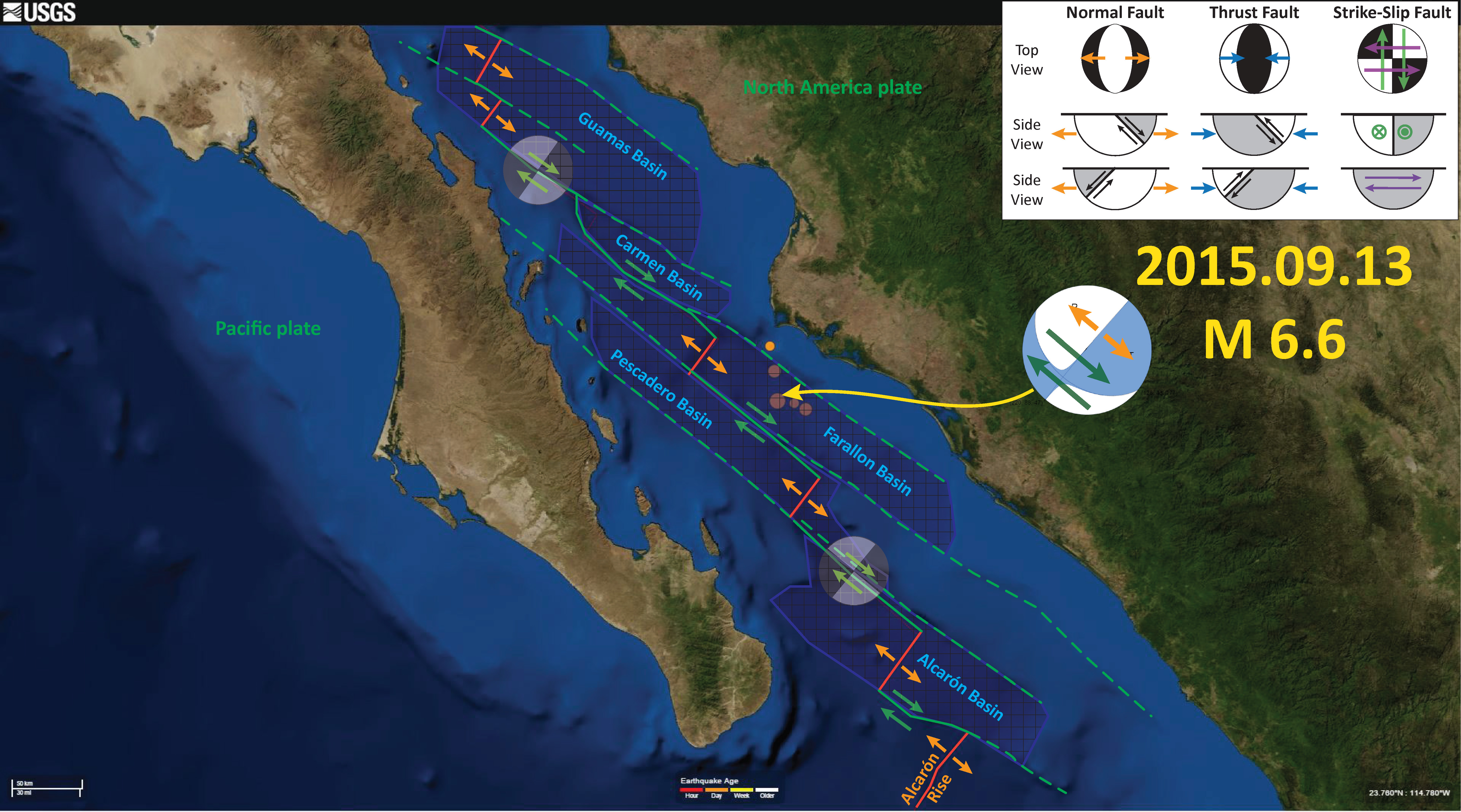
Here is an update to the early morning post… I have prepared an updated map that shows the fracture zones, spreading ridges, transform faults, and basins in the region of seismicity from the past 24 hours.
Here is the map. I include more explanation (e.g. about moment tensors) on the first post here. As David Bazard points out, the oblique slip during this earthquake could be interpreted as transtensional (extension due to the orientation of strike-slip faults, i.e. “step overs”).
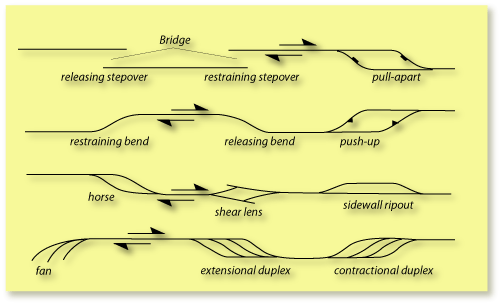
This is a nice simple figure, from the University of Sydney here, showing the terminology of strike slip faulting. It may help with the following figures.
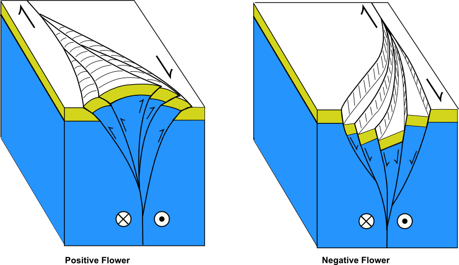
Here is a fault block diagram showing how strike-slip step overs can create localized compression (positive flower) or extension (negative flower). More on strike-slip tectonics (and the source of this image) here.
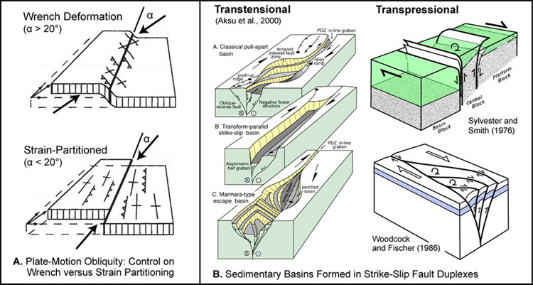
Here is another great figure showing how sedimentary basins can be developed as a result of step overs in strike slip fault systems (source: Becky Dorsey, University of Oregon, Dept. of Geological Sciences).
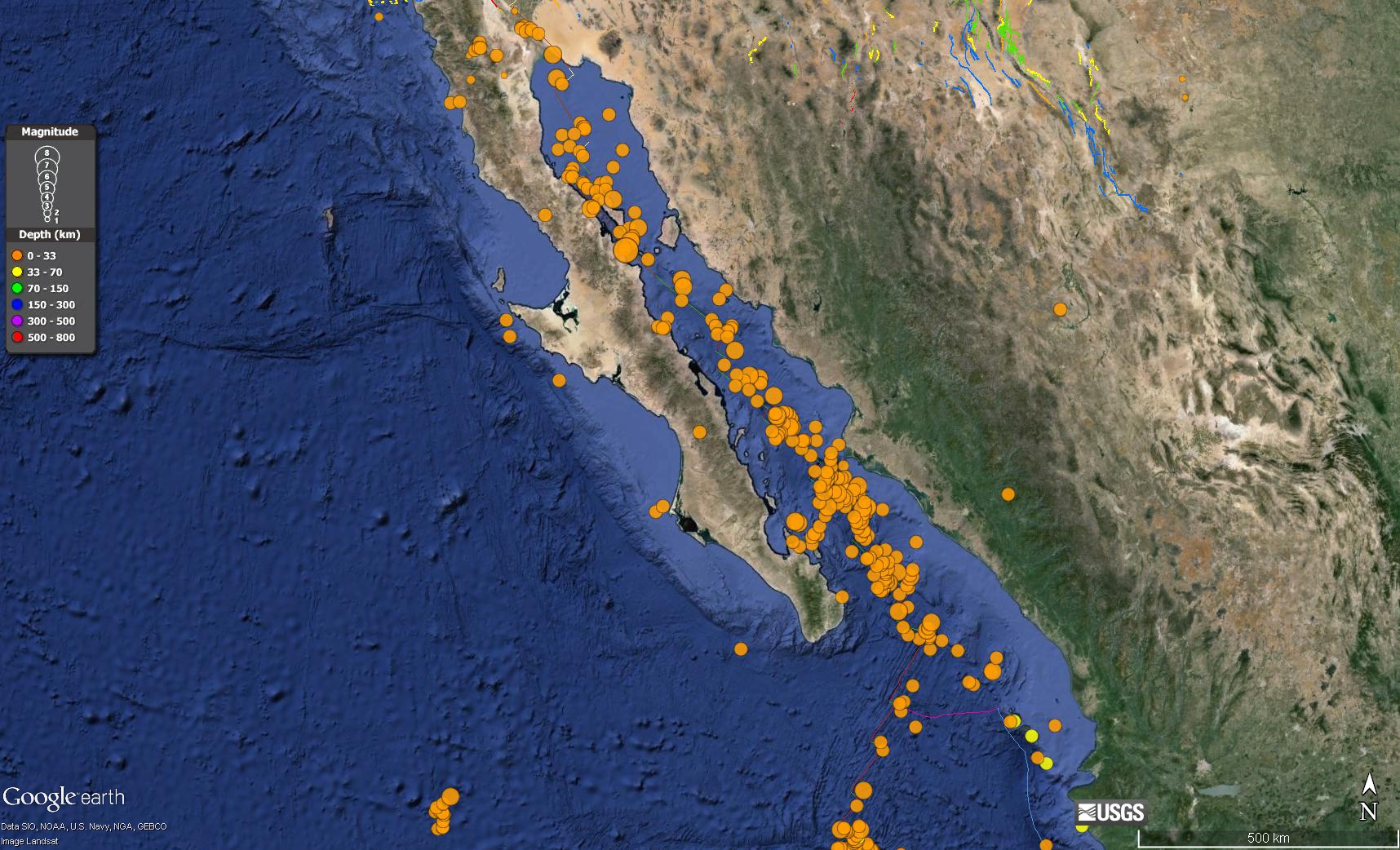
I also put together an animation of seismicity from 1065 – 2015. First, here is a map that shows the spatial extent of this animation.
Here is the animation link (2 MB mp4 file) if you cannot view the embedded video below. Note how the animation begins in 1965, but has the recent seismicity plotted for reference.
Gulf of California Earthquakes! (first update)

Jay-really nice flower structure figure! Can I use it on the upcoming FOP-can you provide an image file?
yes, just right click on the image and save as.. it is a png file i believe… or here is the link… (to save you time, which you clearly need… heheh)
http://earthjay.com/earthquakes/20150913_gulf_california/Flowerstructure1.png
this is where i got it… https://en.wikipedia.org/wiki/Strike-slip_tectonics
here is more info on that file that mike norton made… https://commons.wikimedia.org/wiki/File:Flowerstructure1.png
Thanks Jay. Hope to see you and the Humboldt crew on the FOP!
see you there!!! i promise not to jump into the fire this year…