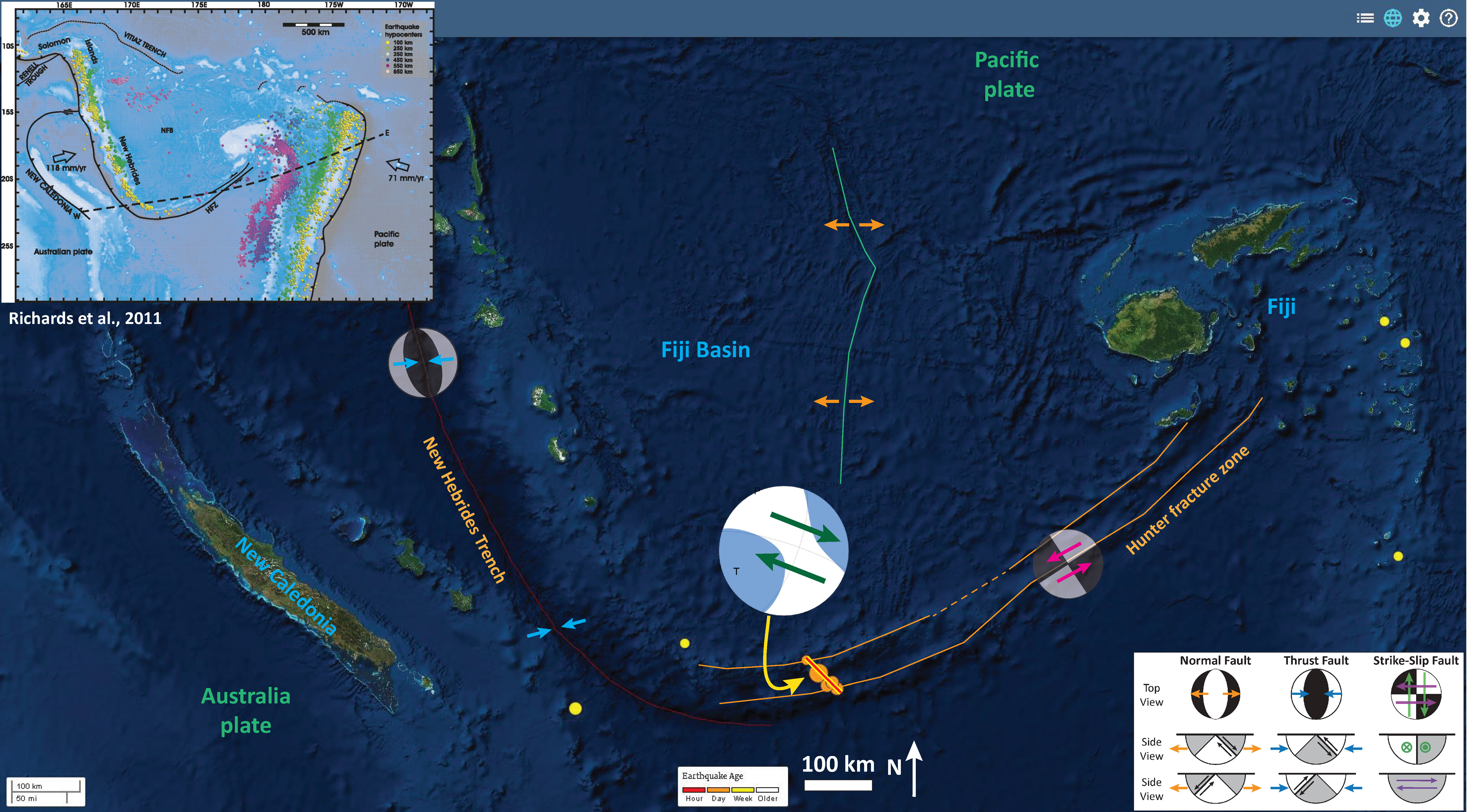
Well, as I was writing my initial report, some aftershocks hit. My initial report is(here, where I provide more information about the tectonics). At first I interpreted this M 7.2 earthquake as a northeast striking left-lateral strike-slip earthquake. However, these aftershocks appear to be aligned in a northwest striking orientation relative to each other. Because of this, there is some justification to interpret the M 7.2 earthquake to be aligned along a northwest striking fault. This would make this a right-lateral (dextral) strike-slip earthquake. I place a yellow-red line along strike of these
Below is a larger scale map with these aftershocks plotted.
I placed a moment tensor / focal mechanism legend on the poster. There is more material from the USGS web sites about moment tensors and focal mechanisms (the beach ball symbols). Both moment tensors and focal mechanisms are solutions to seismologic data that reveal two possible interpretations for fault orientation and sense of motion. One must use other information, like the regional tectonics, to interpret which of the two possibilities is more likely.
-
I include some inset figures in the poster.
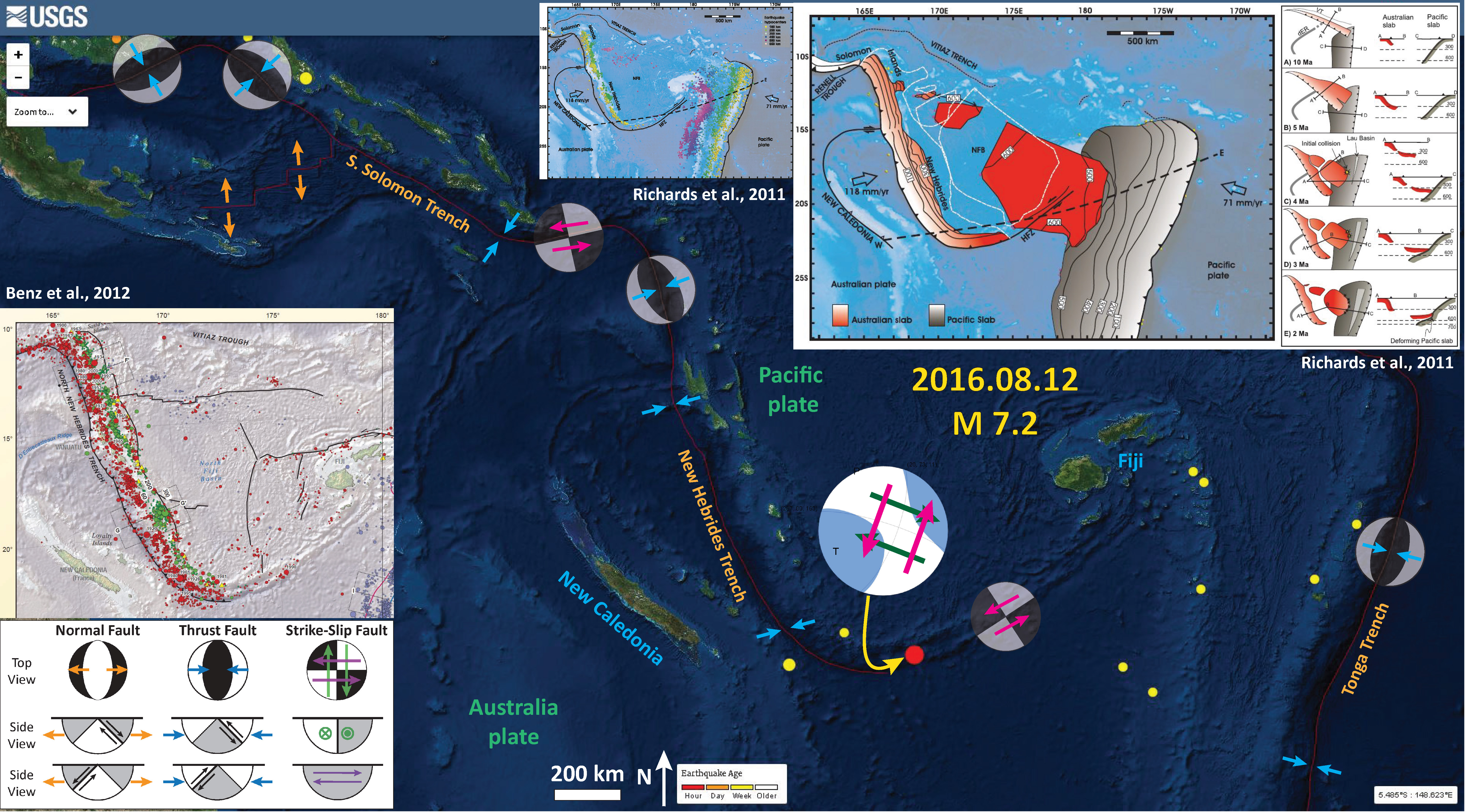
- In the upper right corner is a figure from Richards et al. (2011). This is a tectonic map showing the plate boundaries with seismicity colored vs depth. Note how the New Hebrides earthquakes deepen to the east and the Tonga Trench earthquakes deepen to the west.
-
Here are the USGS websites for the earthquakes plotted below.
- 2016.08.12 M 7.2 01:26:35 UTC
- 2016.08.12 M 5.4 01:38:36 UTC
- 2016.08.12 M 5.2 01:42:28 UTC
- 2016.08.12 M 5.0 02:34:44 UTC
- 2016.08.12 M 4.7 02:47:06 UTC

Interestingly, a M 6.1 earthquake occurred imperfectly along strike with this swarm. These earthquakes are generally far to distant to be related to each other. However, the spatial relations are coincident. Here is a map that shows this M 6.1 earthquake as a red circle. This earthquake has a hypocentral depth of 75 km. Here is the USGS website for this earthquake.
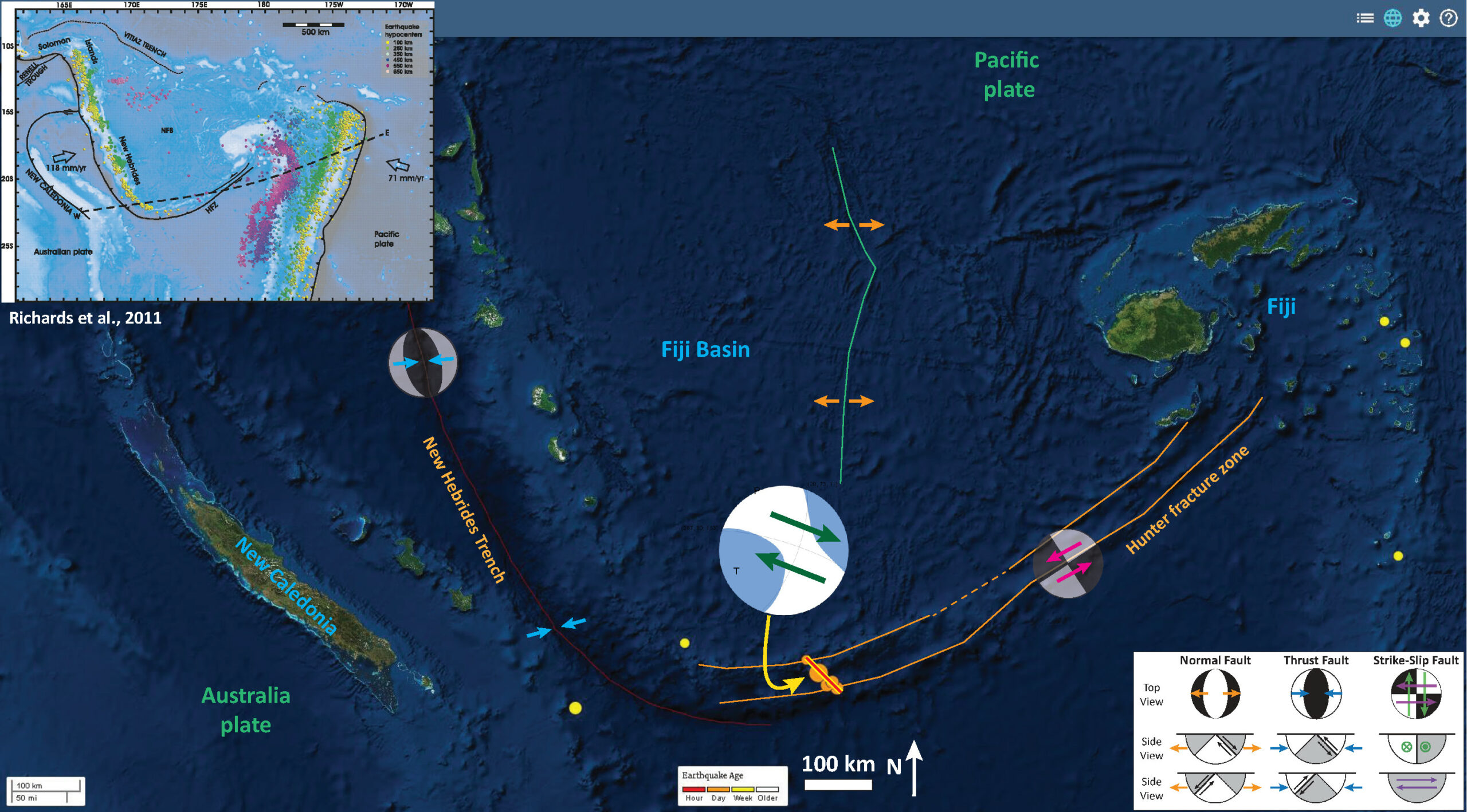
Here is the original Earthquake Report poster for this swarm, at a smaller scale than the one above.

-
References:
- Richards, S., Holm., R., Barber, G., 2011. When slabs collide: A tectonic assessment of deep earthquakes in the Tonga-Vanuatu region, Geology, v. 39, pp. 787-790.

2 thoughts on “Earthquake Report: New Hebrides Update #1”