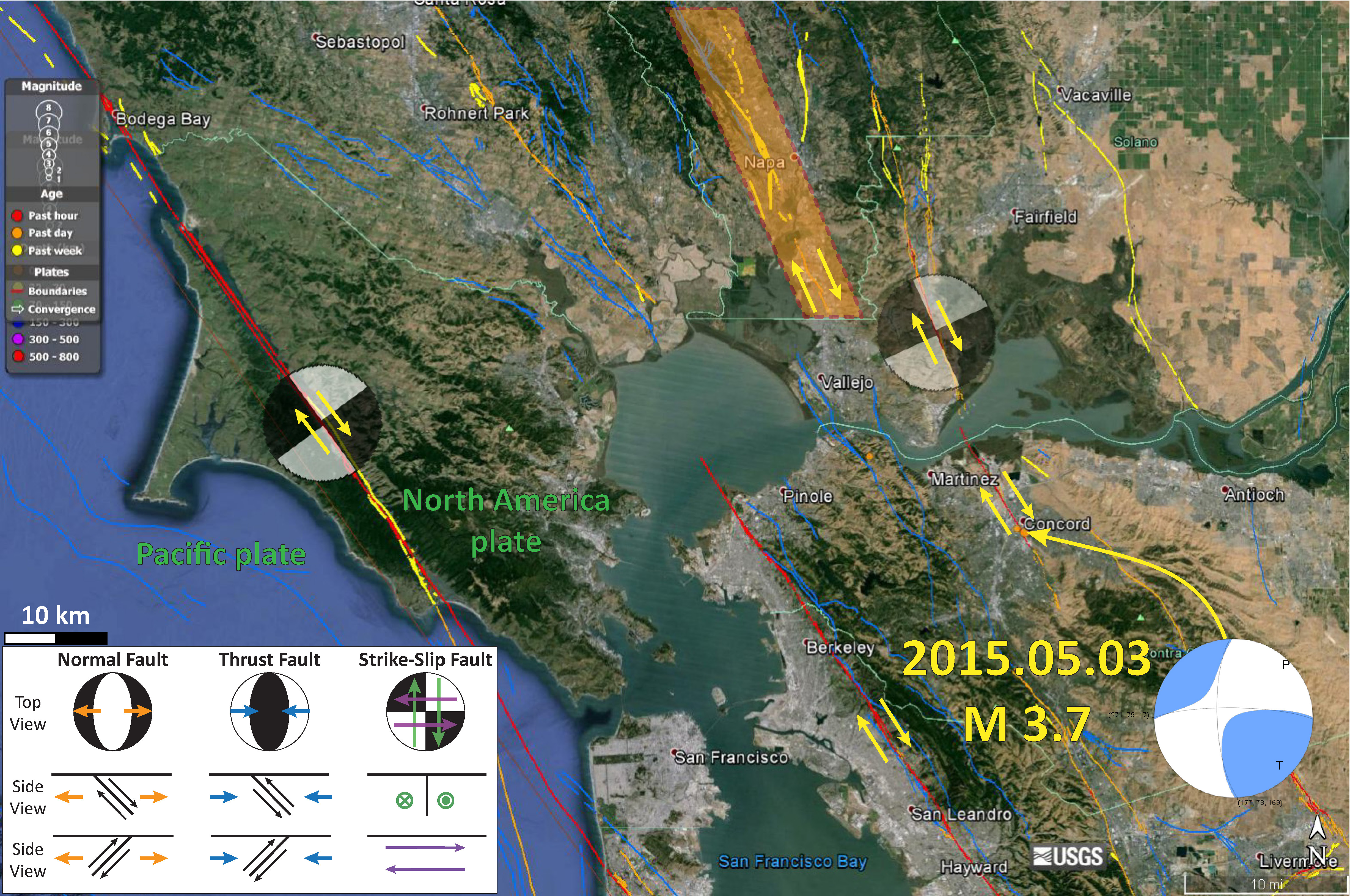
There was a M 3.6 earthquake near Concord, CA. This earthquake was felt widely across the S.F. Bay area. The two earthquakes plotted in the map below are both just southeast of the 2014 August Napa earthquake. The Napa earthquake, a magnitude M = 6.0 earthquake that generated surface rupture. Here was my original post about the Napa earthquake and here is an update. This is the USGS web site for the 2015.05.03 Concord earthquake.
Here is a map that shows the epicenter of the Concord earthquake, as well as some explanation diagrams for the moment tensor plots. The region of the 2014 Napa Earthquake is depicted by the orange and red polygon.

This is a cool map that shows the “Did You Feel It?” survey results in a grid. The colors are light blue, matching the lower intensities of the Modified Mercalli Intensity Scale.
Hmmm! Moving up the coast line maybe?
Gaining momentum….