Here is the latest in the story this April 2014. Another large magnitude earthquake has occurred in locations associated with the New Britain trench in the Solomon Islands. Here is the USGS website for this earthquake. There is some background information for the regional tectonics on their page.
This is a regional map showing today’s M 7.6 strike slip earthquake. The colored contours are computer model estimates of ground shaking based on the earthquake’s magnitude and location. The epicenter for this M 7.6 earthquake is a large orange dot in the center of the intensity contours. The shaking intensity scale is called the Modified Mercalli Shaking Intensity scale and the USGS legend for that scale is in the upper left hand corner of this map.

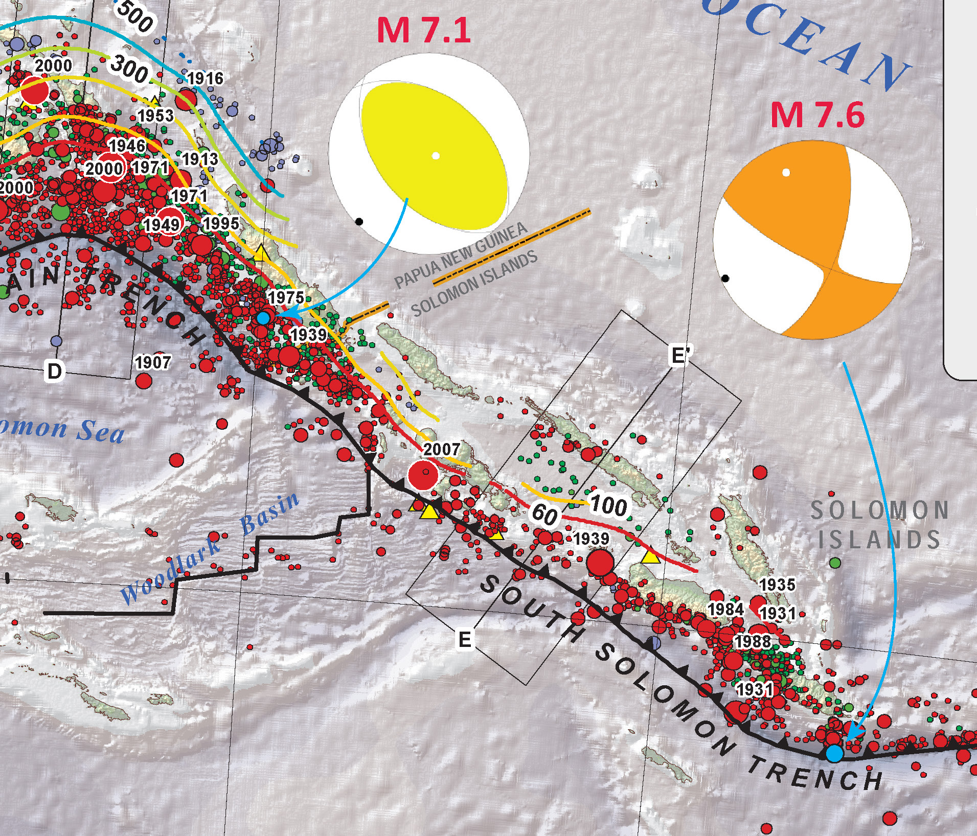
This shows the Mww moment tensor for this strike slip earthquake. The earthquake probably ruptured a fault that was oriented either north-northeast or west-northwest.

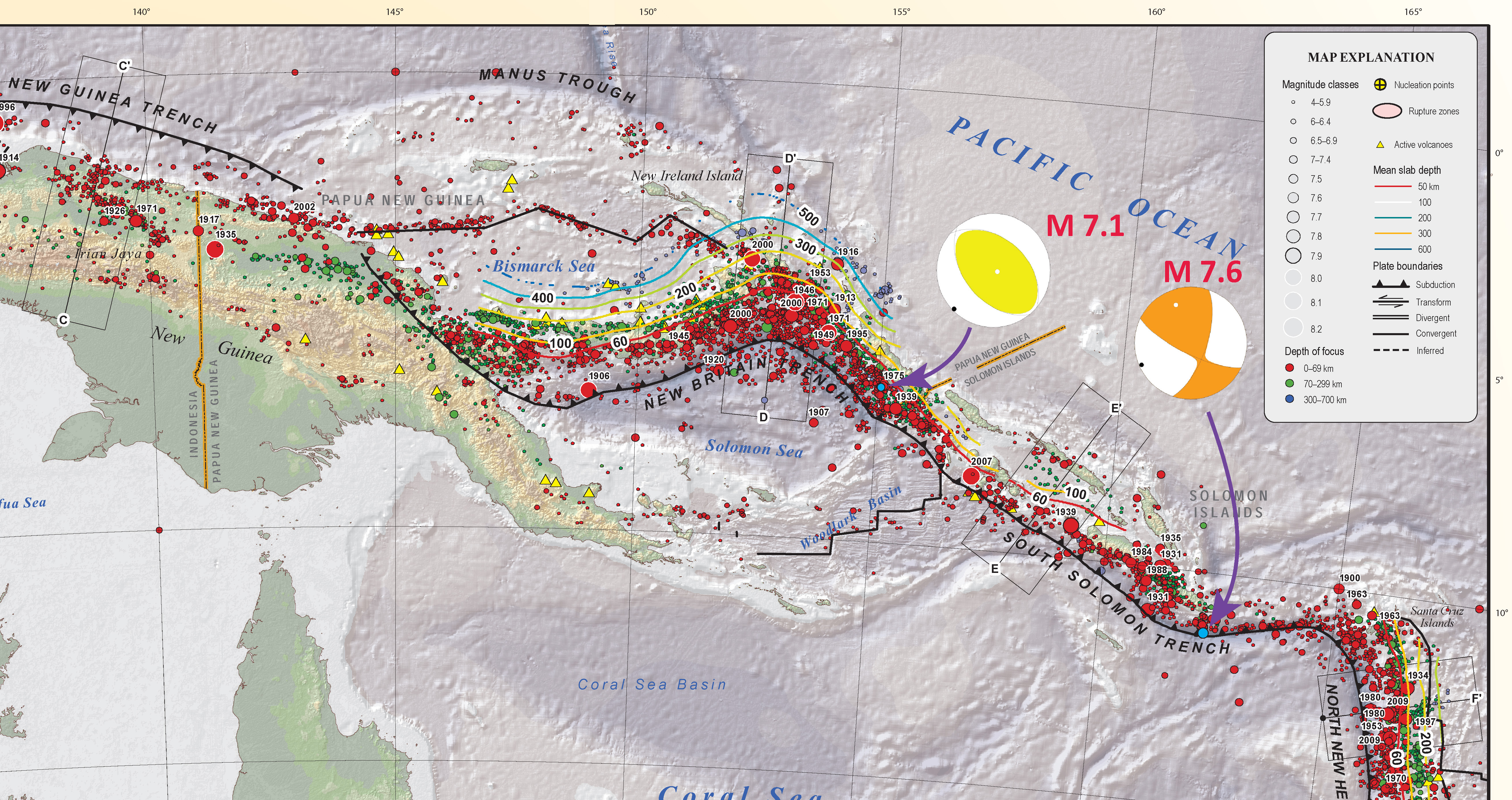
I plot the USGS subduction zone fault slab contours in this region. Today’s earthquake hypocentral depth is currently set at ~29 km, just north of the trench axis. This earthquake is probably related to the other earthquake swarms to the northwest. They were reverse/thrust earthquakes and this one is strike-slip. I will look at some papers to see what the coulomb stress changes might be expected in this scenario (if there are any analogues).

This is a fascinating plot of the modeled shaking intensity for these two large magnitude earthquakes.
Here is the PAGER loss estimate poster. The probability for fatalities is low, but not non-existent.

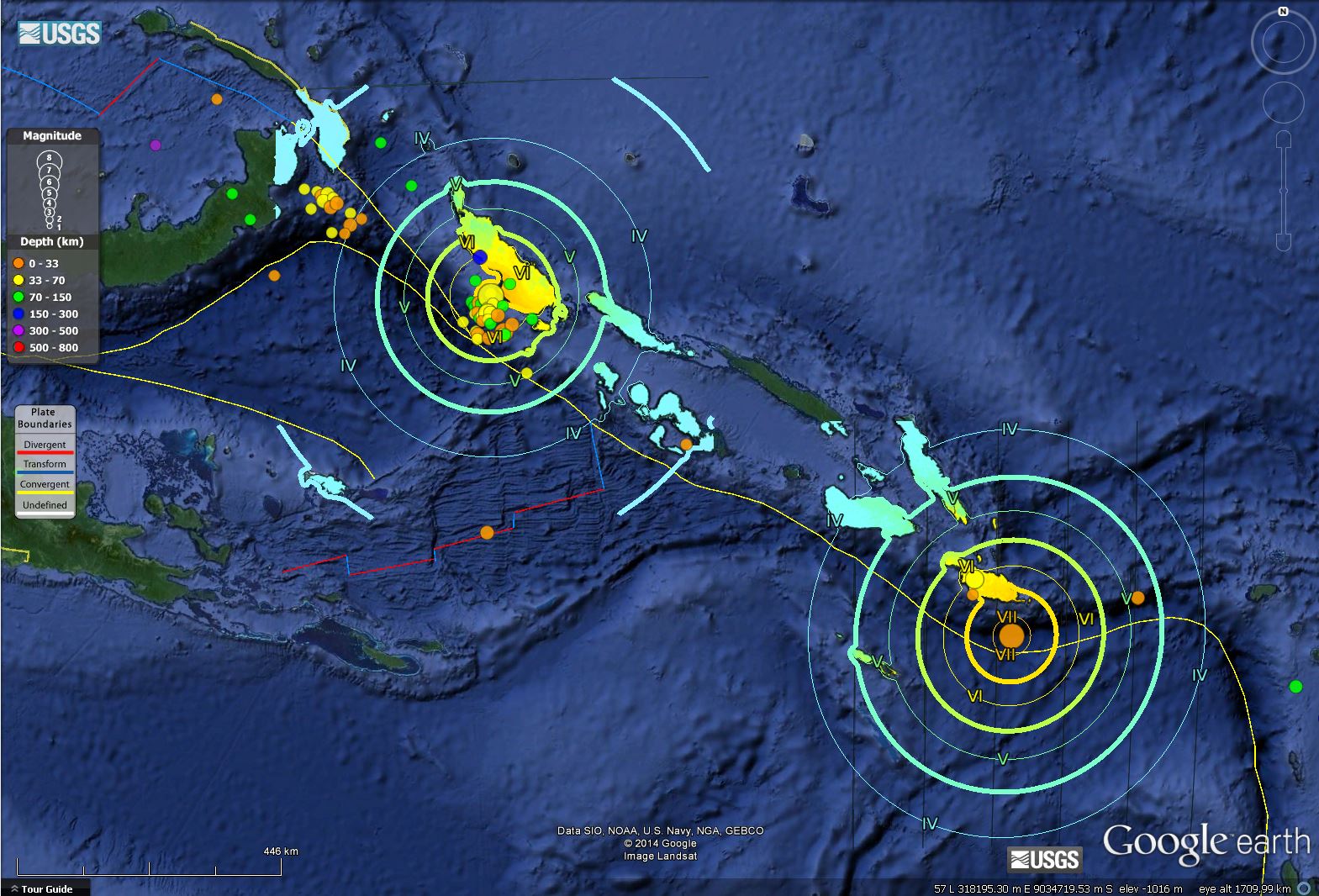
Here is a map where I placed blue dots scaled for magnitude overlain upon the USGS summary poster for this region. I also placed the moment tensor for each of these earthquakes. The 4/11 Mw 7.1 earthquake was at a depth of ~54 km, while the 4/12 earthquake was at a depth of ~36 km. The USGS also has a tectonic summary poster for the New Hebrides trench to the south. Which orientation do you think that todays earthquake fault is oriented upon?
Perhaps this earthquake is on a reactivated strike slip fault in the oceanic crust of the downgoing slab. Looking at the bathymetry along the Woodlark Basin, there are north-south striking transform faults. However, the downgoing slab where the M 7.6 earthquake is located was sourced elsewhere, further to the south. The source of the downgoing slab probably looked similar to the Woodlark Basin at some point.
Another possibility is that there is some sort of a forearc sliver fault in the downgoing slab. These are found where plate convergence is not perpendicular to subduction zone faults (“oblique convergence”). Strain and Slip Partitioning processes result in earthquakes accommodating the maximum and minimum orientations of strain with strike slip faults accommodating the minimum strain axis and thrust or reverse faults accommodating the maximum compressional strain. An excellent example of this is the Sumatra fault, interpreted as a forearc sliver fault that accommodates the strike-slip portion of strain exerted due to subduction of the India-Australia plate beneath the Eurasia plate. I need to do more work to find analogues of forearc slivers in downgoing slabs. I might be out in left field about this.
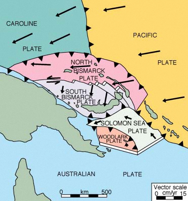
Here is a map that shows plate motion vectors. Note how the plate motions of the Pacific plate and the Solomon Sea plate are not perpendicular to the subduction zone fault.
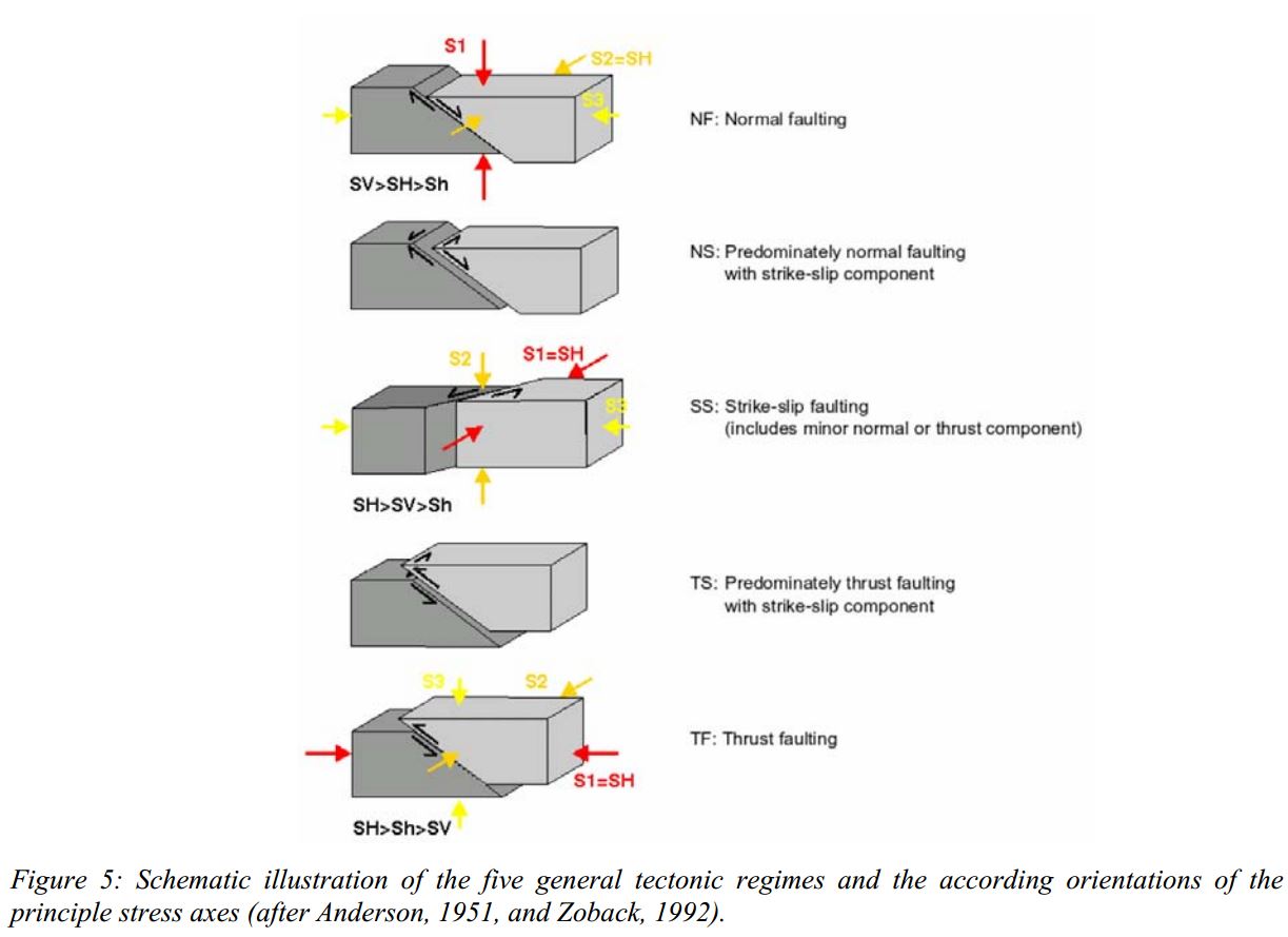
Here is a primer for the orientations of principle stress in different tectonic regimes. This is from the World Stress Map Project.
Here is a map that is zoomed into these two earthquakes.
Anderson, E.M., 1951. The dynamics of faulting and dyke formation with application to Britain, 2nd ed., Edinburgh, Oliver and Boyd.
Zoback, M.L., 1992. First- and second-order patterns of stress in the lithosphere: The World Stress Map project. J. Geophys. Res., 97, 11,703-11,728.
4 thoughts on “These earthquakes, in the Solomons”