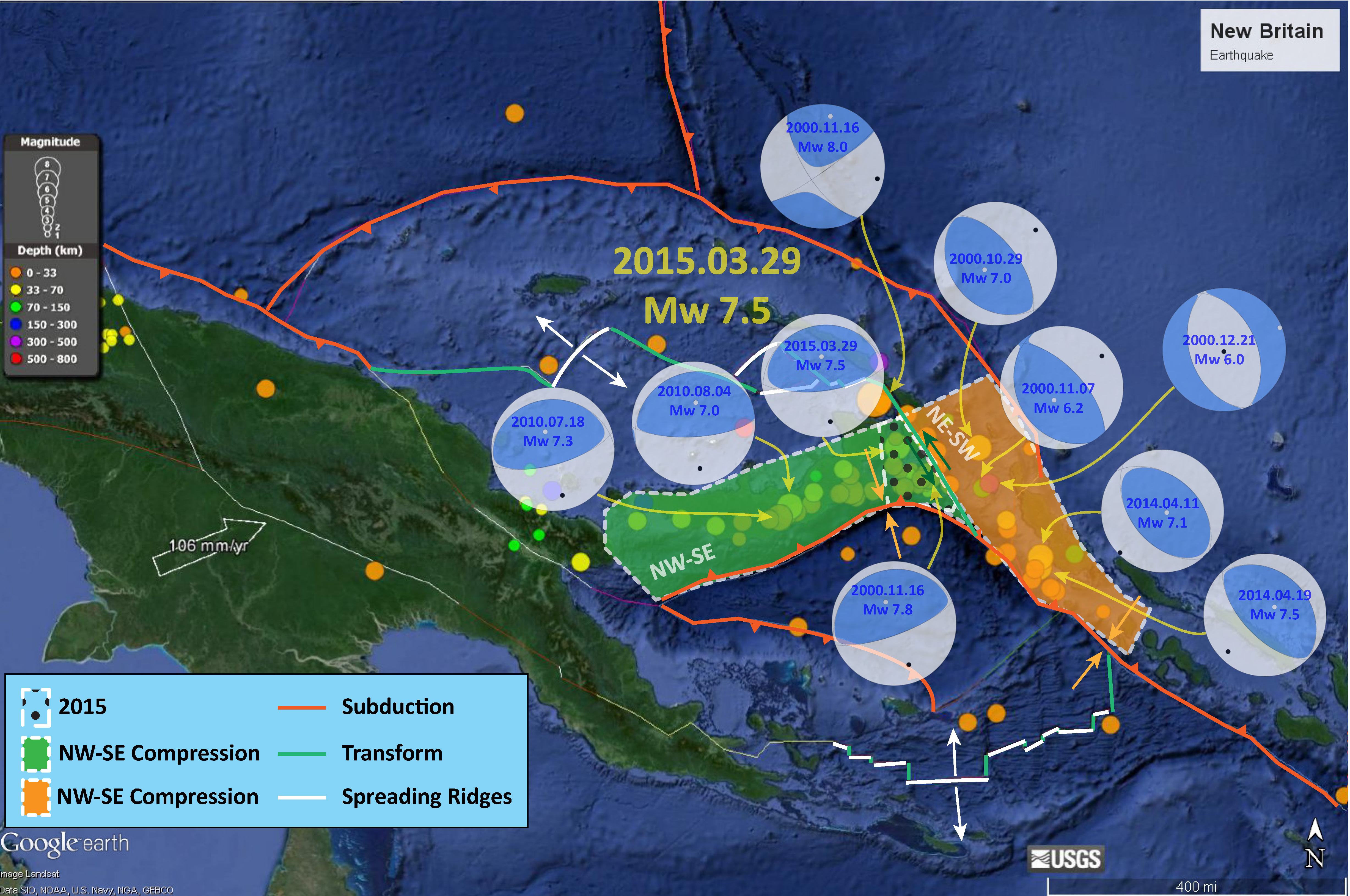
I was taking a looksie at the different moment tensors for the years of 2000, 2010, 2014, and March 2015. I noticed that the transform plate boundary on the eastern side of the South Bismarck plate may separate segments of the subduction fault formed by the downgoing Solomon Sea plate (as it subducts beneath the South Bismarck plate to the north and the Pacific plate to the east). Earthquakes to the west of this transform fault (fault segment colored green) show northwest-southeast oriented compression. The earthquakes to the east of this transform fault (colored orange)show northeast-southwest compression. The transform fault appears to have ruptured in 2000 with a Mw 8.0 earthquake. I outlined the March 2015 swarm with a polygon that has dots as fill, within the region of NW-NE Compression. I placed the fault boundaries onto the Google Earth imagery (bathy is a combination of coarse SRTM data from Smith and Sandwell and some fine bathy in some locations). These fault boundaries are very imprecisely located. Here is a post that has some of the geography/plates/etc. labeled. Here is my initial post regarding the Mw 7.5 earthquake.

12 thoughts on “New Britain and Bougainville: tectonic domains?”