
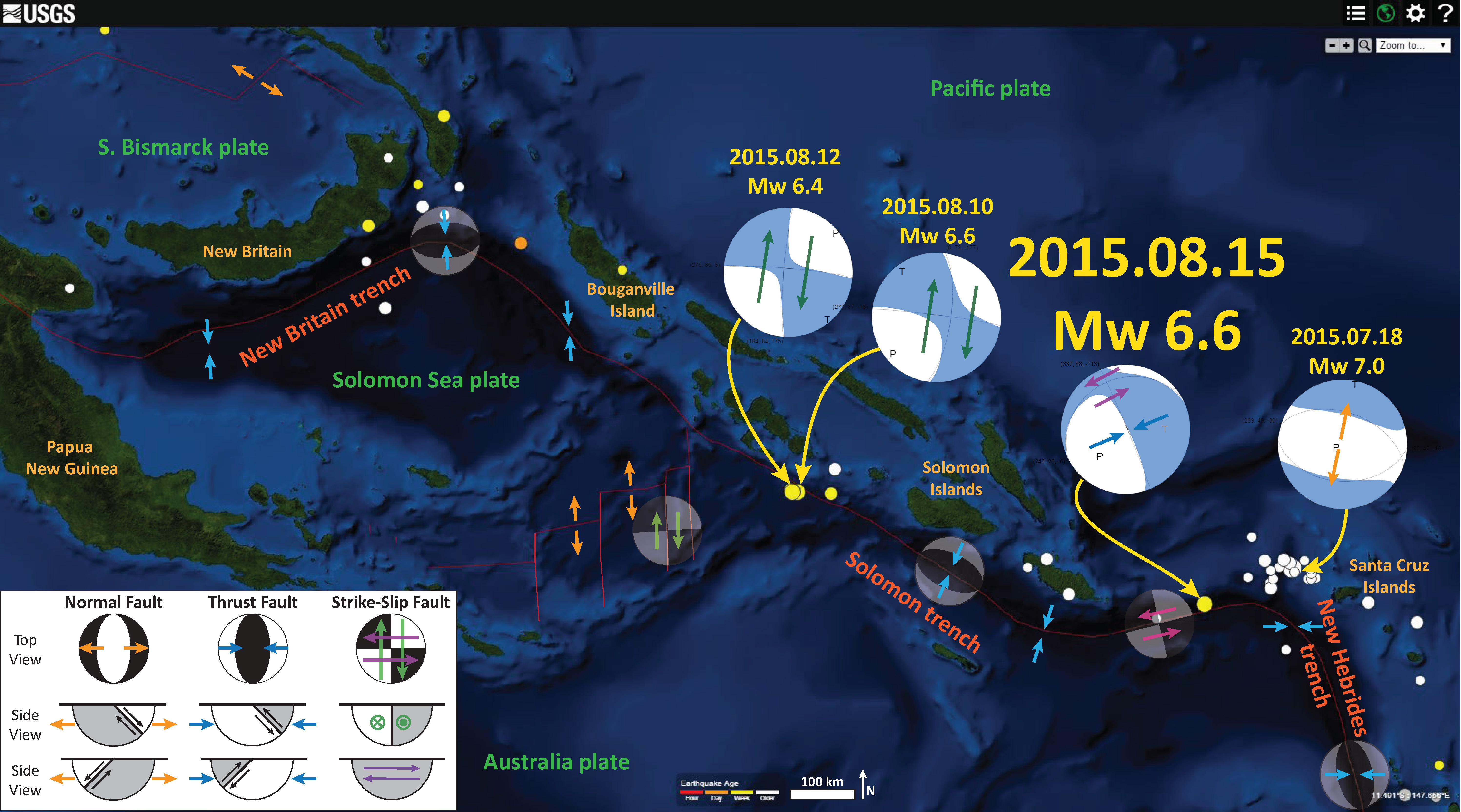
Yesterday we had a large magnitude earthquake along a plate boundary that connects the South Solomon trench with the New Hebrides trench. This region had a swarm of earthquakes in May. Here is the USGS website for the M 6.6 earthquake.
Below is a map that shows my interpretation some earthquakes along these plate boundaries. I plot the moment tensors for each earthquake. I placed a moment tensor / focal mechanism legend in the upper right corner of the map. There is more material from the USGS web sites about moment tensors and focal mechanisms (the beach ball symbols). Both moment tensors and focal mechanisms are solutions to seismologic data that reveal two possible interpretations for fault orientation and sense of motion. One must use other information, like the regional tectonics, to interpret which of the two possibilities is more likely.
Yesterday’s M 6.6 earthquake appears to plot along a strike-slip fault system. In May, three earthquakes each had strike-slip moment tensors. Yesterday’s earthquake has an oblique moment tensor, which shows mostly compression (thrust/reverse) with slight left-lateral possible motion. I use the earthquakes in May to help me interpret this moment tensor. In the past few days (2015.08.10 and 2015.08.12) there has been a swarm of earthquakes in the downgoing plate along the South Solomon trench. I interpret that these are along north-striking fracture zone/transform faults in the Woodlark Basin. In July, there was a M 7.0 earthquake near the Santa Cruz Islands that has an extensional moment tensor. This earthquake appears to be located along the outer rise, which is a region where the Pacific plate is bending. The bending creates extensional stresses, causing extensional earthquakes. Based on the orientation (strike) of this extensional earthquake, yesterday’s M 6.6 could possibly have been in a region of increased coulomb stress. It might be that the May and July earthquakes all created increased stress that led to yesterday’s M 6.6 earthquake.
-
Here are links to the four earthquakes shown on the above map.
- 2015.07.18 M 7.0
- 2015.08.10 M 6.6
- 2015.08.12 M 6.4
- 2015.08.15 M 6.6
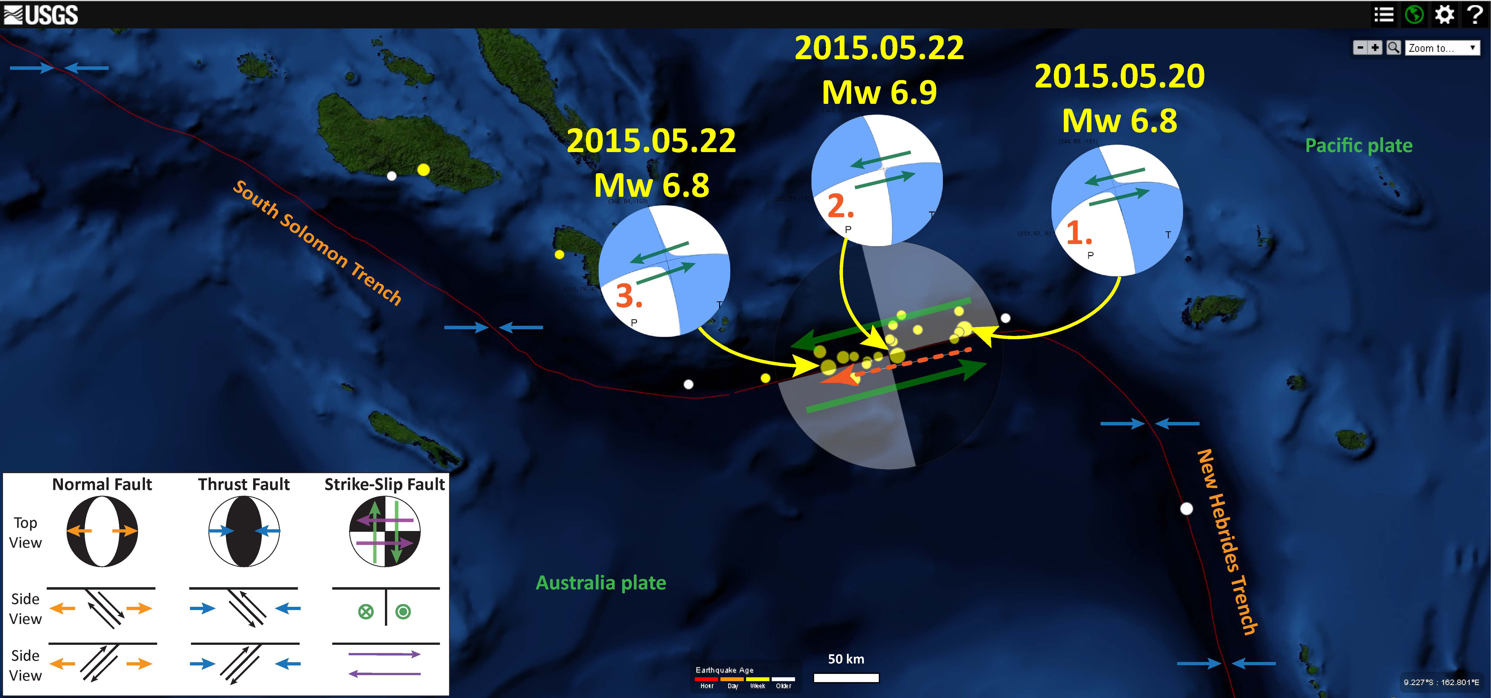
Here is a map that shows the three earthquakes that happened in May, 2015. Note how the easternmost earthquake dips slightly to the north, which matches the dip of yesterday’s M 6.6 earthquake (presuming my interpretation is correct).
-
The USGS has two tectonic summary posters for this region. They overlap slightly where yesterday’s earthquake occurred.
- Seismicity of the Earth 1900–2010 Eastern Margin of the Australia Plate: OFR 2010-1083-I
- Seismicity of the Earth 1900–2010 New Guinea and Vicinity: OFR 2010-1083-H (This one is possibly better for this region.)
2 thoughts on “Earthquake near the Santa Cruz Islands (western Pacific)!”