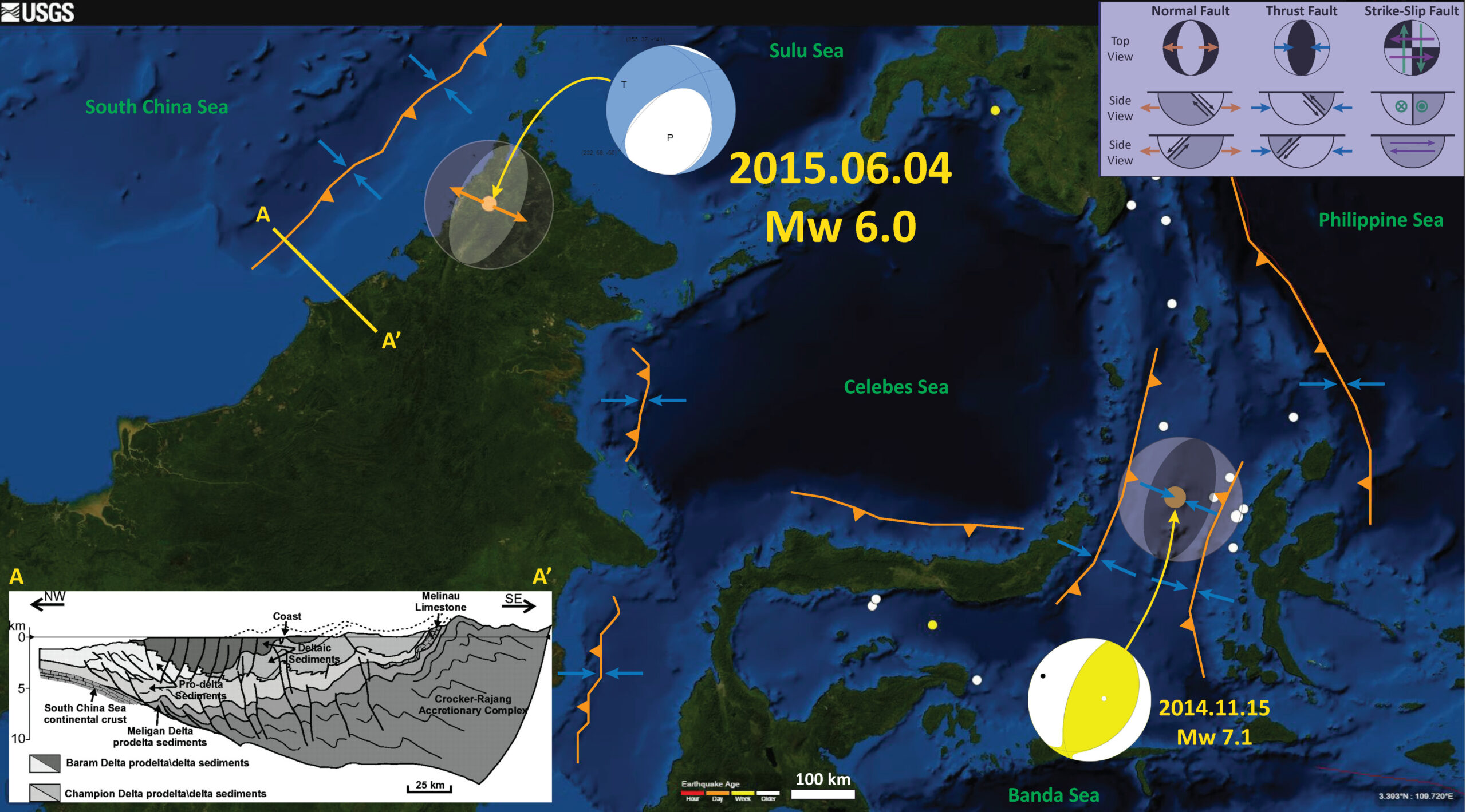
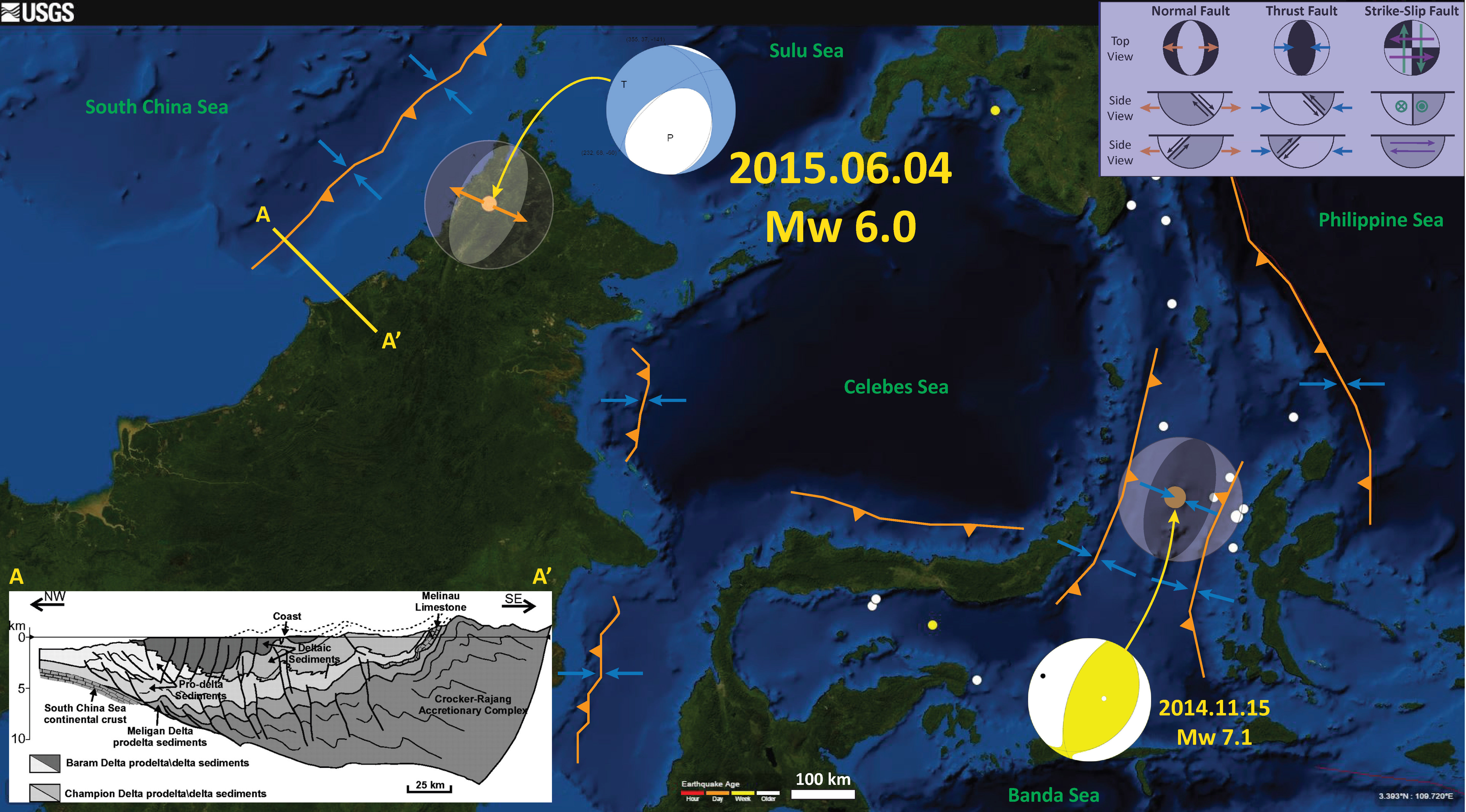
We had an extensional earthquake in northwest Borneo today. The region is an old accretionary prism, probably still active. Here is the USGS web page for this M 6.0 earthquake.
Here is a map that shows where today’s earthquake is, along with the USGS moment tensor. The earthquake is plotted as an orange circle (represents depth) with a diameter related to the magnitude of the earthquake. Moment tensors (and focal mechanisms) are graphical depictions that show the 3-D orientation of the stresses associated with the earthquake. These graphical solutions are determined differently for moment tensors and for focal mechanisms, however, their graphical depiction of their solutions are the same. There is also a small legend explaining the implications for the different moment tensors. I also plot the moment tensor for an earthquake that happened in November of 2014.
Also, I plot a cross section from Tingay et al. (2005). This cross section (marked A-A’ ) shows the Tertiary-Quaternary accretionary prism structure, as well as the seismic stratigraphic and geotechnical interpretation of the sedimentary deposits. Note the predominance of thrust faults in this cross section, the result of convergence.
-
The region east of the Celebes Sea has been quite active in the past six months. Here are some posts where I discuss this swarm.
- 2015/11/15 Mw 7.1 earthquake
- 2015/11/21 Mw 6.5 aftershocks
- 2015/11/26 Mw 6.5 aftershocks
- 2015/11/15 Mw 6.2 extensional earthquake
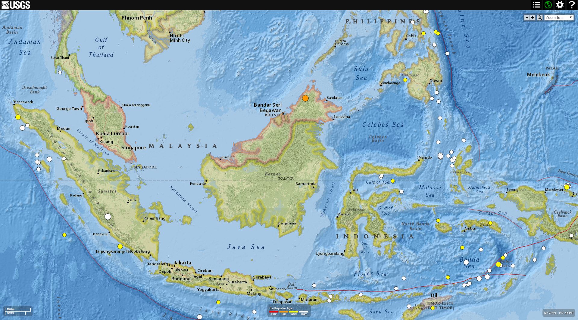
Here is a map that shows the earthquake at a more global scale, to help orient us for the above map. Today’s M 6.0 earthquake is plotted as an orange dot.
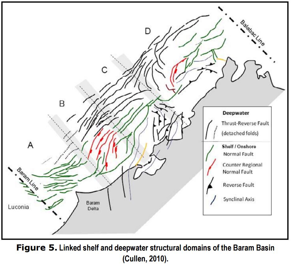
Here is a map from Cullen (2011). This shows how the region has both thrust/reverse and normal faults. The cross section is located near the Baram Delta shown in this map.
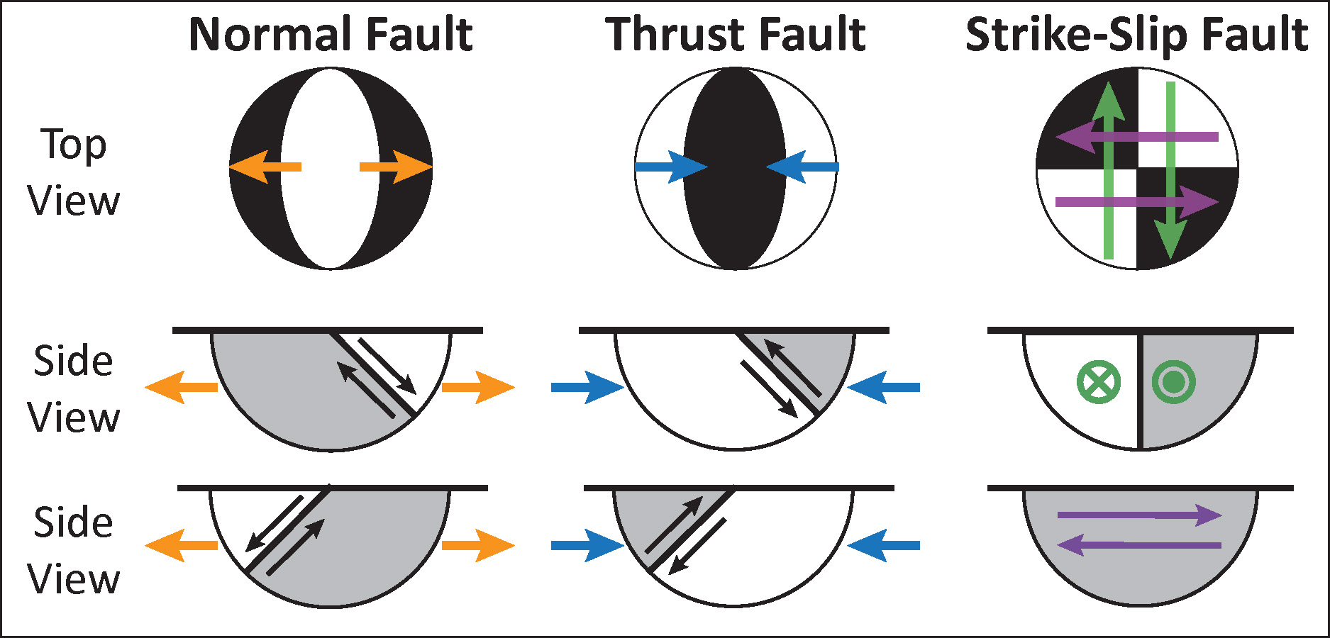
This is the moment tensor legend at a larger scale.
-
References:
- Cullen, A., 2011, Influence of Hinterland Bedrock Lithologies on Aspect of Borneo’s Deepwater Fold and Thrust Belt, Berita Sedimentologi #22
- Tingay, M., Hillis, R., Morley, C., Swarbick, R., and Drake, S., 2005. Prograding tectonics in Brunei: regional implications for fault sealing, Alaska rocks 2005 proceedings: rock mechanics for energy, mineral and infrastructure development in the northern regions, 25-29 June, 2005, in Gang Chen, et al (eds.),ARMA/USRMS Paper 05-785.
Thank you!