Well well.
The faults in southern CA are large in number. Following Danielle’s lead, I looked into the tectonics of the region. The Shaw et al. (2002) paper has a really good summary of the tectonics of this region of southern CA. I posted some of his figures on my first page for this earthquake swarm.
Here is a map from Shaw et al. (2002) that shows the blind thrust faults that almost daylight just south of the Whittier fault.

Here, Danielle placed a georeferenced version of that map into google earth. She has the mainshock and some aftershocks plotted.
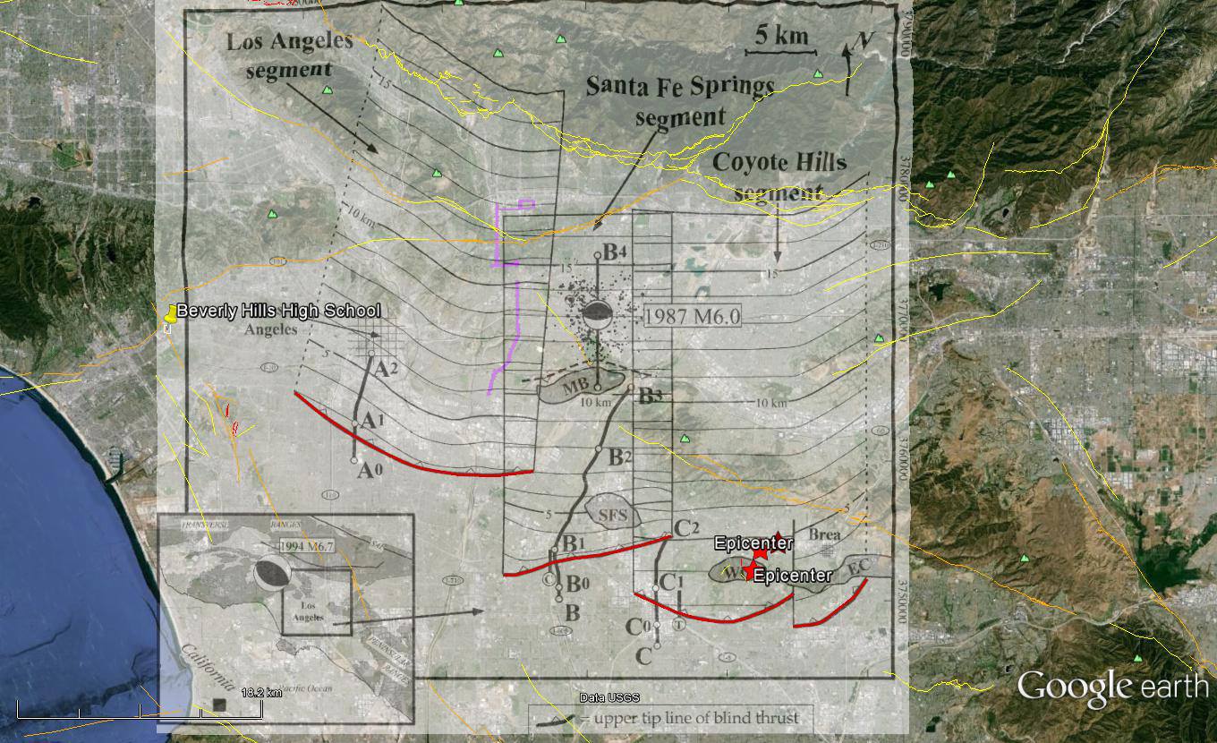
Along with her husband Chris, also a geologist at Earth Consultants International, have been discussing which fault this earthquake swarm ruptured. At first they thought it was on the Puente Hills Thrust fault, specifically the Coyote Hills segment. Now that we have this map rubbersheeted, we can compare the hypocentral depth of the M 5.1 earthquake (7.5 km) and compare with the geometry of the faults based on seismic profiles (the Shaw 2002 paper and Leon et al, 2007 paper). The depth of the PHT fault at the epicentral location of the M 5.1 earthquake shows a depth ~4-5 km, shallower than the M 5.1 earthquake. And, as Chris and Danielle point out, the M 5.1 hypocenter is not deep enough to be on the Elysian fault (which is shown on the following map from Shaw). A shared hypothesis from the Madugos (i just love how they combined their prior last names, madden and verdugo, to create their new shared last name), “Probably a conjugate accommodational structure in the hanging wall of the EPT.”

More updates.
The Southern California Seismic Network has put together a web site for this earthquake swarm.
Here is a summary of the potential of a larger aftershock, or triggered earthquake on a different fault, from the LA Times. It seems to me like this swarm may have retarded the earthquake likelihood of an earthquake on the Whittier fault, but possibly imparts stress on adjacent thrust faults in the region.
Here is a map the USGS put together to illustrate the historic earthquakes in the LA region. One may order a hard copy for 12 bucks.

Here is a map that shows the Modified Mercalli Intensity shaking modeled for this earthquake, shown in contours.

This map shows the ground motions in Peak Ground Acceleration (in % g, which stands for gravity, 9.8 m/s^2)

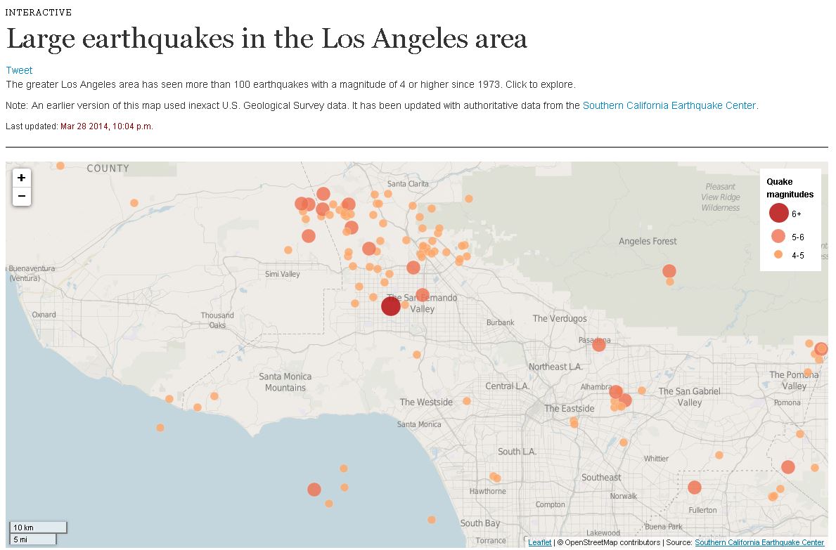
Here is an interactive map from the LA Times that shows the historic earthquakes in LA.
Here is a video from the Southern California Earthquake Center that shows the geometry of faults in the region of the Puente Hills Thrust fault. The animation ends with the PHT fault in purple. This is a 58 MB mov file.
3 thoughts on “La Habra M 5.1 earthquake update”