All right! That was exciting and a little bit scary. Most all earthquakes scare me because I recognize they might get bigger or trigger a bigger one.
This earthquake is most likely on a northeast striking strike-slip fault in the downgoing Gorda plate. The GP is caught in a vice between the older and stronger North America and Pacific plates.
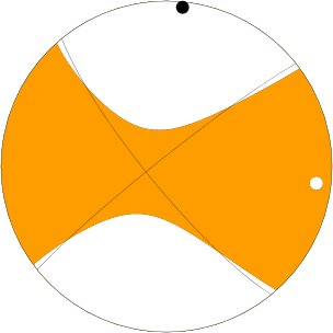
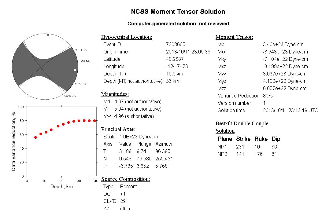
Here is the moment tensor
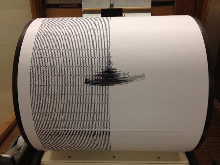
Here is the seismogrpaph at HSU (photo credit Lori Dengler)
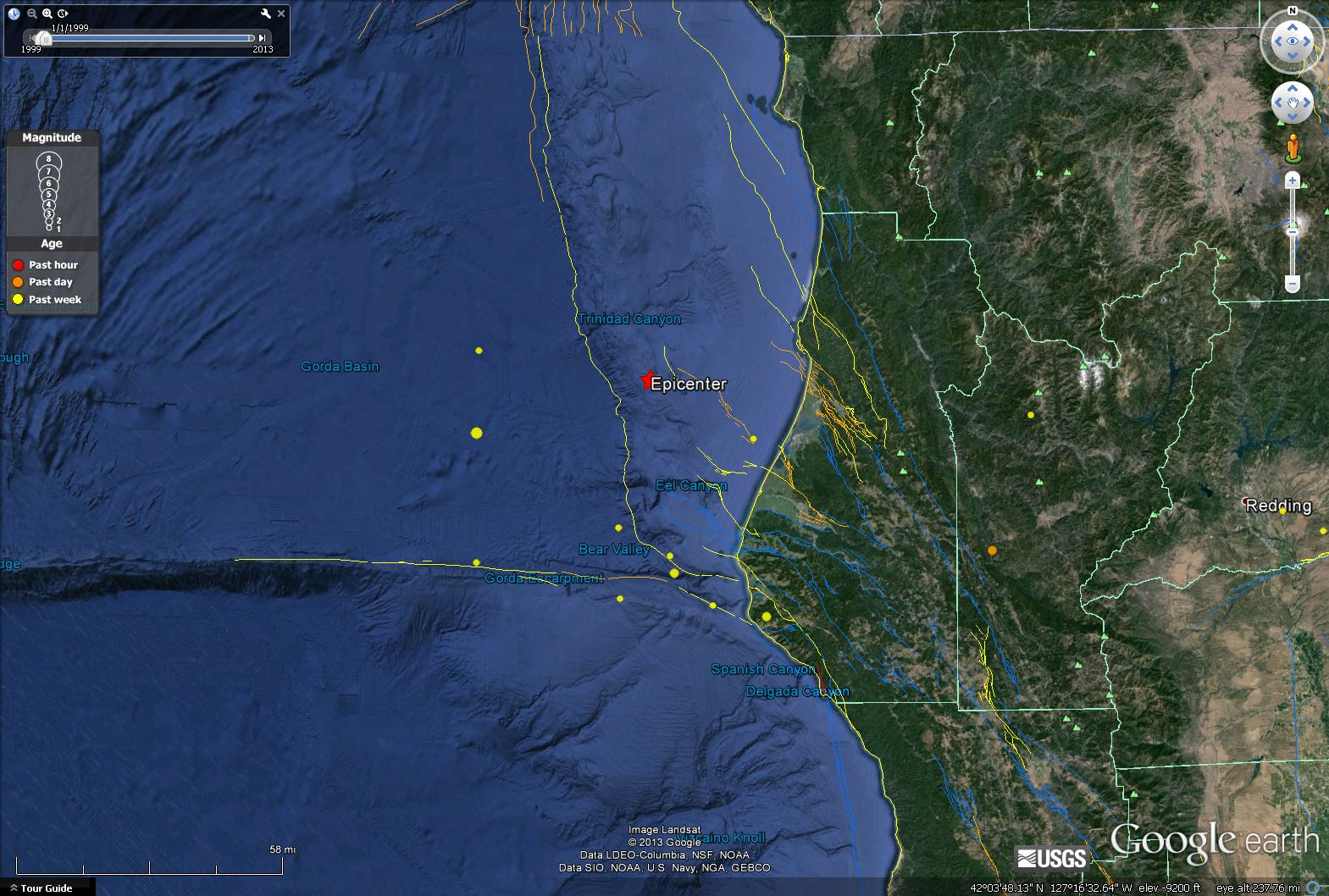
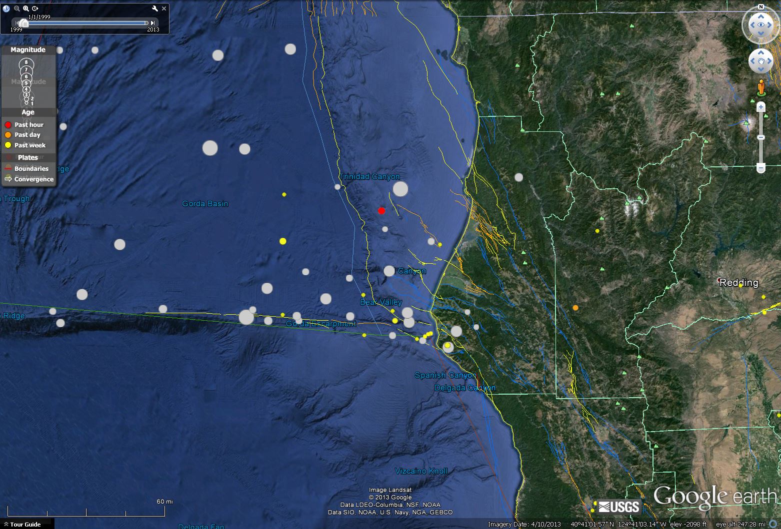
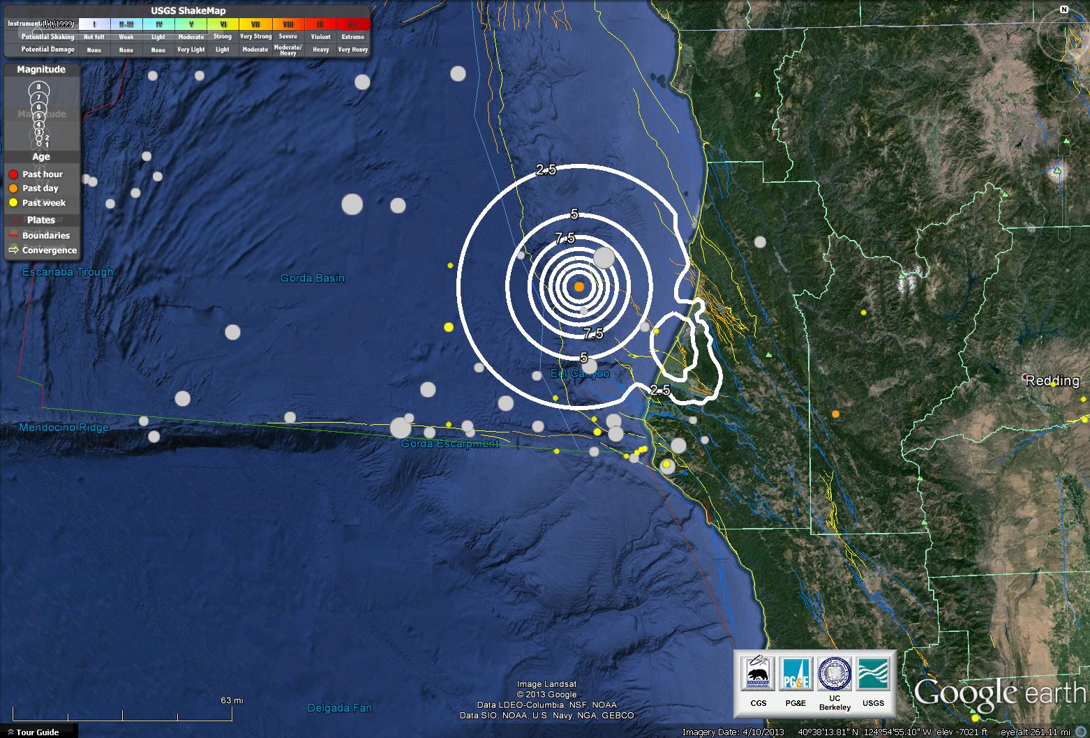
Here is a map I made in google earth showing historic earthquakes. Note the larger gray circle to the northeast of today’s earthquake. That is the 1980 Mw = 7.2 earthquake that caused extensive damage in Humboldt County (knocking the bridge partly down on hwy 101 near CR). Today’s earthquake appears to be along the same fault system that ruptured in 1980:
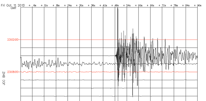
Here is the seismogrpaph at Jacoby Creek (data credit Lori Dengler). The vertical lines are six seconds apart.
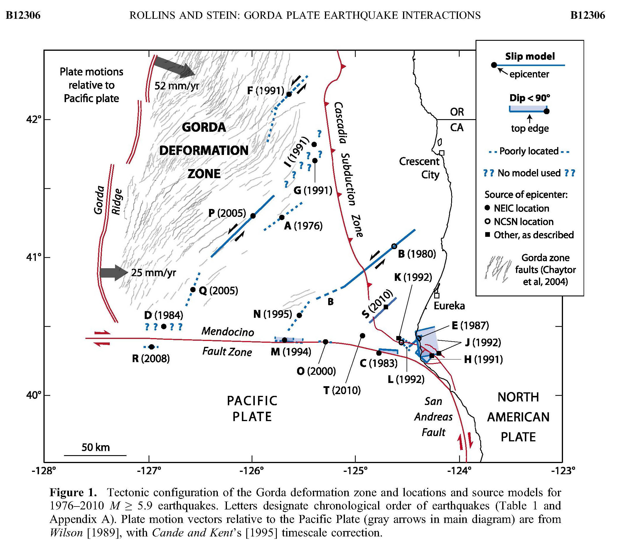
Here is a map that Chris Rollins used in his 2010 paper. It shows historic seismicity in this region, including the 1980 swarm.
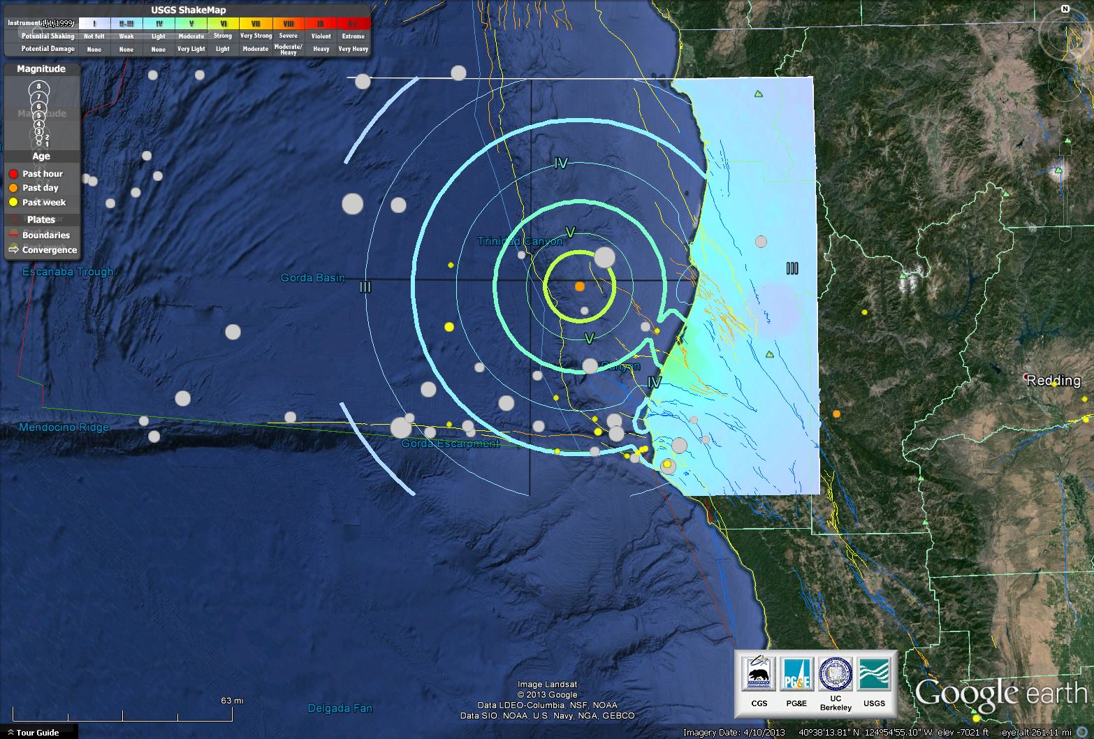
Here is a map that I made in google earth that shows the shaking intensity (Modified Mercalli Intensity Scale).
Here is a map that I made in google earth that shows the % Peak Ground Acceleration (% of g, where g is defined as 9.8 m/s^2).
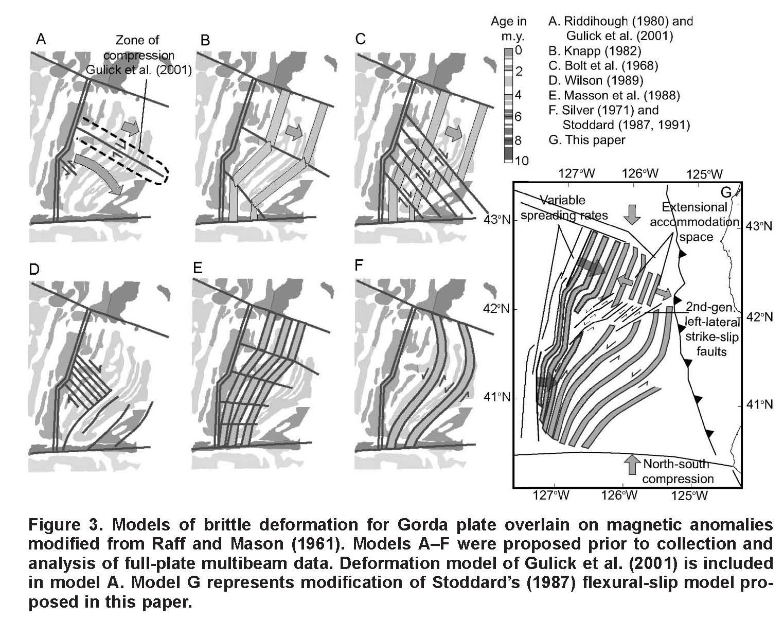
These are the models for tectonic deformation within the Gorda plate as presented by Jason Chaytor in 2004.
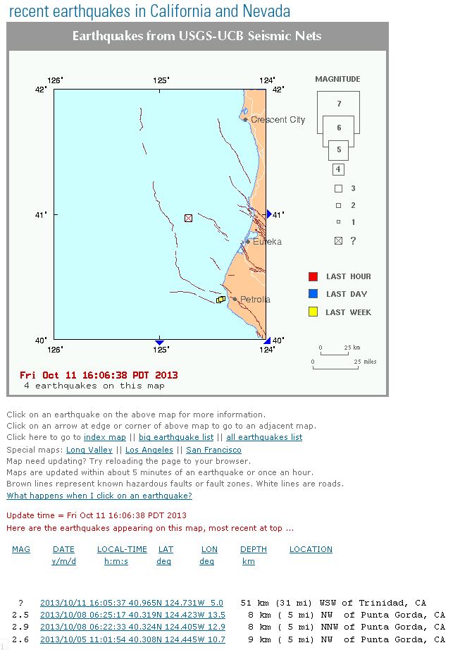
Here is the SCEC page: http://www.data.scec.org/recenteqs/Quakes/nc72086051.html
Here are the seismologic information:
Here is the SCEC map I went to before it showed up on the USGS page. Note that no magnitude had been assigned yet: