We had a large Mw 7.1 earthquake today along the Charlie Gibbs fracture zone, which is the longest transform plate boundary fault system in the North Atlantic, which offsets the Reykjanes Ridge from the Mid Atlantic Ridge.
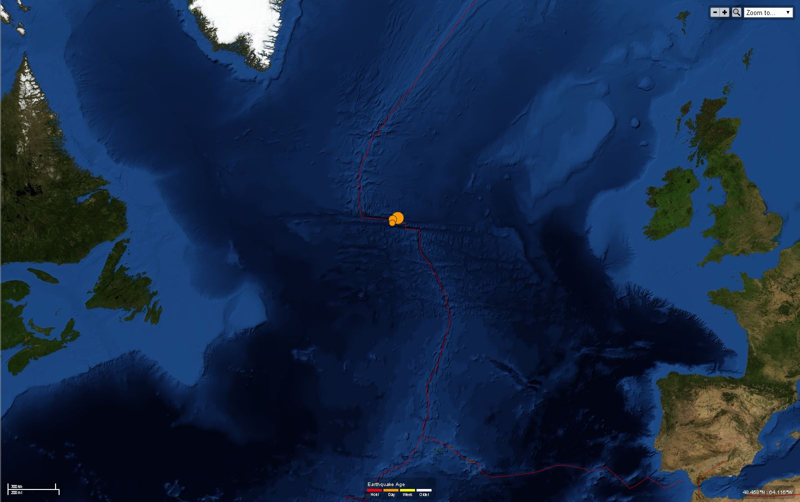
Here is a map showing this earthquake swarm at a global scale.
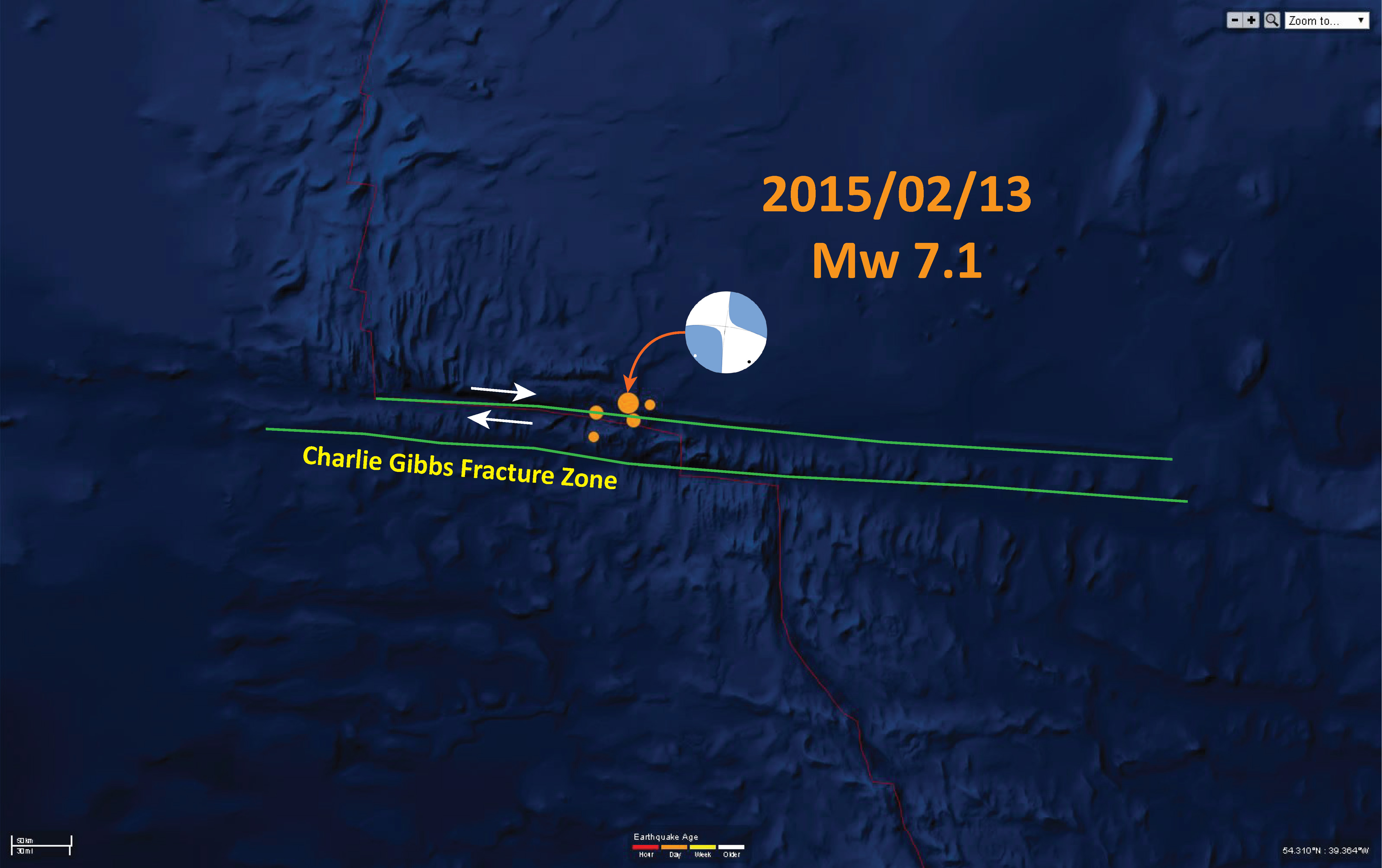
Here is a map showing the moment tensor and my basic interpretation of this swarm as it relates to the existing structures. It is possible that this earthquake is a triggered left-lateral earthquake on a N-S striking fault, though the foreshocks and aftershocks suggest this is a swarm along an E-W striking fault associated with this FZ.
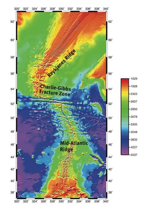
Here is a cool map showing the strucural relations between these two North Atlantic spreading ridges. The CGFZ is a protected marine area, the Charlie Gibbs Marine Protected Area organization made this map.
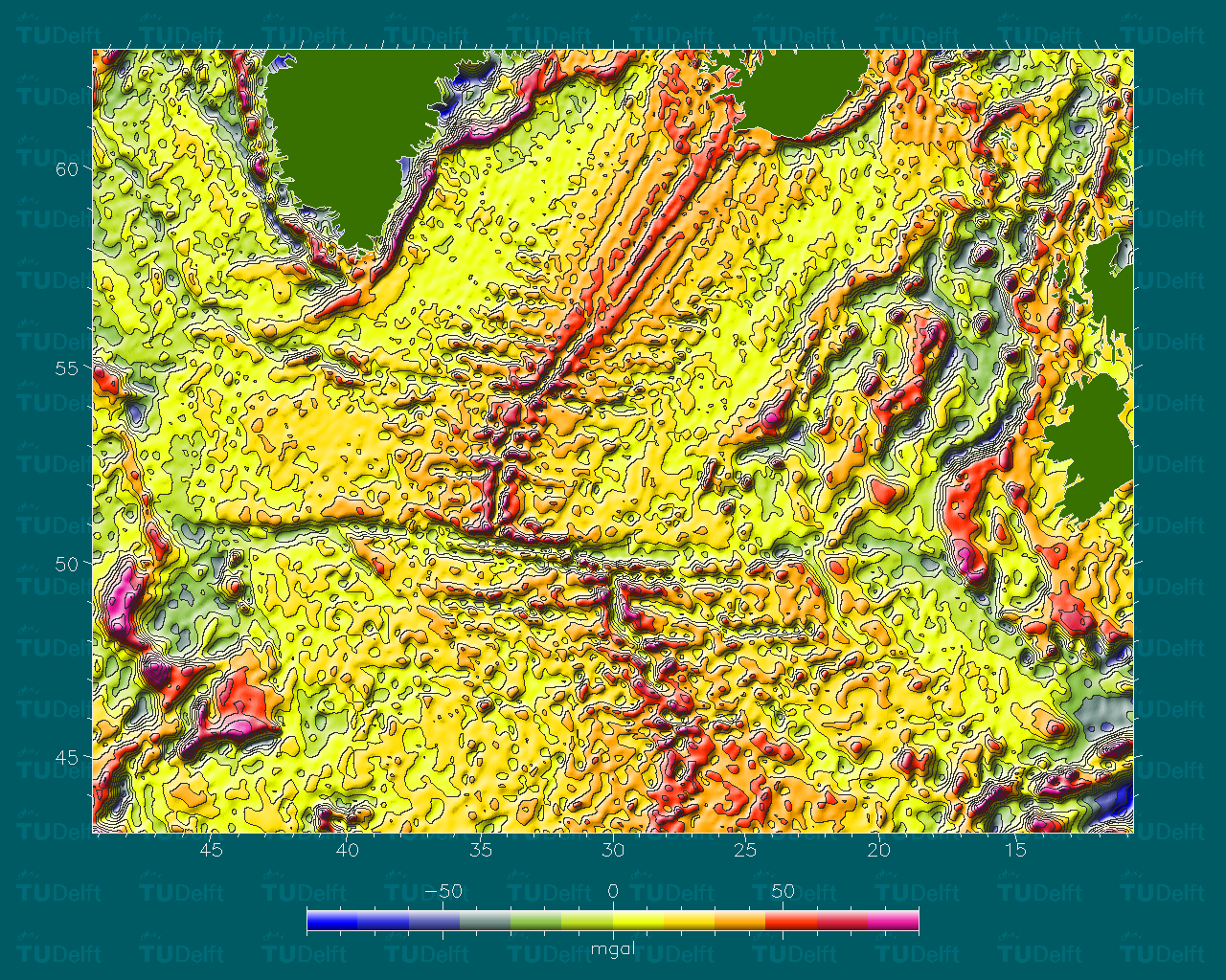
This map shows the gravity anomaly map for this region of the North Atlantic. This map came from the The Altimetry Atlas, Widde et al., 1993. The gravity anomaly maps of the oceans was computed from a combined solution of satellite altimeter data gathered by a number of satellites: GEOSAT, ERS-1 and TOPEX/Poseidon. Check out this paper that describes their methods.
References:
- E. Wisse, R. Scharroo, M. C. Naeije, and K. F. Wakker, 1993. Mean sea surface computation from ERS-1 data: Proceedings of the Second ERS-1 Symposium – Space at the Service of our Environment, Hamburg, Germany, 11-14 October 1993, ESA SP-361, p. 1053-1058, January 1994.
4 thoughts on “Northern Mid Atlantic Ridge: Charlie Gibbs fracture zone”