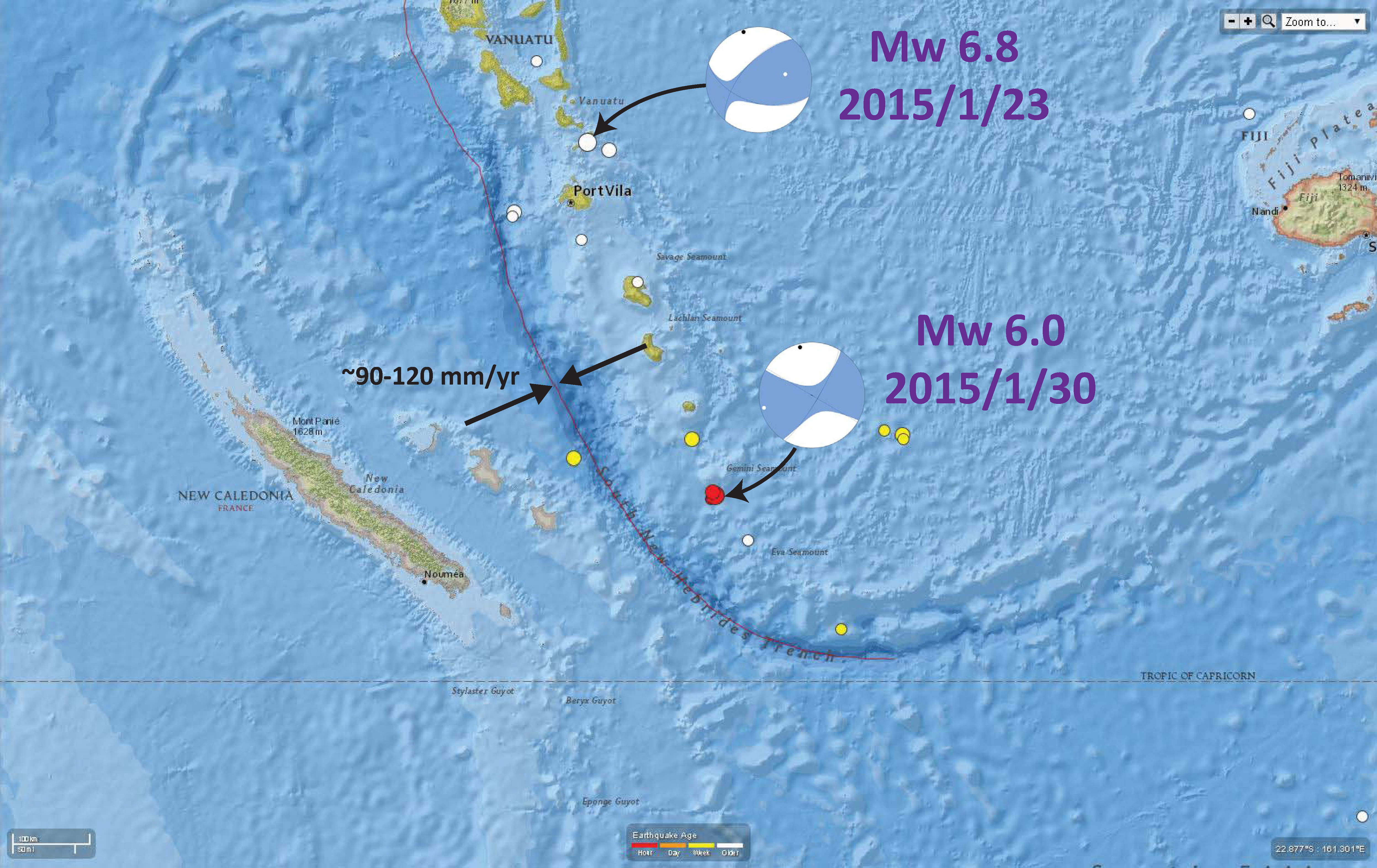
We just had a swarm of shallow seismic activity along the arc above the South New Hebrides trench. The largest magnitude was a Mw 6.0. There was a very deep (~220km) Mw 6.8 just to the north about a week ago.
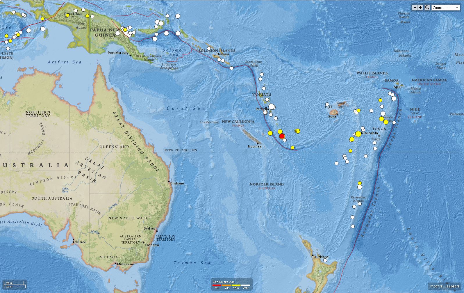
Here is a global scale map showing the general location of these earthquakes.
This map shows the moment tensors for these two earthquakes. The Mw 6.0 may either be a NW striking right-lateral or NE striking left-lateral earthquake. The Mw 6.8 shows north-south compression.
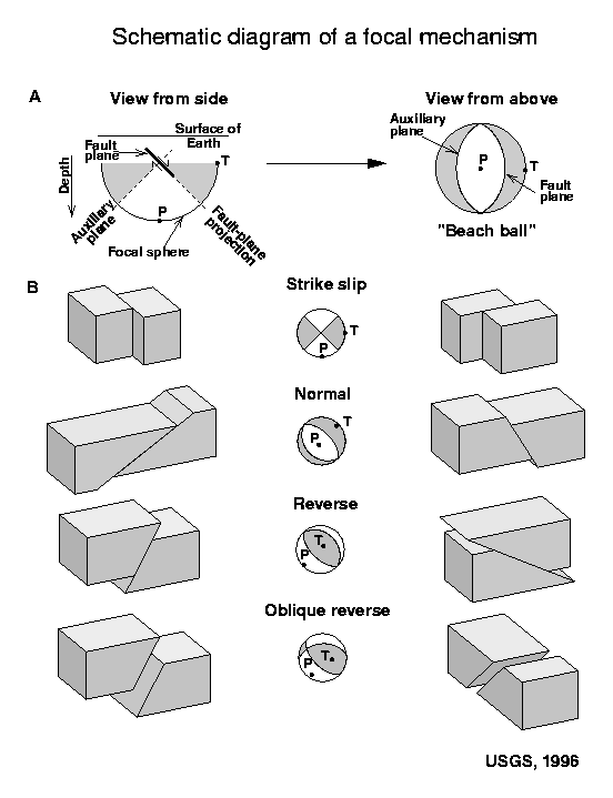
Here is a primer for us to help us interpret these moment tensors. This figure, from the USGS, actually is for focal mechanisms. However, the graphical representation of these two symbols is the same.
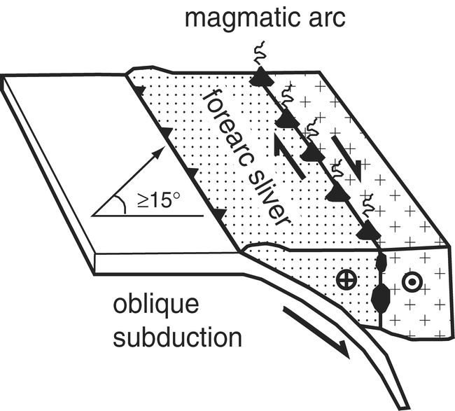
The plate convergence in this part of the arc is almost purely normal (the convergence is perpendicular to the trench). Because of this, there is little to no strain partitioning, so there is probably not a forearc sliver fault system (like the Sumatra and Mentawai faults in Sumatra). Here is what a forearc sliver fault looks like in schematic. This does not necessarily help us interpret the moment tensor, but if there were a forearc sliver, resulting from oblique convergence, we would probably interpret the fault as nw striking.
This is a plot of how oblique convergence is along the New Hebrides trench (McCaffrey, 1996). North is to the left. This shows that there is oblique convergence further north (the plot shows about 75 mm/yr obliquity).
This shows the Modified Mercalli Intensity contours for the Me 6.0.
Here is a USGS poster for the tectonics in this region.
-
References
- McCaffrey, E., 1996. Estimates of modern arc-parallel strain rates in fore arcs, Geology, v. 24, no. 1, p. 27-30, 1996.
I love your tectonic updates, thanks!
;-)