How exciting! This earthquake is on the other side of the Scotia plate from the earthquake swarm from last week.
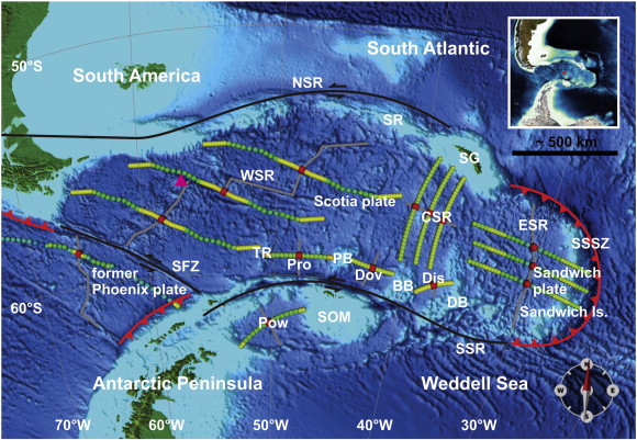
This M7.0 earthquake appears to have slipped along a fault associated with the North Scotia Ridge (NSR). The NSR is mapped as a left-lateral transform fault (not a ridge, like it is named). There is not yet a moment tensor available, but I suspect this may be a left-lateral strike-slip earthquake.
Here is the USGS earthquake page.
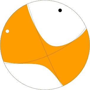
Indeed, the moment tensor shows a possible left-lateral strike slip earthquake. 
Here is a tectonic map of the region from here:

Here is a regional map with the epicenter in orange and historic earthquake epicenters in gray.
Here is a local map showing Modified Mercalli Intensity contours and historic earthquake epicenters.
Here is the USGS page showing the contributed moment tensors:
1 thought on “M7.0 in the South Atlantic”