There was a large earthquake in the Fiji region yesterday (Saturday my time). The epicenter is far from the major convergent plate boundary. Here is the USGS page for this earthquake.
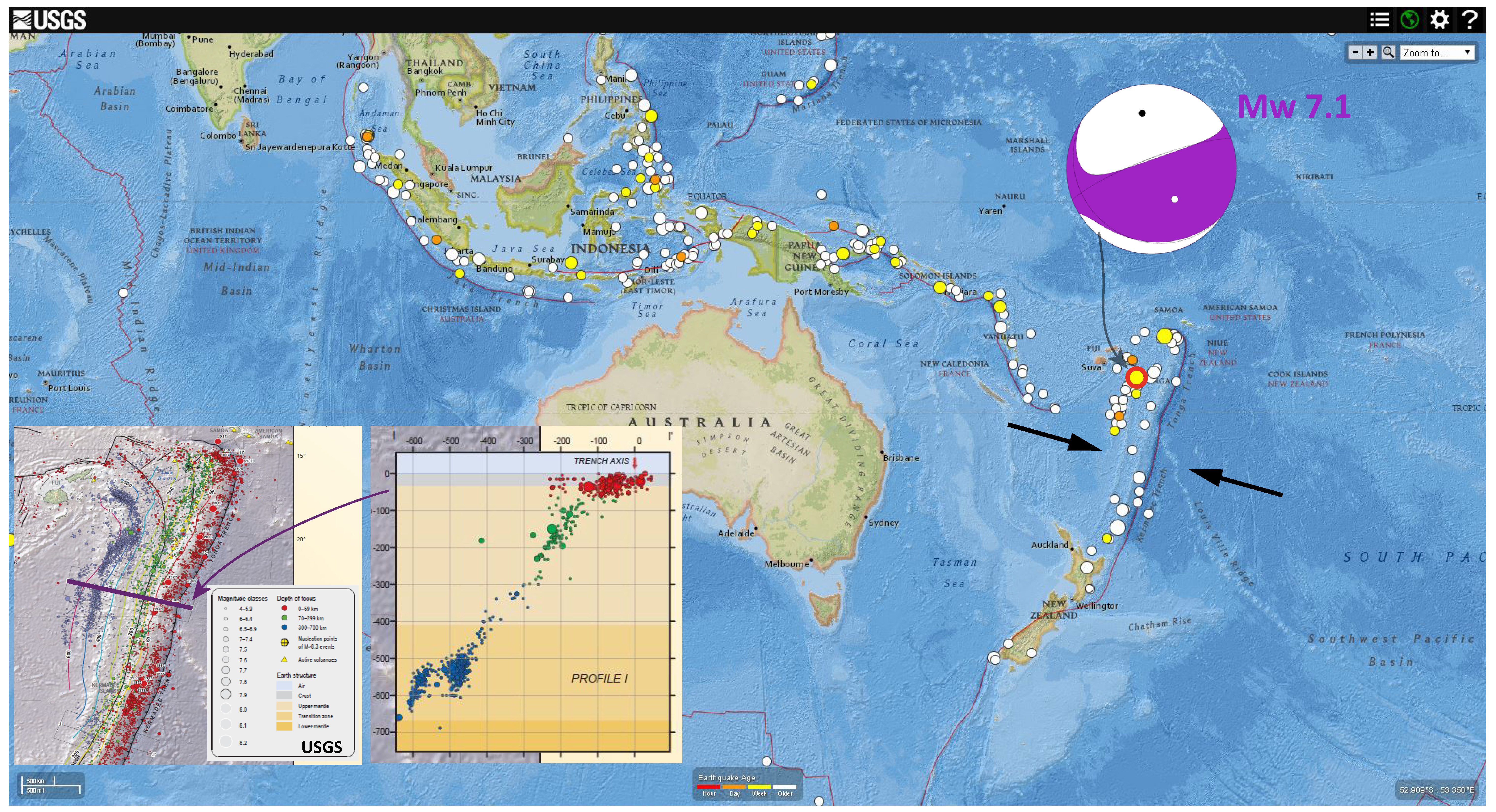
Here is a map at the global scale. The epicenter is marked by a red circle, just South of Samoa and East of Fiji. This earthquake is related to the subduction zone associated with the Tonga Trench. The moment tensor shows an east-northeast striking compressional solution, due to principal axis compression in the n-nw/s-se direction. Prior to looking at the moment tensor, I was expecting to see an extensional solution at this depth. The cross section of seismicity is sourced from earthquakes designated by the purple line.
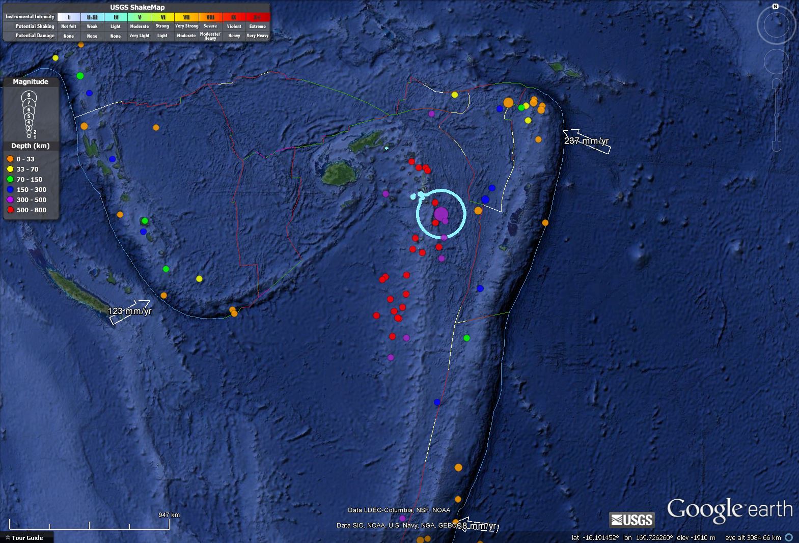
Here is a regional scale map showing the plate configuration.
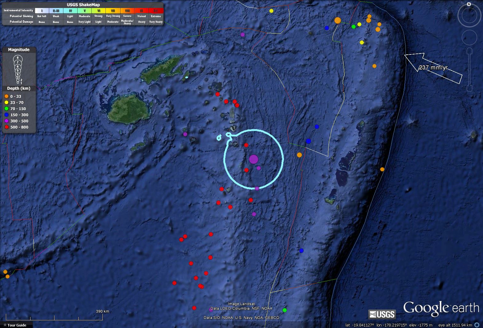
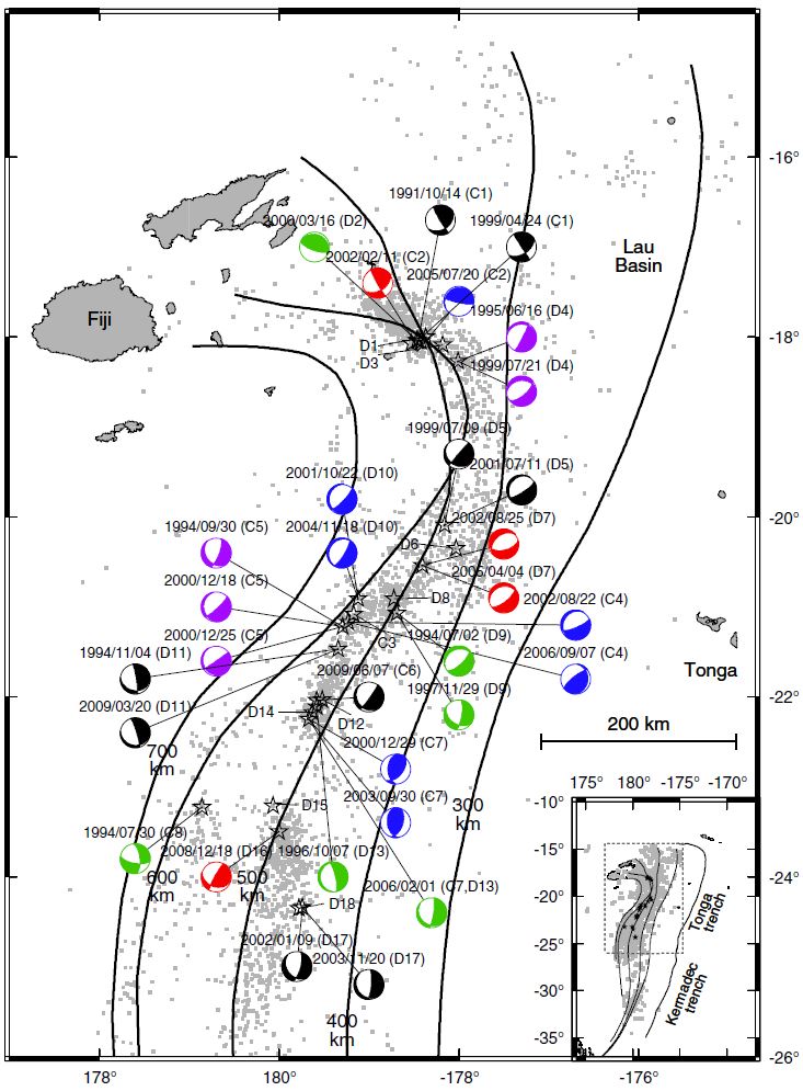
This is a local scaled map showing the complexity of the spreading ridges and transform faults to the east of this earthquake swarm. The Modified Mercali Intensity Contour 3.5 is plotted as a light blue circle. Epicenters are plotted by color in relation to depth.
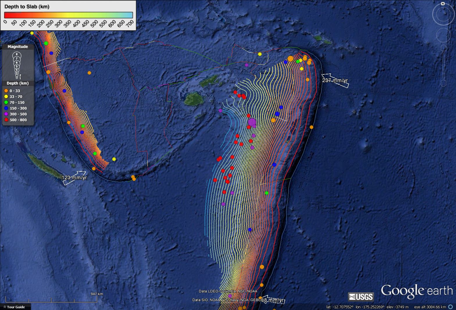
Here is the regional map showing the slab contours. The depth of this earthquake (434 km) is close to, but above, the slab depth (500 km). If one looks at the cross section of historic seismicity, it appears that the slab is possibly bending upwards. Perhaps there is some compression in the upper plate here, causing the compressional moment tensor.
Here is another view of the slab, generated using P-wave tomography. Doug Weins discusses his work in this region. “Red and blue colors denote slow and fast velocities, respectively, and the velocity perturbation scale is shown at the bottom.”
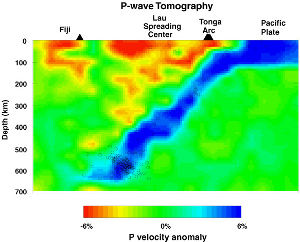
Interestingly, deep focus earthquakes take up ~66% of the deep earthquakes globally. From this paper, we can see that the slab contour may change strike in the region of yesterday’s earthquake.
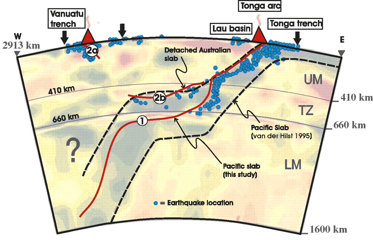
Richards et al., 2011 also show bends in the downgoing slab. There is some controversy about the configuration of the slab in this region. They show a detached slab just above the main port (more Star Wars), above the main slab.
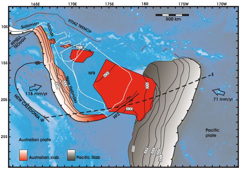
The New Hebrides subduction zone dips to the east and turns into a transform fault just west of yesterdays earthquake. This map shows the profile for the above cross section from Richards et al. (2102)
This figure shows Richards et al. Figure 4, that displays their interpretation of how the plates came to be configured here. The Australia plate detached and collided with the Pacific slab about 4 million years ago.
Here is the USGS Open File poster for the region (Benz et al., 2010). Hypocenters are plotted as cross sections to show the geometry of the subducting slabs.
As one might expect, an earthquake at this depth, given this magnitude, would not generate strong ground motions at the surface. The pager, an estimate of human and infrastructural losses, reflects this low likelihood of damage.
Here is a primer about Focal Mechanisms from the USGS.
-
References:
- Hayes, G. P., D. J. Wald, and R. L. Johnson (2012), Slab1.0: A three-dimensional model of global subduction zone geometries, J. Geophys. Res., 117, B01302, doi:10.1029/2011JB008524.
- Benz, H.M., Herman, Matthew, Tarr, A.C., Furlong, K.P., Hayes, G.P., Villaseñor, Antonio, Dart, R.L., and Rhea, Susan, 2011, Seismicity of the Earth 1900–2010 eastern margin of the Australia plate: U.S. Geological Survey Open-File Report 2010–1083-I, scale 1:8,000,000.
- Richards, S., Holm., R., Barber, G., 2011. When slabs collide: A tectonic assessment of deep earthquakes in the Tonga-Vanuatu region, Geology, v. 39, pp. 787-790.
- Yu, W. and Wen, L., 2012. Deep-Focus Repeating Earthquakes in the Tonga–Fiji Subduction Zone, BSSA, v. 102, no. 4, pp. 1829-1849
Question.
Background:
If one wants to simulate what air viscosity is for bumble bee wings at the foot scale size, one uses thick sugar water. This is what viscosity of air would be like for a bee’s wings but at a scale that can be studied. The flap rate is slow tremendously also. Scale means everything.
Now the question:
If the earth was the size of a basketball, what would the viscosity of the magma be like? Water? Oil? Differential grease?
And what would be the time scales? Days becomes seconds?
When Reynolds number was first introduced to me many moons ago – the sixties – i had no concept of what a deminsionaless number could represent. First time i ever heard the word was earlier when i was interested in aeronautics and building model airplanes – funny but when i finally got the gut level feeling combined with the physics for the Reynolds Numbers was from an article about insect flight and how that actually works, what the physics is, and why scale is important.
http://deepblue.lib.umich.edu/bitstream/handle/2027.42/77131/AIAA-32191-805.pdf?sequence=1
So what is the reynolds numbers needed if we scale the earth to our intuitive gut level world experience – the earth as a basketball size?
i am not really sure…. tho it is clear that it would need to be scaled…
in terms of reynolds numbers… i think the scale would be irrelevant…
but i am not a geodynamicist nor a geophysicist…