
Here I post some updates about the M 8.3 Great Earthquake in Chile and the associated tsunami observations and models.
-
I have three earlier posts about this earthquake and tsunami event.
- First Post
- Update #1
- Tsunami Observations
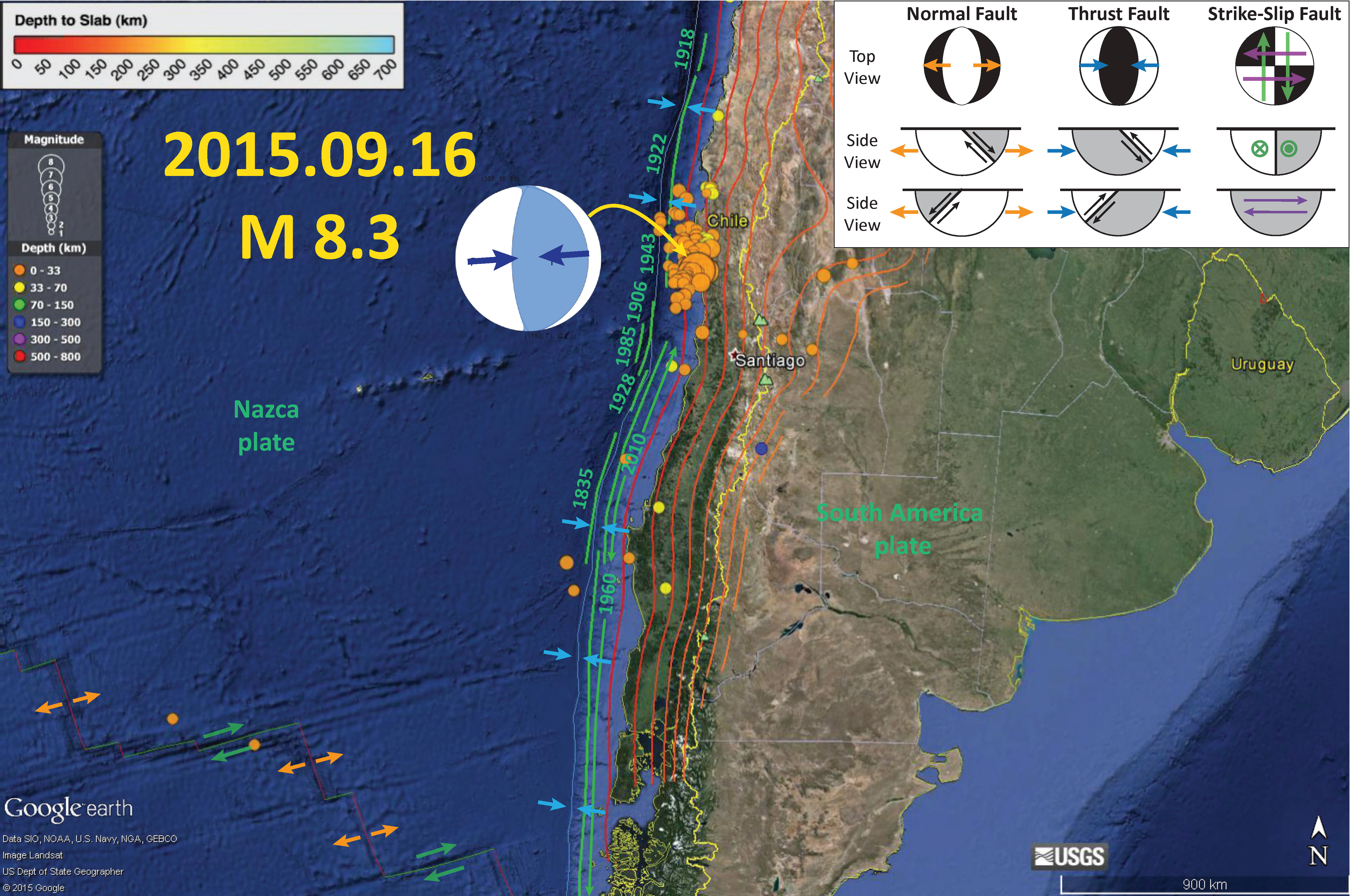
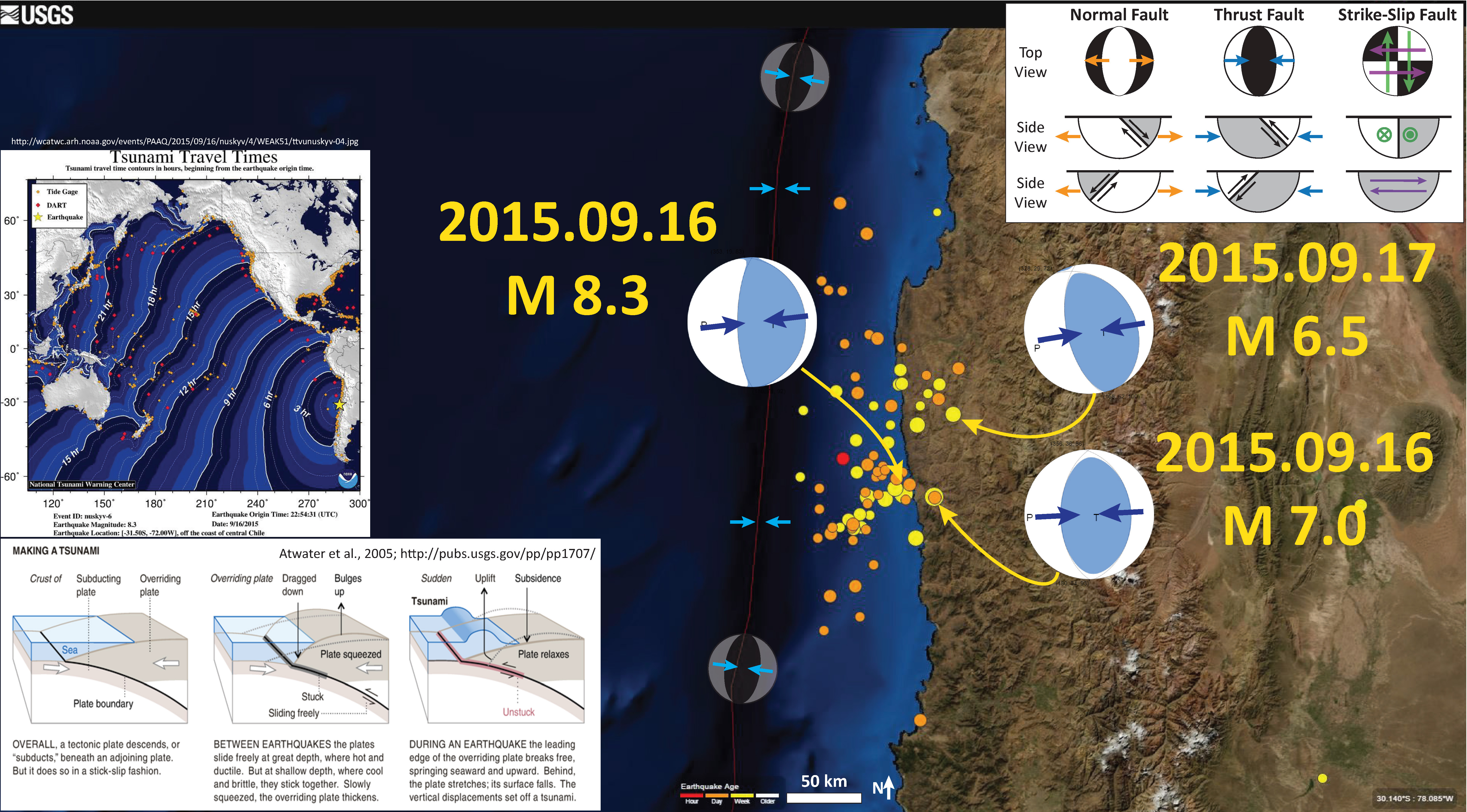
Here is an updated map, that shows the aftershocks are extending further north and south, out of the 1943 strike length region. The 1922 earthquake to the north was much larger, with a magnitude of M 8.5.
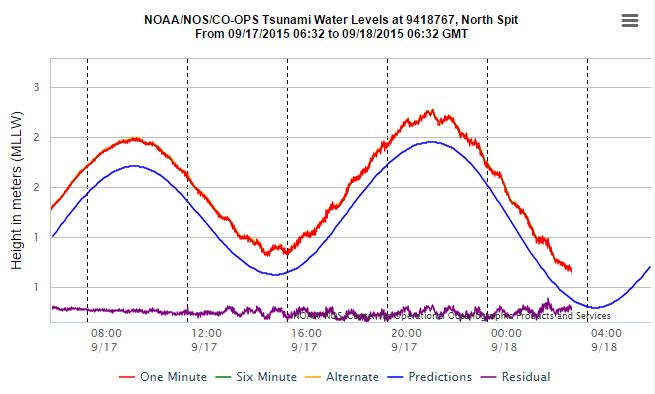
Here are some observations from tide gages along the west coast of the US. These all come from here.
Crescent City

North Spit (Humboldt Bay)
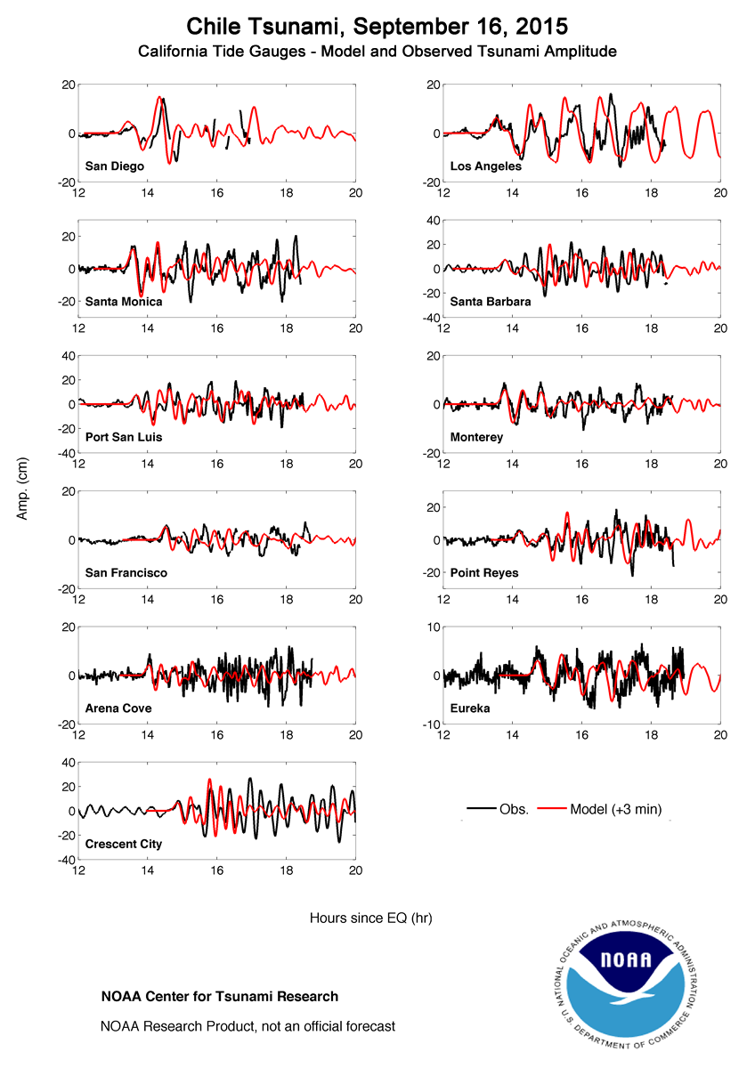
Here are some tsunami simulations from NOAA here.
Here is the wave height map, based on numerical simulations of wave propagation throughout the Pacific Ocean. These simulations are recurrently compared with tide gage and buoy data.

This plot shows their model results as compared to tide gages in Chile.

This plot shows their model results as compared to tide gages in California.
This is an animation of their wave propagation model. Here is the link to the embedded mp4 video below.
Here is some drone footage of the tsunami damage in Chile.
RT:
emol TV:
The Guardian:
Here is a large scale map showing an update of the epicenter plots.
10 thoughts on “2015.09.16 Chile Update #2”