Last night (Pacific Time) there was a M 6.7 earthquake in the western Pacific near Guam. Here is the USGS page for the earthquake. The depth is about 137 km, so it is unlikely to generate a tsunami. Also, the depth reduces the likelihood of damage from ground shaking.
Here is a map showing the global tectonics. The epicenter is west of the Marianas Trench, which is formed by subduction of the Pacific plate beneath the Philippine plate. Note there is a spreading ridge east of the epicenter.
Here is a map showing the global tectonics along with the historic seismicity.
Here is a regional map showing the epicenter as it relates to Guam (the city Hagatna is labelled) and Saipan.
Here is a regional map showing the historic earthquakes.
This map shows the modeled Modified Mercalli Shaking Intensity (contours), along with the Did You Feel It results (colors on the islands). The MMI contours are generated by a computer model. The DYFI data are the results of observations made by real people.
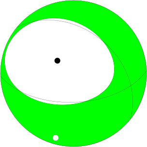
This is the Moment Tensor from the USGS website. This shows that the earthquake is a “normal” earthquake, caused by extension in the Earth’s crust. Based on the location of this earthquake, it is probably located in the downgoing Pacific plate.

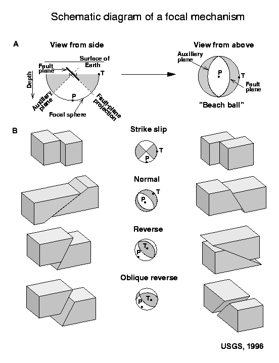
Here is a primer about Focal Mechanisms from the USGS.

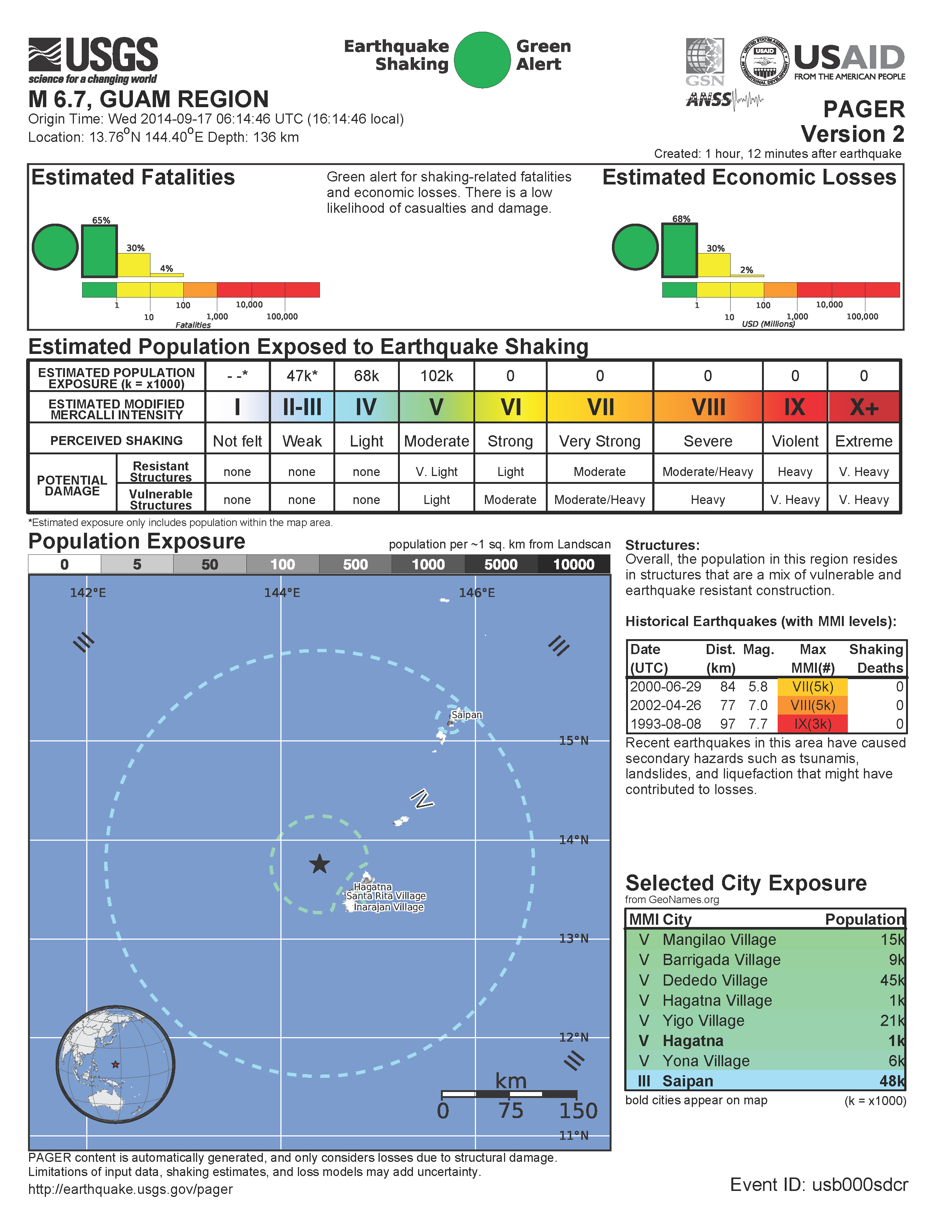
This is the Pager Page, which shows the probability of damage to people and their infrastructure. These are generated by a computer model and are updated regularly following an earthquake as more seismological information is used to refine the earthquake shaking/intensity models. This one is version 2 and probably wont be updated.

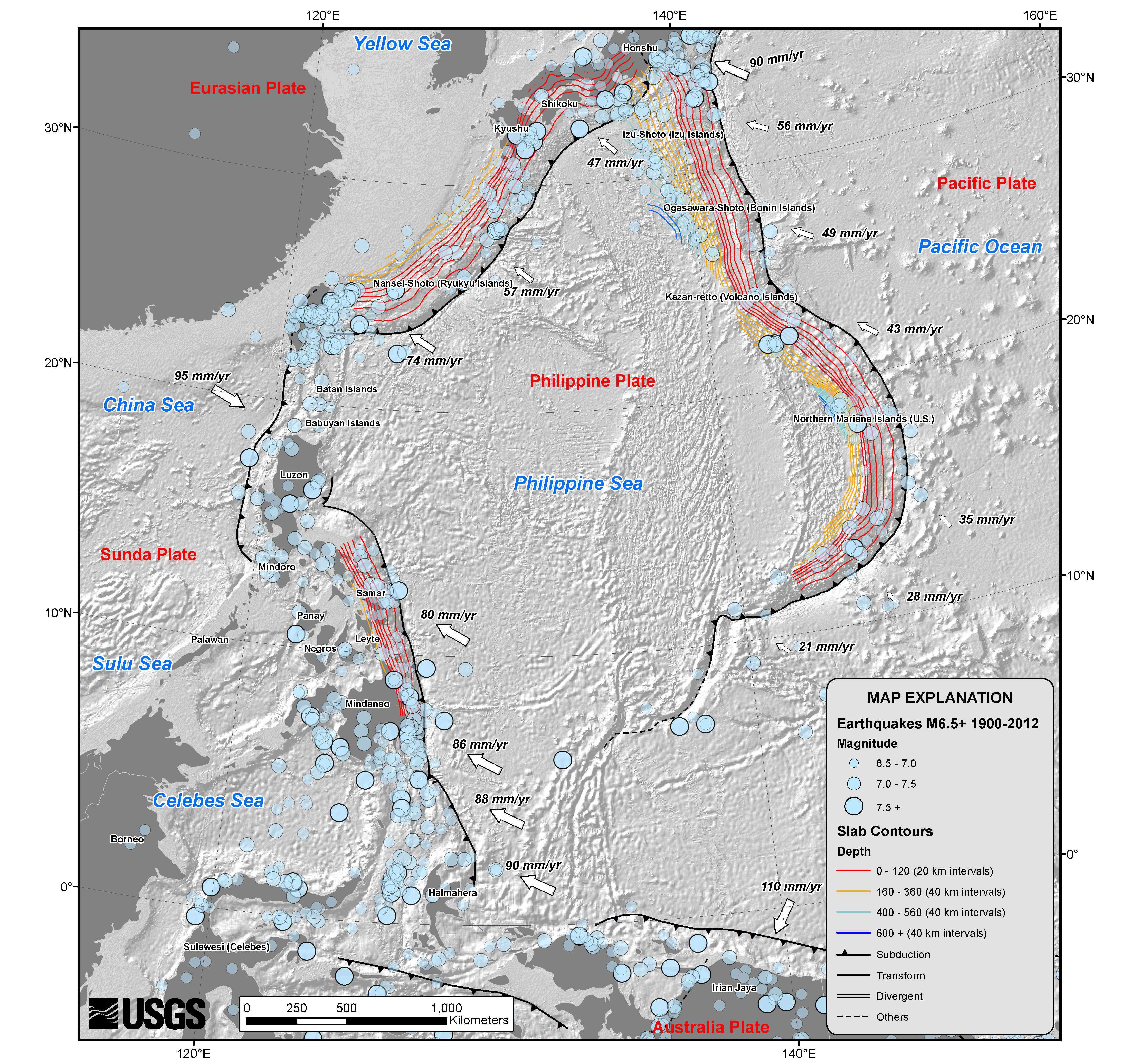
Here is the regional tectonic map produced by the USGS. Historic earthquakes, tectonic plate boundaries, and downgoing plate slab contours are plotted.

Here is a map that shows the bathymetry (the shape and depths of the seafloor) in this region, as determined by Smith and Sandwell at Scripps Institute of Oceanography. Depth contours are 500 meters.
Here is a regional map showing the depth contours of the dowgoing Pacific plate, as generated by Gavin Hayes from the USGS.
References:
Hayes, G. P., D. J. Wald, and R. L. Johnson (2012), Slab1.0: A three-dimensional model of global subduction zone geometries, J. Geophys. Res., 117, B01302, doi:10.1029/2011JB008524.
Smith, W. H. F., and D. T. Sandwell, Global seafloor topography from satellite altimetry and ship depth soundings, Science, v. 277, p. 1957-1962, 26 Sept., 1997.