This one is large and fairly deep. Here is the USGS web page for this earthquake. There are several aftershocks, the largest so far is M 6. Today’s earthquakes are located along the Aleutian subduction zone, nearby the Bolan Ridge (the horseshoe shaped ridge to the north of the earthquake epicenters).
Here is the moment tensor, which shows this to be an oblique earthquake mechanism. This earthquake is possibly related to the internal deformation in the downgoing slab, which appears to be extensional in this location.

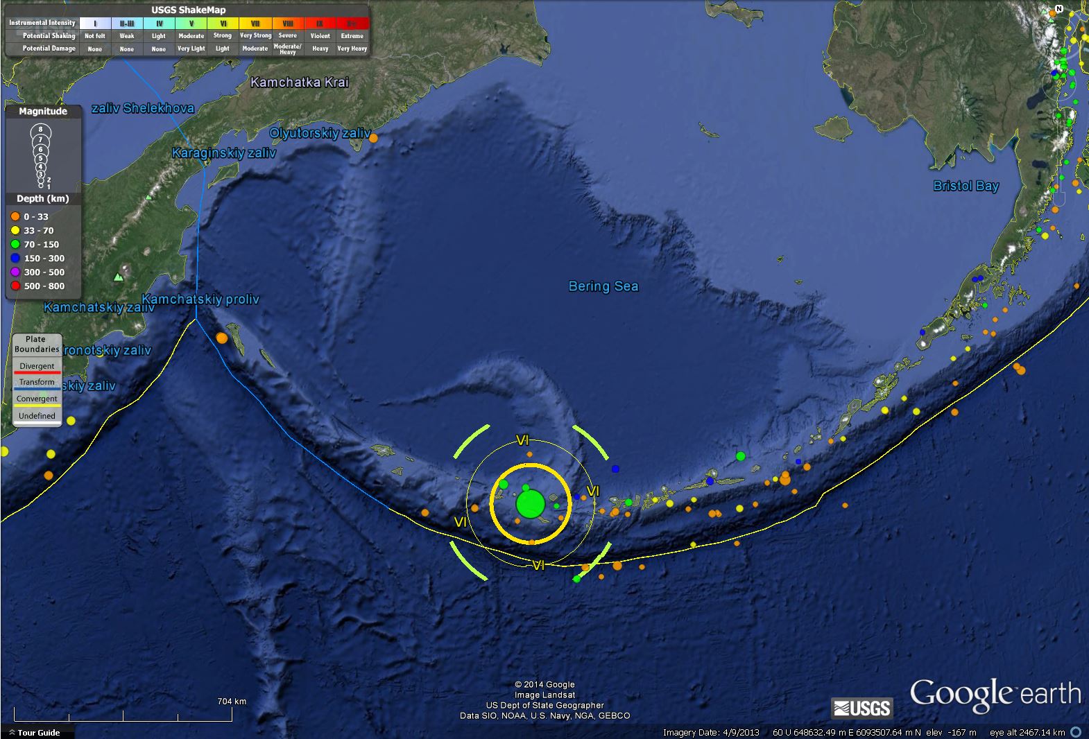
Here is a regional map showing the shaking intensity (Modified Mercalli Scale).
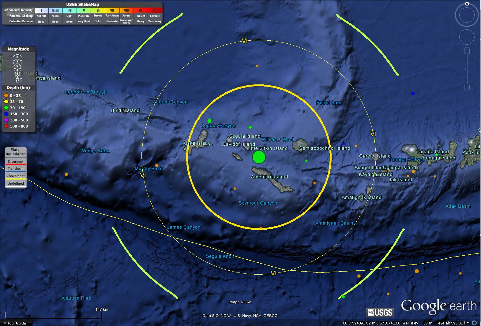
Here is a local map showing the shaking intensity and some of the island names.
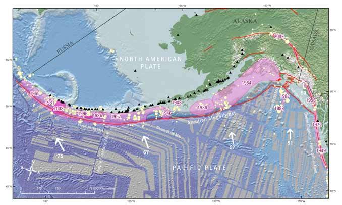
This map shows historic earthquakes in pink. Today’s earthquake is on the eastern boundary of the 1965 M 8.7 subduction zone earthquake.
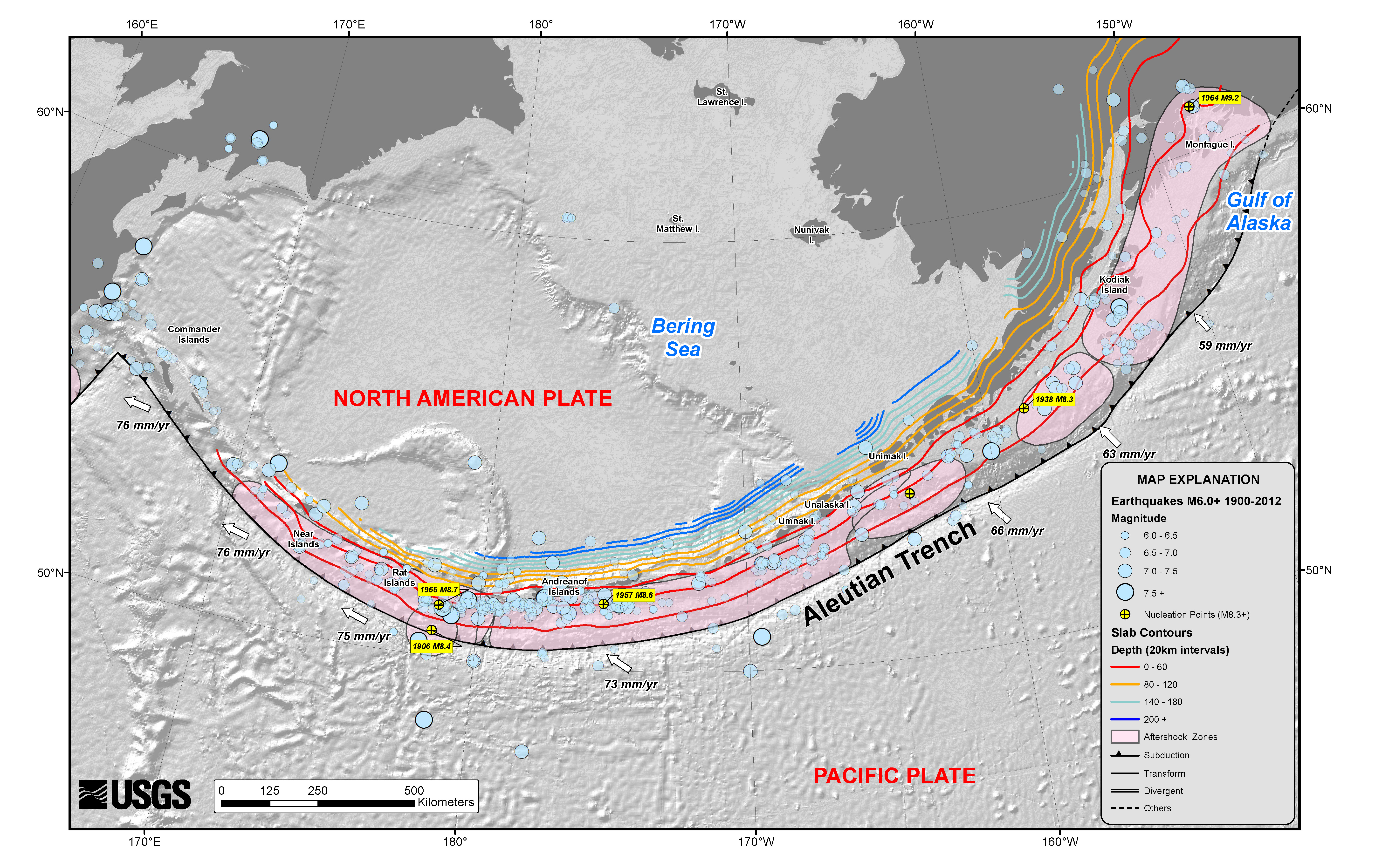
This is a different map of the historic earthquakes (a better resolution than the one above, but with fewer earthquake slip patches plotted).
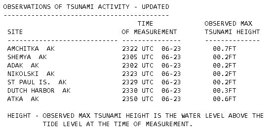
Here is the list of recorded wave heights reported by:
NWS NATIONAL TSUNAMI WARNING CENTER PALMER AK
435 PM AKDT MON JUN 23 2014
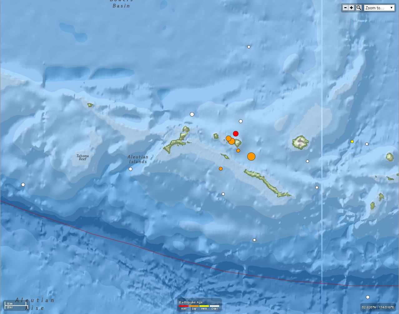
Here are some aftershocks plotted. They align with the northwest striking moment tensor.
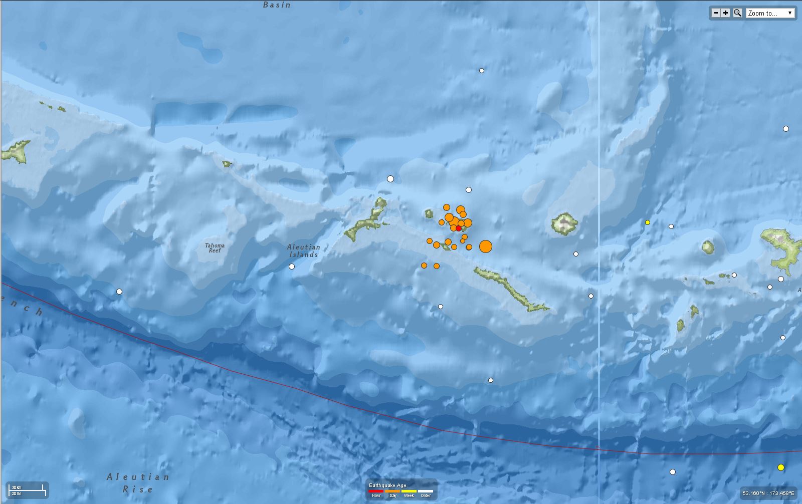
Here are some more aftershocks plotted. I left the earlier map since it shows how the largest aftershocks are aligned with each other.
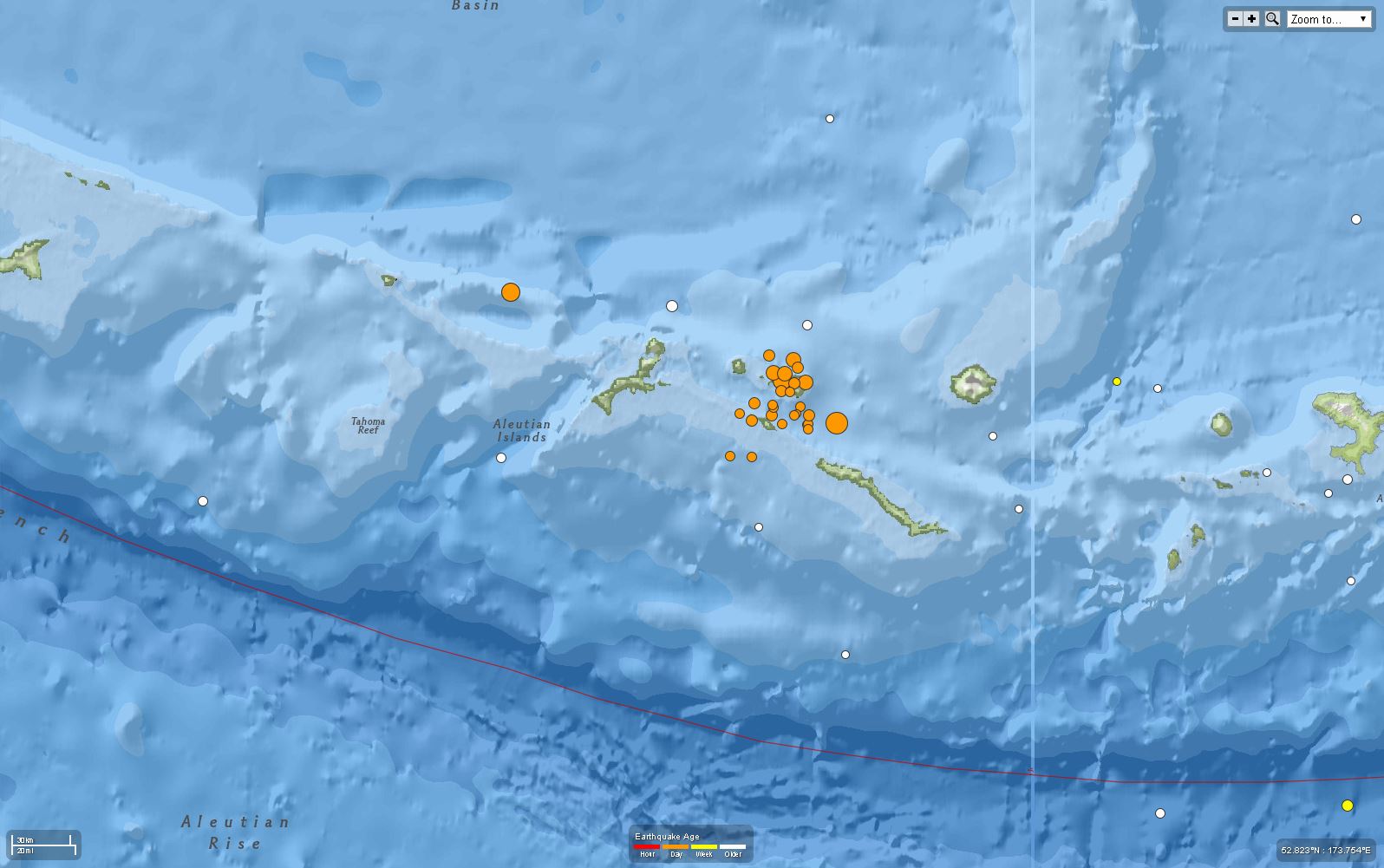
Major triggered earthquake along strike with the west-northwest trend of the main shock and largest aftershocks. This swarm looks like it has reactivated a ridge-parallel fault. The magnetic anomalies are sub-parallel to this trend (look at the historic earthquake slip map above to see the magnetic anomalies).
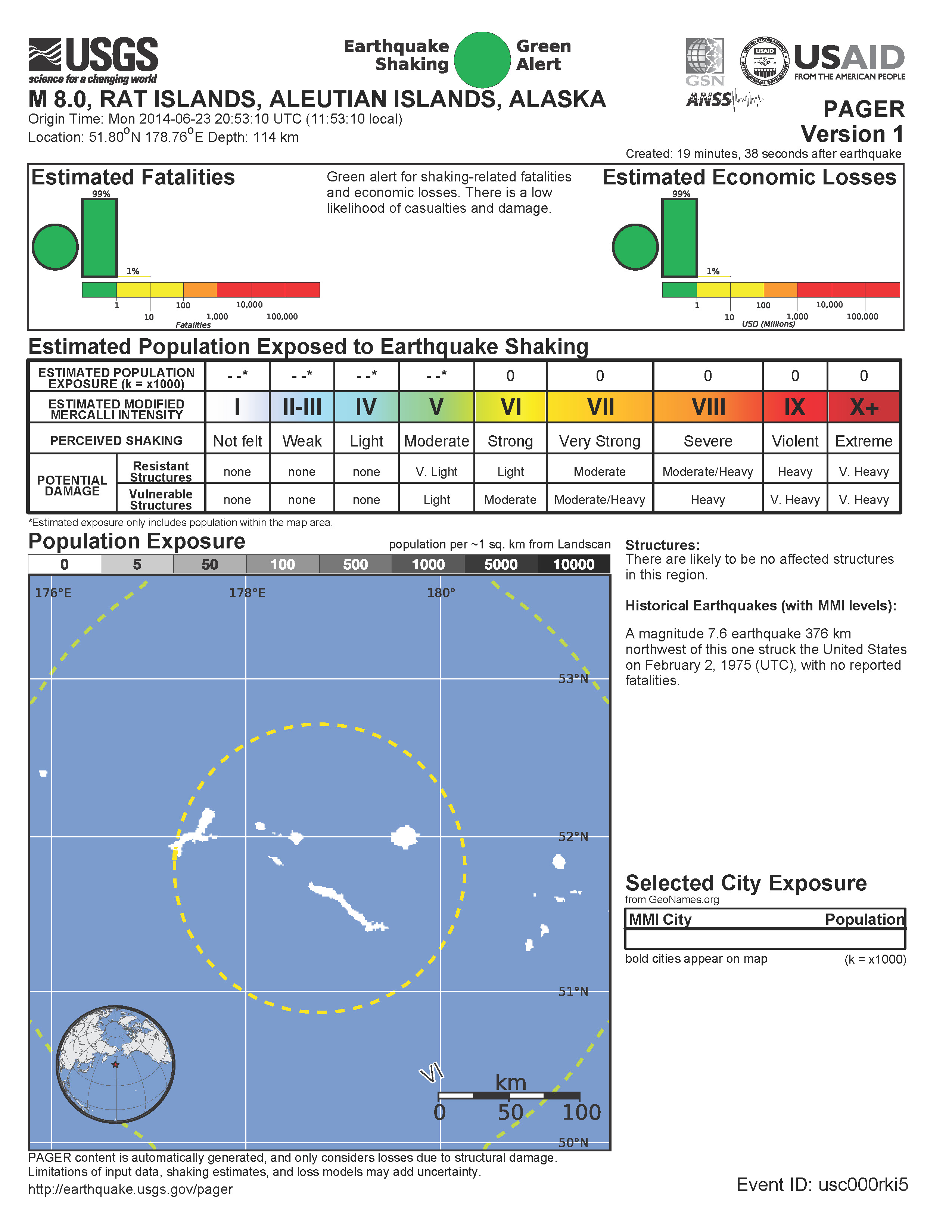
According to the pager report, there is low exposure (not many people, nor their infrastructure, were in region of strong shaking determined from the computer simulations). Note the large probability for <1 fatality and <1 million USD loss.
biggie. Where in the Aleutians?
oh, way out.
wayyy out.
Tsunami potential in Manila?
no tsunami potential in manila
i updated the page with the recorded wave heights in alaska… you can see they are very small waves in AK http://earthjay.com/earthquakes/20140623_aleutians/20140623_aleutians_M80_observed_tsunami.jpg