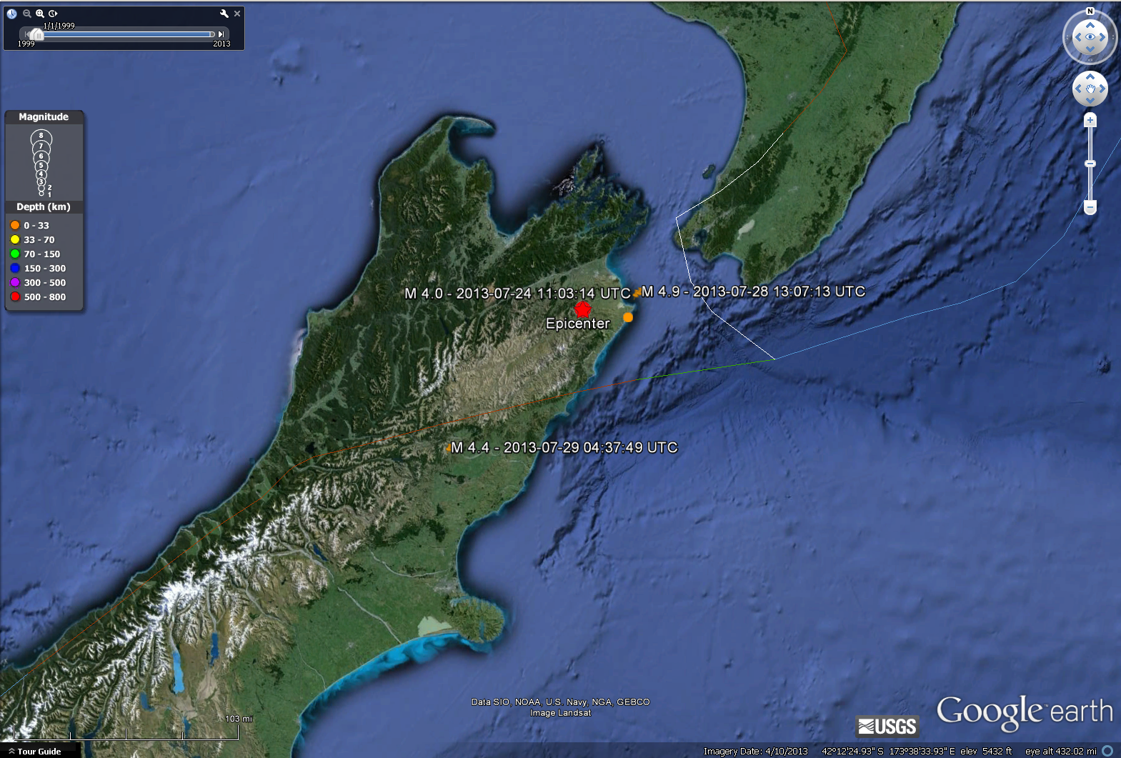
here is a big earthquake! M = 6.8, now a 6.5 depth = 10km pretty shallow (may change). it ruptured part of the Marlborough fault zone (part of the Alpine fault system).
the moment tensor fits the fault map, a right lateral strike slip earthquake on northeast striking fault (most likely).

looks like the eel river valley, but in New Zealand: USGS kml file
there was a smaller quake swarm just to the east in the last 2 weeks (they are in orange in my map). it caused landslides (lateral spreads i saw in some photos). this EQ may indeed be related, but i have no direct information about that (tho triggering that does happen proceeds in a short time following the trigger quake). ill need to look that last one up.
here is the usgs page:
http://comcat.cr.usgs.gov/earthquakes/eventpage/usb000j4iz#summary
here is an article on the damage:
http://www.nzherald.co.nz/nz/news/article.cfm?c_id=1&objectid=10913399
here is a map
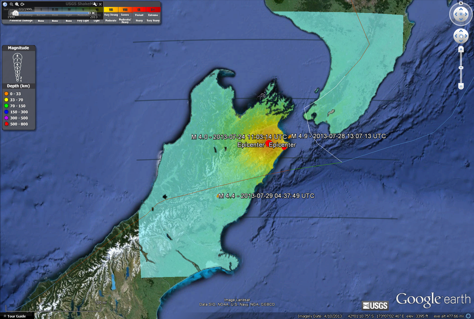
here is a map with the USGS shakemap overlay:
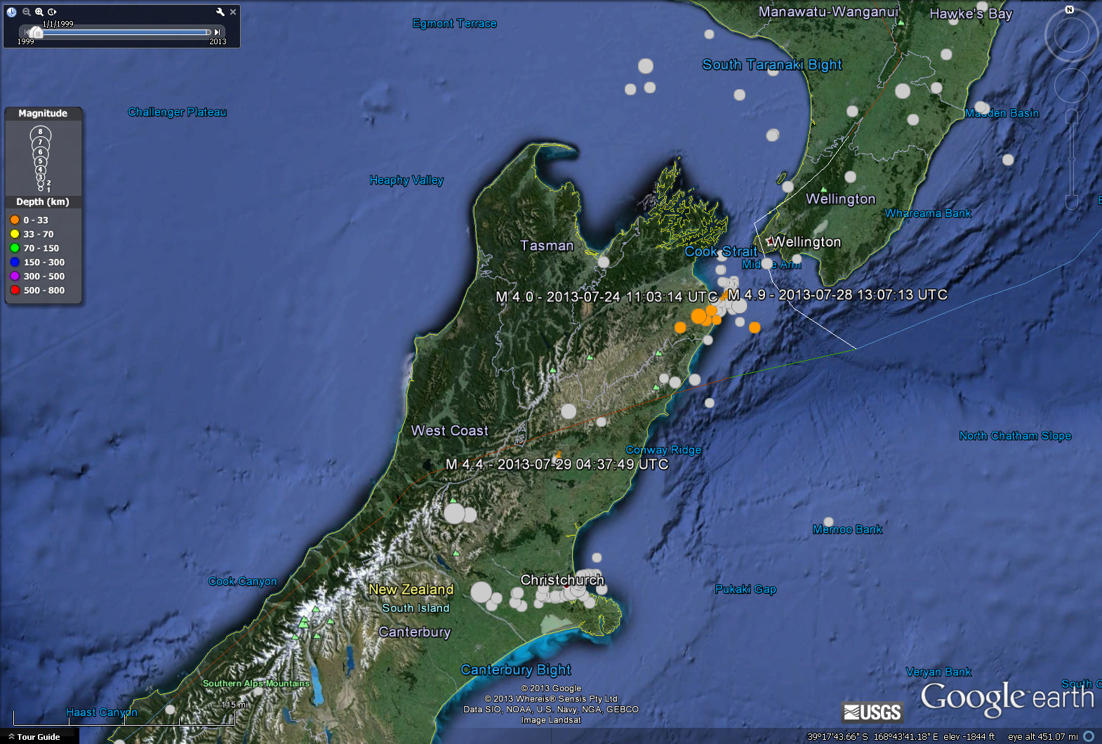
here is a map with historic earthquakes plotted as grey circles (note epicenters near Christchurch on the lower part of the map):
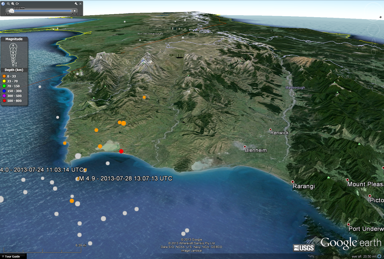
here is a low angle oblique view, looking south-west along the axis of the south island. the Marlborough fault system forms the mountain ranges you are looking at (they are largely pointed at you). the main M=6.5 epicenter is the large orange dot above the red dot (“…just below the main port” in star wars). the Alpine fault is the red line off in the distance (though it is not placed well due to the scale of those data).
here is a map made by Mike Norton:

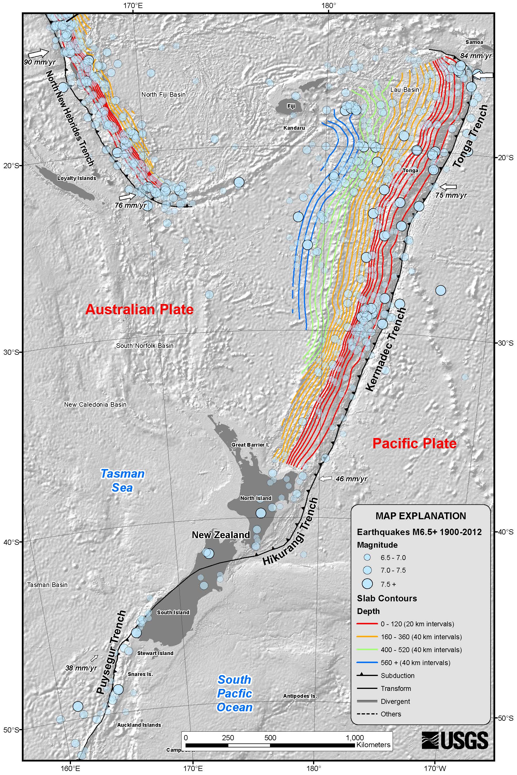
here is the usgs page on the tectonics of the region:
 4.5 MB pdf
2 thoughts on “M 6.8 on the South Island of New Zealand”