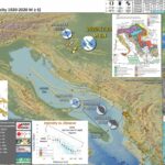
Yesterday as I was signing into work, my colleague Jackie Bott (a seismologist, seismic hazard/geology mapper, and on my tsunami team at CGS) mentioned the outer rise earthquake offshore of Chile that caused a small tsunami.
https://earthquake.usgs.gov/earthquakes/eventpage/us6000d3i9/executive
I checked this out and found a 20 cm wave height tsunami observed on a tide gage directly east of the earthquake epicenter. This was interesting as the earthquake was an “outer rise” event (seaward of the subduction zone trench, where the Nazca plate flexes downward prior to being subducted.
As the plate flexes downward, the upper part of the plate gets stretched and extensional faults can form here (or cause pre-existing faults to be reactivated as extensional/normal faults). For more background about different types of faults, head here: Earthquake Plate Tectonic Fundamentals page.
And, this M 6.7 earthquake was a normal fault earthquake (based on the earthquake mechanism). The largest tsunami waves can be generated by landslides or subduction zone faults, but other fault types can generate tsunami too (albeit smaller in size). Interesting indeed (there is more, like it is in a region of a triggered outer rise events following the 1960 M 9.5 Chile earthquake; is this M 6.7 an aftershock?, probably not).
BUT, this earthquake report is about the earthquake in Croatia that Jackie also mentioned in her email. Upon quick review, looking at the USGS PAGER Alert page, I knew that there was a high likelihood for casualties.
https://earthquake.usgs.gov/earthquakes/eventpage/us6000d3zh/executive
PAGER provides shaking and loss estimates following significant earthquakes anywhere in the world. These estimates are generally available within 30 minutes and are updated as more information becomes available. Rapid estimates include the number of people and names of cities exposed to each shaking intensity level as well as the likely ranges of fatalities and economic losses.
Yesterday’s M 6.4 is a strike-slip earthquake (look at the earthquake mechanism legend on the top center of the poster) and appears to have slipped along the Petrinja fault. This fault has different names in different papers (which is common), but this name comes from the European Database of Seismogenic Faults.
According to the database, the Petrinja fault is capable of a M 6.5 earthquake.
Below is my interpretive poster for this earthquake
- I plot the seismicity from the past month, with diameter representing magnitude (see legend). I include earthquake epicenters from 1920-2020 with magnitudes M ≥ 3.0 in one version.
- I plot the USGS fault plane solutions (moment tensors in blue and focal mechanisms in orange), possibly in addition to some relevant historic earthquakes.
- A review of the basic base map variations and data that I use for the interpretive posters can be found on the Earthquake Reports page. I have improved these posters over time and some of this background information applies to the older posters.
- Some basic fundamentals of earthquake geology and plate tectonics can be found on the Earthquake Plate Tectonic Fundamentals page.
- In the upper right corner is a map showing the crustal and plate boundary tectonic faults in the eastern Mediterranean region. Note the seismicity (1 century M≥6) dominates the area to the southeast of today’s earthquake.
- In the lower left corner is the legend. Above the legend is a map from Woudlopper (2009) that shows the Alpide belt in Europe and the Middle East. This “belt” is a convergent plate boundary (plates pushing together) that extends from Australia/Indonesia, through Miyanmar and India, across Iraq and Iran, through Europe, and possibly extending as far as offshore west of Portugal. The tectonics in the eastern Mediterranean is dominated by this north-south oriented compression and how this tectonic strain interacts with existing tectonic structures.
- In the right center top is a geologic map from Schmid et al. (2019) that shows the main crustal faults and geologic units in the region. These geologic units all reflect the tectonic history of this region.
- In the center left bottom is a plot that shows earthquake intensity (vertical axis) as it decreases with distance from the earthquake (horizontal axis with the earthquake source at 0km distance). Two types of data are plotted here:
- The USGS uses a model that uses seismometer (accelerometer) observations from thousands of earthquakes to estimate the intensity of the earthquake based on its magnitude (generally). The USGS uses the Modified Mercalli Intensity (MMI)scale. The green and brown lines show the average intensity for models based on earthquakes in the western USA (brown) and the eastern USA (green). These models are used to create the intensity map in the lower right corner.
- The USGS has a webpage for each earthquake where people can enter their location and observations. These observations are used to estimate the MMI at the location of the person. These Did You Feel It? results are plotted individually as blue dots and statistically as orange and larger blue dots.
- In the lower right corner is a map that shows the earthquake intensity as derived from the USGS models. I also placed the Did You Feel It? results as colored dots (some are labeled).
- In the right middle is a map that shows the liquefaction susceptibility from this earthquake. This is generated from a model that relates earthquake size and the potential for an area to experience liquefaction.
- In the upper left corner are two maps: seismic hazard and seismic risk. I review this type of information below. I labeled the range in ground shaking (pga) and normalized construction costs (millions of dollars) for the area of the M 6.4 earthquake.
I include some inset figures. Some of the same figures are located in different places on the larger scale map below.
- Here is the map with a years’ (EMSC) and century’s (USGS) seismicity plotted.
- Note that there have been very few earthquakes in the past century M≥6. But there are some along the eastern Adriatic Sea that show this to be a region of northeast-southwest oriented compression. The 1979 doublet and 1996 M 6.
- Also, check out the M 5.3 from earlier this year. This is a thrust (compressional/convergent) fault earthquake that happened on a fault that exists to the north of Zagreb. This region has a complicated tectonic history, but the 5.3 matches the overall north-south convergence of the Alpide belt (the Africa plate moving relatively north and the Eurasia plate moving relatively south).
- Because these thrust faults are oblique to the relative plate motion, the tectonic strain is partitioned onto different faults. The thrust faults accommodate some of the convergence, while strike-slip faults accommodate other portions of the convergence. This M 6.4 earthquake has accommodated some of the strike-slip motion.
UPDATE: 2021.01.03 Aftershocks and Intensity Comparison.
- I use the EMSC database to plot aftershocks (1 monthish) for the two earthquakes in central Croatia, the 22 March ’20 M 5.3 near Zagreb and the 29 Dec ’20 M 64 near Petrinja.
- The locations are aliased (see how they align in rows and columns) due to rounding of the lat long coordinates provided by EMSC (rounded to 1km spacing).
- Also note the scale on the intensity maps are different.
- I list the potential magnitudes for the faults from the SHARE fault database.
- Here are the database entries for the faults plotted in the above interpretive poster.
- http://diss.rm.ingv.it/share-edsf/sharedata/SHHTML/SICS022INF.html
- http://diss.rm.ingv.it/share-edsf/sharedata/SHHTML/HRCS022INF.html
- http://diss.rm.ingv.it/share-edsf/sharedata/SHHTML/HRCS37INF.html
- http://diss.rm.ingv.it/share-edsf/sharedata/SHHTML/HRCS030INF.html
- http://diss.rm.ingv.it/share-edsf/sharedata/SHHTML/HRCS027INF.html
- http://diss.rm.ingv.it/share-edsf/sharedata/SHHTML/HRCS038INF.html
Other Report Pages
- Below are a series of maps that show the shaking intensity and potential for landslides and liquefaction. These are all USGS data products.
- Below is the liquefaction susceptibility and landslide probability map (Jessee et al., 2017; Zhu et al., 2017). Please head over to that report for more information about the USGS Ground Failure products (landslides and liquefaction). Basically, earthquakes shake the ground and this ground shaking can cause landslides. We can see that there is a low probability for landslides. However, we have already seen photographic evidence for landslides and the lower limit for earthquake triggered landslides is magnitude M 5.5 (from Keefer 1984)
- I use the same color scheme that the USGS uses on their website. Note how the areas that are more likely to have experienced earthquake induced liquefaction are in the valleys. Learn more about how the USGS prepares these model results here.
- As a reminder, this region is in the most seismically hazardous region of the Mediterranean. Here is the 50% probability of exceedance map (for 50 yrs) from Giardini et al. (2013).
- I put together this figure that shows the seismic hazard and seismic risk for Europe.
- The GEM Seismic Hazard and the GEM Seismic Risk maps from Pagani et al. (2018) and Silva et al. (2018).
- I list the general range of values for hazard (pga) and risk (construction cost). The USGS shaking models suggest that there were ground accelerations exceeding 50% g (gravity at sea level). This is higher than the hazard map suggests, but this is just a model.
- The GEM Seismic Hazard Map:
- The Global Earthquake Model (GEM) Global Seismic Hazard Map (version 2018.1) depicts the geographic distribution of the Peak Ground Acceleration (PGA) with a 10% probability of being exceeded in 50 years, computed for reference rock conditions (shear wave velocity, VS30, of 760-800 m/s). The map was created by collating maps computed using national and regional probabilistic seismic hazard models developed by various institutions and projects, and by GEM Foundation scientists. The OpenQuake engine, an open-source seismic hazard and risk calculation software developed principally by the GEM Foundation, was used to calculate the hazard values. A smoothing methodology was applied to homogenise hazard values along the model borders. The map is based on a database of hazard models described using the OpenQuake engine data format (NRML); those models originally implemented in other software formats were converted into NRML. While translating these models, various checks were performed to test the compatibility between the original results and the new results computed using the OpenQuake engine. Overall the differences between the original and translated model results are small, notwithstanding some diversity in modelling methodologies implemented in different hazard modelling software. The hashed areas in the map (e.g. Greenland) are currently not covered by a hazard model. The map and the underlying database of models are a dynamic framework, capable to incorporate newly released open models. Due to possible model limitations, regions portrayed with low hazard may still experience potentially damaging earthquakes.
- The GEM Seismic Risk Map:
- The Global Seismic Risk Map (v2018.1) presents the geographic distribution of average annual loss (USD) normalised by the average construction costs of the respective country (USD/m2) due to ground shaking in the residential, commercial and industrial building stock, considering contents, structural and non-structural components. The normalised metric allows a direct comparison of the risk between countries with widely different construction costs. It does not consider the effects of tsunamis, liquefaction, landslides, and fires following earthquakes. The loss estimates are from direct physical damage to buildings due to shaking, and thus damage to infrastructure or indirect losses due to business interruption are not included. The average annual losses are presented on a hexagonal grid, with a spacing of 0.30 x 0.34 decimal degrees (approximately 1,000 km2 at the equator). The average annual losses were computed using the event-based calculator of the OpenQuake engine, an open-source software for seismic hazard and risk analysis developed by the GEM Foundation. The seismic hazard, exposure and vulnerability models employed in these calculations were provided by national institutions, or developed within the scope of regional programs or bilateral collaborations. This global map and the underlying databases are based on best available and publicly accessible datasets and models. Due to possible model limitations, regions portrayed with low risk may still experience potentially damaging earthquakes.
Shaking Intensity and Potential for Ground Failure
There are many different ways in which a landslide can be triggered. The first order relations behind slope failure (landslides) is that the “resisting” forces that are preventing slope failure (e.g. the strength of the bedrock or soil) are overcome by the “driving” forces that are pushing this land downwards (e.g. gravity). The ratio of resisting forces to driving forces is called the Factor of Safety (FOS). We can write this ratio like this:
FOS = Resisting Force / Driving Force
When FOS > 1, the slope is stable and when FOS < 1, the slope fails and we get a landslide. The illustration below shows these relations. Note how the slope angle α can take part in this ratio (the steeper the slope, the greater impact of the mass of the slope can contribute to driving forces). The real world is more complicated than the simplified illustration below.
Landslide ground shaking can change the Factor of Safety in several ways that might increase the driving force or decrease the resisting force. Keefer (1984) studied a global data set of earthquake triggered landslides and found that larger earthquakes trigger larger and more numerous landslides across a larger area than do smaller earthquakes. Earthquakes can cause landslides because the seismic waves can cause the driving force to increase (the earthquake motions can “push” the land downwards), leading to a landslide. In addition, ground shaking can change the strength of these earth materials (a form of resisting force) with a process called liquefaction.
Sediment or soil strength is based upon the ability for sediment particles to push against each other without moving. This is a combination of friction and the forces exerted between these particles. This is loosely what we call the “angle of internal friction.” Liquefaction is a process by which pore pressure increases cause water to push out against the sediment particles so that they are no longer touching.
An analogy that some may be familiar with relates to a visit to the beach. When one is walking on the wet sand near the shoreline, the sand may hold the weight of our body generally pretty well. However, if we stop and vibrate our feet back and forth, this causes pore pressure to increase and we sink into the sand as the sand liquefies. Or, at least our feet sink into the sand.
Below is a diagram showing how an increase in pore pressure can push against the sediment particles so that they are not touching any more. This allows the particles to move around and this is why our feet sink in the sand in the analogy above. This is also what changes the strength of earth materials such that a landslide can be triggered.
Below is a diagram based upon a publication designed to educate the public about landslides and the processes that trigger them (USGS, 2004). Additional background information about landslide types can be found in Highland et al. (2008). There was a variety of landslide types that can be observed surrounding the earthquake region. So, this illustration can help people when they observing the landscape response to the earthquake whether they are using aerial imagery, photos in newspaper or website articles, or videos on social media. Will you be able to locate a landslide scarp or the toe of a landslide? This figure shows a rotational landslide, one where the land rotates along a curvilinear failure surface.
Seismic Hazard and Seismic Risk
Human Impact
- Copernicus is an organization that is part of the European Union that has many programs devoted to helping people mitigate, prepare, and respond to natural disasters.
- Below is a poster that summarizes the impacts from the M 6.4 earthquake as of 30 December 2020.
Some Relevant Discussion and Figures
- This is the Wouldloper (2009) tectonic map of the Mediterranean Sea.
- Here is another map of the region showing the compression in this region (Burchfiel et al., 2008 ). I include the figure caption below in blockquote.
Location of the South Balkan extensional system (SBER) withing the eastern European region. The system today is within the southern Balkan region north of the North Anatolian fault (NAF), shown by the horizontal line patter. Retreating subduction zones and related backarc extensional areas for the Mediterranean region are shown in blue , and advancing subduction zones an related are a of backarc shortening are shown in red). Backarc extensional regions are shown by dotted pattern. KF = Kefalonia fault zone.
- Here is a map showing the active faults in Croatia (Markušić and Herak_1998). They prepared thsi figure to help explain how they subdivided Croatia for seismic hazard zoning.
Map of the most important seismogenic faults
- The area impacted by the M 6.4 is in the western part of a large sedimentary basin called the Pannononian Basin. The geographic name for this place is the Great Hungarian Plain. The map below shows Zagreb in the lower left part of the map. The fault involved with yesterday’s M 6.4 are at the boundary of the Pannononian Basin and the Dinarides Mountains (Horváth et al., 2015).
Digital terrain model of the Pannonian basin to show its position within the Alpine mountain belt and the location of different subunits.
- Here is a low angle oblique view of a tectonic model for this region (Horváth et al., 2015). Their paper describes the tectonic history that led to the development of the Pannononian Basin.
Block model depicting the present position of the Alcapa and Tisza-Dacia terranes in the Carpathian embayment and the associated lithospheric and asthenosphericprocesses down to the upper mantle transition zone (inspired after Ustaszewski et al., 2008).
- This is a map that shows the Neogene-Quaternary (time periods) sedimentary basin deposits, and how thick they are (Dolton, 2006). The river that runs between Zagreb, Sisak, and Petrinja is the blue line in the southwest of the basin (outlined in a red line). Note that there are thick (over 4km) sedimentary deposits here.
Map of the Neogene Pannonian Basin, showing depocenters of the subbasins. The associated Transylvanian (TR) and Vienna (V) basins are shown. Modified from Horvath (1985a).
- Here is a similar map that shows the main fault systems where there are regions of tectonic subsidence (we need subsidence to create space for sediments to deposit, called accommodation space). Note the area of subsidence that straddles the sedimentary basin deposits and river in the previous map. Also, note that the faults bounding this subsiding area are strike-slip faults (note the arrows).
- Sedimentary basins can amplify ground shaking, thus leading to increased liquefaction susceptibility. Note how the higher liquefaction susceptibility areas for the M 6.4 are associated with the mapped sedimentary deposits and the region of subsidence.
Tectonic map of the Pannonian Basin and surrounding regions showing the main extensional faults of Neogene age. After Rumpler and Horvath (1988). Area of Pannonian Basin Tertiary rocks within the Alpine-Carpathian fold belts shown as white.
- To understand the tectonic stresses that cause earthquakes in this region, Bada et al. (1998) prepared a numerical model. The next several figures help us walk through the basics of their modeling.
- This first figure shows their configuration, with the boundary conditions and relative plate motions that cause the tectonic stresses.
- These two panels compare two versions of their model results, showing the orientation of maximum stress compared with their calculations of maximum stress. The region south of Zagreb is in an area with north-south compression, in the western part of the Pannanonian Basin.
- This is a map showing the major faults in the region and how their tectonic stresses are oriented relative to these faults (the gray arrows at the boundary of the model).
Model geometry and boundary conditions used in the finite element procedure. Note that a larger framework was created to minimize edge effects and errors. As a result, the ‘free’ edges are buffered but can be deformed on a small scale. For further discussion see text. The Adria–Europe rotation pole was taken from Ward (1994).
Best-fitting resultant stress pattern reflecting the combined effects of the applied boundary conditions (see insets), changing crustal thickness and two predefined weakness zones. (a), ( b) The edge at the Bohemian Massif is fixed and slightly deforming, respectively. In order to make direct comparison possible, the smoothed (observed) and calculated stress directions are superimposed.
Cartoon summarizing the main stress sources in the Alpine–Carpathian–Pannonian–Dinaric system applied in our finite element models. Buttresses are rigid crustal blocks indenting or blocking their surroundings. Dashed lines represent faults that were included during modelling. The kinematics of some major faults showing present-day activity are also shown (after Gerner et al. 1997) 1: Molasse belt; 2: Flysch belt; 3: internal units; 4: Neogene and Quaternary
volcanites; 5: Pieniny Klippen Belt; 6: strike-slip faults; 7: normal faults; 8: thrust faults.
- 2020.12.30 M 6.4 Croatia
- 2020.10.30 M 7.0 Turkey
- 2020.05.02 M 6.6 Crete, Greece
- 2020.01.24 M 6.7 Turkey
- 2019.11.26 M 6.4 Albania
- 2018.10.25 M 6.8 Greece
- 2017.07.20 M 6.7 Turkey
- 2017.06.12 M 6.3 Turkey/Greece
- 2016.10.30 M 6.6 Italy
- 2016.10.30 M 6.6 Italy Update #1
- 2016.10.28 M 5.8 Tyrrhenian Sea
- 2016.10.26 M 6.1 Italy
- 2016.10.16 M 5.3 Greece/Albania
- 2016.08.23 M 6.2 Italy
- 2016.01.24 M 6.1 Mediterranean
- 2015.11.17 M 6.5 Greece
- 2015.04.16 M 6.0 Crete
- Frisch, W., Meschede, M., Blakey, R., 2011. Plate Tectonics, Springer-Verlag, London, 213 pp.
- Hayes, G., 2018, Slab2 – A Comprehensive Subduction Zone Geometry Model: U.S. Geological Survey data release, https://doi.org/10.5066/F7PV6JNV.
- Holt, W. E., C. Kreemer, A. J. Haines, L. Estey, C. Meertens, G. Blewitt, and D. Lavallee (2005), Project helps constrain continental dynamics and seismic hazards, Eos Trans. AGU, 86(41), 383–387, , https://doi.org/10.1029/2005EO410002. /li>
- Jessee, M.A.N., Hamburger, M. W., Allstadt, K., Wald, D. J., Robeson, S. M., Tanyas, H., et al. (2018). A global empirical model for near-real-time assessment of seismically induced landslides. Journal of Geophysical Research: Earth Surface, 123, 1835–1859. https://doi.org/10.1029/2017JF004494
- Kreemer, C., J. Haines, W. Holt, G. Blewitt, and D. Lavallee (2000), On the determination of a global strain rate model, Geophys. J. Int., 52(10), 765–770.
- Kreemer, C., W. E. Holt, and A. J. Haines (2003), An integrated global model of present-day plate motions and plate boundary deformation, Geophys. J. Int., 154(1), 8–34, , https://doi.org/10.1046/j.1365-246X.2003.01917.x.
- Kreemer, C., G. Blewitt, E.C. Klein, 2014. A geodetic plate motion and Global Strain Rate Model in Geochemistry, Geophysics, Geosystems, v. 15, p. 3849-3889, https://doi.org/10.1002/2014GC005407.
- Meyer, B., Saltus, R., Chulliat, a., 2017. EMAG2: Earth Magnetic Anomaly Grid (2-arc-minute resolution) Version 3. National Centers for Environmental Information, NOAA. Model. https://doi.org/10.7289/V5H70CVX
- Müller, R.D., Sdrolias, M., Gaina, C. and Roest, W.R., 2008, Age spreading rates and spreading asymmetry of the world’s ocean crust in Geochemistry, Geophysics, Geosystems, 9, Q04006, https://doi.org/10.1029/2007GC001743
- Pagani,M. , J. Garcia-Pelaez, R. Gee, K. Johnson, V. Poggi, R. Styron, G. Weatherill, M. Simionato, D. Viganò, L. Danciu, D. Monelli (2018). Global Earthquake Model (GEM) Seismic Hazard Map (version 2018.1 – December 2018), DOI: 10.13117/GEM-GLOBAL-SEISMIC-HAZARD-MAP-2018.1
- Silva, V ., D Amo-Oduro, A Calderon, J Dabbeek, V Despotaki, L Martins, A Rao, M Simionato, D Viganò, C Yepes, A Acevedo, N Horspool, H Crowley, K Jaiswal, M Journeay, M Pittore, 2018. Global Earthquake Model (GEM) Seismic Risk Map (version 2018.1). https://doi.org/10.13117/GEM-GLOBAL-SEISMIC-RISK-MAP-2018.1
- Zhu, J., Baise, L. G., Thompson, E. M., 2017, An Updated Geospatial Liquefaction Model for Global Application, Bulletin of the Seismological Society of America, 107, p 1365-1385, https://doi.org/0.1785/0120160198
- Bada, G., Cloetingh, S., Gerner, P., and Horvath, F., 1998. Sources of recent tectonic stress in the Pannonian region: inferences from finite element modelling in GJI, v. 134, p. 87-101
- Benetatos, C., Kiratzi, A., 2006. Finite-fault slip models for the 15 April 1979 (Mw 7.1) Montenegro
earthquake and its strongest aftershock of 24 May 1979 (Mw 6.2) in Tectonophysics, v. 421, p. 129-143, http://dx.doi.org/10.1016/j.tecto.2006.04.009 - Burchfiel, B.C., et al., 2008. Evolution and dynamics of the Cenozoic tectonics of the South Balkan extensional system in Geosphere, v. 4, p. 919-938.
- Dilek, Y., 2006. Collision tectonics of the Mediterranean region: Causes and consequences in Dilek, Y., and Pavlides, S., eds., Postcollisional tectonics and magmatism in the Mediterranean region and Asia: Geological Society of America Special Paper 409, p. 1–13
- Dilek, Y. and Sandvol, E., 2006. Collision tectonics of the Mediterranean region: Causes and consequences in Dilek, Y., and Pavlides, S., eds., Postcollisional tectonics and magmatism in the Mediterranean region and Asia: Geological Society of America Special Paper 409, p. 1–13
- DISS Working Group (2015). Database of Individual Seismogenic Sources (DISS), Version 3.2.0: A compilation of potential sources for earthquakes larger than M 5.5 in Italy and surrounding areas. http://diss.rm.ingv.it/diss/, Istituto Nazionale di Geofisica e Vulcanologia; DOI:10.6092/INGV.IT-DISS3.2.0.
- Dolton, G.L., 2006, Pannonian Basin Province, Central Europe (Province 4808)—Petroleum geology, total petroleum systems, and petroleum resource assessment: U.S. Geological Survey Bulletin 2204–B, 47 p.
- Ganas, A., and T. Parsons (2009), Three-dimensional model of Hellenic Arc deformation and origin of the Cretan uplift, J. Geophys. Res., 114, B06404, doi:10.1029/2008JB005599
- Ganas, A., Oikonomou, I.A., and Tsimi, C., 2013. NOAFAULTS: A Digital Database for Active Faults in Greece in Bulletin of the Geological Society of Greece, v. XLVII, Proceedings of the 13th International Congress, Chania, Sept, 2013
- Horváth, F., Mustiz, B., Balazs, A., Vegh, A., Uhrin, A., Nador, A., Koroknai, B., Pap, N., Toth, T., and Worum, G., 2015. Evolution of the Pannonian basin and its geothermal resources in Geothermics, v. 53, p. 328-352
- Jolivet, L., et al., 2013. Aegean tectonics: Strain localisation, slab tearing and trench retreat in Tectonophysics, v. 597-598, p. 1-33
- Kokkalas, S., et al., 2006. Postcollisional contractional and extensional deformation in the Aegean region in GSA Special Papers, v. 409, p. 97-123.
- Markušić, S. and Herak, M., 1998. Seismic Zoning of Croatia in Natural Hazards, v. 18, p. 269-285.
- Picha, F. J., 2002. Late Orogenic Strike-Slip Faulting and Escape Tectonics in Frontal Dinarides-Hellenides, Croatia, Yugoslavia, Albania, and Greece, AAPG Bull., v. 86, p. 1659–1671.
- Taymaz, T., Yilmaz, Y., and Dilek, Y., 2007. The geodynamics of the Aegean and Anatolia: introduction in Geological Society Special Publications, v. 291, p. 1-16.
- Woudloper, 2009. Tectonic map of southern Europe and the Middle East, showing tectonic structures of the western Alpide mountain belt. Only Alpine (tertiary) structures are shown.
- Sorted by Magnitude
- Sorted by Year
- Sorted by Day of the Year
- Sorted By Region
- I plot the seismicity from the past 6 months, with diameter representing magnitude (see legend). I include earthquake epicenters from 1920-2020 with magnitudes M ≥ 6.0 in one version.
- I plot the USGS fault plane solutions (moment tensors in blue and focal mechanisms in orange), possibly in addition to some relevant historic earthquakes.
- A review of the basic base map variations and data that I use for the interpretive posters can be found on the Earthquake Reports page.
- Some basic fundamentals of earthquake geology and plate tectonics can be found on the Earthquake Plate Tectonic Fundamentals page.
- In the center left is an inset map from Dilek and Sandovol (2009) that shows the tectonic plates and the plate boundary faults in the region. There is a blue star in the general location of the M 6.6 earthquake.
- In the upper right corner is a smaller scale view of the region with 6 months of seismicity plotted.
- In the lower right corner is a map that shows a model estimate of the shaking intensity from this M 6.6 earthquake.
- Above the intensity map is a map that shows earthquake mechanisms for historic earthquakes in the region.
- In the bottom center are seismic hazard and seismic risk maps for the European area. There is more about hazard and risk later in this report.
- Here is the tectonic map from Dilek and Sandvol (2009).
- This is the Wouldloper (2009) tectonic map of the Mediterranean Sea.
- Here is the large scale tectonic setting map (Taymaz et al., 2007) with their figure below.
- This figure shows GPS velocities in the region (Taymaz et al., 2007).
- Finally their summary figure showing the tectonic regimes (Taymaz et al., 2007).
- This is a tectonic summary figure from Kokkalas et al. (2006).
- The following three figures are from Dilek and Sandvol, 2006. The locations of the cross sections are shown on the map as orange lines. Cross section G-G’ is located in the region of today’s earthquake.
- Here is the map (Dilek and Sandvol, 2006). I include the figure caption below in blockquote.
- Here are cross sections A-D (Dilek and Sandvol, 2006). I include the figure caption below in blockquote.
- (A) Eastern Alps. The collision of Adria with Europe produced a bidivergent crustal architecture with both NNW- and SSE-directed nappe structures that involved Tertiary molasse deposits, with deep-seated thrust faults that exhumed lower crustal rocks. The Austro-Alpine units north of the Peri-Adriatic lineament represent the allochthonous outliers of the Adriatic upper crust tectonically resting on the underplating European crust. The Penninic ophiolites mark the remnants of the Mesozoic ocean basin (Meliata). The Oligocene granitoids between the Tauern window and the Peri-Adriatic lineament represent the postcollisional intrusions in the eastern Alps. Modified from Castellarin et al. (2006), with additional data from Coward and Dietrich (1989); Lüschen et al. (2006); Ortner et al. (2006).
- (B) Northern Apennines. Following the collision of Adria with the Apenninic platform and Europe in the late Miocene, the westward subduction of the Adriatic lithosphere and the slab roll-back (eastward) produced a broad extensional regime in the west (Apenninic back-arc extension) affecting the Alpine orogenic crust, and also a frontal thrust belt to the east. Lithospheric-scale extension in this broad back-arc environment above the west-dipping Adria lithosphere resulted in the development of a large boudinage structure in the European (Alpine) lithosphere. Modified from Doglioni et al. (1999), with data from Spakman and Wortel (2004); Zeck (1999).
- (C) Western Mediterranean–Southern Apennines–Calabria. The westward subduction of the Ionian seafloor as part of Adria since ca. 23 Ma and the associated slab roll-back have induced eastward-progressing extension and lithospheric necking through time, producing a series of basins. Rifting of Sardinia from continental Europe developed the Gulf of Lion passive margin and the Algero-Provencal basin (ca. 15–10 Ma), then the Vavilov and Marsili sub-basins in the broader Tyrrhenian basin to the east (ca. 5 Ma to present). Eastward-migrating lithospheric-scale extension and
necking and asthenospheric upwelling have produced locally well-developed alkaline volcanism (e.g., Sardinia). Slab tear or detachment in the Calabria segment of Adria, as imaged through seismic tomography (Spakman and Wortel, 2004), is probably responsible for asthenospheric upwelling and alkaline volcanism in southern Calabria and eastern Sicily (e.g., Mount Etna). Modified from Séranne (1999), with additional data from Spakman et al. (1993); Doglioni et al. (1999); Spakman and Wortel (2004); Lentini et al. (this volume). - (D) Southern Apennines–Albanides–Hellenides. Note the break where the Adriatic Sea is located between the western and eastern sections along this traverse. The Adria plate and the remnant Ionian oceanic lithosphere underlie the Apenninic-Maghrebian orogenic belt. The Alpine-Tethyan and Apulian platform units are telescoped along ENE-vergent thrust faults. The Tyrrhenian Sea opened up in the latest Miocene as a back-arc basin behind the Apenninic-Maghrebian mountain belt. The Aeolian volcanoes in the Tyrrhenian Sea represent the volcanic arc system in this subduction-collision zone environment. Modified from Lentini et al. (this volume). The eastern section of this traverse across the Albanides-Hellenides in the northern Balkan Peninsula shows a bidivergent crustal architecture, with the Jurassic Tethyan ophiolites (Mirdita ophiolites in Albania and Western Hellenic ophiolites in Greece) forming the highest tectonic nappe, resting on the Cretaceous and younger flysch deposits of the Adria affinity to the west and the Pelagonia affinity to the east. Following the emplacement of the Mirdita- Hellenic ophiolites onto the Pelagonian ribbon continent in the Early Cretaceous, the Adria plate collided with Pelagonia-Europe obliquely starting around ca. 55 Ma. WSW-directed thrusting, developed as a result of this oblique collision, has been migrating westward into the peri-Adriatic depression. Modified from Dilek et al. (2005).
- (E) Dinarides–Pannonian basin–Carpathians. The Carpathians developed as a result of the diachronous collision of the Alcapa and Tsia lithospheric blocks, respectively, with the southern edge of the East European platform during the early to middle Miocene (Nemcok et al., 1998; Seghedi et al., 2004). The Pannonian basin evolved as a back-arc basin above the eastward retreating European platform slab (Royden, 1988). Lithospheric-scale necking and boudinage development occurred synchronously with this extension and resulted in the isolation of continental fragments (e.g., the Apuseni mountains) within a broadly extensional Pannonian basin separating the Great Hungarian Plain and the Transylvanian subbasin. Steepening and tearing of the west-dipping slab may have caused asthenospheric flow and upwelling, decompressional melting, and alkaline volcanism (with an ocean island basalt–like mantle source) in the Eastern Carpathians. Modified from Royden (1988), with additional data from Linzer (1996); Nemcok et al. (1998); Doglioni et al. (1999); Seghedi et al. (2004).
- (F) Arabia-Eurasia collision zone and the Turkish-Iranian plateau. The collision of Arabia with Eurasia around 13 Ma resulted in (1) development of a thick orogenic crust via intracontinental convergence and shortening and a high plateau and (2) westward escape of a lithospheric block (the Anatolian microplate) away from the collision front. The Arabia plate and the Bitlis-Pütürge ribbon continent were probably amalgamated earlier (ca. the Eocene) via a separate collision event within the Neo-Tethyan realm. BSZ—Bitlis suture zone; EKP—Erzurum-Kars plateau. A slab break-off and the subsequent removal of the lithospheric mantle (lithospheric delamination) beneath the eastern Anatolian accretionary complex caused asthenospheric upwelling and extensive melting, leading to continental volcanism and regional uplift, which has contributed to the high mean elevation of the Turkish-Iranian plateau. The Eastern Turkey Seismic Experiment results have shown that the crustal thickness here is ~ 45–48 km and that the Turkish-Iranian plateau is devoid of mantle lithosphere. The collision-induced convergence has been accommodated by active diffuse north-south shortening and oblique-slip faults dispersing crustal blocks both to the west and the east. The late Miocene through Plio-Quaternary volcanism appears to have become more alkaline toward the south in time. The Pleistocene Karacadag shield volcano in the Arabian foreland represents a local fissure eruption associated with intraplate extension. Data from Pearce et al. (1990); Keskin (2003); Sandvol et al. (2003); S¸engör et al. (2003).
- (G) Africa-Eurasia collision zone and the Aegean extensional province. The African lithosphere is subducting beneath Eurasia at the Hellenic trench. The Mediterranean Ridge represents a lithospheric block between the Africa and Eurasian plate (Hsü, 1995). The Aegean extensional province straddles the Anatolide-Tauride and Sakarya continental blocks, which collided in the Eocene. NAF—North Anatolian fault. South-transported Tethyan ophiolite nappes were derived from the suture zone between these two continental blocks. Postcollisional granitic intrusions (Eocone and Oligo-Miocene, shown in red) occur mainly north of the suture zone and at the southern edge of the Sakarya continent. Postcollisional volcanism during the Eocene–Quaternary appears to have migrated southward and to have changed from calc-alkaline to alkaline in composition through time. Lithospheric-scale necking, reminiscent of the Europe-Apennine-Adria collision system, and associated extension are also important processes beneath the Aegean and have resulted in the exhumation of core complexes, widespread upper crustal attenuation, and alkaline and mid-ocean ridge basalt volcanism. Slab steepening and slab roll-back appear to have been at work resulting in subduction zone magmatism along the Hellenic arc.
- Here is another cross section that shows the temporal evolution of the tectonics of this region in the area of cross section G-G’ above (Dilek and Sandvol, 2009).
- Here is the map showing the historic earthquake mechanisms from Jolivet et al. (2013).
- These are the two maps shown in the map above, the GEM Seismic Hazard and the GEM Seismic Risk maps from Pagani et al. (2018) and Silva et al. (2018).
- The GEM Seismic Hazard Map:
- The Global Earthquake Model (GEM) Global Seismic Hazard Map (version 2018.1) depicts the geographic distribution of the Peak Ground Acceleration (PGA) with a 10% probability of being exceeded in 50 years, computed for reference rock conditions (shear wave velocity, VS30, of 760-800 m/s). The map was created by collating maps computed using national and regional probabilistic seismic hazard models developed by various institutions and projects, and by GEM Foundation scientists. The OpenQuake engine, an open-source seismic hazard and risk calculation software developed principally by the GEM Foundation, was used to calculate the hazard values. A smoothing methodology was applied to homogenise hazard values along the model borders. The map is based on a database of hazard models described using the OpenQuake engine data format (NRML). Due to possible model limitations, regions portrayed with low hazard may still experience potentially damaging earthquakes.
- Here is a view of the GEM seismic hazard map for Europe, the western Middle East, and Northern Africa.
- The GEM Seismic Risk Map:
- The Global Seismic Risk Map (v2018.1) presents the geographic distribution of average annual loss (USD) normalised by the average construction costs of the respective country (USD/m2) due to ground shaking in the residential, commercial and industrial building stock, considering contents, structural and non-structural components. The normalised metric allows a direct comparison of the risk between countries with widely different construction costs. It does not consider the effects of tsunamis, liquefaction, landslides, and fires following earthquakes. The loss estimates are from direct physical damage to buildings due to shaking, and thus damage to infrastructure or indirect losses due to business interruption are not included. The average annual losses are presented on a hexagonal grid, with a spacing of 0.30 x 0.34 decimal degrees (approximately 1,000 km2 at the equator). The average annual losses were computed using the event-based calculator of the OpenQuake engine, an open-source software for seismic hazard and risk analysis developed by the GEM Foundation. The seismic hazard, exposure and vulnerability models employed in these calculations were provided by national institutions, or developed within the scope of regional programs or bilateral collaborations.
- Here is a view of the GEM seismic risk map for Europe, the western Middle East, and Northern Africa.
- 2020.05.02 M 6.6 Crete, Greece
- 2020.01.24 M 6.7 Turkey
- 2019.11.26 M 6.4 Albania
- 2018.10.25 M 6.8 Greece
- 2017.07.20 M 6.7 Turkey
- 2017.06.12 M 6.3 Turkey/Greece
- 2016.10.30 M 6.6 Italy
- 2016.10.30 M 6.6 Italy Update #1
- 2016.10.28 M 5.8 Tyrrhenian Sea
- 2016.10.26 M 6.1 Italy
- 2016.10.16 M 5.3 Greece/Albania
- 2016.08.23 M 6.2 Italy
- 2016.01.24 M 6.1 Mediterranean
- 2015.11.17 M 6.5 Greece
- 2015.04.16 M 6.0 Crete
- Frisch, W., Meschede, M., Blakey, R., 2011. Plate Tectonics, Springer-Verlag, London, 213 pp.
- Hayes, G., 2018, Slab2 – A Comprehensive Subduction Zone Geometry Model: U.S. Geological Survey data release, https://doi.org/10.5066/F7PV6JNV.
- Holt, W. E., C. Kreemer, A. J. Haines, L. Estey, C. Meertens, G. Blewitt, and D. Lavallee (2005), Project helps constrain continental dynamics and seismic hazards, Eos Trans. AGU, 86(41), 383–387, , https://doi.org/10.1029/2005EO410002. /li>
- Jessee, M.A.N., Hamburger, M. W., Allstadt, K., Wald, D. J., Robeson, S. M., Tanyas, H., et al. (2018). A global empirical model for near-real-time assessment of seismically induced landslides. Journal of Geophysical Research: Earth Surface, 123, 1835–1859. https://doi.org/10.1029/2017JF004494
- Kreemer, C., J. Haines, W. Holt, G. Blewitt, and D. Lavallee (2000), On the determination of a global strain rate model, Geophys. J. Int., 52(10), 765–770.
- Kreemer, C., W. E. Holt, and A. J. Haines (2003), An integrated global model of present-day plate motions and plate boundary deformation, Geophys. J. Int., 154(1), 8–34, , https://doi.org/10.1046/j.1365-246X.2003.01917.x.
- Kreemer, C., G. Blewitt, E.C. Klein, 2014. A geodetic plate motion and Global Strain Rate Model in Geochemistry, Geophysics, Geosystems, v. 15, p. 3849-3889, https://doi.org/10.1002/2014GC005407.
- Meyer, B., Saltus, R., Chulliat, a., 2017. EMAG2: Earth Magnetic Anomaly Grid (2-arc-minute resolution) Version 3. National Centers for Environmental Information, NOAA. Model. https://doi.org/10.7289/V5H70CVX
- Müller, R.D., Sdrolias, M., Gaina, C. and Roest, W.R., 2008, Age spreading rates and spreading asymmetry of the world’s ocean crust in Geochemistry, Geophysics, Geosystems, 9, Q04006, https://doi.org/10.1029/2007GC001743
- Pagani,M. , J. Garcia-Pelaez, R. Gee, K. Johnson, V. Poggi, R. Styron, G. Weatherill, M. Simionato, D. Viganò, L. Danciu, D. Monelli (2018). Global Earthquake Model (GEM) Seismic Hazard Map (version 2018.1 – December 2018), DOI: 10.13117/GEM-GLOBAL-SEISMIC-HAZARD-MAP-2018.1
- Silva, V ., D Amo-Oduro, A Calderon, J Dabbeek, V Despotaki, L Martins, A Rao, M Simionato, D Viganò, C Yepes, A Acevedo, N Horspool, H Crowley, K Jaiswal, M Journeay, M Pittore, 2018. Global Earthquake Model (GEM) Seismic Risk Map (version 2018.1). https://doi.org/10.13117/GEM-GLOBAL-SEISMIC-RISK-MAP-2018.1
- Zhu, J., Baise, L. G., Thompson, E. M., 2017, An Updated Geospatial Liquefaction Model for Global Application, Bulletin of the Seismological Society of America, 107, p 1365-1385, https://doi.org/0.1785/0120160198
- Basili R., G. Valensise, P. Vannoli, P. Burrato, U. Fracassi, S. Mariano, M.M. Tiberti, E. Boschi (2008), The Database of Individual Seismogenic Sources (DISS), version 3: summarizing 20 years of research on Italy’s earthquake geology, Tectonophysics, doi:10.1016/j.tecto.2007.04.014
- Brun, J.-P., Sokoutis, D., 2012. 45 m.y. of Aegean crust and mantle flow driven by trench retreat. Geol. Soc. Am., v. 38, p. 815–818.
- Caputo, R., Chatzipetros, A., Pavlides, S., and Sboras, S., 2012. The Greek Database of Seismogenic Sources (GreDaSS): state-of-the-art for northern Greece in Annals of Geophysics, v. 55, no. 5, doi: 10.4401/ag-5168
- Dilek, Y. and Sandvol, E., 2006. Collision tectonics of the Mediterranean region: Causes and consequences in Dilek, Y., and Pavlides, S., eds., Postcollisional tectonics and magmatism in the Mediterranean region and Asia: Geological Society of America Special Paper 409, p. 1–13
- DISS Working Group (2015). Database of Individual Seismogenic Sources (DISS), Version 3.2.0: A compilation of potential sources for earthquakes larger than M 5.5 in Italy and surrounding areas. http://diss.rm.ingv.it/diss/, Istituto Nazionale di Geofisica e Vulcanologia; DOI:10.6092/INGV.IT-DISS3.2.0.
- Ersoy, E.Y., Cemen, I., Helvaci, C., and Billor, Z., 2014. Tectono-stratigraphy of the Neogene basins in Western Turkey: Implications for tectonic evolution of the Aegean Extended Region in Tectonophysics v. 635, p. 33-58.
- Ganas, A., and T. Parsons (2009), Three-dimensional model of Hellenic Arc deformation and origin of the Cretan uplift, J. Geophys. Res., 114, B06404, doi:10.1029/2008JB005599
- Ganas, A., Oikonomou, I.A., and Tsimi, C., 2013. NOAFAULTS: A Digital Database for Active Faults in Greece in Bulletin of the Geological Society of Greece, v. XLVII, Proceedings fo the 13th International Cogfress, Chania, Sept, 2013
- Kokkalas, S., Xypolias, P., Koukouvelas, I., and Doutsos, T., 2006, Postcollisional contractional and extensional deformation in the Aegean region, in Dilek, Y., and Pavlides, S., eds., Postcollisional tectonics and magmatism in the Mediterranean region and Asia: Geological Society of America Special Paper 409, p. 97–123, doi: 10.1130/2006.2409(06)
- Papazachos, B.C., Papadimitrious, E.E., Kiratzi, A.A., Papazachos, C.B., and Louvari, E.k., 1998. Fault Plane Solutions in the Aegean Sea and the Surrounding Area and their Tectonic Implication, in Bollettino Di Geofisica Terorica Ed Applicata, v. 39, no. 3, p. 199-218.
- Taymaz, T. , Yilmaz, Y., and Dilek, Y., 2007. The geodynamics of the Aegean and Anatolia: introduction in TAYMAZ, T., YILMAZ, Y. & DILEK, Y. (eds) The Geodynamics of the Aegean and Anatolia. Geological Society, London, Special Publications, 291, 1–16. DOI: 10.1144/SP291.1 0305-8719/07
- Wouldloper, 2009. Tectonic map of southern Europe and the Middle East, showing tectonic structures of the western Alpide mountain belt. Only Alpine (tertiary) structures are shown.
- Sorted by Magnitude
- Sorted by Year
- Sorted by Day of the Year
- Sorted By Region
- I plot the seismicity from the past year, with diameter representing magnitude (see legend). I include earthquake epicenters from 1920-2020 with magnitudes M ≥ 6.5 in one version.
- I plot the USGS fault plane solutions (moment tensors in blue and focal mechanisms in orange), possibly in addition to some relevant historic earthquakes.
- A review of the basic base map variations and data that I use for the interpretive posters can be found on the Earthquake Reports page.
- Some basic fundamentals of earthquake geology and plate tectonics can be found on the Earthquake Plate Tectonic Fundamentals page.
- In the upper right corner is a map from Armijo et al. (1999) that shows the plate boundary faults and tectonic plates in the region. This M 6.7 earthquake, denoted by the blue star, is along the East Anatolia fault, a left-lateral strike-slip plate boundary fault.
- In the upper left corner is a comparison of the shaking intensity modeled by the USGS and the shaking intensity based on peoples’ “boots on the ground” observations. People felt intensities exceeding MMI 7.
- To the right of the intensity map is a figure from Duman and Emre (2013). This shows the historic earthquakes along the EAF.
- In the lower right corner is a larger scale map showing the tectonic geomorphology of the region (how the landscape is sculpted by tectonic forces).
- To the right of the legend are two maps that show (left) liquefaction susceptibility and (right) landslide probability. These are based on empirical models from the USGS that show the chance an area may have experienced these processes that may have happened as a result of the ground shaking from the earthquake. I spend more time explaining these types of models and what they represent in this Earthquake Report for the recent event in Albania.
- Here is the map with a month’s (ESMC catalog) and a century’s seismicity plotted (USGS NEIC catalog).
- Here is the map with a month’s and a year’s seismicity plotted (CSEM EMSC catalog).
- In the upper left corner is a map that shows the tectonic strain in the region. Areas of red are deforming more from tectonic motion than are areas that are blue. Learn more about the Global Strain Rate Map project here.
- I also show a figure from Wells and Coppersmith (1994). These authors used a global dataset of earthquakes to develop an empirical relation between earthquakes and various parameters. They found relations between the physical size of an earthquake versus earthquake magnitude. These plots show how the magnitude of an earthquake relates to the “surface rupture length in km.” The surface rupture length is the length of the fault that actually caused the ground surface to be offset during the earthquake.
- The table shows calculated magnitudes based on surface rupture lengths of different length. Given the formula in the Wells and Coppersmith (1994) plot shown, an earthquake with a surface rupture length of 35 km would have a magnitude of M 6.8. Note how the aftershock zone is about 75 km long. We will see in the coming week or two if there is a potential for finding surface rupture. Geologists will use satellite data to measure ground offset. This type of remote sensing analysis can help people locate field observations of surface rupture. This kind of analysis was very helpful for our mapping following the July 2019 Ridgecrest Earthquake Sequence.
- Let’s take a look at the USGS fault slip model. USGS seismologists analyze seismologic data (from broadband seismometers) to model the distribution of slip for this earthquake. Below is their model that is based on a southwest-northeast striking (trending) fault (parallel to the EAF). Maximum slip is less than 2 meters.
- Note the coincidence between the estimated length of surface rupture length in the table above (35 km) and this slip model. The slip model shows slip on the fault at or near the surface for about 40 km or so.
- Because this 1999 earthquake is important for many reasons, I will be writing up an Earthquake Report for that event sometime soon. In the meantime, here is a poster I put together for that event.
- Of particular note is that this August earthquake generated a small tsunami. I use this in my tsunami talks to highlight how there are non-traditional tsunami sources that need to be considered when mitigating tsunami hazards. Even though this tsunami was only a couple meters high, that is enough to damage harbors, boats, and people.
- This is the plate tectonic map from Armijo et al., 1999.
- Here is the tectonic map from Dilek and Sandvol (2009).
- This is the Woudloper (2009) tectonic map of the Mediterranean Sea. The yellow/orange band represents the Alpide Belt, a convergent plate boundary that extends from western Europe, through the Middle East, beneath northern India and Nepal (forming the Himalayas), through Indonesia, terminating east of Australia.
- Below is a series of figures from Jolivet et al. (2013). These show various data sets and analyses for Greece and Turkey.
- Upper Panel (A): This is a tectonic map showing the major faults and geologic terranes in the region. The fault possibly associated with today’s earthquake is labeled “Neo Tethys Suture” on the map, for the Eastern Anatolia fault.
- Lower Panel (B): This shows historic seismicity for the region. Note the general correlation with the faults in the upper panel.
- Upper Panel (C): These red arrows are Global Positioning System (GPS) velocity vectors. The velocity scale vector is in the lower left corner. The main geodetic (study of plate motions and deformation of the earth) signal here is the westward motion of the North Anatolian fault system as it rotates southward as it traverses Greece. The motion trends almost south near the island of Crete, which is perpendicular to the subduction zone.
- Lower Panel (D): This map shows the region of mid-Cenozoic (Oligo-Miocene) extension (shaded orange). It just happens that there is still extension going on in parts of this prehistoric extension.
- Upper Panel (E): This map shows where the downgoing slab may be located (in blue), along with the volcanic centers associated with the subduction zone in the past.
- Lower Panel (F): This map shows the orientation of how seismic waves orient themselves differently in different places (anisotropy). We think seismic waves travel in ways that reflects how tectonic strain is stored in the earth. The blue lines show the direction of extension in the asthenosphere, green lines in the lithospheric mantle, and red lines for the crust.
- Upper Panel (G): This is the map showing focal mechanisms in the poster above. Note the strike slip earthquakes associated with the North Anatolia and East Anatolia faults and the thrust/reverse mechanisms associated with the thrust faults.
- Here is a map showing tectonic domains (Taymaz et al., 2007).
- Here is a tectonic overview figure from Duman and Emre, 2013.
- This is a map that shows the subdivisions of the EAF (Duman and Emre, 2013). Note Lake Hazar for reference.
- This map shows the fault mapping from Duman and Emre, 2013. Note Lake Hazar for reference. We can see some of the thrust faults mapped as part of the Southeast Anatolia fault zone.
- This is the figure from Duman and Emre (2013) that shows the spatial extent for historic earthquakes on the EAF.
- These are the two seismic maps from the Global Earthquake Model (GEM) project, the GEM Seismic Hazard and the GEM Seismic Risk maps from Pagani et al. (2018) and Silva et al. (2018).
- The GEM Seismic Hazard Map:
- The Global Earthquake Model (GEM) Global Seismic Hazard Map (version 2018.1) depicts the geographic distribution of the Peak Ground Acceleration (PGA) with a 10% probability of being exceeded in 50 years, computed for reference rock conditions (shear wave velocity, VS30, of 760-800 m/s). The map was created by collating maps computed using national and regional probabilistic seismic hazard models developed by various institutions and projects, and by GEM Foundation scientists. The OpenQuake engine, an open-source seismic hazard and risk calculation software developed principally by the GEM Foundation, was used to calculate the hazard values. A smoothing methodology was applied to homogenise hazard values along the model borders. The map is based on a database of hazard models described using the OpenQuake engine data format (NRML). Due to possible model limitations, regions portrayed with low hazard may still experience potentially damaging earthquakes.
- Here is a view of the GEM seismic hazard map for Europe.
- The USGS Seismic Hazard Map:
- Here is a map that displays an estimate of seismic hazard for the region (Jenkins et al., 2010). This comes from Giardini et al. (1999).
- The GEM Seismic Risk Map:
- The Global Seismic Risk Map (v2018.1) presents the geographic distribution of average annual loss (USD) normalised by the average construction costs of the respective country (USD/m2) due to ground shaking in the residential, commercial and industrial building stock, considering contents, structural and non-structural components. The normalised metric allows a direct comparison of the risk between countries with widely different construction costs. It does not consider the effects of tsunamis, liquefaction, landslides, and fires following earthquakes. The loss estimates are from direct physical damage to buildings due to shaking, and thus damage to infrastructure or indirect losses due to business interruption are not included. The average annual losses are presented on a hexagonal grid, with a spacing of 0.30 x 0.34 decimal degrees (approximately 1,000 km2 at the equator). The average annual losses were computed using the event-based calculator of the OpenQuake engine, an open-source software for seismic hazard and risk analysis developed by the GEM Foundation. The seismic hazard, exposure and vulnerability models employed in these calculations were provided by national institutions, or developed within the scope of regional programs or bilateral collaborations.
- Here is a view of the GEM seismic risk map for Europe.
- 2020.01.24 M 6.7 Turkey
- 2019.11.26 M 6.4 Albania
- 2018.10.25 M 6.8 Greece
- 2017.07.20 M 6.7 Turkey
- 2017.06.12 M 6.3 Turkey/Greece
- 2016.10.30 M 6.6 Italy
- 2016.10.30 M 6.6 Italy Update #1
- 2016.10.28 M 5.8 Tyrrhenian Sea
- 2016.10.26 M 6.1 Italy
- 2016.10.16 M 5.3 Greece/Albania
- 2016.08.23 M 6.2 Italy
- 2016.01.24 M 6.1 Mediterranean
- 2015.11.17 M 6.5 Greece
- 2015.04.16 M 6.0 Crete
- 2018.11.25 M 6.3 Iran/Iraq
- 2017.12.01 M 6.1 Iran
- 2017.11.12 M 7.3 Iraq
- 2017.02.08 M 6.3 Makran subduction zone (Pakistan)
- 2015.10.27 M 7.5 Afghanistan
- Frisch, W., Meschede, M., Blakey, R., 2011. Plate Tectonics, Springer-Verlag, London, 213 pp.
- Hayes, G., 2018, Slab2 – A Comprehensive Subduction Zone Geometry Model: U.S. Geological Survey data release, https://doi.org/10.5066/F7PV6JNV.
- Holt, W. E., C. Kreemer, A. J. Haines, L. Estey, C. Meertens, G. Blewitt, and D. Lavallee (2005), Project helps constrain continental dynamics and seismic hazards, Eos Trans. AGU, 86(41), 383–387, , https://doi.org/10.1029/2005EO410002. /li>
- Jessee, M.A.N., Hamburger, M. W., Allstadt, K., Wald, D. J., Robeson, S. M., Tanyas, H., et al. (2018). A global empirical model for near-real-time assessment of seismically induced landslides. Journal of Geophysical Research: Earth Surface, 123, 1835–1859. https://doi.org/10.1029/2017JF004494
- Kreemer, C., J. Haines, W. Holt, G. Blewitt, and D. Lavallee (2000), On the determination of a global strain rate model, Geophys. J. Int., 52(10), 765–770.
- Kreemer, C., W. E. Holt, and A. J. Haines (2003), An integrated global model of present-day plate motions and plate boundary deformation, Geophys. J. Int., 154(1), 8–34, , https://doi.org/10.1046/j.1365-246X.2003.01917.x.
- Kreemer, C., G. Blewitt, E.C. Klein, 2014. A geodetic plate motion and Global Strain Rate Model in Geochemistry, Geophysics, Geosystems, v. 15, p. 3849-3889, https://doi.org/10.1002/2014GC005407.
- Meyer, B., Saltus, R., Chulliat, a., 2017. EMAG2: Earth Magnetic Anomaly Grid (2-arc-minute resolution) Version 3. National Centers for Environmental Information, NOAA. Model. https://doi.org/10.7289/V5H70CVX
- Müller, R.D., Sdrolias, M., Gaina, C. and Roest, W.R., 2008, Age spreading rates and spreading asymmetry of the world’s ocean crust in Geochemistry, Geophysics, Geosystems, 9, Q04006, https://doi.org/10.1029/2007GC001743
- Pagani,M. , J. Garcia-Pelaez, R. Gee, K. Johnson, V. Poggi, R. Styron, G. Weatherill, M. Simionato, D. Viganò, L. Danciu, D. Monelli (2018). Global Earthquake Model (GEM) Seismic Hazard Map (version 2018.1 – December 2018), DOI: 10.13117/GEM-GLOBAL-SEISMIC-HAZARD-MAP-2018.1
- Silva, V ., D Amo-Oduro, A Calderon, J Dabbeek, V Despotaki, L Martins, A Rao, M Simionato, D Viganò, C Yepes, A Acevedo, N Horspool, H Crowley, K Jaiswal, M Journeay, M Pittore, 2018. Global Earthquake Model (GEM) Seismic Risk Map (version 2018.1). https://doi.org/10.13117/GEM-GLOBAL-SEISMIC-RISK-MAP-2018.1
- Zhu, J., Baise, L. G., Thompson, E. M., 2017, An Updated Geospatial Liquefaction Model for Global Application, Bulletin of the Seismological Society of America, 107, p 1365-1385, https://doi.org/0.1785/0120160198
- Armijo, R., Meyer, B., Hubert, A., and Barka, A., 1999. Westward propagation of the North Anatolian fault into the northern Aegean: Timing and kinematics in Geology, v. 27, no. 3, p. 267-270
- Basili R., G. Valensise, P. Vannoli, P. Burrato, U. Fracassi, S. Mariano, M.M. Tiberti, E. Boschi (2008), The Database of Individual Seismogenic Sources (DISS), version 3: summarizing 20 years of research on Italy’s earthquake geology, Tectonophysics, doi:10.1016/j.tecto.2007.04.014
- Brun, J.-P., Sokoutis, D., 2012. 45 m.y. of Aegean crust and mantle flow driven by trench retreat. Geol. Soc. Am., v. 38, p. 815–818.
- Caputo, R., Chatzipetros, A., Pavlides, S., and Sboras, S., 2012. The Greek Database of Seismogenic Sources (GreDaSS): state-of-the-art for northern Greece in Annals of Geophysics, v. 55, no. 5, doi: 10.4401/ag-5168
- Dilek, Y., 2006. Collision tectonics of the Mediterranean region: Causes and consequences in Dilek, Y., and Pavlides, S., eds., Postcollisional tectonics and magmatism in the Mediterranean region and Asia: Geological Society of America Special Paper 409, p. 1–13
- Dilek, Y. and Sandvol, E., 2006. Collision tectonics of the Mediterranean region: Causes and consequences in Dilek, Y., and Pavlides, S., eds., Postcollisional tectonics and magmatism in the Mediterranean region and Asia: Geological Society of America Special Paper 409, p. 1–13
- DISS Working Group (2015). Database of Individual Seismogenic Sources (DISS), Version 3.2.0: A compilation of potential sources for earthquakes larger than M 5.5 in Italy and surrounding areas. http://diss.rm.ingv.it/diss/, Istituto Nazionale di Geofisica e Vulcanologia; DOI:10.6092/INGV.IT-DISS3.2.0.
- Duman, T.Y. and Emre, O., 2013. The East Anatolian Fault: geometry, segmentation and jog characteristics in Geological Society of London, Special Publications, v. 372, doi: 10.1144/SP372.14
- Ersoy, E.Y., Cemen, I., Helvaci, C., and Billor, Z., 2014. Tectono-stratigraphy of the Neogene basins in Western Turkey: Implications for tectonic evolution of the Aegean Extended Region in Tectonophysics v. 635, p. 33-58.
- Jenkins, Jennifer, Turner, Bethan, Turner, Rebecca, Hayes, G.P., Sinclair, Alison, Davies, Sian, Parker, A.L., Dart, R.L., Tarr, A.C., Villaseñor, Antonio, and Benz, H.M., compilers, 2013, Seismicity of the Earth 1900–2010 Middle East and vicinity (ver 1.1, Jan. 28, 2014): U.S. Geological Survey Open-File Report 2010–1083-K, scale 1:7,000,000, https://pubs.usgs.gov/of/2010/1083/k/.
- Jolivet, L., et al., 2013. Aegean tectonics: Strain localisation, slab tearing and trench retreat in Tectonophysics, v. 597-598, p. 1-33
- Kokkalas, S., et al., 2006. Postcollisional contractional and extensional deformation in the Aegean region in GSA Special Papers, v. 409, p. 97-123.
- Kurt, H., Demirbag, E., and Kuscu, I., 1999. Investigation of the submarine active tectonism in the Gulf of Gokova, southwest Anatolia–southeast Aegean Sea, by multi-channel seismic reflection data in Tectonophysics, v. 305, p. 477-496
- Papazachos, B.C., Papadimitrious, E.E., Kiratzi, A.A., Papazachos, C.B., and Louvari, E.k., 1998. Fault Plane Solutions in the Aegean Sea and the Surrounding Area and their Tectonic Implication, in Bollettino Di Geofisica Terorica Ed Applicata, v. 39, no. 3, p. 199-218.
- Taymaz, T., Yilmaz, Y., and Dilek, Y., 2007. The geodynamics of the Aegean and Anatolia: introduction in Geological Society Special Publications, v. 291, p. 1-16.
- Wouldloper, 2009. Tectonic map of southern Europe and the Middle East, showing tectonic structures of the western Alpide mountain belt. Only Alpine (tertiary) structures are shown.
- I placed a moment tensor / focal mechanism legend on the poster. There is more material from the USGS web sites about moment tensors and focal mechanisms (the beach ball symbols). Both moment tensors and focal mechanisms are solutions to seismologic data that reveal two possible interpretations for fault orientation and sense of motion. One must use other information, like the regional tectonics, to interpret which of the two possibilities is more likely.
- I also include the shaking intensity contours on the map. These use the Modified Mercalli Intensity Scale (MMI; see the legend on the map). This is based upon a computer model estimate of ground motions, different from the “Did You Feel It?” estimate of ground motions that is actually based on real observations. The MMI is a qualitative measure of shaking intensity. More on the MMI scale can be found here and here. This is based upon a computer model estimate of ground motions, different from the “Did You Feel It?” estimate of ground motions that is actually based on real observations.
- In the upper left corner is a map showing the regional plate boundary faults and some information about relative plate motions (Stern and Johnson, 2010). As for other inset figures, I plate a transparent cyan star in the general location of today’s M 6.3 earthquake.
- In the lower left corner is a similarly scaled tectonic map from Scharf et al. (2015) showing more information about the amount of plate motion in the Tertiary (post 66 Ma). Note the contrast of the extension (in red) associated with the rifting in east Africa and the convergence (in blue) associated with the Alpide belt in this area.
- In the upper right corner is a structural cross section showing the folding of the crust and rocks associated with the convergence at this plate boundary (Verges et al., 2011). I show the general location for this cross section on the map as a cyan line with balls on the ends.
- In the lower left center is a map from Emami et al. (2010). This map shows how this convergent plate boundary creates topography (uplift and mountains) with color. Lower elevations are shown as yellow and green and higher elevations are shown as red and brown. Note the location of the Khanaqin fault, a left-lateral strike slip fault..
- In the upper left center is a map showing a kinematic interpretation of the faulting in this area (Hessami, 2002). While the focus of this PhD dissertation is for the faulting in the southern Zagros system, they show relative plate motions and how the Khanaqin fault may accommodate this plate motion (oblique to Zagros).
- In the lower right corner is a map showing USGS seismicity from 2016.11.22 through 2018.11.25 for earthquakes M ≥ 3.0. The spatial extent of this area is shown in a dashed white rectangle on the main map.
- In the lower right center is the USGS seismic hazard map for the region (Jenkins et al., 2014).
- The Alpide Belt, shown in this map, is a convergent plate boundary that extends from Australia to Portugal. This map shows the westernmost extent of this system. The convergence here drives uplift of the Himalayas and the European Alps. Subduction along the Makran and Sunda subduction zones are also part of this system.
- Below is the tectonic map from Stern and Johnson (2010).
- Here is the Scharf et al., 2015 map.
- This is the Enami et al., 2010 figure.
- This is the tectonic map from Hessami, 2002.
- Below are a series of figures from Verges et al., 2011. First is a map that shows the tectonics and locations of the cross section.
- Here are the cross sections from Verges et al. (2011).
- Here is a map that displays an estimate of seismic hazard for the region (Jenkins et al., 2010). This comes from Giardini et al. (1999).
- Just found this as it as posted to the Bertrand tweet (see social media below). This is a figure from Talebian and Jackson (2004) that uses Sumatra as an analogue to the oblique convergence along the Zagros thrust. Pretty cool.
- For more on the graphical representation of moment tensors and focal mechnisms, check this IRIS video out:
- Here is a fantastic infographic from Frisch et al. (2011). This figure shows some examples of earthquakes in different plate tectonic settings, and what their fault plane solutions are. There is a cross section showing these focal mechanisms for a thrust or reverse earthquake. The upper right corner includes my favorite figure of all time. This shows the first motion (up or down) for each of the four quadrants. This figure also shows how the amplitude of the seismic waves are greatest (generally) in the middle of the quadrant and decrease to zero at the nodal planes (the boundary of each quadrant).
- Here is another way to look at these beach balls.
- There are three types of earthquakes, strike-slip, compressional (reverse or thrust, depending upon the dip of the fault), and extensional (normal). Here is are some animations of these three types of earthquake faults. The following three animations are from IRIS.
- This is an image from the USGS that shows how, when an oceanic plate moves over a hotspot, the volcanoes formed over the hotspot form a series of volcanoes that increase in age in the direction of plate motion. The presumption is that the hotspot is stable and stays in one location. Torsvik et al. (2017) use various methods to evaluate why this is a false presumption for the Hawaii Hotspot.
- Here is a map from Torsvik et al. (2017) that shows the age of volcanic rocks at different locations along the Hawaii-Emperor Seamount Chain.
- 2018.11.25 M 6.3 Iran/Iraq
- 2017.12.01 M 6.1 Iran
- 2017.11.12 M 7.3 Iraq
- 2017.02.08 M 6.3 Makran subduction zone (Pakistan)
- 2015.10.27 M 7.5 Afghanistan
- Allen, M.B., Saville, C., Blac, E.K-P., Talebian, M., and Nissen, E., 2013. Orogenic plateau growth: Expansion of the Turkish-Iranian Plateau across the Zagros fold-and-thrust belt in Tectonics, v. 32, p. 171-190, doi:10.1002/tect.20025
- Emami, H., Verges, J., nalpas, T., Gillespie, P., Sharp, I., Karpuz, R., Blanc, E.P., and Goodarzi, G.H., 2010. Structure of the Mountain Front Flexure along the Anaran anticline in the Pusht-e Kuh Arc (NW Zagros, Iran): insights from sand box models in LETURMY, P. & ROBIN, C. (eds) Tectonic and Stratigraphic Evolution of Zagros and Makran during the Mesozoic–Cenozoic. Geological Society, London, Special Publications, 330, 155–178.
- Giardini, D., Grunthal, G., Shedlock, K., Zhang. P., and Global Seismic Hazards Program, 1999. Global seismic hazards map: Accessed on Jan. 9, 2007 at http://www.seismo.ethz.ch/GSHAP.
- Hessami, K., 2002. Tectonic History and Present-Day Deformation in the Zagros Fold-Thrust Belt, PhD for the Degree of Doctor of Philosophy in Mineralogy, Petrology, and Tectonics presented at Uppsala University in 2002, ISBN 91-554-5285-5
- Jenkins, Jennifer, Turner, Bethan, Turner, Rebecca, Hayes, G.P., Sinclair, Alison, Davies, Sian, Parker, A.L., Dart, R.L., Tarr, A.C., Villaseñor, Antonio, and Benz, H.M., compilers, 2013, Seismicity of the Earth 1900–2010 Middle East and vicinity (ver 1.1, Jan. 28, 2014): U.S. Geological Survey Open-File Report 2010–1083-K, scale 1:7,000,000, https://pubs.usgs.gov/of/2010/1083/k/.
- Scharf, A., Mattern, F., and Al Sadi, S., 2016. Kinematics of Post-obduction Deformation of the Tertiary Ridge at Al-Khod Village (Muscat Area, Oman) in SQU Journal for Science, v. 21, no. 1, p. 26-40
- Stern, R.J. and Johnson, P., 2010. Continental lithosphere of the Arabian Plate: A geologic, petrologic, and geophysical synthesis in Earth-Science Reviews, v. 101, p. 29-67.
- Talebian and Jackson, 2004. A reappraisal of earthquake focal mechanisms and active shortening in the Zagros mountains of Iran in GJI, v. 156, no. 3, P. 506–526, https://doi.org/10.1111/j.1365-246X.2004.02092.x
- Taymaz, T., Yilmaz, Y., and Dilek, Y., 2007. The geodynamics of the Aegean and Anatolia: introduction in Geological Society, London, Special Publications, v. 291; p. 1-16, doi:10.1144/SP291.1
- Verges, J., Saura, E., Casciello, E., Fernandez, M., Villasenor, A., Jimenez-Munt, I., and Garcia-Castellanos, D., 2011. Crustal-scale cross-sections across the NW Zagros belt: implications for the Arabian margin reconstruction in Geol. Mag, v. 148, no. 5-6, p. 739-761, doi:10.1017/S0016756811000331
- Woudloper, 2009. Tectonic map of southern Europe and the Middle East, showing tectonic structures of the western Alpide mountain belt.
- I placed a moment tensor / focal mechanism legend on the poster. There is more material from the USGS web sites about moment tensors and focal mechanisms (the beach ball symbols). Both moment tensors and focal mechanisms are solutions to seismologic data that reveal two possible interpretations for fault orientation and sense of motion. One must use other information, like the regional tectonics, to interpret which of the two possibilities is more likely. I plot moment tensors for the M 6.3 earthquake. Based upon the series of earthquakes and the mapped faults, I interpret this M 6.7 earthquake to be a normal fault (extensional) earthquake.
- I also include the shaking intensity contours on the map. These use the Modified Mercalli Intensity Scale (MMI; see the legend on the map). This is based upon a computer model estimate of ground motions, different from the “Did You Feel It?” estimate of ground motions that is actually based on real observations. The MMI is a qualitative measure of shaking intensity. More on the MMI scale can be found here and here. This is based upon a computer model estimate of ground motions, different from the “Did You Feel It?” estimate of ground motions that is actually based on real observations.
- I include the slab contours plotted from the (Database of Individual Seismogenic Sources (DISS), Version 3.2.0), which are contours that represent the depth to the subduction zone fault. These are mostly based upon seismicity. The depths of the earthquakes have considerable error and do not all occur along the subduction zone faults, so these slab contours are simply the best estimate for the location of the fault.
- In the lower left corner I include a map of the regional tectonics (Dilek and Sandvol, 2009). I place a green star in the general location of today’s M 6.7 earthquake.
- In the lower right corner is a figure from Jolivet et al. (2013) that shows focal mechanisms for earthquakes across the Aegean-Anatolian region. Earthquakes plotted in the region of today’s M 6.7 (the green star) are all normal (extensional) earthquakes (with one extensional oblique).
- In the upper right corner is a tectonic map of western Eurasia and northern Africa (Dilek, 2006). Today’s earthquake lies near the cross section G-G (in yellow). I also show the general location of this cross-section on the main map.
- Below this map is a figure showing a north-south cross section through this region (Dilek, 2006), G-G on the above map. This shows the subduction zone in the south, the transform fault (North Anatolian fault) in the north, and the Aegean Extensional Province in the center. Today’s earthquake is along the southern boundary of the core complex, which is in the center of this extensional province.
- In the upper left corner is a larger scale map showing the same earthquakes as the main map. I also include the faults and fault planes from the GreDASS database. I also label the larger earthquakes in this region. Note the 2017 M 6.3 Lesbos earthquake in the north. Here is my earthquake report for that earthquake. Note the flare up of seismicity in the 1950s, possibly beginning in 1948.
- There was a small tsunami recorded at the Bodum tide gage. Here is the source.
- Here is the tectonic map from Dilek and Sandvol (2009).
- This is the Wouldloper (2009) tectonic map of the Mediterranean Sea.
- Below is a series of figures from Jolivet et al. (2013). These show various data sets and analyses for Greece and Turkey.
- Upper Panel (A): This is a tectonic map showing the major faults and geologic terranes in the region. The fault possibly associated with today’s earthquake is labeled OU on the map, for the Ula-Oren fault.
- Lower Panel (B): This shows historic seismicity for the region. Note the general correlation with the faults in the upper panel.
- Upper Panel (C): These red arrows are Global Positioning System (GPS) velocity vectors. The velocity scale vector is in the lower left corner. The main geodetic (study of plate motions and deformation of the earth) signal here is the westward motion of the North Anatolian fault system as it rotates southward as it traverses Greece. The motion trends almost south near the island of Crete, which is perpendicular to the subduction zone.
- Lower Panel (D): This map shows the region of mid-Cenozoic (Oligo-Miocene) extension (shaded orange). It just happens that there is still extension going on in parts of this prehistoric extension.
- Upper Panel (E): This map shows where the downgoing slab may be located (in blue), along with the volcanic centers associated with the subduction zone in the past.
- Lower Panel (F): This map shows the orientation of how seismic waves orient themselves differently in different places (anisotropy). We think seismic waves travel in ways that reflects how tectonic strain is stored in the earth. The blue lines show the direction of extension in the asthenosphere, green lines in the lithospheric mantle, and red lines for the crust.
- Upper Panel (G): This is the map showing focal mechanisms in the poster above. Note the strike slip earthquakes associated with the North Anatolian fault and the thrust/reverse mechanisms associated with the thrust faults.
- Here is a figure showing a north-south cross section through this region, from ~95 million years ago until about 2 million years ago (Dilek and Sandvol, 2009). This figure shows how the regional tectonics have developed over time, with the modern subduction zone in the south, the North Anatolian transform fault in the north, and an extensional metamorphic core complex in the center (“Core Complex” on cross section). Today’s earthquake is along the southern boundary of this core complex.
- This is a great figure showing another interpretation to explain the extension in this region (slab rollback and mantle flow) from Brun and Sokoutis (2012).
- Finally, here is a map showing tectonic domains (Taymaz et al., 2007).
- 2017.06.12 M 6.3 Turkey/Greece
- 2016.10.30 M 6.6 Italy
- 2016.10.30 M 6.6 Italy Update #1
- 2016.10.28 M 5.8 Tyrrhenian Sea
- 2016.10.26 M 6.1 Italy
- 2016.10.16 M 5.3 Greece/Albania
- 2016.08.23 M 6.2 Italy
- 2016.01.24 M 6.1 Mediterranean
- 2015.11.17 M 6.5 Greece
- 2015.04.16 M 6.0 Crete
- Basili R., G. Valensise, P. Vannoli, P. Burrato, U. Fracassi, S. Mariano, M.M. Tiberti, E. Boschi (2008), The Database of Individual Seismogenic Sources (DISS), version 3: summarizing 20 years of research on Italy’s earthquake geology, Tectonophysics, doi:10.1016/j.tecto.2007.04.014
- Brun, J.-P., Sokoutis, D., 2012. 45 m.y. of Aegean crust and mantle flow driven by trench retreat. Geol. Soc. Am., v. 38, p. 815–818.
- Caputo, R., Chatzipetros, A., Pavlides, S., and Sboras, S., 2012. The Greek Database of Seismogenic Sources (GreDaSS): state-of-the-art for northern Greece in Annals of Geophysics, v. 55, no. 5, doi: 10.4401/ag-5168
- Dilek, Y., 2006. Collision tectonics of the Mediterranean region: Causes and consequences in Dilek, Y., and Pavlides, S., eds., Postcollisional tectonics and magmatism in the Mediterranean region and Asia: Geological Society of America Special Paper 409, p. 1–13
- Dilek, Y. and Sandvol, E., 2006. Collision tectonics of the Mediterranean region: Causes and consequences in Dilek, Y., and Pavlides, S., eds., Postcollisional tectonics and magmatism in the Mediterranean region and Asia: Geological Society of America Special Paper 409, p. 1–13
- DISS Working Group (2015). Database of Individual Seismogenic Sources (DISS), Version 3.2.0: A compilation of potential sources for earthquakes larger than M 5.5 in Italy and surrounding areas. http://diss.rm.ingv.it/diss/, Istituto Nazionale di Geofisica e Vulcanologia; DOI:10.6092/INGV.IT-DISS3.2.0.
- Ersoy, E.Y., Cemen, I., Helvaci, C., and Billor, Z., 2014. Tectono-stratigraphy of the Neogene basins in Western Turkey: Implications for tectonic evolution of the Aegean Extended Region in Tectonophysics v. 635, p. 33-58.
- Jolivet, L., et al., 2013. Aegean tectonics: Strain localisation, slab tearing and trench retreat in Tectonophysics, v. 597-598, p. 1-33
- Kokkalas, S., et al., 2006. Postcollisional contractional and extensional deformation in the Aegean region in GSA Special Papers, v. 409, p. 97-123.
- Kurt, H., Demirbag, E., and Kuscu, I., 1999. Investigation of the submarine active tectonism in the Gulf of Gokova, southwest Anatolia–southeast Aegean Sea, by multi-channel seismic reflection data in Tectonophysics, v. 305, p. 477-496
- Papazachos, B.C., Papadimitrious, E.E., Kiratzi, A.A., Papazachos, C.B., and Louvari, E.k., 1998. Fault Plane Solutions in the Aegean Sea and the Surrounding Area and their Tectonic Implication, in Bollettino Di Geofisica Terorica Ed Applicata, v. 39, no. 3, p. 199-218.
- Taymaz, T., Yilmaz, Y., and Dilek, Y., 2007. The geodynamics of the Aegean and Anatolia: introduction in Geological Society Special Publications, v. 291, p. 1-16.
- Wouldloper, 2009. Tectonic map of southern Europe and the Middle East, showing tectonic structures of the western Alpide mountain belt. Only Alpine (tertiary) structures are shown.
- 2017.06.12 M 6.3 Greece
- 2017.06.12 M 4.4 Greece
- I placed a moment tensor / focal mechanism legend on the poster. There is more material from the USGS web sites about moment tensors and focal mechanisms (the beach ball symbols). Both moment tensors and focal mechanisms are solutions to seismologic data that reveal two possible interpretations for fault orientation and sense of motion. One must use other information, like the regional tectonics, to interpret which of the two possibilities is more likely.
- I also include the shaking intensity contours on the map. These use the Modified Mercalli Intensity Scale (MMI; see the legend on the map). This is based upon a computer model estimate of ground motions, different from the “Did You Feel It?” estimate of ground motions that is actually based on real observations. The MMI is a qualitative measure of shaking intensity. More on the MMI scale can be found here and here. This is based upon a computer model estimate of ground motions, different from the “Did You Feel It?” estimate of ground motions that is actually based on real observations.
- I include faults included in two fault databases. Faults in Italy are from the Instituto Nazionale di Geofisica e Vulcanologia Database of Individual Seismogenic Sources (DISS; Basili et al., 2008; DISS Working Group, 2015). This DISS is available online here. The faults in Greece are from the Greek Satabase of Seismogenic Sources (GreDaSS; Caputo et al., 2012). The GreDaSS is available online here.
- In the upper right corner is a regional tectonic map from Dilek and Sandvol (2009). This shows all the major tectonic plate boundary faults, as well as some of the major intraplate faults for this region. Reverse/Thrust faults are labeled with triangles on the upthrown (hanging wall) side of the fault. strike slip faults show relative motion arrows on either sides of the fault. The different plates and microplates are colored. I place a cyan star in the general location of today’s earthquake (also placed in the other inset figures).
- In the upper left corner is a map that shows focal mechanisms for historic earthquakes in this region. Note the focal mechanism for the 1949 earthquake and compare this with the M 6.3 earthquake moment tensor from today.
- In the lower right corner I include a larger scale view of the seismicity and faults displayed in the main map. I here also include the fault planes from the active fault databases (orange rectilinear polygons). These polygons show how different faults dip in different directions. The strike slip faults have more narrow polygons becuase they dip more vertically than the normal and thrust/reverse faults. I label the two faults mentioned above (possibly related to the 2017 M 6.3 and 1949 M 6.5 earthquakes), the Magiras and Northern Chios faults (Caputo et al., 2012).
- In the lower left corner is a figure from Ersoy et al. (2014). This shows their interpretation of the geodynamics of the Aegean Sea. They hypothesize that this region is rotating in a clockwise fashion, leading to extension in western Turkey and the northern Aegean Sea. The 1949 and 2017 earthquake fault plane solutions (focal mechanisma and moment tensors) are oriented correctly with this model.
- Here is the tectonic map from Dilek and Sandvol (2009).
- This is the Wouldloper (2009) tectonic map of the Mediterranean Sea.
- Here is a great map from Ersoy et al. (2014) that shows the geologic map of the region. Faults are shown also. Today’s earthquakes happened in the northwest corner of the figure 2 inset rectangle.
- This is the Ersoy et al. (2014) map showing their interpretation of the modern deformation in the northern Aegean Sea and western Turkey.
- This is a great figure showing another interpretation to explain the extension in this region (slab rollback and mantle flow) from Brun and Sokoutis (2012).
- The following three figures are from Dilek and Sandvol, 2006. The locations of the cross sections are shown on the map as orange lines. Cross section G-G’ is located in the region of today’s earthquake.
- Here is the map (Dilek and Sandvol, 2006). I include the figure caption below in blockquote.
- Here are cross sections A-D (Dilek and Sandvol, 2006). I include the figure caption below in blockquote.
- (A) Eastern Alps. The collision of Adria with Europe produced a bidivergent crustal architecture with both NNW- and SSE-directed nappe structures that involved Tertiary molasse deposits, with deep-seated thrust faults that exhumed lower crustal rocks. The Austro-Alpine units north of the Peri-Adriatic lineament represent the allochthonous outliers of the Adriatic upper crust tectonically resting on the underplating European crust. The Penninic ophiolites mark the remnants of the Mesozoic ocean basin (Meliata). The Oligocene granitoids between the Tauern window and the Peri-Adriatic lineament represent the postcollisional intrusions in the eastern Alps. Modified from Castellarin et al. (2006), with additional data from Coward and Dietrich (1989); Lüschen et al. (2006); Ortner et al. (2006).
- (B) Northern Apennines. Following the collision of Adria with the Apenninic platform and Europe in the late Miocene, the westward subduction of the Adriatic lithosphere and the slab roll-back (eastward) produced a broad extensional regime in the west (Apenninic back-arc extension) affecting the Alpine orogenic crust, and also a frontal thrust belt to the east. Lithospheric-scale extension in this broad back-arc environment above the west-dipping Adria lithosphere resulted in the development of a large boudinage structure in the European (Alpine) lithosphere. Modified from Doglioni et al. (1999), with data from Spakman and Wortel (2004); Zeck (1999).
- (C) Western Mediterranean–Southern Apennines–Calabria. The westward subduction of the Ionian seafloor as part of Adria since ca. 23 Ma and the associated slab roll-back have induced eastward-progressing extension and lithospheric necking through time, producing a series of basins. Rifting of Sardinia from continental Europe developed the Gulf of Lion passive margin and the Algero-Provencal basin (ca. 15–10 Ma), then the Vavilov and Marsili sub-basins in the broader Tyrrhenian basin to the east (ca. 5 Ma to present). Eastward-migrating lithospheric-scale extension and
necking and asthenospheric upwelling have produced locally well-developed alkaline volcanism (e.g., Sardinia). Slab tear or detachment in the Calabria segment of Adria, as imaged through seismic tomography (Spakman and Wortel, 2004), is probably responsible for asthenospheric upwelling and alkaline volcanism in southern Calabria and eastern Sicily (e.g., Mount Etna). Modified from Séranne (1999), with additional data from Spakman et al. (1993); Doglioni et al. (1999); Spakman and Wortel (2004); Lentini et al. (this volume). - (D) Southern Apennines–Albanides–Hellenides. Note the break where the Adriatic Sea is located between the western and eastern sections along this traverse. The Adria plate and the remnant Ionian oceanic lithosphere underlie the Apenninic-Maghrebian orogenic belt. The Alpine-Tethyan and Apulian platform units are telescoped along ENE-vergent thrust faults. The Tyrrhenian Sea opened up in the latest Miocene as a back-arc basin behind the Apenninic-Maghrebian mountain belt. The Aeolian volcanoes in the Tyrrhenian Sea represent the volcanic arc system in this subduction-collision zone environment. Modified from Lentini et al. (this volume). The eastern section of this traverse across the Albanides-Hellenides in the northern Balkan Peninsula shows a bidivergent crustal architecture, with the Jurassic Tethyan ophiolites (Mirdita ophiolites in Albania and Western Hellenic ophiolites in Greece) forming the highest tectonic nappe, resting on the Cretaceous and younger flysch deposits of the Adria affinity to the west and the Pelagonia affinity to the east. Following the emplacement of the Mirdita- Hellenic ophiolites onto the Pelagonian ribbon continent in the Early Cretaceous, the Adria plate collided with Pelagonia-Europe obliquely starting around ca. 55 Ma. WSW-directed thrusting, developed as a result of this oblique collision, has been migrating westward into the peri-Adriatic depression. Modified from Dilek et al. (2005).
- (E) Dinarides–Pannonian basin–Carpathians. The Carpathians developed as a result of the diachronous collision of the Alcapa and Tsia lithospheric blocks, respectively, with the southern edge of the East European platform during the early to middle Miocene (Nemcok et al., 1998; Seghedi et al., 2004). The Pannonian basin evolved as a back-arc basin above the eastward retreating European platform slab (Royden, 1988). Lithospheric-scale necking and boudinage development occurred synchronously with this extension and resulted in the isolation of continental fragments (e.g., the Apuseni mountains) within a broadly extensional Pannonian basin separating the Great Hungarian Plain and the Transylvanian subbasin. Steepening and tearing of the west-dipping slab may have caused asthenospheric flow and upwelling, decompressional melting, and alkaline volcanism (with an ocean island basalt–like mantle source) in the Eastern Carpathians. Modified from Royden (1988), with additional data from Linzer (1996); Nemcok et al. (1998); Doglioni et al. (1999); Seghedi et al. (2004).
- (F) Arabia-Eurasia collision zone and the Turkish-Iranian plateau. The collision of Arabia with Eurasia around 13 Ma resulted in (1) development of a thick orogenic crust via intracontinental convergence and shortening and a high plateau and (2) westward escape of a lithospheric block (the Anatolian microplate) away from the collision front. The Arabia plate and the Bitlis-Pütürge ribbon continent were probably amalgamated earlier (ca. the Eocene) via a separate collision event within the Neo-Tethyan realm. BSZ—Bitlis suture zone; EKP—Erzurum-Kars plateau. A slab break-off and the subsequent removal of the lithospheric mantle (lithospheric delamination) beneath the eastern Anatolian accretionary complex caused asthenospheric upwelling and extensive melting, leading to continental volcanism and regional uplift, which has contributed to the high mean elevation of the Turkish-Iranian plateau. The Eastern Turkey Seismic Experiment results have shown that the crustal thickness here is ~ 45–48 km and that the Turkish-Iranian plateau is devoid of mantle lithosphere. The collision-induced convergence has been accommodated by active diffuse north-south shortening and oblique-slip faults dispersing crustal blocks both to the west and the east. The late Miocene through Plio-Quaternary volcanism appears to have become more alkaline toward the south in time. The Pleistocene Karacadag shield volcano in the Arabian foreland represents a local fissure eruption associated with intraplate extension. Data from Pearce et al. (1990); Keskin (2003); Sandvol et al. (2003); S¸engör et al. (2003).
- (G) Africa-Eurasia collision zone and the Aegean extensional province. The African lithosphere is subducting beneath Eurasia at the Hellenic trench. The Mediterranean Ridge represents a lithospheric block between the Africa and Eurasian plate (Hsü, 1995). The Aegean extensional province straddles the Anatolide-Tauride and Sakarya continental blocks, which collided in the Eocene. NAF—North Anatolian fault. South-transported Tethyan ophiolite nappes were derived from the suture zone between these two continental blocks. Postcollisional granitic intrusions (Eocone and Oligo-Miocene, shown in red) occur mainly north of the suture zone and at the southern edge of the Sakarya continent. Postcollisional volcanism during the Eocene–Quaternary appears to have migrated southward and to have changed from calc-alkaline to alkaline in composition through time. Lithospheric-scale necking, reminiscent of the Europe-Apennine-Adria collision system, and associated extension are also important processes beneath the Aegean and have resulted in the exhumation of core complexes, widespread upper crustal attenuation, and alkaline and mid-ocean ridge basalt volcanism. Slab steepening and slab roll-back appear to have been at work resulting in subduction zone magmatism along the Hellenic arc.
- Here is another cross section that shows the temporal evolution of the tectonics of this region in the area of cross section G-G’ above (Dilek and Sandvol, 2009).
- Basili R., G. Valensise, P. Vannoli, P. Burrato, U. Fracassi, S. Mariano, M.M. Tiberti, E. Boschi (2008), The Database of Individual Seismogenic Sources (DISS), version 3: summarizing 20 years of research on Italy’s earthquake geology, Tectonophysics, doi:10.1016/j.tecto.2007.04.014
- Brun, J.-P., Sokoutis, D., 2012. 45 m.y. of Aegean crust and mantle flow driven by trench retreat. Geol. Soc. Am., v. 38, p. 815–818.
- Caputo, R., Chatzipetros, A., Pavlides, S., and Sboras, S., 2012. The Greek Database of Seismogenic Sources (GreDaSS): state-of-the-art for northern Greece in Annals of Geophysics, v. 55, no. 5, doi: 10.4401/ag-5168
- Dilek, Y. and Sandvol, E., 2006. Collision tectonics of the Mediterranean region: Causes and consequences in Dilek, Y., and Pavlides, S., eds., Postcollisional tectonics and magmatism in the Mediterranean region and Asia: Geological Society of America Special Paper 409, p. 1–13
- DISS Working Group (2015). Database of Individual Seismogenic Sources (DISS), Version 3.2.0: A compilation of potential sources for earthquakes larger than M 5.5 in Italy and surrounding areas. http://diss.rm.ingv.it/diss/, Istituto Nazionale di Geofisica e Vulcanologia; DOI:10.6092/INGV.IT-DISS3.2.0.
- Ersoy, E.Y., Cemen, I., Helvaci, C., and Billor, Z., 2014. Tectono-stratigraphy of the Neogene basins in Western Turkey: Implications for tectonic evolution of the Aegean Extended Region in Tectonophysics v. 635, p. 33-58.
- Papazachos, B.C., Papadimitrious, E.E., Kiratzi, A.A., Papazachos, C.B., and Louvari, E.k., 1998. Fault Plane Solutions in the Aegean Sea and the Surrounding Area and their Tectonic Implication, in Bollettino Di Geofisica Terorica Ed Applicata, v. 39, no. 3, p. 199-218.
- Wouldloper, 2009. Tectonic map of southern Europe and the Middle East, showing tectonic structures of the western Alpide mountain belt. Only Alpine (tertiary) structures are shown.
- 2009.04.06 M 6.3 USGS website
- 2016.08.24 M 6.2 USGS website and Earthjay Earthquake Report
- 2016.10.26 M 5.5 USGS website and Earthjay Earthquake Report
- 2016.10.26 M 6.1 USGS website and Earthjay Earthquake Report
- 2016.10.30 M 6.6 USGS website and Earthjay Earthquake Report
- In the upper left corner is a map that shows seismicity for this region on maps and cross sections (Boncio et al., 2004). I placed orange stars in the approximate location of the October, 2016 earthquakes. These earthquakes happen to appear right on the center of cross section b (the lowermost cross section on the right). It appears that these earthquakes are rupturing along the Mt. Vettore fault.
- In the upper right corner I include a map and cross section compiled by Istituto Nazionale di Geofisica e Vulcanologia (INGV). The map and cross section are from Pierantoni et al. (2013). The cross sectional focal mechanism is located in the approximate location on the cross section. Stars designate the epicentral locations for the recent seismicity on the map. This hypothesis for which structures these earthquakes are appearing on is consistent with my interpretation shown on the Boncio et al. (2004) map and cross section.
- In the lower right corner is another map from INGV that shows the mapped faults in this region and the location of hte 2016.10.30 M 6.6 earthquake, along with other October 2016 seismicity. Observations of potential surface rupture have occurred in the region labeled “Surface faulting.”
- In the lower left corner is another map from INGV that shows epicenters discriminated by time (August = blue, 72 hours = yeallow, 24 hours = orange, 1 hour = red). Note the overlap not seen in my main map. The local seismic network that INGV uses shows many more earthquakes than the global network contributing to the USGS database.
- Along the base of the poster I include “USGS Did You Feel It?” maps for the 4 largest earthquakes plotted on this map.
- Here is my original poster for the M 6.2 earthquake in August. Read more on my initial report here.
- Here is my original poster for this M 6.1 earthquake from a few days ago. Read more on my initial report here.
- Here is my original poster for this M 6.6 earthquake. Read more on my initial report here.
- Here is an animation from INGV that shows seismicity over time. This gif is from here. “This video shows the spatial distribution of simica sequence from 24 August to 31 October.”
- Here is a European Space Agency plot that shows LOS displacement for the 30 Oct earthquake, sourced from here. “Areas in red shifted 15 inches (40 cm) toward the perspective of the satellite, while areas in blue moved away to a similar degree. (Copernicus Sentinel/ESA/CNR-IREA).
- Here is a preliminary visualization of the seismic waves propagating from the M 6.6 earthquake. I include the embedded yt video, as well as an embedded mp4 video.
- Here is the mp4 file to download. (20 MB mp4)
- Here is a great visualization of the seismic waves traveling through the EarthScope Transportable Array of seismometers. Not all these seismometers are being transported as the TS is currrently deployed in Alaska. Other visualizations like this can be found on the IRIS website here.
- Here is the mp4 file to download. (3 MB mp4)
- Here is a video from some hunters.
- Here is the mp4 file to download. (3 MB mp4)
- As a reminder, this region is in a seismically hazardous region of Italy. Here is the 10% probability of exceedance map (for 50 yrs) from INGV.
- This is another view of the seismic hazard in Europe (Giardini et al., 2013).
- Boncio et a. (2004) present a remarkable assessment of the seismic hazard in this region based on a 3-D model for seismogenic sources. I present some of their figures below. I include their original figure captions as blockquotes.
- This map shows a detailed view of the normal faults in the region. Today’s earthquake is in the region shown in box 3, east of the Umbra Valley.
- This map shows an even more detailed and large scale view of the faults and seismicity in this region. Today’s earthquakes align to the north of Norcia, approximately along the cross section labeled “sec B.” The two cross sections are in the lower right part of the figure, with section B the lowermost cross section. Today’s earthquake may be on the AF2, the C-NFs (Colfiorito-Norcia fault systems), or MVf (Mt. Vettore fault). The AF2 fault is a proposed low angle detachment fault. These types of faults are controversial in that there are arguments about whether they are seismogenic or not. This year’s Pacific Cell Friends of the Pleistocene field trip in Panamint Valley presented research results that attempted to address this question. In Panamint Valley there are faults that have similar configurations as these faults in Italy.
- This map shows a smaller scaled view (than the above figure) with focal mechanisms and cross sections (with structural interpretations). Hypocenters are also plotted on these cross sections. Today’s earthquakes are just south of cross section b. (earthquakes happened here in 1997)
- Billi et al., 2006.
- Boncio, P., Brossetti, F., and Lavecchia, G., 2000. Architecture and seismotectonics of a regional low-angle normal fault zone in central ltaly in Tectonics, v. 19, no. 6, p. 1038-1055.
- Boncio et al., 2004. Defining a model of 3D seismogenic sources for Seismic Hazard Assessment applications: The case of central Apennines (Italy) in Journal of Seismology, v. 8, p. 417-125.
- DISS Working Group (2015). Database of Individual Seismogenic Sources (DISS), Version 3.2.0: A compilation of potential sources for earthquakes larger than M 5.5 in Italy and surrounding areas. http://diss.rm.ingv.it/diss/, Istituto Nazionale di Geofisica e Vulcanologia; DOI:10.6092/INGV.IT-DISS3.2.0
- Galadini, F. and Galli, P., 1999. The Holocene paleoearthquakes on the 1915 Avezzano earthquake faults (central Italy): implications for active tectonics in the central Apennines in Tectonophysics, v. 308, p. 143-170.
- Giardini, D., Woessner, J., Danciu, L., Cotton, F., Grünthal, G., Pinho, R., and Valensise, L.., and the SHARE Consortium, 2013. SHARE European Seismic Hazard Map for Peak Ground Acceleration, 10% Exceedance Probabilities in 50 years, doi: 10.2777/30345, ISBN-13, 978-92-79-25148-1.
- Palumbo et al., 2004. Slip history of the Magnola fault (Apennines, Central Italy) from 36Cl surface exposure dating: evidence for strong earthquakes over the Holocene in Earth and Planetary Science Letters, v. 225, p. 163–176.
- Pierantoni, P., Deiana, G., and Galdenzi, 2013. Stratigraphic and structural features of the Sibillini Mountains (Umbria-Marche Apennines, Italy) in Italian Journal of Geoscience, v. 132, no. 3, p. 497-520 DOI
http://dx.doi.org/10.3301/IJG.2013.08 - Stucci, M., Meletti, C., Montaldo, V., Crowley, H., Calvi, G.M., and Boschi, E., 2011. Seismic Hazard Assessment (2003–2009) for the Italian Building Code in BSSA, v. 101, no. 4, p. 1885-1911.
- Woudloper, 2009. Tectonic map of southern Europe and the Middle East, showing tectonic structures of the western Alpide mountain belt.
- 2016.08.23 M 6.2 USGS website and Earthjay Earthquake Report
- 2016.10.26 M 5.5 USGS website and Earthjay Earthquake Report
- 2016.10.26 M 6.1 USGS website and Earthjay Earthquake Report
- 2016.10.30 M 6.6 USGS website and Earthjay Earthquake Report
- In the upper left corner I include estimates of damage to people (possible fatalities) and their belongings from the Rapid Assessment of an Earthquake’s Impact (PAGER) report. More on the PAGER program can be found here. An explanation of a PAGER report can be found here. PAGER reports are modeled estimates of damage. On the top is a histogram showing estimated casualties and on the right is an estimate of possible economic losses. This PAGER report suggests that there will be quite a bit of damage from this earthquake (and casualties). This earthquake has a high probability of damage to people and their belongings.
- In the upper right corner is a map showing the faulting mapped in the region surrounding and including Italy (Billi et al., 2006). There is a convergent plate boundary along the eastern part of Italy (part of the Alpide belt, a convergent boundary that extends from the Straits of Gibraltar to Australia). This fault system dips westward and is onshore in the south, but extends offshore into the Adriatic Sea in central-northern Italy. In the central part of Italy is a series of north-northwest striking extensional faults. It is these extensional (normal) faults that are responsible for the damaging seismicity in this region of central Italy. This includes the 1915, 1997, 2009, and 2016 earthquakes.
- To the right of the Billi et al. (2006) fault map is a plot showing the seismicity from the last year. Today’s earthquakes are plotted as orange circles and the epicenters from August are plotted as gray circles.
- To the left of this map is a figure that shows the median PGA (Peak Ground Acceleration, units of g where g = 9.8 m/s2) that has a 10% probability of exceedance (PE) in the next 50 years. This model assumes a Vs30 greater than 800 m/s. Vs is the average seismic velocity in the upper 30 meters. Vs30 is a proxy used for global to regional estimates of seismic hazard.I include their original figure captions as blockquote. This is from Stucchi et al., 2011.
- In the lower right corner are two panels with results from the USGS “Did You Feel It?” website. The upper panel shows results from felt reports. The circles are colored vs. MMI intensity. The lower panel is a plot that shows these reports as their MMI values vary with distance from the earthquake (the horizontal axis). There are Ground Motion Prediction Equations that are empirical models (that model shaking intensity vs. distance) that are used to estimate shaking for this earthquake. The output from this model is the source of data for the shakemaps and the PAGEr damage estimates. Note how the attenuation relations (how the seismic energy is absorbed with distance from the earthquake) fit the green line (GMPE relations for lithosphere and earthquakes in California).
- In the lower left corner is a map that shows seismicity for this region on maps and cross sections. I placed orange stars in the approximate location of the October, 2016 earthquakes. These earthquakes happen to appear right on the center of cross section b (the lowermost cross section on the right). It appears that these earthquakes are rupturing along the Mt. Vettore fault.
- Here is the shaking intensity map (using the MMI color scale).
- This is the GMPE regression for the above map.
- This Billi et al. (2006) map shows some of these west dipping normal faults in central Italy, just south of the Apennines.
- There are some excellent maps and figures from a study from 2004 (Boncio et al, 2004). This material was posted on twitter here.
- Below is my interpretive poster from the August swarm. For more information about the figures displayed on this poster, here is the complete report for this swarm.
- David Schwartz (USGS) noted that August’s earthquake is “between the 1997 Assisi aftershock zone and the north end of the 2009 l’aquila rupture” and may be a “foreshock to a 1915-like Fucino rupture.” So we need to look at these two earthquakes to learn more about what Schwartz is talking about. Here is a web post about an INQUA workshop held in “Pescina, to commemorate the centenary of the 13/1/1915 M7 Fucino Earthquake.” This was posted by Stephanie Baize who is also on twitter. Follow him to learn more about tonight’s earthquake. There is a great paper that discusses the 1915 earthquake sequence that Schwartz was talking about here (Galadini and Galli, 1999). A more recent paper also discusses the faulting in this region (Palumbo et al., 2004). Today’s earthquakes also lie in this seismic gap.
- Below is my interpretive poster from the earthquakes from a few days ago. For more information about the figures displayed on this poster, here is the complete report for this swarm.
- Here is a map that shows the earthquakes from the past few months, for magnitudes greater than or equal to M = 2.5. Note the M 6.6 earthquake (the largest orange circle) is between the 2016.08.23 M 6.2 earthquake (the largest gray circle in the south) and the 2016/10/28 M 6.2 earthquake (the largest yellow circle in the north).
- Boncio et a. (2004) present a remarkable assessment of the seismic hazard in this region based on a 3-D model for seismogenic sources. I present some of their figures below. I include their original figure captions as blockquotes.
- This map shows a detailed view of the normal faults in the region. Today’s earthquake is in the region shown in box 3, east of the Umbra Valley.
- This map shows an even more detailed and large scale view of the faults and seismicity in this region. Today’s earthquakes align to the north of Norcia, approximately along the cross section labeled “sec B.” The two cross sections are in the lower right part of the figure, with section B the lowermost cross section. Today’s earthquake may be on the AF2, the C-NFs (Colfiorito-Norcia fault systems), or MVf (Mt. Vettore fault). The AF2 fault is a proposed low angle detachment fault. These types of faults are controversial in that there are arguments about whether they are seismogenic or not. This year’s Pacific Cell Friends of the Pleistocene field trip in Panamint Valley presented research results that attempted to address this question. In Panamint Valley there are faults that have similar configurations as these faults in Italy.
- This map shows a smaller scaled view (than the above figure) with focal mechanisms and cross sections (with structural interpretations). Hypocenters are also plotted on these cross sections. Today’s earthquakes are just south of cross section b. (earthquakes happened here in 1997)
- Here is a more detailed seismic hazard map for Italy (Stucchi et al., 2011). This shows the median PGA (Peak Ground Acceleration, units of g where g = 9.8 m/s2) that has a 10% probability of exceedance (PE) in the next 50 years. This model assumes a Vs30 greater than 800 m/s. Vs is the average seismic velocity in the upper 30 meters. Vs30 is a proxy used for global to regional estimates of seismic hazard.I include their original figure captions as blockquote.
- Billi et al., 2006.
- Boncio et al., 2004. Defining a model of 3D seismogenic sources for Seismic Hazard Assessment applications: The case of central Apennines (Italy) in Journal of Seismology, v. 8, p. 417-125.
- Galadini, F. and Galli, P., 1999. The Holocene paleoearthquakes on the 1915 Avezzano earthquake faults (central Italy): implications for active tectonics in the central Apennines in Tectonophysics, v. 308, p. 143-170.
- Giardini, D., Woessner, J., Danciu, L., Cotton, F., Grünthal, G., Pinho, R., and Valensise, L.., and the SHARE Consortium, 2013. SHARE European Seismic Hazard Map for Peak Ground Acceleration, 10% Exceedance Probabilities in 50 years, doi: 10.2777/30345, ISBN-13, 978-92-79-25148-1.
- Palumbo et al., 2004. Slip history of the Magnola fault (Apennines, Central Italy) from 36Cl surface exposure dating: evidence for strong earthquakes over the Holocene in Earth and Planetary Science Letters, v. 225, p. 163–176.
- Stucci, M., Meletti, C., Montaldo, V., Crowley, H., Calvi, G.M., and Boschi, E., 2011. Seismic Hazard Assessment (2003–2009) for the Italian Building Code in BSSA, v. 101, no. 4, p. 1885-1911.
- Woudloper, 2009. Tectonic map of southern Europe and the Middle East, showing tectonic structures of the western Alpide mountain belt.
- 2015.11.17 M 6.5 Greece
- 2016.10.16 M 5.3 Greece/Albania
- 2016.08.24 M 6.2 Italy
- 2016.10.26 M 6.1 & M 5.5 Italy
- In the upper right corner I include a map that shows the USGS epicenters for earthquakes with magnitudes M ≥ 4.5 from 1900-2016. There is an animation of these earthquakes below. The epicenters are plotted with the same colors as the main map (the depth color legend is in the upper left corner). Today’s earthquake has an hypocentral depth of 457 km, so I plot this as a purple star.
- In the lower right corner is a cross section showing the crust, lithospheric mantle, and asthenospheric mantle in the region (Dilek, 2006). The location of the cross section is located on the map as designated by a dashed orange line labeled C – C’. The cross section shows a volcanic arc and I have labeled this arc on the map, the “Aeolian Arc.” I just love aeoli! yum.
- To the left of this cross section, I include a map from Peccerillo et al. (2013) that displays a simplified view of the plate configuration in this region.
- In the lower left corner, I include a low-angle oblique figure of this subduction zone as presented by Doglioni et al. (2012). These authors present research that suggests that the hinge of the subduction zone is migrating over time.
- In the upper left corner I include a map showing the seismicity plotted vs. depth (using color) from the European-Mediterranean Seismological Center. Magnitudes of these earthquakes is represented by the circle diameter. I place a purple triangle in the location of today’s earthquake.
- I present some of the inset figures, as well as some additional figures, with their original figure captions in blockquotes.
- This map shows a view of the regional tectonics (Dilek, 2006). The subduction zones and thrust faults in southern Europe and north Arabia are all part of the Alpide Belt. The locations of the cross sections shown below are designated by orange labeled lines. I include their evaluation of these main collision zones (Table 1).
- These are the cross sections from Dilek (2006). As noted above, the one of note for this earthquake is cross section C.
- (A) Eastern Alps. The collision of Adria with Europe produced a bidivergent crustal architecture with both NNW- and SSE-directed nappe structures that involved Tertiary molasse deposits, with deep-seated thrust faults that exhumed lower crustal rocks. The Austro-Alpine units north of the Peri-Adriatic lineament represent the allochthonous outliers of the Adriatic upper crust tectonically resting on the underplating European crust. The Penninic ophiolites mark the remnants of the Mesozoic ocean basin (Meliata). The Oligocene granitoids between the Tauern window and the Peri-Adriatic lineament represent the postcollisional intrusions in the eastern Alps. Modified from Castellarin et al. (2006), with additional data from Coward and Dietrich (1989); Lüschen et al. (2006); Ortner et al. (2006).
- (B) Northern Apennines. Following the collision of Adria with the Apenninic platform and Europe in the late Miocene, the westward subduction of the Adriatic lithosphere and the slab roll-back (eastward) produced a broad extensional regime in the west (Apenninic back-arc extension) affecting the Alpine orogenic crust, and also a frontal thrust belt to the east. Lithospheric-scale extension in this broad back-arc environment above the west-dipping Adria lithosphere resulted in the development of a large boudinage structure in the European (Alpine) lithosphere. Modified from Doglioni et al. (1999), with data from Spakman and Wortel (2004); Zeck (1999).
- (C) Western Mediterranean–Southern Apennines–Calabria. The westward subduction of the Ionian seafloor as part of Adria since ca. 23 Ma and the associated slab roll-back have induced eastward-progressing extension and lithospheric necking through time, producing a series of basins. Rifting of Sardinia from continental Europe developed the Gulf of Lion passive margin and the Algero-Provencal basin (ca. 15–10 Ma), then the Vavilov and Marsili sub-basins in the broader Tyrrhenian basin to the east (ca. 5 Ma to present). Eastward-migrating lithospheric-scale extension and
necking and asthenospheric upwelling have produced locally well-developed alkaline volcanism (e.g., Sardinia). Slab tear or detachment in the Calabria segment of Adria, as imaged through seismic tomography (Spakman and Wortel, 2004), is probably responsible for asthenospheric upwelling and alkaline volcanism in southern Calabria and eastern Sicily (e.g., Mount Etna). Modified from Séranne (1999), with additional data from Spakman et al. (1993); Doglioni et al. (1999); Spakman and Wortel (2004); Lentini et al. (this volume). - (D) Southern Apennines–Albanides–Hellenides. Note the break where the Adriatic Sea is located between the western and eastern sections along this traverse. The Adria plate and the remnant Ionian oceanic lithosphere underlie the Apenninic-Maghrebian orogenic belt. The Alpine-Tethyan and Apulian platform units are telescoped along ENE-vergent thrust faults. The Tyrrhenian Sea opened up in the latest Miocene as a back-arc basin behind the Apenninic-Maghrebian mountain belt. The Aeolian volcanoes in the Tyrrhenian Sea represent the volcanic arc system in this subduction-collision zone environment. Modified from Lentini et al. (this volume). The eastern section of this traverse across the Albanides-Hellenides in the northern Balkan Peninsula shows a bidivergent crustal architecture, with the Jurassic Tethyan ophiolites (Mirdita ophiolites in Albania and Western Hellenic ophiolites in Greece) forming the highest tectonic nappe, resting on the Cretaceous and younger flysch deposits of the Adria affinity to the west and the Pelagonia affinity to the east. Following the emplacement of the Mirdita- Hellenic ophiolites onto the Pelagonian ribbon continent in the Early Cretaceous, the Adria plate collided with Pelagonia-Europe obliquely starting around ca. 55 Ma. WSW-directed thrusting, developed as a result of this oblique collision, has been migrating westward into the peri-Adriatic depression. Modified from Dilek et al. (2005).
- (E) Dinarides–Pannonian basin–Carpathians. The Carpathians developed as a result of the diachronous collision of the Alcapa and Tsia lithospheric blocks, respectively, with the southern edge of the East European platform during the early to middle Miocene (Nemcok et al., 1998; Seghedi et al., 2004). The Pannonian basin evolved as a back-arc basin above the eastward retreating European platform slab (Royden, 1988). Lithospheric-scale necking and boudinage development occurred synchronously with this extension and resulted in the isolation of continental fragments (e.g., the Apuseni mountains) within a broadly extensional Pannonian basin separating the Great Hungarian Plain and the Transylvanian subbasin. Steepening and tearing of the west-dipping slab may have caused asthenospheric flow and upwelling, decompressional melting, and alkaline volcanism (with an ocean island basalt–like mantle source) in the Eastern Carpathians. Modified from Royden (1988), with additional data from Linzer (1996); Nemcok et al. (1998); Doglioni et al. (1999); Seghedi et al. (2004).
- (F) Arabia-Eurasia collision zone and the Turkish-Iranian plateau. The collision of Arabia with Eurasia around 13 Ma resulted in (1) development of a thick orogenic crust via intracontinental convergence and shortening and a high plateau and (2) westward escape of a lithospheric block (the Anatolian microplate) away from the collision front. The Arabia plate and the Bitlis-Pütürge ribbon continent were probably amalgamated earlier (ca. the Eocene) via a separate collision event within the Neo-Tethyan realm. BSZ—Bitlis suture zone; EKP—Erzurum-Kars plateau. A slab break-off and the subsequent removal of the lithospheric mantle (lithospheric delamination) beneath the eastern Anatolian accretionary complex caused asthenospheric upwelling and extensive melting, leading to continental volcanism and regional uplift, which has contributed to the high mean elevation of the Turkish-Iranian plateau. The Eastern Turkey Seismic Experiment results have shown that the crustal thickness here is ~ 45–48 km and that the Turkish-Iranian plateau is devoid of mantle lithosphere. The collision-induced convergence has been accommodated by active diffuse north-south shortening and oblique-slip faults dispersing crustal blocks both to the west and the east. The late Miocene through Plio-Quaternary volcanism appears to have become more alkaline toward the south in time. The Pleistocene Karacadag shield volcano in the Arabian foreland represents a local fissure eruption associated with intraplate extension. Data from Pearce et al. (1990); Keskin (2003); Sandvol et al. (2003); S¸engör et al. (2003).
- (G) Africa-Eurasia collision zone and the Aegean extensional province. The African lithosphere is subducting beneath Eurasia at the Hellenic trench. The Mediterranean Ridge represents a lithospheric block between the Africa and Eurasian plate (Hsü, 1995). The Aegean extensional province straddles the Anatolide-Tauride and Sakarya continental blocks, which collided in the Eocene. NAF—North Anatolian fault. South-transported Tethyan ophiolite nappes were derived from the suture zone between these two continental blocks. Postcollisional granitic intrusions (Eocone and Oligo-Miocene, shown in red) occur mainly north of the suture zone and at the southern edge of the Sakarya continent. Postcollisional volcanism during the Eocene–Quaternary appears to have migrated southward and to have changed from calc-alkaline to alkaline in composition through time. Lithospheric-scale necking, reminiscent of the Europe-Apennine-Adria collision system, and associated extension are also important processes beneath the Aegean and have resulted in the exhumation of core complexes, widespread upper crustal attenuation, and alkaline and mid-ocean ridge basalt volcanism. Slab steepening and slab roll-back appear to have been at work resulting in subduction zone magmatism along the Hellenic arc.
- This map shows a low-angle oblique view of this subduction zone (Doglioni et al. (2012). Their paper focuses on the evidence for the tear in the subduction zone that forms between Sicily and Calabria.
- First a static map showing all seismicity, plotted with color representing depth, for magnitudes greater than or equal to M 4.5.
- Here is a link to the embedded video below (5 MB mp4). Here is the query I used to make this map and video. Here is the kml file.
- Bonio,
- Dilek, Y., 2006. Collision tectonics of the Mediterranean region: Causes and consequences, in Dilek, Y., and Pavlides, S., eds., Postcollisional tectonics and magmatism in the Mediterranean region and Asia: Geological Society of America Special Paper 409, p. 1–13, doi: 10.1130/2006.2409(01).
- Doglioni, C., Ligi, M., Scrocca, D., Bigi, S., Bortoluzzi, G., Carminati, E., Cuffaro, M., D’Oriano, F., Forleo, V., Muccini, F., and Rigussi, F., 2012. The tectonic puzzle of the Messina area (Southern Italy): Insights from new seismic reflection data in Scientific Reports, v. 2, doi: 10.1038/srep00970
- Peccerillo, A., De Astis, G., Faraone, D., Forni, F., and Frezzoti, M.L., 2013. Compositional variations of magmas in the Aeolian arc: implications for petrogenesis and geodynamics in Lucchi, F., Peccerillo, A., Keller, J., Tranne, C. A. & Rossi, P. L. (eds) 2013. The Aeolian Islands Volcanoes. Geological Society, London, Memoirs, v. 37, p. 491–510. http://dx.doi.org/10.1144/M37.15
- 2016.10.26 M 5.5 Italy
- 2016.10.26 M 6.1 Italy
- 1915.01.13 M 6.7 Italy
- 1997.09.26 M 6.0 Italy
- 2009.04.06 M 6.3 Italy
- 2016.08.24 M 6.2 Italy
- In the lower right corner I include the Rapid Assessment of an Earthquake’s Impact (PAGER) report. More on the PAGER program can be found here. An explanation of a PAGER report can be found here. PAGER reports are modeled estimates of damage. On the top is a histogram showing estimated casualties and on the right is an estimate of possible economic losses. This PAGER report suggests that there will be quite a bit of damage from this earthquake (and casualties). This earthquake has a high probability of damage to people and their belongings.
- Above that I show the Seismic Hazard for Europe as prepared by the SHARE Consortium (Giardini et al., 2013).
- In the upper left corner I include a basic tectonic map of this region (Woudloper, 2009). Maps with local (larger) scale have much more detailed views of the faulting.
- In the lower left corner is a map showing the faulting mapped in the region surrounding and including Italy (Billi et al., 2006). There is a convergent plate boundary along the eastern part of Italy (part of the Alpide belt, a convergent boundary that extends from the Straits of Gibraltar to Australia). This fault system dips westward and is onshore in the south, but extends offshore into the Adriatic Sea in central-northern Italy. In the central part of Italy is a series of north-northwest striking extensional faults. It is these extensional (normal) faults that are responsible for the damaging seismicity in this region of central Italy. This includes the 1915, 1997, 2009, and 2016 earthquakes.
- To the right of the Billi et al. (2006) fault map is a plot showing the seismicity from the last year. Today’s earthquakes are plotted as orange circles and the epicenters from August are plotted as gray circles.
- Below is my interpretive poster from the August swarm. For more information about the figures displayed on this poster, here is the complete report for this swarm.
- David Schwartz (USGS) noted that August’s earthquake is “between the 1997 Assisi aftershock zone and the north end of the 2009 l’aquila rupture” and may be a “foreshock to a 1915-like Fucino rupture.” So we need to look at these two earthquakes to learn more about what Schwartz is talking about. Here is a web post about an INQUA workshop held in “Pescina, to commemorate the centenary of the 13/1/1915 M7 Fucino Earthquake.” This was posted by Stephanie Baize who is also on twitter. Follow him to learn more about tonight’s earthquake. There is a great paper that discusses the 1915 earthquake sequence that Schwartz was talking about here (Galadini and Galli, 1999). A more recent paper also discusses the faulting in this region (Palumbo et al., 2004). Today’s earthquakes also lie in this seismic gap.
- Bonio et a. (2004) present a remarkable assessment of the seismic hazard in this region based on a 3-D model for seismogenic sources. I present some of their figures below. I include their original figure captions as blockquotes.
- This map shows a detailed view of the normal faults in the region. Today’s earthquake is in the region shown in box 3, east of the Umbra Valley.
- This map shows an even more detailed and large scale view of the faults and seismicity in this region. Today’s earthquakes align to the north of Norcia, approximately along the cross section labeled “sec B.” The two cross sections are in the lower right part of the figure, with section B the lowermost cross section. Today’s earthquake may be on the AF2, the C-NFs (Colfiorito-Norcia fault systems), or MVf (Mt. Vettore fault). The AF2 fault is a proposed low angle detachment fault. These types of faults are controversial in that there are arguments about whether they are seismogenic or not. This year’s Pacific Cell Friends of the Pleistocene field trip in Panamint Valley presented research results that attempted to address this question. In Panamint Valley there are faults that have similar configurations as these faults in Italy.
- This map shows a smaller scaled view (than the above figure) with focal mechanisms and cross sections (with structural interpretations). Hypocenters are also plotted on these cross sections. Today’s earthquakes are just south of cross section b. (earthquakes happened here in 1997)
- Here is a more detailed seismic hazard map for Italy (Stucchi et al., 2011). This shows the median PGA (Peak Ground Acceleration, units of g where g = 9.8 m/s2) that has a 10% probability of exceedance (PE) in the next 50 years. This model assumes a Vs30 greater than 800 m/s. Vs is the average seismic velocity in the upper 30 meters. Vs30 is a proxy used for global to regional estimates of seismic hazard.I include their original figure captions as blockquote.
- First a static map showing all seismicity, plotted with color representing depth, for magnitudes greater than or equal to M 4.5.
- Here is a link to the embedded video below (5 MB mp4). Here is the query I used to make this map and video. Here is the kml file.
- Billi et al., 2006.
- Boncio et al., 2004. Defining a model of 3D seismogenic sources for Seismic Hazard Assessment applications: The case of central Apennines (Italy) in Journal of Seismology, v. 8, p. 417-125.
- Galadini, F. and Galli, P., 1999. The Holocene paleoearthquakes on the 1915 Avezzano earthquake faults (central Italy): implications for active tectonics in the central Apennines in Tectonophysics, v. 308, p. 143-170.
- Giardini, D., Woessner, J., Danciu, L., Cotton, F., Grünthal, G., Pinho, R., and Valensise, L.., and the SHARE Consortium, 2013. SHARE European Seismic Hazard Map for Peak Ground Acceleration, 10% Exceedance Probabilities in 50 years, doi: 10.2777/30345, ISBN-13, 978-92-79-25148-1.
- Palumbo et al., 2004. Slip history of the Magnola fault (Apennines, Central Italy) from 36Cl surface exposure dating: evidence for strong earthquakes over the Holocene in Earth and Planetary Science Letters, v. 225, p. 163–176.
- Stucci, M., Meletti, C., Montaldo, V., Crowley, H., Calvi, G.M., and Boschi, E., 2011. Seismic Hazard Assessment (2003–2009) for the Italian Building Code in BSSA, v. 101, no. 4, p. 1885-1911.
- Woudloper, 2009. Tectonic map of southern Europe and the Middle East, showing tectonic structures of the western Alpide mountain belt.
Europe
General Overview
Earthquake Reports
Social Media
#EarthquakeReport poster for M6.4 strike-slip #Earthquake in #Croatia https://t.co/nWCoPdKZ68
high chance for liquefaction
likely ruptured the Petrinja fault, thought to be capable of M6.5 eventshttps://t.co/4Agp4cBnrz pic.twitter.com/TLJkADieQZ
— Jason "Jay" R. Patton (@patton_cascadia) December 30, 2020
today's epicenter of the earthquake pic.twitter.com/OTZN5jrRWJ
— Tomislav Kelekovic (@tkelekovic) December 29, 2020
Here is some more liquefaction on video https://t.co/EPOygT9shI
— Marko (@Marko61511524) December 29, 2020
Photo of a sand boil(?) (indicating subsurface liquefaction) from the M6.4 #CroatiaEarthquake near #Petrinja. Seismic shaking increases pressure in water-filled pores between sand grains until the lose contact w/ each other, start acting like liquid (Photo from @LastQuake app) pic.twitter.com/09aoP2Hl03
— Brian Olson (@mrbrianolson) December 29, 2020
Preliminary automatic scenario of expected permanent deformations for the M 6.4 #Croatia #Earthquake.
Focal mechanism from GFZ Geofon (https://t.co/6E9hLx3oaI), both planes are considered.Waiting for other solutions and, of course, InSAR data.
With @antandre71 pic.twitter.com/I78q9lpJ1Z
— Simone Atzori (@SimoneAtzori73) December 29, 2020
#ERCC #DailyMap: 2020-12-30 ⦙ <p>Croatia | 6.4M Earthquake of 29 December</p> ▸https://t.co/OWf76WHpXL pic.twitter.com/Y4YsXLxEIy
— Copernicus EMS (@CopernicusEMS) December 30, 2020
Best candidate fault structure for today's M6.4 #earthquake near Petrinja & Sisak, Croatia; NW-SE trending Petrinja fault zone (red arrows – HRCS027 in SHARE db) clearly visible in the terrain morphology. Epicenters (yellow) from @EMSC, foc mechs from GFZ. pic.twitter.com/dgeCep2ZUF
— Sotiris Valkaniotis (@SotisValkan) December 29, 2020
This video compilation of footage from the M6.3 in Croatia has quite a number of remarkable perspectives, including
*on a lake*
*inside a church*
*on a street with bricks toppling*
*across from a damaged barn crumbling*
and … on a cooking show?https://t.co/TvihBKsdov— Austin Elliott (@TTremblingEarth) December 30, 2020
Sentinel-1 coseismic interferogram of the M6.3 Petrinja/Sisak earthquake #potres from ascending track @SotisValkan @EricFielding @gfun @LastQuake @JosipStipcevic pic.twitter.com/wreomZH1QG
— Marin Govorcin (@Govorcin) December 30, 2020
M6.4 Petrinja, Croatia (2020.12.29)https://t.co/J82bValkmu
Sentinel path 146 (2020.12.24-2020.12.30) pic.twitter.com/NfLG80tLWJ
— gCent (@gCentBulletin) December 30, 2020
#EarthquakeReport for M6.4 #Earthquake in #Croatia #CroatiaEarthquake
videos confirm liquefaction as suggested by USGS #liquefaction susceptibility model
EQ Intensity exceed MMI 8tectonic background here:https://t.co/ie8S2LGJeT pic.twitter.com/01ZKZD5bAI
— Jason "Jay" R. Patton (@patton_cascadia) December 31, 2020
Magnitude 6.4 Earthquake in Croatia Kills at Least 7, Cuts Power and Water for Tens of Thousands https://t.co/Zaxkke9Dyg
— Democracy Now! (@democracynow) December 31, 2020
#Sentinel-1 co-seismic deformation map and 3D displacement view (exaggerated) of 29.12.2020 M 6.4 #Petrinja, #Croatia #earthquake. Positive values (blue) indicate upward displacements. InSAR data obtained from COMET-LiCS database. pic.twitter.com/rGCO2otqHG
— Reza Saber (@Geo_Reza) December 31, 2020
Today's 2020-12-29 M6.4 #Croatia #earthquake waves as seen from #Europe's #seismograph network via Ground Motion Visualization.
The video does not reflect the actual speed of the waves. Time is shown at the bottom right.
Code by @IRIS_EPO, with some preprocessing. @EGU_Seismo pic.twitter.com/EJAtqyqAFb
— Giuseppe Petricca (@gmrpetricca) December 29, 2020
Enough with pain, loss and disasters in 2020.
Petrinja, Croatia – one day after a destructive and deadly earthquake.#CroatiaEarthquake
📷 Antonio Bronic pic.twitter.com/aNzfueKWO1— Asieh Namdar (@asiehnamdar) December 30, 2020
#30Dicembre #30December #December30 2020
Earthquake Mw 6.4
Petrinja, Croatia 🇭🇷
Local time 12:19:54 2020-12-29Shakemovie – Animations of seismic wave propagation on the earth's surface (source INGV Italy)#earthquake #potres #terremoto #Petrinja #Croatia #Croazia #Hrvatska pic.twitter.com/4UeO74zwkT
— geocappiello (@geocappiello) December 30, 2020
The largest onshore earthquake rupture in Europe since Norcia 2016. Copernicus #Sentinel1 co-seismic interferogram (ascending) for the M6.4 Petrinja, Croatia #earthquake. Shallow NW-SE 15-20km rupture along the fault scarp just west of Petrinja. pic.twitter.com/kB5bTuFV5X
— Sotiris Valkaniotis (@SotisValkan) December 30, 2020
A number of large #landslides were triggered (with a few cm of displacement) by the M6.4 Petrinja, Croatia #earthquake – identifiable in the #Sentinel1 interferogram in distances as far as 30km from the earthquake rupture. pic.twitter.com/BBR8lgjwCH
— Sotiris Valkaniotis (@SotisValkan) December 31, 2020
A damaging M6.4 #earthquake rattled #Croatia today, centered near Petrinja. It appears to have struck on a strike slip fault. This quake came a day after a M5.2 quake struck just to the northwest. Today’s quake was felt throughout the region. https://t.co/Zhezg7qu4U
— temblor (@temblor) December 29, 2020
Efforts to assess the damage from yesterday’s magnitude-6.4 earthquake in Central Croatia continue. https://t.co/tMTXrys1RH
— temblor (@temblor) December 30, 2020
— Marin Govorcin (@Govorcin) December 31, 2020
Here is a newly received picture following #CroatiaEarthquake It is liquefaction. Please read previous tweets for explanations pic.twitter.com/2iTjSse1Co
— EMSC (@LastQuake) January 1, 2021
Earthquake caught on live camera during interview about earthquakes at Trending Views
#EarthquakeReport update for #Croatia #CroatiaEarthquake #Earthquake
see aftershocks and intensities for both 22 March '20 M 5.3 and 29 Dec '20 M 6.4 events
potential magnitudes from eg https://t.co/4Agp4cBnrzthe rest of the original report:https://t.co/ie8S2LGJeT pic.twitter.com/JnVzX7xmzI
— Jason "Jay" R. Patton (@patton_cascadia) January 3, 2021
[Update] We're studying the evolution of the #Croatia #seimic sequence after the #earthuqake a few days ago, and thought it could be worthwhle to share.
[Data source @EMSC; elaborations @robBaras] pic.twitter.com/VOMpUKCevx— iunio iervolino (@iuniervo) January 2, 2021
A bit of #MondayDataViz.
Temporal evolution of the foreshock and aftershock sequences associated with last week's magnitude 6.4 Croatia earthquake. pic.twitter.com/F68nSP4QOg— Dr Stephen Hicks 🇪🇺 (@seismo_steve) January 4, 2021
Report on the M6.4 Petrinja #earthquake, Croatia (29/12/2020), by the Geological Survey of Croatia https://t.co/L3gRZztvZm pic.twitter.com/NLmJukz4m3
— Stéphane Baize (@stef92320) January 4, 2021
Aftershocks of this week’s damaging M6.4 #Petrinja #earthquake are migrating onto a mapped fault that cuts through the capital city of #Zagreb. https://t.co/bA9j0UARKp
— temblor (@temblor) January 2, 2021
🗺 New map: [#EMSR491] Petrinja Town: Grading Product, version 1, release 1, Vector Package [v1, 1:]
🔗 https://t.co/4JoOJLRoIm — #earthquake #grading in #Croatia#Copernicus #CEMS #RapidMapping #EUCivPro— Copernicus EMS (@CopernicusEMS) December 31, 2020
References:
Basic & General References
Specific References
Return to the Earthquake Reports page.
Well, last weekend I was working on a house, so did not have the time to write this up until now. (2023 update: the magnitude is now M 6.5) https://earthquake.usgs.gov/earthquakes/eventpage/us700098qd/executive The eastern Mediterranean Sea region is dominated by plate tectonics (no surprise, right?). The plate boundary fault system that is responsible for this earthquake near Crete is a convergent plate boundary called a subduction zone. Convergent means that one plate is moving towards another plate. One of the largest plate boundary systems in the world is a convergent plate boundary that extends from between the north side of Australia and Indonesia, through southern Asia forming the Himalayan Mountains, through the Middle East, into Europe and west past the Mediterranean. Near Crete the Africa plate is diving (northwards) beneath the Anatolia plate (a sliver of the Eurasia plate). The 2 May magnitude M 6.6 earthquake appears to have been an earthquake on the subduction zone megathrust fault interface (a subduction zone earthquake). The earthquake even caused a tsunami that was recorded at teh Lerapetra tide gage in Crete, Greece. The wave was small at about 40 cm peak to trough (measured vertically from the highest part of the wave, the peak, to the lowest part of the wave, the trough).
Tectonic map of the Aegean and eastern Mediterranean region showing the main plate boundaries, major suture zones, fault systems and tectonic units. Thick, white arrows depict the direction and magnitude (mm a21) of plate convergence; grey arrows mark the direction of extension (Miocene–Recent). Orange and purple delineate Eurasian and African plate affinities, respectively. Key to lettering: BF, Burdur fault; CACC, Central Anatolian Crystalline Complex; DKF, Datc¸a–Kale fault (part of the SW Anatolian Shear Zone); EAFZ, East Anatolian fault zone; EF, Ecemis fault; EKP, Erzurum–Kars Plateau; IASZ, Izmir–Ankara suture zone; IPS, Intra–Pontide suture zone; ITS, Inner–Tauride suture; KF, Kefalonia fault; KOTJ, Karliova triple junction; MM, Menderes massif; MS, Marmara Sea; MTR, Maras triple junction; NAFZ, North Anatolian fault zone; OF, Ovacik fault; PSF, Pampak–Sevan fault; TF, Tutak fault; TGF, Tuzgo¨lu¨ fault; TIP, Turkish–Iranian plateau (modified from Dilek 2006).
Summary sketch map of the faulting and bathymetry in the Eastern Mediterranean region, compiled from our observations and those of Le Pichon & Angelier (1981), Taymaz (1990), Taymaz et al. (1990, 1991a, b); S¸arogˇlu et al. (1992), Papazachos et al. (1998), McClusky et al. (2000) and Tan & Taymaz (2006). Large black arrows show relative motions of plates with respect to Eurasia (McClusky et al. 2003). Bathymetry data are derived from GEBCO/97–BODC, provided by GEBCO (1997) and Smith & Sandwell (1997a, b). Shaded relief map derived from the GTOPO-30 Global Topography Data taken after USGS. NAF, North Anatolian Fault; EAF, East Anatolian Fault; DSF, Dead Sea Fault; NEAF, North East Anatolian Fault; EPF, Ezinepazarı Fault; PTF, Paphos Transform Fault; CTF, Cephalonia Transform Fault; PSF, Pampak–Sevan Fault; AS, Apsheron Sill; GF, Garni Fault; OF, Ovacık Fault; MT, Mus¸ Thrust Zone; TuF, Tutak Fault; TF, Tebriz Fault; KBF, Kavakbas¸ı Fault; MRF, Main Recent Fault; KF, Kagˇızman Fault; IF, Igˇdır Fault; BF, Bozova Fault; EF, Elbistan Fault; SaF, Salmas Fault; SuF, Su¨rgu¨ Fault; G, Go¨kova; BMG, Bu¨yu¨k Menderes Graben; Ge, Gediz Graben; Si, Simav Graben; BuF, Burdur Fault; BGF, Beys¸ehir Go¨lu¨ Fault; TF, Tatarlı Fault; SuF, Sultandagˇ Fault; TGF, Tuz Go¨lu¨ Fault; EcF, Ecemis¸ Fau; ErF, Erciyes Fault; DF, Deliler Fault; MF, Malatya Fault; KFZ, Karatas¸–Osmaniye Fault Zone.
GPS horizontal velocities and their 95% confidence ellipses in a Eurasia-fixed reference frame for the period 1988–1997 superimposed on a shaded relief map derived from the GTOPO-30 Global Topography Data taken after USGS. Bathymetry data are derived from GEBCO/97–BODC, provided by GEBCO (1997) and Smith & Sandwell (1997a, b). Large arrows designate generalized relative motions of plates with respect to Eurasia (in mm a21) (recompiled after McClusky et al. 2000). NAF, North Anatolian Fault; EAF, East Anatolian Fault; DSF, Dead Sea Fault; NEAF, North East Anatolian Fault; EPF, Ezinepazarı Fault; CTF, Cephalonia Transform Fault; PTF, Paphos Transform Fault; CMT, Caucasus Main Thrust; MRF, Main Recent Fault.
Schematic map of the principal tectonic settings in the Eastern Mediterranean. Hatching shows areas of coherent motion and zones of distributed deformation. Large arrows designate generalized regional motion (in mm a21) and errors (recompiled after McClusky et al. (2000, 2003). NAF, North Anatolian Fault; EAF, East Anatolian Fault; DSF, Dead Sea Fault; NEAF, North East Anatolian Fault; EPF, Ezinepazarı Fault; CTF, Cephalonia Transform Fault; PTF, Paphos Transform Fault.
Simplified map showing the main structural features along the Hellenic arc and trench system, as well as the main active structures in the Aegean area. The mean GPS horizontal velocities in the Aegean plate, with respect to a Eurasia-fixed reference frame, are shown (after Kahle et al., 1998; McClusky et al., 2000). The lengths of vectors are
Simplified tectonic map of the Mediterranean region showing the plate boundaries, collisional zones, and directions of extension and tectonic transport. Red lines A through G show the approximate profile lines for the geological traverses depicted in Figure 2. MHSZ—mid-Hungarian shear zone; MP—Moesian platform; RM—Rhodope massif; IAESZ— Izmir-Ankara-Erzincan suture zone; IPS—Intra-Pontide suture zone; ITS—inner Tauride suture zone; NAFZ—north Anatolian fault zone; KB—Kirsehir block; EKP—Erzurum-Kars plateau; TIP—Turkish-Iranian plateau.
Simplified tectonic cross-sections across various segments of the broader Alpine orogenic belt.
Late Mesozoic–Cenozoic geodynamic evolution of the western Anatolian orogenic belt as a result of collisional
Focal mechanisms of earthquakes over the Aegean Anatolian region.
This M 6.7 earthquake was the result of slip probably along a left-lateral strike-slip fault associated with the East Anatolia fault zone (EAF). The event was shallow and produced strong ground shaking in the region. https://earthquake.usgs.gov/earthquakes/eventpage/us60007ewc/executive As I write this, there have been about 5 building collapses and 22 deaths. The high number of deaths may be due to the building design used in the region. The EAF accommodates the relative plate motion between the Anatolia and Arabia plates. Because the northern motion of the Arabia plate is oblique to the plate boundary, the tectonic strain (deformation of the Earth) is proportioned on different fault types. We call this strain partitioning. The lateral strain is localized along the EAF in the form of strike-slip faults. The compressive strain formed the Southeast Anatolia fault zone, a series of imbricate thrust faults south and east of the EAF. Further to the west, this north-south compression results in the subduction of the Africa plate northwards beneath the Anatolia and Eurasia plates. This subduction forms the Hellenic trench. On the northern part of Turkey is bordered by a right-lateral strike-slip fault, the North Anatolia fault. Last year (2019) was the 20 year commemoration of the 1999 Izmit M 7.6 earthquake. The M 6.7 earthquake may have caused landslides or liquefaction in places, but the chances of this are modest at best. Geologists have studied the EAF and subdivided the fault into segments based on their mapping efforts. This M 6.7 is within the Pütürge segment of the EAF. If we look at the historic record of the EAF here, we find that the M 6.7 happened in a part of the fault that does not have an historic rupture. There was an earthquake in 1875 that appears to end to the north of the M 6.7 and there is an earthquake in 1893 that appears to terminate just to the south of the M 6.7.
Tectonic setting of continental extrusion in eastern Mediterranean. Anatolia-Aegean block escapes westward from Arabia-Eurasia collision zone, toward Hellenic subduction zone. Current motion relative to Eurasia (GPS [Global Positioning System] and SLR [Satellite Laser Ranging] velocity vectors, in mm/yr, from Reilinger et al., 1997). In Aegean, two deformation regimes are superimposed (Armijo et al., 1996): widespread, slow extension starting earlier (orange stripes, white diverging arrows), and more localized, fast transtension associated with later, westward propagation of North Anatolian fault (NAF). EAF—East Anatolian fault, K—Karliova triple junction, DSF—Dead Sea fault,NAT—North Aegean Trough, CR—Corinth Rift.Box outlines Marmara pull-apart region, where North Anatolian fault enters Aegean.
Tectonic map of the Aegean and eastern Mediterranean region showing the main plate boundaries, major suture zones, fault systems and tectonic units. Thick, white arrows depict the direction and magnitude (mm a21) of plate convergence; grey arrows mark the direction of extension (Miocene–Recent). Orange and purple delineate Eurasian and African plate affinities, respectively. Key to lettering: BF, Burdur fault; CACC, Central Anatolian Crystalline Complex; DKF, Datc¸a–Kale fault (part of the SW Anatolian Shear Zone); EAFZ, East Anatolian fault zone; EF, Ecemis fault; EKP, Erzurum–Kars Plateau; IASZ, Izmir–Ankara suture zone; IPS, Intra–Pontide suture zone; ITS, Inner–Tauride suture; KF, Kefalonia fault; KOTJ, Karliova triple junction; MM, Menderes massif; MS, Marmara Sea; MTR, Maras triple junction; NAFZ, North Anatolian fault zone; OF, Ovacik fault; PSF, Pampak–Sevan fault; TF, Tutak fault; TGF, Tuzgo¨lu¨ fault; TIP, Turkish–Iranian plateau (modified from Dilek 2006).
A: Tectonic map of the Aegean and Anatolian region showing the main active structures
C: GPS velocity field with a fixed Eurasia after Reilinger et al. (2010) D: the domain affected by distributed post-orogenic extension in the Oligocene and the Miocene and the stretching lineations in the exhumed metamorphic complexes.
E: The thick blue lines illustrate the schematized position of the slab at ~150 km according to the tomographic model of Piromallo and Morelli (2003), and show the disruption of the slab at three positions and possible ages of these tears discussed in the text. Velocity anomalies are displayed in percentages with respect to the reference model sp6 (Morelli and Dziewonski, 1993). Coloured symbols represent the volcanic centres between 0 and 3 Ma after Pe-Piper and Piper (2006). F: Seismic anisotropy obtained from SKS waves (blue bars, Paul et al., 2010) and Rayleigh waves (green and orange bars, Endrun et al., 2011). See also Sandvol et al. (2003). Blue lines show the direction of stretching in the asthenosphere, green bars represent the stretching in the lithospheric mantle and orange bars in the lower crust.
G: Focal mechanisms of earthquakes over the Aegean Anatolian region.
Schematic map of the principal tectonic settings in the Eastern Mediterranean. Hatching shows areas of coherent motion and zones of distributed deformation. Large arrows designate generalized regional motion (in mm a21) and errors (recompiled after McClusky et al. (2000, 2003). NAF, North Anatolian Fault; EAF, East Anatolian Fault; DSF, Dead Sea Fault; NEAF, North East Anatolian Fault; EPF, Ezinepazarı Fault; CTF, Cephalonia Transform Fault; PTF, Paphos Transform Fault.
The main fault systems of the AN–AR and TR–AF plate boundaries (modified from Sengor & Yılmaz 1981; Saroglu et al. 1992a, b; Westaway 2003; Emre et al. 2011a, b, c). Arrows indicate relative plate motions (McClusky et al. 2000). Abbreviations: AN, Anatolian microplate; AF, African plate; AR, Arabian plate; EU, Eurasian plate; NAFZ, North Anatolian Fault Zone; EAFZ, East Anatolian Fault Zone; DSFZ, Dead Sea Fault Zone; MF; Malatya Fault, TF, Tuzgo¨lu¨ fault; EF, Ecemis¸ fault; SATZ, Southeast Anatolian Thrust Zone; SS, southern strand of the EAFZ; NS, northern strand of the EAFZ.
Map of the East Anatolian strike-slip fault system showing strands, segments and fault jogs. Abbreviations: FS, fault Segment; RB, releasing bend; RS, releasing stepover; RDB, restraining double bend; RSB, restraining bend; PB, paired bend; (1) Du¨zic¸i–Osmaniye fault segment; (2) Erzin fault segment; (3) Payas fault segment; (4) Yakapınar fault segment; (5) C¸ okak fault segment; (6) Islahiye releasing bend; (7) Demrek restraining stepover; (8) Engizek fault zone; (9) Maras¸ fault zone.
Map of the (a) Palu and (b) Puturge segments of the East Anatolian fault. Abbreviations: LHRB, Lake Hazar releasing bend; PS, Palu segment; ES, Erkenek segment; H, hill; M, mountain; C, creek; (1) left lateral strike-slip fault; (2) normal fault; (3) reverse or thrust fault; (4) East Anatolian Fault; (5) Southeastern Anatolian Thrust Zone; (6) syncline;(7) anticline; (8) undifferentiated Holocene deposits; (9) undifferentiated Quaternary deposits; (10) landslide.
Surface ruptures produced by large earthquakes during the 19th and 20th centuries along the EAF. Data from Arpat (1971), Arpat and S¸arog˘lu (1972), Seymen and Aydın (1972), Ambraseys (1988), Ambraseys and Jackson (1998), Cetin et al. (2003), Herece (2008), Karabacak et al. (2011) and this study. Ruptured fault segments are highlighted.
The Global Seismic Hazard Map. Peak ground acceleration (pga) with a 10% chance of exceedance in 50 years is depicted in m/s2. The site classification is rock everywhere except Canada and the United States, which assume rock/firm soil site classifications. White and green correspond to low seismicity hazard (0%-8%g), yellow and orange correspond to moderate seismic hazard (8%-24%g), pink and dark pink correspond to high seismicity hazard (24%-40%g), and red and brown correspond to very high seismic hazard (greater than 40%g).
#EarthquakeReport for #depremElazig #Deprem #Earthquake in #Turkey Posters here I have tweeted before, now there is a report to explain them. I will update this report over time — Jason "Jay" R. Patton (@patton_cascadia) January 25, 2020 #EarthquakeReport pages can now be translated on https://t.co/fGEEJoACJA by simply clicking the language on the upper right. Uses Google Translate plugin "GTranslate: for WordPress" pic.twitter.com/hkLvy8VlAq — Jason "Jay" R. Patton (@patton_cascadia) January 26, 2020 Mw=6.7, TURKEY (Depth: 23 km), 2020/01/24 17:55:14 UTC – Full details here: https://t.co/rL50XD3kRs pic.twitter.com/uBFWy5q1hN — Earthquakes (@geoscope_ipgp) January 24, 2020 very strong and dangerous #earthquake #deprem along border of #Turkey and #Syria near #Elazig and #Malatya, felt widely including as far as #Istanbul and all over the Middle East Due to crisis situation in this region, impact estimates are difficult@ShakingEarth pic.twitter.com/Z1EPX0byHi — CATnews | Andreas M. Schäfer (@CATnewsDE) January 24, 2020 Map of felt reports received so far following the #earthquake M6.9 in Eastern Turkey 40 min ago pic.twitter.com/RXQx9Vkbw3 — EMSC (@LastQuake) January 24, 2020 Updated aftershock map of Jan 24 Mw6.8 #earthquake near Sivrice, Elazığ (eastern Turkey); >60km rupture along the Pütürge Segment of East Anatolia Fault Zone. Epicenters & focal mechanism from AFAD, active fault traces from MTA. Latest #Landsat8 image from Jan 22. pic.twitter.com/YR45rY6C1z — Sotiris Valkaniotis (@SotisValkan) January 25, 2020 Watch the waves from the M6.7 Turkey #earthquake roll across the USArray Transportable Array seismic network (https://t.co/RIcNz4bgWq ). #TurkeyEarthquake (THREAD) pic.twitter.com/UoxtaFVOQ6 — IRIS Earthquake Sci (@IRIS_EPO) January 24, 2020 Mw6.9 #earthquake in eastern #Turkey. Possible activation of Pütürge Segment, East Anatolia Fault. Preliminary locations of the epicenter, and GFZ focal mech. Fault map from Duman & Emre (2013) pic.twitter.com/iot7Rb58EA — Sotiris Valkaniotis (@SotisValkan) January 24, 2020 The @USGS generates finite fault models for larger EQs, where they try to reconstruct the quake. For the #TurkeyEarthquake, their prelim estimate is ~20 seconds of rupture, or 20 seconds just for the fault(s) to break. This is different from how long the earth shook. https://t.co/ln4bqol3OU — Alka Tripathy-Lang, PhD (@DrAlkaTrip) January 25, 2020 🗺 New map: [#EMSR423] Elazig: Grading Product, version 1, release 1, RTP Map #01 [v1, 1:30000] — Copernicus EMS (@CopernicusEMS) January 25, 2020 29 dead, 1,466 injured as massive quake of magnitude 6.8 rocks Turkey's Elazığ https://t.co/HaUzX5C8hR — Jason "Jay" R. Patton (@patton_cascadia) January 25, 2020 The Elazig earthquake from a 6-day Sentinel-1 pair (@ESA_EO @CopernicusData), processed using ISCE. The colour gradient from red to blue (instead of a sharp discontinuity) suggests that most of the slip occurred at depth and did not make it to the surface (intriguing…) pic.twitter.com/gZcqhs1wsq — Gareth Funning (@gfun) January 28, 2020
This morning (my time) there was a possibly shallow earthquake in western Iran with a magnitude of M = 6.3. This earthquake occurred in the aftershock zone of the 2017.11.12 M 7.3 earthquake. Here is my report for the M 7.3 earthquake. Here are the USGS webpagea for the M 6.3 and M 7.3 earthquakes. I plot the seismicity from the past month, with color representing depth and diameter representing magnitude (see legend). I include earthquake epicenters from 1918-2018 with magnitudes M ≥ 5.0 in one version.
Simpli”ed map of the Arabian Plate, with plate boundaries, approximate plate convergence vectors, and principal geologic features. Note location of Central Arabian Magnetic Anomaly (CAMA).
Tectonic setting of the Arabian Plate. Red and blue coloured symbols indicate divergence and convergence with overall amount and age, respectively. Green arrows show present-day GPS values with respect to fixed Europa from Iran [21] and white arrow from Oman [22]. a – [23]; b – [20]; c – [18]; d – [19]; e – [14]; f – [15]; g – [8]; h – [16]; i – [17]
Tectonic map of the Zagros Fold Belt showing the position and geometry of the Mountain Front Flexure (MFF). Earthquakes of M ≥ 5 are indicated by small black diamonds. Focal mechanisms from Talebian & Jackson (2004) are also shown, in black (Mw ≥ 5.3) and grey (Mw ≥ 5.3). KH, Khavir anticline; SI, Siah Kuh anticline; ZDF, Zagros Deformation Front.
a) Earthquakes with mb > 5.0 (Jackson and McKenzie, 1984) along seismogenic basement thrusts offset by major strike-slip faults. b) Schematic interpretative map of the main structural features in the Zagros basement. The overall north-south motion of Arabia increases along the belt from NW to SE (arrows with numbers). Central Iran acted as a rigid backstop and caused the strike-slip faults with N-S trends in the west to bulge increasingly eastward. Fault blocks in the north (elongated NW-SE) rotate anticlockwise; while fault blocks in the south (elongated NE-SW) rotate clockwise. c) Simple model involving parallel paper sheets illustrating the observed strike-slip faults in the Zagros. Opening between the sheets (i.e. faults) helped salt diapirs to extrude.
Tectonic map of the Zagros showing the location of the previously published cross-sections with the calculated amount of shortening and the extent of major hydrocarbon fields. The balanced cross-section is marked by the thick black line. M – Mand anticline. Dark grey: Naien-Baft ophiolites (Stöklin, 1968).
Structural cross-sections showing the style of folding across the studied regional transect (see location in Fig. 3). (a) The front of the Zagros Fold Belt along the Anaran anticline above the Mountain Front Flexure (MFF in Emami et al. 2010); (b) the Kabir Kuh anticline, which represents a multi-detachment fold (Vergés et al. 2010); (c) folds developed in the Upper Cretaceous basinal stratigraphy showing much tighter and upright anticlines (modified from Casciello et al. 2009).
The Global Seismic Hazard Map. Peak ground acceleration (pga) with a 10% chance of exceedance in 50 years is depicted in m/s2. The site classification is rock everywhere except Canada and the United States, which assume rock/firm soil site classifications. White and green correspond to low seismicity hazard (0%-8%g), yellow and orange correspond to moderate seismic hazard (8%-24%g), pink and dark pink correspond to high seismicity hazard (24%-40%g), and red and brown correspond to very high seismic hazard (greater than 40%g).
(a) Summary sketch of the tectonic pattern in the Zagros. Overall Arabia–Eurasia motions are shown by the big white arrows, as before. In the NW Zagros (Borujerd-Dezful), oblique shortening is partitioned into right-lateral strike-slip on the Main Recent Fault (MRF) and orthogonal shortening (large gray arrows). In the SE Zagros (Bandar Abbas) no strike-slip is necessary, as the shortening is parallel to the overall convergence. The central Zagros (Shiraz) is where the transition between these two regimes occurs, with anticlockwise rotating strike-slip faults allowing an along-strike extension (black arrows) between Bandar Abbas and Dezful. (b) A similar sketch for the Himalaya (after McCaffrey & N´abˇelek 1998). In this case the overall Tibet-India motion is likely to be slightly west of north. (The India-Eurasia motion is about 020◦, but Tibet moves east relative to both India and Eurasia: Wang et al. 2001). Thrust faulting slip vectors are radially outward around the entire arc (gray arrows). This leads to partitioning of the oblique convergence in the west, where right-lateral strike-slip is prominent on the Karakoram Fault, but no strike-slip in the east, where the convergence and shortening are parallel. The region in between extends parallel to the arc, on normal faults in southern Tibet. (c) A similar sketch for the Java–Sumatra arc, based on McCaffrey (1991). Slip partitioning occurs in the NW, with strike-slip faulting through Sumatra, but not in the SE, near Java. This change along the zone requires the Java–Sumatra forearc to extend along strike.
The two beach balls show the stike-slip fault motions for the M6.4 (left) and M6.0 (right) earthquakes. Helena Buurman's primer on reading those symbols is here. pic.twitter.com/aWrrb8I9tj — AK Earthquake Center (@AKearthquake) August 15, 2018
Strike Slip: A cutaway view along the Hawaiian island chain showing the inferred mantle plume that has fed the Hawaiian hot spot on the overriding Pacific Plate. The geologic ages of the oldest volcano on each island (Ma = millions of years ago) are progressively older to the northwest, consistent with the hot spot model for the origin of the Hawaiian Ridge-Emperor Seamount Chain. (Modified from image of Joel E. Robinson, USGS, in “This Dynamic Planet” map of Simkin and others, 2006.)
Hawaiian-Emperor Chain. White dots are the locations of radiometrically dated seamounts, atolls and islands, based on compilations of Doubrovine et al. and O’Connor et al. Features encircled with larger white circles are discussed in the text and Fig. 2. Marine gravity anomaly map is from Sandwell and Smith.
Significant #earthquake in #Iran, likely an aftershock of the M7.3 Ezgeleh earthquake of November 2017. The difference in focal mechanism reveals slip partitionning in the region. 2 other large strike-slip aftershocks were also recorded last summer pic.twitter.com/P2BOzGI625 — Baptiste Gombert (@BaptisteGomb) November 25, 2018 Mw=6.3, IRAN-IRAQ BORDER REGION (Depth: 10 km), 2018/11/25 16:37:31 UTC – Full details here: https://t.co/YoEYOD1agB pic.twitter.com/u54xzgx8ol — Earthquakes (@geoscope_ipgp) November 25, 2018 strong #earthquake along #Iran #Iraq border, felt #Baghdad, #Kirkuk and #Mosul in Iraq and in #Kermanshah, #Hamadan, #Sulaymaniyah in Iran, even even #Kuwait @LastQuake @Quake_Tracker @JuskisErdbeben @UKEQ_Bulletin pic.twitter.com/NpLVsxxunx — CATnews (@CATnewsDE) November 25, 2018 GFZ moment tensor solution of M6.3 earthquake on Iran-Iraq border https://t.co/ri4JlRyY3K #earthquake pic.twitter.com/VXAO5EdvNO — Aram Fathian (@AramFathian) November 25, 2018 Earthquake in Irak Iran border was widely felt more than 500 km away. Local damage close to the epicentre cannot be excluded, but having struck an area of low population, no widespread damage is expected pic.twitter.com/AaxB5X0ZX8 — EMSC (@LastQuake) November 25, 2018 Mwp6.1 #earthquake Iran – Iraq Border Region 2018.11.25-16:37:34UTC https://t.co/kCIw9Vypa6 — Anthony Lomax 🌍🇪🇺 (@ALomaxNet) November 25, 2018 My thoughts and solidarity to the people affected by #IranEarthquake. Deeply proud of our @Iranian_RCS volunteers and staff, who are ready to support their local communities. pic.twitter.com/Axi1dlRFjQ — Francesco Rocca (@Francescorocca) November 25, 2018 An interesting comparison of the latest M6.3 #Iran #Iraq #earthquake aftershocks and the 2013 #Khanaqin earthquake sequence. Epicenters from IRSC & @IRIS_EPO , focal mechanisms from GFZ pic.twitter.com/xTpds1Ke6V — Sotiris Valkaniotis (@SotisValkan) November 26, 2018 Wrapped interferogram (2.8 cm/1 inch color contours) for M6.3 earthquake near Iran-Iraq border from automatic processing of Copernicus Sentinel-1 SAR by NASA Caltech-JPL ARIA and ESA, with USGS epicenter (star). No sign of surface ruptures, so all fault slip was at depth pic.twitter.com/7eMx6LcpbB — Eric Fielding (@EricFielding) November 26, 2018 #Sentinel1 #InSAR descending interferogram for the M6.3 #Iran #Iraq #earthquake. No clear indications for surface ruptures, most of the slip occured at depth. Processed with DIAPASON at @esa_gep using @CopernicusEU #Sentinel1 data. pic.twitter.com/2Aj9y1759o — Sotiris Valkaniotis (@SotisValkan) November 26, 2018 Simulated coseismic ground deformation map of M6.3 earthquake near Iran/Irap border from our "quickdeform" platform: https://t.co/lrLi8Nrbnt. — Wenbin Xu (@WenbXu) November 27, 2018
Return to the Earthquake Reports page. We just had a good shaker in western Turkey. At the moment, there are over 400 reports of ground shaking to the USGS “Did you Feel It?” web page. The USGS PAGER report estimates that there may be some casualties (though a low number of them), but that the economic loss estimate is higher (35% chance of between 10 and 100 million USD). This earthquake appears to have been along a normal fault named either the Bodum fault (NOA; Helenic Seismic Network) or the Ula-Oren fault (GreDASS; Greek Database of Seismogenic Sources). The inset map shows the faults and fault planes from the GreDASS database. A third name for this fault is the Gökova fault (Kurt et al., 1999). Here is the USGS website for this earthquake. There is lots of information on the European-Mediterranean Seismological Centre (EMSC) page here. I plot the seismicity from the past month, with color representing depth and diameter representing magnitude (see legend). I also include USGS earthquake epicenters from 1917-2017 for magnitudes M ≥ 6.5. This is also the time and magnitude range of earthquakes in the inset map.
Tectonic map of the Aegean and eastern Mediterranean region showing the main plate boundaries, major suture zones, fault systems and tectonic units. Thick, white arrows depict the direction and magnitude (mm a21) of plate convergence; grey arrows mark the direction of extension (Miocene–Recent). Orange and purple delineate Eurasian and African plate affinities, respectively. Key to lettering: BF, Burdur fault; CACC, Central Anatolian Crystalline Complex; DKF, Datc¸a–Kale fault (part of the SW Anatolian Shear Zone); EAFZ, East Anatolian fault zone; EF, Ecemis fault; EKP, Erzurum–Kars Plateau; IASZ, Izmir–Ankara suture zone; IPS, Intra–Pontide suture zone; ITS, Inner–Tauride suture; KF, Kefalonia fault; KOTJ, Karliova triple junction; MM, Menderes massif; MS, Marmara Sea; MTR, Maras triple junction; NAFZ, North Anatolian fault zone; OF, Ovacik fault; PSF, Pampak–Sevan fault; TF, Tutak fault; TGF, Tuzgo¨lu¨ fault; TIP, Turkish–Iranian plateau (modified from Dilek 2006).
A: Tectonic map of the Aegean and Anatolian region showing the main active structures
C: GPS velocity field with a fixed Eurasia after Reilinger et al. (2010) D: the domain affected by distributed post-orogenic extension in the Oligocene and the Miocene and the stretching lineations in the exhumed metamorphic complexes.
E: The thick blue lines illustrate the schematized position of the slab at ~150 km according to the tomographic model of Piromallo and Morelli (2003), and show the disruption of the slab at three positions and possible ages of these tears discussed in the text. Velocity anomalies are displayed in percentages with respect to the reference model sp6 (Morelli and Dziewonski, 1993). Coloured symbols represent the volcanic centres between 0 and 3 Ma after Pe-Piper and Piper (2006). F: Seismic anisotropy obtained from SKS waves (blue bars, Paul et al., 2010) and Rayleigh waves (green and orange bars, Endrun et al., 2011). See also Sandvol et al. (2003). Blue lines show the direction of stretching in the asthenosphere, green bars represent the stretching in the lithospheric mantle and orange bars in the lower crust.
G: Focal mechanisms of earthquakes over the Aegean Anatolian region.
Late Mesozoic–Cenozoic geodynamic evolution of the western Anatolian orogenic belt as a result of collisional and extensional processes in the upper plate of north-dipping subduction zone(s) within the Tethyan realm.
Mantle flow pattern at Aegean scale powered by slab rollback in rotation around vertical axis located at Scutary-Pec (Albania). A: Map view of flow lines above (red) and below (blue) slab. B: Three-dimensional sketch showing how slab tear may accommodate slab rotation. Mantle fl ow above and below slab in red and blue, respectively. Yellow arrows show crustal stretching.
Schematic map of the principal tectonic settings in the Eastern Mediterranean. Hatching shows areas of coherent motion and zones of distributed deformation. Large arrows designate generalized regional motion (in mm a21) and errors (recompiled after McClusky et al. (2000, 2003). NAF, North Anatolian Fault; EAF, East Anatolian Fault; DSF, Dead Sea Fault; NEAF, North East Anatolian Fault; EPF, Ezinepazarı Fault; CTF, Cephalonia Transform Fault; PTF, Paphos Transform Fault.
We had a couple of earthquakes in western Turkey today (in the Aegean Sea offshore of the Island of Lesbos, part of Greece). The M 6.3 earthquake shows evidence for extension (normal fault), based on the moment tensor (read below). The tectonics here are dominated by the compressional tectonics related to (1) the Alpide Belt, a convergent plate boundary formed in the Cenozoic that extends from Australia to Morocco and (2) the North Anatolia fault, a strike-slip fault system that strikes along northern Turkey and extends into Greece and the Aegean Sea. There is a series of normal faults in this region of the north Aegean Sea and today’s earthquakes are likely associated with that extensional regime. The M 6.3 epicenter plots near the Magiras fault, though the strike of the fault is different from the orientation of the moment tensor. Perhaps the fault is not optimally aligned to the modern tectonic strain. There was an earthquake on 1949.07.23 that had a similarly oriented fault plane solution (showing northeast-southwest extension), which probably occurred on the Northern Chios fault. See below (Papazachos et al., 1998). I plot the seismicity from the past month, with color representing depth and diameter representing magnitude (see legend). I also include USGS seismicity from 1917-2017 for earthquakes with M ≥ 6.0.
Tectonic map of the Aegean and eastern Mediterranean region showing the main plate boundaries, major suture zones, fault systems and tectonic units. Thick, white arrows depict the direction and magnitude (mm a21) of plate convergence; grey arrows mark the direction of extension (Miocene–Recent). Orange and purple delineate Eurasian and African plate affinities, respectively. Key to lettering: BF, Burdur fault; CACC, Central Anatolian Crystalline Complex; DKF, Datc¸a–Kale fault (part of the SW Anatolian Shear Zone); EAFZ, East Anatolian fault zone; EF, Ecemis fault; EKP, Erzurum–Kars Plateau; IASZ, Izmir–Ankara suture zone; IPS, Intra–Pontide suture zone; ITS, Inner–Tauride suture; KF, Kefalonia fault; KOTJ, Karliova triple junction; MM, Menderes massif; MS, Marmara Sea; MTR, Maras triple junction; NAFZ, North Anatolian fault zone; OF, Ovacik fault; PSF, Pampak–Sevan fault; TF, Tutak fault; TGF, Tuzgo¨lu¨ fault; TIP, Turkish–Iranian plateau (modified from Dilek 2006).
Tectonostratigraphic units and major tectonic elements of the Aegean Extensional Province (compiled from1/500,000 scaled geological maps of Greece (IGME) and Turkey (MTA), Okay and Tüysüz, 1999; Ring et al., 2001, 2010; Candan et al., 2005; van Hinsbergen et al., 2005; Ersoy and Palmer, 2013). CRCC: Central Rhodope, SRCC: Southern Rhodope, KCC: Kazdağ, CCC: Cycladic, SAC: South Aegean (Crete) core complexes. KKD: Kesebir–Kardamos Dome. MEMC1 and MEMC2 refer to first- and second-stage development of theMenderes Extensional Metamorphic Complex (MEMC). VİAS: Vardar–İzmir–Ankara suture zone, NAF: North Anatolian Fault Zone.
Geological map showing the distribution of the Menderes Extensional Metamorphic Complex (MEMC), Oligocene–Miocene volcanic and sedimentary units and volcanic centers in the Aegean Extensional Province (compiled from geological maps of Greece (IGME) and Turkey (MTA), and adapted from Ersoy and Palmer, 2013). Extensional deformation field with rotation (rotational extension) is shown with gray field, and simplified from Brun and Sokoutis (2012), Kissel et al. (2003) and van Hinsbergen and Schmid (2012). İzmir–Balıkesir Transfer zone (İBTZ) give the outer limit for the rotational extension, and also limit of ellipsoidal structure of the MEMC. MEMC developed in two stages: the first one was accommodated during early Miocene by the Simav Detachment Fault (SDF) in the north; and the second one developed during Middle Miocene along the Gediz (Alaşehir) Detachment Fault (GDF) and Küçük Menderes Detachment Fault (KMDF). Extensional detachments were also accommodated by strike-slip movement along the İBTZ (Ersoy et al., 2011) and Uşak–Muğla Transfer Zone (Çemen et al., 2006; Karaoğlu and Helvacı, 2012). Other main core complexes in the Aegean, the Central Rhodope (CRCC), Southern Rhodope (SRCC), Kesebir–Kardamos Dome (KKD) and Cycladic (CCC) Core Complexes are also shown. The area bordered with dashed green line represents the surface trace of the asthenospheric window between the Aegean and Cyprean subducted slabs (Biryol et al., 2011; de Boorder et al., 1998). See text for detail.
Mantle flow pattern at Aegean scale powered by slab rollback in rotation around vertical axis located at Scutary-Pec (Albania). A: Map view of fl ow lines above (red) and below (blue) slab. B: Three-dimensional sketch showing how slab tear may accommodate slab rotation. Mantle fl ow above and below slab in red and blue, respectively. Yellow arrows show crustal stretching.
Simplified tectonic map of the Mediterranean region showing the plate boundaries, collisional zones, and directions of extension and tectonic transport. Red lines A through G show the approximate profile lines for the geological traverses depicted in Figure 2. MHSZ—mid-Hungarian shear zone; MP—Moesian platform; RM—Rhodope massif; IAESZ— Izmir-Ankara-Erzincan suture zone; IPS—Intra-Pontide suture zone; ITS—inner Tauride suture zone; NAFZ—north Anatolian fault zone; KB—Kirsehir block; EKP—Erzurum-Kars plateau; TIP—Turkish-Iranian plateau.
Simplified tectonic cross-sections across various segments of the broader Alpine orogenic belt.
Late Mesozoic–Cenozoic geodynamic evolution of the western Anatolian orogenic belt as a result of collisional Here is an update to the #EarthquakeReport for the M 6.6 earthquake that hit Italy early this morning my time. Ironically, I was preparing a report for earthquakes in the western Pacific for my class when this M 6.6 earthquake hit and I did not notice the USGS email because I was so engaged with the western Pacific report. Here is the interpretive poster for that region over the past week or so. Below is a poster that shows epicenters from 2008 – 2016. I have included moment tensors for the largest megnitude earthquakes and outlined the region that has had earthquakes in the two periods (2009 & 2016). I also include the fault database from the Instituto Nazionale di Geofisica e Vulcanologia (the Database of Individual Seismogenic Sources, DISS v. 3.; DISS Working Group, 2015). There is a DISS legend to the right of the moment tensor legend. The Mt Vettore fault is considered a “Debated Seismogenic Source” in this database and is the blue fault line on the northern part of the 2016 rupture region.
Digital elevation model of central Italy with active normal faults of the Umbria-Marche-Abruzzo Apennines and parameters of active stress tensors obtained by inversion of focal mechanisms of background microseismicity (1), aftershock sequences (2, 3, 4, 5) or striated active faults in seismic areas (6); stress data from Brozzetti and Lavecchia (1994), Boncio and Lavecchia (2000a) and Pace et al. (2002a); the stress axes are given as trend (first three numbers) and plunge (last two numbers).
Geological cross sections from seismic reflection profiles across the Gubbio, Gualdo T. and Colfiorito seismic areas (from Boncio et al., 1998; Boncio and Lavecchia, 2000b); epi- and hypocentral distribution of back-ground microseismicity recorded in the Umbria-Marche Apennines and rheological profiles (strength envelopes in critical stress difference, σ1–σ3) built for two different thermal contexts (50 and 40 mW/m2 surface heat flow, see Figure 3 for location); the depth of the brittle-plastic transition on rheological profiles is indicated by arrows; the used rheological parameters are indicated: crustal layering is from DSS data; A (empirical material constant), n (stress exponent) and E (activation energy) are creep parameters; ´ε = longitudinal strain rate (calculated by balancing of a regional geologic section; Figure 5 in Boncio et al., 2000); see text for further details.
Epicentres of the major seismic sequences of the last twenty years (Gubbio, 1984; Colfiorito, 1997; Norcia, 1979; Sangro, 1984) plus three small seismic sequences in the L’Aquila area (1992, 1994 and 1996); seismotectonic sections and rheological profiles built according to the local thermal context. The dashed line (sections ‘a’ and ‘b’) represents the AF low-angle extensional detachment; arrows in seismotectonic sections indicate the maximum depth-extent of the activated seismogenic faults as suggested by the best defined aftershock volume; rheological parameters as in Figure 7; in the southern Abruzzo area, creep strengths for geologic and geodetic longitudinal strain rates are compared (geologic strain rate calculated from data of Galadini and Galli, 2000; geodetic strain rate from D’Agostino et al., 2001); seismological data from Amato et al. (1998); Boncio (1998); Boncio et al. (2004); Cattaneo et al. (2000); De Luca et al. (2000); Deschamps et al. (1984); Ekstrom et al. (1998); Haessler et al. (1988); Harvard CMT database at www.seismology.harvard.edu.
There was just another earthquake in Italy. This one is a larger magnitude M = 6.6. This region has been especially seismically active since August 2016. This earthquake is north of the region that had an M 6.3 earthquake in 2009 that led to an interesting (putting it nicely) interaction between scientists, public employees/politicians, and the legal system. Basically, several seismologists were sentenced to prison. More on this is found online, for example, here and here.
Digital elevation model of central Italy with active normal faults of the Umbria-Marche-Abruzzo Apennines and parameters of active stress tensors obtained by inversion of focal mechanisms of background microseismicity (1), aftershock sequences (2, 3, 4, 5) or striated active faults in seismic areas (6); stress data from Brozzetti and Lavecchia (1994), Boncio and Lavecchia (2000a) and Pace et al. (2002a); the stress axes are given as trend (first three numbers) and plunge (last two numbers).
Geological cross sections from seismic reflection profiles across the Gubbio, Gualdo T. and Colfiorito seismic areas (from Boncio et al., 1998; Boncio and Lavecchia, 2000b); epi- and hypocentral distribution of back-ground microseismicity recorded in the Umbria-Marche Apennines and rheological profiles (strength envelopes in critical stress difference, σ1–σ3) built for two different thermal contexts (50 and 40 mW/m2 surface heat flow, see Figure 3 for location); the depth of the brittle-plastic transition on rheological profiles is indicated by arrows; the used rheological parameters are indicated: crustal layering is from DSS data; A (empirical material constant), n (stress exponent) and E (activation energy) are creep parameters; ´ε = longitudinal strain rate (calculated by balancing of a regional geologic section; Figure 5 in Boncio et al., 2000); see text for further details.
Epicentres of the major seismic sequences of the last twenty years (Gubbio, 1984; Colfiorito, 1997; Norcia, 1979; Sangro, 1984) plus three small seismic sequences in the L’Aquila area (1992, 1994 and 1996); seismotectonic sections and rheological profiles built according to the local thermal context. The dashed line (sections ‘a’ and ‘b’) represents the AF low-angle extensional detachment; arrows in seismotectonic sections indicate the maximum depth-extent of the activated seismogenic faults as suggested by the best defined aftershock volume; rheological parameters as in Figure 7; in the southern Abruzzo area, creep strengths for geologic and geodetic longitudinal strain rates are compared (geologic strain rate calculated from data of Galadini and Galli, 2000; geodetic strain rate from D’Agostino et al., 2001); seismological data from Amato et al. (1998); Boncio (1998); Boncio et al. (2004); Cattaneo et al. (2000); De Luca et al. (2000); Deschamps et al. (1984); Ekstrom et al. (1998); Haessler et al. (1988); Harvard CMT database at www.seismology.harvard.edu.
The seismic hazard map showing the PGA distribution with 10% probability of exceedance in 50 years, computed on hard ground (VS30 > 800 m=s).
There was just a very deep earthquake along a small subduction zone in the Mediterranean Sea. This subduction zone is formed along the southern coast of Italy where the Ionian plate subducts to the north. This subduction zone is part of the Alpide Belt, a convergent boundary that extends from the Straits of Gibraltar to Australia. The Alpide Belt is responsibel for some of the largest mountain peaks in the world (in the European Alps and the Himalayas). Here is the USGS website for today’s M 5.8 earthquake. Below is my interpretive map that shows the epicenter, along with the shaking intensity contours. These contours use the Modified Mercalli Intensity (MMI) scale. The MMI is a qualitative measure of shaking intensity. More on the MMI scale can be found here and here. This is based upon a computer model estimate of ground motions, different from the “Did You Feel It?” estimate of ground motions that is actually based on real observations. There is a legend for MMI intensities in the upper part of the interpretive poster below. The contours are difficult to see, but there is a small region (above the label for the Tyrrhenian Sea) of MMI II. There was only one felt report for this earthquake, probably due to its depth.
Simplified tectonic map of the Mediterranean region showing the plate boundaries, collisional zones, and directions of extension and tectonic transport. Red lines Athrough G show the approximate profile lines for the geological traverses depicted in Figure 2. MHSZ—mid-Hungarian shear zone; MP—Moesian platform; RM—Rhodope massif; IAESZ— Izmir-Ankara-Erzincan suture zone; IPS—Intra-Pontide suture zone; ITS—inner Tauride suture zone; NAFZ—north Anatolian fault zone; KB—Kirsehir block; EKP—Erzurum-Kars plateau; TIP—Turkish-Iranian plateau.
Simplified tectonic cross-sections across various segments of the broader Alpine orogenic belt.
Block diagram showing the geometry of the Apennines-Calabrian subduction zone, the differential advancement/retreat of the slab hinge relative to the Sardinia upper plate, in comparison with the Sicilian segment, and the state of stress at the surface. The Messina Strait area is located at the transfer zone where the two tectonic mechanisms partly overlap.
Italy continues to shake following the Armatrice Earthquake series in August 2016. Here is my report for that series of earthquakes. Today’s earthquakes occurred along the northern end of the earthquakes that happened a few months ago. This earthquake is north of the region that had an M 6.3 earthquake in 2009 that led to an interesting (putting it nicely) interaction between scientists, public employees/politicians, and the legal system. Basically, several seismologists were sentenced to prison. More on this is found online, for example, here and here.
Digital elevation model of central Italy with active normal faults of the Umbria-Marche-Abruzzo Apennines and parameters of active stress tensors obtained by inversion of focal mechanisms of background microseismicity (1), aftershock sequences (2, 3, 4, 5) or striated active faults in seismic areas (6); stress data from Brozzetti and Lavecchia (1994), Boncio and Lavecchia (2000a) and Pace et al. (2002a); the stress axes are given as trend (first three numbers) and plunge (last two numbers).
Geological cross sections from seismic reflection profiles across the Gubbio, Gualdo T. and Colfiorito seismic areas (from Boncio et al., 1998; Boncio and Lavecchia, 2000b); epi- and hypocentral distribution of back-ground microseismicity recorded in the Umbria-Marche Apennines and rheological profiles (strength envelopes in critical stress difference, σ1–σ3) built for two different thermal contexts (50 and 40 mW/m2 surface heat flow, see Figure 3 for location); the depth of the brittle-plastic transition on rheological profiles is indicated by arrows; the used rheological parameters are indicated: crustal layering is from DSS data; A (empirical material constant), n (stress exponent) and E (activation energy) are creep parameters; ´ε = longitudinal strain rate (calculated by balancing of a regional geologic section; Figure 5 in Boncio et al., 2000); see text for further details.
Epicentres of the major seismic sequences of the last twenty years (Gubbio, 1984; Colfiorito, 1997; Norcia, 1979; Sangro, 1984) plus three small seismic sequences in the L’Aquila area (1992, 1994 and 1996); seismotectonic sections and rheological profiles built according to the local thermal context. The dashed line (sections ‘a’ and ‘b’) represents the AF low-angle extensional detachment; arrows in seismotectonic sections indicate the maximum depth-extent of the activated seismogenic faults as suggested by the best defined aftershock volume; rheological parameters as in Figure 7; in the southern Abruzzo area, creep strengths for geologic and geodetic longitudinal strain rates are compared (geologic strain rate calculated from data of Galadini and Galli, 2000; geodetic strain rate from D’Agostino et al., 2001); seismological data from Amato et al. (1998); Boncio (1998); Boncio et al. (2004); Cattaneo et al. (2000); De Luca et al. (2000); Deschamps et al. (1984); Ekstrom et al. (1998); Haessler et al. (1988); Harvard CMT database at www.seismology.harvard.edu.
The seismic hazard map showing the PGA distribution with 10% probability of exceedance in 50 years, computed on hard ground (VS30 > 800 m=s).
Earthquake Report: M 6.5 in Crete, Greece
The earthquake was felt across the region with intensity as high as MMI 6 in Crete, to around MMI 4 in Cairo, Egypt.
Here are the tide gage data downloaded from the IOC website here. The tsunami starts at around 13:00 hours.Below is my interpretive poster for this earthquake
I include some inset figures. Some of the same figures are located in different places on the larger scale map below.
Other Report Pages
Some Relevant Discussion and Figures
proportional to the amount of movement. The thick black arrows indicate the mean motion vectors of the plates. The polygonal areas on the map (dashed lines) define the approximate borders of the five different structural regions discussed in the text. The borders between structural regions are not straightforward, and wide transitional zones probably exist between them. The inset shows a schematic map with the geodynamic framework in the eastern Mediterranean area (modified from McClusky et al., 2000). DSF—Dead Sea fault; EAF—East Anatolia fault; HT—Hellenic trench; KFZ— Kefallonia fault zone; MRAC—Mediterranean Ridge accretionary complex; NAF—North Anatolia fault; NAT—North Aegean trough.
and extensional processes in the upper plate of north-dipping subduction zone(s) within the Tethyan realm. See text
for discussion.
Seismic Hazard and Seismic Risk
Europe
General Overview
Earthquake Reports
Social Media
References:
Basic & General References
Specific References
Return to the Earthquake Reports page.
Earthquake Report: East Anatolia fault zone
Below is my interpretive poster for this earthquake
I include some inset figures. Some of the same figures are located in different places on the larger scale map below.
Other Report Pages
Some Relevant Discussion and Figures
(black lines), the main sutures zones (thick violet or blue lines), the main thrusts in the Hellenides where they have not been reworked by later extension (thin blue lines), the North Cycladic Detachment (NCDS, in red) and its extension in the Simav Detachment (SD), the main metamorphic units and their contacts; AlW: Almyropotamos window; BD: Bey Daglari; CB: Cycladic Basement; CBBT: Cycladic Basement basal thrust; CBS: Cycladic Blueschists; CHSZ: Central Hellenic Shear Zone; CR: Corinth Rift; CRMC: Central Rhodope Metamorphic Complex; GT: Gavrovo–Tripolitza Nappe; KD: Kazdag dome; KeD: Kerdylion Detachment; KKD: Kesebir–Kardamos dome; KT: Kephalonia Transform Fault; LN: Lycian Nappes; LNBT: Lycian Nappes Basal Thrust; MCC: Metamorphic Core Complex; MG: Menderes Grabens; NAT: North Aegean Trough; NCDS: North Cycladic Detachment System; NSZ: Nestos Shear Zone; OlW: Olympos Window; OsW: Ossa Window; OSZ: Ören Shear Zone; Pel.: Peloponnese; ÖU: Ören Unit; PQN: Phyllite–Quartzite Nappe; SiD: Simav Detachment; SRCC: South Rhodope Core Complex; StD: Strymon Detachment; WCDS: West Cycladic Detachment System; ZD: Zaroukla Detachment. B: Seismicity. Earthquakes are taken from the USGS-NEIC database. Colour of symbols gives the depth (blue for shallow depths) and size gives the magnitude (from 4.5 to 7.6).
Seismic Hazard and Seismic Risk
Europe Earthquake Reports
General Overview
Earthquake Reports
Middle East Earthquake Reports
General Overview
Earthquake Reports
Social Media
https://t.co/EuFXnSeqlc#TurkeyEarthquake #elazığdepremi #elazığdadeprem #Elazıg #Malatya #Ergani pic.twitter.com/OXwkvfjDJP
🔗 https://t.co/uJIGwWyfBc — #earthquake #grading in #Turkey#Copernicus #CEMS #RapidMapping #EUCivPro
References:
Basic & General References
Specific References
Return to the Earthquake Reports page.
Earthquake Report: Iran
The M 7.3 earthquake was a reverse/thrust earthquake associated with tectonics of the Zagros fold and thrust belt. This plate boundary fault system is a section of the Alpide belt, a convergent plate boundary that extends from the west of the Straits of Gibraltar, through Europe (causing uplift of the Alps and subduction offshore of Greece), the Middle East, India (causing the uplift forming the Himalayas), then to end in eastern Indonesia (forming the continental collision zone between Australia and Indonesia).
Some of the earthquakes (including this one) are strike-slip earthquakes (see explanation of different earthquake types below in the geologic fundamentals section). So, one might ask why there are strike-slip earthquakes associated with a compressional earthquake?
As pointed out by Baptiste Gombert, these strike-slip earthquakes are are evidence of strain partitioning. Basically, when relative plate motion (the direction that plates are moving relative to each other) is not perpendicular or parallel to a tectonic fault, this oblique motion is partitioned into these perpendicular and parallel directions.
A great example of this type of strain partitioning is the plate boundary offshore of Sumatra where the India-Australia plate subducts beneath the Sunda plate (part of Eurasia). The plate boundary is roughly N45W (oriented to the northwest with an azimuth of 325°) and the relative plate motion direction is oriented closer to a north-south orientation. The relative plate motion perpendicular to the plate boundary is accommodated by earthquakes on the subduction. These earthquakes are oriented showing compression in a northeast direction. Along the axis of Sumatra is a huge strike-slip fault called the Great Sumatra fault. This fault is parallel to the plate boundary and accommodates relative plate motion parallel to the plate boundary. The Great Sumatra fault is a fault called a forearc sliver fault.
There are other examples of this elsewhere, like here in western Iran/eastern Iraq. Relative plate motion between the Arabia and Eurasia plates is oriented north-south, but the plate boundary is oriented northwest-southeast (just like the Sumatra example). So this oblique relative plate motion is partitioned into fault normal compression (the M 7.3 earthquake) and fault parallel shear (today’s M 6.3 earthquake).
There is also a strike-slip fault in the region of today’s M 6.3, the Khanaqin fault. So, given what we know about the tectonics and historic seismicity, I interpret today’s M 6.3 earthquake to have been a strike-slip earthquake associated with the Khanaqin fault, triggered by changes in stress by the M 7.3 earthquake. I could be incorrect and this earthquake could be unrelated to the > 7.3 earthquake.Below is my interpretive poster for this earthquake
I include an inset map showing seismicity from 2016.11.22 through 2018.11.28 showing the aftershocks from the M 7.3 earthquake. Note the cluster of earthquakes to the south of the aftershock zone. This is a swarm with earthquakes in the lower to mid M 5 range. The earthquakes with mechanisms are compressional, oriented the same as the M 7.3.
I plot the USGS fault plane solutions (moment tensors in blue and focal mechanisms in orange), possibly in addition to some relevant historic earthquakes.
I include some inset figures. Some of the same figures are located in different places on the larger scale map below.
Other Report Pages
Some Relevant Discussion and Figures
Geologic Fundamentals
Compressional:
Extensional:
Middle East
General Overview
Earthquake Reports
Social Media
UPDATE: 2018.11.26
This website automatically display coseismic deformation maps of recent M >= 6 earthquakes for rapid hazard evaluations. pic.twitter.com/gDqRceAHK7
References:
Earthquake Report: Turkey
Below is my interpretive poster for this earthquake.
I include some inset figures in the poster.
(black lines), the main sutures zones (thick violet or blue lines), the main thrusts in the Hellenides where they have not been reworked by later extension (thin blue lines), the North Cycladic Detachment (NCDS, in red) and its extension in the Simav Detachment (SD), the main metamorphic units and their contacts; AlW: Almyropotamos window; BD: Bey Daglari; CB: Cycladic Basement; CBBT: Cycladic Basement basal thrust; CBS: Cycladic Blueschists; CHSZ: Central Hellenic Shear Zone; CR: Corinth Rift; CRMC: Central Rhodope Metamorphic Complex; GT: Gavrovo–Tripolitza Nappe; KD: Kazdag dome; KeD: Kerdylion Detachment; KKD: Kesebir–Kardamos dome; KT: Kephalonia Transform Fault; LN: Lycian Nappes; LNBT: Lycian Nappes Basal Thrust; MCC: Metamorphic Core Complex; MG: Menderes Grabens; NAT: North Aegean Trough; NCDS: North Cycladic Detachment System; NSZ: Nestos Shear Zone; OlW: Olympos Window; OsW: Ossa Window; OSZ: Ören Shear Zone; Pel.: Peloponnese; ÖU: Ören Unit; PQN: Phyllite–Quartzite Nappe; SiD: Simav Detachment; SRCC: South Rhodope Core Complex; StD: Strymon Detachment; WCDS: West Cycladic Detachment System; ZD: Zaroukla Detachment. B: Seismicity. Earthquakes are taken from the USGS-NEIC database. Colour of symbols gives the depth (blue for shallow depths) and size gives the magnitude (from 4.5 to 7.6).
Europe Seismicity
Earthquake Reports
References
Earthquake Report: Turkey!
Here are the USGS websites for these two earthquakes.
Below is my interpretive poster for this earthquake.
I include some inset figures in the poster.
and extensional processes in the upper plate of north-dipping subduction zone(s) within the Tethyan realm. See text
for discussion.
References
Earthquake Report: Italy Update #1!
This region has been experiencing a series of large earthquakes since August 2016, possibly culminating in this M 6.6 earthquake. These earthquakes may load adjacent faults in the region, so this may not be over. Given the series of earthquakes in the region further to the north (from 1916-1920), this may not be over. Stay tuned and stay safe!
The M 6.1 earthquake happened following the M 5.5 earthquake, so people had already been staying outside of their houses. This is thought to be why the casualty number was lower than expected for the M 6.1 earthquake. While the damage estimates are likely to be closer to the bar for both the M 6.1 and M 6.6 earthquakes, the casualty list is also thought to be lower for the M 6.6 earthquake for the same reason.
Here are the USGS websites and Earthquake reports for this region of Italy.
I placed a moment tensor / focal mechanism legend on the poster. There is more material from the USGS web sites about moment tensors and focal mechanisms (the beach ball symbols). Both moment tensors and focal mechanisms are solutions to seismologic data that reveal two possible interpretations for fault orientation and sense of motion. One must use other information, like the regional tectonics, to interpret which of the two possibilities is more likely. The tectonics of this region has many normal (extensional) faults, which explain the extensional moment tensor.
I include some inset figures and maps.
References
Earthquake Report: Italy!
Here are the USGS websites and Earthquake reports for this region of Italy.
Below is my interpretive map that shows the epicenter, along with the shaking intensity contours. These contours use the Modified Mercalli Intensity (MMI) scale. The MMI is a qualitative measure of shaking intensity. More on the MMI scale can be found here and here. This is based upon a computer model estimate of ground motions, different from the “Did You Feel It?” estimate of ground motions that is actually based on real observations. There is a legend for MMI intensities in the upper part of the interpretive poster below.
I placed a moment tensor / focal mechanism legend on the poster. There is more material from the USGS web sites about moment tensors and focal mechanisms (the beach ball symbols). Both moment tensors and focal mechanisms are solutions to seismologic data that reveal two possible interpretations for fault orientation and sense of motion. One must use other information, like the regional tectonics, to interpret which of the two possibilities is more likely. The tectonics of this region has many normal (extensional) faults, which explain the extensional moment tensor.
I include some inset figures and maps.
Here are some other maps that might help. (well, one so far)
References
Earthquake Report: Tyrrhenian Sea!
In the past few months, there have been a series of earthquakes in Italy, Greece, and Albania. Here are my Earthquake Reports for those earthquakes.
I placed a moment tensor / focal mechanism legend on the poster. There is more material from the USGS web sites about moment tensors and focal mechanisms (the beach ball symbols). Both moment tensors and focal mechanisms are solutions to seismologic data that reveal two possible interpretations for fault orientation and sense of motion. One must use other information, like the regional tectonics, to interpret which of the two possibilities is more likely. Today’s earthquake is likely due to extension in the subducting Ionian plate.
I include some inset figures and maps.
Here is a video of the historic seismicity of this region (I prepared this in August, but it is still useful today).
References
Earthquake Report: Italy
Today’s series started with a M 5.5, which was a foreshock to a M 6.1 earthquake. Here are the USGS websites for these two earthquakes. I plot the USGS moment tensors for each of these earthquakes on the interpretive poster below.
Earthquakes with similar magnitudes in this region are listed below (with links to the USGS websites).
Below is my interpretive map that shows the epicenter, along with the shaking intensity contours. These contours use the Modified Mercalli Intensity (MMI) scale. The MMI is a qualitative measure of shaking intensity. More on the MMI scale can be found here and here. This is based upon a computer model estimate of ground motions, different from the “Did You Feel It?” estimate of ground motions that is actually based on real observations. There is a legend for MMI intensities in the upper part of the interpretive poster below.
I placed a moment tensor / focal mechanism legend on the poster. There is more material from the USGS web sites about moment tensors and focal mechanisms (the beach ball symbols). Both moment tensors and focal mechanisms are solutions to seismologic data that reveal two possible interpretations for fault orientation and sense of motion. One must use other information, like the regional tectonics, to interpret which of the two possibilities is more likely. The tectonics of this region has many normal (extensional) faults, which explain the extensional moment tensor. However, I do not know enough of this region to interpret is this is an east or west dipping fault that ruptured (depends upon which side of which basin experience this earthquake; see below).
I include some inset figures and maps.
Here is a video of the historic seismicity of this region (I prepared this in August, but it is still useful today).
References