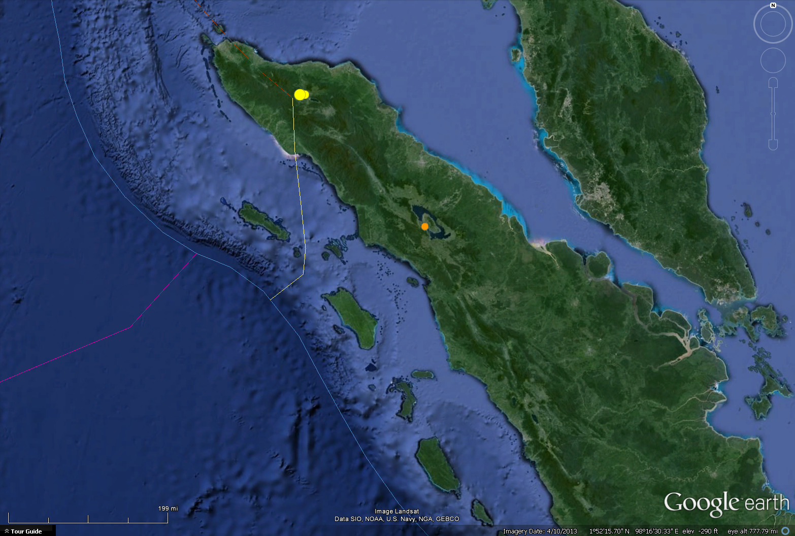
There was a M=4.7 earthquake today in central Sumatra along the Sumatra fault system. Interesting that it is following the 6.1 further to the north just a few days ago. in the map below, the earthquakes associated with the M 6.1 are in yellow. today’s earthquake is in orange. Possibly triggered from the earlier earthquakes, though these are distanced by ~300 km (so seems less likely, depending upon the state of stress on the fault(s).
Today’s earthquake is aligned on the western edge of Lake Toba formed in the caldera left behind from the largest volcanic eruption on earth during the Quaternary period (~1.8 Ma until the present). This volcanic center is aligned with fracture zones located in the subducting India-Australia plate (eg the Investigator fracture zone).
here is the USGS web page for this earthquake. There is a write up about the tectonics of the region. They also have a map, view it with a grain of salt.