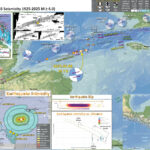
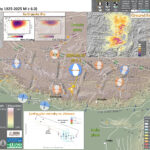
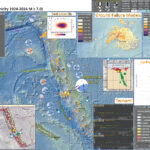
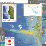
As I was socializing with my coworkers at our weekly social hour, my colleagues noted that they were getting an Earthquake Early Warning. Soon after they reported feeling the ground shake.
After refreshing the USGS earthquakes map webpage a few times, the earthquake showed up. Methinks it was a M 5.5 at first, and changed a few times over the coming minutes (eventually settling on M 5.5).
https://earthquake.usgs.gov/earthquakes/eventpage/ew1683847190/executive
Cindy and I realized that we would need to get to work preparing an Earthquake Quick Report. We had not yet gotten notifications from our information sources, but we left the social hour to get to work.
Cindy and I got our report out and our other colleague Brian got some tweets out from our twitter account. It is important to provide information in a rapid manner so that people learn that they can rely upon us as a credible source of information.
The earthquake reminded me of an earthquake sequence in 2013. I remember discussing this M 5.7 sequence in real time with other colleagues, like Danielle. This was early in the earthjay years, so I was still getting used to preparing material for Earthquake Reports.
https://earthquake.usgs.gov/earthquakes/eventpage/nc71996906/executive
The 2013 M 5.7 was a normal oblique (combination of tension and strike-slip) earthquake mainshock. The earthquake mechanisms for the 2013 and 2023 earthquakes are remarkably similar.
These earthquakes happened along the Almanor fault zone, a right-lateral strike-slip and extensional fault system. Further to the south is the Mohawk Valley fault zone (MHVZ), a right-lateral strike-slip fault system.
The relative plate motions between the North America and Pacific plates (plate motion localized along faults like the San Andreas) cause this region of northern California to experience transtension (combination of strike-slip and extension). The relative plate motions are accommodated by fault slip on both strike-slip faults and normal (tensional) faults.
The MVFZ feeds right-lateral (“dextral”) shear from the Walker Lane. The Walker Lane is the northern extension of the Eastern California Shear Zone. These dextral fault systems may accommodate about 20% of the relative plate motion between the North America and Pacific plates.
There are a number of valleys that have been formed from the extension on the normal faults. As earthquakes slip on these normal faults, the center of the valleys subside (forming what we call grabens if there are normal faults on each side of the valley, or half grabens if the fault is only on one side).
The 2015 Pacific Cell Friends of the Pleistocene led us on a tour of the Quaternary stratigraphy of the Mohawk Valley fault zone.
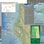
Below is my interpretive poster for this earthquake
- I plot the seismicity from the past month, with diameter representing magnitude (see legend). I include earthquake epicenters from 1922-2022 with magnitudes M ≥ 3.0 in one version.
- I plot the USGS fault plane solutions (moment tensors in blue and focal mechanisms in orange), possibly in addition to some relevant historic earthquakes.
- A review of the basic base map variations and data that I use for the interpretive posters can be found on the Earthquake Reports page. I have improved these posters over time and some of this background information applies to the older posters.
- Some basic fundamentals of earthquake geology and plate tectonics can be found on the Earthquake Plate Tectonic Fundamentals page.
- In the upper left corner is a map that shows the main tectonic boundaries, crustal faults, and a century of seismicity.
- In the lower right corner is a map that shows the earthquake intensity using the modified Mercalli intensity scale. Earthquake intensity is a measure of how strongly the Earth shakes during an earthquake, so gets smaller the further away one is from the earthquake epicenter. The map colors represent a model of what the intensity may be. The USGS has a system called “Did You Feel It?” (DYFI) where people enter their observations from the earthquake and the USGS calculates what the intensity was for that person. The transparent colors with yellow labels show what people actually felt in those different locations.
- Above the map is a plot that shows the same intensity (both modeled and reported) data as displayed on the map. Note how the intensity gets smaller with distance from the earthquake.
I include some inset figures. Some of the same figures are located in different places on the larger scale map below.
- Here is the map with aftershocks plotted and comparisons with the 2013 M 5.7 Earthquake Sequence.
- Note the large number of triggered and aftershock earthquakes from 2013. This represents a month of time and there were about 770 earthquakes, with four M>4 events.
- When I put the aftershock poster (less than 24 hours later), there were 50 aftershocks (with one M>5). There have only been a handful since then so it looks like the aftershock decay is winding down.
- Though the USGS is setting up a seismic array to detect more aftershocks as a local network will be able to detect events of smaller magnitudes. Events like this provide an opportunity to study the subsurface structures as this “microseismicity” can align with the faults and people can visualize these.
- In the lower right corner is a comparison of the modeled and reported intensity (using MMI scale) for these two earthquakes.
Some Relevant Discussion and Figures
- This is a great overview map showing the plate boundary fault systems from Dr. Jayne Bormann’s submission to the 2015 FOP guidebook (Bormann et al., 2015).
- Note how the Eastern California Shear Zone (ECSZ) feeds relative plate motion via fault slip, from the San Andreas along the east side of the Sierra Nevada. This plate motion slip feeds into the Walker Lane.
- There remains considerable debate about how this Pacific-North America relative plate motion goes north of the Walker Lane. Some suggest it feeds into the eastern Cascades and others suggest that it feeds out to the subduction zone. It is likely a combination of these two hypotheses.
- Here is the Gold et al. (2014) map. I include the figure caption as a blockquote below.
- This shows the main faults in the region. Note how the main throughgoing faults are right-lateral strike-slip (the lines with the arrows showing the relative motion along the fault), while there are also basin forming normal faults (the lines with the ball tipped line symbols).
- The Mohawk Valley fault zone is highlighted by the white rectangle. Note how it trends to the northwest, towards Quincy and the IVF (the Indian Valley fault runs through Lake Almanor).
- Here is a figure that shows how GPS and seismicity compare with the surface fault mapping.
- The upper panel shows a topographic profile from A-A’ looking northwest from the south eastern side of the box..
- Panel B shows the GPS velocity relative to stable North America. These data are from the GPS sites within the blue rectangle on the map. The crust further to the west is moving faster to the north relative to the crust in the eastern portion.
- Panel C shows the seismicity sourced from the green box.
- Here, Dr. Jayne Bormann and others (Bormann et al., 2015) present additional geodetic profiles. These GPS (or GNSS) rates are relative to stable North America. Note how the western sites move faster to the north relative to the eastern sites.
- This stepwise reduction in northern velocity represents the accumulated strain from the dextral (right-lateral) faults. I.e., going from west to east, each time a dextral fault is crossed, the relative plate velocity decreases.
- This is a portion of their poster, highlighting profiles 1 and 2. We can see Almanor Lake in the map just to the northwest of profile 1. The Mohawk Valley fault is in the location of the blue dashed line in the profiles.
- This is a different, more local, map and cross section from Bormann et al. (Bormann et al., 2015). The GNSS velocity data are from sites within the yellow rectangle.
- This profile includes more faults designated by the green dashed lines.
- Here is a table from Dr. Bormann’s FOP trip material (Bormann et al., 2015). Using a complicated yet elegant tectonic block model, with two scenarios, Dr. Bormann estimated the slip rates for the faults in the region.
- They suggest that the MCVF has about 2 mm/year of fault slip (aka slip deficit).
- The following material is from the USGS report on the 2013 M 5.7 Canyondam Earthquake Sequence.
- Here is a geologic map showing the M5.7 epicenter.
- Dr. Angela Jayko is one of the most knowledgeable field geologists that I have ever met. Just look into her publication history, you will see the breadth of experience Jayko has. Truly remarkable.
- Dr. Jayko presented a fascinating interpretation of the interaction of the Klamath and northern Sierra terranes. I just learned lots from a quick glimpse. I learn something new every time I am exposed to Dr. Jayko’s work.
- Here is their (Jayko, 1990) intro small scale map showing the setting for the geologic mapping and interpretation for this 1990 paper.
- Here is the medium scale map of the region from Jayko (1990).
- Here is the large scale map of the region from Jayko (1990)
- These are cross sections whose locations are shown on the above map.
- Here is a map that Dr. Jayko compiled from other geologists.
- Note the Melones fault zone as this is a key part of their next figure.
- Hold on to your hats. You will probably need to read Dr. Jayko’s paper to really understand these hypotheses. I know that I need to spend more time reading that paper!
Regional map showing topography and the location of faults in the Northern Walker Lane. Faults are modified from the USGS Quaternary Fault and Fold database [U.S. Geological Survey, California Geological Survey, and Nevada Bureau of Mines and Geology, 2006]. Major faults are drawn in black lines and other Quaternary active faults are drawn in thin gray lines. Towns and cities are indicated by red stars. Inset shows the location of the study area in relation to other elements of the Pacific/North America Plate boundary zone.
Map of the northern Walker Lane study area and regional strike-slip and normal faults, simplified from the U.S. Geological Survey, Nevada Bureau of Mines and Geology, and California Geological Survey [2006], Faulds and Henry [2008], the California Department of Water Resources [1963], Saucedo and Wagner [1992], Hunter et al. [2011], Gold et al. [2013a, 2013b], Olig et al. [2005], and our mapping using lidar data and field observations. Abbreviations: CL, Carson Lineament; DVF, Dog Valley fault; ETFZ, East Truckee fault zone; GVF, Grizzly Valley fault; HLF, Honey Lake fault; HSF, Hot Springs fault; IVF, Indian Valley fault; MVFZ, Mohawk Valley fault zone; OF, Olinghouse fault; PF, Polaris fault; PLF, Pyramid Lake fault; and WSVF, Warm Springs Valley fault. Arrows indicate relative direction of strike-slip fault movement. Bar and ball indicates downthrown block of normal faults. Star depicts location of Sulphur Creek site.
Northeast trending profile from the Sierra Nevada across Sierra Valley which crosses the mapped Mohawk Valley fault zone (MVFZ), Grizzly Valley fault (GVF), and Hot Springs fault (HSF). (a) Topography (National Elevation Data Set 10m DEM). (b) Geodetic data from Hammond et al. [2011] in a Great Basin reference frame (GB09, uncorrected for postseismic relaxation), which show northwest-directed motion relative to the Great Basin to the east. The geodetic data show a gradual eastward decrease in velocities from the Sierra Nevada to the Diamond Mountains. (c) Historical seismicity from 1910 to 2013, M 0–5.3, showing a concentration of earthquakes along themapped trace of MVFZ and other mapped faults in Sierra Valley (Advanced National Seismic System composite catalogue, http://www.quake.geo.berkeley.edu/anss/catalog-search.html, accessed 9 September 2013). The horizontal alignment of earthquakes at 5 km depth results from a default setting in the hypocentral location for earthquake with limited instrumental constraints. (d) Location map showing location of profile line A–A′ and the corresponding swathes from which the geodetic (blue) and seismic data (green) were sampled. Red star indicates location of 27 October 2011, M 4.7 earthquake near the MVFZ.
Western Basin and Range, Walker Lane/ECSZ, and Sierra Nevada GPS velocities in a North America reference frame (NA12) corrected for postseismic relaxation following historic earthquakes in California and Nevada. Velocity uncertainties represent the 95% conndence interval. Red rectangles mark the locations of GPS velocity profiles across the Walker Lane/ECSZ at various latitudes.
Magnitude of GPS velocities for transects of GPS stations that are perpendicular to the Walker Lane direction of maximum shear strain. Gray circles are the observed rates, green (continuous) and yellow (MAGNET) circles with 2 sigma error bars are the rates corrected for the eects of viscoelastic postseismic relaxation. Velocity annotations are station names. Dashed lines indicate the location of the Sierra Nevada frontal boundary (blue) and the easternmost Walker Lane/ECSZ fault (red). Profiles are annotated with the deformation “budget” across the Walker Lane.
GPS velocity profiles across the NWL. (Left) Map showing the location of GPS sites and the profile extending from the southwest of the Mohawk Valley fault (near station P144) to the northeast of the Honey Lake fault (near station FOXR). (Bottom) The upper profile plots the velocity parallel to the long axis of the profile, in the N45°E direction. The lower profile plots the velocity normal to the profile, in the N45°W direction. Note the vertical axis scale change between the two profiles. Gray circles are the observed rates, red circles with 2 sigma error bars are the rates corrected for the effects of viscoelastic
postseismic relaxation from the Central Nevada Seismic Belt [Hammond et al., 2009].
Map of northern California showing location of major tectonic units discussed in text, including Eastern Klamath and Northern Sierra terranes. Map also shows location of the Lake Almanor study area in the northern Sierra Nevada.
Simplified map showing major tectonic units of the Lake Almanor area.
A (above), Geologic map of the Lake Almanor Quadrangle, modified from Jayko (1988).
Structure sections of the Lake Almanor area, modified from Jayko (1988). Pattern in J T s unit of sections A-A’ and B-B’, and in T b unit of section A-A’ used to schematically show kink folds.
Simplified geologic map showing most of the northern Sierra terrane (modified from Harwood, 1988; D’Allura and others, 1977; Jayko, 1988).
Schematic map. A, Northward continuation of the Melones fault zone to the west of the Eastern Klamath terrane (ekt), with inferred left-lateral displacement of tectonic slivers of Eastern Klamath terrane affinity. In this scenario the slivers and their bounding faults are considered to be part of the Melones fault zone. B, Northward continuation of the Melones fault zone east of the Klamath terrane, with inferred right-lateral displacement of the Eastern Klamath terrane relative to the northern Sierra terrane (nst). This scenario implies that the Eastern Klamath terrane was juxtaposed with the Northern Sierra terrane prior to northward displacement of the Eastern Klamath terrane.
- 1906.04.18 M 7.9 San Francisco
- 2023.05.11 M 5.5 Lake Almanor
- 2017.12.14 M 4.3 Laytonville
- 2016.11.06 M 4.1 Laytonville, CA
- 2016.11.03 M 3.8 Laytonville, CA
- 2016.08.10 M 5.1 Lake Pillsbury, CA
- 2016.08.04 M 4.5 Honey Lake, CA
- 2015.03.17 M 3.8 Lake Almanor
- 2015.08.30 M 3.6 Mendocino County, CA
- 2015.07.27 M 3.5 Point Arena, CA
- 2018.07.30 M 3.7 San Pablo Bay
- 2018.01.04 M 4.4 Berkeley
- 1989.10.18 M 6.9 Loma Prieta
- 2020.09.19 M 4.5 El Monte
- 2020.06.24 M 5.8 Lone Pine
- 2019.07.04 M 6.4 Ridgecrest
- 2019.07.05 M 6.4 / 7.1 Ridgecrest Update #1
- 2019.07.18 M 6.4 / 7.1 Ridgecrest Update #2
- 2019.07.20 M 6.4 / 7.1 Ridgecrest Update #3
- 2019.06.05 M 4.3 San Clemente Island
- 2018.04.05 M 5.3 Channel Islands
- 2018.04.05 M 5.3 Channel Islands Update #1
- 2016.02.23 M 4.9 Bakersfield
- 2015.12.30 M 4.4 San Bernardino, CA
- 2015.05.03 M 3.8 Los Angeles, CA
- 2015.04.13 M 3.3 Los Angeles, CA
- 2014.04.01 M 5.1 La Habra p-3
- 2014.03.29 M 5.1 La Habra p-2
- 2014.03.28 M 5.1 La Habra p-1
- 1994.11.17 M 6.7 Northridge, CA
- 1971.02.09 M 6.7 Sylmar, CA
San Andreas plate boundary Earthquake Reports
General Overview
Earthquake Reports
Northern CA
Central CA
Southern CA
- 2020.03.18 M 5.7 Salt Lake City, Utah
- 2020.03.31 M 6.5 Idaho
- 2017.09.02 M 5.3 Idaho
- 2020.05.15 M 6.5 Nevada
- 2016.12.28 M 5.7 swarm Nevada
- 2014.11.05 M 4.6 swarm Nevada
Basin and Range
General Overview
Earthquake Reports
Utah
Idaho
Nevada
Social Media
original thread:
#EarthquakeReport for M5.5 along Skinner flat fault in Lake Almanor northern CA
some brief info about the tectonics in previous reporthttps://t.co/77RgFixKanhttps://t.co/ysfzAxU5eG pic.twitter.com/O9I3WT5DgS
— Jason "Jay" R. Patton (@patton_cascadia) May 12, 2023
#EarthquakeReport for the M5.5 #LakeAlmanor #Earthquake #Sequence near #Chester #Canyondam #Greenville
i have compiled some of the tectonic research conducted in the area
see this and the interpretive posters herehttps://t.co/QTBAFWJyig pic.twitter.com/VqrcXAPirn
— Jason "Jay" R. Patton (@patton_cascadia) May 13, 2023
A M5.4 earthquake occurred near Lake Almanor (Plumas County) in northern California. Shaking reportedly felt 120 miles to the south in Sacramento. A quake of this size can potentially damage structures near the epicenter. CGS is monitoring this area. #earthquake pic.twitter.com/HZ9LyJi1DI
— California Geological Survey (@CAGeoSurvey) May 11, 2023
Updated map for the M5.5 earthquake in Plumas County, near Lake Almanor. Several M2+ aftershocks have been measured. Continued aftershocks can be expected. This quake was on a normal fault in the northern Sierra Nevada.
Did you feel it? Let us know! pic.twitter.com/dI1HE14IFn
— California Geological Survey (@CAGeoSurvey) May 12, 2023
The Sacramento Bee interviewed CGS geologist, Tim Dawson, about the Almanor Fault Zone and the recent M5.5 and M5.2 earthquakes in Plumas County this week. #earthquake @sacbee_news @CalConservation https://t.co/Z5F2Yuoowu
— California Geological Survey (@CAGeoSurvey) May 12, 2023
Information on the M5.5 earthquake in Northern California https://t.co/LbO0pPJiCp pic.twitter.com/EJaOyIrZpa
— Wendy Bohon, PhD 🌏 (@DrWendyRocks) May 12, 2023
Focal mechanism looks similar to the May 23, 2013, Mw 5.7 Canyondam earthquake and the main shock looks located at the northern tip of that previous EQ sequence. #lakealmanor #earthquake pic.twitter.com/XeLJmsxzXD
— Danielle Madugo (@DanielleVerdugo) May 12, 2023
Good afternoon Northeastern, CA! Did you feel the M5.4 quake about 3 miles from East Shore at 4:19 pm? The #ShakeAlert system was activated. See: https://t.co/ggzHGYCcWf @Cal_OES @CAGeoSurvey pic.twitter.com/ThQQFtg4os
— USGS ShakeAlert (@USGS_ShakeAlert) May 11, 2023
A M5.5 earthquake recently occurred in Plumas County, CA near Lake Almanor. Moderate earthquakes occasionally occur on faults in the region, including a M5.7 earthquake at Lake Almanor in 2013. pic.twitter.com/UgkCfOE582
— EarthScope Consortium (@EarthScope_sci) May 12, 2023
Feel today's M5.5 quake? Did you get a warning? People with the @MyShakeApp got up to 15 sec warning. Want a warning for the next earthquake? Download the free app! @BerkeleySeismo @Cal_OES #earthquake pic.twitter.com/TQlPKALTyC
— Richard Allen (@RAllenBerkeley) May 12, 2023
The Butt Creek Fault Zone is near today’s Almanor Fault Zone. There’s totally a crack in Butt Creek. Huh huh huh. pic.twitter.com/CA7P2OqKPo
— Ryan Hollister (@phaneritic) May 12, 2023
Earthquakes in northeastern California? Yesterday's 5.2 falls within a zone of high hazard that includes the eastern Sierra corridor, basically the East Wing of the plate boundary between the Pacific & North American plates. pic.twitter.com/X7pOv4dQLr
— Dr. Susan Hough 🦖 (@SeismoSue) May 12, 2023
Aftershock of yesterday's M5.5 in California! To learn about the mainshock, visit my blog. (Link is in my bio; Twitter is limiting tweets that mention the platform.)
Both quakes triggered the USGS ShakeAlert early warning system. https://t.co/L2zTVXYfEn pic.twitter.com/degEy6kYIq
— Dr. Judith Hubbard (@JudithGeology) May 12, 2023
This map shows GPS velocities in the Western US relative to the stable interior of North America, with the location of recent earthquakes at Lake Almanor in CA marked by a star. The North American Plate in CA moves to the northwest due to deformation along the plate boundary. pic.twitter.com/5VJlHs9R0u
— EarthScope Consortium (@EarthScope_sci) May 12, 2023
- Frisch, W., Meschede, M., Blakey, R., 2011. Plate Tectonics, Springer-Verlag, London, 213 pp.
- Hayes, G., 2018, Slab2 – A Comprehensive Subduction Zone Geometry Model: U.S. Geological Survey data release, https://doi.org/10.5066/F7PV6JNV.
- Holt, W. E., C. Kreemer, A. J. Haines, L. Estey, C. Meertens, G. Blewitt, and D. Lavallee (2005), Project helps constrain continental dynamics and seismic hazards, Eos Trans. AGU, 86(41), 383–387, , https://doi.org/10.1029/2005EO410002. /li>
- Jessee, M.A.N., Hamburger, M. W., Allstadt, K., Wald, D. J., Robeson, S. M., Tanyas, H., et al. (2018). A global empirical model for near-real-time assessment of seismically induced landslides. Journal of Geophysical Research: Earth Surface, 123, 1835–1859. https://doi.org/10.1029/2017JF004494
- Kreemer, C., J. Haines, W. Holt, G. Blewitt, and D. Lavallee (2000), On the determination of a global strain rate model, Geophys. J. Int., 52(10), 765–770.
- Kreemer, C., W. E. Holt, and A. J. Haines (2003), An integrated global model of present-day plate motions and plate boundary deformation, Geophys. J. Int., 154(1), 8–34, , https://doi.org/10.1046/j.1365-246X.2003.01917.x.
- Kreemer, C., G. Blewitt, E.C. Klein, 2014. A geodetic plate motion and Global Strain Rate Model in Geochemistry, Geophysics, Geosystems, v. 15, p. 3849-3889, https://doi.org/10.1002/2014GC005407.
- Meyer, B., Saltus, R., Chulliat, a., 2017. EMAG2: Earth Magnetic Anomaly Grid (2-arc-minute resolution) Version 3. National Centers for Environmental Information, NOAA. Model. https://doi.org/10.7289/V5H70CVX
- Müller, R.D., Sdrolias, M., Gaina, C. and Roest, W.R., 2008, Age spreading rates and spreading asymmetry of the world’s ocean crust in Geochemistry, Geophysics, Geosystems, 9, Q04006, https://doi.org/10.1029/2007GC001743
- Pagani,M. , J. Garcia-Pelaez, R. Gee, K. Johnson, V. Poggi, R. Styron, G. Weatherill, M. Simionato, D. Viganò, L. Danciu, D. Monelli (2018). Global Earthquake Model (GEM) Seismic Hazard Map (version 2018.1 – December 2018), DOI: 10.13117/GEM-GLOBAL-SEISMIC-HAZARD-MAP-2018.1
- Silva, V ., D Amo-Oduro, A Calderon, J Dabbeek, V Despotaki, L Martins, A Rao, M Simionato, D Viganò, C Yepes, A Acevedo, N Horspool, H Crowley, K Jaiswal, M Journeay, M Pittore, 2018. Global Earthquake Model (GEM) Seismic Risk Map (version 2018.1). https://doi.org/10.13117/GEM-GLOBAL-SEISMIC-RISK-MAP-2018.1
- Zhu, J., Baise, L. G., Thompson, E. M., 2017, An Updated Geospatial Liquefaction Model for Global Application, Bulletin of the Seismological Society of America, 107, p 1365-1385, https://doi.org/0.1785/0120160198
- Bormann, J.M., 2013, New Insights into Strain Accumulation and Release in the Central and Northern Walker Lane, Pacific-North American Plate Boundary, California and Nevada, USA [Ph.D. dissertation]: Reno, University of Nevada, Reno, 134 p.
- Bormann, J.M., Hammond, W.C., Kreemer, C., and Blewitt, G., 2015. GPS constraints on the present-day slip rates of the Honey Lake and Mohawk Valley Faults, Northern Walker Lane in Redwine et al., 2015. The 2015 Annual Pacific Cell Friends of the Pleistocene field trip. From Mohawk Valley to Caribou Junction Middle and North Forks of the Feather River, northeastern California. Friday through Sunday, September 25-27, 242 pp.
- Chapman, K., Gold, M.B., Boatwright, J., Sipe, J., Quitoriano, V., Dreger, D., and Hardebeck, J., 2016, Faulting, damage, and intensity in the Canyondam earthquake of May 23, 2013: U.S. Geological Survey Open-File Report 2016-1145, 49 p., http://dx.doi.org/10.3133/ofr20161145.
- Gold, R., Briggs, R.W., Personius, S.F., Crone, A.J., Mahan, S.A., and Angster, S.J., 2014. Latest Quaternary paleoseismology and evidence of distributed dextral shear along the MohawkValley fault zone, northern Walker Lane, California in Journal of Geophysical Research, v. 119, 5014-5032, doi:10.1002/2014JB010987
- Jayko, A. S., 1990, Stratigraphy and tectonics of Paleozoic arc-related rocks of the northernmost Sierra Nevada, California; The eastern Klamath and northern Sierra terranes, in Harwood, D. S., and Miller, M. M., eds., Paleozoic and early Mesozoic paleogeographic relations; Sierra Nevada, Klamath Mountains, and related terranes; Boulder, Colorado, Geological Society of America Special Paper 255, https://doi.org/10.1130/SPE255-p307
References:
Basic & General References
Specific References
Return to the Earthquake Reports page.
- Sorted by Magnitude
- Sorted by Year
- Sorted by Day of the Year
- Sorted By Region
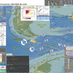
As I completed the Earthquake Report for yesterday’s M 7.1 earthquake along the Kermadec Trench, I tweeted the report and interpretive poster to notice a colleague had tweeted about a magnitude M 7.1 earthquake about an hour earlier. So, I got to work on this report. https://earthquake.usgs.gov/earthquakes/eventpage/us7000jvl3/executive Needless to say, I am a little tired. So, I will write this up more tomorrow. Until then, I present the interpretive poster for this earthquake below. Here is a fantastic view of this plate boundary from a low-angle oblique perspective. The geologists at the EOS Singapore prepared this. This M7.1 earthquake happened along the plate boundary megathrust subduction zone fault (labeled Sunda megathrust in the illustration). The location was near the “t” in the Mentawai fault label. Luckily I updated this page because I noticed that the interpretive figure below was incorrect (it was for a different earthquake). FOS = Resisting Force / Driving Force
Sumatra core location and plate setting map with sedimentary and erosive systems figure. A. India-Australia plate subducts northeastwardly beneath the Sunda plate (part of Eurasia) at modern rates (GPS velocities are based on regional modeling of Bock et al, 2003 as plotted in Subarya et al., 2006). Historic earthquake ruptures (Bilham, 2005; Malik et al., 2011) are plotted in orange. 2004 earthquake and 2005 earthquake 5 meter slip contours are plotted in orange and green respectively (Chlieh et al., 2007, 2008). Bengal and Nicobar fans cover structures of the India-Australia plate in the northern part of the map. RR0705 cores are plotted as light blue. SRTM bathymetry and topography is in shaded relief and colored vs. depth/elevation (Smith and Sandwell, 1997). B. Schematic illustration of geomorphic elements of subduction zone trench and slope sedimentary settings. Submarine channels, submarine canyons, dune fields and sediment waves, abyssal plain, trench axis, plunge pool, apron fans, and apron fan channels are labeled here. Modified from Patton et al. (2013 a).
Map of Southeast Asia showing recent and selected historical ruptures of the Sunda megathrust. Black lines with sense of motion are major plate-bounding faults, and gray lines are seafloor fracture zones. Motions of Australian and Indian plates relative to Sunda plate are from the MORVEL-1 global model [DeMets et al., 2010]. The fore-arc sliver between the Sunda megathrust and the strike-slip Sumatran Fault becomes the Burma microplate farther north, but this long, thin strip of crust does not necessarily all behave as a rigid block. Sim = Simeulue, Ni = Nias, Bt = Batu Islands, and Eng = Enggano. Brown rectangle centered at 2°S, 99°E delineates the area of Figure 3, highlighting the Mentawai Islands. Figure adapted from Meltzner et al. [2012] with rupture areas and magnitudes from Briggs et al. [2006], Konca et al. [2008], Meltzner et al. [2010], Hill et al. [2012], and references therein.
Recent and ancient ruptures along the Mentawai section of the Sunda megathrust. Colored patches are surface projections of 1-m slip contours of the deep megathrust ruptures on 12–13 September 2007 (pink to red) and the shallow rupture on 25 October 2010 (green). Dashed rectangles indicate roughly the sections that ruptured in 1797 and 1833. Ancient ruptures are adapted from Natawidjaja et al. [2006] and recent ones come from Konca et al. [2008] and Hill et al. (submitted manuscript, 2012). Labeled points indicate coral study sites Sikici (SKC), Pasapuat (PSP), Simanganya (SMY), Pulau Pasir (PSR), and Bulasat (BLS).
Distribution of coupling on the Sumatra megathrust derived from the formal inversion of the coral and of the GPS data (Tables 2, 3, and 4) prior to the 2004 Sumatra-Andaman earthquake (model I-a in Table 7). (a) Distribution of coupling on the megathrust. Fully coupled areas are red, and fully creeping areas are white. Three strongly coupled patches are revealed beneath Nias island, Siberut island, and Pagai island. The annual moment deficit rate corresponding to that model is 4.0 X 10^20 N m/a. (b) Observed (black vectors) and predicted (red vectors) horizontal velocities appear. Observed and predicted vertical displacements are shown by color-coded large and small circles, respectively. The Xr^2 of this model is 3.9 (Table 7).
Distribution of coupling on the Sumatra megathrust derived from the formal inversion of the horizontal velocities and uplift rates derived from the CGPS measurements at the SuGAr stations (processed at SOPAC). To reduce the influence of postseismic deformation caused by the March 2005 Nias-Simeulue rupture, velocities were determined for the period between June 2005 and October 2006. (a) Distribution of coupling on the megathrust. Fully coupled areas are red and fully creeping areas are white. This model reveals strong coupling beneath the Mentawai Islands (Siberut, Sipora, and Pagai islands), offshore Padang city, and suggests that the megathrust south of Bengkulu city is creeping at the plate velocity. (b) Comparison of observed (green) and predicted (red) velocities. The Xr^2 associated to that model is 24.5 (Table 8).
Distribution of coupling on the Sumatra megathrust derived from the formal inversion of all the data (model J-a, Table 8). (a) Distribution of coupling on the megathrust. Fully coupled areas are red, and fully creeping areas are white. This model shows strong coupling beneath Nias island and beneath the Mentawai (Siberut, Sipora and Pagai) islands. The rate of accumulation of moment deficit is 4.5 X 10^20 N m/a. (b) Comparison of observed (black arrows for pre-2004 Sumatra-Andaman earthquake and green arrows for post-2005 Nias earthquake) and predicted velocities (in red). Observed and predicted vertical displacements are shown by color-coded large and small circles (for the corals) and large and small diamonds (for the CGPS), respectively. The Xr^2 of this model is 12.8.
Comparison of interseismic coupling along the megathrust with the rupture areas of the great 1797, 1833, and 2005 earthquakes. The southernmost rupture area of the 2004 Sumatra-Andaman earthquake lies north of our study area and is shown only for reference. Epicenters of the 2007 Mw 8.4 and Mw 7.9 earthquakes are also shown for reference. (a) Geometry of the locked fault zone corresponding to forward model F-f (Figure 6c). Below the Batu Islands, where coupling occurs in a narrow band, the largest earthquake for the past 260 years has been a Mw 7.7 in 1935 [Natawidjaja et al., 2004; Rivera et al., 2002]. The wide zones of coupling, beneath Nias, Siberut, and Pagai islands, coincide well with the source of great earthquakes (Mw > 8.5) in 2005 from Konca et al. [2007] and in 1797 and 1833 from Natawidjaja et al. [2006]. The narrow locked patch beneath the Batu islands lies above the subducting fossil Investigator Fracture Zone. (b) Distribution of interseismic coupling corresponding to inverse model J-a (Figure 10). The coincidence of the high coupling area (orange-red dots) with the region of high coseismic slip during the 2005 Nias-Simeulue earthquake suggests that strongly coupled patches during interseismic correspond to seismic asperities during megathrust ruptures. The source regions of the 1797 and 1833 ruptures also correlate well with patches that are highly coupled beneath Siberut, Sipora, and Pagai islands.
Latitudinal distributions of seismic moment released by great historical earthquakes and of accumulated deficit of moment due to interseismic locking of the plate interface. Values represent integrals over half a degree of latitude. Accumulated interseismic deficits since 1797, 1833, and 1861 are based on (a) model F-f and (b) model J-a. Seismic moments for the 1797 and 1833 Mentawai earthquakes are estimated based on the work by Natawidjaja et al. [2006], the 2005 Nias-Simeulue earthquake is taken from Konca et al. [2007], and the 2004 Sumatra-Andaman earthquake is taken from Chlieh et al. [2007]. Postseismic moments released in the month that follows the 2004 earthquake and in the 11 months that follows the Nias-Simeulue 2005 earthquake are shown in red and green, respectively, based on the work by Chlieh et al. [2007] and Hsu et al. [2006].
Free-air gravity anomaly map derived from satellite altimetry [Sandwell and Smith, 2009] over the Wharton Basin area.
Structure and age of the Wharton Basin deduced from free-air gravity anomaly [Sandwell and Smith, 2009; background colors] for the fracture zones (thin black longitudinal lines), and marine magnetic anomaly profiles (not shown) for the isochrons (thin black latitudinal lines). The plain colors represent the oceanic lithosphere created during normal geomagnetic polarity intervals (see legend for the ages of Chrons 20 to 34 according to the time scale of Gradstein et al. [2004]). Compartments separated by major fracture zones are labeled A to H. Grey areas: oceanic plateaus, thick black line: Sunda Trench subduction zone.
Reconstitution of the subducted magnetic isochrons and fracture zones of the northern Wharton Basin using the finite rotation parameters deduced from our two- and three-plate reconstructions. (a) First the geometry is restored on the Earth surface, then (b) it is draped on the top of the subducting plate as derived from seismic tomography [Pesicek et al., 2010] shown by the thin dotted lines at intervals of 100 km (b). Colored dots: identified magnetic anomalies; colored triangles: rotated magnetic anomalies, solid lines; observed fracture zones and isochrons, dashed lines: uncertain or reconstructed fracture zones, dotted lines: reconstructed isochrons from rotated magnetic anomalies (two-plate and three-plate reconstructions), colored area: oceanic lithosphere created during normal geomagnetic polarity intervals (see legend for the ages; the colored areas without solid or dotted lines have been interpolated), grey areas: oceanic plateaus, thick line: Sunda Trench subduction zone.
The deviation of the Sunda Trench from a regular arc shape (dotted lines) off Sumatra is explained by the presence of the younger, hotter and therefore lighter lithosphere in compartments C–F, which resists subduction and form an indentor (solid line). The very young compartment G was probably part of this indentor before oceanic crust formed at slow spreading rate near the Wharton fossil spreading center approached subduction: The weaker rheology of outcropping or shallow serpentinite may have favored the restoration of the accretionary prism in this area. Further south, the deviation off Java is explained by the resistance of the thicker Roo Rise, an oceanic plateau entering the subduction.
Annual probability of experiencing a tsunami with a height at the coast of (a) 0.5m (a tsunami warning) and (b) 3m (a major tsunami warning).
#EarthquakeReport for M7.1 #Gempa #Earthquake offshore of #Sumatra #Indonesia Strong ground shaking w felt reports of intensity MMI 9 Learn more from earlier report https://t.co/KKizpqrU0Chttps://t.co/b9naiPPnbA pic.twitter.com/ThnHCzPNxv — Jason "Jay" R. Patton (@patton_cascadia) April 24, 2023 #EarthquakeReport for M7.1 #Gempa #Earthquake offshore of #Sumatra #Indonesia @USGS_Quakes model results show the likelihood (chance) for liquefaction induced by the earthquake Learn more from earlier report https://t.co/MsVJ54GpGMhttps://t.co/s269GrVReM pic.twitter.com/cZ2EjlRHb1 — Jason "Jay" R. Patton (@patton_cascadia) April 24, 2023 #EarthquakeReport for M7.1 #Gempa #Earthquake offshore of #Sumatra #Indonesia felt reports of intensity MMI 9 This plot shows how earthquake intensity gets smaller w/distance Learn more from earlier report https://t.co/MsVJ54GpGMhttps://t.co/ROpl0cNYYx pic.twitter.com/pGuafAWLxN — Jason "Jay" R. Patton (@patton_cascadia) April 24, 2023 #EarthquakeReport for M7.1 #Gempa #Earthquake offshore of Batu Islands, Siberut Island, and #Sumatra #Indonesia megathrust subduction zone earthquake interpretive poster and report herehttps://t.co/yATr1rEugZ pic.twitter.com/3S6OeT3mow — Jason "Jay" R. Patton (@patton_cascadia) April 25, 2023 — Jason "Jay" R. Patton (@patton_cascadia) April 24, 2023 M 7.1 – 170 km SSE of Teluk Dalam, Indonesiahttps://t.co/7jWUUYLp7E pic.twitter.com/n83OgwYCmj — Wendy Bohon, PhD 🌏 (@DrWendyRocks) April 24, 2023 #Earthquake (#gempa) confirmed by seismic data.⚠Preliminary info: M6.7 || 174 km W of #Pariaman (#Indonesia) || 9 min ago (local time 03:00:54). Follow the thread for the updates👇 pic.twitter.com/T0fEZEoE6j — EMSC (@LastQuake) April 24, 2023 #Earthquake in #Indonesia – Early impact estimation. Modified Mercalli Intensity: 7.0/10 – Population Exposure Estim.: https://t.co/BPHYunonh4 pic.twitter.com/ONbpUUpzdd — ADAM Disaster Alerts (@WFP_ADAM) April 24, 2023 Major M7ish, shallow, upslip (reverse) faulting #earthquake on Australian-Sunda (Pacific) plates boundary with 5-6cm/y convergence. Potential for local land and mud slides and perhaps minor tsunami impact. Region known for recent great earthquakes.#geohazards #Indonesia https://t.co/7h2pOcX1TV pic.twitter.com/GG6kF7lg5Z — 🌎 Prof Ben van der Pluijm ⚒️ (@vdpluijm) April 24, 2023 Watch the waves from the M7.1 Sumatra, Indonesia earthquake roll across seismic stations in North America. More info⬇️ pic.twitter.com/DW7qzpRwjm — EarthScope Consortium (@EarthScope_sci) April 25, 2023 2023-04-24 M7.1 #Indonesia #earthquake recorded in #Scotland + historical seismicity & cross section. Weak P/PcP arrival on many stations & clear surface waves for most (2nd plot). Dist: 10889km — Giuseppe Petricca (@gmrpetricca) April 25, 2023 M7.1 earthquake near Indonesia at 20.00 UTC on 24 April 2023. Recorded in Nottingham using horizontal pendulum school seismometer from @mindsets_uk #earthquake https://t.co/wQVD8D7eVg pic.twitter.com/rSPebaQ0YZ — Geological Outreach (@GeoOutreach) April 24, 2023 Large earthquake near Indonesia, preliminary information suggests M6.7-M6.9 and shallow depth. Based on early depths and epicenter, this could be a shallow subduction interface event. https://t.co/1x9UBcPEZx pic.twitter.com/qkiOfaqwzA — Jascha Polet (@CPPGeophysics) April 24, 2023 Pretty decent size earthquake this morning, I am currently at my in laws, a little bit to the southeast of Padang but it didn't woke me up although my in laws said they felt a strong swaying, stay safe everyone on the outer islands 🙏 pic.twitter.com/8PVekovYEC — Gayatri Marliyani (@GMarliyani) April 24, 2023 Karakteristik Gempa Megathrust dengan mekanisme naik (thrust fault) di bidang kontak antar lempeng di kedalaman 23 km. pic.twitter.com/ORbJymysj8 — DARYONO BMKG (@DaryonoBMKG) April 24, 2023 Sebelum terjadi gempa dengan skala 7 pagi hari ini. Setidaknya telah terjadi beberapa kali gempa preshock yang mendahului sejak 2 hari yang lalu (23 April 2023) pic.twitter.com/iUmYYMUgyt — INFOMITIGASI™ (@infomitigasi) April 24, 2023 Recent Earthquake Teachable Moment for the M7.1 Indonesia earthquake. Teachable Moments presentations capture the opportunity to bring knowledge, insight, and critical thinking to the classroom following a newsworthy earthquake.https://t.co/NrmdZ6Xu2Y pic.twitter.com/dzUpYiC0LR — EarthScope Consortium (@EarthScope_sci) April 25, 2023 The magnitude-7.1 earthquake that struck off the coast of Sumatra earlier today occurred at the edge of a seismic gap. Asst Prof Meltzner @QuakesAndShakes said that we are still expecting a great earthquake in the region in the future. Find out more at https://t.co/3jYBFB8MBx — Earth Observatory SG (@EOS_SG) April 25, 2023
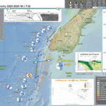
I am currently taking a break following an excellent Seismological Society of America Meeting in San Juan Puerto Rico. I presented a couple posters and one talk on the results from our USGS Powell Center meeting where we developed a basic logic tree for probabilistic tsunami hazard assessment for the Cascadia subduction zone. Last night (my time, in Arecibo) there was an earthquake along the subduction zone, a convergent plate boundary, that forms the Kermadec trench (a deep sea trench, much like the Mariana trench). Initially, there was one M 7.3 earthquake. I received a text message from the National Tsunami Warning Center stating that there was no tsunami risk for California, Oregon, Washington, British Columbia, and Alaska. https://earthquake.usgs.gov/earthquakes/eventpage/us6000k6mg/executive Shortly after that, there were then two M7.3 earthquakes. One was located east of the trench (an earthquake within the Pacific plate, much like the March 2023 M 7.3 earthquake, which was also in a similar location). The other earthquake was located west of the trench and had a depth that suggested it was a megathrust subduction zone earthquake. Because these earthquakes happened at nearly the same time and had the same magnitude, I suspected that they were actually the same earthquake but had been automatically located in two locations (possibly due to something about the seismic waves that complicated the automatic location algorithm). In a few minutes, this was all worked out and the two earthquake pages began to show the same information, a single M 7.3 that was a subduction zone interface earthquake (an earthquake that slipped the megathrust fault). Within a few more minutes, the magnitude was revised to be M 7.1. This is a much smaller earthquake than a M 7.3 but still quite significant. People on Raoul Island, about 75 km from the epicenter, reported strong ground shaking (intensity MMI 8, though initially reported as MMI 9). After a few tweets, I went over to the tide gage websites that I monitor when there are subduction zone earthquakes. I often look at the UNESCO Sea Level Monitoring Facility website first. There is a map and one may click on the dots that represent most of the tide gages around the globe. This page provides basic information about water surface elevations. One may take a quick look to see if there are excursions in the sea level data, possibly related to tsunami. Then, when I am ready to download some data so that I may plot these data I head over to the European Commission World Sea Levels website. This is also a map interface and it takes a little more effort to learn how to operate the website to obtain the data one likes. These data are in a better format than the UNESCO site since they provide the observations, the tide prediction, and the excursion (i.e., the tsunami with the tide data removed). I prefer to prepare my own plots so that I can control their graphical composition, these organizations create plots automatically and they are not always the best looking; I download these data, open them in excel, plot, then place them in adobe illustrator so that I can annotate them. OK, back to the earthquake. There was a magnitude M8.1 subduction zone earthquake in this area on 4 March 2021. Here is my poster for that earthquake, where I show that several large earthquakes happened closely in space and in time. It was phenomenal that these 3 earthquakes also generated 3 tsunami that showed up on tide gages across the south Pacific. Yesterday’s M 7.1 happened within the area of aftershocks from the M 8.1. So, I interpret this to be an aftershock of the M8.1. (Though I could easily be convinced that it was instead simply a triggered earthquake; it also followed the 15 March 2023 M 7.0 earthquake which was directly east of yesterday’s M 7.1. The earlier M 8.1 and yesterday’s M 7.1 earthquakes were along the subduction zone, where the Pacific plate subducts beneath the Australia plate. This subduction zone is quite active with many analogical historical earthquakes of similar magnitude in this area and also further to the north and to the south. We may recall the 15 January 2022 Hunga Tonga eruption that generated a large trans-Pacific tsunami. Here is my report on that event. Here is a web page that I put together for the California Geological Survey where I serve the public in the Seismic Hazards Program and Tsunami Unit (actually, I cannot share that page as it does not work outside of the USA, sadly; I will add a link once I am back home). At the bottom of this report are a series of tweets that include some additional educational material. Check out the EarthScope Consortium tweets!
Bathymetric map of the Tonga–Kermadec arc system. Map showing the depth of the subducted slab beneath the Tonga–Kermadec arc system. Louisville seamount ages are after Koppers et al.49 ELSC, eastern Lau-spreading centre; DSDP, Deep Sea Drilling Programme; NHT, Northern Havre Trough; OT, Osbourn Trough; VFR, Valu Fa Ridge. Arrows mark total convergence rates.
Map of the Southwest Pacific Ocean showing the regional tectonic setting and location of the two dredged profiles. Depth contours in kilometres. The presently active arcs comprise New Zealand–Kermadec Ridge–Tonga Ridge, linked with Vanuatu by transforms associated with the North Fiji Basin. Colville Ridge–Lau Ridge is the remnant arc. Havre Trough–Lau Basin is the active backarc basin. Kermadec–Tonga Trench marks the site of subduction of Pacific lithosphere westward beneath Australian plate lithosphere. North and South Fiji Basins are marginal basins of late Neogene and probable Oligocene age, respectively. 5.4sK–Ar date of dredged basalt sample (Adams et al., 1994).
Large subduction-zone interplate earthquakes (large open gray stars) labeled with event date, Mw, GCMT focal mechanisms, and GPS velocity vectors (gray arrows and black triangles labeled with station name). GPS velocities are listed in Table 3. Black lines indicate the Tonga–Kermadec and Vanuatu trenches. Note that the 2009/09/29 Samoa–Tonga outer trench-slope event (Mw 8.1) triggered large interplate doublets (both of Mw 7.8; Lay et al., 2010). The Pacific plate subducts westward beneath the Australian plate along the Tonga–Kermadec trench, whereas the Australian plate subducts eastward beneath the Vanuatu arc and North Fiji basin. The opposite orientation between the Tonga–Kermadec and Vanuatu subduction systems is due to complex and broad back-arc extension in the Lau and North Fiji basins (Pelletier et al., 1998).
Regional map of moderate-sized (mb > 4:7) shallow-focus repeating earthquakes and background seismicity along the (a) Tonga–Kermadec and (b) Vanuatu (former New Hebrides) subduction zones. Shallow repeating earthquakes (black stars) and their available Global Centroid Moment Tensor (GCMT; Dziewoński et al., 1981; Ekström et al., 2003) are labeled with event date and doublet/cluster id where applicable. Colors of GCMT are used to distinguish nearby different repeaters. Source parameters for the clusters and doublets are listed in Tables 1 and 2. Background seismicity is shown as gray dots and large interplate earthquakes (moment magnitude, Mw > 7:3) since 1976 are shown as large open gray stars. Black lines indicate the trench (Bird, 2003) and slab contour at 50-km depth (Gudmundsson and Sambridge, 1998). Repeating earthquake clusters in the (a) T1 and T2 plate-interface regions in Tonga and (b) V3 plate-interface region in Vanuatu are used to study the fault-slip rate ( _d). A regional map of the Tonga–Kermadec–Vanuatu subduction zones is Kermadec Trench from Woods Hole Oceanographic Inst. on Vimeo.
Earthquakes and subducted slabs beneath the Tonga–Fiji area. The subducting slab and detached slab are defined by the historic earthquakes in this region: the steeply dipping surface descending from the Tonga Trench marks the currently active subduction zone, and the surface lying mostly between 500 and 680 km, but rising to 300 km in the east, is a relict from an old subduction zone that descended from the fossil Vitiaz Trench. The locations of the mainshocks of the two Tongan earthquake sequences discussed by Tibi et al. are marked in yellow (2002 sequence) and orange (1986 series). Triggering mainshocks are denoted by stars; triggered mainshocks by circles. The 2002 sequence lies wholly in the currently subducting slab (and slightly extends the earthquake distribution in it),whereas the 1986 mainshock is in that slab but the triggered series is located in the detached slab,which apparently contains significant amounts of metastable olivine
bathymetry, and major tectonic element map of the study area. The Tonga and Vanuatu subduction systems are shown together with the locations of earthquake epicenters discussed herein. Earthquakes between 0 and 70 km depth have been removed for clarity. Remaining earthquakes are color-coded according to depth. Earthquakes located at 500–650 km depth beneath the North Fiji Basin are also shown. Plate motions for Vanuatu are from the U.S. Geological Survey, and for Tonga from Beavan et al. (2002) (see text for details). Dashed line indicates location of cross section shown in Figure 3. NFB—North Fiji Basin; HFZ—Hunter Fracture Zone.
Map showing distribution of slab segments beneath the Tonga-Vanuatu region. West-dipping Pacifi c slab is shown in gray; northeast-dipping Australian slab is shown in red. Three detached segments of Australian slab lie below the North Fiji Basin (NFB). HFZ—Hunter Fracture Zone. Contour interval is 100 km. Detached segments of Australian plate form sub-horizontal sheets located at ~600 km depth. White dashed line shows outline of the subducted slab fragments when reconstructed from 660 km depth to the surface. When all subducted components are brought to the surface, the geometry closely approximates that of the North Fiji Basin.
Previous interpretation of combined P-wave tomography and seismicity from van der Hilst (1995). Earthquake hypocenters are shown in blue. The previous interpretation of slab structure is contained within the black dashed lines. Solid red lines mark the surface of the Pacifi c slab (1), the still attached subducting Australian slab (2a), and the detached segment of the Australian plate (2b). UM—upper mantle;
Simplified plate tectonic reconstruction showing the progressive geometric evolution of the Vanuatu and Tonga subduction systems in plan view and in cross section. Initiation of the Vanuatu subduction system begins by 10 Ma. Initial detachment of the basal part of the Australian slab begins at ca. 5–4 Ma and then sinking and collision between the detached segment and the Pacifi c slab occur by 3–4 Ma. Initial opening of the Lau backarc also occurred at this time. Between 3 Ma and the present, both slabs have been sinking progressively to their current position. VT—Vitiaz trench; dER—d’Entrecasteaux Ridge.
#EarthquakeReport for at least 1 M7.3 #Earthquake along Kermadec trench One M7.3 appears to be megathrust subduction interface earthquake maybe M8.1 aftershock No tsunami likely in CA, OR, WA, BC, AK Read earlier report for 8.1 https://t.co/57SWSkASPuhttps://t.co/Q6yHAqbrdR pic.twitter.com/3Qt9mqEwsB — Jason "Jay" R. Patton (@patton_cascadia) April 24, 2023 #EarthquakeReport for M7.1 #Earthquake along the Kermadec trench north of #NewZealand south of #Fiji report and interpretive poster#Tsunami plots from Raoul Island read about the regional tectonics:https://t.co/FMza1rzeti pic.twitter.com/qe4kgEGrPl — Jason "Jay" R. Patton (@patton_cascadia) April 24, 2023 Tsunami Info Stmt: M7.3 Kermadec Islands Region 1742PDT Apr 23: Tsunami NOT expected; CA,OR,WA,BC,and AK — NWS Tsunami Alerts (@NWS_NTWC) April 24, 2023 #Earthquake confirmed by seismic data.⚠Preliminary info: M7.0 || 977 km NE of #Kerikeri (New Zealand) || 12 min ago (local time 12:41:52). Follow the thread for the updates👇 pic.twitter.com/ewrGObyPwb — EMSC (@LastQuake) April 24, 2023 Mw=7.1, KERMADEC ISLANDS, NEW ZEALAND (Depth: 45 km), 2023/04/24 00:41:54 UTC – Full details here: https://t.co/rFPxkijKBP pic.twitter.com/iSHp9EU849 — Earthquakes (@geoscope_ipgp) April 24, 2023 No #tsunami threat to Australia from magnitude 7.2 #earthquake near the Kermadec Islands Region. Latest Advice at https://t.co/YzmlhRlr4V pic.twitter.com/ZQ7k8CjcPS — Bureau of Meteorology, Australia (@BOM_au) April 24, 2023 Waves from the M7.1 Kermadec Islands earthquake shown using Station Monitor. Use Station Monitor to see how the ground moved near you: https://t.co/Tir0KZELXN pic.twitter.com/sH1ktj0Kv4 — EarthScope Consortium (@EarthScope_sci) April 24, 2023 Seismic waves from the M7.3 Kermadec Islands earthquake are rolling under me here on the east coast of the US. These waves are far too small for people to feel but not too small to be detected by seismometers. Data from @EarthScope_sci Station Monitor. pic.twitter.com/yE1RkcWLyo — Wendy Bohon, PhD 🌏 (@DrWendyRocks) April 24, 2023 The Kermadec Islands region experiences a very high degree of seismicity Here, the Pacific Plate subducts beneath the Australian Plate, and earthquakes increase in depth from east to west. pic.twitter.com/hCkvUMBgPg — EarthScope Consortium (@EarthScope_sci) April 24, 2023 Good point about duration, looks like duration of long period seismic waves is only 1-2 min at (clipped) nearby seismic station at Raoul pic.twitter.com/JevcnqZjC6 — Anthony Lomax 🇪🇺🌍🇺🇦 (@ALomaxNet) April 24, 2023 Mw 7.1 earthquake near Raoul Island today. Reverse faulting at 50 km depth. Small tsunami (~20 cm peak-to-trough) recorded at Raoul Island. The earthquake was well recorded across the New Zealand seismic network. pic.twitter.com/gJfahJ6KAK — John Ristau 🇨🇦 🇳🇿 (@SinistralSeismo) April 24, 2023 Watch the waves from the M7.1 Kermadec Islands earthquake roll across seismic stations in North America. pic.twitter.com/iERRx9v6Q2 — EarthScope Consortium (@EarthScope_sci) April 24, 2023 Recent Earthquake Teachable Moment for the M7.1 Kermadec Islands earthquake. Teachable Moments presentations capture the opportunity to bring knowledge, insight, and critical thinking to the classroom following a newsworthy earthquake.https://t.co/Ltmp5G5EBu pic.twitter.com/gzHYlaCCX9 — EarthScope Consortium (@EarthScope_sci) April 24, 2023 1/3 – 2023-04-24 M7.1 #Kermadec #earthquake recorded in #Scotland & #Stornoway + historical seismicity & cross section. Core waves clearly detected by all stations in the region. Dist.: 16868km — Giuseppe Petricca (@gmrpetricca) April 24, 2023 You can see the seismic action northeast of NZ, around the Kermadec Islands. The brown (🟤) colouring indicates the strongest activity. https://t.co/97AgBb6gz8 pic.twitter.com/7GTHcViRmh — NIWA Weather (@NiwaWeather) April 24, 2023 Section from a M7.1 earthquake in the Kermadec Islands, New Zealand at 2023-04-24 00:41:56UTC recorded on the global @raspishake network. See: https://t.co/75dBE7ppyG…. Uses @obspy & @matplotlib. PcP are reflections from the outer core, PKIKP pass through the inner core. pic.twitter.com/YgppoTV4xD — Mark Vanstone (@wmvanstone) April 24, 2023 M7.1 earthquake from the Kermadec Islands, New Zealand at 2023-04-24 00:41:56UTC recorded 17 670 km away on the @raspishake and @BGSseismology networks in SW England and Brittany, France. See: https://t.co/75dBE7ppyG. Uses @obspy, @matplotlib & folium libraries. pic.twitter.com/wI3GUfIhnd — Mark Vanstone (@wmvanstone) April 24, 2023
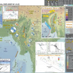
This morning (my time) I received a notification from the National Tsunami Warning Center, the organization responsible for generating notifications for my locality (California). There was a magnitude M 7.0 earthquake in Papua New Guinea. https://earthquake.usgs.gov/earthquakes/eventpage/at00rsi26z/executive This earthquake was almost intermediate depth (about 63 km), not on a tsunamigenic fault, and far inland (so likely no tsunami). There was an event last September just to the east. Here is the earthquake report for that event. The USGS includes many products on their earthquake pages. We can see from their ground failure products that this earthquake likely generated significant liquefaction. I show this on the interpretive poster and include a write up about ground failure generated by earthquakes below. Something that influences the liquefaction and landslide modeling is the topography. The M 7.0 earthquake happened in an area that is mostly low lying Earth adjacent to the Sepik River system. The ground is probably highly saturated with water. Also, there is little steep topography in the area, which probably contributes to the low chance for landslides in the USGS model for earthquake triggered landslides. As always, we hope that there was not much suffering from this earthquake. The shaking intensity was high, so it must have been quite terrifying. The region does not have a high population density, so the USGS PAGER alert estimate reflects this. There were about 133,000 people who may have been exposed to intensity MMI 7 and 333,000 exposed to MMI 6.
Topography, bathymetry and regional tectonic setting of New Guinea and Solomon Islands. Arrows indicate rate and direction of plate motion of the Australian and Pacific plates (MORVEL, DeMets et al., 2010); Mamberamo thrust belt, Indonesia (MTB); North Fiji Basin (NFB)
Tectonic setting of Papua New Guinea and Solomon Islands. a) Regional plate boundaries and tectonic elements. Light grey shading illustrates bathymetry b2000mbelow sea level indicative of continental or arc crust, and oceanic plateaus; 1000mdepth contour is also shown. Adelbert Terrane (AT); Bismarck Sea fault (BSF); Bundi fault zone (BFZ); Feni Deep (FD); Finisterre Terrane (FT); Gazelle Peninsula (GP); Kia-Kaipito-Korigole fault zone (KKKF); Lagaip fault zone (LFZ); Mamberamo thrust belt (MTB); Manus Island (MI); New Britain (NB); New Ireland (NI); North Sepik arc (NSA); Ramu-Markham fault (RMF); Weitin Fault (WF);West Bismarck fault (WBF); Willaumez-Manus Rise (WMR). b) Magmatic arcs and volcanic centers related to this study.
a) Present day tectonic features of the Papua New Guinea and Solomon Islands region as shown in plate reconstructions. Sea floor magnetic anomalies are shown for the Caroline plate (Gaina and Müller, 2007), Solomon Sea plate (Gaina and Müller, 2007) and Coral Sea (Weissel and Watts, 1979). Outline of the reconstructed Solomon Sea slab (SSP) and Vanuatu slab (VS)models are as indicated. b) Cross-sections related to the present day tectonic setting. Section locations are as indicated. Bismarck Sea fault (BSF); Feni Deep (FD); Louisiade Plateau (LP); Manus Basin (MB); New Britain trench (NBT); North Bismarck microplate (NBP); North Solomon trench (NST); Ontong Java Plateau (OJP); Ramu-Markham fault (RMF); San Cristobal trench (SCT); Solomon Sea plate (SSP); South Bismarck microplate (SBP); Trobriand trough (TT); projected Vanuatu slab (VS); West Bismarck fault (WBF); West Torres Plateau (WTP); Woodlark Basin (WB).
The GPS velocity field and 95 per cent confidence interval ellipses with respect to the Australian Plate. Red and blue vectors are the new calculated field and black vectors are from Wallace et al. (2004). The dashed rectangle shows the area of Fig. 3. The blue dashed lines correspond to the location of profiles shown in Fig. 4. Note that the velocity scales for the red and blue vectors are different (see the lower right corner for scales). The black velocities are plotted at the same scale as the red vectors.
Profiles A–A& and B–B& from Fig. 2 showing model fit to GPS observations. Red symbols and lines are the GPS observed and modelled velocities, respectively, for the profile-normal component. Blue symbols and lines correspond to the profile-parallel component. The green and pink lines corresponds to the model using the Ramu-Markham fault geometry from Wallace et al. (2004), south of Lae. Grey profiles show the projected topography. The seismicity is from the ISC catalogue for events > Mw 3.5 (1960–2011).
Tectonic map of New Guinea, adapted from Hamilton (1979), Cooper and Taylor (1987), Dow et al. (1988), and Sapiie et al. (1999). AFTB—Aure fold and thrust belt, FTB—fold-and-thrust belt, IOB—Irian Ophiolite Belt, TFB—thrust-and-fold belt, POB—Papuan Ophiolite Belt, BTFZ—Bewani-Torricelli fault zone, MDZ—Mamberamo deformation zone, YFZ—Yapen fault zone, SFZ—Sorong fault zone, WO—Weyland overthrust. Continental basement exposures are concentrated along the southern fl ank of the Central Range: BD—Baupo Dome, MA—Mapenduma anticline, DM—Digul monocline, IDI—Idenberg Inlier, MUA—Mueller anticline, KA—Kubor anticline, LFTB—Legguru fold-and-thrust belt, RMFZ—Ramu-Markham fault zone, TAFZ—Tarera-Aiduna fault zone. The Tasman line separates continental crust that is Paleozoic and younger to the east from Precambrian to the west.
Lithospheric-scale cross section at 2 Ma. Plate motion is now focused along the Yapen fault zone in the center of the recently extinct arc. This probably occurred because this zone of weakness had a trend that could accommodate the imposed movements as the corner of the Caroline microplate ruptured, forming the Bismarck plate, and the corner of the Australian plate ruptured, forming the Solomon microplate. The collisional delamination-generated magmatic event ends in the highlands as the lower crustal magma chamber solidifies. Upwelled asthenosphere cools and transforms into lithospheric mantle. This drives a slow regional subsidence of the highlands that will continue for tens of millions of years or until other plate-tectonic movements are initiated. Deep erosion is still concentrated on the fl anks of the mountain belt. RMB—Ruffaer Metamorphic Belt, AUS—Australian plate, PAC—Pacific plate.
Seismotectonic interpretation of New Guinea. Tectonic features: PTFB—Papuan thrust-and-fold belt; RMFZ—Ramu-Markham fault zone; BTFZ—Bewani-Torricelli fault zone; MTFB—Mamberamo thrust-and-fold belt; SFZ—Sorong fault zone; YFZ—Yapen fault zone; RFZ—Ransiki fault zone; TAFZ—Tarera-Aiduna fault zone; WT—Waipona Trough. After Sapiie et al. (1999).
Topography, bathymetry and major tectonic elements of the study area. (a) Major tectonic boundaries of Papua New Guinea and the western Solomon Islands; CP, Caroline plate; MB, Manus Basin; NBP, North Bismarck plate; NBT, New Britain trench; NGT, New Guinea trench; NST, North Solomon trench; PFTB, Papuan Fold and Thrust Belt; PT, Pocklington trough; RMF, Ramu-Markham Fault; SBP, South Bismarck plate; SCT, San Cristobal trench; SS, Solomon Sea plate; TT, Trobriand trough; WB,Woodlark Basin; WMT,West Melanesian trench. Study area is indicated by rectangle labelled Figure 1b; the other inset rectangle highlights location for subsequent figures. Present day GPS motions of plates are indicated relative to the Australian plate (from Tregoning et al. 1998, 1999; Tregoning 2002; Wallace et al. 2004). (b) Detailed topography, bathymetry and structural elements significant to the South Bismarck region (terms not in common use are referenced); AFB, Aure Fold Belt (Davies 2012); AT, Adelbert Terrane (e.g. Wallace et al. 2004); BFZ, Bundi Fault Zone (Abbott 1995); BSSL, Bismarck Sea Seismic Lineation; CG, Cape Gloucester; FT, Finisterre Terrane; GF, Gogol Fault (Abbott 1995); GP, Gazelle Peninsula; HP, Huon Peninsula; MB, Manus Basin; NB, New Britain; NI, New Ireland; OSF, Owen Stanley Fault; RMF, Ramu-Markham Fault; SS, Solomon Sea; WMR, Willaumez-Manus Rise (Johnson et al. 1979); WT, Wonga Thrust (Abbott et al. 1994); minor strike-slip faults are shown adjacent to Huon Peninsula (Abers & McCaffrey 1994) and in east New Britain, the Gazelle Peninsula (e.g. Madsen & Lindley 1994). Circles indicate centres of Quaternary volcanism of the Bismarck arc. Filled triangles indicate active thrusting or subduction, empty triangles indicate extinct or negligible thrusting or subduction.
Tectonic maps of the New Guinea region. (a) Seismicity, volcanoes, and plate motion vectors. Plate motion vectors relative to the Australian plate are surface velocity models based on GPS data, fault slip rates, and earthquake focal mechanisms (UNAVCO, http://jules.unavco.org/Voyager/Earth). Earthquake data are sourced from the International Seismological Center EHB Bulletin (http://www.isc.ac.uk); data represent events from January 1994 through January 2009 with constrained focal depths. Background image is generated from http://www.geomapapp.org. Abbreviations: AB, Arafura Basin; AT, Aure Trough; AyT, Ayu Trough; BA, Banda arc; BSSL, Bismarck Sea seismic lineation; BH, Bird’s Head; BT, Banda Trench; BTFZ, Bewani-Torricelli fault zone; DD, Dayman Dome; DEI, D’Entrecasteaux Islands; FP, Fly Platform; GOP, Gulf of Papua; HP, Huon peninsula; LA, Louisiade Archipelago; LFZ, Lowlands fault zone; MaT, Manus Trench; ML, Mt. Lamington; MT, Mt. Trafalgar; MuT, Mussau Trough; MV, Mt. Victory; MTB, Mamberamo thrust belt; MVF, Managalase Plateau volcanic field; NBT, New Britain Trench; NBA, New Britain arc; NF, Nubara fault; NGT, New Guinea Trench; OJP, Ontong Java Plateau; OSF, Owen Stanley fault zone; PFTB, Papuan fold-and-thrust belt; PP, Papuan peninsula; PRi, Pocklington Rise; PT, Pocklington Trough; RMF, Ramu-Markham fault; SST, South Solomons Trench; SA, Solomon arc; SFZ, Sorong fault zone; ST, Seram Trench; TFZ, Tarera-Aiduna fault zone; TJ, AUS-WDKPAC triple junction; TL, Tasman line; TT, Trobriand Trough;WD, Weber Deep;WB, Woodlark Basin;WFTB, Western (Irian) fold-and-thrust belt; WR,Woodlark Rift; WRi, Woodlark Rise; WTB, Weyland thrust; YFZ, Yapen fault zone.White box indicates the location shown in Figure 3. (b) Map of plates, microplates, and tectonic blocks and elements of the New Guinea region. Tectonic elements modified after Hill & Hall (2003). Abbreviations: ADB, Adelbert block; AOB, April ultramafics; AUS, Australian plate; BHB, Bird’s Head block; CM, Cyclops Mountains; CWB, Cendrawasih block; CAR, Caroline microplate; EMD, Ertsberg Mining District; FA, Finisterre arc; IOB, Irian ophiolite belt; KBB, Kubor & Bena blocks (including Bena Bena terrane); LFTB, Lengguru fold-and-thrust belt; MA, Mapenduma anticline; MB, Mamberamo Basin block; MO, Marum ophiolite belt; MHS, Manus hotspot; NBS, North Bismarck plate; NGH, New Guinea highlands block; NNG, Northern New Guinea block; OKT, Ok Tedi mining district; PAC, Pacific plate; PIC, Porgera intrusive complex; PSP, Philippine Sea plate; PUB, Papuan Ultramafic Belt ophiolite; SB, Sepik Basin block; SDB, Sunda block; SBS, South Bismarck plate; SIB, Solomon Islands block; WP, Wandamen peninsula; WDK, Woodlark microplate; YQ, Yeleme quarries.
Oblique block diagram of New Guinea from the northeast with schematic cross sections showing the present-day plate tectonic setting. Digital elevation model was generated from http://www.geomapapp.org. Oceanic crust in tectonic cross sections is shown by thick black-and-white hatched lines, with arrows indicating active subduction; thick gray-and-white hatched lines indicate uncertain former subduction. Continental crust, transitional continental crust, and arc-related crust are shown without pattern. Representative geologic cross sections across parts of slices C and D are marked with transparent red ovals and within slices B and E are shown by dotted lines. (i ) Cross section of the Papuan peninsula and D’Entrecasteaux Islands modified from Little et al. (2011), showing the obducted ophiolite belt due to collision of the Australian (AUS) plate with an arc in the Paleogene, with later Pliocene extension and exhumation to form the D’Entrecasteaux Islands. (ii ) Cross section of the Papuan peninsula after Davies & Jaques (1984) shows the Papuan ophiolite thrust over metamorphic rocks of AUS margin affinity. (iii ) Across the Papuan mainland, the cross section after Crowhurst et al. (1996) shows the obducted Marum ophiolite and complex folding and thrusting due to collision of the Melanesian arc (the Adelbert, Finisterre, and Huon blocks) in the Late Miocene to recent. (iv) Across the Bird’s Head, the cross section after Bailly et al. (2009) illustrates deformation in the Lengguru fold-and-thrust belt as a result of Late Miocene–Early Pliocene northeast-southwest shortening, followed by Late Pliocene–Quaternary extension. Abbreviations as in Figure 2, in addition to NI, New Ireland; SI, Solomon Islands; SS, Solomon Sea; (U)HP, (ultra)high-pressure.
Across the Papuan mainland, the cross section after Crowhurst et al. (1996) shows the obducted Marum ophiolite and complex folding and thrusting due to collision of the Melanesian arc (the Adelbert, Finisterre, and Huon blocks) in the Late Miocene to recent.
Active tectonic setting of eastern Papua New Guinea showing the boundaries of the Woodlark microplate that includes previously proposed oceanic Solomon Sea plate, the Trobriand platform, and the Woodlark plate [Wallace et al., 2014]. The New Britain trench along the northern margin of the Woodlark plate is a rapidly subducting, 600 km long slab that generates a strong pull on the unsubducted Woodlark microplate [Weissel et al., 1982; Wallace et al., 2004, 2014]. Small circles around the Trobriand platform/Australia pole predict the described pattern of transpressional deformation along the Aure-Moresby fold-thrust belt and the formation of the adjacent, late Miocene to Recent Aure-Moresby foreland basin. Approximate location of the downdip limits of the subducted Solomon Sea slabs are shown by dashed lines and modified from Pegler et al. [1995], Woodhead et al. [2010], and Hayes et al. [2012]. Earthquake data are provided courtesy of the U.S. Geological Survey. Note that the tapering triangular shape of the extension in the Woodlark basin closely matches the size and shape of the thrusting observed in the Aure-Moresby fold-thrust belt and foreland basin.
Luckily I updated this page because I noticed that the interpretive figure below was incorrect (it was for a different earthquake). FOS = Resisting Force / Driving Force #EarthquakeReport for M7.0 #Earthquake #Gempa in #PapuaNewGuinea Strike-slip oblique event in one of several potential plates Learn more abt complicated plate configuration in 2022 reporthttps://t.co/Y11LG1L4kQhttps://t.co/YYoUD6Y4Re pic.twitter.com/YZDefxU6GA — Jason "Jay" R. Patton (@patton_cascadia) April 2, 2023 #EarthquakeReport for M 7.0 #Gempa #Earthquake in #PapuaNewGuinea high chance for earthquake induced liquefaction along the floodplain of the Sepik River see updated poster & read the Earthquake Report for this earthquake: https://t.co/q6snAD90D4 pic.twitter.com/4FWiJLbVv7 — Jason "Jay" R. Patton (@patton_cascadia) April 2, 2023 Mw=7.2, NEW GUINEA, PAPUA NEW GUINEA (Depth: 38 km), 2023/04/02 18:04:10 UTC – Full details here: https://t.co/2fyPxMfrBX pic.twitter.com/mKPZRxWN8L — Earthquakes (@geoscope_ipgp) April 2, 2023 Prelim M 7.0 earthquake in Papua New Guinea. Lots of liquefaction is expected over an extensive area. Not sure how that will affect destruction or fatalities. #earthquake pic.twitter.com/37nVo6uIQ9 — Brian Olson (@mrbrianolson) April 2, 2023 Seismic shaking from the M7.0 Papua New Guinea earthquake as seen on a seismometer 720 km away. Data from @EarthScope_sci Station Monitor app. https://t.co/ZIY1tPTyqg pic.twitter.com/OpfoTvs7mI — Wendy Bohon, PhD 🌏 (@DrWendyRocks) April 2, 2023 Just 20 minutes ago, M7.1 #earthquake near Ambuti, Papua New Guinea, not far from the epicenter of the July 16 1980 Mw7.3 earthquake. — José R. Ribeiro (@JoseRodRibeiro) April 2, 2023 2023-04-02 M7.0 #PNG #earthquake recorded in #Scotland & #Stornoway + historical seismicity & cross section. In the middle of the shadow zone, core waves well seen by all stations. Dist: 13459km — Giuseppe Petricca (@gmrpetricca) April 2, 2023 A M7 earthquake occurred an hour ago in Papua New Guinea. Here, the Australian Plate is colliding with the Pacific Plate, and … it's complicated, and extremely seismic. 1/ https://t.co/RLgoh6GHBH pic.twitter.com/mUFTWnpSO8 — Dr. Judith Hubbard (@JudithGeology) April 2, 2023 Preliminary M7.3 #Earthquake – Learn more about us at https://t.co/ojzht2DDAL – EVENT: https://t.co/mqZvq8Q35O pic.twitter.com/DawcKV0u0Q — Raspberry Shake Earthquake Channel (@raspishakEQ) April 2, 2023 Major ~M7, intermediate depth, mostly lateral slip #earthquake in northern #PapuaNewGuinea along Australian-Pacific plates 10cm/y convergence zone. Moderate surface shaking with limited societal impact. Some landslide potential.#geohazards https://t.co/S1cErfcnTN pic.twitter.com/lyyb4Ddbop — 🌎 Prof Ben van der Pluijm ⚒️ (@vdpluijm) April 2, 2023 62.6Km deep, M7 earthquake in Papua New Guinea at 2023-04-02 18:04:11UTC recorded on the @raspishake and @BGSseismology networks in SW England and Brittany 14116km away, in the core shadow zone. See: https://t.co/EBWY5YqTIc. Uses @obspy, @matplotlib & folium libraries. pic.twitter.com/VIqO6xMQZR — Mark Vanstone (@wmvanstone) April 2, 2023 Section from today's 62.6km deep, M7 earthquake in Papua New Guinea at 2023-04-02 18:04:11UTC recorded on the @raspishake network, with very clear PKiKP responses and good coverage in the core shadow zone, 104 to 140°. See: https://t.co/EBWY5YqTIc…. Uses @obspy & @matplotlib. pic.twitter.com/QwyXt2aGfw — Mark Vanstone (@wmvanstone) April 2, 2023 Watch the earthquake waves from the M7.0 in Papua New Guinea sweep across seismic stations in Europe. GMV from @EarthScope_sci Sound on 🔊 for an explanation pic.twitter.com/N0HbgerTf5 — Wendy Bohon, PhD 🌏 (@DrWendyRocks) April 2, 2023 The M7.0 earthquake in Papua New Guinea today occurred in a region of high seismicity, with complex tectonics and microplates where the Pacific Plate converges rapidly with the Australian Plate. pic.twitter.com/q3Q5LbLQoe — EarthScope Consortium (@EarthScope_sci) April 2, 2023 Video overview on the M7.0 Papua New Guinea earthquake pic.twitter.com/2FUZba9l4e — EarthScope Consortium (@EarthScope_sci) April 3, 2023 ..
This morning my time there was a magnitude M 6.8 earthquake in Ecuador. https://earthquake.usgs.gov/earthquakes/eventpage/pt23077000/executive I got a notification that there would not be a tsunami to reach the west coast of the USA. Because of the depth and magnitude, there was a low chance for a local tsunami as well (but we have been surprised before). I could not identify a tsunami on the tide gages in the region. However, the USGS One Pager PAGER alert suggests that there may be significant casualties. I hope this estimate is incorrect. I have seen some videos online of significant building damage. The USGS prepares models to estimate the chance of earthquake triggered landslides and earthquake induced liquefaction. These models suggest that there is a low chance for landslides but a moderate chance for liquefaction. See the ground failure section of the USGS earthquake page for more information. I don’t always have the time to write a proper Earthquake Report. However, I prepare interpretive posters for these events. Because of this, I present Earthquake Report Lite. (but it is more than just water, like the adult beverage that claims otherwise). I will try to describe the figures included in the poster, but sometimes I will simply post the poster here. #EarthquakeReport for M6.7 #Sismo #Terremoto #Earthquake in #Ecuador High felt intensity so far MMI 8 Probably in subducted Nazca plate based on depth Read abt regional tectonics in 2026 report:https://t.co/oRoUsoAg9Nhttps://t.co/Yj2id26Hx0 pic.twitter.com/C5KOK6INZv — Jason "Jay" R. Patton (@patton_cascadia) March 18, 2023 #EarthquakeReport for M6.7 #Sismo #Terremoto #Earthquake in #Ecuador@USGS_Quakes model suggests there's a good chance for earthquake induced liquefaction but low chance for landslides Read abt regional tectonics in 2026 report:https://t.co/YtuvhYtJfWhttps://t.co/IqomwlFNwP pic.twitter.com/i0cxnA4nCP — Jason "Jay" R. Patton (@patton_cascadia) March 18, 2023 #EarthquakeReport for M6.8 #Sismo #Terremoto #Earthquake in #Ecuador High felt intensity exceeding MMI 8 poster/report for this event:https://t.co/0h3VIhOk79 pic.twitter.com/mdAWJ9hnAg — Jason "Jay" R. Patton (@patton_cascadia) March 18, 2023 Mw=6.7, NEAR COAST OF ECUADOR (Depth: 65 km), 2023/03/18 17:12:53 UTC – Full details here: https://t.co/JUP39EWuRp pic.twitter.com/NaYScmwaCX — Earthquakes (@geoscope_ipgp) March 18, 2023 The waves from the M6.8 earthquake in Ecuador are passing under the eastern US – you can seem them on this seismic station in VA. They are far too small to feel but not too small to be measured by sensitive seismic instruments. Data from @EarthScope_sci https://t.co/UGVApJ5ZzW pic.twitter.com/0rEVT37G2Y — Wendy Bohon, PhD 🌏 (@DrWendyRocks) March 18, 2023 According to USGS PAGER, at least 6 million people experienced strong to very strong shaking and an additional 2 million people felt moderate shaking. Unfortunately casualties are likely and damage may be widespread. https://t.co/ozEi0E2Zlt pic.twitter.com/mrKOGB60b7 — Wendy Bohon, PhD 🌏 (@DrWendyRocks) March 18, 2023 Western South America, including Ecuador, is an area with high seismic hazard because this is where the Nazca Plate is diving down, or subducting, beneath the South American Plate. pic.twitter.com/Wz6xo5VmEb — Wendy Bohon, PhD 🌏 (@DrWendyRocks) March 18, 2023 Some cases reported pic.twitter.com/tZmChNTiIe — Willington Renteria 🇪🇨 (@wrenteria) March 18, 2023 Fuerte temblor en Tumbes🇵🇪 — ASISMET (@Asismet_IF) March 18, 2023 The tectonic setting of this earthquake is actually pretty unusual – to the north, the Nazca plate subducts steadily. To the south, it dives to ~80 km depth, then flattens out for 400 km before sinking again. The earthquake occurred near the upper bend. 1/ https://t.co/2L23juB9Eb pic.twitter.com/FEn41itAD4 — Dr. Judith Hubbard (@JudithGeology) March 18, 2023 Today 6.7 Mw Southern #ECUADOR 🇪🇨, intermediate depth and strike-slip mechanism, suggests its association with the subducted "Alvarado 2 Ridge/Fracture Zone" (Nazca Slab tearing?). pic.twitter.com/9CBoL2AFWd — Abel Seism🌏Sánchez (@EQuake_Analysis) March 18, 2023 Watch the earthquake waves from the M6.8 earthquake in #Ecuador cross over seismic stations in the US and parts of Canada. Data from @EarthScope_sci pic.twitter.com/UnP5QGyB64 — Wendy Bohon, PhD 🌏 (@DrWendyRocks) March 18, 2023 Tonight (my time) there was a tsunami notification for a magnitude M 7.1 earthquake along the Kermadec subduction zone. https://earthquake.usgs.gov/earthquakes/eventpage/us7000jkbd/executive My cat is not letting me complete this report. So, I will add some more stuff over the next few days. There was an earthquake further to the north last November, check out that report here. In this part of the world, there is a convergent plate boundary where the Pacific plate dives westward beneath the Australia plate forming the Kermadec megathrust subduction zone fault. This fault has a history of earthquakes with magnitudes commonly exceeding M 7 and some exceeding M 8.
Map of the Southwest Pacific Ocean showing the regional tectonic setting and location of the two dredged profiles. Depth contours in kilometres. The presently active arcs comprise New Zealand–Kermadec Ridge–Tonga Ridge, linked with Vanuatu by transforms associated with the North Fiji Basin. Colville Ridge–Lau Ridge is the remnant arc. Havre Trough–Lau Basin is the active backarc basin. Kermadec–Tonga Trench marks the site of subduction of Pacific lithosphere westward beneath Australian plate lithosphere. North and South Fiji Basins are marginal basins of late Neogene and probable Oligocene age, respectively. 5.4sK–Ar date of dredged basalt sample (Adams et al., 1994).
Kermadec Trench from Woods Hole Oceanographic Inst. on Vimeo. We just had a severe earthquake in south eastern Turkey, northwestern Syria. We call this the Kahramanmaraş Earthquake https://earthquake.usgs.gov/earthquakes/eventpage/us6000jllz/executive Well, I learned tonight (14 Feb) that these M 7.8 and M 7.5 earthquakes have been named by the Turkey Minister of the Interior. The names are the Pazarcik (M7.7) and Elbistan (M7.5) earthquakes. For AFAD, it is M7.7 Pazarcik and M7.5 Elbistan earthquakes. Both are towns of Kahramanmaras. Kandilli's naming is more complicated: https://t.co/4cTMPQyYMI — Dr. Ezgi Karasozen (@ezgikarasozen) February 14, 2023 This earthquake is the largest magnitude event in Turkey since 1939 and it looks like there will be many many casualties. Hopefully international aid can rapidly travel there to assist in rescue and recovery. The videos I have seen so far are terrifying. This is the same magnitude as the 1906 San Francisco earthquake. There has already been an aftershock with a magnitude M 6.7. This size of an earthquake would be damaging on its own, let alone as it is an aftershock. I will be updating this page over the next few days. UPDATE 6 Feb ’23 The East Anatolia fault is a left-lateral strike-slip fault system composed of many faults and is subdivided into different branches and different segments. The first thing to remember is that people created these names and organized these faults using these names. The faults don’t know this and don’t care. It is possible that the people that organized these faults did not fully understand the reason these faults are here, so they may have organized them incorrectly. It may be centuries to millenia before we really know the real answer to why faults are where they are and how they relate to each other. The Arabia plate moves north towards the Eurasia plate, forming the Alpide belt (perhaps the longest convergent plate boundary on Earth, extending from Australia/Indonesia in the east to offshore Portugal in the west. This convergence helps form the European Alps and the Asian Himalaya. In the aftershock poster below, we see the Bitlis-Zagros fold and thrust belt, also part of this convergence. Turkey is escaping this convergence westwards. This escape has developed the right-lateral strike-slip North Anatolia fault system along the northern boundary of Turkey and the left-lateral East Anatolia fault system in southern Turkey. During the 20th century, there was a series of large, deadly, and damaging earthquakes along the North Anatolia fault (NAF), culminating (for now) with the 1999 M7.6 Izmit Earthquake. The remaining segment of the NAF that has yet to rupture in this series is the section of the NAF that extends near Istanbul and into the Marmara Sea. The East Anatolia fault (EAF) has a long history of large earthquakes and I include maps that show this history in the posters and in the report below (I have more to add later this week). Today, I woke up to learn that there was a magnitude M 7.5 earthquake that happened since I posted this report the night before. This was not an aftershock but a newly triggered earthquake on a different fault than that that slipped during the M 7.8. However, there will be some people who will call this an aftershock. https://earthquake.usgs.gov/earthquakes/eventpage/us6000jlqa/executive The aftershocks have been filling in to reveal what faults are involved and there are many faults involved in this sequence. I include a larger scale view of these faults in the updated aftershock interpretive poster below. >>> This M 7.5 earthquake is on a different fault than the main part of the sequence (the Çardak fault). The main sequence appears to be on two segments of the main branch of the East Anatolia fault UPDATE: 6 February 2023 UPDATE: 8 February 2023 UPDATE: 14 February 2023 I updated some of the content below including slip rate estimates, probabilistic seismic hazard assessment for the EAF, stress modeling following the 2020 M 6.7 earthquake, and information about the Dead Sea fault. UPDATE: 15 February 2023 UPDATE: 27 February 2023
Tectonic setting of continental extrusion in eastern Mediterranean. Anatolia-Aegean block escapes westward from Arabia-Eurasia collision zone, toward Hellenic subduction zone. Current motion relative to Eurasia (GPS [Global Positioning System] and SLR [Satellite Laser Ranging] velocity vectors, in mm/yr, from Reilinger et al., 1997). In Aegean, two deformation regimes are superimposed (Armijo et al., 1996): widespread, slow extension starting earlier (orange stripes, white diverging arrows), and more localized, fast transtension associated with later, westward propagation of North Anatolian fault (NAF). EAF—East Anatolian fault, K—Karliova triple junction, DSF—Dead Sea fault,NAT—North Aegean Trough, CR—Corinth Rift.Box outlines Marmara pull-apart region, where North Anatolian fault enters Aegean.
Tectonic map of the Aegean and eastern Mediterranean region showing the main plate boundaries, major suture zones, fault systems and tectonic units. Thick, white arrows depict the direction and magnitude (mm a21) of plate convergence; grey arrows mark the direction of extension (Miocene–Recent). Orange and purple delineate Eurasian and African plate affinities, respectively. Key to lettering: BF, Burdur fault; CACC, Central Anatolian Crystalline Complex; DKF, Datc¸a–Kale fault (part of the SW Anatolian Shear Zone); EAFZ, East Anatolian fault zone; EF, Ecemis fault; EKP, Erzurum–Kars Plateau; IASZ, Izmir–Ankara suture zone; IPS, Intra–Pontide suture zone; ITS, Inner–Tauride suture; KF, Kefalonia fault; KOTJ, Karliova triple junction; MM, Menderes massif; MS, Marmara Sea; MTR, Maras triple junction; NAFZ, North Anatolian fault zone; OF, Ovacik fault; PSF, Pampak–Sevan fault; TF, Tutak fault; TGF, Tuzgo¨lu¨ fault; TIP, Turkish–Iranian plateau (modified from Dilek 2006).
A: Tectonic map of the Aegean and Anatolian region showing the main active structures
C: GPS velocity field with a fixed Eurasia after Reilinger et al. (2010) D: the domain affected by distributed post-orogenic extension in the Oligocene and the Miocene and the stretching lineations in the exhumed metamorphic complexes.
E: The thick blue lines illustrate the schematized position of the slab at ~150 km according to the tomographic model of Piromallo and Morelli (2003), and show the disruption of the slab at three positions and possible ages of these tears discussed in the text. Velocity anomalies are displayed in percentages with respect to the reference model sp6 (Morelli and Dziewonski, 1993). Coloured symbols represent the volcanic centres between 0 and 3 Ma after Pe-Piper and Piper (2006). F: Seismic anisotropy obtained from SKS waves (blue bars, Paul et al., 2010) and Rayleigh waves (green and orange bars, Endrun et al., 2011). See also Sandvol et al. (2003). Blue lines show the direction of stretching in the asthenosphere, green bars represent the stretching in the lithospheric mantle and orange bars in the lower crust.
G: Focal mechanisms of earthquakes over the Aegean Anatolian region.
Epicentral map and depth sectional views for seismicity along the EAFZ obtained in this study based on (a, c) absolute locations and (b, d) double-difference derived relative locations, respectively. Black dots represent earthquake locations and the gray lines are presently active faults. Selected NWSE trending transects indicated in Figures 6a and 6b and plotted as depth sections in Figures 6c and 6d.
Schematic map of the principal tectonic settings in the Eastern Mediterranean. Hatching shows areas of coherent motion and zones of distributed deformation. Large arrows designate generalized regional motion (in mm a21) and errors (recompiled after McClusky et al. (2000, 2003). NAF, North Anatolian Fault; EAF, East Anatolian Fault; DSF, Dead Sea Fault; NEAF, North East Anatolian Fault; EPF, Ezinepazarı Fault; CTF, Cephalonia Transform Fault; PTF, Paphos Transform Fault.
The main fault systems of the AN–AR and TR–AF plate boundaries (modified from Sengor & Yılmaz 1981; Saroglu et al. 1992a, b; Westaway 2003; Emre et al. 2011a, b, c). Arrows indicate relative plate motions (McClusky et al. 2000). Abbreviations: AN, Anatolian microplate; AF, African plate; AR, Arabian plate; EU, Eurasian plate; NAFZ, North Anatolian Fault Zone; EAFZ, East Anatolian Fault Zone; DSFZ, Dead Sea Fault Zone; MF; Malatya Fault, TF, Tuzgo¨lu¨ fault; EF, Ecemis¸ fault; SATZ, Southeast Anatolian Thrust Zone; SS, southern strand of the EAFZ; NS, northern strand of the EAFZ.
Map of the East Anatolian strike-slip fault system showing strands, segments and fault jogs. Abbreviations: FS, fault Segment; RB, releasing bend; RS, releasing stepover; RDB, restraining double bend; RSB, restraining bend; PB, paired bend; (1) Du¨zic¸i–Osmaniye fault segment; (2) Erzin fault segment; (3) Payas fault segment; (4) Yakapınar fault segment; (5) C¸ okak fault segment; (6) Islahiye releasing bend; (7) Demrek restraining stepover; (8) Engizek fault zone; (9) Maras¸ fault zone.
Map of the (a) Palu and (b) Puturge segments of the East Anatolian fault. Abbreviations: LHRB, Lake Hazar releasing bend; PS, Palu segment; ES, Erkenek segment; H, hill; M, mountain; C, creek; (1) left lateral strike-slip fault; (2) normal fault; (3) reverse or thrust fault; (4) East Anatolian Fault; (5) Southeastern Anatolian Thrust Zone; (6) syncline;(7) anticline; (8) undifferentiated Holocene deposits; (9) undifferentiated Quaternary deposits; (10) landslide.
Surface ruptures produced by large earthquakes during the 19th and 20th centuries along the EAF. Data from Arpat (1971), Arpat and S¸arog˘lu (1972), Seymen and Aydın (1972), Ambraseys (1988), Ambraseys and Jackson (1998), Cetin et al. (2003), Herece (2008), Karabacak et al. (2011) and this study. Ruptured fault segments are highlighted.
The GPS observations employed in this study. The velocity error ellipses are at 95% confidence level. The dashed rectangles show the profiles for investigating the trade-off between the slip rate and the locking depth.
The variability of the slip rates w.r.t. the locking depth (red) and the χ2 values of the estimation (black). The thick grey bands show 2-s error bounds of the slip rates for profiles a to c (left panel) and the velocity profiles with slip rate and locking depth estimated simultaneously (right panel). The red curve shows the model fit to the GPS data (open circles with error bars at 95% confidence level) and the blue curve is the fault parallel shear strain rate for the best fit model determined from the analysis shown in Figure 3 and described in the text.
a) General map of the Dead Sea Transform system. Numbers are geological slip rates (in black) and geodetic strain rates (in white). Sources: Klinger et al. (2000); Niemi et al. (2001); Meghraoui et al. (2003); Reilinger et al. (2006); Ferry et al. (2007). Pull-apart basins: ab, Amik basin; gb, Ghab basin; hb, Hula basin; ds, Dead Sea. Major fault segments: EAF, East Anatolian fault; AF, Afrin fault; KF, Karasu fault; JSF, Jisr Shuggur fault; MF, Missyaf fault; YF, Yammouneh fault; ROF, Roum fault; RAF, Rachaya fault; SF, Serghaya fault; JVF, Jordan Valley fault; WAF, Wadi Araba fault. (b) Detailed map of the JVF segment between the Sea of Galilee and the Dead Sea. The segment itself is organized as six 15-km to 30-km-long right-stepping subsegments limited by 2-km to 3-km-wide transpressive relay zones. The active trace of the JVF continues for a further ∼10 km northward into the Sea of Galilee (SG) and ∼20 km southward into the northern Dead Sea (DS). The color version of this figure is available only in the electronic edition.
Seismicity of the Dead Sea Transform system. Instrumental events with M ≥4 from 1964 to 2006 (IRIS Data Management Center; see Data and Resources section) in filled circles. Background seismicity is very scarce and mainly restricted to the Lebanese Bend and the Jordan Valley. The 1995 Mw 7.3 Aqaba earthquake and aftershock swarm dominate the seismicity of the Red Sea basin. Historical events with I0 ≥ VII (Ambraseys and Jackson, 1998; Sbeinati et al., 2005) in open circles. Apart from the 1927 Mw 6.2 Jericho earthquake, no significant event has occurred along the JVF since A.D. 1033 (see text for details).
FOS = Resisting Force / Driving Force
The Global Seismic Hazard Map. Peak ground acceleration (pga) with a 10% chance of exceedance in 50 years is depicted in m/s2. The site classification is rock everywhere except Canada and the United States, which assume rock/firm soil site classifications. White and green correspond to low seismicity hazard (0%-8%g), yellow and orange correspond to moderate seismic hazard (8%-24%g), pink and dark pink correspond to high seismicity hazard (24%-40%g), and red and brown correspond to very high seismic hazard (greater than 40%g).
PSHA map for the 475-yr return period peak ground acceleration (PGA) for (a) VS30 760 m=s and (b) VS30 1100 m=s. Contour lines (for PGA 0:4g) represent the design value for the highest earthquake zone in Turkish Earthquake Code (2007). The color version of this figure is available only in the electronic edition.
PSHA map for the 2475-yr return period PGA for (a) VS30 760 m=s and (b) VS30 1100 m=s. Contour lines (for PGA 0:6g) represent the design value for special structures for the highest earthquake zone in Turkish Earthquake Code (2007). The color version of this figure is available only in the electronic edition.
Tectonic setting of the 2020 Doganyol earthquake. Red and black stars represent the epicenter of the 2020 earthquake and historical earthquakes, respectively. Black lines indicate the major active faults in this region, and the white box shows the projection of the fault plane. The locations of mainshock and historical earthquakes are from Kandilli Observatory and Earthquake Research Institute (KOERI; see Data and Resources) and U.S. Geological Survey (USGS) (see Data and Resources), respectively. Focal mechanisms are also plotted (see Data and Resources). The inset
Segments of the East Anatolian fault (EAF), distribution of historical earthquakes, and stress accumulation on the surrounding faults caused by the earthquake at a depth of 10 km (inset). The receiver fault is −246°=67°= − 9°. The geometry of each fault segment refers to the mechanism of the regional historical earthquake, and the effective friction coefficient is 0.4. The locations of historical earthquakes are from Ambraseys (1989), Ambraseys and Jackson (1998), Tan et al. (2008), and USGS (see Data and Resources). GCMT; Global Centroid Moment Tensor; KTJ, Karliova Triple Junction.
Stress accumulation caused by the earthquake on the surrounding faults calculated at a depth of 10 km; the dip angles are (a) 67°, (b) 47°, and (c) 87° with reference strikes fromDuman and Emre (2013). Stress accumulation caused by the earthquake on the surrounding faults calculated at (d) depths of 5 km; the geometry of each fault segment refers to the mechanism of the regional historical earthquake. The effective friction coefficient is 0.4.
Original Thread: #EarthquakeReport for M7.8 #Deprem #Earthquake in #Turkey near #Syria Felt intensity MMI 8 Read more abt regional tectonics here https://t.co/3vFCChWOo9https://t.co/g7OiqPRrKk pic.twitter.com/3wUMjXIXzl — Jason "Jay" R. Patton (@patton_cascadia) February 6, 2023 #EarthquakeReport for M7.8 #Deprem #Earthquake in #Turkey near #Syria largest magnitude earthquake in Turkey since 1939 M 7.8 report here (and will continue to update)https://t.co/HIrvdxepUn pic.twitter.com/H3f187sijL — Jason "Jay" R. Patton (@patton_cascadia) February 6, 2023 Aftershock zone of today's M7.8 #earthquake in SE Turkey extend for ~250km along the East Anatolian Fault system. That left-lateral fault system bounds the Anatolian tectonic microplate to the east. pic.twitter.com/tsq5YqoWpa — Robin Lacassin – @RobinLacassin@qoto.org (@RLacassin) February 6, 2023 Damaging M7.8 EQ hit southern Turkey near the Syrian border ~4am local time. PAGER is red for this event; extensive damage is probable. Our hearts go out to those affected. See @Kandilli_info for local info. https://t.co/dMyc6ZVrE1 https://t.co/0OxrznZf1v pic.twitter.com/eco071JqVm — USGS Earthquakes (@USGS_Quakes) February 6, 2023 The distance between the two blue markers in this map is ~330km. Some events to the SW could be on separate faults, events further to the NE may be triggered (???) or around the end of a (very long) main rupture (???). https://t.co/RHimY8B2g4 pic.twitter.com/DUROJZC6qd — Anthony Lomax 😷🇪🇺🌍🇺🇦 (@ALomaxNet) February 6, 2023 Some tectonic background on today's M 7.8 #earthquake on (or just off?) the East Anatolian Fault (EAF) in #Turkey 🇹🇷. Figure updated from @Lea_Coromoto's recent GRL paper (https://t.co/xbMdGGyYoO). 🧵 pic.twitter.com/OY71CPvrVw — Dr. Edwin Nissen (@faulty_data) February 6, 2023 #EarthquakeReport for M7.8 #Deprem #Earthquake in #Turkey near #Syria reported intensities at least MMI 9! report here (and will continue to update)https://t.co/HIrvdxepUn pic.twitter.com/m8gCVoelFH — Jason "Jay" R. Patton (@patton_cascadia) February 6, 2023 #EarthquakeReport for M7.8 #Deprem #Earthquake in #Turkey and #Syria the difference in global eq catalog and a more local one (56 vs. 285 events)https://t.co/rFzezAxn5mhttps://t.co/1Ujy0bsZZd read about this sequence here (will keep updating this) https://t.co/HIrvdxepUn pic.twitter.com/voOC221T4R — Jason "Jay" R. Patton (@patton_cascadia) February 6, 2023 #EarthquakeReport & #TsunamiReport for M7.8 #Deprem #Earthquake in #Turkiye #Turkey #Syria updated poster w/tide gage plot read more in report (will continue to update)https://t.co/HIrvdxepUn pic.twitter.com/Asq8YdNsJ4 — Jason "Jay" R. Patton (@patton_cascadia) February 7, 2023 #EarthquakeReport for M7.8/7.5 Pazarcik/Elbistan #Deprem #Earthquake in #Turkiye #Turkey #Syria updated aftershock map w/@USGS_Quakes interp & AFEAD faults updated and continuing to update report https://t.co/HIrvdxepUn pic.twitter.com/Cf1592F1Oe — Jason "Jay" R. Patton (@patton_cascadia) February 16, 2023 Coseismic displacements from GPS PPP @ResusScience results of February 6, 2023 Mw7.8 (red star and arrows) and Mw7.6 (blue star and arrows) earthquakes in Maraş Turkey @Tubitak @ProfHasanMandal @profugurdogan @sergintav @AktifTektonik @etayruk @ilayfarimaz @geodesist_a pic.twitter.com/vHticEw9N1 — Seda Özarpacı (@sedaozarpaci) February 8, 2023 On it! Azimuth offsets. pic.twitter.com/SfrGAXPx8T — Danielle Lindsay (@DLindsay_EQ) February 9, 2023 Pixel tracking of @planet satellite images shows fault rupture of Mw 7.8 in Turkey extends through and past Kirikhan, not clear where southern rupture termination occurs. Displacement varies from 2-4 m (1/2). You can access fault mapping from here https://t.co/1eOHTT4LsD (1/2) pic.twitter.com/dRS1VuPUPa — Dr. Chris Milliner (@Geo_GIF) February 9, 2023 Here's @temblor's preliminary Coulomb stress analysis for the 2023 Türkiye earthquakes that can help understand *where* aftershocks are most likely (but not when or how big). Article by @EeWkKI8KqQLHUqz @rstein357 et al. https://t.co/Xed6yOyySU — temblor (@temblor) February 9, 2023 Prelim. observations of fault rupture in Turkey EQ sequence using satellite images & radar data. This provides a first estimate of surface rupture length– over 300 km (~185 mi) from both EQs. We expect to see more of the rupture as data become available @USGS_HDDS @DisastersChart pic.twitter.com/A9xQ5nG27d — USGS Earthquakes (@USGS_Quakes) February 9, 2023 (1/2) Preliminary displacement maps from ALOS-2 descending track 78, acquired between 2022/04/06 and 2023/02/08 in radar line-of-sight, for the Mw 7.8 (February 6, 2023) main shock near the city of Nurdagi, Turkey, followed by Mw 7.5 aftershock within 9 hours. pic.twitter.com/lMcc8gn5YI — Advanced Rapid Imaging & Analysis (ARIA) (@aria_hazards) February 9, 2023 It appears half of the Mw 7.8 Turkey surface rupture has been imaged with satellite data. This shows surface motion combining Sentinel-2 optical offsets from @NERC_COMET with ALOS-2 radar from @aria_hazards projected into NNE direction. Rupture terminates south of Kirikhan pic.twitter.com/djmMFZ0ZFJ — Dr. Chris Milliner (@Geo_GIF) February 9, 2023 The range offset map from Sentinel-1 shows the two ruptures clearly Data available athttps://t.co/IzMLypaBF7 We should have complete coverage for this terrible event by tomorrow morning. The scale of the event is frightening and our thoughts go out to everyone in the area. pic.twitter.com/lCanGRFAZ4 — NERC COMET (@NERC_COMET) February 9, 2023 The same North-South displacement field with fault trace overlay (from MTA 250K fault maps) 2/2 pic.twitter.com/L7pTLLhIKj — Sotiris Valkaniotis (@SotisValkan) February 9, 2023 #Sentinel-1 Descending interferogram/ ground range, LOS displacement maps, and 3D displacement views (exaggerated) of the 06.02.2023 #Kahramanmaras #TurkeySyriaEarthquake . #InSAR data obtained from @NERC_COMET / @COMET_database@ISIK_VEYSEL @caglayanayse @AnkaraUni #deprem pic.twitter.com/r1WGK2ZOy9 — Reza Saber (@Geo_Reza) February 12, 2023 Today's M7.8 earthquake in Turkey occurred in the East Anatolian Fault zone. Although this fault is a known hazard, the quake is unusual. Today's M7.8 released >2x as much energy as the largest recorded quakes in the region (M7.4). Image credit: Kyle Bradley — Dr. Judith Hubbard (@JudithGeology) February 6, 2023 During the night, terrible M7.8 #earthquake along the East Anatolian Fault zone, in Turkey, near border with Syria, felt over a very wide area. — José R. Ribeiro (@JoseRodRibeiro) February 6, 2023 Major M7.8, shallow, lateral slip #earthquake on S Anatolian Fault of European-Arabian convergence zone. Significant surface shaking with major surface and societal impact in densely populated area.#Turkey. https://t.co/qxeUaGEv6m pic.twitter.com/SSWH4n9aR8 — 🌎 Prof Ben van der Pluijm ⚒️ (@vdpluijm) February 6, 2023 The 6 February 2023 Mw=7.8 #earthquake near #Nurdağı in #Gaziantep, #Turkey is likely to have triggered substantial numbers of landslides:- https://t.co/6JNBwwEvkJ #TurkeyEarthquake pic.twitter.com/Z6HnYqwa69 — Dave Petley (@davepetley) February 6, 2023 Mw ~7.8 Nurdağı earthquake, Turkey aligns with a rapidly deforming mantle region compatible with left-lateral shear on the East Anatolian Fault. The fault broke in piecemeal ruptures in the past. Today's earthquake connected multiple segments https://t.co/oVXH18azgh pic.twitter.com/aMONEdrXBg — Sylvain Barbot (@quakephysics) February 6, 2023 Artçı #deprem dağılımı ve segment uzunluğu esas alındığında, 06.02.2023, 04:17 Mw=7.8 depreminde 150 km uzunlukta bir yırtılma olduğu tahmin edilebilir.#Pazarcık#Maraş#Hatay#Antakya#nurdağı pic.twitter.com/QG5rGhLf2F — Dr. Ramazan Demirtaş (@Paleosismolog) February 6, 2023 Türkei / Syrien: Opferzahl steigt auf 604 mit über 3000 Verletzten und einer unbekannten Anzahl an Vermissten. Nachbeben und Feldbeobachtungen lassen auf eine Bruchlänge von über 300 Kilometern schließen. Aktualisierte ShakeMap pic.twitter.com/1MDnqH8CPa — Erdbebennews (@Erdbebennews) February 6, 2023 This is a visualization of the waves from the M7.8 #earthquake in #Turkey rolling through most of North America. This events and the ones that followed caused an enormous amount of damage, please consider donating to relief efforts. #deprem @EarthScope_sci pic.twitter.com/xivO7ijZDP — UMN Seismology (@UMNseismology) February 6, 2023 This seismic trace from a seismic station in Turkey (shown by the green triangle) shows the waves from the M7.8, M7.5 and numerous aftershocks. pic.twitter.com/ObB9FmrW0G — Wendy Bohon, PhD 🌏 (@DrWendyRocks) February 6, 2023 Automatic displacement scenario, expected #InSAR fringes and Sentinel-1 orbits & dates for the February 6 M 7.9 #Turkey #earthquake, based on USGS slip distribution. With @antandre71 — Simone Atzori (@SimoneAtzori73) February 6, 2023 Early Photos from the Earthquake in Turkey and Syria – 28 images of the widespread damage and rescue efforts following last night's magnitude 7.8 earthquake, which claimed at least 2,100 lives. https://t.co/vxPybAqJmA pic.twitter.com/KlTu3ta0if — The Atlantic Photo (@TheAtlPhoto) February 6, 2023 Clear cumulative left-lateral offsets of Quaternary markers on the Sürgü-Çartak Fault: here a river and alluvial terrace offset by several tens of meters (be careful, this is not the offset of today's rupture). Arrows outline fault trace. pic.twitter.com/fauhotfiDv — Robin Lacassin – @RobinLacassin@qoto.org (@RLacassin) February 6, 2023 Seismic waves from the M7.8 (USGS) earthquake in Southern Turkey crossing Europe. Each dot is a seismic station. (GMV) https://t.co/6cY0RObbXv pic.twitter.com/SHbdkxQXzD — Nahel Belgherze (@WxNB_) February 6, 2023 7.8 Mw #earthquake in #Turkey as recorded by the @GEO3BCN_CSIC SEP seismometer in Barcelona pic.twitter.com/8CoAzuTcEk — Jordi Diaz Cusi (@JDiazCusi) February 6, 2023 This earthquake does not significantly change the possibility of an earthquake in Istanbul. This probability remains significant as a large earthquake is expected to hit the area anytime in the coming decades. So what is key is to be prepared! https://t.co/EtLJxGrnwC — EMSC (@LastQuake) February 6, 2023 Today's M7.8 #earthquake in #Turkey also generated a #tsunami. The tsunami height is 30 cm in Erdemli (see the picture). We expect a maximum tsunami coastal runup of up to around 1.5 m (or 2 m) in some places near the epicenter. pic.twitter.com/pHTiasEroj — Dr Mohammad Heidarzadeh (@Mo_Heidarzadeh) February 6, 2023 This TV crew was broadcasting live when a second magnitude 7.5 #earthquake hit #Turkey ⤵️ Follow @CBKNEWS #TurkeyEarthquake #Turkiye #PrayForTurkey pic.twitter.com/ebA1QmxgkA — CBKNEWS (@CBKNEWS121) February 6, 2023 Just awoke to see there was a M7.5 earthquake a few hours ago in the same area as the earlier M7.8 quake. Looking at the epicenters it seems this might be a second (triggered?) fault (blue), not the East Anatolian FZ (yellow). This is devestating for this area. #Turkey #Syria pic.twitter.com/7Im5dx6jfb — Brian Olson (@mrbrianolson) February 6, 2023 This animation shows how Anatolia (Turkey) is pushed to the west by the indentation of Arabia, during the last 10 million years or so. This is accommodated along the North and East Anatolian Faults, causing major earthquakes. @UUEarthSciences #Tectonics #GPlates pic.twitter.com/tBz3dwfqQn — Douwe van Hinsbergen (@vanHinsbergen) May 15, 2021 🗒️Registros de máxima aceleración del suelo (PGA, en cm/s²) del sismo 7.8 Mw de Turquía🇹🇷. — ASISMET (@Asismet_IF) February 6, 2023 Taiwan has sent a search team to 🇹🇷 in response to the earthquake and donated Previously, Turkey came to the aid of Taiwan in the 1999 and was the first team to depart their country. There was a Taiwanese search team in 🇹🇷 at the time in response to the 1999 Izmit earthquake. pic.twitter.com/f4Em2AB6GV — 陳彥翰 Chen Yen-Han (@chen_yenhan) February 6, 2023 Part 2: pic.twitter.com/57tcAtX3CE — Stephen Hicks 🇪🇺 (@seismo_steve) February 6, 2023 I wouldn't have been able to get through the last 24 hours of interviews without the online resources complied by this wonderful geoscience community including @Harold_Tobin @patton_cascadia @DrWendyRocks @SquigglyVolcano @JudithGeology @DrLucyJones @CPPGeophysics & many others🙏 — Adam Pascale (@SeisLOLogist) February 7, 2023 Refugees Drown in Shipwrecks Off Coasts of Greece, Italy https://t.co/Mdmh5YYDOk — Democracy Now! (@democracynow) February 7, 2023 The Mw 7.5 aftershock in Turkey seems to have ruptured a splay fault that extends westward from the East Anatolian Fault. I attach a fault map from Bozkurt (2001) https://t.co/bUDHG3iDSI pic.twitter.com/Sk0P9ku005 — Sylvain Barbot (@quakephysics) February 6, 2023 Following the M7.8 EQ, a M7.5 aftershock struck at ~1:30 pm local time. Significant and widespread damage is likely. More aftershocks will occur. Follow @Kandilli_info for local information. https://t.co/KLLmXlfS70 https://t.co/8wyrVPRJ9J pic.twitter.com/Kh825PfB11 — USGS Earthquakes (@USGS_Quakes) February 6, 2023 BBC News – Drone footage shows earthquake aftermath in Turkeyhttps://t.co/aZPGuU5UKl — EMSC (@LastQuake) February 7, 2023 L’allerta tsunami per il terremoto in Turchia del 6 febbraio 2023 https://t.co/SP8KG1HvMB — INGVterremoti (@INGVterremoti) February 6, 2023 Yes, I totally agree. Those doing preliminary fact finding are a massive part of the whole communication effort. Giving many interviews in a day is pretty stressful and time consuming so getting a clear picture and updates from Tweets is so valuable. — Stephen Hicks 🇪🇺 (@seismo_steve) February 7, 2023 M7.8 Turkey (2023.02.06) Range and azimuth offsets — gCent (@gCentBulletin) February 8, 2023 Molltrack in the east of Türkoglu. @AktifTektonik @CengizZabci @HNK390978941, Gürsel Sunal, Erdem Kırkan, Nurettin Yakupoğlu, Asen Sabuncu pic.twitter.com/mxveGjmzld — H. Serdar Akyüz (@akyuz24) February 8, 2023 The death toll in the earthquake that struck Turkey and Syria on Monday has risen to at least 12,000, with an unknown number still missing. @JaneFerguson5 reports from Adana in Southern Turkey. https://t.co/x2wbLMyl6O pic.twitter.com/4JhthDEyYF — PBS NewsHour (@NewsHour) February 8, 2023 YIKIMIN RESMİ !!!! — Dr. Ramazan Demirtaş (@Paleosismolog) February 8, 2023 In this episode, @NPRShortWave host @emilykwong1234 talks to geologist Wendy Bohon and @NPR science correspondent Geoff Brumfiel about why earthquake prediction is such a difficult problem, and the science behind detecting them in the first place.https://t.co/0XTOyhKmQV — Wendy Bohon, PhD 🌏 (@DrWendyRocks) February 8, 2023 NE-SW/N-S orientated fracture systems formed within the deformation zone of the #Malatya #Fault after the second #earthquake.#TurkeyEarthquake pic.twitter.com/3DWgq05aLT — Taylan SANÇAR (@tsancar) February 8, 2023 A damage proxy map for the M7.8 and M7.5 #earthquake that struck #Türkiye (#Turkey) and #Syria on 6 Feb 2023. From #ALOS2 satellite #SAR data acquired 2 days after the earthquakes. We hope this map will support relief efforts. More maps and information at https://t.co/XEMyD6ztqv pic.twitter.com/61WnlPUiQy — EOS Remote Sensing (@eos_rs) February 8, 2023 Scenario update of what we expect from #InSAR data, with Sentinel-1 coverage, for both M 7+ #Earthquaketurkeysyria events combined. SCENARIOS ARE PREDICTED AND NOT REAL DATA pic.twitter.com/UhiiIIgSdt — Simone Atzori (@SimoneAtzori73) February 8, 2023 A Teachable Moment? https://t.co/hBDsTQwRmV — Chris Goldfinger (@goldfinger300) February 9, 2023 Interesting look at how earthquake-resilient building codes are not enforced in Turkey and why we saw brand-new buildings that should've been compliant and safe crumple. https://t.co/aY4QXuMtGO — Megan Sever (@MeganSever4) February 8, 2023 Sea level has risen in earthquake-hit city of Iskenderun, Turkey pic.twitter.com/0OS9uwANcJ — Ragıp Soylu (@ragipsoylu) February 7, 2023 The local KOERI-RETMC seismic catalog from Boğaziçi University, Turkey, has recorded more than 1300 events since Monday – the vast majority associated with the M7.8 earthquake. Zoom in and explore the seismic patterns here: https://t.co/DEzVNJzLoX pic.twitter.com/PkFxMDBxCx — Dr. Judith Hubbard (@JudithGeology) February 8, 2023 Pixel offsets for Feb 6, 2023 M7.8 Turkey mainshock and M7.5 aftershock ALOS-2 path 78, frame 2850, 2860 — Danielle Lindsay (@DLindsay_EQ) February 8, 2023 Here is the updated map of aftershocks distribution @john_galetzka https://t.co/JD9D2flHtl pic.twitter.com/bXXglWqtSB — Ziyadin Çakır (@ziyadin) February 9, 2023 This is the footage (and see Ian’s comment) https://t.co/iNZjtbxoXX — Stéphane Baize (@Stef_EQ_Geology) February 9, 2023 Kırığın ilk İHA tabanlı SYM’leri / First UAV-based DSMs of the surface rupture(s) @AktifTektonik @akyuz24 @HNK390978941 Gürsel Sunal, Erdem Kırkan, Asen Sabuncu, Nurettin Yakupoğlu pic.twitter.com/bq1XjqyfIf — Cengiz Zabcı (@CengizZabci) February 9, 2023 Kırığın güney devamı; Kırıkhan’ın 9 km kuzeyi; the southern extent of the surface rupture(s), 9 km to the north of Kırıkhan @AktifTektonik @akyuz24 @HNK390978941 Gürsel Sunal, Nurettin Yakupoğlu, Erdem Kırkan, Asen Sabuncu pic.twitter.com/JFm956JAFR — Cengiz Zabcı (@CengizZabci) February 9, 2023 Some more heartwarming footage coming out of the Turkey earthquake zone, rescuers we able to free a little friend! — 🥀_Imposter_🕸️ (@Imposter_Edits) February 8, 2023 An earthquake has only ONE magnitude, but can produce MANY different intensities of shaking. The intensity of shaking in a given place depends on many things, including the earthquake magnitude, the distance from the quake, and the local geology. pic.twitter.com/N9mv8bkj7R — Wendy Bohon, PhD 🌏 (@DrWendyRocks) February 8, 2023 Almost 600 aftershocks reported by @lastquake — Gilles Mazet-Roux (@gmazet) February 8, 2023 Surface faulting in Hatay @earthquakeTurkey pic.twitter.com/0Cca6tSRX5 — pigall (@Pigall6) February 8, 2023 Looking a bit more closely and plotted a bit more fancily, the KOERI hypocenter (white star) plots right next to the blob along trend from that fringe, so it looks like a good call. Do we know what the first motion focal mechanism looks like? pic.twitter.com/o9wS8NpcPS — Dr Gareth Funning (@gfun) February 9, 2023 Artçılar: AFAD, diri faylar: Emre 2013. pic.twitter.com/Mktsjh6xn8 — ATAG (@AktifTektonik) February 8, 2023 Updated @ResearchGate llink: https://t.co/9fRLqpYTTJ Direct PDF link: https://t.co/mUxbqcHlU5 https://t.co/sY54g23UcQ — iunio iervolino (@iuniervo) February 8, 2023 The amount of damage in the #Turkey–#Syria #earthquake towards #Hatay and Syria is not surprising. — Risklayer (@risklayer) February 7, 2023 Here is another comparison pre/post-event near #Nurdagi#earthquake #deprem Also take a look at the collapsed grain silos on the right hand side. imagery from google-earth and maxar pic.twitter.com/2PHCAKrONR — Andreas Schäfer (@DrAndreasS) February 9, 2023 Extended coverage of Turkey-Syria Earthquake displacement from pixel tracking with Sentinel-2 imagery. Data at: https://t.co/lZPKL5ZSB9 pic.twitter.com/x12RL1DxGg — COMET Datasets & Services (@COMET_database) February 9, 2023 Corruption kills. “This same (BBC Turkish) report cited the Environment and Urbanisation Ministry as stating in 2018 that over 50% of buildings in Turkey – equivalent to almost 13 million buildings – were constructed in violation of regulations.” https://t.co/W5vIm9EniM — Beth Bartel (@EatTheCrust) February 9, 2023 6.7 meter offset! Me and @KokumMehmet measured 6.7 m fence offset along the Sürgü-Çardak Fault. #earthquake #TurkeyEarthquake #TurkeyQuake #Elbistan #Kahramanmaras pic.twitter.com/kkhioL5MtV — Taylan SANÇAR (@tsancar) February 9, 2023 We GSI detected coseismic deformation by the earthquake (M 7.8, M7.5, USGS) occurred in the Republic of Turkey on Feb. 6, 2023 (UTC) with InSAR/Pixel Offset analysis of JAXA ALOS2/PALSAR-2.https://t.co/vEiQJIYrca pic.twitter.com/eb52SSHKh5 — 国土地理院地理地殻活動研究センター (@GSI_Research) February 9, 2023 Here is the EKZ1 GNSS station, which is very close to epicenter of 06.02.2023 Elbistan Earthquake Mw7.6 There is approximately 4 meters coseismic displacement in EKZ1 after the second earthquake.@etayruk @akurt_74 @profugurdogan @AktifTektonik pic.twitter.com/F3HeQiprgZ — Seda Özarpacı (@sedaozarpaci) February 9, 2023 Turkish Earthquake Scientist Turns Turkey-Syria Earthquake Into Real-Life Lesson for Students | CSUF News @csufcnsm Dr. Sinan Akçiz #TitanGeologyhttps://t.co/nSFqojsZOt — CSUFullertonGeology (@CSUFGeology) February 9, 2023 My science friends: speed of discovery, research cooperation, data sharing — outstanding — Martin Mai (@Prof_QuakeMod) February 9, 2023 Well done, Sentinel-1! Now the ball goes to the unwrapping algorithms: a very high fringe rate, but well shaped. Thanks @CrisTolomei (#INGV GeoSAR Lab) for this first image.#EarthquakeTurkeySyria pic.twitter.com/xd7rRtDQDO — Simone Atzori (@SimoneAtzori73) February 9, 2023 (2/2) The ALOS-2/PALSAR-2 Data Products are provided by JAXA and analyzed at the NASA Jet Propulsion Laboratory. The area close to epicenter of the Mw 7.8 earthquake moved towards east and up. pic.twitter.com/5Jdo7knHxA — Advanced Rapid Imaging & Analysis (ARIA) (@aria_hazards) February 9, 2023 More fault crossing profiles north of the epicenter. Data from JAXA by agreement with NASA. #Earthquake #Turkey pic.twitter.com/sLJTMKthEH — Danielle Lindsay (@DLindsay_EQ) February 9, 2023 #Kahramanmaraş #deprem #earthquake #surfacerupture #yüzeykırığı Hatay Kırıkhan @AynurDikbas DoğacanÖzcan @ProfHasanMandal @TUBITAK_MAM @paleoseismicity @DJIGlobal pic.twitter.com/XVR1qigfnO — M. Korhan Erturaç (@mkorhanerturac) February 9, 2023 Giving media interviews about geohazard events is fairly simple if you're giving it in an unaffected country. Giving a live interview for the country most impacted is trickier. I just gave a live interview on Turkish TV & here are the #scicomm questions I first considered. pic.twitter.com/bD1keZYgFQ — Stephen Hicks 🇪🇺 (@seismo_steve) February 7, 2023 UPDATE: 2023.02.12 Today I got caught up with embedding tweets. The range offset map from Sentinel-1 shows the two ruptures clearly Data available athttps://t.co/IzMLypaBF7 We should have complete coverage for this terrible event by tomorrow morning. The scale of the event is frightening and our thoughts go out to everyone in the area. pic.twitter.com/lCanGRFAZ4 — NERC COMET (@NERC_COMET) February 9, 2023 The same North-South displacement field with fault trace overlay (from MTA 250K fault maps) 2/2 pic.twitter.com/L7pTLLhIKj — Sotiris Valkaniotis (@SotisValkan) February 9, 2023 Pixel tracking of the Mw 7.8 earthquake in Turkey using Sentinel-2 optical satellite images shows a very large fault rupture, with at least 250 km of fault motion reaching up to ~5 m. Download fault traces and offsets here: https://t.co/IJRTggiB2h pic.twitter.com/yzjhx4RGTY — Dr. Chris Milliner (@Geo_GIF) February 9, 2023 Full extent map. Note that processing is preliminary and the images contain linear artifacts. pic.twitter.com/qZvtIdsx0a — COMET Datasets & Services (@COMET_database) February 9, 2023 Washington Post article this morning with contributions from @ezgikarasozen, @DrWendyRocks, and me, on the known risk of earthquakes in this region, and the inadequacy of our preparedness not only in Türkiye, but many places around the world. https://t.co/EVYRdqsHka — Harold Tobin (@Harold_Tobin) February 9, 2023 5.20 m offset along the Surgu-Cardak Fault (February 6th, 2023, 13:23, M7.6). with @tsancar @firatresmihesap @fu_ogrenci @AktifTektonik @paleoseismicity @ProfGoktas @zekiakbiyik #TurkeySyriaEarthquake #earthquake pic.twitter.com/VDa4tE076R — Mehmet Köküm (@KokumMehmet) February 9, 2023 Newly available Maxar satellite imagery shows several hundred meters long surface rupture with horizontal displacements up to 4m near Nurdağı, Gaziantep province, Turkey. pic.twitter.com/3JVZTTHrk1 — Nahel Belgherze (@WxNB_) February 9, 2023 Gövdesinde çatlaklar yarıklar oluşan ve sızıntı başlayan Malatya'daki Sultansuyu Barajı tahliye ediliyor… Diğer barajlarda çatlaklar olduğu bilgisi var. Bu barajlar çökerse bu su önüne gelen evi canlıyı alır götürür. Umarım önlem alınıyordur alınır!!! #cokusdonemi pic.twitter.com/ypPaxDuRqZ — Who? (@who98408150) February 8, 2023 Compete picture of the two earthquake ruptures now available from the Sentinel-1 descending pass. @CopernicusEU @COMET_database — NERC COMET (@NERC_COMET) February 10, 2023 6 Şubat 2023 Mw=7.8 depremi Amik ovasını doğudan sınırlayan ÖDFZ ve batıdan sınırlayan DAFZ (Amanos segmenti) üzerinde birçok segment üzerinde çoklu kırılmaya yol açmıştır. Tıpkı 12 fayda kırılmaya yol açan 14 Kasım 2016 Kaikoura depremi (Y.Zellanda) depremi (Mw=7.8) gibi#deprem pic.twitter.com/STEv8BsfyX — Dr. Ramazan Demirtaş (@Paleosismolog) February 10, 2023 #Earthquake in #Türkiye 🇹🇷 Impressive image where you can see the horizontal displacement caused by the catastrophic earthquake. Situation before and after in #Nurdağı 25/01 – 09/02, 2023. @CopernicusEU #Sentinel2 🛰️ | h/t @syf_kync @Rainmaker1973 | 🧵1/n pic.twitter.com/sWDff2863i — Iban Ameztoy (@i_ameztoy) February 10, 2023 Analisi preliminare delle registrazioni accelerometriche del terremoto in Turchia (Mw 7.9) del 6 febbraio 2023 – https://t.co/SyzWQK3xxr — INGV presidente (@ingv_president) February 10, 2023 800 aftershocks in 4 days (data from @lastquake)#TurkeySyriaEarthquake pic.twitter.com/awlWmnjkKm — Gilles Mazet-Roux (@gmazet) February 10, 2023 I posted an animation earlier this week about the westward motion of Anatolia (Turkey), pushed by Arabia. That was part of a larger reconstruction, of which this clip shows the last 100 million years (published in Gond. Res., 2020). #TurkeySyriaEarthquake @UUGeo #geology pic.twitter.com/GPUYzyIDvC — Douwe van Hinsbergen (@vanHinsbergen) February 10, 2023 Next, the range offsets, which record the same deformation as the InSAR, but less sensitively. In this case, that may not be a bad thing, the deformation is large! The range pixel size is 2.3 m, so the largest offsets are around 5.5 m in range. Positive deformation is to the ENE. pic.twitter.com/c7umSsjK0Z — Dr Gareth Funning (@gfun) February 10, 2023 2/2) Along-track (azimuth) and across-track (range) offset maps showing near-field deformation. Access our disaster response datasets via: https://t.co/WeaE2pihgX pic.twitter.com/Zk0ZM1JjQb — Advanced Rapid Imaging & Analysis (ARIA) (@aria_hazards) February 10, 2023 NASA and other agencies are using satellites to map damage caused by the 7.8 and 7.5 earthquakes in southern Türkiye and western Syria on Feb. 6. https://t.co/C7jWcow5Gn — NASA Earth (@NASAEarth) February 10, 2023 Bulunduğu sokaktaki tüm yapılar yıkılırken İnşaat Mühendisleri Odası depremde hiçbir zarar görmedi. (Kahramanmaraş) pic.twitter.com/wKRWVH9Rt8 — Etkili Haber (@etkilihaber) February 10, 2023 M7.8 and M7.5 Turkey earthquakes, as seen from space by radar (ESA Sentinel-1 sensor). To date, satellite images have been over the western half of the ruptures. Sentinel-1 will fly over the eastern half on Feb 10 and hopefully complete the rest of the picture. pic.twitter.com/RR1KhoISnb — gCent (@gCentBulletin) February 9, 2023 Sentinel-1 descending interferogram and range pixel offsets over the Turkey earthquake. Epicentres shown by red stars pic.twitter.com/3qejCsJMaP — COMET Datasets & Services (@COMET_database) February 10, 2023 Here is also the range offset map of des21 track. The fault triple junction is digitized almost exactly along the discontinuity. https://t.co/wjGYc0zKer pic.twitter.com/nmgFKMQljJ — Zeyu Jin (@jzyjzy9) February 10, 2023 Surface displacement maps for the tragic M7.8 and M7.5 earthquakes in southern Turkey. There were several metres of slip which can be traced ~300 km on one fault and ~100 km on the second. Calculated from Sentinel-2, I have uploaded the data for sharing: https://t.co/WayeuyMlUw pic.twitter.com/J6dzPVA08B — Max Van Wyk de Vries (@Max_VWDV) February 9, 2023 Yıl 1996: Türkiye'de M>7.0 #deprem üretme potansiyeli yüksek 15 SİSMİK BOŞLUK olan fayları belirlemiştik. Bu boşluklardan 24 Ocak 2020 ve 6 Şubat 2023 depremler olmak üzere 7'si büyük deprem üretti (Demirtaş ve Yılmaz 1996).https://t.co/ABPIm7FpFVhttps://t.co/gOKV5Uw3A6 pic.twitter.com/3RpxDzWAbv — Dr. Ramazan Demirtaş (@Paleosismolog) February 10, 2023 Rupture processes of the two Turkey major events. The M7.8 mainshck first ruptured NE direction for over 100km, then departed from hypocenter to the SW. The M7.6 event ruptured bilaterally, and its last subevent E4 activated a NE-trending subfault. Very complex ruptures. pic.twitter.com/5HFVbA9CSx — Zhe Jia (@jiazhe868) February 10, 2023 NASA-NOAA's Suomi NPP satellite captured the power outages resulting from the massive 7.8 earthquake that struck southern Turkey and Syria. Look at all these cities plunged into darkness along the East Anatolian Fault Zone. pic.twitter.com/ubHpdmMwLe — Nahel Belgherze (@WxNB_) February 10, 2023 The azimuth offsets, positive to the SSW, once again highlight the slip along the East Anatolian fault and are somewhat insensitive to the northern fault (which can be made out from the E-W trend of the later aftershocks, shown in black). pic.twitter.com/e1KZmpUM45 — Dr Gareth Funning (@gfun) February 10, 2023 This across-fault profile over the Mw 7.5 rupture and near its epicenter shows an offset of over 8 m. Red line is from result shown above, green is from @Max_VWDV. Location is Lat: 38.02, Long: 37.21. Note y-axis ranges from -4 to 4 m. pic.twitter.com/AfUCrPmUrF — Dr. Chris Milliner (@Geo_GIF) February 10, 2023 Mr. Milliner, this video clearly shows the devastating surface movement during the first EQ that hit our country. pic.twitter.com/qVMwH1r2iJ — UzAy&Dünya (@UzaydaBugun) February 10, 2023 With the last two large events on this fault segment occurring in 1509 and 1766, and a suggested recurrence interval of ~200-250 years, this part of the fault may produce an earthquake at any time. — Dr. Judith Hubbard (@JudithGeology) February 10, 2023 On the Blog: Radar interferogram over Turkey & Syria using @CopernicusEU Sentinel-1 acquisitions of 9 Feb. & 28 Jan. 2023 + link to the public data package (products generated with InSAR processor from @CNES & @TRE_ALTAMIRA hosted on GEP)https://t.co/gVnIR9mrHt — Geohazards Exploitation Platform (@esa_gep) February 10, 2023 We've updated the report on the #earthquake #engineering aspects of the #Turkey #seismic sequence to V2.0. This versionis based on recently released data and also makes them available -> https://t.co/ImltvfnFjg@ConsorzioReLUIS @UninaIT @IussPavia @UniRCMedi pic.twitter.com/r0RrnNcckD — iunio iervolino (@iuniervo) February 10, 2023 Here's the animation of the backprojection pic.twitter.com/63hePMCWRZ — Claudio Satriano (@claudiodsf) February 10, 2023 Deprem bölgesinden bir bina komple temelden kalkmış… Uzmanı değilim ama bilenler yazsın, 5 kat binaya 1-2 metrelik temel atılması neredeyse cinayete teşebbüs değil mi?!pic.twitter.com/XWb6SWcS4k — can gurses (@canitti) February 9, 2023 Short video that show obvious surface rupture along the Surgu-Cardak Fault with @tsancar @fu_ogrenci @ProfGoktas @AktifTektonik @paleoseismicity @firatresmihesap pic.twitter.com/I2uhEWVSVY — Mehmet Köküm (@KokumMehmet) February 10, 2023 #surfacerupture #yüzeykırığı #deprem #earthquake #Kahramanmaraş #Hatay #KIRIKHAN @AynurDikbas DoğacanÖzcan pic.twitter.com/p6Um1Dgk0D — M. Korhan Erturaç (@mkorhanerturac) February 10, 2023 Satellite mapping of earthquake faults has become a powerful tool, especially in the era of @CopernicusEU #Sentinel1a. (#Sentinel1c cannot get up quick enough!) Smart work here from @NERC_COMET – a UK institution making good use of an EU resource! https://t.co/6wRnempIvA pic.twitter.com/NZP0l8FvqF — Jonathan Amos (@BBCAmos) February 10, 2023 The worst seismic event of 20st century in Turkey, 1939 #Erzincan #earthquake, happened on North Anatolian Fault. Its magnitude (M~7.8-7.9) and rupture length (~350km) compare well with the Mw7.8 of past Monday on East Anatolian Fault, the other major fault of the system. 1/n pic.twitter.com/7r2mRH3Zrc — Robin Lacassin – @RobinLacassin@qoto.org (@RLacassin) February 10, 2023 Expanded coverage of Turkey earthquake displacement from pixel tracking on Sentinel-2 imagery. Data are noisy around topography. Data including KMZs for Google Earth overlay are at: https://t.co/RFsxdPZeEr pic.twitter.com/t6dC8of86L — COMET Datasets & Services (@COMET_database) February 10, 2023 Many factors contributed to making this event so deadly. Some were foreseeable, others bad luck. What can we do to mitigate the impacts of the next earthquake? Something I wrote for the Anadolu News Agency in Turkey.https://t.co/RziBaPgd3C — Dr. Judith Hubbard (@JudithGeology) February 10, 2023 Journalists: don't. stop. talking. about. Syria. The silence around my country is deafening, it has been for the last few years. People were living in the most dire of circumstances even before the earthquake. — Rachelle Bonja (@rachellebonja) February 9, 2023 “…although the earthquakes themselves were natural, the devastation is in part man-made.” In other words, there are no natural disasters. There are natural hazards that occur near human cities and towns that are vulnerable to those hazards, thus creating disasters. https://t.co/6wnnoQvVR8 — Wendy Bohon, PhD 🌏 (@DrWendyRocks) February 10, 2023 Now that we have a quite complete vision of the offsets by satellite imagery, the performance of the fast automated slipmaps can be appraised. Slipmaps from single plane SLIPNEAR method were obtained and published the day of the earthquakes. Here compared to offsets by COMET (1) pic.twitter.com/pBUVC1Jz1y — Bertrand Delouis (@BertrandDelouis) February 10, 2023 Geodetic slip model for the Turkey earthquake, which combines both M7.8 and M7.5 events. Data are Sentinel-1 range offsets from ascending 14 and descending 21 tracks. The estimated geodetic slip moment is 7.9872. pic.twitter.com/iKIJKBZ96H — Zeyu Jin (@jzyjzy9) February 11, 2023 #EMSR648 #Earthquake in #Türkiye🇹🇷 Our #RapidMappingTeam has delivered its Grading Monitoring Product for the #Kahramanmaraş AoI using VHR 🛰️ imagery 9⃣2⃣7⃣ affected buildings🏚️ have been detected: 🔗https://t.co/Rxfhj84v3R pic.twitter.com/miPkl6QGFL — Copernicus EMS (@CopernicusEMS) February 10, 2023 The earth is going to quake, and we need to build the things around us accordingly. Enforcement of modern building regulations will save lives when major earthquakes strike. pic.twitter.com/dmKrcjeXX7 — Adam Pascale (@SeisLOLogist) February 10, 2023 Ölü Deniz Fayı Narlı Segmenti üzerinde gelişmiş olan yüzey kırıklarını ilişkin MTA tarafindan bulunan ilk bulgular#atag #deprem #jeoloji pic.twitter.com/etLIf4JYR9 — Hasan Elmacı (@arduvaz06) February 10, 2023 Earthquake prediction has been called, by people including me, the holy grail of seismology. — Dr. Susan Hough 🦖 (@SeismoSue) February 11, 2023 California faces threat from the type of back-to-back mega-earthquakes that devastated Turkey https://t.co/2yTmFpmkmQ — Ron Lin (@ronlin) February 8, 2023 This is, and it even has a section for non engineers. https://t.co/MbLXOvZZBW https://t.co/AiSz0PJKYQ — Forrest Lanning (@rabidmarmot) February 11, 2023 California hasn't seen a catastrophic earthquake recently. But ‘quiet’ period won’t last “We’ve had 7.8 earthquakes in our historic past. We’ve had a great run without them, but it’s important to be prepared for these possibilities in the future.” https://t.co/of46rmi1h1 — Ron Lin (@ronlin) February 7, 2023 1-Bu Türkiye'nin gördüğü en büyük ivmeli depremi değerli arkadaşlar. Üstelik tek bir noktada değil, kırık boyunca çok yüksek değerler. Düşünün ki 200mG değerleri bile hasar vermek için yeterli iken, bu depremde hemen her yerde 400mG'nin üzerinde. #deprem #hatay #Turkey #MARAS pic.twitter.com/ikf4qyQiWh — Eşref Yalçınkaya (@eyalcinka) February 11, 2023 We have just published a 🆕 Information Bulletin! It details #CEMS activities related to the damage assessments performed in the aftermath of the disastrous #earthquake that struck #Türkiye 🇹🇷 on 6 February 5⃣3⃣ maps delivered in ~100h More👉 https://t.co/hAVwDgCV2G pic.twitter.com/9478AmUwEP — Copernicus EMS (@CopernicusEMS) February 10, 2023 Additionally, as @DrLucyJones has said, knowing that people are working on the science behind the event can sometimes be comforting to those experiencing it, because it can help them feel like the cause is less out of control if it is known and understood. — Wendy Bohon, PhD 🌏 (@DrWendyRocks) February 11, 2023 ❝24 saatten kısa bir süre içinde bu kadar büyük iki deprem neredeyse eşi benzeri görülmemiş bir olay❞ ABD’li sismolog Tobin, Kahramanmaraş merkezli, 10 ili etkileyen depremlerin büyüklüğünü ve yapısını AA’ya anlattı https://t.co/zkDmUmjXXO pic.twitter.com/AUO4d3Y2KC — ANADOLU AJANSI (@anadoluajansi) February 9, 2023 Why the Earthquake in Turkey Was So Damaging and Deadly – Scientific American https://t.co/GY4xH9dFhs — M. Teresa Ramírez-H. (@TeresaRamirezH) February 11, 2023 Bulevar Azerbaycan esquina con Bulevar Hükümet 2022/2023 #GoogleMaps Ciudad de #Kahramanmaraş, #Turquia. 🇹🇷 pic.twitter.com/7CcBev4vlC — Alejandro S. Méndez ⚒️ (@asalmendez) February 11, 2023 Kandilli's Disaster Preparedness Education Unit used to have a great handbook/resource on this but it looks like it's no longer available https://t.co/NXsKzPiqRE — elizabeth (@kitabet@zirk.us) (@kitabet) February 11, 2023 ARIA Displacement maps from Copernicus Sentinel-1 track D21 acquired on 10 Feb. 2023 for Türkiye (Turkey) earthquakes are now released. Along-track and across-track displacement maps cover full length of both magnitude 7.8 and 7.5 quake ruptures. Online: https://t.co/1W1sMtatQd pic.twitter.com/Fj4Q0CTjEQ — Advanced Rapid Imaging & Analysis (ARIA) (@aria_hazards) February 12, 2023 Türkoğlu’nda 6 Şubat #deprem inin yüzey kırığı / Surface rupture of the 6 Faburary Mw 7.8 Kahramanmaraş #Earthquake at Türkoğlu @AktifTektonik @akyuz24 @HNK390978941 @KirkanErdem @asensabuncu Gursel Sunal, Nurettin Yakupoglu pic.twitter.com/CocbSjNKUm — Cengiz Zabcı (@CengizZabci) February 11, 2023 Yeşilyurt köyü/Islahiye zeytin bahçesinde meydana gelen sol yanal ötelenme./ Sinistral offset that take place in an olive garden at Yeşilyurt village,İslahiye#Gaziantep #Islahiye #deprem #earthquake #Türkiye #surfacerupture #leftlateral pic.twitter.com/Yi96WASpeM — OzdemirAlpay (@geodesist_a) February 11, 2023 Böyle bir deprem bekleniyor muydu? #AçıkveNetDepremÖzel'de @kubrapc sordu; Prof. Dr. Ziyadin Çakır yanıtladı: "Böyle bir deprem bekleniyordu. Fakat yıkımların büyük kısmı binaların depreme dayanıklı olmamasından kaynaklanıyor. Zeminler de uygun değildi." pic.twitter.com/e1pgBB2KK4 — Habertürk TV (@HaberturkTV) February 6, 2023 To try this for yourself, click the link below, wait for it a sec, then click & drag the slider right & left. You’ll see cities lit up at night before (more lights on) [left side] the earthquakes and after (darker due to power outages) [right side]. Black Marble via @NASAEarth 🛰️ pic.twitter.com/RF0hnirlCI — Ken Hudnut 🌎 (@HudnutKen) February 11, 2023 #Hatay’ın Altınözü ilçesinde deprem sonrası tarlada 30 metre derinliğinde yarık meydana geldi. — 🗨️ Haber Seyret (@haberseyret) February 11, 2023 ARIA Damage Proxy Map (DPM) calculated from Copernicus Sentinel-1 track 21 (10 Feb. 2023) shows likely damage in many cities and some other surface changes that could be snow cover, flooding, or liquefaction. Data online at https://t.co/tRn9fvUmQM pic.twitter.com/hWdAtVBv9D — Advanced Rapid Imaging & Analysis (ARIA) (@aria_hazards) February 12, 2023 Sentinel-1 Ascending T14 POT Results — Yunmeng Cao (@yunmengCao) February 12, 2023 Security camera footage of the ground shaking in Maras. @mrbrianolson https://t.co/EU9fy8BqJi #gazetesozcu via @gazetesozcu — Sinan Akciz (@snnkcz) February 11, 2023 #Sentinel-1 Ascending interferogram/LOS, Slant range pixel offsets displacement maps, and 3D displacement view (exaggerated) of the 06.02.2023 #Kahramanmaras #TurkeySyriaEarthquake . #InSAR data obtained from @NERC_COMET — Reza Saber (@Geo_Reza) February 10, 2023 TÜBİTAK 1002-C projesi kapsamında Prof. Dr. Semih Ergintav’ın yürütücü olduğu @YildizEdu @itu1773 ve @Kandilli_info’nin birlikte yaptıkları çalışmada arazide GNSS ölçümleri yapılacak noktaların kontrolleri devam etmektedir. @ProfHasanMandal @profugurdogan @ziyadin @sergintav pic.twitter.com/A4EieKcjto — OzdemirAlpay (@geodesist_a) February 11, 2023 Wow! "30-meter-deep rift formed" after the #earthquake in #Türkiye | You can see the before/after situation between the 25th of January and 9th of February 2023. h/t @Rainmaker1973 pic.twitter.com/kjmfkSqZY9 — Iban Ameztoy (@i_ameztoy) February 11, 2023 A joint EERI-GEER advance reconnaissance team will join colleagues in the field in Turkey early next week. For more information about EERI's response to the Turkey/Syria earthquake, view the news post here: https://t.co/5uDyE6CJkj — EERI (@EERI_tweets) February 11, 2023 Unfortunately the Turkish media interviewed many seismologists, not to learn from them but to reinforce the narrative that "the earthquake was too big to handle", despite the fact that the experts also underlined the negligence in applying the earthquake regulations. Shameful. pic.twitter.com/7BnGvg1jni — Tugrulcan Elmas (T.j.) (@tugrulcanelmas) February 11, 2023 Approximate 3-meter shift in Hatay from Maxar satellite image. #earthquaketurkey #Geology #Türkiye 🇹🇷 pic.twitter.com/OGNBZAJM6b — Abdülhamit Doğanay (@abdulhamid_hoca) February 12, 2023 Here is the latest mapping status and priority for the #OpenStreetMap #TurkeySyriaEarthquake response. Urgent projects: 14226, 14232, 14235, 14245, 14246. Urgent projects in Syria have so far received less mapping and can use your attention! pic.twitter.com/K4Tulax2Bj — Humanitarian OpenStreetMap Team (@hotosm) February 12, 2023 Coseismic displacements near the two faults are asymmetric, in part due to opposing motion between the two faults. This prelim. result is from Sentinel-1&2 offsets by @JinhongLiu4 here at #KAUST as a part of the CDI and @CES_KAUST group efforts. @KAUST_PSE @ESA_EO 1/5 pic.twitter.com/2fMdCWbSos — Sigurjón (Sjonni) Jónsson (@Sjonni_KAUST) February 12, 2023 YOL YERLE BİR OLDU Adıyaman-Şanlıurfa-Gaziantep Otoyolu'nun üzerinden geçen Köşeli köyünün yolunun yerle bir olması ve oluşan devasa çatlaklar depremin büyüklüğünü bir kez daha gösterdi. pic.twitter.com/BLu2ADfTLE — Sabah (@sabah) February 12, 2023 10-11 Şubat saha çalışmalarını incelemek için; https://t.co/MMrzZTgvDm pic.twitter.com/k7rP283a56 — MTA Genel Müdürlüğü (@MTAGenelMd) February 12, 2023 Initial images from the major Turkey-Syria earthquakes this week show #landslide damage to 🛣️ roadways, writes @davepetley in The Landslide Blog. #AGUblogshttps://t.co/aImRbESyzi — AGU (American Geophysical Union) (@theAGU) February 12, 2023 İlk andan itibaren Van YYÜ ve Alperen ekibi olarak bölgeye vardık, tabi ilk amaç afetzede olduğu için yolda yüzey kırığı ile ilgili çok kısa gözlem yapabildik.Ötelenme yaklaşık 3.5 metre. Anca paylasabildim @saglamselcuk @M_t_h_n_O_z_d_g @vanlinihathoca #depremzede #kahramamaras pic.twitter.com/sho0AqroRb — sacit mutlu (@sacitmutlu65) February 12, 2023 UPDATE 13 February 2023 Preliminary mapping of fault rupture in Turkey earthquakes. Red lines are simplified fault traces based on radar images. Blue lines are detailed surface rupture mapped from high-res satellite imagery. Will be updated as more data become available. https://t.co/X5qaQwlbud pic.twitter.com/dEohrosSdP — USGS Earthquakes (@USGS_Quakes) February 13, 2023 Rupture (!) velocity of second sub-event of M7.8 earthquake. It looks equal to the S wave velocity. May be causing high amplitudes to the SW.@ALomaxNet #seismology #earthquaketurkey @AGUSeismology @EGU_Seismo @ntv @halktvcomtr @HaberturkTV @FOXhaber pic.twitter.com/eRnhU0cuP7 — Eşref Yalçınkaya (@eyalcinka) February 13, 2023 House on a fault! Result is not surprising. @firatresmihesap @fu_muh_1967 @AktifTektonik @paleoseismicity #earthquakeinturkey #earthquake @tsancar pic.twitter.com/rwnfBm3165 — Mehmet Köküm (@KokumMehmet) February 13, 2023 Map of the seismic activity of February 6, 2023, near the Turkey –Syria border. Picture from @Prof_QuakeMod (CES Group) and @Sjonni_KAUST (CDI Group) professors of Earth Science and Engineering Program. Read the full article here – https://t.co/EAWFPSVyMV pic.twitter.com/VtcMzgcFEg — KAUST Earth Science and Engineering Program (ErSE) (@KAUST_ErSE) February 13, 2023 #CCMEO’s EGS team used #RADARSAT-2 imagery to assess displacement as a result of the #earthquake in Turkey and Syria. The map shows more than 3m displacement along the fault line. https://t.co/abvBZLhOkz. Follow @csa_asc and @DisastersChart for updates. pic.twitter.com/6gq218aTOt — Eric Loubier (@LoubierEric) February 10, 2023 Well-constrained locations of the 2800+ aftershocks computed by @DepremDairesi. They delinate a complex faults system.#turkeyearthquake pic.twitter.com/YD3m3Dclsu — Gilles Mazet-Roux (@gmazet) February 13, 2023 An interferogram showing the coseismic surface displacement in the area near #Gaziantep, generated from multiple @CopernicusEU #Sentinel1 scans – before & after the Türkiye–Syria earthquakes. — ESA EarthObservation (@ESA_EO) February 13, 2023 On the Blog: Measuring horizontal ground deformations of the Turkey-Syria earthquakes with @CopernicusEU Sentinel-2 images from Jan 25 (pre-) & Feb 9 (post-) 2023 Products generated on GEP by CNRS/EOST & ESA/SAT using the @ForMaTerre service GDM-OPT-ETQhttps://t.co/YaUhK4gFDv — Geohazards Exploitation Platform (@esa_gep) February 13, 2023 My first slip model of the #TurkeySyriaEarthquakes, from #Sentinel1 range and azimuth offsets. It is very preliminary, and needs considerable refinement. Slip is higher on the northern fault, as other models and data have shown. Dips/rakes from the @USGS_Quakes W-phase solution. pic.twitter.com/jucjdbqcyo — Dr Gareth Funning (@gfun) February 13, 2023 — Harold Tobin (@Harold_Tobin) February 13, 2023 Building codes need to be enforced and know they don’t address existing buildings, which makes up most cities. #retrofit #earthquake pic.twitter.com/AhWCRGSs2T — Forrest Lanning (@rabidmarmot) February 13, 2023 With help from Prof. Ugur Sanli, #gnss data has been obtained from some @tusaga_actif network stations near the epicenters of the recent #TurkeySyriaEarthquakes. Solutions are available at https://t.co/dHMpWbkpQV. Coseismic displacements from 5 minute samples shown below. pic.twitter.com/ckBf9hzLx7 — Nevada Geodetic Laboratory (@NVGeodeticLab) February 13, 2023 We are moving from Türkoğlu towards Gölbaşı. Offset amount is increasing. S of Kahramanmaraş, nearly 5 m offset. @AktifTektonik @CengizZabci @gulsen_ucarkus @ersenma @KirkanErdem @HNK390978941 @asensabuncu Gursel Sunal, Nurettin Yakupoglu pic.twitter.com/FclrVPPrMS — H. Serdar Akyüz (@akyuz24) February 12, 2023 This is crazy! 🤯 We used @ASFHyP3 and AutoRIFT, the ITS_LIVE glacier tracking software, to map the displacement from the #turkeyearthquake with incredible fidelity. Graphic by Alex Gardner, @NASAJPL pic.twitter.com/iLhhk8s6r3 — Joseph H. Kennedy (@aJollyAdventure) February 11, 2023 Also, below are the peak ground accelerations (PGAs) measured from all available stations in Antakya during each of these three earthquakes. Both spectral and PGAs are above design and maximum considered earthquake levels during the first quake. pic.twitter.com/dPETA8MmWW — Osman E. Ozbulut (@OsmanEOzbulut) February 13, 2023 Saha incelemelerimiz devam etmektedir. 12-13 Şubat saha çalışmalarını incelemek için; https://t.co/MMrzZTgvDm pic.twitter.com/pXHQTzgqDd — MTA Genel Müdürlüğü (@MTAGenelMd) February 13, 2023 UPDATE: 14 February 2023 The @Fault2SHA #POQER group is created for organizing further post-#earthquake response in Euro-Med region. — Stéphane Baize (@Stef_EQ_Geology) February 14, 2023 Fault scarp on the East Anatolian Fault.@tsancar @firatresmihesap @fu_muh_1967 @AktifTektonik @paleoseismicity #EarthquakeTurkeySyria pic.twitter.com/nB9P30jtzG — Mehmet Köküm (@KokumMehmet) February 14, 2023 The 11-year-old Syrian girl Lina and her mother were rescued after spending 160 hours under the rubble. Turkish rescuers worked 10 hours until they were able to reach them. #earthquakeinturkey #earthquakeinsyria pic.twitter.com/t83GCQavUd — Bana Alabed (@AlabedBana) February 14, 2023 Preliminary mapping of fault rupture in #Türkiye earthquakes updated 13 February 2023. Red lines are simplified fault traces based on satellite radar data. Blue lines are detailed surface rupture mapped from high-res satellite images. https://t.co/X5qaQwlbud pic.twitter.com/BvQF2jzPvU — USGS Earthquakes (@USGS_Quakes) February 14, 2023 Coulomb stress change for #Turkeyquake using new finite fault model results from @USGS_Quakes. Stress change from all FFM slip resolved onto M7.5 sections (from FFM) receivers. As in earlier results, only the section where M7.5 nucleated has positive change. pic.twitter.com/1LIJxp6kv9 — Michael Bunds (@cataclasite) February 15, 2023 Satellite data show how close the Mw 6.8 that occurred back in 2020 (orange-purple colors) was with the recent Mw 7.8 and Mw 7.5 (red-blue) in Turkey. Only a ~55 km gap exists along the same fault between them. Was this unexpected? N.B. difference in scale and disp. (1/n) 🧵 pic.twitter.com/NWCIYZZsK5 — Dr. Chris Milliner (@Geo_GIF) February 15, 2023 Updated finite fault models for #Türkiye M7.8 & M7.5 EQs now constrained by seismic & geodetic data https://t.co/hCAE6wtjtm, https://t.co/CK9bX6wo10. Fault geometries from surface rupture mapping of satellite images & radar pixel tracking. — USGS Earthquakes (@USGS_Quakes) February 14, 2023 UPDATE 23 May 2023 The National Earthquake Information Center rapidly characterized the devastating EQs in Tükiye on Feb. 6 in collaboration w/ Turkish colleagues. Here, we describe how these results came to be, including finite fault models, PAGER, and remote fault mapping: https://t.co/MSVcvsMn9s pic.twitter.com/lH26JQKyrH — USGS Earthquakes (@USGS_Quakes) May 23, 2023 Aftershocks continue in Turkey – and with them, speculation about possible triggered earthquakes. Most aftershocks are near Göksun – at the western end of the northern rupture. With them come rumors of a possible quake reaching towards Adana. — Dr. Judith Hubbard (@JudithGeology) May 24, 2023
Early this morning (my time) I got a notification from the Pacific Tsunami Warning Center that there was no tsunami threat from an M 7.2 earthquake in the Vanuatu Islands. Tsunami Info Stmt: M7.2 Vanuatu Islands 0433PST Jan 8: Tsunami NOT expected; CA,OR,WA,BC,and AK — NWS Tsunami Alerts (@NWS_NTWC) January 8, 2023 Later, as I woke up I checked the USGS website to see that there was an M7.0 earthquake offshore of the Vanuatu Islands. https://earthquake.usgs.gov/earthquakes/eventpage/us7000j2yw/executive Based on the depth of the hypocenter (the 3-D location of the earthquake) it appears that this M 7.0 ruptured a thrust fault within the Australia plate. Given the uncertainty of the location of the megathrust fault, it is possible that this actually was on the megathrust subduction zone fault (so is what we call an “interface” event). I don’t think that the USGS finite fault model is correct (it seems unlikely that this earthquake ruptured a fault within the Australia plate and slipped up into the upper plate). But I could be wrong (which is quite common). I don’t always have the time to write a proper Earthquake Report. However, I prepare interpretive posters for these events.
(a) Geodynamic setting of the VSZ, with block motions relative to the North Fiji Basin [from Calmant et al., 2003]. The Vanuatu arc is split into three blocks, with anticlockwise rotation (north), convergence (center), and clockwise rotation (south). Dashed line is the BATB; solid lines are the spreading ridge; bold line is the VSZ. Bathymetry data are from Calmant et al. [2002]. The black rectangle is the central part of the Vanuatu arc. White arrows are velocities (millimeters per year) with respect to the Australian plate (AP); black arrows are block motion with respect to the North Fiji Basin. Dotted line is the cross section of Figure 2b. (b) Schematic of the central part of the VSZ [from Lagabrielle et al., 2003]. The direction of this cross section is west to east, and it intersects the Santo and Maewo Islands (dotted line in Figure 2a). Abbreviations are as follows: IAB, Aoba Intra-arc Basin; BATB, back-arc thrust belt; NFB, North Fiji Basin.
Horizontal interseismic GPS velocities for the VSZ in an Australia-fixed reference frame. The Australian motion is estimated as a rigid rotation from our GPS results with a least squares inversion. Abbreviations are as follows: WTP, West Torres Plateau; DER, D’Entrecasteaux Ridge. Lines are (1) BATB, (2) spreading ridge, (3) VSZ, (4) discontinuity supposed between TGOA and Epi island, and (5) transition zone.
Transects and GPS stations used to assess the locked zone parameters in this study. Shaded triangles represent the A-A0 (TNMR, LVMP, LMBU, WLRN, SWBY, VMVS, NSUP, RNSR, and AMBR) transect GPS stations, and solid triangles represent the B-B0 transect GPS stations (LISB, TASM, AVNA, RATA, RATU, SANC, AOBA, PNCT, and MAWO). The bold lines represent the A-A0 and B-B0 transects. The white arrows show the convergence direction. Abbreviations are as follows: DER, D’Entrecasteaux Ridge; WTP, Wet Torres Plateau. The stars indicate the edge of the locked zone as deduced from the GPS velocity interpretation (Figure 12). Lines are (1) BATB and (2) VSZ.
(top) Vertical and (bottom) horizontal (perpendicular to the trench) velocity profiles for the GPS stations of the A-A0 (open circle) and B-B0 (filled circle) transects. Distances are given with respect to the trench. The bold curves represent the best fit of the locked zone and long-term convergence rate model (dip, 20; width, 50 km; slip, 54 mm a1) estimated from observed velocities. Lines 2 and 3 represent the effect of the width variation in the model (45 and 60 km, respectively). See Figure 11 for the transect location.
(left) Seismicity of the northern Vanuatu subduction zone, displaying all USGS-NEIC earthquake hypocenters since 1973. The Australian plate subducts beneath the Pacific in nearly trench-orthogonal convergence along the Vanuatu subduction zone. The largest events are displayed with dotted outlines of the magnitude-scaled circle. Convergence rates are calculated using the MORVEL model for Australia Plate relative to Pacific Plate [DeMets et al., 2010]. (right) All GCMT moment tensor solutions and centroids for Mw ≥ 5 since 1976, scaled with moment. This region experiences abundant moderate and large earthquakes but lacks any events with Mw >8 since at least 1900.
One hundred day aftershock distributions of all earthquakes listed in the ISC catalog for the 1966 sequence and in the USGS-NEIC catalog for the 1980, 1997, 2009, and 2013 sequences in northern Vanuatu. The 1966 main shocks are plotted at locations listed by Tajima et al. [1990]. Events of the 1997 and 2009 sequences were relocated using the double difference method [Waldhauser and Ellsworth, 2000] for P wave first arrivals based on EDR picks. The event symbol areas are scaled relative to the earthquake magnitudes based on a method developed by Utsu and Seki [1954]. Hypocenters of most aftershock events occurred at <50 km depth.
(right) Space-time plot of shallow (≤ 70 km) seismicity M ≥ 5.0 in northern Vanuatu recorded in the NEIC catalog as a function of distance south of ~10°N, 165.25°E. (left) The location of the seismicity on a map rotated to orient the trench vertically.
Outer-rise seismicity along the New Hebrides arc. (a) Seismicity and focal mechanisms. Seismicity at the southern end of the arc is dominated by two major outer-rise normal faulting events, and MW 7.6 on 1995 May 16 and an MW 7.1 on 2004 January 3. Earthquakes are included from Chapple & Forsyth (1979); Chinn & Isacks (1983); Liu & McNally (1993). (b) Time versus latitude plot.
Schematic diagram for the factors influencing the depth of the transition from horizontal extension to horizontal compression beneath the outer rise. Slab pull, the interaction of the descending slab with the 660 km discontinuity (or increasing drag from the surround mantle), and variations in the interface stress influence both the bending moment and the in-plane stress. Increases in the angle of slab dip increases the dominance of the bending moment relative to the in-plane stress, and hence moves the depth of transition towards the middle of the mechanical plate from either an shallower or a deeper position. A decrease in slab dip enhances the influence of the in-plane stress, and hence moves the transition further from the middle of the mechanical plate, either deeper for an extensional in-plane stress, or shallower for a compressional in-plane stress. Increased plate age of the incoming plate leads to increases in the magnitude of ridge push and intraplate thermal contraction, increasing the in-plane compressional stress in the plate prior to bending. Dynamic topography of the oceanic plate seawards of the trench can result in either in-plane extension or compression prior to the application of the bending stresses.
Map showing distribution of slab segments beneath the Tonga-Vanuatu region. West-dipping Pacifi c slab is shown in gray; northeast-dipping Australian slab is shown in red. Three detached segments of Australian slab lie below the North Fiji Basin (NFB). HFZ—Hunter Fracture Zone. Contour interval is 100 km. Detached segments of Australian plate form sub-horizontal sheets located at ~600 km depth. White dashed line shows outline of the subducted slab fragments when reconstructed from 660 km depth to the surface. When all subducted components are brought to the surface, the geometry closely approximates that of the North Fiji Basin.
Previous interpretation of combined P-wave tomography and seismicity from van der Hilst (1995). Earthquake hypocenters are shown in blue. The previous interpretation of slab structure is contained within the black dashed lines. Solid red lines mark the surface of the Pacifi c slab (1), the still attached subducting Australian slab (2a), and the detached segment of the Australian plate (2b). UM—upper mantle;
Simplifi ed plate tectonic reconstruction showing the progressive geometric evolution of the Vanuatu and Tonga subduction systems in plan view and in cross section. Initiation of the Vanuatu subduction system begins by 10 Ma. Initial detachment of the basal part of the Australian slab begins at ca. 5–4 Ma and then sinking and collision between the detached segment and the Pacifi c slab occur by 3–4 Ma. Initial opening of the Lau backarc also occurred at this time. Between 3 Ma and the present, both slabs have been sinking progressively to their current position. VT—Vitiaz trench; dER—d’Entrecasteaux Ridge.
Geological and geophysical constraints regarding the evolution of the Vanuatu arc. (a) Bathymetric map showing the locations of islands for which samples were included in our geochemical compilation. Slab dip contours below the Vanuatu arc are displayed every 20° (from Hayes et al., 2018). (b) Bathymetric map of the Vanuatu arc and an inset showing depth-to-slab versus distance-from-trench for each of the sample localities included in our compilation (Table S1 in Supporting Information S1). Slab depth contours beneath the Vanuatu arc are displayed every 20 km (from Hayes et al., 2018). The orange lines show the chosen cross sections (i.e., Sections A, B, C) across the different blocks of the Vanuatu arc, which were used to estimate slab dips. Orange dots denote the location of Deep Sea Drilling Project Site 286 and Ocean Drilling Program Legs 134 Sites 828 and 831. (c) Interpreted geodynamic setting of the Vanuatu arc based on modern global positioning system velocity measurements (observed, black arrows; modeled, white arrows; from Bergeot et al., 2009). The Vanuatu arc can be divided into three tectonic blocks that are separated by two strike-slip faults (magenta dashed lines; Calmant et al., 2003; Taylor et al., 1995), which are the counterclockwise rotated Northern Block, the eastward migrated Central Block and the clockwise rotated Southern Block. Orange arrows indicate plate convergence velocities (in mm/year) with respect to the Australian plate (Bergeot et al., 2009). (d) Intermediate-depth seismicity distribution (50–170 km) since 1972 with magnitudes in the range of 4–7, from USGS Earthquake Catalog (https://earthquake.usgs.gov/earthquakes/search/). The seismic gap is highlighted by a solid polygon. The wide red arrow depicts the influx of hot sub-slab mantle to the forearc mantle wedge through a slab tear.
Schematic of the Vanuatu subduction zone to illustrate the model proposed by this study. The conceptual model highlights the role that the subducting buoyant D’Entrecasteaux ridge plays in the dynamic evolution of the Vanuatu arc. The introduction of D’Entrecasteauz Ridge causes shallow subduction and the development of a slab tear south of the ridge and the segmentation of the Vanuatu arc into the Northern Block, Central Block and Southern Block. Shallow slab subduction beneath the Central Block results in (a) squeezing out of the asthenospheric mantle; (b) scraping off the bottom of the ancient continental lithospheric mantle beneath the forearc, which then migrates ahead of the advancing slab and forms a bulldozed keel underneath the main-arc and (c) transmitting compressional stresses in the over-riding plate, which inhibits the formation of backarc spreading and instead produces a backarc thrust belt. Additionally, the ingression of hot subslab mantle causes partial melting of the cold forearc mantle and produces magmatism anomalously close to the trench (i.e., the Efate, Nguna, and Pele volcanoes that are situated in the forearc).
Geometry of the subduction interface and updip/downdip extents of the seismogenic zone. (a) Map view. The green contour is at 27 km depth and marks the intersection with the fore-arc Moho. The dashed contours present the updip and downdip extents of the seismogenic zone. The numbered lines showthe location of cross sections plotted to the right. NDR: north d’Entrecasteaux ridge; BS: Bougainville seamount. (b) Geometric cross sections of the subduction interface (depth as a function of distance from the subduction front). (c) Dip cross sections (dip angle as a function of distance from the subduction front).
Cross section of seismic activity through the center of our total catalog (only events with residuals <0.2 s are plotted). Three clusters of activity are observed: (1) around the subduction interface (green), (2) within the subducting plate beneath the subduction interface (red), and (3) at intermediate depths (blue). The dotted line is our interpretation of the subduction interface.
Clusters and focal mechanisms in the local catalog. Simple focal mechanisms are illustrated in black, composite focal mechanisms in colors corresponding to the cluster events (circles). P axes indicated in red. (a) Map view. The boxes indicate the orientation and dimensions of the cross sections. (b) Cross section beneath Santo Island. (c) Cross section between Santo and Malekula Islands. The cross sections also show the picked subduction interface (thick black curve), the Australian Plate Moho (dotted line, assuming a 8 km thick crust), and the North Fiji Basin Moho (dotted line, assuming a 27 km thick fore-arc crust).
Oceanic-Oceanic Subduction Zone Figure #EarthquakeReport for M7.0 #Earthquake in #Vanuatu Felt intensity MMI 7 Read more about regional tectonics in 2017 reporthttps://t.co/Nvbes3IH0Lhttps://t.co/DbR3abwbKC pic.twitter.com/0Yjc8ywQVA — Jason "Jay" R. Patton (@patton_cascadia) January 8, 2023 #EarthquakeReport for the M 7.0 #Earthquake offshore of #Vanuatu high intensity felt (MMI 7.8) no observed tsunami on tide gages read more in the reporthttps://t.co/gcdHfboaF5 pic.twitter.com/ySQT4lXgQS — Jason "Jay" R. Patton (@patton_cascadia) January 8, 2023 Notable quake, preliminary info: M 7.2 – 38 km WSW of Port-Olry, Vanuatu https://t.co/35aMQ7mTt7 — USGS Earthquakes (@USGS_Quakes) January 8, 2023 The waves from the M7.0 earthquake near Vanuatu are passing under me on the east coast of the US right now! Look carefully at the scale on the 2nd image – by the time they reach VA these waves are about 1/2 the width of a human hair so far too small to feel. 1/n pic.twitter.com/q56UWKN6WA — Wendy Bohon, PhD 🌏 (@DrWendyRocks) January 8, 2023 Waves from the M7.0 earthquake in Vanuatu shown on a nearby station using Station Monitor. https://t.co/Tir0KZELXN pic.twitter.com/JUey79Uizv — EarthScope Consortium (@EarthScope_sci) January 8, 2023 Back projection for the M7.0 earthquake in Vanuatuhttps://t.co/j6otX26QHa pic.twitter.com/wiVXSX7iop — EarthScope Consortium (@EarthScope_sci) January 8, 2023 One hour ago, M7.0 #earthquake in the Espiritu Santo island, Vanuatu. Very shallow!https://t.co/2cwp078v1N pic.twitter.com/wqrjbGSwMN — José R. Ribeiro (@JoseRodRibeiro) January 8, 2023 Preliminary M6.9 #Earthquake Join the largest #CitizenScience #seismograph community ➡ https://t.co/Y5O0dgJqJF EVENT ➡ https://t.co/wk0tSVfL2i pic.twitter.com/NjEfzppBQE — Raspberry Shake Earthquake Channel (@raspishakEQ) January 8, 2023 No #tsunami threat to Australia from magnitude 6.9 #earthquake near Vanuatu Islands. Latest advice at https://t.co/Tynv3ZQpEq. pic.twitter.com/eoxJwLiQbo — Bureau of Meteorology, Australia (@BOM_au) January 8, 2023 The eastern margin of the Australia plate is so sesimically active due to high rates of convergence between the Australia and Pacific plates. You can view earthquakes in this area (and around the world) in 3D using the IRIS Earthquake Browser, like I’ve done here. pic.twitter.com/KBRtwCagcl — Wendy Bohon, PhD 🌏 (@DrWendyRocks) January 8, 2023 Schweres gefährliches Erdbeben im Norden von Vanuatu: Tsunami-Warnung https://t.co/1RRYtpqeKx pic.twitter.com/3I6S2KfGCA — Erdbebennews (@Erdbebennews) January 8, 2023 Today 7.0 Mw Central #VANUATU🇻🇺, ruptured at ~23 km depth along the subduction\megathrust fault (associated to the d'Entrecasteaux Zone). Tecto-schematic 3D figure from : — Abel Seism🌏Sánchez (@EQuake_Analysis) January 8, 2023 The M7.0 earthquake in Vanuatu occurred at a depth of ~28 km in a seismically active area that experiences frequent large earthquakes. Earthquakes in this region are caused by the Australian Plate subducting under the Pacific Plate.https://t.co/OM7bvJKw7W pic.twitter.com/xq9NfDJTiX — EarthScope Consortium (@EarthScope_sci) January 8, 2023 Global surface and body wave sections from the M7.0 earthquake in Vanuatuhttps://t.co/60idTVV9BN pic.twitter.com/6gJaLM01LZ — EarthScope Consortium (@EarthScope_sci) January 8, 2023 I cannot confirm this is from today’s earthquake:
Well, it has been a very busy week. I had gotten back from the American Geophysical Union Fall Meeting in Chicago late Saturday night. I had one day to hang out with my cats before I was to head down to Santa Cruz to meet with the city there to discuss installing a tide gage. Santa Cruz lacks a gage yet receives large tsunami inundations. So, I drove down and got there about 10pm Monday evening. I was up for an hour or two and went to sleep. At shortly after 2:30am I got a text message about a M 6.4 earthquake near Ferndale. I immediately got up and texted my colleague Cynthia Pridmore. We are tasked to prepare Earthquake Quick Reports that we (California Geological Survey, CGS) provide to the California Governor’s Office of Emergency Services (Cal OES). These reports provide technical information that helps them provide resources to local first responders during times following natural hazards impacts. https://earthquake.usgs.gov/earthquakes/eventpage/nc73821036/executive These reports are reviewed by the head of the Seismic Hazards Program (Tim Dawson) and by the State Geologist prior to being provided to the leadership in our organization and parent organizations. Reports for larger earthquakes and tsunami sometimes end up on the Governor’s desk. We got our report submitted within about 45 minutes and we prepared for a long couple of days. We at CGS met at 8am to discuss our field response activities. CGS and the U.S. Geological Survey (USGS) work closely together to document field evidence from earthquakes and tsunami. Kate Thomas (CGS) and Luke Blair (USGS) have a database ready to go within about 15 minutes after an earthquake. This database is used on mobile devices to collect observational information that include photos and other information. We use the ESRI Field Maps app for this purpose. We decided to send CGS staff from the Eureka office out to collect information. I was to drive back to Humboldt and then join the field teams the following day. Something that also happens following significant or damaging earthquakes is the activation of the California Earthquake Clearinghouse. Pridmore (CGS) is the chair of the EQCH and works with our partners (USGS, EERI, etc.) to decide when to activate the EQCH. Data from these CGS/USGS field observations, along with data from other field teams, are posted onto the EQCH page for this event. Here is where those data are made available for this M 6.4 Ferndale Earthquake. The dataset of field observations are posted on that page are found by clicking on the “Resources” tab, also linked here. When I returned to my home, the power was still out. We (CGS) had a scheduled meeting at 6pm and the EQCH meeting at 7pm. So, I went to the Eureka National Weather Service (NWS) Office on Woodley Island. They have electric power backup and satellite internet access. I work closely with the NWS and Cal OES and have been granted access to set up my workstation there during natural hazard emergencies like earthquake and tsunami. This was we can all better coordinate our actions without the burden of having power or internet outages at our residences. We are thankful for these relationships between CGS, the NWS (Ryan Aylward, Troy Nicolini) and Cal OES Eureka (Todd Becker). So, I got up very early to work with my co-workers to continue the field investigations. There was little geological evidence from the earthquake. We identified some landslides and cracks in road fill. We did not locate any evidence for liquefaction, even though the USGS liquefaction susceptibility data suggested a high chance for that phenomena. This earthquake is in a tectonically complicated region of the western United States, the Mendocino triple junction. Here, three plate boundary fault systems meet (the definition of a triple junction): the San Andreas fault from the south, the Cascadia subduction zone from the north, and the Mendocino fault from the west. These plate boundary fault systems all overlap like fingers do when we fold our hands together. The Cascadia subduction zone is a convergent (moving together) plate boundary where the Gorda and Juan de Fuca plates dive into the Earth beneath the North America plate. The fault formed here is called the megathrust subduction zone fault. Earthquakes on subduction zone faults generate the largest magnitude earthquakes of all fault types and also generate tsunami that can impact the local area and also travel across the ocean to impact places elsewhere. The most recent known Cascadia megathrust subduction zone fault earthquake was in January 1700. The San Andreas and Mendocino fault systems are strike-slip (plates move side by side) fault systems. Many are familiar with the 1906 San Francisco Earthquake. While the largest source of annual seismicity are intraplate Gorda plate earthquakes, the two largest contributors to seismic hazards in California are the Cascadia subduction zone (CSZ) and the San Andreas fault (SAF) systems. These sources overlap in the region of the Mendocino triple junction (MTJ) and may interact in ways we are only beginning to understand as evidenced by the 2016 M7.8 Kaikōura earthquake in New Zealand (Clark et al., 2017 Litchfield et al., 2018), which occurred along a similar subduction/transform boundary, and included co-seismic rupture of more than 20 faults. The M 6.4 earthquake was a strike-slip earthquake within the downgoing Gorda plate (an intra plate earthquake). The earthquake started offshore and then the fault slipped to the east. There is modest evidence that this earthquake generated focused seismic waves in the direction of fault slip (this is called directivity). In addition, the area of the lower Eel River Valley is a sedimentary basin. Sedimentary basins are known for amplifying ground shaking and trapping seismic waves, further increasing the ground shaking. The lower Eel River Valley is formed by tectonic folding caused by the northward migration of the Mendocino triple junction (read my contributions in the 2022 Pacific Cell Friends of the Pleistocene guidebook for more information about the structure of the Eel River and Van Duzen River valleys and surrounding regions. So the seismic waves could have been trapped in the sedimentary basin formed within the Eel River Valley. However, there is an even older sedimentary basin here in which the Eel/Van Duzen river sediments are deposited within. These older sedimentary rocks have different seismic velocity properties that could also affect how seismic waves are transmitted here. There is a terrane bounding fault that separates these older rocks (Cretaceous Franciscan Formation) to the south from the younger rocks (Quaternary-Tertiary Wildcat Group) to the north. Also, any of the large crustal fault systems (e.g., the Russ fault, the Little Salmon or Table Bluff faults, etc.) could guide seismic waves (a.k.a. act as wave guides), directing them in orientations relative to the fault systems. My leading hypothesis is that the younger (latest Pleistocene to Holocene) river sediments that form the younger sedimentary basin and the crustal faults are both responsible for modifying the seismic wave transmission from this earthquake. One thing people almost always ask is about whether or not there is a higher chance that there will be a Cascadia subduction zone earthquake. This is currently impossible to tell. However, we can make some estimates of how forces within the Earth might have changed after a given earthquake. There was a Gorda plate earthquake sequence in 2018 that allowed us to consider these changes in the crust to see if the megathrust was brought more close to rupture. Here is the report from that Gorda plate earthquake sequence. I will update this report further in the future, as we collect additional information. One last thing for now. Bob McPherson formed a research group that we call Team Gorda. Team Gorda, supported by Connie Stewart at Cal Poly Humboldt, is using recently constructed fiber cables as a seismic instrument (called distributed acoustic seismic, DAS) to learn more about the underlying tectonic structures in the region. This fiber cable acts as thousands of little seismometers. Jeff McGuire and his team just installed the interrogator in our office at the Arcata City Hall. Horst from the Berkeley Seismic Lab is also working with Bob to install seismometers along the fiber cable so that we can calibrate the DAS observations. We ran our first DAS experiment earlier this year and plan on doing more experiments far into the future, including fiber cables that are installed from here into the Pacific Ocean (on their way to Asia). What is an earthquake? What causes earthquakes and where do they happen? How are earthquakes recorded and measured? Learn more about 'The Science of Earthquakes' at: https://t.co/JAQv4cc2KC pic.twitter.com/pJ2IfQ76bs — USGS Earthquakes (@USGS_Quakes) January 4, 2023
Block rotation model for the central Cascadia forearc. SeaBeam bathymetry shaded from the north. The Wecoma and Daisy Bank faults are show, with the Daisy Bank fault exposed in the foreground. Well-mapped fault traces are in solid; discontinuous traces are dashed. The arc-parallel component of oblique subduction creates a dextral share couple, which is accommodated by WNW trending left-lateral strike-slip faults. We propose that shearing of the slab due to oblique subduction is responsible for the fault involving oceanic crust. WF, Wecoma fault; DBF, Daisy bank fault; FF, Fulmar fault, “pr,” pressure ridge; “DB,” Daisy Bank; “OT?,” possible old left-lateral fault strand. Arrow heads and tails show strike-slip motion. White arrows at western end of Wecoma fault show eastward increasing slip calculated from isopach offsets.
Coseismic displacements from the 15-Jun-2005 M7.2 Gorda plate earthquake located (off the map) 156 km (97 miles) W (280°) from Trinidad, CA and 157 km (98 miles) WSW (251°) from Crescent City, CA. Note the similarity to the deformation pattern of the 1994 event. Continuously operating GPS stations shown here are operated and maintained through the Plate Boundary Observatory component (pboweb.unavco. org) of the National Science Foundation’s EarthScope project
The Gorda and Juan de Fuca plates subduct beneath the North America plate to form the Cascadia subduction zone fault system. In 1992 there was a swarm of earthquakes with the magnitude Mw 7.2 Mainshock on 4/25. Initially this earthquake was interpreted to have been on the Cascadia subduction zone (CSZ). The moment tensor shows a compressional mechanism. However the two largest aftershocks on 4/26/1992 (Mw 6.5 and Mw 6.7), had strike-slip moment tensors. In my mind, these two aftershocks aligned on what may be the eastern extension of the Mendocino fault. However, looking at their locations, my mind was incorrect. These two earthquakes were not aftershocks, but were either left-lateral or right-lateral strike-slip Gorda plate earthquakes triggered by the M 7.1 thrust event. These two quakes appear to be aligned with the two northwest trends in seismicity and the 18 March 2020 M 5.2. The orientation of the mechanisms are not as perfectly well aligned, but there are lots of reasons for this (perhaps the faults were formed in a slightly different orientation, but have rotated slightly). There have been several series of intra-plate earthquakes in the Gorda plate. Two main shocks that I plot of this type of earthquake are the 1980 (Mw 7.2) and 2005 (Mw 7.2) earthquakes. I place orange lines approximately where the faults are that ruptured in 1980 and 2005. These are also plotted in the Rollins and Stein (2010) figure above. The Gorda plate is being deformed due to compression between the Pacific plate to the south and the Juan de Fuca plate to the north. Due to this north-south compression, the plate is deforming internally so that normal faults that formed at the spreading center (the Gorda Rise) are reactivated as left-lateral strike-slip faults. In 2014, there was another swarm of left-lateral earthquakes in the Gorda plate. I posted some material about the Gorda plate setting on this page.
Tectonic configuration of the Gorda deformation zone and locations and source models for 1976–2010 M ≥ 5.9 earthquakes. Letters designate chronological order of earthquakes (Table 1 and Appendix A). Plate motion vectors relative to the Pacific Plate (gray arrows in main diagram) are from Wilson [1989], with Cande and Kent’s [1995] timescale correction.
A: Mapped faults and fault-related ridges within Gorda plate based on basement structure and surface morphology, overlain on bathymetric contours (gray lines—250 m interval). Approximate boundaries of three structural segments are also shown. Black arrows indicated approximate location of possible northwest- trending large-scale folds. B, C: uninterpreted and interpreted enlargements of center of plate showing location of interpreted second-generation strike-slip faults and features that they appear to offset. OSC—overlapping spreading center.
Models of brittle deformation for Gorda plate overlain on magnetic anomalies modified from Raff and Mason (1961). Models A–F were proposed prior to collection and analysis of full-plate multibeam data. Deformation model of Gulick et al. (2001) is included in model A. Model G represents modification of Stoddard’s (1987) flexural-slip model proposed in this paper.
There are many different ways in which a landslide can be triggered. The first order relations behind slope failure (landslides) is that the “resisting” forces that are preventing slope failure (e.g. the strength of the bedrock or soil) are overcome by the “driving” forces that are pushing this land downwards (e.g. gravity). The ratio of resisting forces to driving forces is called the Factor of Safety (FOS). We can write this ratio like this: FOS = Resisting Force / Driving Force When FOS > 1, the slope is stable and when FOS < 1, the slope fails and we get a landslide. The illustration below shows these relations. Note how the slope angle α can take part in this ratio (the steeper the slope, the greater impact of the mass of the slope can contribute to driving forces). The real world is more complicated than the simplified illustration below. Landslide ground shaking can change the Factor of Safety in several ways that might increase the driving force or decrease the resisting force. Keefer (1984) studied a global data set of earthquake triggered landslides and found that larger earthquakes trigger larger and more numerous landslides across a larger area than do smaller earthquakes. Earthquakes can cause landslides because the seismic waves can cause the driving force to increase (the earthquake motions can “push” the land downwards), leading to a landslide. In addition, ground shaking can change the strength of these earth materials (a form of resisting force) with a process called liquefaction. Sediment or soil strength is based upon the ability for sediment particles to push against each other without moving. This is a combination of friction and the forces exerted between these particles. This is loosely what we call the “angle of internal friction.” Liquefaction is a process by which pore pressure increases cause water to push out against the sediment particles so that they are no longer touching. An analogy that some may be familiar with relates to a visit to the beach. When one is walking on the wet sand near the shoreline, the sand may hold the weight of our body generally pretty well. However, if we stop and vibrate our feet back and forth, this causes pore pressure to increase and we sink into the sand as the sand liquefies. Or, at least our feet sink into the sand. Below is a diagram showing how an increase in pore pressure can push against the sediment particles so that they are not touching any more. This allows the particles to move around and this is why our feet sink in the sand in the analogy above. This is also what changes the strength of earth materials such that a landslide can be triggered. Below is a diagram based upon a publication designed to educate the public about landslides and the processes that trigger them (USGS, 2004). Additional background information about landslide types can be found in Highland et al. (2008). There was a variety of landslide types that can be observed surrounding the earthquake region. So, this illustration can help people when they observing the landscape response to the earthquake whether they are using aerial imagery, photos in newspaper or website articles, or videos on social media. Will you be able to locate a landslide scarp or the toe of a landslide? This figure shows a rotational landslide, one where the land rotates along a curvilinear failure surface.
Source models for earthquakes S and T, 10 January 2010, M = 6.5, and 4 February 2010, Mw = 5.9.
Coulomb stress changes imparted by the 1980 Mw = 7.3 earthquake (B) to a matrix of faults representing the Mendocino Fault Zone, the Cascadia subduction zone, and NE striking left‐lateral faults in the Gorda zone. The Mendocino Fault Zone is represented by right‐lateral faults whose strike rotates from 285° in the east to 270° in the west; Cascadia is represented by reverse faults striking 350° and dipping 9°; faults in the Gorda zone are represented by vertical left‐lateral faults striking 45°. The boundary between the left‐lateral “zone” and the reverse “zone” in the fault matrix is placed at the 6 km depth contour on Cascadia, approximated by extending the top edge of the Oppenheimer et al.
Coulomb stress changes imparted by the Shao and Ji (2005) variable slip model for the 15 June 2005 Mw = 7.2 earthquake (P) to the epicenter of the 17 June 2005 Mw = 6.6 earthquake (Q). Calculation depth is 10 km.
Coulomb stress changes imparted by the D. Dreger (unpublished report, 2010, [no longer] available at http://seismo.berkeley.edu/∼dreger/jan10210_ff_summary.pdf) model for the January 2010 M = 6.5 shock (S) to nearby faults. East of the dashed line, stress changes are resolved on the Cascadia subduction zone, represented by a northward extension of the Oppenheimer et al. [1993] rupture plane for the 1992 Mw = 6.9 Cape Mendocino earthquake. West of the dashed line, stress changes are resolved on the NW striking nodal plane for the February 2010 Mw = 5.9 earthquake (T) at a depth of 23.6 km.
#EarthquakeReport for M 6.4 #Earthquake in Mendocino triple junction (Triangle of Doom) region early to tell (if we learned from last year) left or right lateral strike-slip prob in Gorda plate read more from last year's reporthttps://t.co/aS9ySr9YIPhttps://t.co/9HKHnpuwE9 pic.twitter.com/YZeimi6AC9 — Jason "Jay" R. Patton (@patton_cascadia) December 20, 2022 #EarthquakeReport for M 6.4 #Earthquake in Mendocino triple junction (Triangle of Doom) region aftershocks suggest left-lateral strike-slip in Gorda plate felt broadly, about 92%g in Ferndale read more from last year's reporthttps://t.co/aS9ySrs7WXhttps://t.co/9HKHnpMFSh pic.twitter.com/wt4UduAuvt — Jason "Jay" R. Patton (@patton_cascadia) December 20, 2022 #EarthquakeReport for M 6.4 #Earthquake offshore of #HumboldtCounty #California intensity summary: @USGS_Quakes model vs Did You Feel It? observations PGA in g units from https://t.co/KM7lTGSzX7 report forthcoming, 2021 review: https://t.co/aS9ySr9YIPhttps://t.co/9HKHnpuwE9 pic.twitter.com/K2JiOEKJTm — Jason "Jay" R. Patton (@patton_cascadia) December 22, 2022 #EarthquakeReport for M 6.4 #Earthquake in #Humboldt County #California interpretive poster showing aftershocks and comparison with '22 sequence no foreshocks@USGS_Quakes slip/GNSS model compared with GNSS observations report forthcoming, '22 report: https://t.co/aS9ySr9YIP pic.twitter.com/NfYkUuW13J — Jason "Jay" R. Patton (@patton_cascadia) December 22, 2022 #EarthquakeReport for M6.4 #Earthquake offshore northern #California#FerndaleEarthquake hypocenters from @USGS_Quakes read report herehttps://t.co/0rRNL3TfNk pic.twitter.com/Mni4dbD8Oo — Jason "Jay" R. Patton (@patton_cascadia) December 24, 2022 #EarthquakeReport for M6.4 #Earthquake in #HumboldtCounty #California Gorda intraplate left-lateral strike-slip earthquake some tensional mechanisms possibly 2 main faults involved (?) outlined in white read report herehttps://t.co/0rRNL3TfNk pic.twitter.com/FQripjzAa0 — Jason "Jay" R. Patton (@patton_cascadia) December 26, 2022 #EarthquakeReport for M 6.4 #Earthquake in northern @California updated plot: hypocenters compared to Gorda crust and the @USGS_Quakes Finite Fault Model showing that most of the slip occurred in the NAP (not sure this is correct) read more herehttps://t.co/0rRNL3TfNk pic.twitter.com/Nca4IimQ3z — Jason "Jay" R. Patton (@patton_cascadia) December 26, 2022 #EarthquakeReport for M6.4 #Earthquake in northern #California geology from CDMG '99 and McLaughlin et al. '00. units are labeled, so no legend (abt 30 units in each data set) lack of upper plate structures oriented with 6.4 seismicity read report here:https://t.co/0rRNL3TfNk pic.twitter.com/iyCQBCsxf4 — Jason "Jay" R. Patton (@patton_cascadia) December 26, 2022 a triple junction is defined as where three plate boundaries meet, not where three plates meet (though that is also true). the types of triple junctions (e.g., RRR, TTT, RFF) refer to the types of faults that meet there. https://t.co/zfP2DidN6Ihttps://t.co/CLUfzwNanj pic.twitter.com/t9O5RFstfY — Jason "Jay" R. Patton (@patton_cascadia) December 30, 2022 #EarthquakeReport for M6.4 & 5.4 #Earthquakes in the #Triangleofdoom #Mendocinotriplejunction M6.4 – left-lateral strike-slip (in crust?) updated aftershock map and hypocenter profile read the report herehttps://t.co/0rRNL3TfNk pic.twitter.com/HNpiZRBP8a — Jason "Jay" R. Patton (@patton_cascadia) January 3, 2023 The #earthquake stopped campus clocks at 2:34 AM. pic.twitter.com/PeQNwvL4I0 — Cal Poly Humboldt (@humboldtcalpoly) December 22, 2022 Good morning Redwood Coast CA. Did you feel the magnitude 6.4 quake about 7.5 miles southwest of Ferndale at 2:34 am? The #ShakeAlert system was activated. See: https://t.co/zwOapjTWaA pic.twitter.com/eMSUAT3inw — USGS ShakeAlert (@USGS_ShakeAlert) December 20, 2022 A M6.4 earthquake has occurred south of Eureka, CA in northern CA (Humboldt Co.). Additional shaking from aftershocks is expected in the region. We are continuing to monitor this event, so check back for additional information. #Humboldt #earthquake pic.twitter.com/DpaIlz3RGV — California Geological Survey (@CAGeoSurvey) December 20, 2022 A M6.4 earthquake & several aftershocks hit the coast near Ferndale, CA. Epicenter is close enough to land that strong shaking & some ground/structure damage is expected. #earthquake #Humboldt pic.twitter.com/YcO3mVEJCI — Brian Olson (@mrbrianolson) December 20, 2022 #EarthquakeReport for M 6.4 #Earthquake in Mendocino triple junction (Triangle of Doom) region felt broadly at least intensity MMI 8 read more from last year's reporthttps://t.co/aS9ySr9YIPhttps://t.co/9HKHnpuwE9 pic.twitter.com/8qAaSK6i9y — Jason "Jay" R. Patton (@patton_cascadia) December 20, 2022 #EarthquakeReport for M 6.4 #Earthquake in Mendocino triple junction (Triangle of Doom) region modest chance for eq triggred landslides read more from last year's reporthttps://t.co/aS9ySr9YIPhttps://t.co/RXs6q07wjX pic.twitter.com/zI9cPfnRUG — Jason "Jay" R. Patton (@patton_cascadia) December 20, 2022 A few more clean signals pic.twitter.com/53tL2Rixkb — Brendan Crowell (@bwcphd) December 20, 2022 That was a big one. Power is now out in #ferndaleca. House is a mess. #earthquake pic.twitter.com/YEmcv1Urhp — Caroline Titus (@caroline95536) December 20, 2022 About 50,000 PG&E customers are without power in Humboldt after that earthquake, which was a preliminary magnitude 6.4.https://t.co/TLWiUpfEGp — North Coast Journal (@ncj_of_humboldt) December 20, 2022 Road Closure: State Route 211 at Fernbridge, Humboldt County is CLOSED. The bridge is closed while we conduct safety inspections due to possible seismic damage. pic.twitter.com/601oOQRz2o — Caltrans District 1 (@CaltransDist1) December 20, 2022 FERNBRIDGE EARTHQUAKE DAMAGE: Damage to Fernbridge following the 6.2 magnitude #earthquake in Humboldt County. Main road to Ferndale currently closed off by CalTrans as crews inspect for additional damage. pic.twitter.com/4BPOSvZrN9 — Austin Castro (@AustinCastroTV) December 20, 2022 Auto solution FMNEAR (Géoazur/OCA) with regional records for the M 6.3 – OFFSHORE NORTHERN CALIFORNIA – 2022-12-20 10:34:25 UTC (Loc EMSC used to trigger inversion).https://t.co/UHDsc1hVXA — Bertrand Delouis (@BertrandDelouis) December 20, 2022 Mw=6.4, NEAR COAST OF NORTHERN CALIF. (Depth: 9 km), 2022/12/20 10:34:25 UTC – Full details here: https://t.co/nC4QZqppm0 pic.twitter.com/QW0ggaT4dE — Earthquakes (@geoscope_ipgp) December 20, 2022 strong #Earthquake offshore California, United States Of America — CATnews (@CATnewsDE) December 20, 2022 The area where this quake occurred is quite active. These images from @EarthScope_sci IRIS Earthquake Browser show earthquakes in the area of M4+, M5+, M6+ and M7+. pic.twitter.com/y3xafBrCfd — Wendy Bohon, PhD 🌏 (@DrWendyRocks) December 20, 2022 In fact, there have already been 20+ aftershocks of M2.5+! Again, this is normal and expected. PSA: aftershocks are just smaller earthquakes that occur after a larger quake. Here’s more info https://t.co/byWunrqSqZ — Wendy Bohon, PhD 🌏 (@DrWendyRocks) December 20, 2022 — Robert Martin (@NordBob) December 20, 2022 Following the M6.4 mainshock, there have been well over 20 recorded aftershocks above M2.5. pic.twitter.com/Gej6rRNDlG — EarthScope Consortium (@EarthScope_sci) December 20, 2022 Saw this on Facebook from someone in Eureka after tonight's quake. A reminder to "Secure Your Space" by tethering heavy furniture to the wall for this exact reason. #earthquake pic.twitter.com/1CiYbLOQcE — Brian Olson (@mrbrianolson) December 20, 2022 Some people in Los Angeles and Tacoma really need to chill out and have less caffeine before bed 🧐🤔 https://t.co/5zIRhUR6eq pic.twitter.com/iURHlVVuOS — Austin Elliott (@TTremblingEarth) December 20, 2022 Just took a cruise down Main Street #ferndaleca. Couldn’t see one broken window. Many store owners replaced broken ones after 6.2 on this same day in 2021. Also today’s #earthquake shook north/south. #earthquakeca pic.twitter.com/Ua1nMx0UuJ — Caroline Titus (@caroline95536) December 20, 2022 Ferndale M6.4 strike-slip earthquake and aftershocks so far, all lining up along the left-lateral nodal plane of the focal mechanism. pic.twitter.com/lfWX5Qz4FF — Harold Tobin (@Harold_Tobin) December 20, 2022 M6.4 #earthquake near Ferndale, CA: Seismicity for today (red), the past year (orange) and back to 1982 (green-blue-purple). Views from above/south/east. Today's events may be in upper part of down-going, Gorda plate. pic.twitter.com/WdvPq85LJP — Anthony Lomax 😷🇪🇺🌍🇺🇦 (@ALomaxNet) December 20, 2022 Cal OES is coordinating with local and tribal governments to assess the impacts of the Earthquake and supporting with resources, mutual aid and damage assessment. State Agency response including Cal OES, Cal Fire, Cal Trans, Cal CGS, CHP in support of local efforts — California Governor's Office of Emergency Services (@Cal_OES) December 20, 2022 Peak ground acceleration plot of seismic stations that recorded shaking from last night's M6.4 earthquake in Humboldt County. Notably, several values are *WELL* above the predicted envelope given distance from the epicenter. Is this real? Any explanations? Near-field effect? pic.twitter.com/QHdAMlglbM — Brian Olson (@mrbrianolson) December 20, 2022 A brief explainer about the M6.4 earthquake near Ferndale in Northern California pic.twitter.com/3Ar03QFlC3 — Wendy Bohon, PhD 🌏 (@DrWendyRocks) December 20, 2022 Gov. Newsom & State officials provide updates on the M6.4 earthquake today near Ferndale in Humboldt County. #earthquake #Eureka @Cal_OES @GovPressOffice https://t.co/xHAkna9UYw — California Geological Survey (@CAGeoSurvey) December 20, 2022 Cindy Pridmore representing CGS at today's press conference on the M6.4 Ferndale earthquake. She noted quakes of this size aren't uncommon here & people should be aware of continuing aftershocks, especially if they are in structures already damaged by the quake. @CAGeoSurvey pic.twitter.com/hRrJkLT7Tz — Brian Olson (@mrbrianolson) December 20, 2022 Small teams of CGS geologists are currently out in the Ferndale, Rio Dell, & Eureka areas documenting structural & ground damage from this morning's M6.4 earthquake. Seeing where damage occurs helps us understand how shaking intensity & damage are related. #earthquake #humboldt — California Geological Survey (@CAGeoSurvey) December 20, 2022 The @USGS_Quakes aftershock forecast for the M6.4 event in Northern California is out. MOST LIKELY – “There will likely be smaller aftershocks within the next week with up to 24 M3+ aftershocks. M3+ aftershocks are large enough to be felt nearby.” https://t.co/7o2iJhozp0 — Wendy Bohon, PhD 🌏 (@DrWendyRocks) December 20, 2022 Important info for folks that live in Earthquake country 👇🏻 https://t.co/ZGWNf1zYpr — Wendy Bohon, PhD 🌏 (@DrWendyRocks) December 20, 2022 Sadly, two reported deaths. — Jason "Jay" R. Patton (@patton_cascadia) December 20, 2022 This Magnitude 6.4 earthquake in California and subsequent power outage got me wanting to share this new video guide on small scale solar back up now. This is the short version of the video based on this step-by-step guide – https://t.co/af5okVx2P7#photovoltaics #prepper pic.twitter.com/oxmYbiNQ9i — Lonny Grafman (@LonnyGrafman) December 20, 2022 Seismicity map of today's Ferndale earthquakes with red outline (suggesting EW plane may be fault), and the events from exactly a year ago in purple. A bit confusing, since the M6.2 from a year ago appears to have been relocated significantly from its original offshore location. pic.twitter.com/K3HvECUt4l — Jascha Polet (@CPPGeophysics) December 20, 2022 Still not seeing many images of damage, but based on anecdotes from folks in quake zone it does sound like there was damage to some structures & especially to infrastructure. I suspect that ongoing widespread regional power outages are reason we haven't heard more yet.#earthquake https://t.co/ACvlDpvqJR pic.twitter.com/ejHBRaMOHJ — Daniel Swain (@Weather_West) December 20, 2022 Before (May 2018) & After (today) photos of the old Humboldt Creamery building in Loleta (across from the Cheese Factory). Old brick buildings perform so badly during earthquakes. I hope the cheese factory is safe.🧀🥛 #FerndaleEarthquake #earthquake pic.twitter.com/aMbbpsrsz6 — Brian Olson (@mrbrianolson) December 20, 2022 Some excellent 5-Hz GNSS velocities for the Ferndale EQ showing some strong site amplification at @EarthScope_sci site P168 (peak 35 cm/s). Closest seismic site KNEE is in good agreement. pic.twitter.com/OSskpMEMjX — Brendan Crowell (@bwcphd) December 21, 2022 Wow! Extreme ground accelerations, well above 1 g, during the recent M6.4 earthquake near Ferndale, Caifornia, recorded in Rio Dell: https://t.co/HmJa5feZ3g — Pablo Ampuero (@DocTerremoto) December 20, 2022 Governor @GavinNewsom proclaimed a state of emergency for Humboldt County to support the emergency response to today’s 6.4 magnitude earthquake near the City of Ferndale. https://t.co/EieUtBovqT — Office of the Governor of California (@CAgovernor) December 21, 2022 'Significant' Damages in Rio Dell Area, Says Humboldt Office of Emergency Services; 11 Injuries, Two Dead from Medical Emergencies https://t.co/ruNr3ma5tN — Lost Coast Outpost (@LCOutpost) December 20, 2022 Road damage from Northern California earthquake, in Rio Dell pic.twitter.com/P9eSSX4kRU — EthanBaron (@ethanbaron) December 21, 2022 Over 3 million people in California & Oregon received #ShakeAlert-powered alerts during today’s M6.4 quake near Ferndale, CA. #ShakeAlert is success because of: @Cal_OES @OregonOEM @waEMD @waDNR @CAGeoSurvey @OregonGeology @OHAZ_UO @UW @PNSN1 @CaltechSeismo @BerkeleySeismo @USGS pic.twitter.com/wWL4N6aMxI — USGS ShakeAlert (@USGS_ShakeAlert) December 20, 2022 Watching observations from this morning’s #earthquake come in: Some from our @CAGeoSurvey geologists and others gleaned from news reports and social media by our GIS professionals. Most of these are damage reports so far. Incredibly valuable spatial data! pic.twitter.com/JUPIV2AAtR — Tim Dawson (@timblor) December 20, 2022 Real-time GNSS displacements recorded by GSeisRT for the Ferndale M6.4 event on Dec. 20th. @EarthScope_sci pic.twitter.com/HZz6F758l5 — Jianghui Geng (@GengJianghui) December 21, 2022 Our field teams were out documenting structural & ground damage yesterday to help us understand the shaking effects from yesterday's M6.4 Ferndale earthquake. — California Geological Survey (@CAGeoSurvey) December 21, 2022 Learn more about the M6.4 earthquake near Ferndale, CA in this @USGS featured story : https://t.co/T5EYMvlKK5 @USGS_Quakes @CAGeoSurvey @Cal_OES @OregonOEM @OHAZ_UO @PNSN1 @waDNR @waShakeOut @ShakeOut @ECA @CalConservation @CaltechSeismo @BerkeleySeismo @ListosCA @FEMARegion9 pic.twitter.com/mgPPGQeM54 — USGS ShakeAlert (@USGS_ShakeAlert) December 21, 2022 Regarding the North Coast earthquake, my undergrad Geography advisor, Eugenie Rovai (Rio Dell local), did social geography research after the 1994 earthquake, and wrote about how history affected the capacity for each community to recover. https://t.co/eY4LXrGekl pic.twitter.com/HuWTkzyjVJ — Zeke Lunder ~ The Lookout (@wildland_zko) December 22, 2022 The earthquake waves from the M6.4 Ferndale quake were recorded by seismic stations across North America. By the time the waves move away from the region where the earthquake occurred they are much too small to feel but not too small to measure. pic.twitter.com/s7UYGUjPey — Wendy Bohon, PhD 🌏 (@DrWendyRocks) December 22, 2022 The supercomputer has finished chugging. Here is a preliminary simulation of how yesterday’s M6.4 earthquake might have focused shaking in specific areas. Event page here: https://t.co/UA9LAh0bJ2 pic.twitter.com/bdR9ZFYapn — USGS Earthquakes (@USGS_Quakes) December 21, 2022 What’s the difference between geologic hazard and risk? What are the USGS National Seismic Hazard Maps, and how are they used? Find out in this introduction to the National Seismic Hazard Maps: https://t.co/biDoY1ewWx#SeismicHazards #Earthquakes pic.twitter.com/T48ytJ7gKJ — USGS (@USGS) December 22, 2022 CA worked night and day and — less than 48 hours after a strong earthquake in Humboldt County — power has been restored to all communities. Thank you @Cal_OES, @CaltransHQ, @CAL_FIRE, @CA_EMSA, and @CHP_HQ for helping recovery efforts.https://t.co/JIaFUWJO9A — Office of the Governor of California (@CAgovernor) December 23, 2022 And the corresponding map view. High-precision relocations of M≥2 1982 to 2021/12 done with NLL-SSST-coherence (https://t.co/EwE8DRzwvU), past year done with NLL-SSST. Earthquake arrival data from https://t.co/7TWxvNHnee pic.twitter.com/KVN606rFfC — Anthony Lomax 😷🇪🇺🌍🇺🇦 (@ALomaxNet) December 22, 2022 The 12/20/22 M6.4 earthquake has produced a nice aftershock sequence that illuminates the fault that likely ruptured. A nice zone northeast of the epicenter. @CAGeoSurvey found no surface rupture, so this is a seismologist’s earthquake with lots to learn. pic.twitter.com/XJB8MuJPno — Tim Dawson (@timblor) December 24, 2022 ARIA has processed interferograms with 23 December Copernicus Sentinel-1 covering M6.4 Ferndale earthquake. Geocoded UNWrapped (GUNW) interf. files available from NASA ASF archive. @iamgracebato did InSAR time-series with MintPy to mitigate atmosphere in attached map. pic.twitter.com/6zqOpGFzD0 — Advanced Rapid Imaging & Analysis (ARIA) (@aria_hazards) December 24, 2022 HUMBOLDT OES: Around 70 Local Buildings Deemed Unsafe in the Wake of the Quakes, in Total; Here is the Big List of Resources for People Who Need Help https://t.co/yTizDPCnE5 — Lost Coast Outpost (@LCOutpost) January 3, 2023
There was a damaging earthquake in Turkey yesterday, a magnitude M 6.1. https://earthquake.usgs.gov/earthquakes/eventpage/us7000irp8/executive The seismic hazards of this region of the Earth is dominated by a plate boundary fault, the North Anatolia fault (NAF). The NAF is a right-lateral strike-slip earthquake fault that has a slip rate of about 24 mm/yr. This fault is similar in fault type and slip rate to the San Andreas fault in California. There have been a series of large earthquakes along the NAF in the 20th century. See the poster below that highlights the 1999 M 7.6 Izmit Earthquake.
Tectonic setting of continental extrusion in eastern Mediterranean. Anatolia-Aegean block escapes westward from Arabia-Eurasia collision zone, toward Hellenic subduction zone. Current motion relative to Eurasia (GPS [Global Positioning System] and SLR [Satellite Laser Ranging] velocity vectors, in mm/yr, from Reilinger et al., 1997). In Aegean, two deformation regimes are superimposed (Armijo et al., 1996): widespread, slow extension starting earlier (orange stripes, white diverging arrows), and more localized, fast transtension associated with later, westward propagation of North Anatolian fault (NAF). EAF—East Anatolian fault, K—Karliova triple junction, DSF—Dead Sea fault,NAT—North Aegean Trough, CR—Corinth Rift.Box outlines Marmara pull-apart region, where North Anatolian fault enters Aegean.
Tectonic map of the Aegean and eastern Mediterranean region showing the main plate boundaries, major suture zones, fault systems and tectonic units. Thick, white arrows depict the direction and magnitude (mm a21) of plate convergence; grey arrows mark the direction of extension (Miocene–Recent). Orange and purple delineate Eurasian and African plate affinities, respectively. Key to lettering: BF, Burdur fault; CACC, Central Anatolian Crystalline Complex; DKF, Datc¸a–Kale fault (part of the SW Anatolian Shear Zone); EAFZ, East Anatolian fault zone; EF, Ecemis fault; EKP, Erzurum–Kars Plateau; IASZ, Izmir–Ankara suture zone; IPS, Intra–Pontide suture zone; ITS, Inner–Tauride suture; KF, Kefalonia fault; KOTJ, Karliova triple junction; MM, Menderes massif; MS, Marmara Sea; MTR, Maras triple junction; NAFZ, North Anatolian fault zone; OF, Ovacik fault; PSF, Pampak–Sevan fault; TF, Tutak fault; TGF, Tuzgo¨lu¨ fault; TIP, Turkish–Iranian plateau (modified from Dilek 2006).
Present-day kinematic and tectonic map encompassing the Central and Eastern Mediterranean, summarizing our main results and interpretations. Our kinematic model includes rigid-block motions as well as localized and distributed strain. Central-SW Aegean block (CSW AEG block) and East Anatolian block (East Anat. block) are purely kinematic and directly results from strain modeling (Figure 5). AP-IO Block is our Apulian-Ionian block with tentative tectonic boundaries. Rotation pole of this Apulian-Ionian block relative to Nubia (Nu WAp-Io) and to Eurasia (Eu WAp-Io) are shown with their 95% confidence ellipse.
A: Tectonic map of the Aegean and Anatolian region showing the main active structures
C: GPS velocity field with a fixed Eurasia after Reilinger et al. (2010) D: the domain affected by distributed post-orogenic extension in the Oligocene and the Miocene and the stretching lineations in the exhumed metamorphic complexes.
E: The thick blue lines illustrate the schematized position of the slab at ~150 km according to the tomographic model of Piromallo and Morelli (2003), and show the disruption of the slab at three positions and possible ages of these tears discussed in the text. Velocity anomalies are displayed in percentages with respect to the reference model sp6 (Morelli and Dziewonski, 1993). Coloured symbols represent the volcanic centres between 0 and 3 Ma after Pe-Piper and Piper (2006). F: Seismic anisotropy obtained from SKS waves (blue bars, Paul et al., 2010) and Rayleigh waves (green and orange bars, Endrun et al., 2011). See also Sandvol et al. (2003). Blue lines show the direction of stretching in the asthenosphere, green bars represent the stretching in the lithospheric mantle and orange bars in the lower crust.
G: Focal mechanisms of earthquakes over the Aegean Anatolian region.
Schematic map of the principal tectonic settings in the Eastern Mediterranean. Hatching shows areas of coherent motion and zones of distributed deformation. Large arrows designate generalized regional motion (in mm a21) and errors (recompiled after McClusky et al. (2000, 2003). NAF, North Anatolian Fault; EAF, East Anatolian Fault; DSF, Dead Sea Fault; NEAF, North East Anatolian Fault; EPF, Ezinepazarı Fault; CTF, Cephalonia Transform Fault; PTF, Paphos Transform Fault.
FOS = Resisting Force / Driving Force
The Global Seismic Hazard Map. Peak ground acceleration (pga) with a 10% chance of exceedance in 50 years is depicted in m/s2. The site classification is rock everywhere except Canada and the United States, which assume rock/firm soil site classifications. White and green correspond to low seismicity hazard (0%-8%g), yellow and orange correspond to moderate seismic hazard (8%-24%g), pink and dark pink correspond to high seismicity hazard (24%-40%g), and red and brown correspond to very high seismic hazard (greater than 40%g).
#EarthquakeReport for M6.1 #Deprem #Earthquake in northern #Turkey probably a right-lateral strike-slip earthquake along the North Anatolia fault system strong shaking in the Düzce region, close to the 1999 M7.2 temblor read more in the report herehttps://t.co/7rNAKb3zJu pic.twitter.com/juJlK2L1WM — Jason "Jay" R. Patton (@patton_cascadia) November 24, 2022 Early morning, Nov. 23 local time, a magnitude 6.1 earthquake occurred 16 km (10 mi) west of Düzce, Turkey. This event is currently at PAGER level orange, indicating significant damage is likely & the disaster is potentially widespread. Our thoughts are with the people of Düzce. https://t.co/0fRUHHnnaS pic.twitter.com/CG2DuWfOfK — USGS Earthquakes (@USGS_Quakes) November 23, 2022 ⚠️ Confirmed: Real-time network data show a significant disruption to internet connectivity in #Düzce, #Turkey following a 5.9 magnitude earthquake; the outages are attributed to widespread power cuts reported in the region 📉 pic.twitter.com/88Wi87Am4i — NetBlocks (@netblocks) November 23, 2022 Also playing in to this is the Baader-Meinhof phenomenon, also known as the frequency illusion. https://t.co/yWLqZIoN8b — Wendy Bohon, PhD 🌏 (@DrWendyRocks) November 23, 2022 The region has already a lot of landslides. Triggering will depend on H2O saturation. The NAF also created quite a lot of pull apart basins which are prone to liquefaction, especially around Golyaka — Oz ⚒️ (@OzgurKozaci) November 23, 2022 It looks like side faulde of main North Anatolian Fault Today's tremble was felt over a vast area from western istanbul to ankara pic.twitter.com/RUaU9qKLus — Emre Evren (@EmreEvren_IYI) November 23, 2022 #Latest 5.9 Mw (#KRDAE) Northern #TURKEY 🇹🇷, a shallow right-lateral strike-slip (Karadere-Düzce Branch/North Anatolian Fault System), possible severe damage in nearby localities, figure from Roux/Ben-Zion et al. 2014. pic.twitter.com/0JGFmoKgfa — Abel Seism🌏Sánchez (@EQuake_Analysis) November 23, 2022 Mw=6.1, TURKEY (Depth: 12 km), 2022/11/23 01:08:14 UTC – Full details here: https://t.co/IMFvc2js15 pic.twitter.com/PJ2MJMlpKS — Earthquakes (@geoscope_ipgp) November 23, 2022 Düzce'de #deprem anı… pic.twitter.com/zfjsy7j17T — İzzet Altaş (@izzetaltas_) November 23, 2022 Updated source mechanism of 2022.11.23 Mw6.0 Düzce Earthquake. Green lines=Broken parts of the NAF(Konca et al., 2010; Bouchon et al., 2002). Red line=Unbroken part of Karadere Segment. LowerPanel:Coulomb stress change (Location:@Kandilli_info) pic.twitter.com/GthYfz9ElY — Sezim (@sezim_guvercin) November 23, 2022 In 1999 the North Anatolian Fault (NAF), broke during two destructive #earthquakes (Mw7.4 Izmit and Mw7.2 Düzce). Today's Mw6.1 #earthquake happened east of Düzce with mechanism similar to 2019 event. — Robin Lacassin – @RobinLacassin@qoto.org (@RLacassin) November 23, 2022 Manually revised solution FMNEAR (Géoazur/OCA) with regional records for the M 6.1 – WESTERN TURKEY – 2022-11-23 01:08:15 UTC (Loc KOERI used).https://t.co/UHDsc1hVXA Thanks to the seismic records provided in particular by KOERI and IRIS pic.twitter.com/3unR3l5aAZ — Bertrand Delouis (@BertrandDelouis) November 23, 2022 📌 A brief information about Gölyaka (Düzce) Earthquake (Mw=5.9) — AFAD Deprem (@DepremDairesi) November 23, 2022 Düzce de bir iş yerinin güvenlik kamerasına yansıyam görüntüler çok korkunç rabbim beterinden korusun #deprem pic.twitter.com/Qm7zgygaY1 — Ozan Aydoğdu (@OzyAydogdu) November 23, 2022 23 Kasım 2022 #Düzce-Gölyaka depreminin (Mw=6.0) 230km uzaklıktaki Marmara Denizi'nde 23yıl geçmesine karşın, henüz gerçekleşmeyen beklenen olası #deprem'i etkilemesi söz konusu değildir. Böyle bir bağlantı kurabilecek/ispatlayacak bölgesel bir stres haritası bile sunamazsınız. pic.twitter.com/yWAC3uKHjS — Dr. Ramazan Demirtaş (@Paleosismolog) November 23, 2022 Interesting @NERC_COMET 2020 webinar from Dr Jonathan Weiss & Dr Chris Rollins. Great use of @CopernicusEU #Sentinel1 to help resolve strain rate, & earthquake hazards, in Anatolia. Shows why Mag 5.9 earthquakes, like Duzce, should come as no surprise.https://t.co/UaobvrrHXS pic.twitter.com/jyCFstX9rX — DPManchee (@DPManchee) November 24, 2022
Earthquake Report: M 7.1 Sumatra, Indonesia
Below is my interpretive poster for this earthquake
I include some inset figures. Some of the same figures are located in different places on the larger scale map below.
Shaking Intensity
Potential for Ground Failure
There are many different ways in which a landslide can be triggered. The first order relations behind slope failure (landslides) is that the “resisting” forces that are preventing slope failure (e.g. the strength of the bedrock or soil) are overcome by the “driving” forces that are pushing this land downwards (e.g. gravity). The ratio of resisting forces to driving forces is called the Factor of Safety (FOS). We can write this ratio like this:
Other Report Pages
Some Relevant Discussion and Figures
Seismic Hazard and Seismic Risk
Tsunami Hazard
Indonesia | Sumatra
General Overview
Earthquake Reports
Social Media
must have been terrifying
Hopefully there is little suffering
likely generated a modest local tsunami
potential for ground failure
Travel Time: 13m 37s
Depth: 15km#Python @raspishake @matplotlib #CitizenScience pic.twitter.com/EzZMkYa1W8
References:
Basic & General References
Specific References
Return to the Earthquake Reports page.
Earthquake Report: M 7.1 Kermadec
Below is my interpretive poster for this earthquake
I include some inset figures. Some of the same figures are located in different places on the larger scale map below.
Tsunami
Some Relevant Discussion and Figures
shown in the inset figure, with the gray dotted box indicating the expanded region in the main figure.
TZ—transition zone; LM—lower mantle.
New Britain | Solomon | Bougainville | New Hebrides | Tonga | Kermadec Earthquake Reports
General Overview
Earthquake Reports
Social Media
Travel Time: 17m 42s
Depth: 49km#Python @raspishake @matplotlib #CitizenScience pic.twitter.com/eZvZEg03OJ
References:
Basic & General References
Specific References
Return to the Earthquake Reports page.
Earthquake Report: M 7.0 Papua New Guinea
Below is my interpretive poster for this earthquake
I include some inset figures. Some of the same figures are located in different places on the larger scale map below.
Shaking Intensity
Some Relevant Discussion and Figures
Potential for Ground Failure
There are many different ways in which a landslide can be triggered. The first order relations behind slope failure (landslides) is that the “resisting” forces that are preventing slope failure (e.g. the strength of the bedrock or soil) are overcome by the “driving” forces that are pushing this land downwards (e.g. gravity). The ratio of resisting forces to driving forces is called the Factor of Safety (FOS). We can write this ratio like this:
New Britain | Solomon | Bougainville | New Hebrides | Tonga | Kermadec Earthquake Reports
General Overview
Earthquake Reports
Social Media
Depth was 73 km, but landslides are always to fear…https://t.co/faDg8iiavF pic.twitter.com/EcHpOip5aW
Travel Time: 15m 19s
Depth: 62km#Python @raspishake @matplotlib #CitizenScience pic.twitter.com/akbkiEZWNa
ID: #rs2023gmlahs
New Guinea, Papua New Guinea
2023-04-02 18:04 UTC@raspishake #QuakeView
References:
Basic & General References
Specific References
Return to the Earthquake Reports page.
Earthquake Report: M 6.8 Ecuador
Below is my interpretive poster for this earthquake
I include some inset figures.
Chile | South America
General Overview
Earthquake Reports
Social Media
High chance for significant damage and casualties :-(
Probably in subducted Nazca plate
observations of liquefaction
Un sismo de magnitud 7.0 ocurrió a las 12:12:52 p. m. del 18 de marzo de 2023, con el epicentro localizado en el mar, a 85 km al noreste de Zarumilla, Tumbes. Profundidad: 78 km.
Datos: IGP.
Origen: sismo intraplaca (Nasca).
No genera tsunami. pic.twitter.com/Xt3FNUJvuG
References:
Basic & General References
Specific References
Return to the Earthquake Reports page.
Earthquake Report: M 7.0 Kermadec
Below is my interpretive poster for this earthquake
I include some inset figures. Some of the same figures are located in different places on the larger scale map below.
Some Relevant Discussion and Figures
New Britain | Solomon | Bougainville | New Hebrides | Tonga | Kermadec Earthquake Reports
General Overview
Earthquake Reports
New Zealand | Australia
General Overview
Earthquake Reports
References:
Basic & General References
Specific References
Return to the Earthquake Reports page.
Earthquake Report: M 7.8 in Turkey/Syria
Below is my interpretive poster for this earthquake
I include some inset figures. Some of the same figures are located in different places on the larger scale map below.
Some Relevant Discussion and Figures
(black lines), the main sutures zones (thick violet or blue lines), the main thrusts in the Hellenides where they have not been reworked by later extension (thin blue lines), the North Cycladic Detachment (NCDS, in red) and its extension in the Simav Detachment (SD), the main metamorphic units and their contacts; AlW: Almyropotamos window; BD: Bey Daglari; CB: Cycladic Basement; CBBT: Cycladic Basement basal thrust; CBS: Cycladic Blueschists; CHSZ: Central Hellenic Shear Zone; CR: Corinth Rift; CRMC: Central Rhodope Metamorphic Complex; GT: Gavrovo–Tripolitza Nappe; KD: Kazdag dome; KeD: Kerdylion Detachment; KKD: Kesebir–Kardamos dome; KT: Kephalonia Transform Fault; LN: Lycian Nappes; LNBT: Lycian Nappes Basal Thrust; MCC: Metamorphic Core Complex; MG: Menderes Grabens; NAT: North Aegean Trough; NCDS: North Cycladic Detachment System; NSZ: Nestos Shear Zone; OlW: Olympos Window; OsW: Ossa Window; OSZ: Ören Shear Zone; Pel.: Peloponnese; ÖU: Ören Unit; PQN: Phyllite–Quartzite Nappe; SiD: Simav Detachment; SRCC: South Rhodope Core Complex; StD: Strymon Detachment; WCDS: West Cycladic Detachment System; ZD: Zaroukla Detachment. B: Seismicity. Earthquakes are taken from the USGS-NEIC database. Colour of symbols gives the depth (blue for shallow depths) and size gives the magnitude (from 4.5 to 7.6).
Fault Mapping
Slip Rates
Shaking Intensity
Earthquake Triggered Landslides
Fault Scaling Relations
Seismic Hazard and Seismic Risk
Stress Triggering
shows motions of major tectonic units (Armijo et al., 1999).
Europe
General Overview
Earthquake Reports
Social Media
Sadly many will likely suffer
southwest of 24 jan '20 M 6.7
small tsunami in Erdemli
hopefully international aid arrives soon!
aftershocks from 1 day compared w '20 M6.8
sequence
many faults involved in sequence
ground failure & intensity comparison w/'20 M6.7
Death toll >300, possibly will increase.https://t.co/Pb79TMQE0lhttps://t.co/vtyMMQO8NO
As in 1114
👇https://t.co/ZpBPQz3ela pic.twitter.com/9gavMmVrG2
Post-event images acquired 12 days after the pre-event.
*** SCENARIOS ARE NOT REAL DATA *** pic.twitter.com/35T1EGk1a9
Pazarcık: 1966
Adıyaman Merkez: 880
Antakya: 867
Hassa: 848
Kırıkhan: 749
Altınözü: 534
Belen: 484
Sivrice: 424
Onikişubat: 354
Türkoğlu: 353
Adaklı: 329
Bahçe: 305
Tut: 291
Fuente: AFAD pic.twitter.com/t48oGjIPZG
M7.5 Turkey (2023.02.06)https://t.co/mv8Zdvo2Hshttps://t.co/ZgIfrDhCPj
ALOS-2 path 78, frame 2850-2890
Imagery courtesy of JAXA and facilitated by NASA pic.twitter.com/8tx5ySxInR
5 Şubat (Öncesi) ve 6 Şubat 2023
İnsanlarımıza MEZAR olarak inşa edilen TABUT BİNALAR!
-Ciddi "CEZAİ YAPTIRIMLAR" getirilmeli
-Suçlu ne FAY, ne DEPREM.
-Ne de #deprem BÜYÜKLÜĞÜ
-Suçlu/Sorumlular BELLİ
-YAZIKTIR. GÜNAHTIR
-Bu büyük bir VEBAL
-YETER ARTIK !! pic.twitter.com/2ftyuTu6xT
Thanks @dara_berg_ (USGS) for updating the M 7.9 solution.
06/04/2022- 02/08/2023
Imagery courtesy of JAXA and facilitated by NASA pic.twitter.com/BmHoqfxTFP
(https://t.co/04q4SYvMUs) pic.twitter.com/8xPUil5gJW
so far#Turkey #earthquake #matplotlib #cartopy pic.twitter.com/rrPJHHVeOO
More shaking in the first quake was directed towards the south, thus causing the large amount of damage of infrastructure.
(Dark red and red dots indicate generally more shaking) pic.twitter.com/rVLEJis9ce
But foremost, I am human, a father of 3, a husband.
I was interview by several Turkish journalists; some crushed while we spoke. 20'000 lives lost – 20'000 … and not over yet … pic.twitter.com/3CG1PNF7qB
Image below is range offsets from pixel tracking. The two ruptures appear not to be connected.
Scale of event is horrific – the image is ~250 km across pic.twitter.com/kc7u3k6z3g
🔴286 destroyed
🟠185 damaged
🟡456 possibly damaged
In fact the holy grail is more prosaic, and more attainable: understanding how the ground will shake in future earthquakes so buildings and infrastructure can be built appropriately
A 🧵
IG: asayisberkemal34_ pic.twitter.com/1Iot7OZdyR
Code: https://t.co/X8UKYgT6Bq
Data:https://t.co/nPnPdi8Dsl (use in your own risk)
(just want to present something when you improved a 10hours-process to 10mins) pic.twitter.com/9BURDRzc00
/ @COMET_database @caglayanayse @ISIK_VEYSEL pic.twitter.com/PGWAz5eTMY
It reveals a large-scale deformation between Maras and Antakya: https://t.co/7fU1Zy6b6j pic.twitter.com/IoEefwvNYS
The goal is to promote international cooperation & achieve homogenized geological datasets useful to the Earth Sci and Seismic hazard communities.https://t.co/XF8yMiYtk0
More on FFMs: https://t.co/iPjLVbzyZt pic.twitter.com/ZRq8k30a4s
References:
Basic & General References
Specific References
Return to the Earthquake Reports page.
Earthquake Report: M 7.0 Vanuatu
Because of this, I present Earthquake Report Lite. (but it is more than just water, like the adult beverage that claims otherwise). I will try to describe the figures included in the poster, but sometimes I will simply post the poster here. (UPDATE: I could not resist spending a little time looking at updated papers from this region, so have included some figures below.)Below is my interpretive poster for this earthquake
I include some inset figures.
Some Supporting Information
TZ—transition zone; LM—lower mantle.
New Britain | Solomon | Bougainville | New Hebrides | Tonga | Kermadec Earthquake Reports
General Overview
Earthquake Reports
References:
Basic & General References
Specific References
Music Reference (in 1900-2016 seismicity video)
Social Media
ID: #rs2023anvawm
90km/56miles from #Luganville, in #VanuatuIslands
2023-01-08 12:32 UTC@raspishake network
🔹The Influence of Ridge Subduction on the Geochemistry of Vanuatu Arc Magmas (2022)https://t.co/ykBd2L4myK pic.twitter.com/mFNDdrTkvY
Return to the Earthquake Reports page.
Earthquake Report: M 6.4 Gorda plate
Initial Narrative
The Earthquake Report
Below is my interpretive poster for this earthquake
I include some inset figures. Some of the same figures are located in different places on the larger scale map below.
Seismicity Profile
Aftershock Patterns
(www.earthscope.org).
Mapped Geology
Earlier Report Interpretive Posters
Some Relevant Discussion and Figures
I have compiled some literature about the CSZ earthquake and tsunami. Here is a short list that might help us learn about what is contained within the core that I collected.
Mendocino triple junction video
Shaking Intensity
Shaking Intensity and Potential for Ground Failure
Seismic Hazard and Seismic Risk
Stress Triggering
[1993] model for the 1992 Cape Mendocino earthquake (J). Calculation depth is 5 km. The numbered brackets are groups of aftershocks from Hill et al. [1990].
Cascadia subduction zone
General Overview
Earthquake Reports
Gorda plate
Blanco transform fault
Mendocino fault
Mendocino triple junction
North America plate
Explorer plate
Uncertain
Social Media
i plotted USGS Slab2 depths https://t.co/HdW0ZOzted
i traced Gorda slab from Guo 2021 B-B' https://t.co/t8gXg1jaYY
see: https://t.co/t8gXg1jaYY
M5.4 – right-lateral s-s (in mantle?)
high likelihood for eq induced liquefaction
Thanks to the seismic records provided in particular by IRIS, SCEDC pic.twitter.com/VOEflZWynp
Felt by at least 9.0 m. people.
More than 130k people live in regions, where damage can be expected.
Severe damage is expected in an area affecting more than 50k people.https://t.co/9Ku6UPu3gQ pic.twitter.com/6UN4tIasme
https://t.co/s2By2z6zDh
(preliminary data processing) https://t.co/7RGCxkHmZ5 pic.twitter.com/4FiIYo5EDC
Most vulnerable to any strong shaking are "unreinforced masonry" buildings like the old Humboldt Creamery in Loleta. 1/7 pic.twitter.com/ZCInnRJv6k
References:
Basic & General References
Specific References
Return to the Earthquake Reports page.
Earthquake Report: M 6.1 Turkey
Below is my interpretive poster for this earthquake
I include some inset figures. Some of the same figures are located in different places on the larger scale map below.
Other Report Pages
Some Relevant Discussion and Figures
(black lines), the main sutures zones (thick violet or blue lines), the main thrusts in the Hellenides where they have not been reworked by later extension (thin blue lines), the North Cycladic Detachment (NCDS, in red) and its extension in the Simav Detachment (SD), the main metamorphic units and their contacts; AlW: Almyropotamos window; BD: Bey Daglari; CB: Cycladic Basement; CBBT: Cycladic Basement basal thrust; CBS: Cycladic Blueschists; CHSZ: Central Hellenic Shear Zone; CR: Corinth Rift; CRMC: Central Rhodope Metamorphic Complex; GT: Gavrovo–Tripolitza Nappe; KD: Kazdag dome; KeD: Kerdylion Detachment; KKD: Kesebir–Kardamos dome; KT: Kephalonia Transform Fault; LN: Lycian Nappes; LNBT: Lycian Nappes Basal Thrust; MCC: Metamorphic Core Complex; MG: Menderes Grabens; NAT: North Aegean Trough; NCDS: North Cycladic Detachment System; NSZ: Nestos Shear Zone; OlW: Olympos Window; OsW: Ossa Window; OSZ: Ören Shear Zone; Pel.: Peloponnese; ÖU: Ören Unit; PQN: Phyllite–Quartzite Nappe; SiD: Simav Detachment; SRCC: South Rhodope Core Complex; StD: Strymon Detachment; WCDS: West Cycladic Detachment System; ZD: Zaroukla Detachment. B: Seismicity. Earthquakes are taken from the USGS-NEIC database. Colour of symbols gives the depth (blue for shallow depths) and size gives the magnitude (from 4.5 to 7.6).
Earthquake Triggered Landslides
Seismic Hazard and Seismic Risk
Europe
General Overview
Earthquake Reports
Social Media
At 11/1999 we had major earthquake (7.2Mw) on the NAF segment
08/1999 (7.6Mw) Marmara earthquake had struck southern bold red higlihted fault
Mechanism https://t.co/dKXlLfRKkt
and 1999 rupture map https://t.co/rWvuOEAIPo pic.twitter.com/sSyFd5SmGj
Date: 23.11.2022
Time: 04:08 (Local Time)#Earthquake #Duzceearthquake@LastQuake @ISCseism pic.twitter.com/T5xXRqpnIH
References:
Basic & General References
Specific References
Return to the Earthquake Reports page.