The other evening (my time) I and many others noticed a series of earthquakes in the Banda Sea region.
As is typical, people want as much information about these earthquakes as possible as soon as possible.
There were two quakes within about a minute of each other (first M 6.7, then M 7.1), so it was possible that there was actually just one earthquake (or so we thought).
The reason for this is that sometimes the automated earthquake location algorithms get it wrong. That is when real people step in to review the data from the available seismic networks (data from seismometers that measure seismic waves from earthquakes).
Long story short, these two earthquakes were actually different earthquakes. After a while, the magnitudes stopped changing. And, a while later, another M 6.7 earthquake happened.
- 2023-11-08 04:52:51 (UTC) M 6.7: https://earthquake.usgs.gov/earthquakes/eventpage/us7000l9h2/executive
- 2023-11-08 04:53:50 (UTC) M 7.1: https://earthquake.usgs.gov/earthquakes/eventpage/us7000l9h4/executive
- 2023-11-08 13:02:06 (UTC) M 6.7: https://earthquake.usgs.gov/earthquakes/eventpage/us7000l9ku/executive
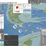
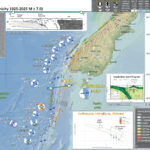
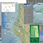
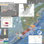
Here are the these three earthquakes:
In this part of the world, there are several different plate boundary faults that interact.
To the south of the Banda Sea, there is a subduction zone. This is a convergent plate boundary fault where an oceanic plate (Australia plate) “subducts” beneath the Sunda plate (part of the Eurasia plate).
This subduction zone extends laterally from between Australia and the Timor Islands, westward through Java and Sumatra, up to Myanmar/Burma. This plate boundary is part of the Alpide Belt, a convergent plate boundary that spans this region, all the way westward past Portugal and Morroco!
There are also some strike-slip faults in the upper plate here. These may be related to faults that extend further to the east, heading into Papua New Guinea and the “Bird’s Head.” One of these faults is the Sorong fault.
When I first saw this earthquake, I thought about the previous Earthquake Reports I had developed for events in this region. Every one of them were for intermediate depth earthquakes within the subducted Australia plate.
The mechanism for this M 7.1 was strike-slip and matched many of the mechanisms from these earlier earthquakes. However, the depth was set at 10 km. This is one of the default earthquake depths, so I thought that it might be updated later to be much deeper. Though, when earthquakes are so much deeper, their initial depths are often not set at the default 10 km depth.
So, I posted to social media that this may be one of these intermediate depth intraslab (within the slab of the plate) earthquakes. I suggested that the depth may be updated, as I mention here ^^^.
Well, it is always good to be receptive to one being incorrect. I was incorrect. That is OK! In the early hours (even days) after an earthquake, everyone is trying to figure out what happened. I don’t want to hold back my imagination from conceiving of hypotheses. But, I do want to be open minded that I need to change my interpretations given more information as that rolls in.
One of these pieces of information was data from a nearby tide gage, a gage located on the Island of Damar (less than 100 km from the epicenter). This tide gage showed a tsunami being recorded.
Strike-slip earthquakes are generally thought to not generate tsunami. Though, the 1906 San Francisco, the 1999 Izmit, and the 2018 Dongalla-Palu earthquakes did. Generally they are simply smaller in size (Dongalla-Palu being an exception, given the configuration of Palu Bay).
If the moderate sized strike-slip earthquake were intermediate depth, it is extremely unlikely to generate a tsunami as there would be very little deformation of the seafloor. Because this M 7.1 generated a tsunami, it supported the shallow depths and a crustal source for this earthquake.
So, this series of earthquakes was indeed shallower, within the upper plate (not the Australia plate). AND there is this strike-slip fault that is already mapped, probably the source for these earthquakes.
A second thing about the tide gage plots is that we can see that the second M 6.7 earthquake also generated a tsunami! Much smaller, but a signal that can be found on several tide gage records.
Indonesia operates an extensive tide gage network. Here one can locate all the gages in their network.
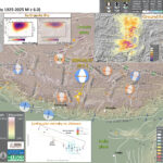
Below I present an interpretive poster and some supporting material.
Below is my interpretive poster for this earthquake
- I plot the seismicity from the past month, with diameter representing magnitude (see legend). I include earthquake epicenters from 1923-2023 with magnitudes M ≥ 7.0 in one version.
- I plot the USGS fault plane solutions (moment tensors in blue and focal mechanisms in orange), possibly in addition to some relevant historic earthquakes.
- A review of the basic base map variations and data that I use for the interpretive posters can be found on the Earthquake Reports page. I have improved these posters over time and some of this background information applies to the older posters.
- Some basic fundamentals of earthquake geology and plate tectonics can be found on the Earthquake Plate Tectonic Fundamentals page.
- In the upper right corner is a map showing plate boundary fault lines and the major tectonic plates.
- To the left of the plate tectonic map is an inset, larger scale map, showing the aftershocks from a couple days. I outline what may be the main fault rupture area, plus a secondary rupture for triggered earthquakes. Based on Wells and Coppersmith (1994), the aftershocks span a region larger in size than expected for a 7.1. So, there may be several faults involved here. Perhaps the second M 6.7 was also a triggered earthquake (on a different fault), not an aftershock(?).
- In the center right is a low angle oblique view of the tectonic plate configuration (Pownall et al., 2014). The previous earthquakes in the poster that have mechanisms plotted all appear to be in the subducted Australia plate, shown here diving downwards.
- In the lower right corner is a view of the tectonic plate configuration (Koulali et al., 2014). I place a blue star in the location of the M 7.1 earthquake. Note that there is an earthquake from 1763 with a magnitude 7 located along the strike-slip fault mapped on this map. This earthquake generated a tsunami.
- In the upper left corner are maps that show the seismic hazard and seismic risk for Indonesia. I spend more time explaining this below.
- In the center top-left is a map that shows earthquake intensity using the Modified Mercalli Intensity (MMI) Scale.
- In the bottom center I plot the tide gage data from Damar Island.
I include some inset figures. Some of the same figures are located in different places on the larger scale map below.
Tsunami Hazard
- Here are two maps that show the results of probabilistic tsunami modeling for the nation of Indonesia (Horspool et al., 2014). These results are similar to results from seismic hazards analysis and maps. The color represents the chance that a given area will experience a certain size tsunami (or larger).
- The first map shows the annual chance of a tsunami with a height of at least 0.5 m (1.5 feet). The second map shows the chance that there will be a tsunami at least 3 meters (10 feet) high at the coast.
- Here are two tide gage records that include observations from the M 7.1 and M 6.7 earthquakes. There were a couple other gages in the region that include the tsunami but the tsunami was very small and difficult to accurately measure.
Annual probability of experiencing a tsunami with a height at the coast of (a) 0.5m (a tsunami warning) and (b) 3m (a major tsunami warning).
- Here is a tectonic map for this part of the world from Zahirovic et al., 2014. They show a fracture zone where the M 7.3 earthquake happened. I left out all the acronym definitions (you’re welcome), but they are listed in the paper.
- Here are a series of maps from Koulali et al. (2014).
- This first one shows the major historic earthquakes at the time of publication (also, this is the map in the interpretive poster).
- This map shows the plate velocities as measured by GPS/GNSS instruments.
- Note the blue arrows show the convergent nature of the plate boundary to the south of this earthquake.
- This map shows the results of their plate tectonic modeling.
- Koulali et al. (2014) basically modeled the different tectonic blocks and made estimates of how much each plate boundary fault would need to move based on these block motions.
- Here we can see that there is lateral motion required for the strike-slip fault that may be the causative fault for this M 7.1 earthquake sequence.
- This is a great visualization showing the Australia plate and how it formed the largest forearc basin on Earth (Pownall et al., 2014).
- The maps on the left show a time history of the tectonics. The low angle oblique view on the right shows the dipping crust (north is not always up, as in this figure).
- In the lower right, they show how there is strike-slip faulting along the Seram trough also (I left out the figure caption for E).
- Here is a map and some cross sections showing seismic tomography (like C-T scans into the Earth using seismic waves instead of X-Rays). The map shows the location of the cross sections (Spakman et al., 2010).
- Here is the map from Benz et al. (2011).
- Here is the tectonic map from Hengesh and Whitney (2016)
- Here is the Audley (2011) cross section showing how the backthrust relates to the subduction zone beneath Timor. I include their figure caption in blockquote below.
- Here is a figure showing the regional geodetic motions (Bock et al., 2003). I include their figure caption below as a blockquote.
- Whitney and Hengesh (2015) used GPS modeling to suggest a model of plate blocks. Below are their model results.
- Here is the conceptual model from Whitney and Hengesh (2015) that shows how left-lateral strike-slip faulting can come into the region.
Some Relevant Discussion and Figures
Regional tectonic setting with plate boundaries (MORs/transforms = black, subduction zones = teethed red) from Bird (2003) and ophiolite belts representing sutures modified from Hutchison (1975) and Baldwin et al. (2012). West Sulawesi basalts are from Polvé et al. (1997), fracture zones are from Matthews et al. (2011) and basin outlines are from Hearn et al. (2003).
Seismotectonic setting of the Sunda-Banda arc-continent collision, East Indonesia. Major faults (thick black lines) [Hamilton, 1979]. Topography and bathymetry are from Shuttle Radar Topography Mission (http://topex.ucsd.edu/www_html/srtm30_plus.html). Focal mechanisms are from the Global Centroid Moment Tensor. Blue mechanisms correspond to earthquakes with Mw>7 (brown transparent ellipses are the corresponding rupture areas for Flores 1992 and Alor 2004 earthquakes), while the green focal mechanism shows the highest magnitude recorded in Sumbawa. Red dots indicate the locations of major historical earthquakes [Musson, 2012].
GPS velocities determined in this study with respect to Sunda Block. Uncertainty ellipses represent 95% confidence level. The inset figure corresponds to the area of the dashed rectangle in the map. Light blue arrows show the velocities for East and West Makassar Blocks.
Relative slip vectors across block boundaries, derived from our best fit model. Arrows show motion of the hanging wall (moving block) relative to the footwall (fixed block) with 95% confidence ellipses. The tails of arrows is located within the “moving” block. Black thick lines show well-defined boundaries we use as active faults in our model and dashed lines show less well-defined boundaries (green : free-slipping boundaries and black: fixed locked faults). Principal axes of the horizontal strain tensor estimated for the SUMB, EMAK, and EJAV are shown in pink. The thick pink arrow shows the relative motion of Australia with respect to Sunda (AUST/SUND). Abbreviations are Sumba Block (SUMB), West Makassar Block (WMAK), East Makassar Block (EMAK), East Java Block (EJAV), and Timor Block (TIMO). The background seismicity is from the International Seismological Centre catalog with magnitudes ≥5.5 and depths <40 km.
Reconstructions of eastern Indonesia, adapted from Hall (2012), depict collision of Australia with Southeast Asia and slab rollback into Banda Embayment. Yellow star indicates Seram. Oceanic crust is shown in purple (older than 120 Ma) and blue (younger than 120 Ma); submarine arcs and oceanic plateaus are shown in cyan; volcanic island arcs, ophiolites, and material accreted along plate margins are shown in green. A: Reconstruction at 15 Ma. B: Reconstruction at 7 Ma. C: Reconstruction at 2 Ma. D: Visualization of present-day slab morphology of proto–Banda Sea based on earthquake hypocenter distribution and tomographic models
The Banda arc and surrounding region. 200 m and 4,000 m bathymetric contours are indicated. The numbered black lines are Benioff zone contours in kilometres. The red triangles are Holocene volcanoes (http://www.volcano.si.edu/world/). Ar=Aru, Ar Tr=Aru trough, Ba=Banggai Islands, Bu=Buru, SBS=South Banda Sea, Se=Seram, Sm=Sumba, Su=Sula Islands, Ta=Tanimbar, Ta Tr=Tanimbar trough, Ti=Timor, W=Weber Deep.
Tomographic images of the Banda slab. Vertical sections through the tomography model along the lines shown in Fig. 1. Colours: P-wave anomalies with reference to velocity model ak135 (ref. 30). Dots: earthquake hypocentres within 12 km of the section. The dashed lines are phase changes at ~410 km and ~660 km. The sections are plotted without vertical exaggeration; the horizontal axis is in degrees. The labelled positive anomalies are the Sunda (Su) and Banda (Ba) slabs: BuDdetached slab under Buru, FlDslab under Flores, SDslab under Seram, TDslab under Timor. a, The Sunda slab enters the lower mantle whereas the Banda embayment slab is entirely in the upper mantle with the change under Sulawesi. b–e, Banda slab morphology in sections parallel to Australia plate motion shows a transition from a steep slab with a flat section (fs) (b) to a spoon shape shallowing eastward (c–e).
Illustration of major tectonic elements in triple junction geometry: tectonic features labeled per Figure 1; seismicity from ISC-GEM catalog [Storchak et al., 2013]; faults in Savu basin from Rigg and Hall [2011] and Harris et al. [2009]. Purple line is edge of Australian continental basement and fore arc [Rigg and Hall, 2011]. Abbreviations: AR = Ashmore Reef; SR = Scott Reef; RS = Rowley Shoals; TCZ = Timor Collision Zone; ST = Savu thrust; SB = Savu Basin; TT = Timor thrust; WT =Wetar thrust; WASZ = Western Australia Shear Zone. Open arrows indicate relative direction of motion; solid arrows direction of vergence.
Cartoon cross section of Timor today, (cf. Richardson & Blundell 1996, their BIRPS figs 3b, 4b & 7; and their fig. 6 gravity model 2 after Woodside et al. 1989; and Snyder et al. 1996 their fig. 6a). Dimensions of the filled 40 km deep present-day Timor Tectonic Collision Zone are based on BIRPS seismic, earthquake seismicity and gravity data all re-interpreted here from Richardson & Blundell (1996) and from Snyder et al. (1996). NB. The Bobonaro Melange, its broken formation and other facies are not indicated, but they are included with the Gondwana mega-sequence. Note defunct Banda Trench, now the Timor TCZ, filled with Australian continental crust and Asian nappes that occupy all space between Wetar Suture and the 2–3 km deep deformation front north of the axis of the Timor Trough. Note the much younger decollement D5 used exactly the same part of the Jurassic lithology of the Gondwana mega-sequence in the older D1 decollement that produced what appears to be much stronger deformation.
Topographic and tectonic map of the Indonesian archipelago and surrounding region. Labeled, shaded arrows show motion (NUVEL-1A model) of the first-named tectonic plate relative to the second. Solid arrows are velocity vectors derived from GPS surveys from 1991 through 2001, in ITRF2000. For clarity, only a few of the vectors for Sumatra are included. The detailed velocity field for Sumatra is shown in Figure 5. Velocity vector ellipses indicate 2-D 95% confidence levels based on the formal (white noise only) uncertainty estimates. NGT, New Guinea Trench; NST, North Sulawesi Trench; SF, Sumatran Fault; TAF, Tarera-Aiduna Fault. Bathymetry [Smith and Sandwell, 1997] in this and all subsequent figures contoured at 2 km intervals.
Plate boundary segments in the Banda Arc region from Nugroho et al (2009). Numbers inside rectangles show possible micro-plate blocks near the Sumba Triple Junction (colored) based on GPS velocities (black arrows) with in a stable Eurasian reference frame.
Schematic map views of kinematic relations between major crustal elements in the Sumba Triple Junction region. CTZ= collisional tectonic zone. Red arrow size designates schematic plate motion relations based on geological data relative to a fixed Sunda shelf reference frame (pin).
Seismic Hazard and Seismic Risk
- These are the two maps shown in the map above, the GEM Seismic Hazard and the GEM Seismic Risk maps from Pagani et al. (2018) and Silva et al. (2018).
- The GEM Seismic Hazard Map:
- The Global Earthquake Model (GEM) Global Seismic Hazard Map (version 2018.1) depicts the geographic distribution of the Peak Ground Acceleration (PGA) with a 10% probability of being exceeded in 50 years, computed for reference rock conditions (shear wave velocity, VS30, of 760-800 m/s). The map was created by collating maps computed using national and regional probabilistic seismic hazard models developed by various institutions and projects, and by GEM Foundation scientists. The OpenQuake engine, an open-source seismic hazard and risk calculation software developed principally by the GEM Foundation, was used to calculate the hazard values. A smoothing methodology was applied to homogenise hazard values along the model borders. The map is based on a database of hazard models described using the OpenQuake engine data format (NRML). Due to possible model limitations, regions portrayed with low hazard may still experience potentially damaging earthquakes.
- Here is a view of the GEM seismic hazard map for Indonesia.
- The GEM Seismic Risk Map:
- The Global Seismic Risk Map (v2018.1) presents the geographic distribution of average annual loss (USD) normalised by the average construction costs of the respective country (USD/m2) due to ground shaking in the residential, commercial and industrial building stock, considering contents, structural and non-structural components. The normalised metric allows a direct comparison of the risk between countries with widely different construction costs. It does not consider the effects of tsunamis, liquefaction, landslides, and fires following earthquakes. The loss estimates are from direct physical damage to buildings due to shaking, and thus damage to infrastructure or indirect losses due to business interruption are not included. The average annual losses are presented on a hexagonal grid, with a spacing of 0.30 x 0.34 decimal degrees (approximately 1,000 km2 at the equator). The average annual losses were computed using the event-based calculator of the OpenQuake engine, an open-source software for seismic hazard and risk analysis developed by the GEM Foundation. The seismic hazard, exposure and vulnerability models employed in these calculations were provided by national institutions, or developed within the scope of regional programs or bilateral collaborations.
- Here is a view of the GEM seismic risk map for Indonesia.
- M 9.2 Andaman-Sumatra subduction zone 2014 Earthquake Anniversary
- M 9.2 Andaman-Sumatra subduction zone SASZ Fault Deformation
- M 9.2 Andaman-Sumatra subduction zone 2016 Earthquake Anniversary
- 2023.11.08 M 7.1 Banda Sea
- 2023.08.28 M 7.1 Lombok & Bali, Indonesia
- 2023.04.24 M 7.1 Sumatra
- 2022.11.18 M 6.9 Sumatra
- 2022.02.25 M 6.2 Sumatra
- 2020.05.06 M 6.8 Banda Sea
- 2019.08.02 M 6.9 Indonesia
- 2019.06.23 M 7.3 Banda Sea
- 2019.04.12 M 6.8 Sulawesi, Indonesia
- 2018.09.28 M 7.5 Sulawesi
- 2018.10.16 M 7.5 Sulawesi UPDATE #1
- 2018.08.19 M 6.9 Lombok, Indonesia
- 2018.08.05 M 6.9 Lombok, Indonesia
- 2018.07.28 M 6.4 Lombok, Indonesia
- 2017.12.15 M 6.5 Java
- 2017.08.31 M 6.3 Mentawai, Sumatra
- 2017.08.13 M 6.4 Bengkulu, Sumatra, Indonesia
- 2017.05.29 M 6.8 Sulawesi, Indonesia
- 2017.03.14 M 6.0 Sumatra
- 2017.03.01 M 5.5 Banda Sea
- 2016.10.19 M 6.6 Java
- 2016.03.02 M 7.8 Sumatra/Indian Ocean
- 2015.07.22 M 5.8 Andaman Sea
- 2015.11.08 M 6.4 Nicobar Isles
- 2012.04.11 M 8.6 Sumatra outer rise
- 2004.12.26 M 9.2 Andaman-Sumatra subduction zone
Indonesia | Sumatra
General Overview
Earthquake Reports
Social Media
Here is my main thread, which includes many intermediate tweets (one can see the process of us figuring this sequence out in real time):
#EarthquakeReport for M6.9 #Gempa #Earthquake offshore in the #BandaSea
Probably intraslab earthquake within Australia plate
In almost same location as 2020 earthquake: https://t.co/DBTKHT6oYnhttps://t.co/yE3fOxqZoO pic.twitter.com/nNAIGl7EaL
— Jason "Jay" R. Patton (@patton_cascadia) November 8, 2023
#EarthquakeReport #TsunamiReport for M 7.1 #Gempa #Earthquake sequence in the #BandaSea
M6.7 foreshock to 7.1 both left-lateral strike-slip earthquakes in the Sunda block crust
triggered a M 6.7
both the 7.1 and triggered 6.7 caused tsunamiread reporthttps://t.co/V9Y1zX4sRr pic.twitter.com/MEot8TVrlU
— Jason "Jay" R. Patton (@patton_cascadia) November 10, 2023
Mw=7.5, BANDA SEA (Depth: 16 km), 2023/11/08 04:52:52 UTC – Full details here: https://t.co/UPXunwhyVI pic.twitter.com/fPFfoh3zUu
— Earthquakes (@geoscope_ipgp) November 8, 2023
This seismic signal actually shows two earthquakes in approx. the same location in the Banda Sea, ~1 min apart – the first a M7.0, the second a M7.1. Our recorders were still picking up a signal >30 mins later. https://t.co/TLOo9ts3yM pic.twitter.com/ztEZGUEECx
— Dr. Dee Ninis (@DeeNinis) November 8, 2023
data monitoring paras muka air laut di stasiun pengamamatan Damar Maluku 12:53 WIB 08/11/2023 cc: @widjokongko pic.twitter.com/oXIklbZtsG
— INFOMITIGASI (@infomitigasi) November 8, 2023
Rabu 08 Nov 2023 pukul 11.52.53 WIB Laut Banda diguncang gempa tektonik. Hasil analisis BMKG menunjukkan gempa ini memiliki parameter update M7,1. Episenter gempa terletak di laut pada jarak 255 Km arah Barat Laut Tanimbar, Maluku pada kedalaman 45 km. pic.twitter.com/AgO1mx94Ka
— DARYONO BMKG (@DaryonoBMKG) November 8, 2023
Today, 7.2 Eq. Banda Sea (Eastern #INDONESIA 🇮🇩), located in the "Inner Banda Arc" (close to Extinct Damar Spreading Basin), crustal strike-slip faulting suggest reactivation of "Damar Extinct Spreading Back-arc Basin (NW-SE structure?).
🔹️Damar Basin :https://t.co/7mSB8NnO4R pic.twitter.com/ZZF6AVeC6n
— Abel Seism🌏Sánchez (@EQuake_Analysis) November 8, 2023
Watch the earthquake waves from these events in Indonesia sweep across North America. (GMV from @EarthScope_sci) https://t.co/ALTlPHqNyt https://t.co/21Y7is9EhQ pic.twitter.com/ywo6DLGUcq
— Wendy Bohon, PhD 🌏 (@DrWendyRocks) November 8, 2023
Recent Earthquake Teachable Moment for the M7.1 earthquake in the Banda Sea.
Teachable Moments presentations capture the opportunity to bring knowledge, insight, and critical thinking to the classroom following a newsworthy earthquake.
➡️ https://t.co/zRd4mRCHc4 pic.twitter.com/fpLiQLuz3E
— EarthScope Consortium (@EarthScope_sci) November 9, 2023
Very interesting series of M6.7, 7.1, and 6.7 earthquakes in the remote Banda Sea yesterday – among the largest shallow strike-slip events recorded in the region!
The tectonics of the region are complex, with many open questions.
Read more on our blog – link in my bio. pic.twitter.com/6B7PLGR7K1
— Dr. Judith Hubbard (@JudithGeology) November 9, 2023
- Frisch, W., Meschede, M., Blakey, R., 2011. Plate Tectonics, Springer-Verlag, London, 213 pp.
- Hayes, G., 2018, Slab2 – A Comprehensive Subduction Zone Geometry Model: U.S. Geological Survey data release, https://doi.org/10.5066/F7PV6JNV.
- Holt, W. E., C. Kreemer, A. J. Haines, L. Estey, C. Meertens, G. Blewitt, and D. Lavallee (2005), Project helps constrain continental dynamics and seismic hazards, Eos Trans. AGU, 86(41), 383–387, , https://doi.org/10.1029/2005EO410002. /li>
- Jessee, M.A.N., Hamburger, M. W., Allstadt, K., Wald, D. J., Robeson, S. M., Tanyas, H., et al. (2018). A global empirical model for near-real-time assessment of seismically induced landslides. Journal of Geophysical Research: Earth Surface, 123, 1835–1859. https://doi.org/10.1029/2017JF004494
- Kreemer, C., J. Haines, W. Holt, G. Blewitt, and D. Lavallee (2000), On the determination of a global strain rate model, Geophys. J. Int., 52(10), 765–770.
- Kreemer, C., W. E. Holt, and A. J. Haines (2003), An integrated global model of present-day plate motions and plate boundary deformation, Geophys. J. Int., 154(1), 8–34, , https://doi.org/10.1046/j.1365-246X.2003.01917.x.
- Kreemer, C., G. Blewitt, E.C. Klein, 2014. A geodetic plate motion and Global Strain Rate Model in Geochemistry, Geophysics, Geosystems, v. 15, p. 3849-3889, https://doi.org/10.1002/2014GC005407.
- Meyer, B., Saltus, R., Chulliat, a., 2017. EMAG2: Earth Magnetic Anomaly Grid (2-arc-minute resolution) Version 3. National Centers for Environmental Information, NOAA. Model. https://doi.org/10.7289/V5H70CVX
- Müller, R.D., Sdrolias, M., Gaina, C. and Roest, W.R., 2008, Age spreading rates and spreading asymmetry of the world’s ocean crust in Geochemistry, Geophysics, Geosystems, 9, Q04006, https://doi.org/10.1029/2007GC001743
- Pagani,M. , J. Garcia-Pelaez, R. Gee, K. Johnson, V. Poggi, R. Styron, G. Weatherill, M. Simionato, D. Viganò, L. Danciu, D. Monelli (2018). Global Earthquake Model (GEM) Seismic Hazard Map (version 2018.1 – December 2018), DOI: 10.13117/GEM-GLOBAL-SEISMIC-HAZARD-MAP-2018.1
- Silva, V ., D Amo-Oduro, A Calderon, J Dabbeek, V Despotaki, L Martins, A Rao, M Simionato, D Viganò, C Yepes, A Acevedo, N Horspool, H Crowley, K Jaiswal, M Journeay, M Pittore, 2018. Global Earthquake Model (GEM) Seismic Risk Map (version 2018.1). https://doi.org/10.13117/GEM-GLOBAL-SEISMIC-RISK-MAP-2018.1
- Storchak, D. A., D. Di Giacomo, I. Bondár, E. R. Engdahl, J. Harris, W. H. K. Lee, A. Villaseñor, and P. Bormann (2013), Public release of the ISC-GEM global instrumental earthquake catalogue (1900–2009), Seismol. Res. Lett., 84(5), 810–815, doi:10.1785/0220130034.
- Zhu, J., Baise, L. G., Thompson, E. M., 2017, An Updated Geospatial Liquefaction Model for Global Application, Bulletin of the Seismological Society of America, 107, p 1365-1385, https://doi.org/0.1785/0120160198
- Audley-Charles, M.G., 1986. Rates of Neogene and Quaternary tectonic movements in the Southern Banda Arc based on micropalaeontology in: Journal of fhe Geological Society, London, Vol. 143, 1986, pp. 161-175.
- Audley-Charles, M.G., 2011. Tectonic post-collision processes in Timor, Hall, R., Cottam, M. A. &Wilson, M. E. J. (eds) The SE Asian Gateway: History and Tectonics of the Australia–Asia Collision. Geological Society, London, Special Publications, 355, 241–266.
- Baldwin, S.L., Fitzgerald, P.G., and Webb, L.E., 2012. Tectonics of the New Guinea Region in Annu. Rev. Earth Planet. Sci., v. 41, p. 485-520.
- Benz, H.M., Herman, Matthew, Tarr, A.C., Hayes, G.P., Furlong, K.P., Villaseñor, Antonio, Dart, R.L., and Rhea, Susan, 2011. Seismicity of the Earth 1900–2010 New Guinea and vicinity: U.S. Geological Survey Open-File Report 2010–1083-H, scale 1:8,000,000.
- Given, J. W., and H. Kanamori (1980). The depth extent of the 1977 Sumbawa, Indonesia, earthquake, in EOS Trans. AGU., v. 61, p. 1044.
- Gusnman, A.R., Tanioka, Y., Matsumoto, H., and Iwasakai, S.-I., 2009. Analysis of the Tsunami Generated by the Great 1977 Sumba Earthquake that Occurred in Indonesia in BSSA, v. 99, no. 4, p. 2169-2179, https://doi.org/10.1785/0120080324
- Hall, R., 2011. Australia-SE Asia collision: plate tectonics and crustal flow in Geological Society, London, Special Publications 2011; v. 355; p. 75-109 doi: 10.1144/SP355.5
- Hangesh, J. and Whitney, B., 2014. Quaternary Reactivation of Australia’s Western Passive Margin: Inception of a New Plate Boundary? in: 5th International INQUA Meeting on Paleoseismology, Active Tectonics and Archeoseismology (PATA), 21-27 September 2014, Busan, Korea, 4 pp.
- Koulali, A., S. Susilo, S. McClusky, I. Meilano, P. Cummins, P. Tregoning, G. Lister, J. Efendi, and M. A. Syafi’i, 2016. Crustal strain partitioning and the associated earthquake hazard in the eastern Sunda-Banda Arc in Geophys. Res. Lett., 43, 1943–1949, doi:10.1002/2016GL067941
- Okal, E. A., & Reymond, D., 2003. The mechanism of great Banda Sea earthquake of 1 February 1938: applying the method of preliminary determination of focal mechanism to a historical event in EPSL, v. 216, p. 1-15.
- Osada, M. and Abe, K., 1981. Mechanism and tectonic implications of the great Banda Sea earthquake of November 4, 1963 in Physics of the Earth and Plentary Interiors, v. 25, p. 129-139
- Pownall, J.M., Hall, R., Armstrong,, R.A., and Forster, M.A., 2014. Earth’s youngest known ultrahigh-temperature granulites discovered on Seram, eastern Indonesia in Geology, v. 42, no. 4, p. 379-282, https://doi.org/10.1130/G35230.1
- Spakman, W. and Hall, R., 2010. Surface deformation and slab–mantle interaction during Banda arc subduction rollback in Nature Geosceince, v. 3, p. 562-566, https://doi.org/10.1038/NGEO917
- Whitney, B.B. and Hengesh, J.V., 2015. A new model for active intraplate tectonics in western Australia in Proceedings of the Tenth Pacific Conference on Earthquake Engineering Building an Earthquake-Resilient Pacific 6-8 November 2015, Sydney, Australia, paper number 82
- Zahirovic, S., Seton, M., and Müller, R.D., 2014. The Cretaceous and Cenozoic tectonic evolution of Southeast Asia in Solid Earth, v. 5, p. 227-273, doi:10.5194/se-5-227-2014
References:
Basic & General References
Specific References
Return to the Earthquake Reports page.
- Sorted by Magnitude
- Sorted by Year
- Sorted by Day of the Year
- Sorted By Region
Early this morning my time, there were several earthquakes in and offshore of Papua New Guinea. The two main earthquakes are magnitude M 6.7 anf 6.9. 2023.10.07 M 6.7: https://earthquake.usgs.gov/earthquakes/eventpage/us6000ldqd/executive There are several different interpretations for the main tectonic features in this part of the world. So there appears to be some uncertainty about the geometry of the plates here. The reason for this uncertainty is partly because of the potentially complicated ways that the plates are oriented relative to each other. These earthquakes happened on a plate boundary fault system (they were intraplate reverse earthquakes, compressional earthquakes along a subduction zone megathrust fault). At least, that is how I am interpreting them. There has been some seismicity along this plate boundary system over the past few years, but the fault geometry has been somewhat still unresolved (?). In this region is the Huon Peninsula, a famous location where a Pleistocene sea-level curve was reconstructed from uplifted and subsided prehistoric marine terraces and shorelines. Along the southern boundary of Huon Peninsula, is a compressional fault system (the Ramu-Markham fault system) that may be the surface trace of a subduction zone fault that dips to the north (??) (or collision?). Holm and Richards (2013) has a figure that includes cross sections showing this subducted slab. On the poster, I include the cross section B-B’ and I placed a yellow star for the two earthquakes. Note the depths for these earthquakes. The M 6.9 is 76 km and the M 6.7 is 53.5 km deep. The M 6.9 is to the north of the M 6.7. These two earthquakes show that they are on a north dipping fault (and this matches the Holm and Richards (2013) figure). We can take this lesson one step further. If we look at the M 6.3 earthquake on 13 March 2023, it is to the north of today’s earthquake and is deeper still. This M 6.3 earthquake led me to take a second look at a M 7.6 earthquake further to the south from 14 September 2022. This earthquake reminds us of how confusing the slabs are and how difficult it is to interpret where these earthquakes are (especially the M 7.6). Here is the Earthquake Report for this M 7.6 earthquake. Because these earthquakes are not close to the surface, the intensities were not too destructive. The USGS Pager Alerts for these earthquakes suggest a very low likelihood for damage or casualties. (click the link to the usgs earthquake pages and navigate to the One Pager tab for these earthquake pages to see more).
Topography, bathymetry and regional tectonic setting of New Guinea and Solomon Islands. Arrows indicate rate and direction of plate motion of the Australian and Pacific plates (MORVEL, DeMets et al., 2010); Mamberamo thrust belt, Indonesia (MTB); North Fiji Basin (NFB)
Tectonic setting of Papua New Guinea and Solomon Islands. a) Regional plate boundaries and tectonic elements. Light grey shading illustrates bathymetry b2000mbelow sea level indicative of continental or arc crust, and oceanic plateaus; 1000mdepth contour is also shown. Adelbert Terrane (AT); Bismarck Sea fault (BSF); Bundi fault zone (BFZ); Feni Deep (FD); Finisterre Terrane (FT); Gazelle Peninsula (GP); Kia-Kaipito-Korigole fault zone (KKKF); Lagaip fault zone (LFZ); Mamberamo thrust belt (MTB); Manus Island (MI); New Britain (NB); New Ireland (NI); North Sepik arc (NSA); Ramu-Markham fault (RMF); Weitin Fault (WF);West Bismarck fault (WBF); Willaumez-Manus Rise (WMR). b) Magmatic arcs and volcanic centers related to this study.
a) Present day tectonic features of the Papua New Guinea and Solomon Islands region as shown in plate reconstructions. Sea floor magnetic anomalies are shown for the Caroline plate (Gaina and Müller, 2007), Solomon Sea plate (Gaina and Müller, 2007) and Coral Sea (Weissel and Watts, 1979). Outline of the reconstructed Solomon Sea slab (SSP) and Vanuatu slab (VS)models are as indicated. b) Cross-sections related to the present day tectonic setting. Section locations are as indicated. Bismarck Sea fault (BSF); Feni Deep (FD); Louisiade Plateau (LP); Manus Basin (MB); New Britain trench (NBT); North Bismarck microplate (NBP); North Solomon trench (NST); Ontong Java Plateau (OJP); Ramu-Markham fault (RMF); San Cristobal trench (SCT); Solomon Sea plate (SSP); South Bismarck microplate (SBP); Trobriand trough (TT); projected Vanuatu slab (VS); West Bismarck fault (WBF); West Torres Plateau (WTP); Woodlark Basin (WB).
The GPS velocity field and 95 per cent confidence interval ellipses with respect to the Australian Plate. Red and blue vectors are the new calculated field and black vectors are from Wallace et al. (2004). The dashed rectangle shows the area of Fig. 3. The blue dashed lines correspond to the location of profiles shown in Fig. 4. Note that the velocity scales for the red and blue vectors are different (see the lower right corner for scales). The black velocities are plotted at the same scale as the red vectors.
Profiles A–A& and B–B& from Fig. 2 showing model fit to GPS observations. Red symbols and lines are the GPS observed and modelled velocities, respectively, for the profile-normal component. Blue symbols and lines correspond to the profile-parallel component. The green and pink lines corresponds to the model using the Ramu-Markham fault geometry from Wallace et al. (2004), south of Lae. Grey profiles show the projected topography. The seismicity is from the ISC catalogue for events > Mw 3.5 (1960–2011).
Tectonic map of New Guinea, adapted from Hamilton (1979), Cooper and Taylor (1987), Dow et al. (1988), and Sapiie et al. (1999). AFTB—Aure fold and thrust belt, FTB—fold-and-thrust belt, IOB—Irian Ophiolite Belt, TFB—thrust-and-fold belt, POB—Papuan Ophiolite Belt, BTFZ—Bewani-Torricelli fault zone, MDZ—Mamberamo deformation zone, YFZ—Yapen fault zone, SFZ—Sorong fault zone, WO—Weyland overthrust. Continental basement exposures are concentrated along the southern fl ank of the Central Range: BD—Baupo Dome, MA—Mapenduma anticline, DM—Digul monocline, IDI—Idenberg Inlier, MUA—Mueller anticline, KA—Kubor anticline, LFTB—Legguru fold-and-thrust belt, RMFZ—Ramu-Markham fault zone, TAFZ—Tarera-Aiduna fault zone. The Tasman line separates continental crust that is Paleozoic and younger to the east from Precambrian to the west.
Lithospheric-scale cross section at 2 Ma. Plate motion is now focused along the Yapen fault zone in the center of the recently extinct arc. This probably occurred because this zone of weakness had a trend that could accommodate the imposed movements as the corner of the Caroline microplate ruptured, forming the Bismarck plate, and the corner of the Australian plate ruptured, forming the Solomon microplate. The collisional delamination-generated magmatic event ends in the highlands as the lower crustal magma chamber solidifies. Upwelled asthenosphere cools and transforms into lithospheric mantle. This drives a slow regional subsidence of the highlands that will continue for tens of millions of years or until other plate-tectonic movements are initiated. Deep erosion is still concentrated on the fl anks of the mountain belt. RMB—Ruffaer Metamorphic Belt, AUS—Australian plate, PAC—Pacific plate.
Seismotectonic interpretation of New Guinea. Tectonic features: PTFB—Papuan thrust-and-fold belt; RMFZ—Ramu-Markham fault zone; BTFZ—Bewani-Torricelli fault zone; MTFB—Mamberamo thrust-and-fold belt; SFZ—Sorong fault zone; YFZ—Yapen fault zone; RFZ—Ransiki fault zone; TAFZ—Tarera-Aiduna fault zone; WT—Waipona Trough. After Sapiie et al. (1999).
Topography, bathymetry and major tectonic elements of the study area. (a) Major tectonic boundaries of Papua New Guinea and the western Solomon Islands; CP, Caroline plate; MB, Manus Basin; NBP, North Bismarck plate; NBT, New Britain trench; NGT, New Guinea trench; NST, North Solomon trench; PFTB, Papuan Fold and Thrust Belt; PT, Pocklington trough; RMF, Ramu-Markham Fault; SBP, South Bismarck plate; SCT, San Cristobal trench; SS, Solomon Sea plate; TT, Trobriand trough; WB,Woodlark Basin; WMT,West Melanesian trench. Study area is indicated by rectangle labelled Figure 1b; the other inset rectangle highlights location for subsequent figures. Present day GPS motions of plates are indicated relative to the Australian plate (from Tregoning et al. 1998, 1999; Tregoning 2002; Wallace et al. 2004). (b) Detailed topography, bathymetry and structural elements significant to the South Bismarck region (terms not in common use are referenced); AFB, Aure Fold Belt (Davies 2012); AT, Adelbert Terrane (e.g. Wallace et al. 2004); BFZ, Bundi Fault Zone (Abbott 1995); BSSL, Bismarck Sea Seismic Lineation; CG, Cape Gloucester; FT, Finisterre Terrane; GF, Gogol Fault (Abbott 1995); GP, Gazelle Peninsula; HP, Huon Peninsula; MB, Manus Basin; NB, New Britain; NI, New Ireland; OSF, Owen Stanley Fault; RMF, Ramu-Markham Fault; SS, Solomon Sea; WMR, Willaumez-Manus Rise (Johnson et al. 1979); WT, Wonga Thrust (Abbott et al. 1994); minor strike-slip faults are shown adjacent to Huon Peninsula (Abers & McCaffrey 1994) and in east New Britain, the Gazelle Peninsula (e.g. Madsen & Lindley 1994). Circles indicate centres of Quaternary volcanism of the Bismarck arc. Filled triangles indicate active thrusting or subduction, empty triangles indicate extinct or negligible thrusting or subduction.
3-D model of the Solomon slab comprising the subducted Solomon Sea plate, and associated crust of the Woodlark Basin and Australian plate subducted at the New Britain and San Cristobal trenches. Depth is in kilometres; the top surface of the slab is contoured at 20 km intervals from the Earth’s surface (black) to termination of slabrelated seismicity at approximately 550 km depth (light brown). Red line indicates the locations of the Ramu-Markham Fault (RMF)–New Britain trench (NBT)–San Cristobal trench (SCT); other major structures are removed for clarity; NB, New Britain; NI, New Ireland; SI, Solomon Islands; SS, Solomon Sea; TLTF, Tabar–Lihir–Tanga–Feni arc. See text for details.
Interpretation of present day tectonic plate configuration and magmatic arc distribution in northeastern Papua New Guinea. Gravity anomaly map is provided as a base map. Bold black outlines illustrate the extent of the underthrust continental crust, formerly the leading edge of the Papua New Guinea mainland; and the associated correlation of the Bundi Fault Zone and Owen Stanley Fault in the under-thrust crust. CMT solutions are shown for the under-thrust margin between 40 and 90 km depth. Below the under-thrust margin, the distribution of subducted oceanic crust of the Solomon slab is shown for comparison, and is contoured at 40 and 100 km until termination to the slab. The ‘Bismarck arc’ is divided into the West Bismarck arc, New Britain arc, and mixing zone between the two; these are derived from continental crust, oceanic slab, and a combination of the two respectively. Cross-sections through the plate arrangement are provided to illustrate the 3-D framework of the new plate arrangement and context of corresponding fluid sources of the equivalent magmatic arc. See text for discussion.
Forward tectonic reconstruction of progressive arc collision and accretion of New Britain to the Papua New Guinea margin. (a) Schematic forward reconstruction of New Britain relative to Papua New Guinea assuming continued northward motion of the Australian plate and clockwise rotation of the South Bismarck plate. (b) Cross-sections illustrate a conceptual interpretation of collision between New Britain and Papua New Guinea.
Tectonic maps of the New Guinea region. (a) Seismicity, volcanoes, and plate motion vectors. Plate motion vectors relative to the Australian plate are surface velocity models based on GPS data, fault slip rates, and earthquake focal mechanisms (UNAVCO, http://jules.unavco.org/Voyager/Earth). Earthquake data are sourced from the International Seismological Center EHB Bulletin (http://www.isc.ac.uk); data represent events from January 1994 through January 2009 with constrained focal depths. Background image is generated from http://www.geomapapp.org. Abbreviations: AB, Arafura Basin; AT, Aure Trough; AyT, Ayu Trough; BA, Banda arc; BSSL, Bismarck Sea seismic lineation; BH, Bird’s Head; BT, Banda Trench; BTFZ, Bewani-Torricelli fault zone; DD, Dayman Dome; DEI, D’Entrecasteaux Islands; FP, Fly Platform; GOP, Gulf of Papua; HP, Huon peninsula; LA, Louisiade Archipelago; LFZ, Lowlands fault zone; MaT, Manus Trench; ML, Mt. Lamington; MT, Mt. Trafalgar; MuT, Mussau Trough; MV, Mt. Victory; MTB, Mamberamo thrust belt; MVF, Managalase Plateau volcanic field; NBT, New Britain Trench; NBA, New Britain arc; NF, Nubara fault; NGT, New Guinea Trench; OJP, Ontong Java Plateau; OSF, Owen Stanley fault zone; PFTB, Papuan fold-and-thrust belt; PP, Papuan peninsula; PRi, Pocklington Rise; PT, Pocklington Trough; RMF, Ramu-Markham fault; SST, South Solomons Trench; SA, Solomon arc; SFZ, Sorong fault zone; ST, Seram Trench; TFZ, Tarera-Aiduna fault zone; TJ, AUS-WDKPAC triple junction; TL, Tasman line; TT, Trobriand Trough;WD, Weber Deep;WB, Woodlark Basin;WFTB, Western (Irian) fold-and-thrust belt; WR,Woodlark Rift; WRi, Woodlark Rise; WTB, Weyland thrust; YFZ, Yapen fault zone.White box indicates the location shown in Figure 3. (b) Map of plates, microplates, and tectonic blocks and elements of the New Guinea region. Tectonic elements modified after Hill & Hall (2003). Abbreviations: ADB, Adelbert block; AOB, April ultramafics; AUS, Australian plate; BHB, Bird’s Head block; CM, Cyclops Mountains; CWB, Cendrawasih block; CAR, Caroline microplate; EMD, Ertsberg Mining District; FA, Finisterre arc; IOB, Irian ophiolite belt; KBB, Kubor & Bena blocks (including Bena Bena terrane); LFTB, Lengguru fold-and-thrust belt; MA, Mapenduma anticline; MB, Mamberamo Basin block; MO, Marum ophiolite belt; MHS, Manus hotspot; NBS, North Bismarck plate; NGH, New Guinea highlands block; NNG, Northern New Guinea block; OKT, Ok Tedi mining district; PAC, Pacific plate; PIC, Porgera intrusive complex; PSP, Philippine Sea plate; PUB, Papuan Ultramafic Belt ophiolite; SB, Sepik Basin block; SDB, Sunda block; SBS, South Bismarck plate; SIB, Solomon Islands block; WP, Wandamen peninsula; WDK, Woodlark microplate; YQ, Yeleme quarries.
Oblique block diagram of New Guinea from the northeast with schematic cross sections showing the present-day plate tectonic setting. Digital elevation model was generated from http://www.geomapapp.org. Oceanic crust in tectonic cross sections is shown by thick black-and-white hatched lines, with arrows indicating active subduction; thick gray-and-white hatched lines indicate uncertain former subduction. Continental crust, transitional continental crust, and arc-related crust are shown without pattern. Representative geologic cross sections across parts of slices C and D are marked with transparent red ovals and within slices B and E are shown by dotted lines. (i ) Cross section of the Papuan peninsula and D’Entrecasteaux Islands modified from Little et al. (2011), showing the obducted ophiolite belt due to collision of the Australian (AUS) plate with an arc in the Paleogene, with later Pliocene extension and exhumation to form the D’Entrecasteaux Islands. (ii ) Cross section of the Papuan peninsula after Davies & Jaques (1984) shows the Papuan ophiolite thrust over metamorphic rocks of AUS margin affinity. (iii ) Across the Papuan mainland, the cross section after Crowhurst et al. (1996) shows the obducted Marum ophiolite and complex folding and thrusting due to collision of the Melanesian arc (the Adelbert, Finisterre, and Huon blocks) in the Late Miocene to recent. (iv) Across the Bird’s Head, the cross section after Bailly et al. (2009) illustrates deformation in the Lengguru fold-and-thrust belt as a result of Late Miocene–Early Pliocene northeast-southwest shortening, followed by Late Pliocene–Quaternary extension. Abbreviations as in Figure 2, in addition to NI, New Ireland; SI, Solomon Islands; SS, Solomon Sea; (U)HP, (ultra)high-pressure.
Across the Papuan mainland, the cross section after Crowhurst et al. (1996) shows the obducted Marum ophiolite and complex folding and thrusting due to collision of the Melanesian arc (the Adelbert, Finisterre, and Huon blocks) in the Late Miocene to recent.
Active tectonic setting of eastern Papua New Guinea showing the boundaries of the Woodlark microplate that includes previously proposed oceanic Solomon Sea plate, the Trobriand platform, and the Woodlark plate [Wallace et al., 2014]. The New Britain trench along the northern margin of the Woodlark plate is a rapidly subducting, 600 km long slab that generates a strong pull on the unsubducted Woodlark microplate [Weissel et al., 1982; Wallace et al., 2004, 2014]. Small circles around the Trobriand platform/Australia pole predict the described pattern of transpressional deformation along the Aure-Moresby fold-thrust belt and the formation of the adjacent, late Miocene to Recent Aure-Moresby foreland basin. Approximate location of the downdip limits of the subducted Solomon Sea slabs are shown by dashed lines and modified from Pegler et al. [1995], Woodhead et al. [2010], and Hayes et al. [2012]. Earthquake data are provided courtesy of the U.S. Geological Survey. Note that the tapering triangular shape of the extension in the Woodlark basin closely matches the size and shape of the thrusting observed in the Aure-Moresby fold-thrust belt and foreland basin.
..
This evening (my time) there was an earthquake in Morocco. Magnitude 6.8, rather shallow, reverse or thrust (compressional) mechanism. https://earthquake.usgs.gov/earthquakes/eventpage/us7000kufc/executive This M 6.8 earthquake happened in the Atlas Mountains, a compressional system with south dipping reverse faults on the north and north dipping reverse faults on the south. It is possible, if not probable, that this earthquake is related to one of these reverse faults. Based on the location, it seems possible that this earthquake is on a south dipping thrust fault (associated with the North Atlas fault system). I used the USGS earthquake catalog and it appears that this is the largest magnitude earthquake to happen in Morocco (since we started recording earthquakes on seismometers). Here is the sobering part of this earthquake. The USGS PAGER Alert provides an estimate for the number of casualties and economic impact. Read more about how these estimates are produced (and how to read this report) here. UPDATE: (2023.09.10 Version 7) UPDATE: (2023.09.11) Empirical fault scaling relations are ways that we can compare fault rupture sizes with earthquake magnitudes. One of the most used and well cited empirical fault scaling relations paper is Wells and Coppersmith, 1994. Here is the USGS fault slip model for the M 6.8 earthquake. The length of the fault slip figure is about 40 kilometers (km) and the width of the fault is about 45 km. The color represents the amount that the fault slipped (in meters) during the earthquake. So, the slip area does not fill this entire area. Most of the slip length is within ~30 km and width is within ~35km. The maximum slip is ~1.7 meters. Here is a plot from Wells and Coppersmith that shows the data relating magnitude with subsurface rupture length. We can see that there is a positive relation between magnitude and length (as the length is larger, so is the magnitude).
(a) Regression of subsurface rupture length on magnitude (M). Regression line shown for all-slip-type relationship. Short dashed line indicates 95% confidence interval. (b) Regression lines for strike-slip relationships. See So, I used these scaling relations to calculate the magnitude for earthquakes of varying subsurface fault length. Here is a table from those calculations. aftershocks may last for weeks, possibly months. aftershocks typically decay at a rate that is dependent on the fault system. each fault system is slightly different. Here is a short story about aftershocks in Northern California but this story is relevant to earthquakes elsewhere. we don’t know the specific rate of decay for a fault system until we observe the aftershocks decay for that fault. some faults have few aftershocks and others have robust aftershock sequences (many events). it is not satisfying to not know how long they will last, i understand. e.g., there was an earthquake in central Washington USA in 1872 and some argue that this continues to have aftershocks. so, they will last a while and nobody will know when they will stop. but for people to feel safe to start living in their homes again, they need to get an expert, like an engineer, to evaluate the stability of their houses. only an expert, who is trained to inspect structures, can make these evaluations. will there be other large earthquakes? this is something nobody can know. follow advice for getting an engineer to check out one’s building(s) so that they can feel safe living in them; if the engineer decides that the structure is safe to withstand earthquakes, that is the best we can do. the M6.8 changed the stresses in the crust adjacent to the earthquake. in some places, these stresses increased the chance for earthquakes on different (or the same) faults. in other places, they decreased the stress. these changes in stress are modest but can trigger a new earthquake. but this depends on the state of stress of the other earthquake fault, something that we cannot yet know. so, we cannot know if the places where stress is increased will have a triggered/new earthquake. the best we can do is to make sure that buildings are resistant to earthquake forces. this capability is reliant on engineers, building inspectors, competent building contractors, building codes, etc. AND that these people follow the rules (building codes). the Feb 2023 Türkiye earthquakes destroyed buildings that were constructed under well designed building codes. but they were destroyed because people did not follow the code. lots of buildings were built before the codes existed and those did not perform well either. so, when living in earthquake country, one simply needs to ensure that they are living/working in earthquake resistant buildings. they may find comfort to live outside these structures until they are inspected. this is the smart thing to do. i don’t have the expertise to know if a building is designed to withstand earthquakes. i am not a structural engineer, an earthquake engineer. i know some and can follow the local building codes here where i live. and i sure could not offer advice remotely. one simply needs to seek local expertise. i wish i could offer more advice. finally, people who have been traumatized by this earthquake and continue to be traumatized by these aftershocks are going through what everyone does when faced with these conditions. this is typical. maybe finding comfort with friends and family and neighbors will help (?). i hope i have provided some constructive feedback to your questions/concerns. hopefully this information can help those in Morocco cope with this extremely challenging natural hazard. if nothing else, the survivors will be able to build back stronger and more earthquake resistant. Luckily I updated this page because I noticed that the interpretive figure below was incorrect (it was for a different earthquake). FOS = Resisting Force / Driving Force Learning Resource: Sentinel-1 Synthetic Aperture Radar Interferometric Coherence Image Services StoryMap This StoryMap tutorial enhances access to the Global Seasonal Sentinel-1 Interferometric Coherence and Backscatter dataset with image services. #SAR https://t.co/VjghtQiBUL pic.twitter.com/zMNLwuAdi3 — NASAEarthdata (@NASAEarthData) September 11, 2023
(a) Location sketch map of the Atlas Mountains in the North African foreland. (b) Geological map of the central High Atlas, indicating the section lines of Figure 2. ATC, Ait Tamlil basement culmination; SC, Skoura basement culmination; MC, Mougueur basement culmination; FZ, Foum Zabel thrust.
Serial geological cross sections through the High Atlas of Morocco (location in Figure 1b): (a) Midelt-Errachidia section, (b) Imilchil section, and (c) Demnat section. Segment x–x0 in 2c is adapted from Errarhaoui [1997].
Plate reconstruction of the Central Atlantic to the Triassic-Jurassic boundary (200 Ma) (modified from Schettino and Turco, 2009). Rift zones are shown in dark grey. The square indicates the reconstructed position of the Marrakech High Atlas pf Morocco (MHA).
(Domènech et al., 2015)
Tectonic sketch map of the Moroccan High Atlas Mountains, indicating the lines of section of Figure 4a, b.
Structural cross-sections across the High Atlas and the Eastern Cordillera of Colombia. (a, b) Sections across the eastern and central High Atlas (from Teixell et al. 2003). These sections are based on field data and were modified from the original according to gravity modelling by Ayarza et al. 2005 (see location in Fig. 1). Although largely eroded, the Cretaceous sediments probably formed a tabular body that covered the entire Atlas domain, representing post-rift conditions. (c) Simplified structural cross-section of the Eastern Cordillera of Colombia, approximately through the latitude of Bogota´ (see location in Fig. 2). This section was constructed on the basis of maps, seismic profiles and structural data provided by ICP-Ecopetrol. The deep structure of the Sabana de Bogota´ region is conjectural as it is poorly imaged in the seismic profiles. The lower–upper Cretaceous boundary is taken for the sake of convenience at the top of the Une and Hilo´ formations. MMVB, Middle Magdalena Valley basin; LLB, Llanos basin.
Location of the study area and simplified geological map of the High Atlas and Anti‐Atlas Mountains. Africa Plate motion considering Eurasia fixed by Serpelloni et al. (2007). FWHA = far western High Atlas; WHA = western High Atlas; CHA = central High Atlas, AA = Anti‐Atlas; MA = Middle Atlas; SAF = South Atlas fault; JTF = Jebilet thrust front.
Simplified geological map of the study area with schematic logs. See Figure 1 for location. The black lines are the cross‐section traces. Data from Baudon et al. (2009), Domènech et al. (2016, 2015), and El Arabi et al. (2003).
(a) GPS site velocities with respect to Nubia and 95% confidence ellipses. Heavy dashed lines show locations of profiles shown in Fig. 3 with the widths of the profiles indicated by lighter dashed lines. Focal mechanism indicates the location of the February 2004 Al Hoceima earthquake. Base map as in Fig. 1. (b) GPS site velocities with respect to Eurasia and 95% confidence ellipses. Format as in (a).
Profiles 1 and 2 (see Fig. 2a). (a and d) Component of velocities and 1-sigma uncertainties along the direction of plate motion (normal to profile). (b and e) Component of velocities and 1-sigma uncertainties normal to the direction of plate motion (i.e., parallel to profiles). The interseismic deformation predicted by elastic block models is shown for the three main hypothesized plate boundaries (Red = Klitgord and Schouten, 1986; Green = Bird, 2003; Blue = Gutscher, 2004, see Fig. 1 for geometry). The pink line is for a model with a central Rif block (see the figure for geometry). (c and f) Topography and interpretative cross-section along Profiles 1 and 2. CC = Continental crust, LM= lithospheric mantle, OC= ocean crust, LVA = low velocity, high attenuation seismic anomaly (Calvert et al., 2000a,b).
UPDATE: 11 Sept 2023
(a) Geologic map of the western and Marrakech High Atlas (modified from Hollard, 1985), showing location of the study area detailed in (b). (b) Geologic map of the Marrakech High Atlas showing the main structural elements. Squares correspond to areas described in detail in this paper.
Present-day cross section of the Marrakech High Atlas (see location in Fig. 2) and restoration to a state previous to the orogenic inversion in the Late Cretaceous.
#EarthquakeReport for M6.8 #Earthquake in #Morroco Looks like it will be quite damaging and may lead to a large number of casualties — Jason "Jay" R. Patton (@patton_cascadia) September 8, 2023 #EarthquakeReport for M6.8 #Earthquake in #Morocco high intensity (reported at least MMI 9) read report here:https://t.co/D6VNcSBjWS pic.twitter.com/uzvloTTa9B — Jason "Jay" R. Patton (@patton_cascadia) September 9, 2023 #EarthquakeReport for M6.8 #Earthquake in #Morocco updated @USGS_Quakes intensity and ground failure data and earthquake slip estimate read report here:https://t.co/D6VNcSBjWS pic.twitter.com/p6vukhjgVn — Jason "Jay" R. Patton (@patton_cascadia) September 10, 2023 The recent M6.8 earthquake in Morocco is the largest ever recorded in the country – and news reports indicate that it was deadly. What happened? Why? What can we expect next? Read more in our blog, Earthquake Insights. Find the link in my bio. pic.twitter.com/FQQBdhzgCs — Dr. Judith Hubbard (@JudithGeology) September 9, 2023 Mw=6.9, MOROCCO (Depth: 24 km), 2023/09/08 22:11:01 UTC – Full details here: https://t.co/WoG8zWb5j2 pic.twitter.com/cdypxjgAjO — Earthquakes (@geoscope_ipgp) September 8, 2023 Prelim. M6.8 in Morocco, about 50 miles southwest of Marrakesh. That's a sizeable population center. USGS estimates over 2 million people were exposed to "strong to very strong" shaking. Fatalities and building damages are sadly expected. #earthquake #morocco pic.twitter.com/V0DVrSho04 — Brian Olson (@mrbrianolson) September 8, 2023 Recent shallow 6.8 Mw (#Morocco 🇲🇦) Western High Atlas, oblique reverse faulting. pic.twitter.com/1T6IxJRyBW — Abel Seism🌏Sánchez (@EQuake_Analysis) September 8, 2023 For sure the causative structure is related to Atlas, however, the preliminary focal mechanism suggests also a N122 trending structure, which may correspond to an oblique structure that is subtle but visible in the satellite imagery. Cannot find literature on this. pic.twitter.com/la7a8t1Ym5 — Dr. Paula M Figueiredo (@paleoquake.bsky.social) (@pm_figueiredo) September 9, 2023 Just half an hour ago, Mw6.8 #earthquake in Morocco, not far from Agadir. — José R. Ribeiro (@JoseRodRibeiro) September 8, 2023 #Earthquake 76 km SW of #Marrakech (#Morocco) 29 min ago (local time 23:11:00). Updated map – Colored dots represent local shaking & damage level reported by eyewitnesses. Share your experience: — EMSC (@LastQuake) September 8, 2023 This is a raw seismogram of the Mw 6.8 High Atlas, Morocco Earthquake which hit about 4.5 hours ago. It is recorded on a seismograph located ~115km east, at Tiouine (where a dam was built in 2013 to provide water for Ouarzazate). The seismograph is recorded many tiny aftershocks pic.twitter.com/ybi1fayxO6 — Jamie Gurney 🇬🇧🇳🇿 (@UKEQ_Bulletin) September 9, 2023 M 6.8 – 56 km W of Oukaïmedene, Morocco https://t.co/Vy54y0q0vc pic.twitter.com/VHLPmgMWS3 — Wendy Bohon, PhD 🌏 (@DrWendyRocks) September 8, 2023 A complex plate boundary separates the African Plate from the Eurasian Plate, skirting the northern edges of Algeria & Morocco. Today's M6.8 was not in the middle of a tectonic plate, but neither was it immediately along an active plate boundary. pic.twitter.com/wZ82Z5sUn6 — Dr. Susan Hough 🦖 (@SeismoSue) September 8, 2023 3 looks at the M6.8 Morocco earthquake: data from a seismometer in Rabat, past earthquakes in the region, and local plate motion relative to Eurasia (pink scale arrow is 25 mm/yr). — EarthScope Consortium (@EarthScope_sci) September 9, 2023 WATCH: 6.8-magnitude earthquake hits Morocco, killing more than 300 people pic.twitter.com/sOHj2HRSMs — BNO News (@BNONews) September 9, 2023 — Jason "Jay" R. Patton (@patton_cascadia) September 9, 2023 Reports of damage after 6.8-magnitude earthquake hits Morocco pic.twitter.com/tQqYsosW8x — BNO News (@BNONews) September 8, 2023 Preliminary M7.0 #Earthquake Join the largest #CitizenScience #seismograph community ➡ https://t.co/Y5O0dgJqJF EVENT ➡ https://t.co/TPA2YZeitu pic.twitter.com/9lj9vO1oPw — Raspberry Shake Earthquake Channel (@raspishakEQ) September 8, 2023 Schweres Erdbeben mit Magnitude 6.9 im Zentrum von Marokko, etwa mittig zwischen Marrakech und Agadir. Spürbar bis weit nach Spanien und Portugal. Mit Abstand das stärkste Erdbeben in der Geschichte von Marokko (auf dem Festland). Viele Opfer zu befürchten. pic.twitter.com/A57vM45hcF — Erdbebennews (@Erdbebennews) September 8, 2023 By reminding that SCENARIOS ARE NOT REAL DATA, that could also significantly differ, this is what (and when) we expect from #InSAR for the M 6.8 #moroccoearthquake, both planes — Simone Atzori (@SimoneAtzori73) September 9, 2023 Creo que aún no somos conscientes de que acabamos de sobrevivir al terremoto más grande de la historia de marruecos. Nosotros estamos aún en shock, pero bien. No se como describir lo que estamos viviendo #terremotomarruecos #terremoto #earthquake #Marrakech #terremotomarrakech pic.twitter.com/4Ac64w86NS — Juan Bilbao (@joanbilbao93) September 9, 2023 Recent Earthquake Teachable Moment for the M6.8 earthquake in Morocco. Teachable Moments presentations capture the opportunity to bring knowledge, insight, and critical thinking to the classroom following a newsworthy earthquake. ➡️ https://t.co/oZ08dRr8A8 pic.twitter.com/oU66f6sv7f — EarthScope Consortium (@EarthScope_sci) September 9, 2023 רעידת אדמה עוצמתית במרוקו 🇲🇦, החזקה ביותר שתועדה שם! שרשור גיאולוגי מתגלגל. נתחיל במיקום- כמו שאפשר לראות במפה הטופוגרפית הזאת, הרעידה קרתה בשולי אזור הררי. אזור זה נקרא הרי האטלס הגבוהים (High atlas) והוא אחד ממספר תתי רכסים שמרכיבים את הרי האטלסhttps://t.co/P80eBHCY36 — Tom (@Karnafush) September 9, 2023 How did the ground shake in Morocco? The most immediate data can come from contributed felt reports, from which we estimate "intensities" that indicate the severity of shaking. — Dr. Susan Hough 🦖 (@SeismoSue) September 9, 2023 Hi everyone – we're looking to make our posts more accessible to impacted people. Here is a link to our post via Google Translate; choose your preferred language: https://t.co/02gDh9ZBni If you want to help generate more accurate versions in Arabic/Berber/French, DM me! https://t.co/Tr60gdbf8J — Dr. Judith Hubbard (@JudithGeology) September 9, 2023 At least 1,000 people were killed and 1,200 injured after a 6.8-magnitude earthquake shook Morocco late Friday, the Interior Ministry said. The earthquake struck in the province of Al Haouz, about 43 miles south of Marrakesh, devastating buildings and sending panicked residents… pic.twitter.com/xrQxizRMBA — The Washington Post (@washingtonpost) September 9, 2023 You can find images of destruction submitted to the EMSC here: https://t.co/T6ZCHSBhdh If you live in the region and felt shaking, consider submitting your own description. This helps guide scientific analysis of the event and its impacts: https://t.co/PtinNqMLGu — Dr. Judith Hubbard (@JudithGeology) September 9, 2023 This is the story. The link of reactivation of the Atlas to the dragging I figured out this morning, so is not in this paper :) — Douwe van Hinsbergen (@vanHinsbergen) September 9, 2023 Information on the M6.8 earthquake in Morocco, including video showing the seismic waves from that event as detected in North America. My heart goes out to everyone impacted by this tragedy. pic.twitter.com/TkoQyKAqUS — Wendy Bohon, PhD 🌏 (@DrWendyRocks) September 9, 2023 Powerful earthquake hits Morocco 😢 😢😢 — Alan Kafka (@Weston_Quakes) September 9, 2023 #Séisme au Maroc : « Sa survenue dans cette région n’est pas une surprise » mes explications dans @lemondefr https://t.co/hlCkOCMukY — Robin Lacassin – @RobinLacassin@qoto.org (@RLacassin) September 9, 2023 6.8-magnitude-earthquake-triggered landslide has swept away the town of Adassil in the Moroccan Atlas. >7000 people live there. pic.twitter.com/iXQ773kEpz — Δρ(García-Castellanos) (@danigeos) September 10, 2023 Sections showing responses on @raspishake citizen seismometers across the globe, to yesterday's deadly M6.8 earthquake in Morocco. On the 0-180° section, a response can be seen in Wellington, NZ. On the 0-95° section, filtered at 0.1-10Hz, there are PcP reflections from the core. pic.twitter.com/26hLx0yNVt — Mark Vanstone (@wmvanstone) September 10, 2023 While earthquakes in western Morocco are rare and there have been no other M6+ quakes since 1900, many residences in the area are vulnerable to shaking and earthquake impacts can be severe. In 1960, the M5.8 Agadir earthquake killed 12,000-15,000 people in coastal Morocco. — USGS Earthquakes (@USGS_Quakes) September 9, 2023 It's been a day and a half since the earthquake in Morocco, and we're starting to learn more. Landslides caused damage and are complicating rescue efforts. Aftershocks hint at a possible fault geometry. Satellite images are pending. Read more on our blog; link in my bio. https://t.co/Tr60gdbf8J pic.twitter.com/fjZr1nQM1m — Dr. Judith Hubbard (@JudithGeology) September 10, 2023 The Tinmal Mosque, a historical structure dating back to the 12th century located in the High Atlas mountains of Morocco and renowned for its Almohad architecture, has been reduced to ruins in the aftermath of the devastating earthquake. pic.twitter.com/ijALCucM97 — Morocco World News (@MoroccoWNews) September 9, 2023 I tried to look at the correlation between the location of aftershocks (according to EMSC) and coulomb stress change using the @USGS_Quakes model. Not a good overlap, but informative. @JudithGeology Maybe some insights for your previous blog today. pic.twitter.com/iECjFlPZeR — Achraf (@KoulaliAchraf) September 14, 2023 The comparison between observed and modeled data for track 154 (descending, left) and track 45 (ascending, right). Previous model tweet: https://t.co/d52hngYRzV pic.twitter.com/uLYzKgEl81 — Simone Atzori (@SimoneAtzori73) September 16, 2023 How did the earthquake in Morocco change the shape of the High Atlas mountains – and how do we know? In our latest post, we explain InSAR, and what it can – and can't – tell us. Read more on our blog; the link is in my bio (and in the image below). pic.twitter.com/AkXQ5KxMB2 — Dr. Judith Hubbard (@JudithGeology) September 21, 2023
Today marks 100 years since the 1923 Great Kantō Earthquake. https://earthquake.usgs.gov/earthquakes/eventpage/iscgem911526/executive I am putting together the basics and will update over the next few months. This earthquake generated strong ground shaking, triggered landslides, induced liquefaction, generated tsunami, and (sadly) caused a large number of casualties and deaths. There was also a large typhoon that hit this area around the time of the earthquake. The fires from the earthquake were spread by the winds from this typhoon. There are estimates that as many as 142,800 people died from this earthquake. Here is a short video that mentions the 1923 earthquake. This part of Japan is tectonically dominated by convergent plate boundaries called subduction zones. For example, the Tokyo region was in the southern extent of the 2011 Tohoku-oki Earthquake. Here is an Earthquake Report for the 2011 earthquake. There is a subduction zone that forms the Sagami trough. This is where the Philippine Sea plate subducts northwards beneath the Okhotsk plate (part of North America). The 1923 earthquake appears to have slipped along this fault (maybe several sub-faults of this fault).
Great earthquakes during past 400 years off central Honshu. Encircled areas are earthquake source areas inferred from tsunami refraction diagram (Hatori, 1974, 1975a, 1975b, 1976a). Encircled area with a broken line is an area of the future earthquake of Oiso type. Ages of sudden uplift for the respective terrace were inferred from the thickness of marine sediments overlying the collected 14C samples and the width of the terrace.
Inundation height of tsunamis at the 1923 earthquake (top) and at the 1703 earthquake (bottom) (data from Hatori and others, 1973; Hatori, 1976b).
Distribution of inundation heights (above sea level. unti: m) of the 1923 Kanto tsunami in the Atami region.
Damage to houses caused by the 1023 Kanto tsunami at Atami (from T. Ikeda). The dotted line shows the inundation level (3.0 m above sea level).
Topography of Atami (ground elevations above M.S.L.) and inundation area of the 1923 Kanto tsunami.
(a) Plate tectonic setting of Japan, where four major plates converge: the Eurasian (EU) or Amurian according to Heki et al. [1999] and Heki and Miyazaki [2001], North American (NA) or Okhotsk according to Seno et al. [1993, 1996], Pacific (PA), and Philippine Sea (PH) plates. Northern Honshu is located on the North American or Okhotsk plate. ISTL, Itoigawa-Shizuoka Tectonic Line. The arrows indicate motion of different plates relative to northern Honshu, and the numbers are averages of the rate predictions in millimeters per year, based on Global Positioning System (GPS) observations [Heki et al., 1999; Seno et al., 1996]. The dashed square outlines the area shown in Figure 1b. (b) Isodepth contours of the surfaces of the PH plate based on seismic reflection data [from Sato et al., 2005] and the PA plate based on seismicity data [from Noguchi, 2002]. (c) Active fault map of the coastal region around Sagami Bay with 1923 coseismic fault model planes (model III) of Matsu’ura et al. [1980] and isodepth contours of the PH plate [Sato et al., 2005]. The star indicates the epicenter of the 1923 Kanto earthquake according to the seismic study of Kanamori and Miyamura [1970]. The boldface lines indicate the Sagami trough.
Leveling routes in Kanto and the vertical displacement derived from surveys before and shortly after 1923. The oval indicates tide gauge station Aburatsubo, which provides the data for the absolute vertical reference frame. The roman enumeration and color coding of the arrows correspond to the profiles shown in Figure 10. The direction in which the profiles in Figure 10 display displacement along the routes is here indicated by a black arrow. For closed loops I and IV the white arrow indicates the start of the profile.
Surface projection of a selection of fault plane models that are based on historical geodetic observations (triangulation and leveling data). The arrows indicate the slip direction, and the numbers indicate the magnitude of the slip for the uniform slip models.
Fit of our uniform source model to the leveling observations that are adjusted for interseismic deformation and indicated by the colored lines. The dashed lines represent the absolute vertical displacement of our model. The color coding and roman numerals correspond to the level routes shown in Figure 5. The vertical component of the interseismic deformation field, plotted for routes I through IV, is omitted for routes V through IX, because there its signal is indistinguishable from zero displacement. Route X (Figure 5) is not displayed here, because the observations do not show any deformation and our model predicts zero vertical displacement along this route.
Observed geodetic data. The arrows denote horizontal displacements from triangulation. The bars denote vertical displacements from leveling (up: white, down: black). The rectangular area bounded by dashed lines indicates the horizontal projection of the fault plane. The star symbol denotes the epicenter.
Results from inversions of the geodetic data using the Green’s functions for a 1-D layered structure. (a) Slip distribution. (b) Observed (up: red, down: blue) and calculated (black) vertical displacements. (c) Observed (green) and calculated (black) horizontal displacements. The variance reduction for geodetic data is 0.96.
Tectonic setting near the source area of the 1923 Kanto earthquake. (a) The source areas of the 1923 Kanto earthquake (orange) and the 1703 Genroku Kanto earthquake (green). Red triangles show location of tide gauges in which tsunamis generated by the 1923 Kanto earthquake were observed. (b) Maximum tsunami surveyed heights (Aida, 1993) along the east coast of the Izu Peninsula shown in a red rectangle in panel (a).
Locations of subfaults along the plate interface along the Sagami trough where the Philippine Sea plate subducts. Blue dashed contours show the depth of the plate interface with a 2 km interval. Red triangles show locations of tide gauges where tsunami waveforms were observed.
Results of the joint inversion of tsunami waveforms and crustal deformation data. (a) The estimated slip distribution of the 1923 Kanto earthquake. Red triangles show locations of tide gauges where tsunami waveforms were observed. Two blue dashed ellipsoids, I and II, show large slip areas. A blue star shows the epicenter of the Kanto earthquake. Black
Comparison of observed and computed vertical crustal deformation caused by the 1923 Kanto earthquake. Dark and light blue arrows show observed uplifts and subsidence, respectively. Red and orange arrows show computed uplifts and subsidence, respectively.
Slip distributions estimated from the joint inversion of tsunami waveforms and crustal deformation data using different weighting factors (λ), the weight of the crustal deformation data against the tsunami data, 0.25, 0.5, 0,75, 1.0, and 2.0. Blue arrows show subfault 4C for which a large slip was estimated in this study but not in the previous studies.
(a) Comparison of surveyed tsunami heights (red dots), computed maximum tsunami heights from the estimated slip distribution (blue dots), and those from the slip distribution without subfault 4C (green dots), along the east coast of the Izu Peninsula. (b) Maximum tsunami height distribution near the east coast of the Izu peninsula computed from the estimated slip distribution.
(a) Simplified tectonic map of the Kanto triple junction (Toda et al. submitted), showing the Japan Group and Kashima-Daiichi seamount chains. (b) The Philippine Sea plate is shaded pink, where it descends beneath the Eurasian plate. The proposed Kanto fragment (green) lies between the Philippine Sea plate and the underlying Pacific plate. Sites of
(a) Peak intensities observed during the past 400 years. Observed intensity distribution for (b) 1923 MZ7.9 Kanto (c) 1855 Mw7.4 Ansei-Edo and (d) 1703 Mw8.2 Genroku shocks (Bozkurt et al. submitted), together with our inferred seismic sources for these three earthquakes.
The inferred seismic slip rate (often called the ‘slip deficit rate’) for the major sources, and their association with larger historic events and historical seismicity, modified from Nishimura & Sagiya (submitted). Red sources slip at high rate and are presently locked, and thus are accumulating tectonic strain to be released in future large earthquakes; white sources have a low slip rate or creep, and so are unlikely to be sites of future large shocks.
(a) Spatial distribution of the time-averaged 30 year probability of severe shaking (PGAw0.93g), which is consistent with our independent estimate (Bozkurt et al. submitted). (b) The probability of shaking is correlated with proximity to the plate-boundary faults and to sites of unconsolidated sediments. ISTL, Itoigawa-Shizuoka Tectonic Line.
(A) Plate geometry of the PHS, which subducts below Kanto from the Sagami trough. The arrow represents the plate convergence direction relative to Kanto (25).(B) Map of Kanto. Blue lines denote deep seismic survey lines. Small triangles denote the nearest points between P1 and P2. Small red circles denote repeating earthquakeson the PHS, with the representative focal mechanism (13, 18). Green lines represent isodepth contours of the PHS; numbers denote depths in kilometers (18). The epicenter, focal mechanism, and source fault are shown for the 1923 Kanto earthquake (12, 26), its largest aftershock (13), and the SSE (16, 17), respectively. Small squares represent seismographic stations. (C) The cross section along a line a-b-c-d. The plate boundary of the PHS revealed by P1 (13) is shown as a thick line. Small blue circles denote background earthquakes.
Deep seismic reflection profiles. Horizontal distance from the Sagami trough is shown on top. P2 is projected onto the N30°E direction. Red arrows show the plate boundary. Numbers denote P-wave velocities (km/s). Small triangles denote the nearest point between P1 and P2. In P2, the final hypocenters of the Off-Kanto cluster for which depths were adjusted by the P-S wave are projected (red, RQs; black, background microearthquakes). The original sections are shown in fig. S1. The velocity profile at the location indicated by an open arrow is displayed to the right, with enlargements of waveforms at major deep reflectors (R1 and R2) at locations shown by black arrows (III, IV) that are convolved by reflectors at the basement of the surface sedimentary layer just above each region (I, II). P1 data are from (13).
Schematic illustration of subsurface structure, the plate boundary (red line), and underplating off the Kanto region of the Philippine Sea plate. The depth uncertainty of the RQs is also shown.
Observed intensity distribution for (b) 1923 MZ7.9 Kanto earthquake.
Luckily I updated this page because I noticed that the interpretive figure below was incorrect (it was for a different earthquake). FOS = Resisting Force / Driving Force #EarthquakeReport #TsunamiReport for #OTD in 1923 M8.0 Great Kantō #Japan #Earthquake 100 year commemoration for this earthquake and tsunami report https://t.co/B6hHGVfY9n pic.twitter.com/u1zYUeTrSl — Jason "Jay" R. Patton (@patton_cascadia) September 2, 2023 Asahi TV aired this report tonight marking the 100th anniversary of the massacre of Koreans that took place after the 1923 Great Kantō earthquake. — Jeffrey J. Hall 🇯🇵🇺🇸 (@mrjeffu) September 1, 2023 Website with data from the 1923 Great Kanto Earthquake. This image shows estimates of the scale of the quake across the region. https://t.co/13tjiCZyzs pic.twitter.com/8OnGG6XZOl — Mulboyne (@Mulboyne) September 1, 2023 https://tokyo100years.mapping.jp/kigyo.html Audio version of the wikipedia page:
Yesterday on my way home from a Phil & Graham Lesh show, I got a tsunami notification alert from the National Tsunami Warning Center. There was a magnitude M 6.9 earthquake offshore of Indonesia and there was no tsunami threat for the west coast of the US. I pulled over to investigate and searched the USGS earthquakes page to locate this earthquake. At that time, there were two events spaced closely in time and space. I suspected that there was probably only one earthquake. Shortly, that turned out to be true (within minutes). There was a M 7.1 earthquake north of the islands of Bali and Lombok, part of Indonesia. https://earthquake.usgs.gov/earthquakes/eventpage/us7000krjx/executive There was a series of earthquakes in this area a few years ago, which came to my mind. However, this M 7.1 was much deeper. This M 7.1 earthquake was quite deep (over 500 km!). Those earlier events were shallower and appear to have been related to the Flores thrust fault. Read more about these shallower earthquakes here. This part of the world is geologically dominated by the convergent plate margin between the Australia and Eurasia plates. This convergent plate margin is part of the Alpide belt, a convergent plate margin that spans almost half the globe (from the northern tip of Australia to the western tip of Portugal). The Alpide belt is responsible for building the tallest mountains in the world (the Asian Himalayas and the European Alps). Here, in Indonesia, the Australia plate dives beneath the Australia plate forming a subduction zone and a deep sea trench (the Java trench). Earthquakes along this megathrust subduction zone fault have generated strong ground shaking, generated tsunami, and triggered landslides in the past. In this part of the world, the Eurasia plate is subdivided into a sub-plate called the Sunda plate (so one might see maps with either name labeling this plate). As the Australia plate subducts it starts out dipping shallowly beneath Java, Bali, Lombok, and the other islands. The oceanic crust has water within it that helps generate melt in the magma that exists above the Australia plate and beneath the Sunda plate. When this magma melts, its density decreases and the magma rises until it erupts forming the volcanoes that comprise these islands. As the Australia plate subducts further, the angle that it dips down into the Earth gets steeper. During this process the plate bends and gets exposed to higher pressures (and temperatures). These physical processes change the stresses within and surrounding the plate. These changes in stress can cause earthquakes like the M 7.1. Even though this earthquake was large in magnitude, it was so deep so that the shaking intensity was smaller. The shaking intensity is often reported using the Modified Mercalli Intensity (MMI) scale. People (anyone with internet access) can report their observations on the USGS “Did You Feel It?” web page for this earthquake. These observations are then used to estimate the shaking intensity felt by those people. Reports from this earthquake show that people on these nearby islands felt intensities around MMI 4 to MMI 5 or so. It's been a busy few days for earthquakes! We just released a post about yesterday's M7.1 ultra-deep quake in the Bali Sea. Yesterday we wrote about a M3.6 in Ohio, and the day before that a M5.7 in western Colombia. Subscribe to our newsletter – you'll become great at geography! pic.twitter.com/SE2FhLi4CJ — Dr. Judith Hubbard (@JudithGeology) August 29, 2023 Here is Dr. Hubbard’s report: https://earthquakeinsights.substack.com/p/ultra-deep-m71-earthquake-in-indonesia
Tectonic and geographic map of the eastern Sunda arc and vicinity. Active volcanoes are represented by triangles, and bathymetric contours are in kilometers. Thrust faults are shown with teeth on the upper plate. The dashed box encloses the study area.
Cartoon cross section of Timor today, (cf. Richardson & Blundell 1996, their BIRPS figs 3b, 4b & 7; and their fig. 6 gravity model 2 after Woodside et al. 1989; and Snyder et al. 1996 their fig. 6a). Dimensions of the filled 40 km deep present-day Timor Tectonic Collision Zone are based on BIRPS seismic, earthquake seismicity and gravity data all re-interpreted here from Richardson & Blundell (1996) and from Snyder et al. (1996). NB. The Bobonaro Melange, its broken formation and other facies are not indicated, but they are included with the Gondwana mega-sequence. Note defunct Banda Trench, now the Timor TCZ, filled with Australian continental crust and Asian nappes that occupy all space between Wetar Suture and the 2–3 km deep deformation front north of the axis of the Timor Trough. Note the much younger decollement D5 used exactly the same part of the Jurassic lithology of the Gondwana mega-sequence in the older D1 decollement that produced what appears to be much stronger deformation.
Comparison of hypocentral profiles across the (a) Java subduction zone and (b) Timor collision zone (paleo-Banda trench). Catalog compiled from multiple reporting agencies listed in Table 1. Events of Mw>4.0 are shown for period 1815 to 2015.
Tectonic map of the Lesser Sunda Islands, showing the main tectonic units, main faults, bathymetry and location of seismic sections discussed in this paper.
This plot shows the earthquake localizations on a South-North cross section for the lat -14°/-4° long 114°/124° quadrant corresponding to the Lesser Sunda Islands region. The localizations are extracted from the USGS database and corresponds to magnitude greater than 4.5 in the 1973-2004 time period (shallow earthquakes with undetermined depth have been omitted.
Six 15 km deep seismic sections acquired by BGR from west to east traversing oceanic crust, deep sea trench, accretionary prism, outer arc high and fore-arc basin, derived from Kirchoff prestack depth migration (PreSDM) with a frequency range of 4-60 Hz. Profile BGR06-313 shows exemplarily a velocity-depth model according to refraction/wide-angle
Topographic and tectonic map of the Indonesian archipelago and surrounding region. Labeled, shaded arrows show motion (NUVEL-1A model) of the first-named tectonic plate relative to the second. Solid arrows are velocity vectors derived from GPS surveys from 1991 through 2001, in ITRF2000. For clarity, only a few of the vectors for Sumatra are included. The detailed velocity field for Sumatra is shown in Figure 5. Velocity vector ellipses indicate 2-D 95% confidence levels based on the formal (white noise only) uncertainty estimates. NGT, New Guinea Trench; NST, North Sulawesi Trench; SF, Sumatran Fault; TAF, Tarera-Aiduna Fault. Bathymetry [Smith and Sandwell, 1997] in this and all subsequent figures contoured at 2 km intervals.
Tectonic sketch map of the Sumatra–Java trench-arc region in eastern Indian Ocean Benioff Zone configuration. Hatched line with numbers indicates depth to the top of the Benioff Zone (after Newcomb and McCann13). Magnetic anomaly identifications have been considered from Liu et al.14 and Krishna et al.15. Magnitude and direction of the plate motion is obtained from Sieh and Natawidjaja11. O indicates the location of the recent major earthquakes of 26 December 2004, i.e. the devastating tsunamigenic earthquake (Mw = 9.3) and the 28 March 2005 earthquake (Mw = 8.6).
Seismotectonic setting of the Sunda-Banda arc-continent collision, East Indonesia. Major faults (thick black lines) [Hamilton, 1979]. Topography and bathymetry are from Shuttle Radar Topography Mission (http://topex.ucsd.edu/www_html/srtm30_plus.html). Focal mechanisms are from the Global Centroid Moment Tensor. Blue mechanisms correspond to earthquakes with Mw>7 (brown transparent ellipses are the corresponding rupture areas for Flores 1992 and Alor 2004 earthquakes), while the green focal mechanism shows the highest magnitude recorded in Sumbawa. Red dots indicate the locations of major historical earthquakes [Musson, 2012].
GPS velocities determined in this study with respect to Sunda Block. Uncertainty ellipses represent 95% confidence level. The inset figure corresponds to the area of the dashed rectangle in the map. Light blue arrows show the velocities for East and West Makassar Blocks.
Relative slip vectors across block boundaries, derived from our best fit model. Arrows show motion of the hanging wall (moving block) relative to the footwall (fixed block) with 95% confidence ellipses. The tails of arrows is located within the “moving” block. Black thick lines show well-defined boundaries we use as active faults in our model and dashed lines show less well-defined boundaries (green : free-slipping boundaries and black: fixed locked faults) . Principal axes of the horizontal strain tensor estimated for the SUMB, EMAK, and EJAV are shown in pink. The thick pink arrow shows the relative motion of Australia with respect to Sunda (AUST/SUND). Abbreviations are Sumba Block (SUMB), West Makassar Block (WMAK), East Makassar Block (EMAK), East Java Block (EJAV), and Timor Block (TIMO). The background seismicity is from the International Seismological Centre catalog with magnitudes ≥5.5 and depths <40 km.
Fault slip rate components: (a) fault normal (extension positive) and (b) fault parallel (right-lateral positive).
Annual probability of experiencing a tsunami with a height at the coast of (a) 0.5m (a tsunami warning) and (b) 3m (a major tsunami warning).
#EarthquakeReport for M7.1 #Gempa #Earthquake offshore of #Lombok #Bali #Indonesia Probably in subducted Australia plate Read report for event in similar region https://t.co/i5eSZKqY8Yhttps://t.co/sD5WZ1pIQb pic.twitter.com/YYtB9Zpjnb — Jason "Jay" R. Patton (@patton_cascadia) August 28, 2023 #EarthquakeReport for M7.1 #Gempa #Earthquake offshore of #Lombok #Bali #Indonesia deep intraplate report for '18 event in same region: https://t.co/i5eSZKqY8Yhttps://t.co/sD5WZ1pIQb pic.twitter.com/kCw48mLLkO — Jason "Jay" R. Patton (@patton_cascadia) August 29, 2023 #EarthquakeReport for M7.1 #Gempa #Earthquake offshore of #Lombok & #Bali #Indonesia deep intraplate event in Australia plate report written here:https://t.co/FD7tmQA2yJ pic.twitter.com/xaty2hrJb9 — Jason "Jay" R. Patton (@patton_cascadia) August 30, 2023 Recent 7.1 Mw (#INDONESIA 🇮🇩), a deep instraslab, down a hole in the slab?, no tsunami. pic.twitter.com/huGez4R57M — Abel Seism🌏Sánchez (@EQuake_Analysis) August 28, 2023 Mw=7.1, BALI SEA (Depth: 522 km), 2023/08/28 19:55:32 UTC – Full details here: https://t.co/aPvQGHEpSI pic.twitter.com/ybGehxAvE1 — Earthquakes (@geoscope_ipgp) August 28, 2023 There is no tsunami danger. — NWS Tsunami Alerts (@NWS_NTWC) August 28, 2023 This seismic station near Havana, Cuba shows the incoming tropical storm (#Idalia) & the M7.1 earthquake in the Bali Sea. The storm is visible as thicker “wiggles” in the seismic data. This is the seismic signal of the big waves pounding on the coasts and sea floor. pic.twitter.com/L0g5SCsJES — Wendy Bohon, PhD 🌏 (@DrWendyRocks) August 28, 2023 A deep (~515 km) M7.1 earthquake occurred in the Bali Sea. Use Station Monitor to see the waves from this earthquake recorded at seismic stations around the world. ➡️ https://t.co/Tir0KZEe8f pic.twitter.com/AvMUSWzvi6 — EarthScope Consortium (@EarthScope_sci) August 28, 2023 Notable quake, preliminary info: M 7.1 – Bali Sea https://t.co/nBlmJ2rQia — USGS Earthquakes (@USGS_Quakes) August 28, 2023 #Earthquake recorded on the #RaspberryShake #CitizenScience seismic network. See what's shaking near you with the @raspishake #ShakeNet mobile app pic.twitter.com/iaZX7FKeLB — Ryan Hollister (@phaneritic) August 28, 2023 No #tsunami threat to Australia from magnitude 7.0 #earthquake near Bali Sea. Latest advice at https://t.co/Tynv3ZQpEq. pic.twitter.com/iA5CbBtdPi — Bureau of Meteorology, Australia (@BOM_au) August 28, 2023 Selasa 29 Agus 2023 pukul 02.55.32 WIBLaut Jawa (Utara Lombok) diguncang gempa. Hasil analisis BMKG menunjukkan gempa ini memiliki parameter update M7,1. Episente pada koordinat 6,94° LS ; 116,57° BT, tepatnya di laut 163 Km arah Timur Laut Lombok Utara, NTB kedalaman 525 km. pic.twitter.com/uAtA735Ujw — DARYONO BMKG (@DaryonoBMKG) August 28, 2023 The M7.1 earthquake in the Bali Sea was a deep earthquake (~515 km) that occurred where the Australian Plate subducts beneath the Sunda Plate, the southeastern promontory on the Eurasian Plate. Earthquakes within the Australia Plate increase in depth from south to north. pic.twitter.com/Qzi6gbWqIa — EarthScope Consortium (@EarthScope_sci) August 28, 2023 Almost two hours ago, Mw7.1 #earthquake at Bali Sea, Indonesia. Very deep (h=520 km), it was felt in Java, Bali, Lombok, Sumbawa, Borneo, Celebes and other islands. Thanks to depth, no major damage is expected. Similar EQ in 1937.https://t.co/aJ9UTztiqThttps://t.co/7KROBZ0w20 pic.twitter.com/hwRySyJr7U — José R. Ribeiro (@JoseRodRibeiro) August 28, 2023 Hasil analisis mekanisme sumber menunjukkan bahwa gempabumi Utara Lombok ini memiliki mekanisme pergerakan kombinasi pergerakan mendatar turun (oblique normal). pic.twitter.com/iHai9qqrbZ — DARYONO BMKG (@DaryonoBMKG) August 28, 2023 Although the Bali Sea #earthquake is big with magnitude M7.1, a tsunami is very unlikely because the earthquake was very deep occurring at depth of 513 km (see the photo). #Indonesia #tsunami #resilience pic.twitter.com/KzRrQlfxRi — Dr Mohammad Heidarzadeh (@Mo_Heidarzadeh) August 28, 2023 Watch the waves from the M7.1 earthquake in the Bali Sea roll across seismic stations in North America. (THREAD 🧵) pic.twitter.com/aTmRqDcpuw — EarthScope Consortium (@EarthScope_sci) August 29, 2023 Recent Earthquake Teachable Moment for the M7.1 Bali Sea, Indonesia earthquake. Teachable Moments presentations capture the opportunity to bring knowledge, insight, and critical thinking to the classroom following a newsworthy earthquake. ➡️ https://t.co/daC3ijKUFx pic.twitter.com/rvchwIfDoh — EarthScope Consortium (@EarthScope_sci) August 29, 2023 It's been a busy few days for earthquakes! We just released a post about yesterday's M7.1 ultra-deep quake in the Bali Sea. Yesterday we wrote about a M3.6 in Ohio, and the day before that a M5.7 in western Colombia. Subscribe to our newsletter – you'll become great at geography! pic.twitter.com/SE2FhLi4CJ — Dr. Judith Hubbard (@JudithGeology) August 29, 2023
I am catching up with this today as I have been busy with other things. I am still behind on those things, but wanted to get this put together since I am currently working on a project that includes tsunami sources in this region. There was a magnitude M 7.7 earthquake on 19 May 2023 offshore of New Caledonia. https://earthquake.usgs.gov/earthquakes/eventpage/at00ruvxj7/executive This earthquake happened in the Australia plate, west of the deep sea trench. The deep sea trench owes its existence to the plate boundary fault system there, a convergent plate boundary where plates move towards each other. The plate boundary here is formed by the subduction of the Australia plate beneath the North Fiji Basin. The largest earthquakes that happen on Earth happen on these subduction zone faults. At first I thought that this was an interface earthquake along the megathrust subduction zone fault. These are called interface events because they happen along the fault interface between the two plates. They are also called interplate earthquakes. However, the location showed this to be west of the subduction zone. Also, as the earthquake mechanisms (e.g., focal mechanism or moment tensor) were calculated and posted online, it was clear that this was not a megathrust earthquake. Here is an illustration that shows a cross section of a subduction zone. I show hypothetical locations for different types of earthquakes. I include earthquake mechanisms (as they would be viewed from map view) for these different types of earthquakes. Here is a legend for these different mechanisms. We can see what the mechanisms look like from map view (from looking down onto Earth from outer space or from flying in an airplane) and what they look like from the side. The mechanism for the M 7.7 Loyalty Isles earthquake is an extensional (normal) type of an earthquake that happened in the slab of the Australia plate. Typically, the extension in these slab events is perpendicular to the plate boundary fault because that is the direction that the plate is pulling down (slab pull) due to gravity or that is the orientation of bending of the plate that causes this extension. There are also records of tsunami and seismic waves on water level sensors in this region. A tsunami was observed on the Ouinne (New Caledonia) tide gage. Here are the tide gage data from https://webcritech.jrc.ec.europa.eu/SeaLevelsDb/Home. This M 7.7 earthquake is having lots of aftershocks and the largest was a M 7.1. https://earthquake.usgs.gov/earthquakes/eventpage/us6000kdce/executive Not only did the M 7.7 generate a tsunami but so did the M 7.1 earthquake. The plot below shows both earthquake times relative to the tsunami produced by those events. These tsunami were recorded on other gages as well but this was the best record I saw. My initial tweet called this normal faulting event a tensional earthquake. Dr. Harold Tobin provided an excellent overview of the difference between tension and extension. In the Earth, all 3 principal stresses are (nearly) always compressional or inward-directed. A tensional stress state is a rare condition indeed. If the biggest principal stress is vertical, then high-angle (but not vertical!) extensional normal faults are the result. pic.twitter.com/cvYar2f010 — Harold Tobin (@Harold_Tobin) May 20, 2023 Want to read more about this quake and its tectonic setting? Read my new blog article about it – and the other weird earthquakes in the area, with all kinds of interactions between quakes in the outer rise and on the megathrust. Find the link in my bio! pic.twitter.com/NpBRDv40BU — Dr. Judith Hubbard (@JudithGeology) May 20, 2023 The U.S. Geological Survey (USGS) has a spectacular web page that helps us learn about the plate tectonics (seismotectonics) of the eastern margin of the Australia plate. Check out their webpage here.
A) Simplified present-day geodynamic map of the New Hebrides and Matthew-Hunter subduction systems (modern trenches shown in black). Inferred location of the New Hebrides subduction and its termination as a STEP fault before 2 Ma shown in light grey. Inset map shows the regional bathymetry. B) Schematic evolution of the North Fiji Basin when the system shifted from a STEP fault to subduction initiation at 2 Ma (after Patriat et al., 2015). LR, Loyalty Ridge; NC, New Caledonia.
Location map of North Fiji Basin ridge; box indicates full multibeam covered area of Figure 2. Heavy lines denote north-south, N15°, and N160° main segments of ridge axis; dashed lines are pseudofaults indicating double propagation. F. Z.— fracture zone.
Tectonic reconstruction of the New Hebrides – Tonga region (modified and interpreted from Auzende et al. [1988], Pelletier et al. [1993], Hathway [1993] and Schellart et al.(2002a)) at (a) ~ 13 Ma, (b) ~ 9 Ma, (c) 5 Ma and (d) Present. The Indo-Australian plate is fixed. DER = d’Entrcasteaux Ridge, HFZ = Hunter Fracture Zone, NHT = New Hebrides Trench, TT = Tonga Trench, WTP = West Torres Plateau. Arrows indicate direction of arc migration. During opening of the North Fiji Basin, the New Hebrides block has rotated some 40-50° clockwise [Musgrave and Firth 1999], while the Fiji Plateau has rotated some 70-115° anticlockwise [Malahoff et al. 1982]. During opening of the Lau Basin, the Tonga Ridge has rotated ~ 20° clockwise [Sager et al. 1994]. (Click for enlargement)
Tectonic setting (Figures 1a–1c) and tectonic reconstructions (Figures 1d and 1e) of the Outer Melanesian region (adapted from Hathway [1993]; reprinted with permission from the Geological Society of London).
bathymetry, and major tectonic element map of the study area. The Tonga and Vanuatu subduction systems are shown together with the locations of earthquake epicenters discussed herein. Earthquakes between 0 and 70 km depth have been removed for clarity. Remaining earthquakes are color-coded according to depth. Earthquakes located at 500–650 km depth beneath the North Fiji Basin are also shown. Plate motions for Vanuatu are from the U.S. Geological Survey, and for Tonga from Beavan et al. (2002) (see text for details). Dashed line indicates location of cross section shown in Figure 3. NFB—North Fiji Basin; HFZ—Hunter Fracture Zone.
Map showing distribution of slab segments beneath the Tonga-Vanuatu region. West-dipping Pacifi c slab is shown in gray; northeast-dipping Australian slab is shown in red. Three detached segments of Australian slab lie below the North Fiji Basin (NFB). HFZ—Hunter Fracture Zone. Contour interval is 100 km. Detached segments of Australian plate form sub-horizontal sheets located at ~600 km depth. White dashed line shows outline of the subducted slab fragments when reconstructed from 660 km depth to the surface. When all subducted components are brought to the surface, the geometry closely approximates that of the North Fiji Basin.
Previous interpretation of combined P-wave tomography and seismicity from van der Hilst (1995). Earthquake hypocenters are shown in blue. The previous interpretation of slab structure is contained within the black dashed lines. Solid red lines mark the surface of the Pacifi c slab (1), the still attached subducting Australian slab (2a), and the detached segment of the Australian plate (2b). UM—upper mantle;
Simplified plate tectonic reconstruction showing the progressive geometric evolution of the Vanuatu and Tonga subduction systems in plan view and in cross section. Initiation of the Vanuatu subduction system begins by 10 Ma. Initial detachment of the basal part of the Australian slab begins at ca. 5–4 Ma and then sinking and collision between the detached segment and the Pacifi c slab occur by 3–4 Ma. Initial opening of the Lau backarc also occurred at this time. Between 3 Ma and the present, both slabs have been sinking progressively to their current position. VT—Vitiaz trench; dER—d’Entrecasteaux Ridge.
Here is a cross section showing the seismicity along swatch profile G-G’.
Outer-rise seismicity along the New Hebrides arc. (a) Seismicity and focal mechanisms. Seismicity at the southern end of the arc is dominated by two major outer-rise normal faulting events, and MW 7.6 on 1995 May 16 and an MW 7.1 on 2004 January 3. Earthquakes are included from Chapple & Forsyth (1979); Chinn & Isacks (1983); Liu & McNally (1993). (b) Time versus latitude plot.
Schematic diagram for the factors influencing the depth of the transition from horizontal extension to horizontal compression beneath the outer rise. Slab pull, the interaction of the descending slab with the 660 km discontinuity (or increasing drag from the surround mantle), and variations in the interface stress influence both the bending moment and the in-plane stress. Increases in the angle of slab dip increases the dominance of the bending moment relative to the in-plane stress, and hence moves the depth of transition towards the middle of the mechanical plate from either an shallower or a deeper position. A decrease in slab dip enhances the influence of the in-plane stress, and hence moves the transition further from the middle of the mechanical plate, either deeper for an extensional in-plane stress, or shallower for a compressional in-plane stress. Increased plate age of the incoming plate leads to increases in the magnitude of ridge push and intraplate thermal contraction, increasing the in-plane compressional stress in the plate prior to bending. Dynamic topography of the oceanic plate seawards of the trench can result in either in-plane extension or compression prior to the application of the bending stresses.
(a) Topography and bathymetry of the Southwest Pacific region (from Smith and Sandwell (1997)) and (b) regional tectonic setting of (a). Cfz, Cook fracture zone; ChRfsz, Chatham Rise fossil subduction zone; d’ER, d’Entrecasteaux Ridge; EP, East Papua; ER, Efate Re-entrant; LPl, Louisiade Plateau; LoR, Loyalty Ridge; LTr, Louisiade Trough; MaB, Manus Basin; MeR, Melish Rise; NB, New Britain; NBT, New Britain Trench; NCfsz, New Caledonia fossil subduction zone; Nd’EB, North d’Entrecasteaux Basin; NHT, New Hebrides Trench; NLoB, North Loyalty Basin; NST, North Solomon Trough; QT, Queensland Trough; ReB, Reinga Basin, ReR, Reinga Ridge; SCB, Santa Cruz Basin; SCT, San Cristobal Trench; SER, South Efate Re-entrant; SLoB, South Loyalty Basin; SoS, Solomon Sea; SReT, South Rennell Trough; TaB, Taranaki Basin; TKR, Three Kings Ridge; ToT, Townsville Trough; TrT, Trobriand Trough; VMfz, Vening Meinesz fracture zone;WoB,Woodlark Basin; WTP,West Torres Plateau. 1, normal fault; 2, strike-slip fault; 3, subduction zone; 4, spreading ridge (double line) and transform faults (single lines); 5, land; 6–8, sea, with 6, continental or arc crust; 7, oceanic plateau; and 8, basin/ocean floor. Structures in light grey indicate that they are inactive. Thick continuous east–west line at latitude 20° S in panel (a) shows location of cross-section plotted in Fig. 4h. Thick dashed line in panel (a) shows location of cross-section plotted in Fig. 5.
East–west cross-sections illustrating the evolution of the Southwest Pacific region since the Cretaceous in an Australia-fixed reference frame. For location of final cross-section in Fig. 4h see Fig. 1. White arrows indicate convergence between Pacific plate and Australia. Black arrows illustrate the sinking kinematics of a slab. Diagrams illustrate that subduction of Pacific lithosphere from the Late Cretaceous to Paleocene and subduction of backarc lithosphere (e.g. South Loyalty slab) results primarily from slab rollback (i.e. negligible convergence between overriding and subducting plate), leading to a simple slab geometry with draping of the slab over the upper–lower mantle discontinuity. subduction of the Pacific plate from the Eocene to Present results from both slab rollback and convergence, leading to a more complex slab geometry with slab draping (due to rollback) and folding (due to convergence). Slab kinematics was inspired by subduction models from Guillou-Frottier et al. (1995), Griffiths et al. (1995), Funiciello et al. (2003) and Schellart (2004a, 2005).
Reconstruction of the clockwise rotation of the New Hebrides arc during opening of the North Fiji backarc Basin, resulting in collision of the arc with the d’Entrecasteaux Ridge and formation of the Efate re-entrant during initial collision. Location of the initial collision site provides an estimate of the eastward continuation of the d’Entrecasteaux Ridge, and therefore an estimate of the east–west width of the South Loyalty Basin (∼750km). Location of the rotation pole is indicated by the black dot and the curved arrow. Numbers indicate approximate amount of rotation of the New Hebrides arc since opening of the North Fiji Basin at ∼12–11Ma. Australia is fixed. Hfz, Hunter fracture zone; LB, Lau Basin; NFB, North Fiji Basin; NHT, New Hebrides Trench; SCT, San Cristobal Trench.
Topography and bathymetry (left) and tectonic map (right) of the SW Pacific. Tectonic map is based on our model (see Table 3 and the supporting information): continents in green, submerged continental fragments and volcanic arcs in gray. Present-day plate boundaries in red, former plate boundaries in dark gray. Pink and yellow stars are locations of New Caledonia and Northland ophiolites, respectively. (Former) plate names in dark blue. SW Pacific assemblage consists of multiple smaller plates. BT = Bellona Trough; DEB = D’Entrecasteaux Basin; DEZ = D’Entrecasteaux Zone; FAB = Fairway- Aotea Basin; HT = Havre Trough; KAP = Kupe Abyssal Plain; MAP = Minerva Abyssal Plain = NB, Norfolk Basin; NCB = New Caledonia Basin; NFB = North Fiji Basin; NLB = North Loyalty Basin; LB = Lau Basin; SFB = South Fiji Basin; SLB = South Loyalty Basin; WB = Woodlark Basin; NHT = New Hebdrides Trench; Cfz = Cook fracture zone; Hfz = Hunter fracture zone; VMfz = Vening Meinesz fracture zone; Tr = Trench.
W-E tomographic cross sections of the Tonga-Kermadec slab at the northern (left) and southern (right) ends of the trench, based on the UU-P07 tomographic model (Amaru, 2007). In the north, a significant portion of the slab is flat lying before it continues into the upper mantle, whereas in the south the slab penetrates straight into the upper mantle.
Paleogeographic snapshots of the kinematic reconstruction at selected time slices in an Australia fixed frame. 83 Ma: Start of the reconstruction; 60 Ma: start of New Caledonia subduction; 45 Ma: oldest possible, and frequently mentioned, age of Tonga-Kermadec subduction zone; 30 Ma: end of New Caledonia subduction, youngest possible age of Tonga-Kermadec subduction zone initiation and start of Norfolk and South Fiji Basin back-arc spreading; and 15 Ma: end of Norfolk and South Fiji Basin back-arc spreading.
The subduction of the Australian plate under the Vanuatu arc is also accompanied by vertical movements of the lithosphere. Thus, the altitudes recorded by GPS at the level of the Quaternary reef formations that cover the Loyalty Islands (Ouvéa altitude: 46 m, Lifou: 104 m and Maré 138 m) indicate that the Loyalty Islands accompany a bulge of the Australian plate. just before his subduction. Coral reefs that have “recorded” the high historical levels of the sea serve as a reference marker for geologists who map areas in uprising or vertical depression (called uplift and subsidence). Thus, the various studies have shown that the Loyalty Islands, the Isle of Pines but alsothe south of Grande Terre (Yaté region) rise at speeds between 1.2 and 2.5 millimeters per decade.
#EarthquakeReport for M7.7 #Earthquake offshore of #NewCaledonia #LoyaltyIslands Looks like maybe outer rise tensional event No tsunami threat in coast of USA Read abt regional tectonics in earlier reporthttps://t.co/Ocv4yZXEAn pic.twitter.com/H5v4B78Ypp — Jason "Jay" R. Patton (@patton_cascadia) May 19, 2023 #EarthquakeReport for M7.7 #Earthquake offshore of #NewCaledonia Felt intensity MMI2 Similar event in 2017:https://t.co/2w0qDMoGy0https://t.co/7fid7EahHX pic.twitter.com/3J4ZITrcI6 — Jason "Jay" R. Patton (@patton_cascadia) May 19, 2023 #EarthquakeReport for M7.7 #Earthquake offshore of #NewCaledonia check out the @USGS_Quakes website about the eastern margin of the Australia plate:https://t.co/yB8OayIAsy analogue M7.7 event in 1995 shown on 2017 poster:https://t.co/KFiR3Z6NVghttps://t.co/Ocv4yZXEAn pic.twitter.com/ZvEYKULXdD — Jason "Jay" R. Patton (@patton_cascadia) May 19, 2023 #EarthquakeReport #TsunamiReport for M7.7 #Earthquake and #Tsunami offshore of #NewCaledonia initial waves arriving at Maré (New Caledonia, Loyalty Islands)https://t.co/9kPJP1Lyrdhttps://t.co/Ocv4yZXEAn pic.twitter.com/ctbW4cnj4L — Jason "Jay" R. Patton (@patton_cascadia) May 19, 2023 #EarthquakeReport #TsunamiReport for M7.7 #Earthquake offshore of #NewCaledonia #LoyaltyIslands head to https://t.co/wM2UgCJSGQ for tsunami information message #4 shows the following https://t.co/sXS7cA9ixDhttps://t.co/Ocv4yZXEAn pic.twitter.com/h6clNtT2jB — Jason "Jay" R. Patton (@patton_cascadia) May 19, 2023 #EarthquakeReport #TsunamiReport for M7.7 #Earthquake #Tsunami offshore of #NewCaledonia tsunami observations numbers in the table are actually the tsunami amplitude, the water surface elevation measured above the ambient water level 5th PTWC reporthttps://t.co/NBnD0OQir8 pic.twitter.com/cG7PYPv9Aj — Jason "Jay" R. Patton (@patton_cascadia) May 19, 2023 #EarthquakeReport for M7.7 #Earthquake offshore of #NewCaledonia #LoyaltyIslands the @USGS_Quakes fault slip model shows fault dipping to the south with slip up to about 3metershttps://t.co/oV1IvPqAbp pic.twitter.com/rgoitvjkvQ — Jason "Jay" R. Patton (@patton_cascadia) May 19, 2023 #EarthquakeReport #TsunamiReport for M7.7 #Earthquake #Tsunami offshore of #NewCaledonia #LoyaltyIslands Maré (New Caledonia, Loyalty Islands) tide gage shows continued oscillation max wave height (peak to trough) about 38.6 cmhttps://t.co/vv78U0QFonhttps://t.co/Ocv4yZXEAn pic.twitter.com/pmHxWbiLHK — Jason "Jay" R. Patton (@patton_cascadia) May 19, 2023 #EarthquakeReport #TsunamiReport for M7.7 #Earthquake #Tsunami offshore of #NewCaledonia #LoyaltyIslands for official tsunami information: https://t.co/rEduVDLBBc these wave heights are what we call tsunami amplitudes: height of water above ambient levelhttps://t.co/xIGgD9MeFr pic.twitter.com/uD6CztlvtK — Jason "Jay" R. Patton (@patton_cascadia) May 19, 2023 #EarthquakeReport #TsunamiReport for M7.1 #Earthquake offshore #LoyaltyIslands Aftershock also tensional outer rise event in Australia plate Original and ongoing threadhttps://t.co/sDW4ZAzE4jhttps://t.co/ugD9uKip91 pic.twitter.com/pTkeI8YY34 — Jason "Jay" R. Patton (@patton_cascadia) May 20, 2023 A M 7.7 earthquake just now in the ocean off the east coast of Australia. At the moment, Vanuatu, Fiji, and New Caldonia are cautioned for possible tsunami. #earthquake pic.twitter.com/YMTsCxG8RE — Brian Olson (@mrbrianolson) May 19, 2023 Tsunami Info Stmt: M7.7 Loyalty Islands Region 1957PDT May 18: Tsunami NOT expected; CA,OR,WA,BC,and AK — NWS Tsunami Alerts (@NWS_NTWC) May 19, 2023 The waveforms of the M7.7 SE of Loyalty Islands and ~400 km E of New Caledonia, arriving at our seismic network in southeast Australia ~5 min later. pic.twitter.com/Zfi9NS4Q7F — Dr. Dee Ninis (@DeeNinis) May 19, 2023 Mw=7.7, SOUTHEAST OF LOYALTY ISLANDS (Depth: 12 km), 2023/05/19 02:57:06 UTC – Full details here: https://t.co/53ZfsFdYoe pic.twitter.com/lmwQfhgyOC — Earthquakes (@geoscope_ipgp) May 19, 2023 Waves from the M7.7 earthquake southeast of the Loyalty Islands shown on a seismic station in Fiji. https://t.co/Tir0KZELXN pic.twitter.com/XO9Sflv6Ol — EarthScope Consortium (@EarthScope_sci) May 19, 2023 JMA also warning of “sea level changes” along entire south / east coast of Japan from Okinawa to Hokkaido in response to the M7.8 #earthquake in the S Pacific #tsunami pic.twitter.com/5KqZPNu7Af — James Reynolds (@EarthUncutTV) May 19, 2023 Australia on #Tsunami Watch after magnitude 7.6 #earthquake near Southeast of Loyalty Islands. Potential threat for #LordHoweIsland. Latest info here: https://t.co/Tynv3ZQpEq. pic.twitter.com/RlP5ntbfKS — Bureau of Meteorology, Australia (@BOM_au) May 19, 2023 #EarthquakeReport #TsunamiReport for M7.7 #Earthquake #Tsunami offshore of #NewCaledonia #LoyaltyIsles@EU_Commission World Sea Level wave height observed at Mare tide gage (measured from peak to trough) is now up to 38.4cmhttps://t.co/vv78U0QFonhttps://t.co/Ocv4yZXEAn pic.twitter.com/LKCwFbWQbq — Jason "Jay" R. Patton (@patton_cascadia) May 19, 2023 The M7.7 earthquake southeast of the Loyalty Islands occurred in a highly seismically active region. The direction of subduction changes in this region, and the Australian Plate subducts beneath the Pacific Plate across the New Hebrides Trench. pic.twitter.com/bXI7ZobSwf — EarthScope Consortium (@EarthScope_sci) May 19, 2023 A prelim M7.7 earthquake has occurred in the Loyalty Islands region at 2:57pm FJT, southwest of Fiji. According to PTWC there is a “potential tsunami threat” to Fiji. Follow advice from local authorities as the situation is assessed. Recorded on my @raspishake. pic.twitter.com/L2srDZ86Cr — Fiji Earthquakes & Weather (@FijiEarthquakes) May 19, 2023 NO tsunami threat to Hawai'i is expected from the 7.7 magnitude earthquake detected at 4:57 p.m. HST southeast of the Loyalty Islands. There MAY be tsunami waves affecting coasts within about 600 miles of the epicenter, possibly including Vanuatu, Fiji and New Caledonia. pic.twitter.com/Nr7EK6xWSe — Hawaii EMA (@Hawaii_EMA) May 19, 2023 #EarthquakeReport #TsunamiReport for M7.7 #Earthquake #Tsunami offshore of #NewCaledonia #LoyaltyIslands largest wave so far at Lenakel, Tanna, Vanuatu, but the tide gage seems to be malfunctioning at times — Jason "Jay" R. Patton (@patton_cascadia) May 19, 2023 #Earthquake (#séisme) confirmed by seismic data.⚠Preliminary info: M7.7 || 347 km SE of #Tadine (New Caledonia) || 9 min ago (local time 13:57:07). Follow the thread for the updates👇 pic.twitter.com/ASriuls86Q — EMSC (@LastQuake) May 19, 2023 This map shows affected areas. Strong currents and surges can injure and drown people. People in or near the sea in these areas should move out of the water, off beaches and shore areas and away from harbours, marinas, rivers and estuaries. More info at https://t.co/ccVFYR8001 pic.twitter.com/klTgDFHh4C — National Emergency Management Agency (@NZcivildefence) May 19, 2023 Two hours ago, Mw7.7 #earthquake located southeast of New Caledonia, felt in Nouméa (Mainland) and in the Loyalty islands.https://t.co/rBNyghV7WM — José R. Ribeiro (@JoseRodRibeiro) May 19, 2023 ird2023jtocoa Southeast of Loyalty Islands mb 6.9 2023/05/19 02:57:07 – Event has not yet been reviewed by a seismologist. For subsequent updates and details, please see https://t.co/ZNvz6pXLuu #earthquake #séisme #terremoto #지진 #地震 pic.twitter.com/dA59YhVLdI — New Caledonia Seismic Observatory – RT quake alert (@NCseismicobserv) May 19, 2023 Section from today's 37.7 km deep M7.7 earthquake in the Loyalty Islands, recorded on the global @raspishake network. See: https://t.co/dlC4hZ9mNA. Uses @obspy and @matplotlib. pic.twitter.com/xnhU6tXQm9 — Mark Vanstone (@wmvanstone) May 19, 2023 #BREAKING: Tsunami warning for Fiji, Vanuatu and #NewCaledonia after 7.7 magnitude quake#earthquake — kiran joshi (100% Follow Back) (@kiranjoshi235) May 19, 2023 M7.7 earthquake in the South Pacific about 6 hours ago. It was a relatively shallow, normal-mechanism earthquake (38 km depth). The quake seems to have only triggered a minor tsunami (most observations <0.2m, one 0.6 m). pic.twitter.com/8dMTRRQvrr — Dr. Judith Hubbard (@JudithGeology) May 19, 2023 In the Earth, all 3 principal stresses are (nearly) always compressional or inward-directed. A tensional stress state is a rare condition indeed. If the biggest principal stress is vertical, then high-angle (but not vertical!) extensional normal faults are the result. pic.twitter.com/cvYar2f010 — Harold Tobin (@Harold_Tobin) May 20, 2023 The activity after the major M7.7 & M7.1 SE of #LoyaltyIslands #earthquakes as detected by the @raspishake network. The infographic shows their area distribution with daily & magnitude data. Events in the latest 24h are circled in white.#Python @matplotlib #CitizenScience pic.twitter.com/uePZm9g2R1 — Giuseppe Petricca (@gmrpetricca) May 20, 2023 2023-05-20 M6.5 SE #LoyaltyIslands #earthquake recorded in #Scotland & #Stornoway + historical seismicity & cross section. 3rd largest event after yesterday's M7.7, clear core waves. Dist: 16125km — Giuseppe Petricca (@gmrpetricca) May 20, 2023 A few days ago there was a M7.7 earthquake in the Pacific Ocean. — Dr. Dee Ninis (@DeeNinis) May 21, 2023 Mw=6.0, SOUTHEAST OF LOYALTY ISLANDS (Depth: 9 km), 2023/05/23 06:41:58 UTC – Full details here: https://t.co/OfX7rMC4ss pic.twitter.com/tN09r3ggHA — Earthquakes (@geoscope_ipgp) May 23, 2023 Tsunamis can reach to great heights on land, but the waves themselves aren’t necessarily that tall. The featured tsunami animation from last week’s magnitude 7.7 Loyalty Island earthquake can be found at @geonet pic.twitter.com/lBX6zyule8 — Adam Pascale (@SeisLOLogist) May 26, 2023 Oceanic-Oceanic Subduction Zone Figure
As I was socializing with my coworkers at our weekly social hour, my colleagues noted that they were getting an Earthquake Early Warning. Soon after they reported feeling the ground shake. After refreshing the USGS earthquakes map webpage a few times, the earthquake showed up. Methinks it was a M 5.5 at first, and changed a few times over the coming minutes (eventually settling on M 5.5). https://earthquake.usgs.gov/earthquakes/eventpage/ew1683847190/executive Cindy and I realized that we would need to get to work preparing an Earthquake Quick Report. We had not yet gotten notifications from our information sources, but we left the social hour to get to work. Cindy and I got our report out and our other colleague Brian got some tweets out from our twitter account. It is important to provide information in a rapid manner so that people learn that they can rely upon us as a credible source of information. The earthquake reminded me of an earthquake sequence in 2013. I remember discussing this M 5.7 sequence in real time with other colleagues, like Danielle. This was early in the earthjay years, so I was still getting used to preparing material for Earthquake Reports. https://earthquake.usgs.gov/earthquakes/eventpage/nc71996906/executive The 2013 M 5.7 was a normal oblique (combination of tension and strike-slip) earthquake mainshock. The earthquake mechanisms for the 2013 and 2023 earthquakes are remarkably similar. These earthquakes happened along the Almanor fault zone, a right-lateral strike-slip and extensional fault system. Further to the south is the Mohawk Valley fault zone (MHVZ), a right-lateral strike-slip fault system. The relative plate motions between the North America and Pacific plates (plate motion localized along faults like the San Andreas) cause this region of northern California to experience transtension (combination of strike-slip and extension). The relative plate motions are accommodated by fault slip on both strike-slip faults and normal (tensional) faults. The MVFZ feeds right-lateral (“dextral”) shear from the Walker Lane. The Walker Lane is the northern extension of the Eastern California Shear Zone. These dextral fault systems may accommodate about 20% of the relative plate motion between the North America and Pacific plates. There are a number of valleys that have been formed from the extension on the normal faults. As earthquakes slip on these normal faults, the center of the valleys subside (forming what we call grabens if there are normal faults on each side of the valley, or half grabens if the fault is only on one side). The 2015 Pacific Cell Friends of the Pleistocene led us on a tour of the Quaternary stratigraphy of the Mohawk Valley fault zone.
Regional map showing topography and the location of faults in the Northern Walker Lane. Faults are modified from the USGS Quaternary Fault and Fold database [U.S. Geological Survey, California Geological Survey, and Nevada Bureau of Mines and Geology, 2006]. Major faults are drawn in black lines and other Quaternary active faults are drawn in thin gray lines. Towns and cities are indicated by red stars. Inset shows the location of the study area in relation to other elements of the Pacific/North America Plate boundary zone.
Map of the northern Walker Lane study area and regional strike-slip and normal faults, simplified from the U.S. Geological Survey, Nevada Bureau of Mines and Geology, and California Geological Survey [2006], Faulds and Henry [2008], the California Department of Water Resources [1963], Saucedo and Wagner [1992], Hunter et al. [2011], Gold et al. [2013a, 2013b], Olig et al. [2005], and our mapping using lidar data and field observations. Abbreviations: CL, Carson Lineament; DVF, Dog Valley fault; ETFZ, East Truckee fault zone; GVF, Grizzly Valley fault; HLF, Honey Lake fault; HSF, Hot Springs fault; IVF, Indian Valley fault; MVFZ, Mohawk Valley fault zone; OF, Olinghouse fault; PF, Polaris fault; PLF, Pyramid Lake fault; and WSVF, Warm Springs Valley fault. Arrows indicate relative direction of strike-slip fault movement. Bar and ball indicates downthrown block of normal faults. Star depicts location of Sulphur Creek site.
Northeast trending profile from the Sierra Nevada across Sierra Valley which crosses the mapped Mohawk Valley fault zone (MVFZ), Grizzly Valley fault (GVF), and Hot Springs fault (HSF). (a) Topography (National Elevation Data Set 10m DEM). (b) Geodetic data from Hammond et al. [2011] in a Great Basin reference frame (GB09, uncorrected for postseismic relaxation), which show northwest-directed motion relative to the Great Basin to the east. The geodetic data show a gradual eastward decrease in velocities from the Sierra Nevada to the Diamond Mountains. (c) Historical seismicity from 1910 to 2013, M 0–5.3, showing a concentration of earthquakes along themapped trace of MVFZ and other mapped faults in Sierra Valley (Advanced National Seismic System composite catalogue, http://www.quake.geo.berkeley.edu/anss/catalog-search.html, accessed 9 September 2013). The horizontal alignment of earthquakes at 5 km depth results from a default setting in the hypocentral location for earthquake with limited instrumental constraints. (d) Location map showing location of profile line A–A′ and the corresponding swathes from which the geodetic (blue) and seismic data (green) were sampled. Red star indicates location of 27 October 2011, M 4.7 earthquake near the MVFZ.
Western Basin and Range, Walker Lane/ECSZ, and Sierra Nevada GPS velocities in a North America reference frame (NA12) corrected for postseismic relaxation following historic earthquakes in California and Nevada. Velocity uncertainties represent the 95% conndence interval. Red rectangles mark the locations of GPS velocity profiles across the Walker Lane/ECSZ at various latitudes.
Magnitude of GPS velocities for transects of GPS stations that are perpendicular to the Walker Lane direction of maximum shear strain. Gray circles are the observed rates, green (continuous) and yellow (MAGNET) circles with 2 sigma error bars are the rates corrected for the eects of viscoelastic postseismic relaxation. Velocity annotations are station names. Dashed lines indicate the location of the Sierra Nevada frontal boundary (blue) and the easternmost Walker Lane/ECSZ fault (red). Profiles are annotated with the deformation “budget” across the Walker Lane.
GPS velocity profiles across the NWL. (Left) Map showing the location of GPS sites and the profile extending from the southwest of the Mohawk Valley fault (near station P144) to the northeast of the Honey Lake fault (near station FOXR). (Bottom) The upper profile plots the velocity parallel to the long axis of the profile, in the N45°E direction. The lower profile plots the velocity normal to the profile, in the N45°W direction. Note the vertical axis scale change between the two profiles. Gray circles are the observed rates, red circles with 2 sigma error bars are the rates corrected for the effects of viscoelastic
Map of northern California showing location of major tectonic units discussed in text, including Eastern Klamath and Northern Sierra terranes. Map also shows location of the Lake Almanor study area in the northern Sierra Nevada.
Simplified map showing major tectonic units of the Lake Almanor area.
A (above), Geologic map of the Lake Almanor Quadrangle, modified from Jayko (1988).
Structure sections of the Lake Almanor area, modified from Jayko (1988). Pattern in J T s unit of sections A-A’ and B-B’, and in T b unit of section A-A’ used to schematically show kink folds.
Simplified geologic map showing most of the northern Sierra terrane (modified from Harwood, 1988; D’Allura and others, 1977; Jayko, 1988).
Schematic map. A, Northward continuation of the Melones fault zone to the west of the Eastern Klamath terrane (ekt), with inferred left-lateral displacement of tectonic slivers of Eastern Klamath terrane affinity. In this scenario the slivers and their bounding faults are considered to be part of the Melones fault zone. B, Northward continuation of the Melones fault zone east of the Klamath terrane, with inferred right-lateral displacement of the Eastern Klamath terrane relative to the northern Sierra terrane (nst). This scenario implies that the Eastern Klamath terrane was juxtaposed with the Northern Sierra terrane prior to northward displacement of the Eastern Klamath terrane.
original thread: #EarthquakeReport for M5.5 along Skinner flat fault in Lake Almanor northern CA some brief info about the tectonics in previous reporthttps://t.co/77RgFixKanhttps://t.co/ysfzAxU5eG pic.twitter.com/O9I3WT5DgS — Jason "Jay" R. Patton (@patton_cascadia) May 12, 2023 #EarthquakeReport for the M5.5 #LakeAlmanor #Earthquake #Sequence near #Chester #Canyondam #Greenville i have compiled some of the tectonic research conducted in the area see this and the interpretive posters herehttps://t.co/QTBAFWJyig pic.twitter.com/VqrcXAPirn — Jason "Jay" R. Patton (@patton_cascadia) May 13, 2023 A M5.4 earthquake occurred near Lake Almanor (Plumas County) in northern California. Shaking reportedly felt 120 miles to the south in Sacramento. A quake of this size can potentially damage structures near the epicenter. CGS is monitoring this area. #earthquake pic.twitter.com/HZ9LyJi1DI — California Geological Survey (@CAGeoSurvey) May 11, 2023 Updated map for the M5.5 earthquake in Plumas County, near Lake Almanor. Several M2+ aftershocks have been measured. Continued aftershocks can be expected. This quake was on a normal fault in the northern Sierra Nevada. Did you feel it? Let us know! pic.twitter.com/dI1HE14IFn — California Geological Survey (@CAGeoSurvey) May 12, 2023 The Sacramento Bee interviewed CGS geologist, Tim Dawson, about the Almanor Fault Zone and the recent M5.5 and M5.2 earthquakes in Plumas County this week. #earthquake @sacbee_news @CalConservation https://t.co/Z5F2Yuoowu — California Geological Survey (@CAGeoSurvey) May 12, 2023 Information on the M5.5 earthquake in Northern California https://t.co/LbO0pPJiCp pic.twitter.com/EJaOyIrZpa — Wendy Bohon, PhD 🌏 (@DrWendyRocks) May 12, 2023 Focal mechanism looks similar to the May 23, 2013, Mw 5.7 Canyondam earthquake and the main shock looks located at the northern tip of that previous EQ sequence. #lakealmanor #earthquake pic.twitter.com/XeLJmsxzXD — Danielle Madugo (@DanielleVerdugo) May 12, 2023 Good afternoon Northeastern, CA! Did you feel the M5.4 quake about 3 miles from East Shore at 4:19 pm? The #ShakeAlert system was activated. See: https://t.co/ggzHGYCcWf @Cal_OES @CAGeoSurvey pic.twitter.com/ThQQFtg4os — USGS ShakeAlert (@USGS_ShakeAlert) May 11, 2023 A M5.5 earthquake recently occurred in Plumas County, CA near Lake Almanor. Moderate earthquakes occasionally occur on faults in the region, including a M5.7 earthquake at Lake Almanor in 2013. pic.twitter.com/UgkCfOE582 — EarthScope Consortium (@EarthScope_sci) May 12, 2023 Feel today's M5.5 quake? Did you get a warning? People with the @MyShakeApp got up to 15 sec warning. Want a warning for the next earthquake? Download the free app! @BerkeleySeismo @Cal_OES #earthquake pic.twitter.com/TQlPKALTyC — Richard Allen (@RAllenBerkeley) May 12, 2023 The Butt Creek Fault Zone is near today’s Almanor Fault Zone. There’s totally a crack in Butt Creek. Huh huh huh. pic.twitter.com/CA7P2OqKPo — Ryan Hollister (@phaneritic) May 12, 2023 Earthquakes in northeastern California? Yesterday's 5.2 falls within a zone of high hazard that includes the eastern Sierra corridor, basically the East Wing of the plate boundary between the Pacific & North American plates. pic.twitter.com/X7pOv4dQLr — Dr. Susan Hough 🦖 (@SeismoSue) May 12, 2023 Aftershock of yesterday's M5.5 in California! To learn about the mainshock, visit my blog. (Link is in my bio; Twitter is limiting tweets that mention the platform.) Both quakes triggered the USGS ShakeAlert early warning system. https://t.co/L2zTVXYfEn pic.twitter.com/degEy6kYIq — Dr. Judith Hubbard (@JudithGeology) May 12, 2023 This map shows GPS velocities in the Western US relative to the stable interior of North America, with the location of recent earthquakes at Lake Almanor in CA marked by a star. The North American Plate in CA moves to the northwest due to deformation along the plate boundary. pic.twitter.com/5VJlHs9R0u — EarthScope Consortium (@EarthScope_sci) May 12, 2023
As I completed the Earthquake Report for yesterday’s M 7.1 earthquake along the Kermadec Trench, I tweeted the report and interpretive poster to notice a colleague had tweeted about a magnitude M 7.1 earthquake about an hour earlier. So, I got to work on this report. https://earthquake.usgs.gov/earthquakes/eventpage/us7000jvl3/executive Needless to say, I am a little tired. So, I will write this up more tomorrow. Until then, I present the interpretive poster for this earthquake below. Here is a fantastic view of this plate boundary from a low-angle oblique perspective. The geologists at the EOS Singapore prepared this. This M7.1 earthquake happened along the plate boundary megathrust subduction zone fault (labeled Sunda megathrust in the illustration). The location was near the “t” in the Mentawai fault label. Luckily I updated this page because I noticed that the interpretive figure below was incorrect (it was for a different earthquake). FOS = Resisting Force / Driving Force
Sumatra core location and plate setting map with sedimentary and erosive systems figure. A. India-Australia plate subducts northeastwardly beneath the Sunda plate (part of Eurasia) at modern rates (GPS velocities are based on regional modeling of Bock et al, 2003 as plotted in Subarya et al., 2006). Historic earthquake ruptures (Bilham, 2005; Malik et al., 2011) are plotted in orange. 2004 earthquake and 2005 earthquake 5 meter slip contours are plotted in orange and green respectively (Chlieh et al., 2007, 2008). Bengal and Nicobar fans cover structures of the India-Australia plate in the northern part of the map. RR0705 cores are plotted as light blue. SRTM bathymetry and topography is in shaded relief and colored vs. depth/elevation (Smith and Sandwell, 1997). B. Schematic illustration of geomorphic elements of subduction zone trench and slope sedimentary settings. Submarine channels, submarine canyons, dune fields and sediment waves, abyssal plain, trench axis, plunge pool, apron fans, and apron fan channels are labeled here. Modified from Patton et al. (2013 a).
Map of Southeast Asia showing recent and selected historical ruptures of the Sunda megathrust. Black lines with sense of motion are major plate-bounding faults, and gray lines are seafloor fracture zones. Motions of Australian and Indian plates relative to Sunda plate are from the MORVEL-1 global model [DeMets et al., 2010]. The fore-arc sliver between the Sunda megathrust and the strike-slip Sumatran Fault becomes the Burma microplate farther north, but this long, thin strip of crust does not necessarily all behave as a rigid block. Sim = Simeulue, Ni = Nias, Bt = Batu Islands, and Eng = Enggano. Brown rectangle centered at 2°S, 99°E delineates the area of Figure 3, highlighting the Mentawai Islands. Figure adapted from Meltzner et al. [2012] with rupture areas and magnitudes from Briggs et al. [2006], Konca et al. [2008], Meltzner et al. [2010], Hill et al. [2012], and references therein.
Recent and ancient ruptures along the Mentawai section of the Sunda megathrust. Colored patches are surface projections of 1-m slip contours of the deep megathrust ruptures on 12–13 September 2007 (pink to red) and the shallow rupture on 25 October 2010 (green). Dashed rectangles indicate roughly the sections that ruptured in 1797 and 1833. Ancient ruptures are adapted from Natawidjaja et al. [2006] and recent ones come from Konca et al. [2008] and Hill et al. (submitted manuscript, 2012). Labeled points indicate coral study sites Sikici (SKC), Pasapuat (PSP), Simanganya (SMY), Pulau Pasir (PSR), and Bulasat (BLS).
Distribution of coupling on the Sumatra megathrust derived from the formal inversion of the coral and of the GPS data (Tables 2, 3, and 4) prior to the 2004 Sumatra-Andaman earthquake (model I-a in Table 7). (a) Distribution of coupling on the megathrust. Fully coupled areas are red, and fully creeping areas are white. Three strongly coupled patches are revealed beneath Nias island, Siberut island, and Pagai island. The annual moment deficit rate corresponding to that model is 4.0 X 10^20 N m/a. (b) Observed (black vectors) and predicted (red vectors) horizontal velocities appear. Observed and predicted vertical displacements are shown by color-coded large and small circles, respectively. The Xr^2 of this model is 3.9 (Table 7).
Distribution of coupling on the Sumatra megathrust derived from the formal inversion of the horizontal velocities and uplift rates derived from the CGPS measurements at the SuGAr stations (processed at SOPAC). To reduce the influence of postseismic deformation caused by the March 2005 Nias-Simeulue rupture, velocities were determined for the period between June 2005 and October 2006. (a) Distribution of coupling on the megathrust. Fully coupled areas are red and fully creeping areas are white. This model reveals strong coupling beneath the Mentawai Islands (Siberut, Sipora, and Pagai islands), offshore Padang city, and suggests that the megathrust south of Bengkulu city is creeping at the plate velocity. (b) Comparison of observed (green) and predicted (red) velocities. The Xr^2 associated to that model is 24.5 (Table 8).
Distribution of coupling on the Sumatra megathrust derived from the formal inversion of all the data (model J-a, Table 8). (a) Distribution of coupling on the megathrust. Fully coupled areas are red, and fully creeping areas are white. This model shows strong coupling beneath Nias island and beneath the Mentawai (Siberut, Sipora and Pagai) islands. The rate of accumulation of moment deficit is 4.5 X 10^20 N m/a. (b) Comparison of observed (black arrows for pre-2004 Sumatra-Andaman earthquake and green arrows for post-2005 Nias earthquake) and predicted velocities (in red). Observed and predicted vertical displacements are shown by color-coded large and small circles (for the corals) and large and small diamonds (for the CGPS), respectively. The Xr^2 of this model is 12.8.
Comparison of interseismic coupling along the megathrust with the rupture areas of the great 1797, 1833, and 2005 earthquakes. The southernmost rupture area of the 2004 Sumatra-Andaman earthquake lies north of our study area and is shown only for reference. Epicenters of the 2007 Mw 8.4 and Mw 7.9 earthquakes are also shown for reference. (a) Geometry of the locked fault zone corresponding to forward model F-f (Figure 6c). Below the Batu Islands, where coupling occurs in a narrow band, the largest earthquake for the past 260 years has been a Mw 7.7 in 1935 [Natawidjaja et al., 2004; Rivera et al., 2002]. The wide zones of coupling, beneath Nias, Siberut, and Pagai islands, coincide well with the source of great earthquakes (Mw > 8.5) in 2005 from Konca et al. [2007] and in 1797 and 1833 from Natawidjaja et al. [2006]. The narrow locked patch beneath the Batu islands lies above the subducting fossil Investigator Fracture Zone. (b) Distribution of interseismic coupling corresponding to inverse model J-a (Figure 10). The coincidence of the high coupling area (orange-red dots) with the region of high coseismic slip during the 2005 Nias-Simeulue earthquake suggests that strongly coupled patches during interseismic correspond to seismic asperities during megathrust ruptures. The source regions of the 1797 and 1833 ruptures also correlate well with patches that are highly coupled beneath Siberut, Sipora, and Pagai islands.
Latitudinal distributions of seismic moment released by great historical earthquakes and of accumulated deficit of moment due to interseismic locking of the plate interface. Values represent integrals over half a degree of latitude. Accumulated interseismic deficits since 1797, 1833, and 1861 are based on (a) model F-f and (b) model J-a. Seismic moments for the 1797 and 1833 Mentawai earthquakes are estimated based on the work by Natawidjaja et al. [2006], the 2005 Nias-Simeulue earthquake is taken from Konca et al. [2007], and the 2004 Sumatra-Andaman earthquake is taken from Chlieh et al. [2007]. Postseismic moments released in the month that follows the 2004 earthquake and in the 11 months that follows the Nias-Simeulue 2005 earthquake are shown in red and green, respectively, based on the work by Chlieh et al. [2007] and Hsu et al. [2006].
Free-air gravity anomaly map derived from satellite altimetry [Sandwell and Smith, 2009] over the Wharton Basin area.
Structure and age of the Wharton Basin deduced from free-air gravity anomaly [Sandwell and Smith, 2009; background colors] for the fracture zones (thin black longitudinal lines), and marine magnetic anomaly profiles (not shown) for the isochrons (thin black latitudinal lines). The plain colors represent the oceanic lithosphere created during normal geomagnetic polarity intervals (see legend for the ages of Chrons 20 to 34 according to the time scale of Gradstein et al. [2004]). Compartments separated by major fracture zones are labeled A to H. Grey areas: oceanic plateaus, thick black line: Sunda Trench subduction zone.
Reconstitution of the subducted magnetic isochrons and fracture zones of the northern Wharton Basin using the finite rotation parameters deduced from our two- and three-plate reconstructions. (a) First the geometry is restored on the Earth surface, then (b) it is draped on the top of the subducting plate as derived from seismic tomography [Pesicek et al., 2010] shown by the thin dotted lines at intervals of 100 km (b). Colored dots: identified magnetic anomalies; colored triangles: rotated magnetic anomalies, solid lines; observed fracture zones and isochrons, dashed lines: uncertain or reconstructed fracture zones, dotted lines: reconstructed isochrons from rotated magnetic anomalies (two-plate and three-plate reconstructions), colored area: oceanic lithosphere created during normal geomagnetic polarity intervals (see legend for the ages; the colored areas without solid or dotted lines have been interpolated), grey areas: oceanic plateaus, thick line: Sunda Trench subduction zone.
The deviation of the Sunda Trench from a regular arc shape (dotted lines) off Sumatra is explained by the presence of the younger, hotter and therefore lighter lithosphere in compartments C–F, which resists subduction and form an indentor (solid line). The very young compartment G was probably part of this indentor before oceanic crust formed at slow spreading rate near the Wharton fossil spreading center approached subduction: The weaker rheology of outcropping or shallow serpentinite may have favored the restoration of the accretionary prism in this area. Further south, the deviation off Java is explained by the resistance of the thicker Roo Rise, an oceanic plateau entering the subduction.
Annual probability of experiencing a tsunami with a height at the coast of (a) 0.5m (a tsunami warning) and (b) 3m (a major tsunami warning).
#EarthquakeReport for M7.1 #Gempa #Earthquake offshore of #Sumatra #Indonesia Strong ground shaking w felt reports of intensity MMI 9 Learn more from earlier report https://t.co/KKizpqrU0Chttps://t.co/b9naiPPnbA pic.twitter.com/ThnHCzPNxv — Jason "Jay" R. Patton (@patton_cascadia) April 24, 2023 #EarthquakeReport for M7.1 #Gempa #Earthquake offshore of #Sumatra #Indonesia @USGS_Quakes model results show the likelihood (chance) for liquefaction induced by the earthquake Learn more from earlier report https://t.co/MsVJ54GpGMhttps://t.co/s269GrVReM pic.twitter.com/cZ2EjlRHb1 — Jason "Jay" R. Patton (@patton_cascadia) April 24, 2023 #EarthquakeReport for M7.1 #Gempa #Earthquake offshore of #Sumatra #Indonesia felt reports of intensity MMI 9 This plot shows how earthquake intensity gets smaller w/distance Learn more from earlier report https://t.co/MsVJ54GpGMhttps://t.co/ROpl0cNYYx pic.twitter.com/pGuafAWLxN — Jason "Jay" R. Patton (@patton_cascadia) April 24, 2023 #EarthquakeReport for M7.1 #Gempa #Earthquake offshore of Batu Islands, Siberut Island, and #Sumatra #Indonesia megathrust subduction zone earthquake interpretive poster and report herehttps://t.co/yATr1rEugZ pic.twitter.com/3S6OeT3mow — Jason "Jay" R. Patton (@patton_cascadia) April 25, 2023 — Jason "Jay" R. Patton (@patton_cascadia) April 24, 2023 M 7.1 – 170 km SSE of Teluk Dalam, Indonesiahttps://t.co/7jWUUYLp7E pic.twitter.com/n83OgwYCmj — Wendy Bohon, PhD 🌏 (@DrWendyRocks) April 24, 2023 #Earthquake (#gempa) confirmed by seismic data.⚠Preliminary info: M6.7 || 174 km W of #Pariaman (#Indonesia) || 9 min ago (local time 03:00:54). Follow the thread for the updates👇 pic.twitter.com/T0fEZEoE6j — EMSC (@LastQuake) April 24, 2023 #Earthquake in #Indonesia – Early impact estimation. Modified Mercalli Intensity: 7.0/10 – Population Exposure Estim.: https://t.co/BPHYunonh4 pic.twitter.com/ONbpUUpzdd — ADAM Disaster Alerts (@WFP_ADAM) April 24, 2023 Major M7ish, shallow, upslip (reverse) faulting #earthquake on Australian-Sunda (Pacific) plates boundary with 5-6cm/y convergence. Potential for local land and mud slides and perhaps minor tsunami impact. Region known for recent great earthquakes.#geohazards #Indonesia https://t.co/7h2pOcX1TV pic.twitter.com/GG6kF7lg5Z — 🌎 Prof Ben van der Pluijm ⚒️ (@vdpluijm) April 24, 2023 Watch the waves from the M7.1 Sumatra, Indonesia earthquake roll across seismic stations in North America. More info⬇️ pic.twitter.com/DW7qzpRwjm — EarthScope Consortium (@EarthScope_sci) April 25, 2023 2023-04-24 M7.1 #Indonesia #earthquake recorded in #Scotland + historical seismicity & cross section. Weak P/PcP arrival on many stations & clear surface waves for most (2nd plot). Dist: 10889km — Giuseppe Petricca (@gmrpetricca) April 25, 2023 M7.1 earthquake near Indonesia at 20.00 UTC on 24 April 2023. Recorded in Nottingham using horizontal pendulum school seismometer from @mindsets_uk #earthquake https://t.co/wQVD8D7eVg pic.twitter.com/rSPebaQ0YZ — Geological Outreach (@GeoOutreach) April 24, 2023 Large earthquake near Indonesia, preliminary information suggests M6.7-M6.9 and shallow depth. Based on early depths and epicenter, this could be a shallow subduction interface event. https://t.co/1x9UBcPEZx pic.twitter.com/qkiOfaqwzA — Jascha Polet (@CPPGeophysics) April 24, 2023 Pretty decent size earthquake this morning, I am currently at my in laws, a little bit to the southeast of Padang but it didn't woke me up although my in laws said they felt a strong swaying, stay safe everyone on the outer islands 🙏 pic.twitter.com/8PVekovYEC — Gayatri Marliyani (@GMarliyani) April 24, 2023 Karakteristik Gempa Megathrust dengan mekanisme naik (thrust fault) di bidang kontak antar lempeng di kedalaman 23 km. pic.twitter.com/ORbJymysj8 — DARYONO BMKG (@DaryonoBMKG) April 24, 2023 Sebelum terjadi gempa dengan skala 7 pagi hari ini. Setidaknya telah terjadi beberapa kali gempa preshock yang mendahului sejak 2 hari yang lalu (23 April 2023) pic.twitter.com/iUmYYMUgyt — INFOMITIGASI™ (@infomitigasi) April 24, 2023 Recent Earthquake Teachable Moment for the M7.1 Indonesia earthquake. Teachable Moments presentations capture the opportunity to bring knowledge, insight, and critical thinking to the classroom following a newsworthy earthquake.https://t.co/NrmdZ6Xu2Y pic.twitter.com/dzUpYiC0LR — EarthScope Consortium (@EarthScope_sci) April 25, 2023 The magnitude-7.1 earthquake that struck off the coast of Sumatra earlier today occurred at the edge of a seismic gap. Asst Prof Meltzner @QuakesAndShakes said that we are still expecting a great earthquake in the region in the future. Find out more at https://t.co/3jYBFB8MBx — Earth Observatory SG (@EOS_SG) April 25, 2023
I am currently taking a break following an excellent Seismological Society of America Meeting in San Juan Puerto Rico. I presented a couple posters and one talk on the results from our USGS Powell Center meeting where we developed a basic logic tree for probabilistic tsunami hazard assessment for the Cascadia subduction zone. Last night (my time, in Arecibo) there was an earthquake along the subduction zone, a convergent plate boundary, that forms the Kermadec trench (a deep sea trench, much like the Mariana trench). Initially, there was one M 7.3 earthquake. I received a text message from the National Tsunami Warning Center stating that there was no tsunami risk for California, Oregon, Washington, British Columbia, and Alaska. https://earthquake.usgs.gov/earthquakes/eventpage/us6000k6mg/executive Shortly after that, there were then two M7.3 earthquakes. One was located east of the trench (an earthquake within the Pacific plate, much like the March 2023 M 7.3 earthquake, which was also in a similar location). The other earthquake was located west of the trench and had a depth that suggested it was a megathrust subduction zone earthquake. Because these earthquakes happened at nearly the same time and had the same magnitude, I suspected that they were actually the same earthquake but had been automatically located in two locations (possibly due to something about the seismic waves that complicated the automatic location algorithm). In a few minutes, this was all worked out and the two earthquake pages began to show the same information, a single M 7.3 that was a subduction zone interface earthquake (an earthquake that slipped the megathrust fault). Within a few more minutes, the magnitude was revised to be M 7.1. This is a much smaller earthquake than a M 7.3 but still quite significant. People on Raoul Island, about 75 km from the epicenter, reported strong ground shaking (intensity MMI 8, though initially reported as MMI 9). After a few tweets, I went over to the tide gage websites that I monitor when there are subduction zone earthquakes. I often look at the UNESCO Sea Level Monitoring Facility website first. There is a map and one may click on the dots that represent most of the tide gages around the globe. This page provides basic information about water surface elevations. One may take a quick look to see if there are excursions in the sea level data, possibly related to tsunami. Then, when I am ready to download some data so that I may plot these data I head over to the European Commission World Sea Levels website. This is also a map interface and it takes a little more effort to learn how to operate the website to obtain the data one likes. These data are in a better format than the UNESCO site since they provide the observations, the tide prediction, and the excursion (i.e., the tsunami with the tide data removed). I prefer to prepare my own plots so that I can control their graphical composition, these organizations create plots automatically and they are not always the best looking; I download these data, open them in excel, plot, then place them in adobe illustrator so that I can annotate them. OK, back to the earthquake. There was a magnitude M8.1 subduction zone earthquake in this area on 4 March 2021. Here is my poster for that earthquake, where I show that several large earthquakes happened closely in space and in time. It was phenomenal that these 3 earthquakes also generated 3 tsunami that showed up on tide gages across the south Pacific. Yesterday’s M 7.1 happened within the area of aftershocks from the M 8.1. So, I interpret this to be an aftershock of the M8.1. (Though I could easily be convinced that it was instead simply a triggered earthquake; it also followed the 15 March 2023 M 7.0 earthquake which was directly east of yesterday’s M 7.1. The earlier M 8.1 and yesterday’s M 7.1 earthquakes were along the subduction zone, where the Pacific plate subducts beneath the Australia plate. This subduction zone is quite active with many analogical historical earthquakes of similar magnitude in this area and also further to the north and to the south. We may recall the 15 January 2022 Hunga Tonga eruption that generated a large trans-Pacific tsunami. Here is my report on that event. Here is a web page that I put together for the California Geological Survey where I serve the public in the Seismic Hazards Program and Tsunami Unit (actually, I cannot share that page as it does not work outside of the USA, sadly; I will add a link once I am back home). At the bottom of this report are a series of tweets that include some additional educational material. Check out the EarthScope Consortium tweets!
Bathymetric map of the Tonga–Kermadec arc system. Map showing the depth of the subducted slab beneath the Tonga–Kermadec arc system. Louisville seamount ages are after Koppers et al.49 ELSC, eastern Lau-spreading centre; DSDP, Deep Sea Drilling Programme; NHT, Northern Havre Trough; OT, Osbourn Trough; VFR, Valu Fa Ridge. Arrows mark total convergence rates.
Map of the Southwest Pacific Ocean showing the regional tectonic setting and location of the two dredged profiles. Depth contours in kilometres. The presently active arcs comprise New Zealand–Kermadec Ridge–Tonga Ridge, linked with Vanuatu by transforms associated with the North Fiji Basin. Colville Ridge–Lau Ridge is the remnant arc. Havre Trough–Lau Basin is the active backarc basin. Kermadec–Tonga Trench marks the site of subduction of Pacific lithosphere westward beneath Australian plate lithosphere. North and South Fiji Basins are marginal basins of late Neogene and probable Oligocene age, respectively. 5.4sK–Ar date of dredged basalt sample (Adams et al., 1994).
Large subduction-zone interplate earthquakes (large open gray stars) labeled with event date, Mw, GCMT focal mechanisms, and GPS velocity vectors (gray arrows and black triangles labeled with station name). GPS velocities are listed in Table 3. Black lines indicate the Tonga–Kermadec and Vanuatu trenches. Note that the 2009/09/29 Samoa–Tonga outer trench-slope event (Mw 8.1) triggered large interplate doublets (both of Mw 7.8; Lay et al., 2010). The Pacific plate subducts westward beneath the Australian plate along the Tonga–Kermadec trench, whereas the Australian plate subducts eastward beneath the Vanuatu arc and North Fiji basin. The opposite orientation between the Tonga–Kermadec and Vanuatu subduction systems is due to complex and broad back-arc extension in the Lau and North Fiji basins (Pelletier et al., 1998).
Regional map of moderate-sized (mb > 4:7) shallow-focus repeating earthquakes and background seismicity along the (a) Tonga–Kermadec and (b) Vanuatu (former New Hebrides) subduction zones. Shallow repeating earthquakes (black stars) and their available Global Centroid Moment Tensor (GCMT; Dziewoński et al., 1981; Ekström et al., 2003) are labeled with event date and doublet/cluster id where applicable. Colors of GCMT are used to distinguish nearby different repeaters. Source parameters for the clusters and doublets are listed in Tables 1 and 2. Background seismicity is shown as gray dots and large interplate earthquakes (moment magnitude, Mw > 7:3) since 1976 are shown as large open gray stars. Black lines indicate the trench (Bird, 2003) and slab contour at 50-km depth (Gudmundsson and Sambridge, 1998). Repeating earthquake clusters in the (a) T1 and T2 plate-interface regions in Tonga and (b) V3 plate-interface region in Vanuatu are used to study the fault-slip rate ( _d). A regional map of the Tonga–Kermadec–Vanuatu subduction zones is Kermadec Trench from Woods Hole Oceanographic Inst. on Vimeo.
Earthquakes and subducted slabs beneath the Tonga–Fiji area. The subducting slab and detached slab are defined by the historic earthquakes in this region: the steeply dipping surface descending from the Tonga Trench marks the currently active subduction zone, and the surface lying mostly between 500 and 680 km, but rising to 300 km in the east, is a relict from an old subduction zone that descended from the fossil Vitiaz Trench. The locations of the mainshocks of the two Tongan earthquake sequences discussed by Tibi et al. are marked in yellow (2002 sequence) and orange (1986 series). Triggering mainshocks are denoted by stars; triggered mainshocks by circles. The 2002 sequence lies wholly in the currently subducting slab (and slightly extends the earthquake distribution in it),whereas the 1986 mainshock is in that slab but the triggered series is located in the detached slab,which apparently contains significant amounts of metastable olivine
bathymetry, and major tectonic element map of the study area. The Tonga and Vanuatu subduction systems are shown together with the locations of earthquake epicenters discussed herein. Earthquakes between 0 and 70 km depth have been removed for clarity. Remaining earthquakes are color-coded according to depth. Earthquakes located at 500–650 km depth beneath the North Fiji Basin are also shown. Plate motions for Vanuatu are from the U.S. Geological Survey, and for Tonga from Beavan et al. (2002) (see text for details). Dashed line indicates location of cross section shown in Figure 3. NFB—North Fiji Basin; HFZ—Hunter Fracture Zone.
Map showing distribution of slab segments beneath the Tonga-Vanuatu region. West-dipping Pacifi c slab is shown in gray; northeast-dipping Australian slab is shown in red. Three detached segments of Australian slab lie below the North Fiji Basin (NFB). HFZ—Hunter Fracture Zone. Contour interval is 100 km. Detached segments of Australian plate form sub-horizontal sheets located at ~600 km depth. White dashed line shows outline of the subducted slab fragments when reconstructed from 660 km depth to the surface. When all subducted components are brought to the surface, the geometry closely approximates that of the North Fiji Basin.
Previous interpretation of combined P-wave tomography and seismicity from van der Hilst (1995). Earthquake hypocenters are shown in blue. The previous interpretation of slab structure is contained within the black dashed lines. Solid red lines mark the surface of the Pacifi c slab (1), the still attached subducting Australian slab (2a), and the detached segment of the Australian plate (2b). UM—upper mantle;
Simplified plate tectonic reconstruction showing the progressive geometric evolution of the Vanuatu and Tonga subduction systems in plan view and in cross section. Initiation of the Vanuatu subduction system begins by 10 Ma. Initial detachment of the basal part of the Australian slab begins at ca. 5–4 Ma and then sinking and collision between the detached segment and the Pacifi c slab occur by 3–4 Ma. Initial opening of the Lau backarc also occurred at this time. Between 3 Ma and the present, both slabs have been sinking progressively to their current position. VT—Vitiaz trench; dER—d’Entrecasteaux Ridge.
#EarthquakeReport for at least 1 M7.3 #Earthquake along Kermadec trench One M7.3 appears to be megathrust subduction interface earthquake maybe M8.1 aftershock No tsunami likely in CA, OR, WA, BC, AK Read earlier report for 8.1 https://t.co/57SWSkASPuhttps://t.co/Q6yHAqbrdR pic.twitter.com/3Qt9mqEwsB — Jason "Jay" R. Patton (@patton_cascadia) April 24, 2023 #EarthquakeReport for M7.1 #Earthquake along the Kermadec trench north of #NewZealand south of #Fiji report and interpretive poster#Tsunami plots from Raoul Island read about the regional tectonics:https://t.co/FMza1rzeti pic.twitter.com/qe4kgEGrPl — Jason "Jay" R. Patton (@patton_cascadia) April 24, 2023 Tsunami Info Stmt: M7.3 Kermadec Islands Region 1742PDT Apr 23: Tsunami NOT expected; CA,OR,WA,BC,and AK — NWS Tsunami Alerts (@NWS_NTWC) April 24, 2023 #Earthquake confirmed by seismic data.⚠Preliminary info: M7.0 || 977 km NE of #Kerikeri (New Zealand) || 12 min ago (local time 12:41:52). Follow the thread for the updates👇 pic.twitter.com/ewrGObyPwb — EMSC (@LastQuake) April 24, 2023 Mw=7.1, KERMADEC ISLANDS, NEW ZEALAND (Depth: 45 km), 2023/04/24 00:41:54 UTC – Full details here: https://t.co/rFPxkijKBP pic.twitter.com/iSHp9EU849 — Earthquakes (@geoscope_ipgp) April 24, 2023 No #tsunami threat to Australia from magnitude 7.2 #earthquake near the Kermadec Islands Region. Latest Advice at https://t.co/YzmlhRlr4V pic.twitter.com/ZQ7k8CjcPS — Bureau of Meteorology, Australia (@BOM_au) April 24, 2023 Waves from the M7.1 Kermadec Islands earthquake shown using Station Monitor. Use Station Monitor to see how the ground moved near you: https://t.co/Tir0KZELXN pic.twitter.com/sH1ktj0Kv4 — EarthScope Consortium (@EarthScope_sci) April 24, 2023 Seismic waves from the M7.3 Kermadec Islands earthquake are rolling under me here on the east coast of the US. These waves are far too small for people to feel but not too small to be detected by seismometers. Data from @EarthScope_sci Station Monitor. pic.twitter.com/yE1RkcWLyo — Wendy Bohon, PhD 🌏 (@DrWendyRocks) April 24, 2023 The Kermadec Islands region experiences a very high degree of seismicity Here, the Pacific Plate subducts beneath the Australian Plate, and earthquakes increase in depth from east to west. pic.twitter.com/hCkvUMBgPg — EarthScope Consortium (@EarthScope_sci) April 24, 2023 Good point about duration, looks like duration of long period seismic waves is only 1-2 min at (clipped) nearby seismic station at Raoul pic.twitter.com/JevcnqZjC6 — Anthony Lomax 🇪🇺🌍🇺🇦 (@ALomaxNet) April 24, 2023 Mw 7.1 earthquake near Raoul Island today. Reverse faulting at 50 km depth. Small tsunami (~20 cm peak-to-trough) recorded at Raoul Island. The earthquake was well recorded across the New Zealand seismic network. pic.twitter.com/gJfahJ6KAK — John Ristau 🇨🇦 🇳🇿 (@SinistralSeismo) April 24, 2023 Watch the waves from the M7.1 Kermadec Islands earthquake roll across seismic stations in North America. pic.twitter.com/iERRx9v6Q2 — EarthScope Consortium (@EarthScope_sci) April 24, 2023 Recent Earthquake Teachable Moment for the M7.1 Kermadec Islands earthquake. Teachable Moments presentations capture the opportunity to bring knowledge, insight, and critical thinking to the classroom following a newsworthy earthquake.https://t.co/Ltmp5G5EBu pic.twitter.com/gzHYlaCCX9 — EarthScope Consortium (@EarthScope_sci) April 24, 2023 1/3 – 2023-04-24 M7.1 #Kermadec #earthquake recorded in #Scotland & #Stornoway + historical seismicity & cross section. Core waves clearly detected by all stations in the region. Dist.: 16868km — Giuseppe Petricca (@gmrpetricca) April 24, 2023 You can see the seismic action northeast of NZ, around the Kermadec Islands. The brown (🟤) colouring indicates the strongest activity. https://t.co/97AgBb6gz8 pic.twitter.com/7GTHcViRmh — NIWA Weather (@NiwaWeather) April 24, 2023 Section from a M7.1 earthquake in the Kermadec Islands, New Zealand at 2023-04-24 00:41:56UTC recorded on the global @raspishake network. See: https://t.co/75dBE7ppyG…. Uses @obspy & @matplotlib. PcP are reflections from the outer core, PKIKP pass through the inner core. pic.twitter.com/YgppoTV4xD — Mark Vanstone (@wmvanstone) April 24, 2023 M7.1 earthquake from the Kermadec Islands, New Zealand at 2023-04-24 00:41:56UTC recorded 17 670 km away on the @raspishake and @BGSseismology networks in SW England and Brittany, France. See: https://t.co/75dBE7ppyG. Uses @obspy, @matplotlib & folium libraries. pic.twitter.com/wI3GUfIhnd — Mark Vanstone (@wmvanstone) April 24, 2023
This morning (my time) I received a notification from the National Tsunami Warning Center, the organization responsible for generating notifications for my locality (California). There was a magnitude M 7.0 earthquake in Papua New Guinea. https://earthquake.usgs.gov/earthquakes/eventpage/at00rsi26z/executive This earthquake was almost intermediate depth (about 63 km), not on a tsunamigenic fault, and far inland (so likely no tsunami). There was an event last September just to the east. Here is the earthquake report for that event. The USGS includes many products on their earthquake pages. We can see from their ground failure products that this earthquake likely generated significant liquefaction. I show this on the interpretive poster and include a write up about ground failure generated by earthquakes below. Something that influences the liquefaction and landslide modeling is the topography. The M 7.0 earthquake happened in an area that is mostly low lying Earth adjacent to the Sepik River system. The ground is probably highly saturated with water. Also, there is little steep topography in the area, which probably contributes to the low chance for landslides in the USGS model for earthquake triggered landslides. As always, we hope that there was not much suffering from this earthquake. The shaking intensity was high, so it must have been quite terrifying. The region does not have a high population density, so the USGS PAGER alert estimate reflects this. There were about 133,000 people who may have been exposed to intensity MMI 7 and 333,000 exposed to MMI 6.
Topography, bathymetry and regional tectonic setting of New Guinea and Solomon Islands. Arrows indicate rate and direction of plate motion of the Australian and Pacific plates (MORVEL, DeMets et al., 2010); Mamberamo thrust belt, Indonesia (MTB); North Fiji Basin (NFB)
Tectonic setting of Papua New Guinea and Solomon Islands. a) Regional plate boundaries and tectonic elements. Light grey shading illustrates bathymetry b2000mbelow sea level indicative of continental or arc crust, and oceanic plateaus; 1000mdepth contour is also shown. Adelbert Terrane (AT); Bismarck Sea fault (BSF); Bundi fault zone (BFZ); Feni Deep (FD); Finisterre Terrane (FT); Gazelle Peninsula (GP); Kia-Kaipito-Korigole fault zone (KKKF); Lagaip fault zone (LFZ); Mamberamo thrust belt (MTB); Manus Island (MI); New Britain (NB); New Ireland (NI); North Sepik arc (NSA); Ramu-Markham fault (RMF); Weitin Fault (WF);West Bismarck fault (WBF); Willaumez-Manus Rise (WMR). b) Magmatic arcs and volcanic centers related to this study.
a) Present day tectonic features of the Papua New Guinea and Solomon Islands region as shown in plate reconstructions. Sea floor magnetic anomalies are shown for the Caroline plate (Gaina and Müller, 2007), Solomon Sea plate (Gaina and Müller, 2007) and Coral Sea (Weissel and Watts, 1979). Outline of the reconstructed Solomon Sea slab (SSP) and Vanuatu slab (VS)models are as indicated. b) Cross-sections related to the present day tectonic setting. Section locations are as indicated. Bismarck Sea fault (BSF); Feni Deep (FD); Louisiade Plateau (LP); Manus Basin (MB); New Britain trench (NBT); North Bismarck microplate (NBP); North Solomon trench (NST); Ontong Java Plateau (OJP); Ramu-Markham fault (RMF); San Cristobal trench (SCT); Solomon Sea plate (SSP); South Bismarck microplate (SBP); Trobriand trough (TT); projected Vanuatu slab (VS); West Bismarck fault (WBF); West Torres Plateau (WTP); Woodlark Basin (WB).
The GPS velocity field and 95 per cent confidence interval ellipses with respect to the Australian Plate. Red and blue vectors are the new calculated field and black vectors are from Wallace et al. (2004). The dashed rectangle shows the area of Fig. 3. The blue dashed lines correspond to the location of profiles shown in Fig. 4. Note that the velocity scales for the red and blue vectors are different (see the lower right corner for scales). The black velocities are plotted at the same scale as the red vectors.
Profiles A–A& and B–B& from Fig. 2 showing model fit to GPS observations. Red symbols and lines are the GPS observed and modelled velocities, respectively, for the profile-normal component. Blue symbols and lines correspond to the profile-parallel component. The green and pink lines corresponds to the model using the Ramu-Markham fault geometry from Wallace et al. (2004), south of Lae. Grey profiles show the projected topography. The seismicity is from the ISC catalogue for events > Mw 3.5 (1960–2011).
Tectonic map of New Guinea, adapted from Hamilton (1979), Cooper and Taylor (1987), Dow et al. (1988), and Sapiie et al. (1999). AFTB—Aure fold and thrust belt, FTB—fold-and-thrust belt, IOB—Irian Ophiolite Belt, TFB—thrust-and-fold belt, POB—Papuan Ophiolite Belt, BTFZ—Bewani-Torricelli fault zone, MDZ—Mamberamo deformation zone, YFZ—Yapen fault zone, SFZ—Sorong fault zone, WO—Weyland overthrust. Continental basement exposures are concentrated along the southern fl ank of the Central Range: BD—Baupo Dome, MA—Mapenduma anticline, DM—Digul monocline, IDI—Idenberg Inlier, MUA—Mueller anticline, KA—Kubor anticline, LFTB—Legguru fold-and-thrust belt, RMFZ—Ramu-Markham fault zone, TAFZ—Tarera-Aiduna fault zone. The Tasman line separates continental crust that is Paleozoic and younger to the east from Precambrian to the west.
Lithospheric-scale cross section at 2 Ma. Plate motion is now focused along the Yapen fault zone in the center of the recently extinct arc. This probably occurred because this zone of weakness had a trend that could accommodate the imposed movements as the corner of the Caroline microplate ruptured, forming the Bismarck plate, and the corner of the Australian plate ruptured, forming the Solomon microplate. The collisional delamination-generated magmatic event ends in the highlands as the lower crustal magma chamber solidifies. Upwelled asthenosphere cools and transforms into lithospheric mantle. This drives a slow regional subsidence of the highlands that will continue for tens of millions of years or until other plate-tectonic movements are initiated. Deep erosion is still concentrated on the fl anks of the mountain belt. RMB—Ruffaer Metamorphic Belt, AUS—Australian plate, PAC—Pacific plate.
Seismotectonic interpretation of New Guinea. Tectonic features: PTFB—Papuan thrust-and-fold belt; RMFZ—Ramu-Markham fault zone; BTFZ—Bewani-Torricelli fault zone; MTFB—Mamberamo thrust-and-fold belt; SFZ—Sorong fault zone; YFZ—Yapen fault zone; RFZ—Ransiki fault zone; TAFZ—Tarera-Aiduna fault zone; WT—Waipona Trough. After Sapiie et al. (1999).
Topography, bathymetry and major tectonic elements of the study area. (a) Major tectonic boundaries of Papua New Guinea and the western Solomon Islands; CP, Caroline plate; MB, Manus Basin; NBP, North Bismarck plate; NBT, New Britain trench; NGT, New Guinea trench; NST, North Solomon trench; PFTB, Papuan Fold and Thrust Belt; PT, Pocklington trough; RMF, Ramu-Markham Fault; SBP, South Bismarck plate; SCT, San Cristobal trench; SS, Solomon Sea plate; TT, Trobriand trough; WB,Woodlark Basin; WMT,West Melanesian trench. Study area is indicated by rectangle labelled Figure 1b; the other inset rectangle highlights location for subsequent figures. Present day GPS motions of plates are indicated relative to the Australian plate (from Tregoning et al. 1998, 1999; Tregoning 2002; Wallace et al. 2004). (b) Detailed topography, bathymetry and structural elements significant to the South Bismarck region (terms not in common use are referenced); AFB, Aure Fold Belt (Davies 2012); AT, Adelbert Terrane (e.g. Wallace et al. 2004); BFZ, Bundi Fault Zone (Abbott 1995); BSSL, Bismarck Sea Seismic Lineation; CG, Cape Gloucester; FT, Finisterre Terrane; GF, Gogol Fault (Abbott 1995); GP, Gazelle Peninsula; HP, Huon Peninsula; MB, Manus Basin; NB, New Britain; NI, New Ireland; OSF, Owen Stanley Fault; RMF, Ramu-Markham Fault; SS, Solomon Sea; WMR, Willaumez-Manus Rise (Johnson et al. 1979); WT, Wonga Thrust (Abbott et al. 1994); minor strike-slip faults are shown adjacent to Huon Peninsula (Abers & McCaffrey 1994) and in east New Britain, the Gazelle Peninsula (e.g. Madsen & Lindley 1994). Circles indicate centres of Quaternary volcanism of the Bismarck arc. Filled triangles indicate active thrusting or subduction, empty triangles indicate extinct or negligible thrusting or subduction.
Tectonic maps of the New Guinea region. (a) Seismicity, volcanoes, and plate motion vectors. Plate motion vectors relative to the Australian plate are surface velocity models based on GPS data, fault slip rates, and earthquake focal mechanisms (UNAVCO, http://jules.unavco.org/Voyager/Earth). Earthquake data are sourced from the International Seismological Center EHB Bulletin (http://www.isc.ac.uk); data represent events from January 1994 through January 2009 with constrained focal depths. Background image is generated from http://www.geomapapp.org. Abbreviations: AB, Arafura Basin; AT, Aure Trough; AyT, Ayu Trough; BA, Banda arc; BSSL, Bismarck Sea seismic lineation; BH, Bird’s Head; BT, Banda Trench; BTFZ, Bewani-Torricelli fault zone; DD, Dayman Dome; DEI, D’Entrecasteaux Islands; FP, Fly Platform; GOP, Gulf of Papua; HP, Huon peninsula; LA, Louisiade Archipelago; LFZ, Lowlands fault zone; MaT, Manus Trench; ML, Mt. Lamington; MT, Mt. Trafalgar; MuT, Mussau Trough; MV, Mt. Victory; MTB, Mamberamo thrust belt; MVF, Managalase Plateau volcanic field; NBT, New Britain Trench; NBA, New Britain arc; NF, Nubara fault; NGT, New Guinea Trench; OJP, Ontong Java Plateau; OSF, Owen Stanley fault zone; PFTB, Papuan fold-and-thrust belt; PP, Papuan peninsula; PRi, Pocklington Rise; PT, Pocklington Trough; RMF, Ramu-Markham fault; SST, South Solomons Trench; SA, Solomon arc; SFZ, Sorong fault zone; ST, Seram Trench; TFZ, Tarera-Aiduna fault zone; TJ, AUS-WDKPAC triple junction; TL, Tasman line; TT, Trobriand Trough;WD, Weber Deep;WB, Woodlark Basin;WFTB, Western (Irian) fold-and-thrust belt; WR,Woodlark Rift; WRi, Woodlark Rise; WTB, Weyland thrust; YFZ, Yapen fault zone.White box indicates the location shown in Figure 3. (b) Map of plates, microplates, and tectonic blocks and elements of the New Guinea region. Tectonic elements modified after Hill & Hall (2003). Abbreviations: ADB, Adelbert block; AOB, April ultramafics; AUS, Australian plate; BHB, Bird’s Head block; CM, Cyclops Mountains; CWB, Cendrawasih block; CAR, Caroline microplate; EMD, Ertsberg Mining District; FA, Finisterre arc; IOB, Irian ophiolite belt; KBB, Kubor & Bena blocks (including Bena Bena terrane); LFTB, Lengguru fold-and-thrust belt; MA, Mapenduma anticline; MB, Mamberamo Basin block; MO, Marum ophiolite belt; MHS, Manus hotspot; NBS, North Bismarck plate; NGH, New Guinea highlands block; NNG, Northern New Guinea block; OKT, Ok Tedi mining district; PAC, Pacific plate; PIC, Porgera intrusive complex; PSP, Philippine Sea plate; PUB, Papuan Ultramafic Belt ophiolite; SB, Sepik Basin block; SDB, Sunda block; SBS, South Bismarck plate; SIB, Solomon Islands block; WP, Wandamen peninsula; WDK, Woodlark microplate; YQ, Yeleme quarries.
Oblique block diagram of New Guinea from the northeast with schematic cross sections showing the present-day plate tectonic setting. Digital elevation model was generated from http://www.geomapapp.org. Oceanic crust in tectonic cross sections is shown by thick black-and-white hatched lines, with arrows indicating active subduction; thick gray-and-white hatched lines indicate uncertain former subduction. Continental crust, transitional continental crust, and arc-related crust are shown without pattern. Representative geologic cross sections across parts of slices C and D are marked with transparent red ovals and within slices B and E are shown by dotted lines. (i ) Cross section of the Papuan peninsula and D’Entrecasteaux Islands modified from Little et al. (2011), showing the obducted ophiolite belt due to collision of the Australian (AUS) plate with an arc in the Paleogene, with later Pliocene extension and exhumation to form the D’Entrecasteaux Islands. (ii ) Cross section of the Papuan peninsula after Davies & Jaques (1984) shows the Papuan ophiolite thrust over metamorphic rocks of AUS margin affinity. (iii ) Across the Papuan mainland, the cross section after Crowhurst et al. (1996) shows the obducted Marum ophiolite and complex folding and thrusting due to collision of the Melanesian arc (the Adelbert, Finisterre, and Huon blocks) in the Late Miocene to recent. (iv) Across the Bird’s Head, the cross section after Bailly et al. (2009) illustrates deformation in the Lengguru fold-and-thrust belt as a result of Late Miocene–Early Pliocene northeast-southwest shortening, followed by Late Pliocene–Quaternary extension. Abbreviations as in Figure 2, in addition to NI, New Ireland; SI, Solomon Islands; SS, Solomon Sea; (U)HP, (ultra)high-pressure.
Across the Papuan mainland, the cross section after Crowhurst et al. (1996) shows the obducted Marum ophiolite and complex folding and thrusting due to collision of the Melanesian arc (the Adelbert, Finisterre, and Huon blocks) in the Late Miocene to recent.
Active tectonic setting of eastern Papua New Guinea showing the boundaries of the Woodlark microplate that includes previously proposed oceanic Solomon Sea plate, the Trobriand platform, and the Woodlark plate [Wallace et al., 2014]. The New Britain trench along the northern margin of the Woodlark plate is a rapidly subducting, 600 km long slab that generates a strong pull on the unsubducted Woodlark microplate [Weissel et al., 1982; Wallace et al., 2004, 2014]. Small circles around the Trobriand platform/Australia pole predict the described pattern of transpressional deformation along the Aure-Moresby fold-thrust belt and the formation of the adjacent, late Miocene to Recent Aure-Moresby foreland basin. Approximate location of the downdip limits of the subducted Solomon Sea slabs are shown by dashed lines and modified from Pegler et al. [1995], Woodhead et al. [2010], and Hayes et al. [2012]. Earthquake data are provided courtesy of the U.S. Geological Survey. Note that the tapering triangular shape of the extension in the Woodlark basin closely matches the size and shape of the thrusting observed in the Aure-Moresby fold-thrust belt and foreland basin.
Luckily I updated this page because I noticed that the interpretive figure below was incorrect (it was for a different earthquake). FOS = Resisting Force / Driving Force #EarthquakeReport for M7.0 #Earthquake #Gempa in #PapuaNewGuinea Strike-slip oblique event in one of several potential plates Learn more abt complicated plate configuration in 2022 reporthttps://t.co/Y11LG1L4kQhttps://t.co/YYoUD6Y4Re pic.twitter.com/YZDefxU6GA — Jason "Jay" R. Patton (@patton_cascadia) April 2, 2023 #EarthquakeReport for M 7.0 #Gempa #Earthquake in #PapuaNewGuinea high chance for earthquake induced liquefaction along the floodplain of the Sepik River see updated poster & read the Earthquake Report for this earthquake: https://t.co/q6snAD90D4 pic.twitter.com/4FWiJLbVv7 — Jason "Jay" R. Patton (@patton_cascadia) April 2, 2023 Mw=7.2, NEW GUINEA, PAPUA NEW GUINEA (Depth: 38 km), 2023/04/02 18:04:10 UTC – Full details here: https://t.co/2fyPxMfrBX pic.twitter.com/mKPZRxWN8L — Earthquakes (@geoscope_ipgp) April 2, 2023 Prelim M 7.0 earthquake in Papua New Guinea. Lots of liquefaction is expected over an extensive area. Not sure how that will affect destruction or fatalities. #earthquake pic.twitter.com/37nVo6uIQ9 — Brian Olson (@mrbrianolson) April 2, 2023 Seismic shaking from the M7.0 Papua New Guinea earthquake as seen on a seismometer 720 km away. Data from @EarthScope_sci Station Monitor app. https://t.co/ZIY1tPTyqg pic.twitter.com/OpfoTvs7mI — Wendy Bohon, PhD 🌏 (@DrWendyRocks) April 2, 2023 Just 20 minutes ago, M7.1 #earthquake near Ambuti, Papua New Guinea, not far from the epicenter of the July 16 1980 Mw7.3 earthquake. — José R. Ribeiro (@JoseRodRibeiro) April 2, 2023 2023-04-02 M7.0 #PNG #earthquake recorded in #Scotland & #Stornoway + historical seismicity & cross section. In the middle of the shadow zone, core waves well seen by all stations. Dist: 13459km — Giuseppe Petricca (@gmrpetricca) April 2, 2023 A M7 earthquake occurred an hour ago in Papua New Guinea. Here, the Australian Plate is colliding with the Pacific Plate, and … it's complicated, and extremely seismic. 1/ https://t.co/RLgoh6GHBH pic.twitter.com/mUFTWnpSO8 — Dr. Judith Hubbard (@JudithGeology) April 2, 2023 Preliminary M7.3 #Earthquake – Learn more about us at https://t.co/ojzht2DDAL – EVENT: https://t.co/mqZvq8Q35O pic.twitter.com/DawcKV0u0Q — Raspberry Shake Earthquake Channel (@raspishakEQ) April 2, 2023 Major ~M7, intermediate depth, mostly lateral slip #earthquake in northern #PapuaNewGuinea along Australian-Pacific plates 10cm/y convergence zone. Moderate surface shaking with limited societal impact. Some landslide potential.#geohazards https://t.co/S1cErfcnTN pic.twitter.com/lyyb4Ddbop — 🌎 Prof Ben van der Pluijm ⚒️ (@vdpluijm) April 2, 2023 62.6Km deep, M7 earthquake in Papua New Guinea at 2023-04-02 18:04:11UTC recorded on the @raspishake and @BGSseismology networks in SW England and Brittany 14116km away, in the core shadow zone. See: https://t.co/EBWY5YqTIc. Uses @obspy, @matplotlib & folium libraries. pic.twitter.com/VIqO6xMQZR — Mark Vanstone (@wmvanstone) April 2, 2023 Section from today's 62.6km deep, M7 earthquake in Papua New Guinea at 2023-04-02 18:04:11UTC recorded on the @raspishake network, with very clear PKiKP responses and good coverage in the core shadow zone, 104 to 140°. See: https://t.co/EBWY5YqTIc…. Uses @obspy & @matplotlib. pic.twitter.com/QwyXt2aGfw — Mark Vanstone (@wmvanstone) April 2, 2023 Watch the earthquake waves from the M7.0 in Papua New Guinea sweep across seismic stations in Europe. GMV from @EarthScope_sci Sound on 🔊 for an explanation pic.twitter.com/N0HbgerTf5 — Wendy Bohon, PhD 🌏 (@DrWendyRocks) April 2, 2023 The M7.0 earthquake in Papua New Guinea today occurred in a region of high seismicity, with complex tectonics and microplates where the Pacific Plate converges rapidly with the Australian Plate. pic.twitter.com/q3Q5LbLQoe — EarthScope Consortium (@EarthScope_sci) April 2, 2023 Video overview on the M7.0 Papua New Guinea earthquake pic.twitter.com/2FUZba9l4e — EarthScope Consortium (@EarthScope_sci) April 3, 2023 ..
Earthquake Report: M 6.9 Papua New Guinea
2023.10.07 M 6.9: https://earthquake.usgs.gov/earthquakes/eventpage/us6000ldqf/executiveBelow is my interpretive poster for this earthquake
I include some inset figures. Some of the same figures are located in different places on the larger scale map below.
Some Relevant Discussion and Figures
New Britain | Solomon | Bougainville | New Hebrides | Tonga | Kermadec Earthquake Reports
General Overview
Earthquake Reports
Social Media
References:
Basic & General References
Specific References
Return to the Earthquake Reports page.
Earthquake Report: M 6.8 Morocco
Fault Scaling Relations
Table 2 for regression coefficients. Length of regression lines shows the range of data for each relation.
Below is my interpretive poster for this earthquake
I include some inset figures. Some of the same figures are located in different places on the larger scale map below.
Other Report Pages
Discussion about aftershocks
the following is a series of statements that i wrote to respond to someone who is in Morocco. i thought that perhaps others might find this useful.
Shaking Intensity
Potential for Ground Failure
There are many different ways in which a landslide can be triggered. The first order relations behind slope failure (landslides) is that the “resisting” forces that are preventing slope failure (e.g. the strength of the bedrock or soil) are overcome by the “driving” forces that are pushing this land downwards (e.g. gravity). The ratio of resisting forces to driving forces is called the Factor of Safety (FOS). We can write this ratio like this:
Remote Sensing of Surface Deformation
Some Relevant Discussion and Figures
Seismic Hazard and Seismic Risk
Africa
Earthquake Reports
Social Media
Reported intensity MMI 7
Hopefully suffering is minimalhttps://t.co/mO3uGkOkeK pic.twitter.com/JEOnKz4kpc
associated with tectonics of the Atlas Mountains
Very shallow and very large for that area (the tragic Agadir 1960 EQ was just M5.9)
Felt over a very large area, including Portugal, Spain and Algeria.
Dangerous!https://t.co/cFfpsUSS9c pic.twitter.com/WLU5c686sT
📱https://t.co/bKBgMenA4F
🌐https://t.co/lZLiJgtzeF pic.twitter.com/GYCSBv0zT6
Explore for yourself ⬇️https://t.co/yZeORNrlN6https://t.co/XKHNEprsTchttps://t.co/0P2wufC5ez pic.twitter.com/Igsjwp6OJ4
ID: #rs2023rspqys
31km/19miles from #OuladBerhil, in #Morocco
2023-09-08 22:10 UTC@raspishake network
First Sentinel-1 data in 2 days
more here: https://t.co/70vbRGVzxm@antandre71 @maferp_13 @FraxInSAR pic.twitter.com/ei873ucSmd
A 🧵https://t.co/VjwM1LiKwM
#earthquake #Morocco
Recorded across New England.@westportskyguys @jpulli @BCSchillerInst pic.twitter.com/1mdEqtPApD
References:
Basic & General References
Specific References
Return to the Earthquake Reports page.
Earthquake Report: Kantō, Japan
Below is my interpretive poster for this earthquake
I include some inset figures. Some of the same figures are located in different places on the larger scale map below.
Some Relevant Discussion and Figures
contours show the slip distribution estimated by Matsu’ura et al. (2007) with a contour interval of 2 m. Two blue dashed ellipsoids, I and II, show large slip areas. (b) Comparison of observed (blue) and computed (orange) tsunami waveforms. Yellow hatched areas show parts of tsunami waveforms used in the joint inversion.
large historical earthquakes are identified with their tectonic plate element. Two cross-sections through greater Tokyo are shown with 1979–2003 microseismicity in the lower panels.
Shaking Intensity
Potential for Ground Failure
There are many different ways in which a landslide can be triggered. The first order relations behind slope failure (landslides) is that the “resisting” forces that are preventing slope failure (e.g. the strength of the bedrock or soil) are overcome by the “driving” forces that are pushing this land downwards (e.g. gravity). The ratio of resisting forces to driving forces is called the Factor of Safety (FOS). We can write this ratio like this:
Japan | Izu-Bonin | Mariana
General Overview
Earthquake Reports
Social Media
almost 150,00 deaths :-(
we learned from this event so that we can reduce suffering from future events
It highlights the role of the government and media in spreading the false rumors that fueled the massacres. pic.twitter.com/vtaKvwGHjv
Other Report Pages
https://www.smithsonianmag.com/history/the-great-japan-earthquake-of-1923-1764539/
https://en.wikipedia.org/wiki/1923_Great_Kant%C5%8D_earthquake
https://en.wikipedia.org/wiki/File:1923_Kanto_earthquake_intensity-2.png
https://spectrum.ieee.org/earthquake-detection
https://sustainable.japantimes.com/magazine/vol22/22-01
References:
Basic & General References
Specific References
Return to the Earthquake Reports page.
Earthquake Report: M 7.1 Indonesia
Below is my interpretive poster for this earthquake
I include some inset figures. Some of the same figures are located in different places on the larger scale map below. In some of these inset figures I place a blue star to locate the M 7.1 earthquake on these figures.
Other Report Pages
Some Relevant Discussion and Figures
seismic tomography on coincident profile P31 (modified after Lüschen et al, 2011).
Seismic Hazard and Seismic Risk
Tsunami Hazard
Indonesia | Sumatra
General Overview
Earthquake Reports
Social Media
Possibly normal faulting event
within subducted Australia plate
normal faulting event
hi res poster https://t.co/EgD5mNCxSH
normal-oblique earthquake mechanism
Tsunami Info Stmt: M6.9 Bali Sea 1257PDT
Aug 28: Tsunami NOT expected; CA, OR, WA, BC, and AK
References:
Basic & General References
Specific References
Return to the Earthquake Reports page.
Earthquake Report: M 7.7 Loyalty Islands
Below is my interpretive poster for this earthquake
I include some inset figures. Some of the same figures are located in different places on the larger scale map below.
Other Report Pages
Some Relevant Discussion and Figures
TZ—transition zone; LM—lower mantle.
New Britain | Solomon | Bougainville | New Hebrides | Tonga | Kermadec Earthquake Reports
General Overview
Earthquake Reports
Social Media
Possible tsunami in Vanuatu Fiji New Caledonia
Tensional mechanism supports interpretation of outer rise event in Australia plate
about 45.5 cm wave height (peak to trough)https://t.co/2yp00Srpua pic.twitter.com/yexJnYLVhO
The biggest earthquake this year since the M7.8 of Feb. 6 in Türkiye. pic.twitter.com/dFju1n6MCx
Stay Safe pic.twitter.com/x1NfIMSxFf
Travel Time: 17m 17s
Depth: 10km#Python @raspishake @matplotlib #CitizenScience pic.twitter.com/MNRoPVa3Rp
Hours later, a tweet ‘predicted’ that “a strong aftershock of M6 is possible”.
An aftershock of ~M6 did occur 👀
Was this some remarkable prediction?
(Spoiler: No!)
Let’s talk about the Gutenberg-Richter Law 🤓
🧵/5 pic.twitter.com/bVJBuxuQzN
References:
Basic & General References
Specific References
Music Reference (in 1900-2016 seismicity video)Return to the Earthquake Reports page.
Earthquake Report: M 5.5 Lake Almanor
Below is my interpretive poster for this earthquake
I include some inset figures. Some of the same figures are located in different places on the larger scale map below.
Some Relevant Discussion and Figures
postseismic relaxation from the Central Nevada Seismic Belt [Hammond et al., 2009].
San Andreas plate boundary Earthquake Reports
General Overview
Earthquake Reports
Northern CA
Central CA
Southern CA
Basin and Range
General Overview
Earthquake Reports
Utah
Idaho
Nevada
Social Media
References:
Basic & General References
Specific References
Return to the Earthquake Reports page.
Earthquake Report: M 7.1 Sumatra, Indonesia
Below is my interpretive poster for this earthquake
I include some inset figures. Some of the same figures are located in different places on the larger scale map below.
Shaking Intensity
Potential for Ground Failure
There are many different ways in which a landslide can be triggered. The first order relations behind slope failure (landslides) is that the “resisting” forces that are preventing slope failure (e.g. the strength of the bedrock or soil) are overcome by the “driving” forces that are pushing this land downwards (e.g. gravity). The ratio of resisting forces to driving forces is called the Factor of Safety (FOS). We can write this ratio like this:
Other Report Pages
Some Relevant Discussion and Figures
Seismic Hazard and Seismic Risk
Tsunami Hazard
Indonesia | Sumatra
General Overview
Earthquake Reports
Social Media
must have been terrifying
Hopefully there is little suffering
likely generated a modest local tsunami
potential for ground failure
Travel Time: 13m 37s
Depth: 15km#Python @raspishake @matplotlib #CitizenScience pic.twitter.com/EzZMkYa1W8
References:
Basic & General References
Specific References
Return to the Earthquake Reports page.
Earthquake Report: M 7.1 Kermadec
Below is my interpretive poster for this earthquake
I include some inset figures. Some of the same figures are located in different places on the larger scale map below.
Tsunami
Some Relevant Discussion and Figures
shown in the inset figure, with the gray dotted box indicating the expanded region in the main figure.
TZ—transition zone; LM—lower mantle.
New Britain | Solomon | Bougainville | New Hebrides | Tonga | Kermadec Earthquake Reports
General Overview
Earthquake Reports
Social Media
Travel Time: 17m 42s
Depth: 49km#Python @raspishake @matplotlib #CitizenScience pic.twitter.com/eZvZEg03OJ
References:
Basic & General References
Specific References
Return to the Earthquake Reports page.
Earthquake Report: M 7.0 Papua New Guinea
Below is my interpretive poster for this earthquake
I include some inset figures. Some of the same figures are located in different places on the larger scale map below.
Shaking Intensity
Some Relevant Discussion and Figures
Potential for Ground Failure
There are many different ways in which a landslide can be triggered. The first order relations behind slope failure (landslides) is that the “resisting” forces that are preventing slope failure (e.g. the strength of the bedrock or soil) are overcome by the “driving” forces that are pushing this land downwards (e.g. gravity). The ratio of resisting forces to driving forces is called the Factor of Safety (FOS). We can write this ratio like this:
New Britain | Solomon | Bougainville | New Hebrides | Tonga | Kermadec Earthquake Reports
General Overview
Earthquake Reports
Social Media
Depth was 73 km, but landslides are always to fear…https://t.co/faDg8iiavF pic.twitter.com/EcHpOip5aW
Travel Time: 15m 19s
Depth: 62km#Python @raspishake @matplotlib #CitizenScience pic.twitter.com/akbkiEZWNa
ID: #rs2023gmlahs
New Guinea, Papua New Guinea
2023-04-02 18:04 UTC@raspishake #QuakeView
References:
Basic & General References
Specific References
Return to the Earthquake Reports page.