There was a M 3.6 earthquake near Concord, CA. This earthquake was felt widely across the S.F. Bay area. The two earthquakes plotted in the map below are both just southeast of the 2014 August Napa earthquake. The Napa earthquake,…
New Britain stays seismically active
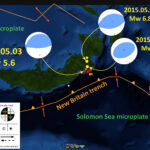
We just had five M~5 earthquakes along the New Britain trench. The New Britain trench is formed by the subduction of the oceanic Solomon Sea microplate beneath the oceanic South Bismark microplate to the north. Here are the USGS web…
Earthquakes in Los Angeles
We have had a number of small earthquakes in the Los Angeles Basin in the past month. These three earthquakes appear aligned with the Newport Inglewood fault system, the fault that ruptured in 1933 for what is generally called the…
Coseismic Surface Deformation: Nepal
We just got an image with an estimate of coseismic surface deformation for the Nepal Earthquake.
Earthquake Pair in New Britain
Good Morning New Britain. Today we had a second M = 6.8 earthquake in as many days. Here are the USGS web pages for the 2015.04.30 and 2015.05.01 earthquakes. Here is my quick post from yesterday’s earthquake. Here is a…
Earthquake in New Britain
Well, we just had a Mw 6.7 earthquake along the coast of New Britain. This region has been active lately… Here is the USGS web page for this earthquake. Here is a map showing the epicenter with Modified Mercalli Intensity…
Updated Historic Seismicity: Nepal, Himalayas (3 data sets)
I have added one more polygon data set to the three main data sets that include records of historic earthquake slip patches. The three data sets now include Bilham (2004), Bettinelli et al (2006), and Berryman et al. (2009). I…
Surface Displacement and Ground Motion Maps: Nepal
I have taken a couple products and combined them in google earth to help us learn about the impact of the Nepal 2015.04.25 Mw 7.8 earthquake. Here is the link to the USGS web page for this earthquake. I provide…
Nepal: PGA, DYFI, and the latest attenuation plot.
Well, data continue to come in. Below I plot the USGS Peak Ground Acceleration model results overlain upon the local map that I have been using to compare the current swarm of seismic activity with historic and prehistoric earthquake slip…
Updated Historic and Prehistoric Maps
I have updated a couple of these maps and include a figure from a recent presentation given by Roger Bilham at AGU (2011). Here was my original and first updated posts about this earthquake and here is my first compilation…
