The Southern California Seismic Network published this animation. Robert Graves, with the URS corporation, created the simulation. The San Diego Super Computer Center also helped. They are all given proper credit in the animation. The animation shows the simulated seismic…
northern Chile M 8.2 earthquake series animations
As I mentioned in my earlier post, there were some foreshocks and have been aftershocks, related to this M 8.2 earthquake on the subduction zone fault offshore of northern Chile. This story may not yet be over… The aftershocks are…
all right, another M 6.2 aftershock in Chile
While I was writing my post about the M 7.6 aftershock, we got a M 6.2 aftershock. A M 6.2, while still large, is much smaller than a M 7.6. Each step in earthquake magnitude (e.g. from M 5 to…
large magnitude aftershock in northern Chile
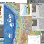
There have been many aftershocks in the region of the 4/1/14 M 8.2 subduction zone earthquake offshore Iquique, Chile. There was a swarm of earthquakes up to M 6.7 in the weeks prior to the current main shock, here is…
M 8.2 northern Chile tsunamis recorded at tide gages
Here are some plots from PMEL comparing model predictions with observations at several tide gages in the Pacific Basin. Crescent City, CA Los Angeles, CA Honolulu, HI Hilo, HI Kahului, HI
Tsunamis in the region of the M 8.2 northern Chile earthquake
Today we had a M 8.2 subduction zone earthquake in northern Chile. I have placed some records of this tsunami here. Here is the National Tsunami Warning Center tusnami travel time map for this tsunami. Here is the National Tsunami…
M 8.2 earthquake in northern Chile
Alright. Lets hope not many people are harmed as a result of this earthquake and likely large tsunami. We all know what to do. Drop, duck, cover, and hold on. Run to high ground. Stay there. Check back here for…
Fault Model 3-D Animation for La Habra EQ Swarm
Here is a short animation I made to visualize the fault geometry possibly associated with the earthquake swarm in La Habra this past week. I placed 2-D maps of these fault models here. Here is the animation. (~41 MB avi)
Fault Model in 3-D
Here are a couple maps that I put together to help me visualize a potential fault that may have ruptured in La Habra on 2014/03/29. This is a very quick, coarse, and precursory look. Others have better tools and will…
La Habra M 5.1 earthquake update
Well well. The faults in southern CA are large in number. Following Danielle’s lead, I looked into the tectonics of the region. The Shaw et al. (2002) paper has a really good summary of the tectonics of this region of…
