- Below are links to various river and stream gage data for the western US. There are graphical depiction of the hydrographs for each gage. Click on the plots to open the plot in a new browser tab. Above each graph are three links (1) the National Weather Service (left), (2) the USGS (center), and (3) the California Nevada River Forecast Center River (right). Sometimes there is a missing source for one of those three options. Interspersed with the hydrographs, I include the radar composite above the rain gages for various regions.
- There are a number of interfaces for these gages that include current conditions and forecasts. Below are some links to these interfaces. These links are configured for northern California, but one may easily find different regions at those sites.
- There is an excellent description of the NOAA NWS river gages here (h/t Antony Lomax).
- NOAA NWS River Stage Current Conditions and Precipitation Forecast
- CA NV River Forecast Center River Stage Forecast
- CA DWR Reservoir Levels
- This site includes some fascinating wind observations. https://earth.nullschool.net/
- This site has a wide range of satellite observations from NOAA NWS
- I use a number of weather forecast sites. Below are some of these.
- NOAA NWS Arcata
- NOAA NWS Forecast Discussion for Eureka
- Weather Underground Arcata
- NOAA NWSWater Vapor Color Infrared Loop
- Here is a 48 hour graphical forecast for Eureka from NOAA NWS.
River Gages and Meteorological Observations
Hydrographs
Other met Observation Sites
USA Composite RADAR
NWS Continental USA National Radar

Surface Winds from Earthschool
This is a fantastic interface that allows one to view a variety of meteorological observations (based on numerical models). More can be found about the interface here. Click on the globe to rotate Earth for a different view. Click on the word Earth to go to their site where one may change the parameters. Single left-click on the map to see the azimuth and wind velocity at a particular location.
To celebrate the 5 year launch anniversary of https://t.co/lKuNGoivSk, there's now a date selector dialog to quickly jump back in time to see historical wind data. It's all there, every three hour step at every pressure level, since launch on Dec 9, 2013. pic.twitter.com/rLZi6d2EJ8
— Cameron Beccario +75 (@cambecc) December 17, 2018
West Coast Composite RADAR
NWS West Coast West Coast Radar

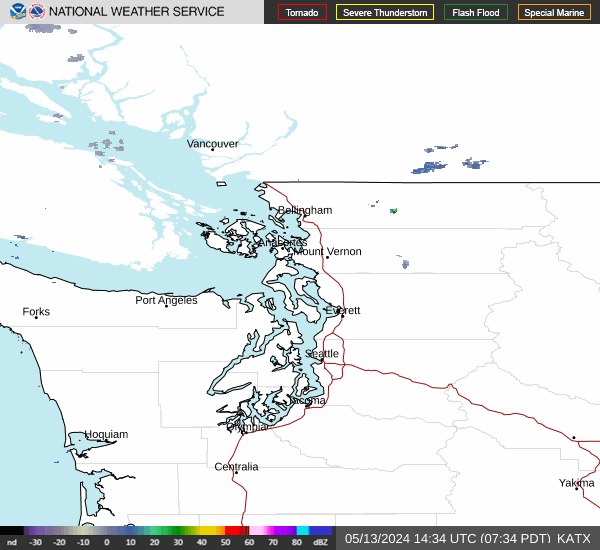
- NWS Langley Hill, WA Composite Reflectivity
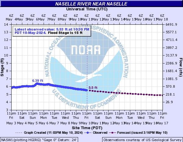
- Nasselle River near Nasselle NOAA NWS USGS
Washington
 |
- NWS Portland Portland Radar
- NWS Medford Medford Radar
- NOAA Gages in Oregon
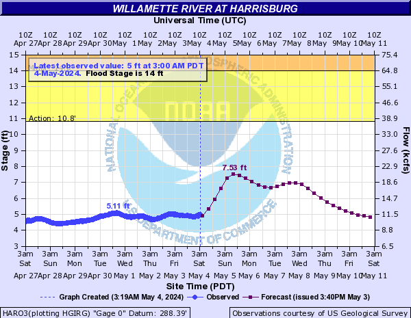
- Willamette River at Harrisburg NOAA NWS
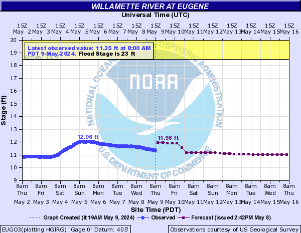
- Willamette River at Eugene NOAA NWS
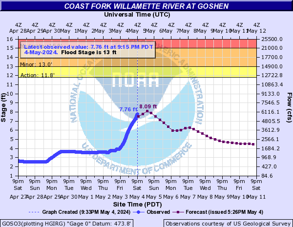
- Coast Fork Willamette River at Goshen NOAA NWS
Oregon


 |
 |
 |
- NWS Eureka KBHX Radar
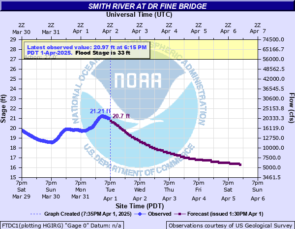
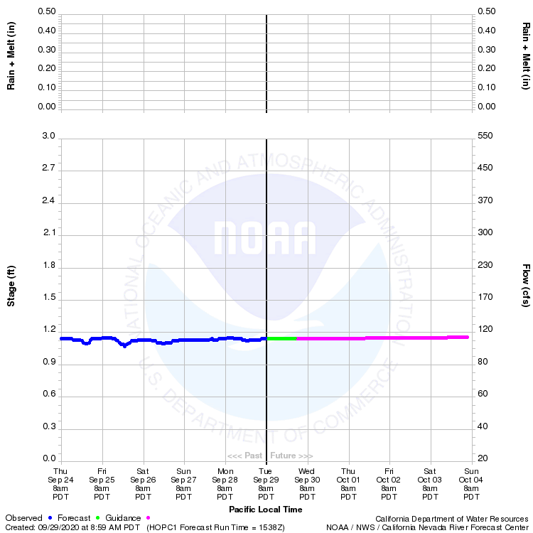
- Smith River Fine Bridge NOAA NWS USGS CANVFC
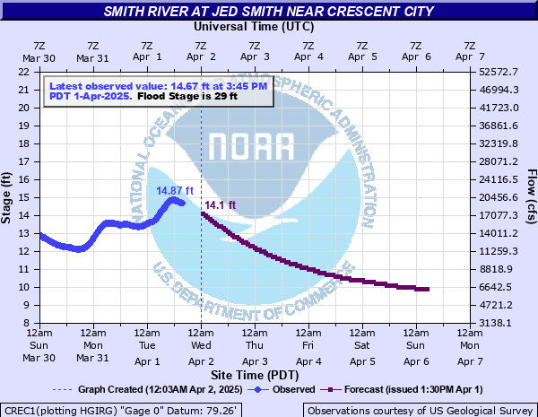
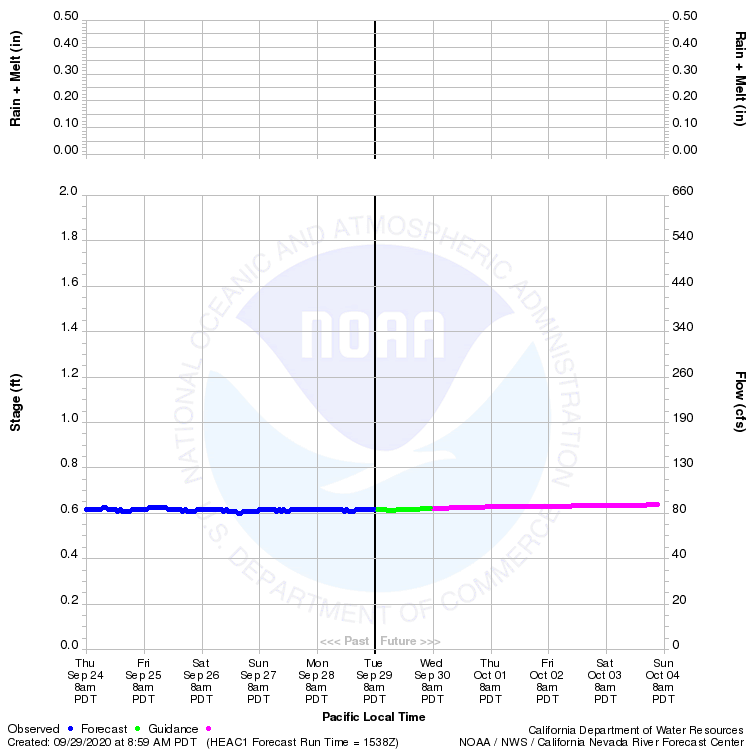
- Smith River at Jed Smith NOAA NWS USGS CANVFC
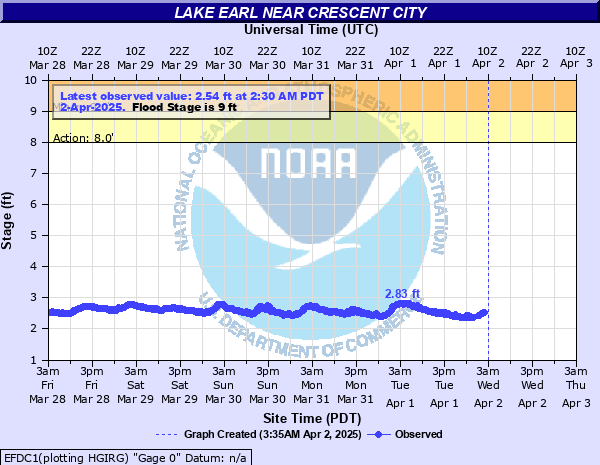
- Lake Earl NOAA NWS
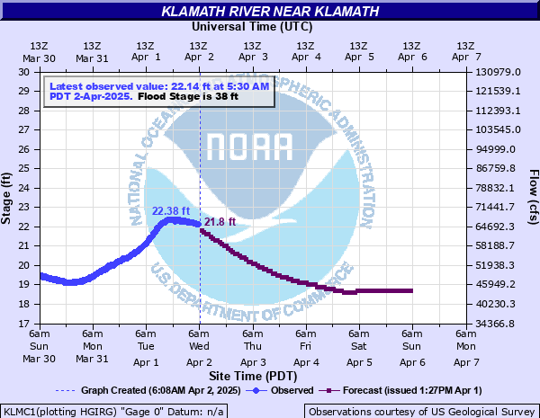
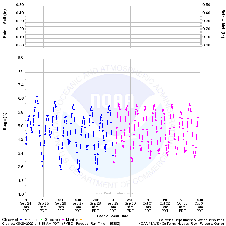
- Klamath River at Klamath NOAA NWS USGS CANVFC
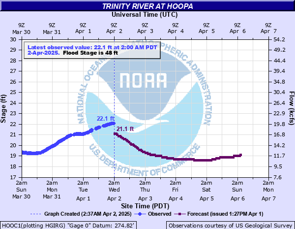
- Trinity River at Hoopa NOAA NWS
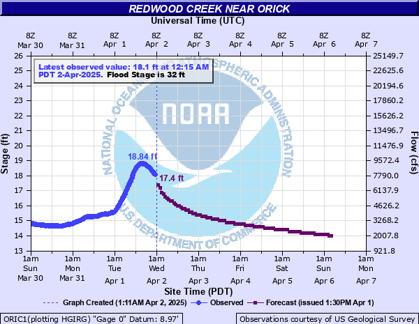
- Redwood Creek at Orick NOAA NWS USGS CANV Forecast
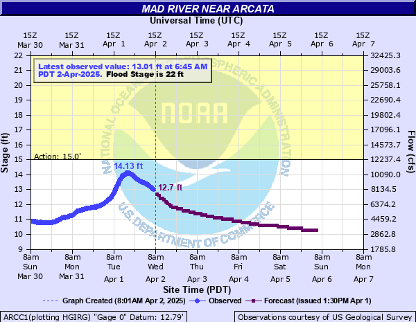
- Mad River near Arcata NOAA NWS USGS CANVFC
- Jacoby Creek
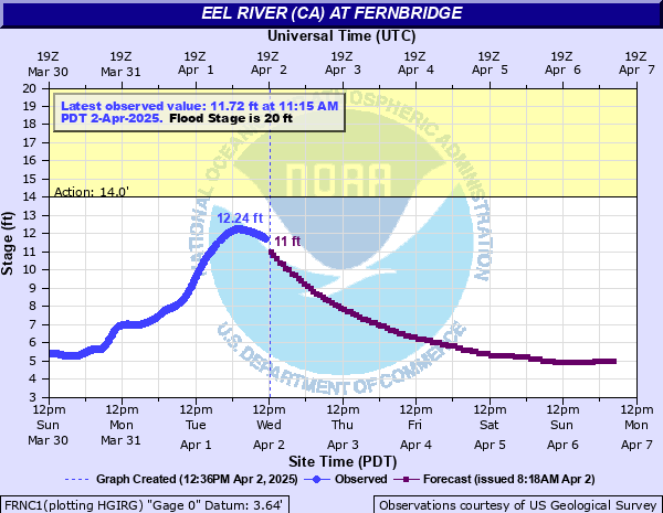
- Eel River Fernbridge NOAA NWS USGS CANVFC
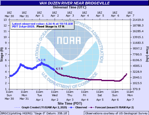
- Van Duzen River Bridgeville NOAA NWS USGS CANVFC
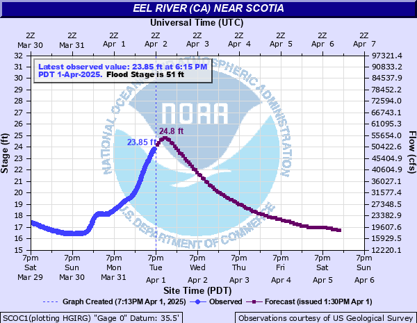
- Eel River Scotia NOAA NWS
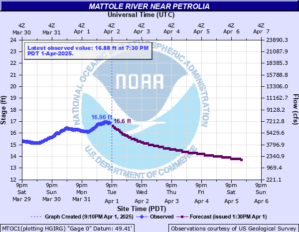
- Mattole River Petrolia NOAA NWS USGS
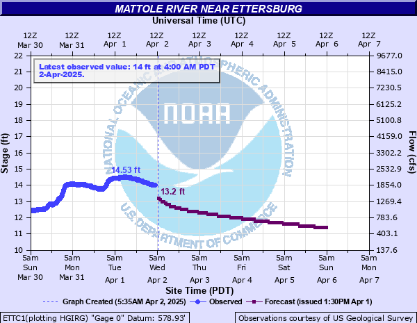
- Mattole River Ettersberg NOAA NWS USGS
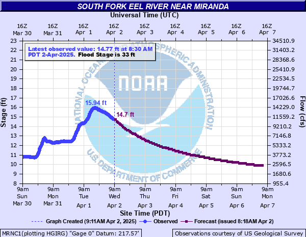
- SF Eel River near Miranda NOAA NWS USGS
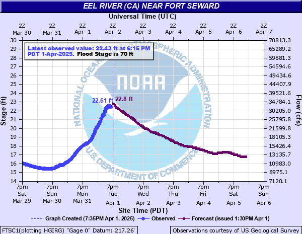
- Eel River at Fort Seward NOAA NWS USGS
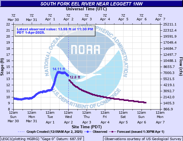
- SF Eel River Leggett NOAA NWS USGS
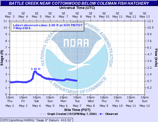
- Battle Creek at Coleman Fish Hatchery NOAA NWS USGS
- NWS Bealle AFB Composite Reflectivity
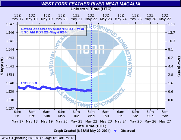
- West Fork Feather River near Magalia NOAA NWS
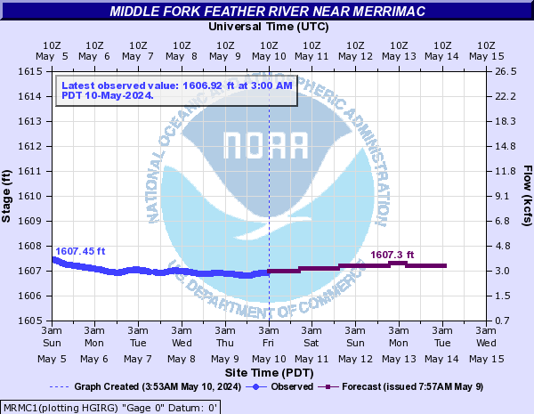
- Middle Fork Feather River near Merrimac NOAA NWS
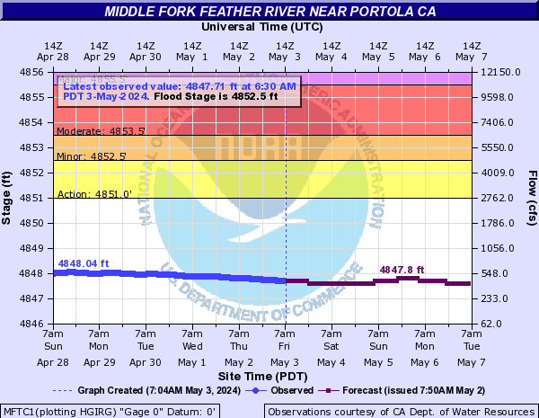
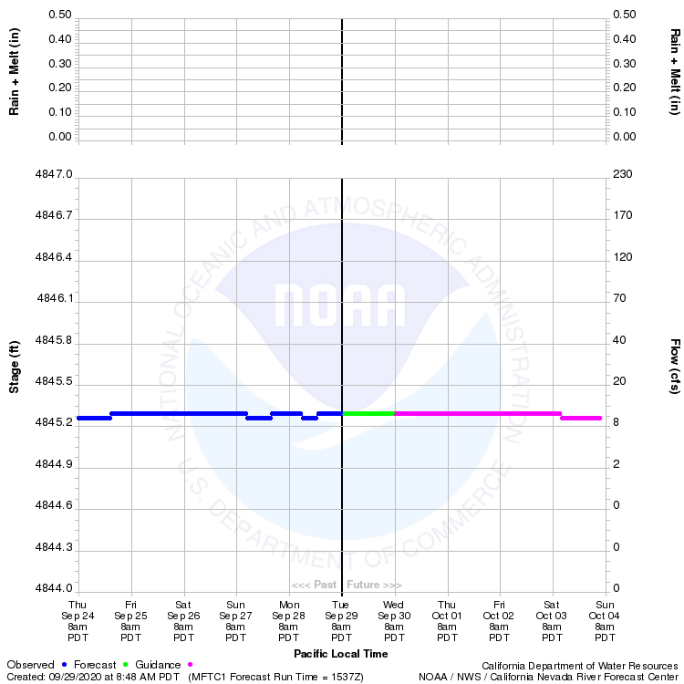
- Middle Fork Feather River near Portola NOAA NWS USGS CANVFC
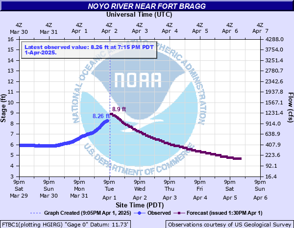
- Noyo River NOAA NWS
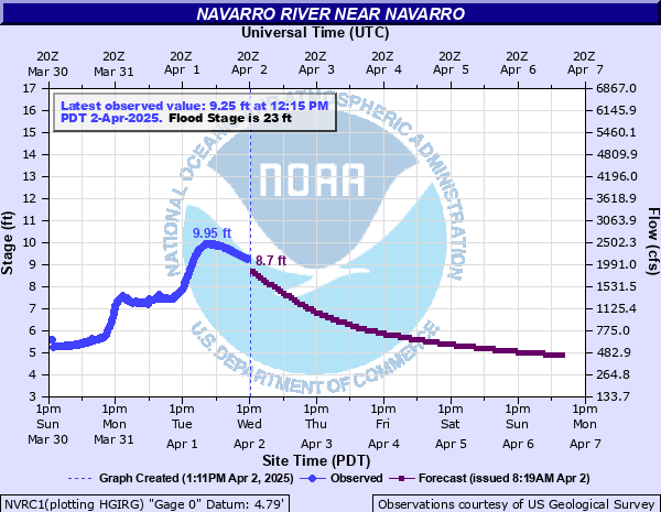
- Navarro River NOAA NWS USGS CANVFC
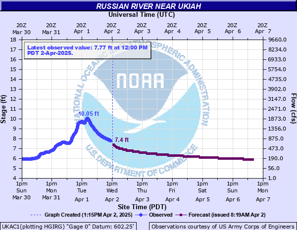
- Russian River at Ukiah NOAA NWS USGS
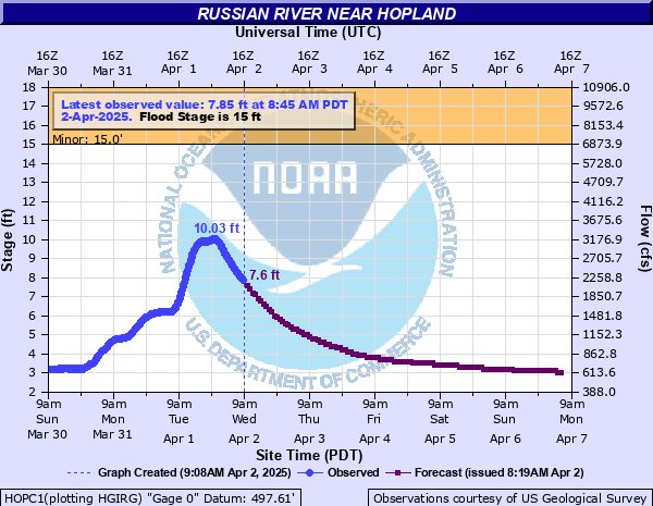
- Russian River at Hopland NOAA NWS USGS CANVFC
- Russian River at Healdsburg NOAA NWS USGS CANVFC
- Russian River at Guerneville NOAA NWS USGS CANVFC
- NWS San Francisco San Francisco Radar
- NWS San Francisco Sacramento Radar
- Sacramento River at I St NOAA NWS
- Sacramento River at Rio Vista NOAA NWS CANVFC
California

Del Norte
 |
 |
 |
 |
 |
 |
 |
 |
Humboldt
 |
 |
 |
 |

 |
 |
 |
 |
 |
 |
 |
 |
 |
Mendocino
 |
Shasta
 |
Shasta


 |
 |
 |
 |
Mendocino/Sonoma

 |
 |
 |
 |
 |
 |
 |
 |
 |
 |


 |
 |
 |