A very large earthquake in Pakistan today!
As a result of collision of the Arabia plate into the Eurasia plate, thrust faults formed in Pakistan. This collision zone is the same basic convergence region that extends from Java/Sumatra, up through Burma, across India (creating the Himalaya), through the middle east, into the Mediterranean creating the Alps.
Here is the moment tensor for this earthquake, showing the oblique mechanism.

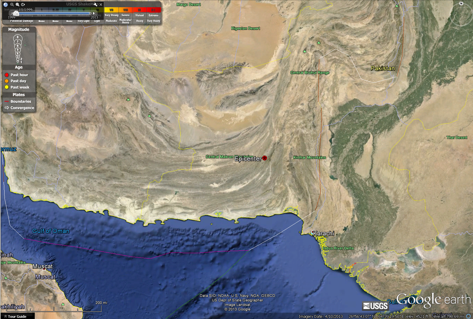
Here is a map with the epicenter plotted in google earth.
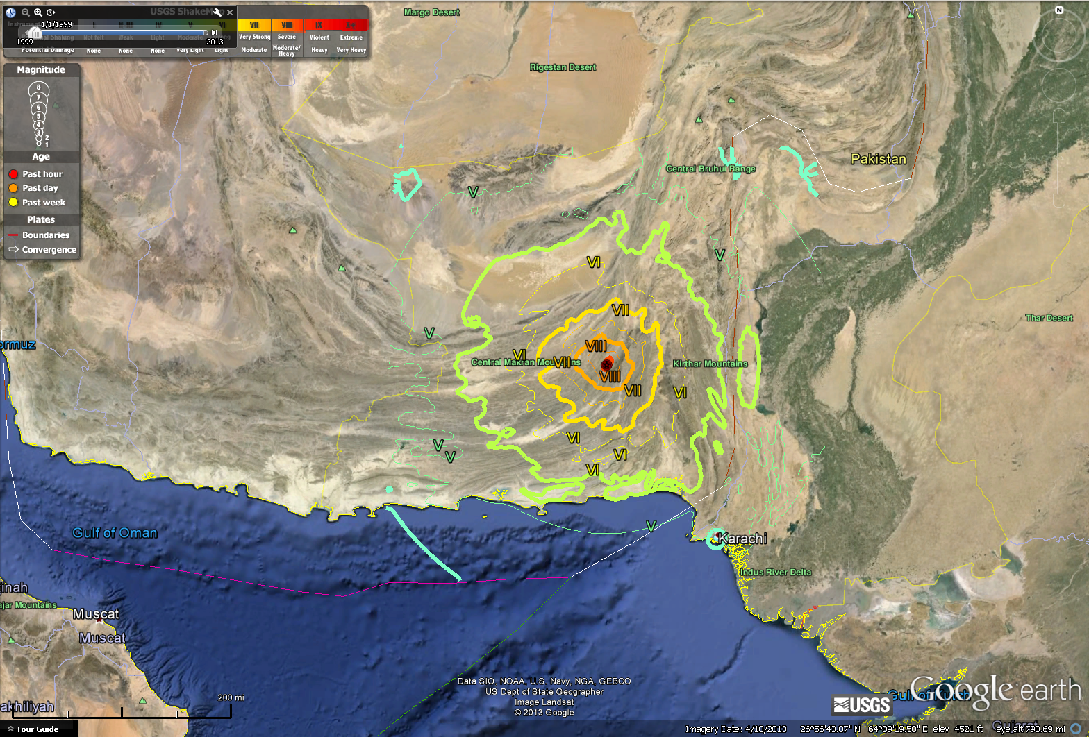
Here is a map with the Modified Mercalli Intensity Contours plotted in google earth.
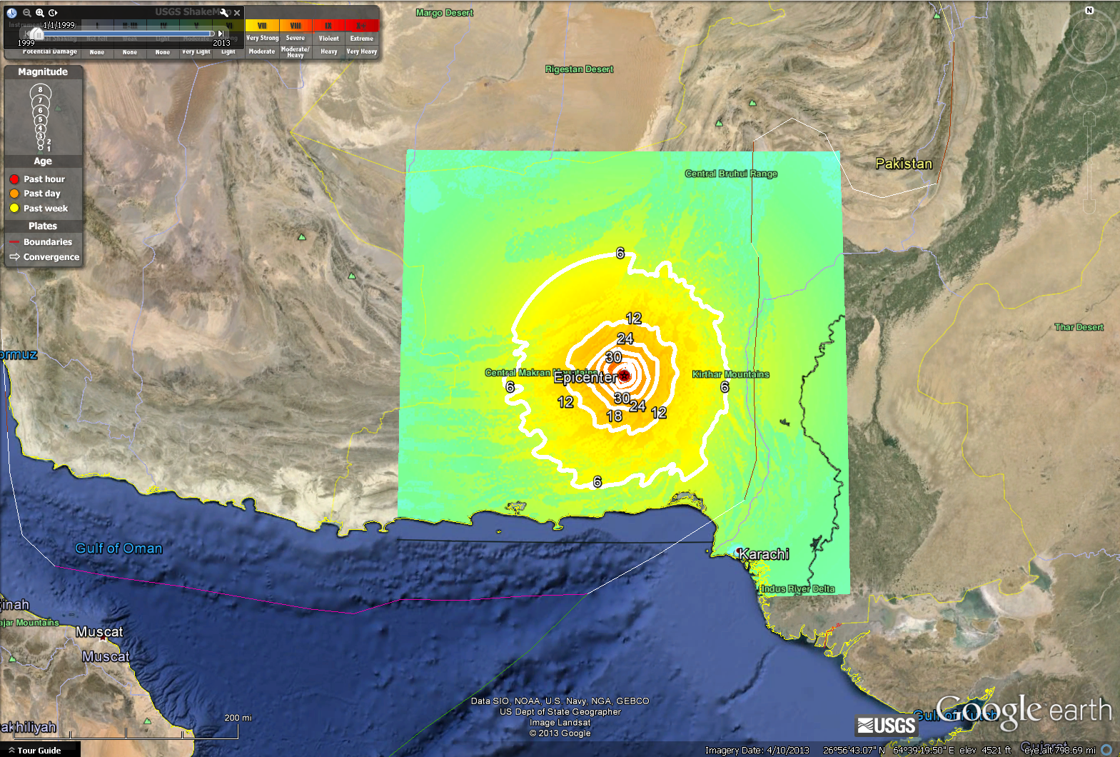
Here is a map with the MMI intensity (USGS shakemap color overlay) and Peak Ground Acceleration Contours plotted in google earth.
Here is the USGS page: http://earthquake.usgs.gov/earthquakes/eventpage/usb000jyiv#summary
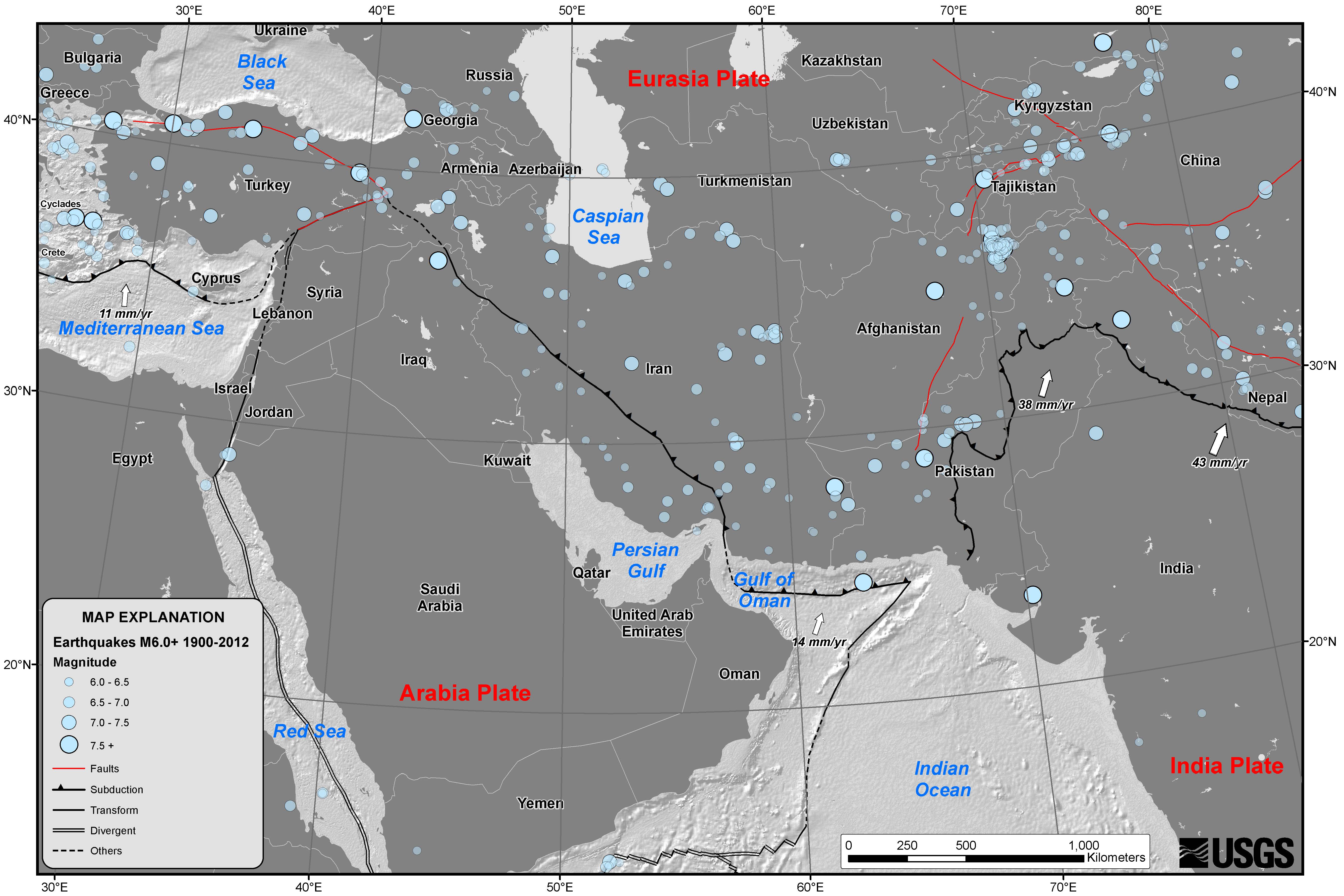
Here is the USGS map for the region:
Here is the USGS page for the loss estimates below: http://earthquake.usgs.gov/earthquakes/eventpage/usb000jyiv#pager
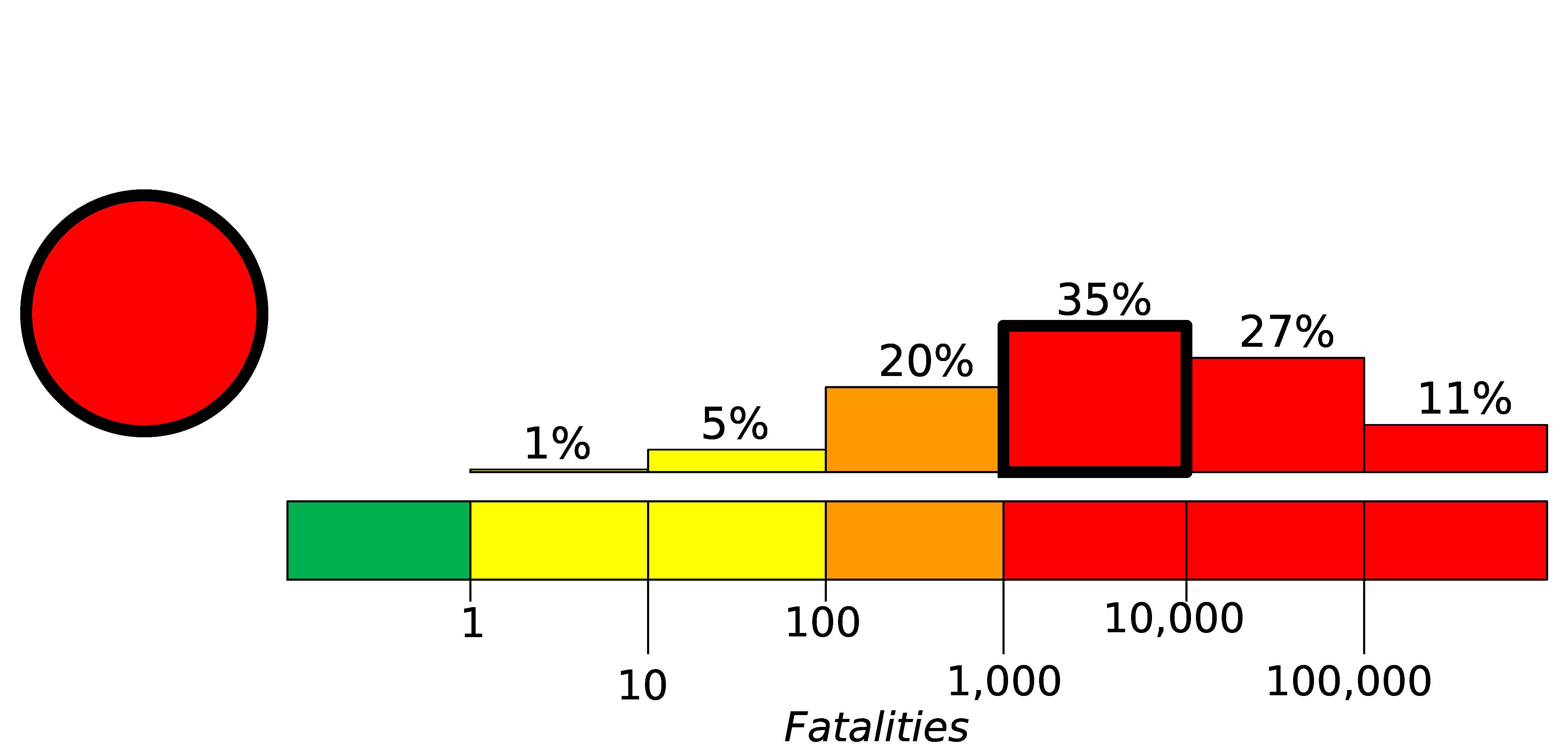
Here is the estimate of fatalities for this earthquake:
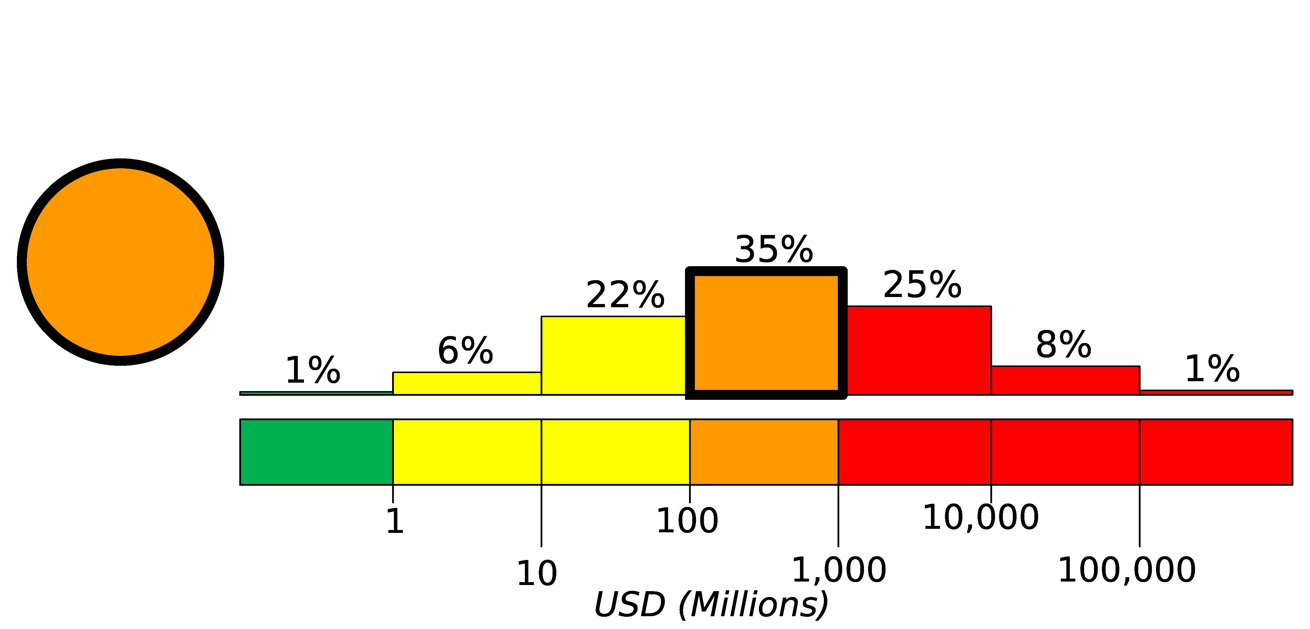
Here is the estimate of economic loss for this earthquake:
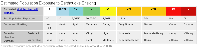
Here is the estimate of “exposure” for this earthquake:
1 thought on “M7.7 in Pakistan”