There was a M = 3.0 earthquake near Petrolia, CA today. Here is the USGS website for this earthquake. On Oct. 28, 2015, there was a small earthquake near Bayside, CA.
Here is a map where I plot the focal mechanism for today’s earthquake, along with the moment tensor from the Mendocino fault earthquake from earlier.
I placed a moment tensor / focal mechanism legend in the lower left corner of the map. There is more material from the USGS web sites about moment tensors and focal mechanisms (the beach ball symbols). Both moment tensors and focal mechanisms are solutions to seismologic data that reveal two possible interpretations for fault orientation and sense of motion. One must use other information, like the regional tectonics, to interpret which of the two possibilities is more likely.
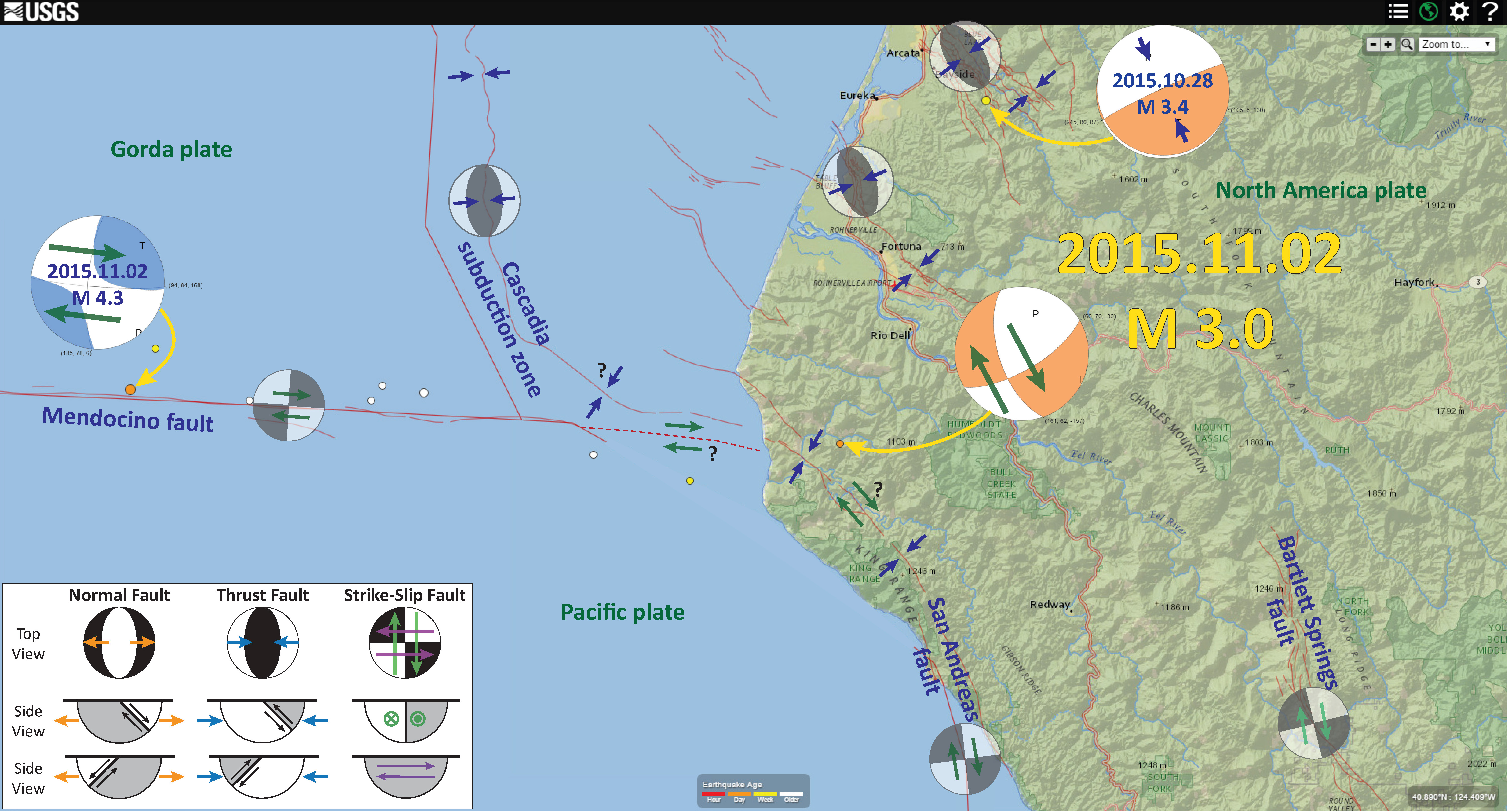
Both the Mendocino fault and the San Andreas fault systems are right-lateral strike-slip fault systems. Considering this, I prefer to interpret this M = 3.0 earthquake to be a north-northwest striking right-lateral strike-slip earthquake. Currently, the fault that forms the northeastern boundary of the King Range is mapped as a backthrust to the Vizcaino block. The King Range has the highest uplift rates in the continental U.S., probably due to the northward propagation of the San Andreas fault. The San Andreas fault appears to die out north of Shelter Cove. There is no evidence that it trends offshore of Shelter Cove (as plotted on other maps; I extend the Mendocino fault eastwards based upon moment tensor/focal mechanisms from earthquakes in this region). Jeff Beeson, a Ph.D. Candidate at Oregon State University, is currently working on the offshore evidence of the San Andreas fault in this region. If is possible that the SAF continues on land, but we need to find this evidence that to date has been elusive.
I will post more later tonight. Check back later.
Earthquake near Petrolia!

1 thought on “Earthquake near Petrolia!”