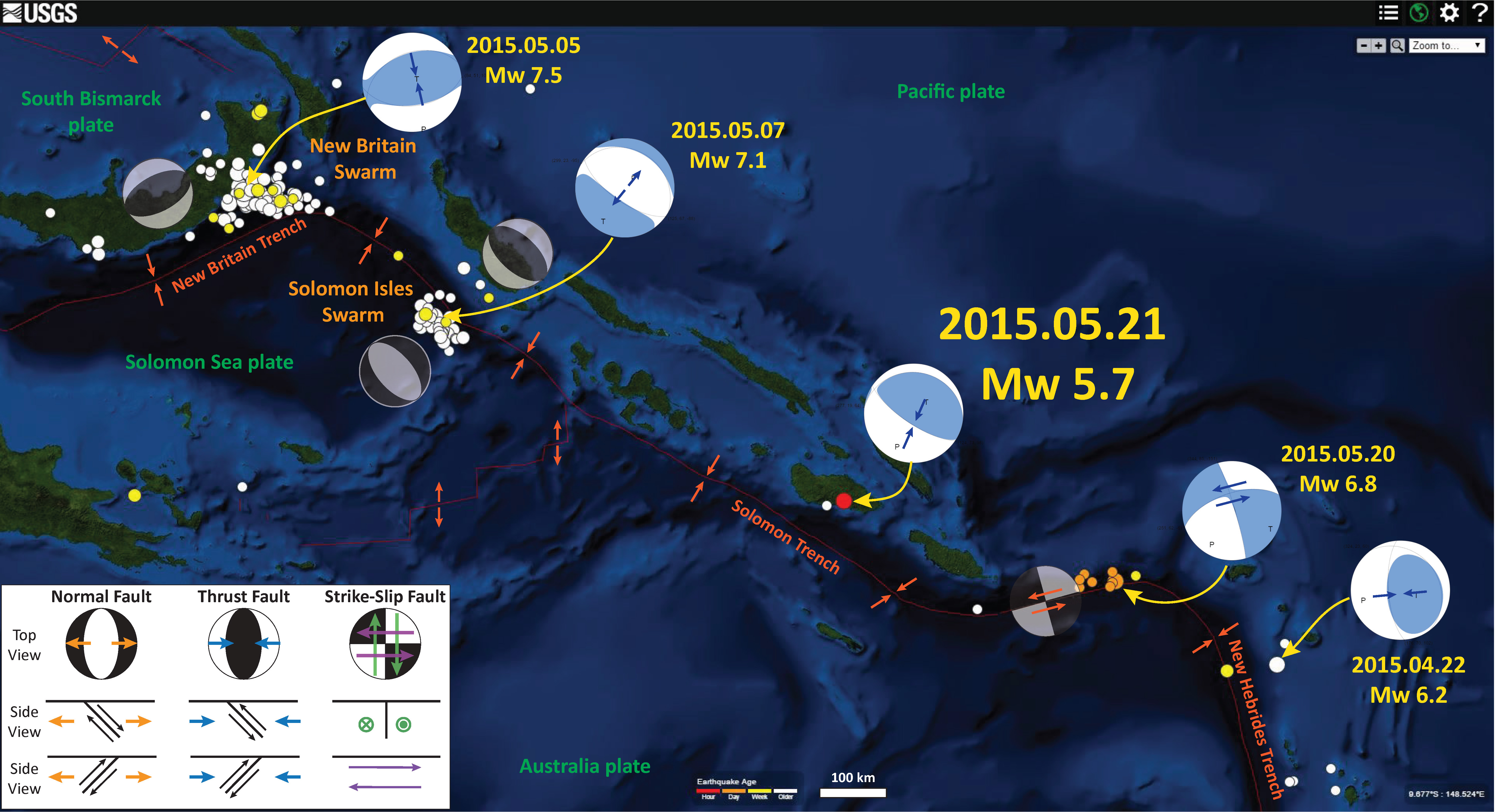
The past couple of days have brought us a series of large magnitude strike-slip earthquakes along a plate boundary between the Solomon Trench and the New Hebrides Trench. I posted about the first earthquake here and here. This swarm of earthquakes, along with the other recent seismic activity along this system, supports the hypothesis that this is a strike-slip plate boundary (nor a subduction zone as plotted on some maps).
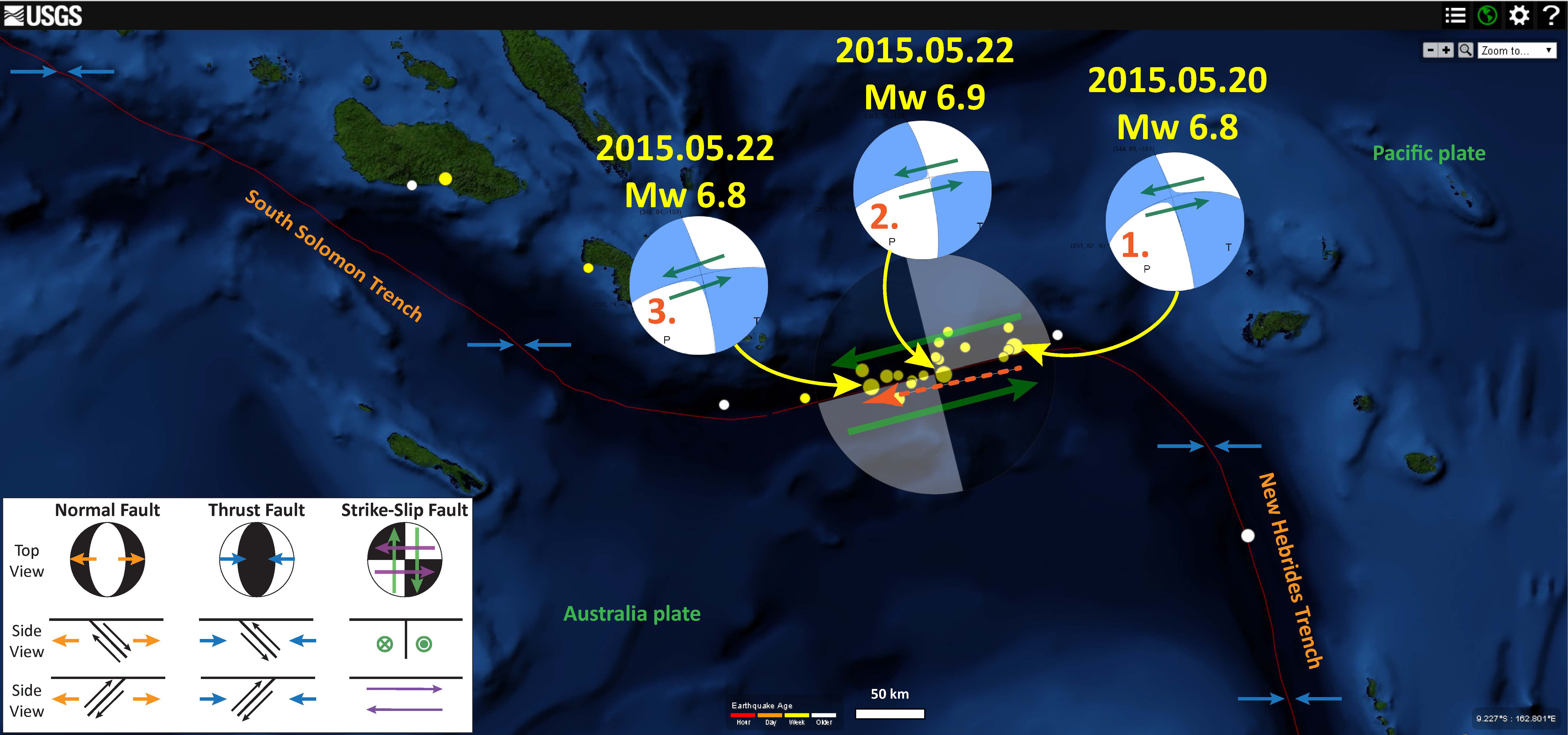
Here is a map that I put together. I plot the epicenters of the earthquakes, along with the moment tensors for the three largest magnitude earthquakes. I also place a transparent focal mechanism over the swarm, showing the sense of motion for this plate boundary fault. Technically, transform plate boundaries are strike-slip (shear) plate boundary fault systems that connect spreading ridges. SO, I would like to call this a transform plate boundary fault system, but need to see if it really satisfies the definition that people use… I’ll get back to us on this…
I also note that these three largest earthquakes happen in a time order from east to west, unzipping the fault over three +- days. I label them in order (1, 2, 3) and place an orange arrow depicting this temporal relation). Very cool!
-
Here are the USGS web pages for the three largest earthquakes in this series:
- 2015.05.20 Mw 6.8
- 2015.05.22 Mw 6.9
- 2015.05.22 Mw 6.8
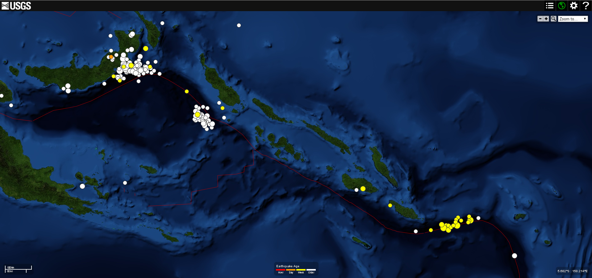
Here is an updated regional map with all of the epicenters from this swarm plotted. Below I link to an earlier map with more notations on it.
4 thoughts on “Santa Cruz (western Pacific) Earthquake Swarm!”