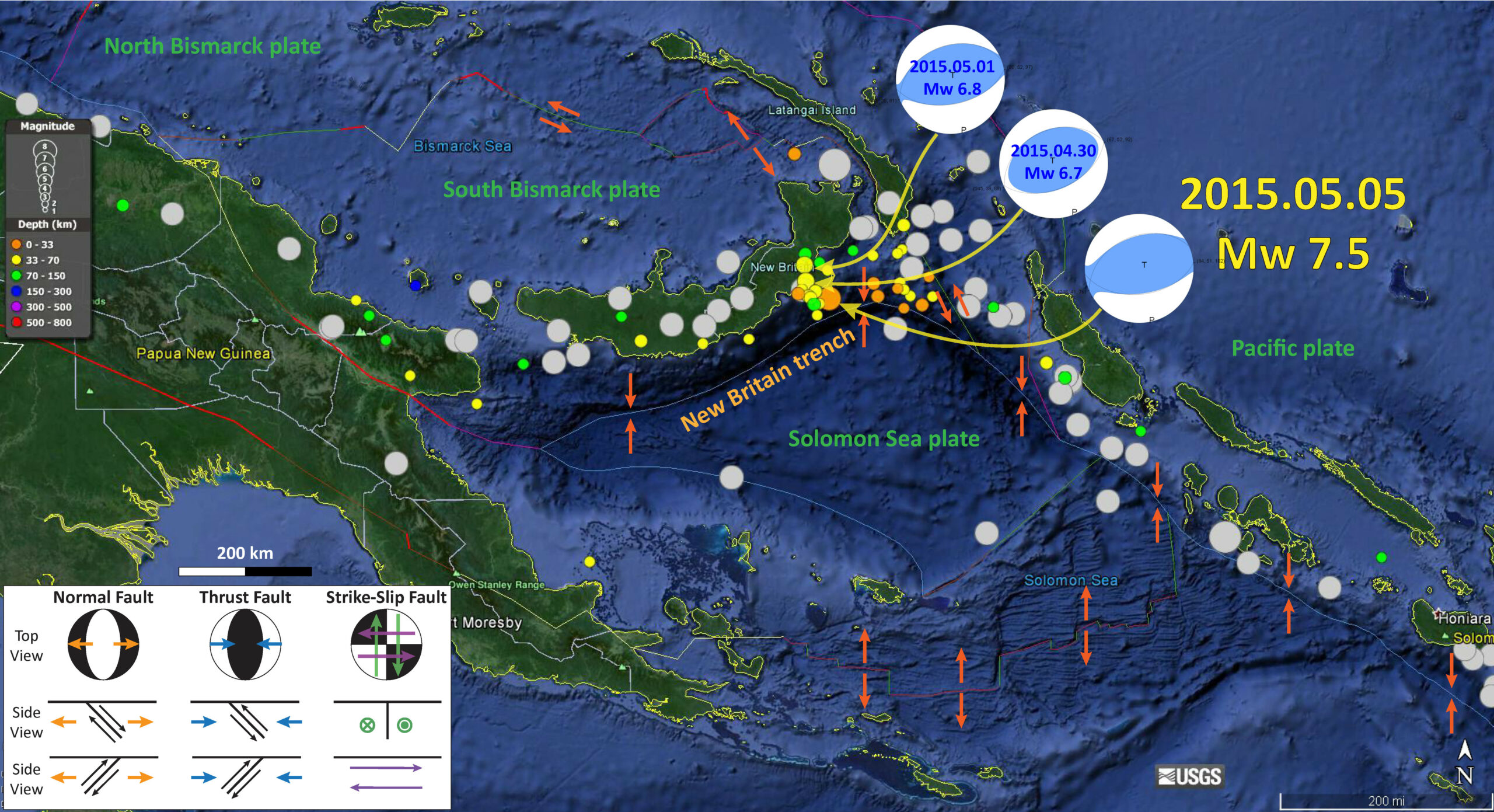
In the past week, there has been a series of earthquakes in the New Britain trench. The largest quakes are M = 6.7 & 6.8. Now we might call those foreshocks to today’s M = 7.5 earthquake de Cinco de Mayo. Historic Earthquakes of epicenter larger than M = 7 are plotted in grey. These are also plotted in more detail below.
Here is a map that shows the seismicity from the last month. The moment tensors for the three largest magnitude earthquakes are shown, as well as a brief explanatory graphic about what moment tensors reveal. Based on the regional tectonics, I would interpret these three earthquakes to be ~east-west striking, north-south compressional earthquakes, dipping to the north.
Based on the original magnitude and hypocentral depth (63 km), it seemed less likely that a tsunami may be generated from this earthquake. The depth is now 42 km, which promotes the likelihood of a tsunami. The 1992 Petrolia Earthquake was at about 10 km depth and produced a tsunami with an earthquake of magnitude 7.2.
Any tsunami from today’s earthquake would probably be local and not travel very far from the region. The PTWC issued a threat message stating that the waves may be 0.3 to 1 meters above the tide level in the Papua New Guinea region.
Here is their forecast ETA for one location:
LOCATION REGION COORDINATES ETA(UTC)
————————————————————
KAVIENG PAPUA NEW GUINEA 2.5S 150.7E 0258 05/05
The depth estimate originally placed this earthquake beneath the slab depth based upon the Hayes et al. (2012) model. At first the depth was set at ~63 km and has since shallowed to 42 km and is now plotted further north (placing it closer to a depth that we might expect based on the Hayes slab model).
-
I have posted material about the recent and near recent (decadal) seismicity in the past:
- Here is a post regarding the foreshocks. 2015.05.03
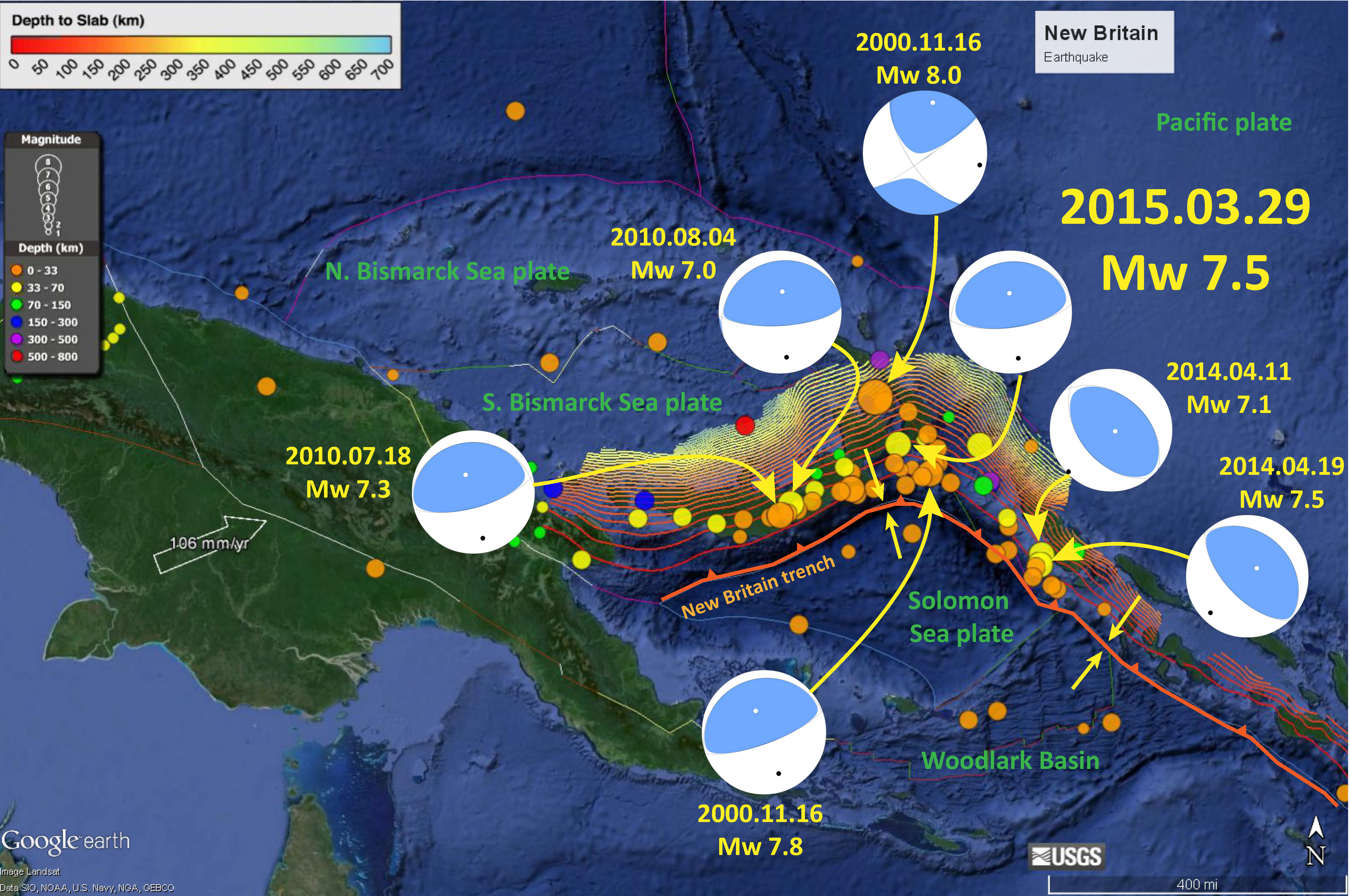
- Here is a post summarizing the seismicity since 2000 AD. 2015.03.29
- Here is a post comparing the New Britain region with the adjacent Bougainville region. 2015.03.30
This is a map showing the seismicity of this region since 2000 A.D.
Here is an updated map showing that the earthquake of magnitude M = 7.5 to have been relocated to near the coastline.
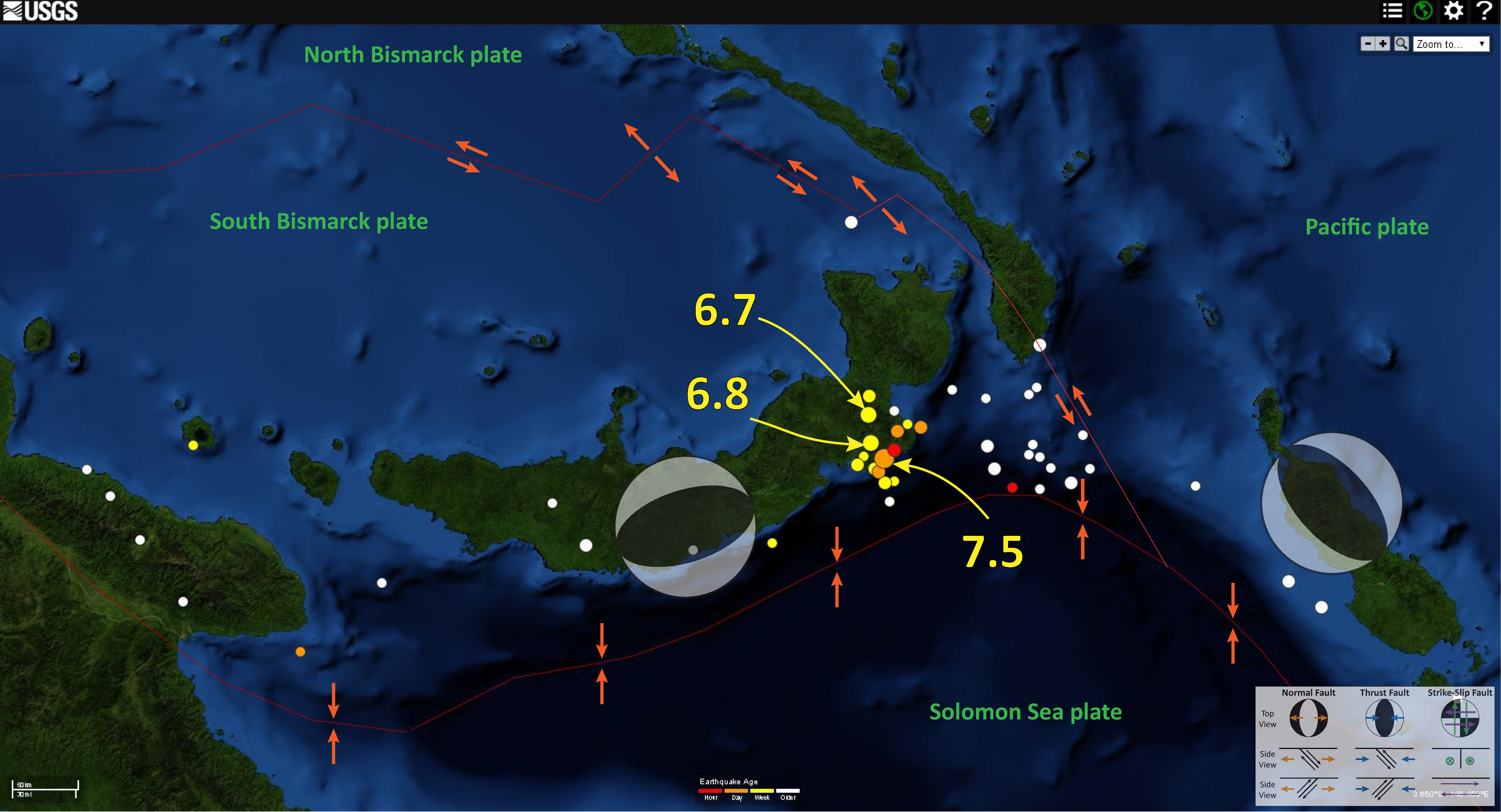
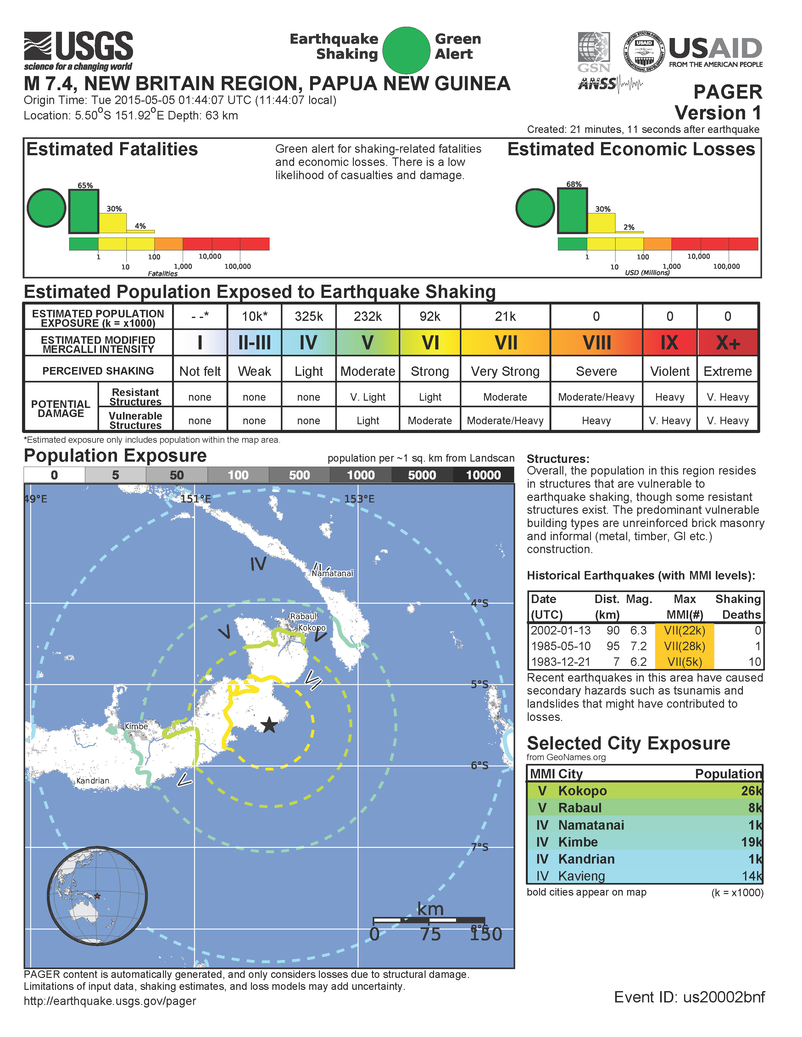
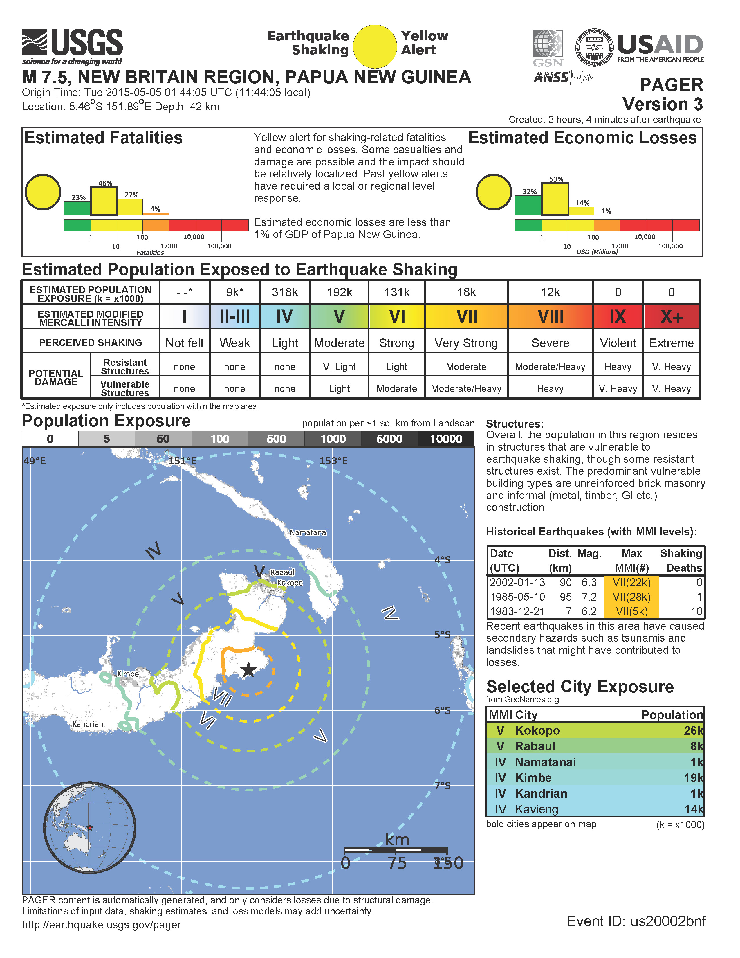
With this relocation, the PAGER estimates for damage to people and their belongings increased (the earthquake got “closer” to the people). Below are the version 1 and version 3 PAGER alerts.
3 thoughts on “New Britain Strikes Again!”