I have taken a couple products and combined them in google earth to help us learn about the impact of the Nepal 2015.04.25 Mw 7.8 earthquake. Here is the link to the USGS web page for this earthquake. I provide links to the different pages where I have summarized the record of historic and prehistoric earthquakes in this region, along with other background information about the regional tectonics.
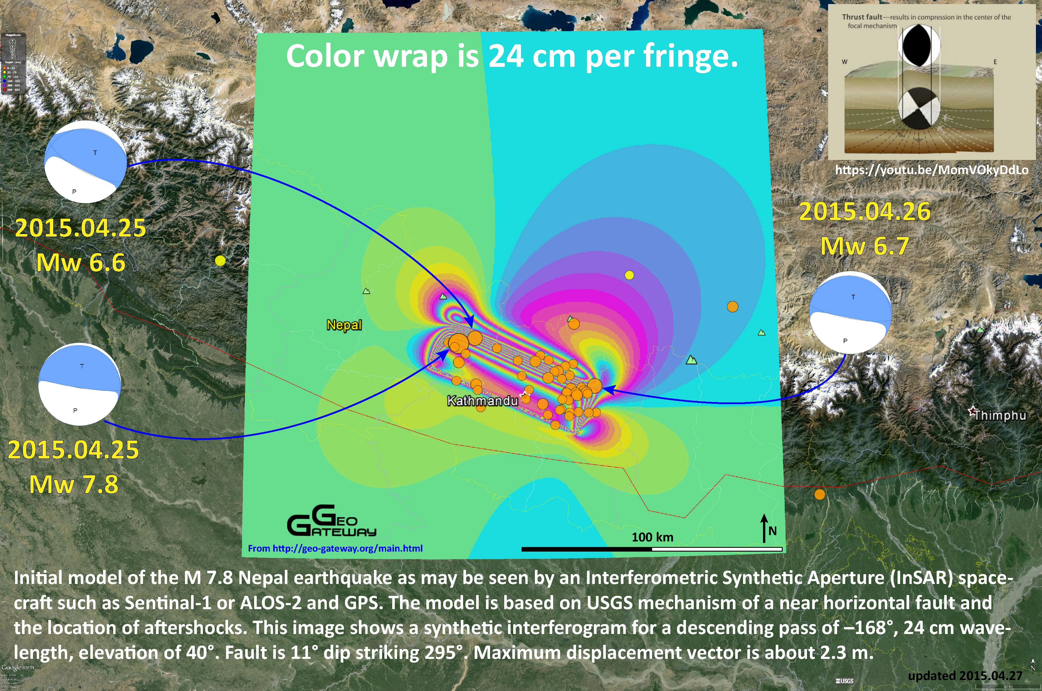
First, here is a map that shows an estimate of the ground displacement based upon a model of the crust and an inversion of the USGS earthquake fault slip model. This surface displacement comes from GEO GATEWAY (you can download the kmz file too!). I have plotted the moment tensors for the three largest earthquakes. These are graphical ways of depicting the possible motion of the earthquake along two possible fault planes. These are calculated based upon seismologic observations. While focal mechanisms and moment tensors are determined differently, their graphical representation is similar. Find out more about focal mechanisms here and moment tensors here.
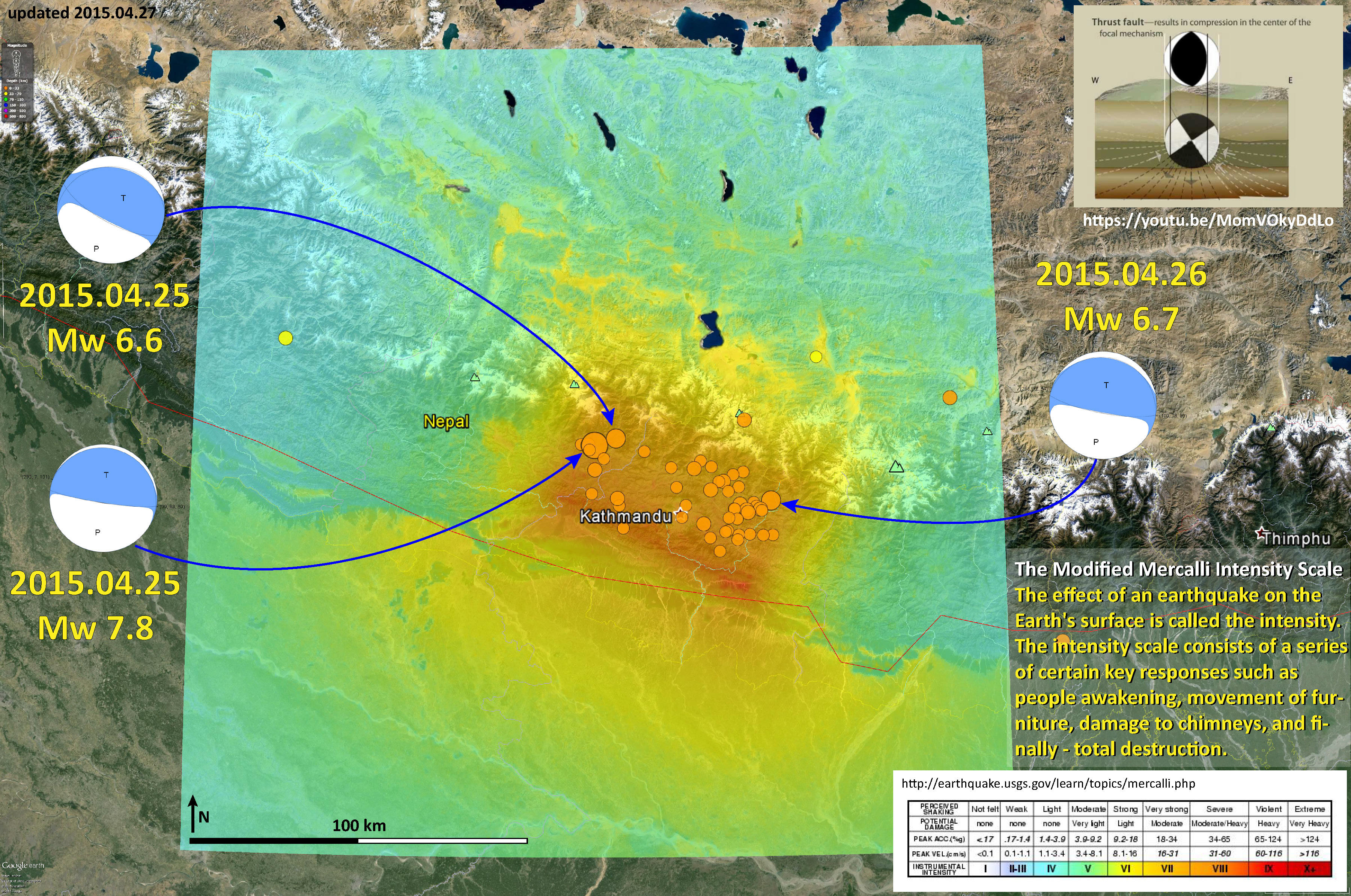
Second, here is a map that shows the modeled ground shaking intensity, using the Modified Mercalli Intensity Scale. These model results also utilize the USGS earthquake fault slip model.
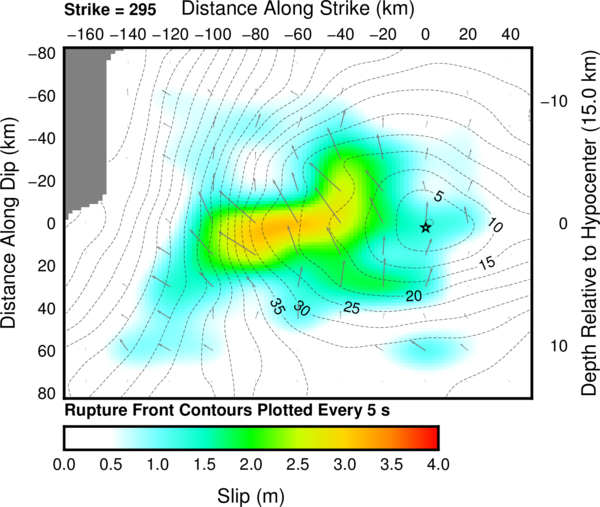
Here is the USGS slip model. Go to their web site for more information. Basically, they create a fault plane and split it up into fault elements. Then one assigns a slip amount (e.g. in meters) and direction (i.e. rake) for the earthquake. Then, one “slips” (in computer space) the fault. The model sends out simulated seismic waves. Then one compares the simulated wave forms with the observed wave forms to see how well the slip model fits the observations. The slip model is modified to optimize the fit between the observed and simulated wave forms.
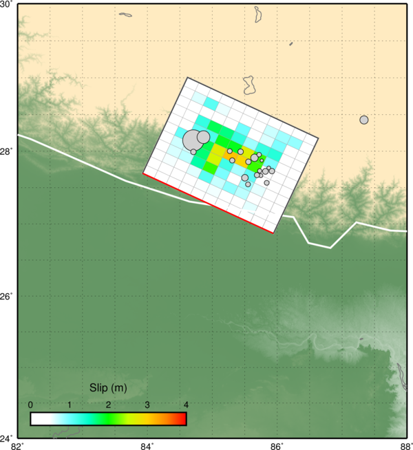
Here is the earthquake fault slip model overlain upon the map with some earthquake epicenters plotted as well.
- Previous Posts from EarthJay
- Original Earthquake Post 2015.04.24
- Aftershocks Define Fault Slip Region 2015.04.25
- Historic and Prehistoric Earthquake History and Tectonic Background 2015.04.25
- Updated Historic and Prehistoric Earthquake History 2015.04.26
- PGA, Did You Feel It?, and Attenuation Plot 2015.04.26
- USGS Web Pages for the three largest earthquakes
- Mw 7.8 2015.04.25
- Mw 6.6 2015.04.25
- Mw 6.7 2015.04.26
2 thoughts on “Surface Displacement and Ground Motion Maps: Nepal”