We have had another small aftershock. Here is the USGS web page for this earthquake. This time it is in a different region than the swarm of the past couple of weeks.
There are several report updates, listed here:
- 2015.02.16 M 6.7 Japan Sanriku Coast – Main Report
- 2015.02.16 M 6.7 Japan Sanriku Coast Update #1
- 2015.02.16 M 6.7 Japan Sanriku Coast Update #2
- 2015.02.20 M 6.7 Japan Sanriku Coast Update #3
- 2015.02.21 M 6.7 Japan Sanriku Coast Update #4
- 2015.02.25 M 6.3 Japan Sanriku Coast Update #5
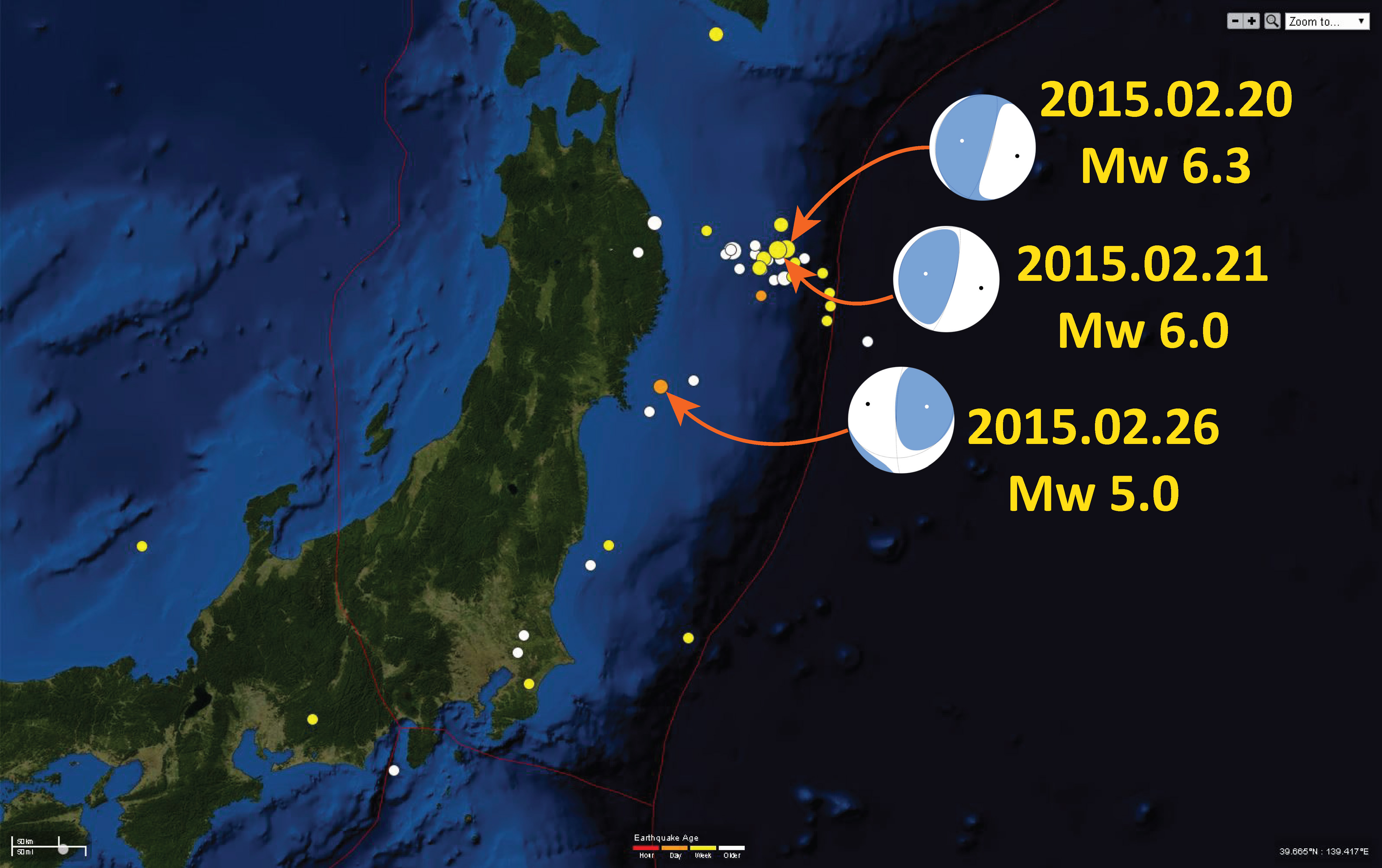
Here is a map showing today’s earthquake with a couple of the larger earthquakes also plotted. See my prior posts about these.
The USGS websites for these earlier earthquakes are here:
This map shows the USGS (Hayes et al., 2012) slab depth contours. These contours represent the depth to the top of the downgoing plate (i.e. the subduction zone fault interface location). The depth is currently set at ~56 km. This is a little deep for the slab model, but the slab model is constrained by seismicity (which has considerable depth variation, so cannot be considered precise).
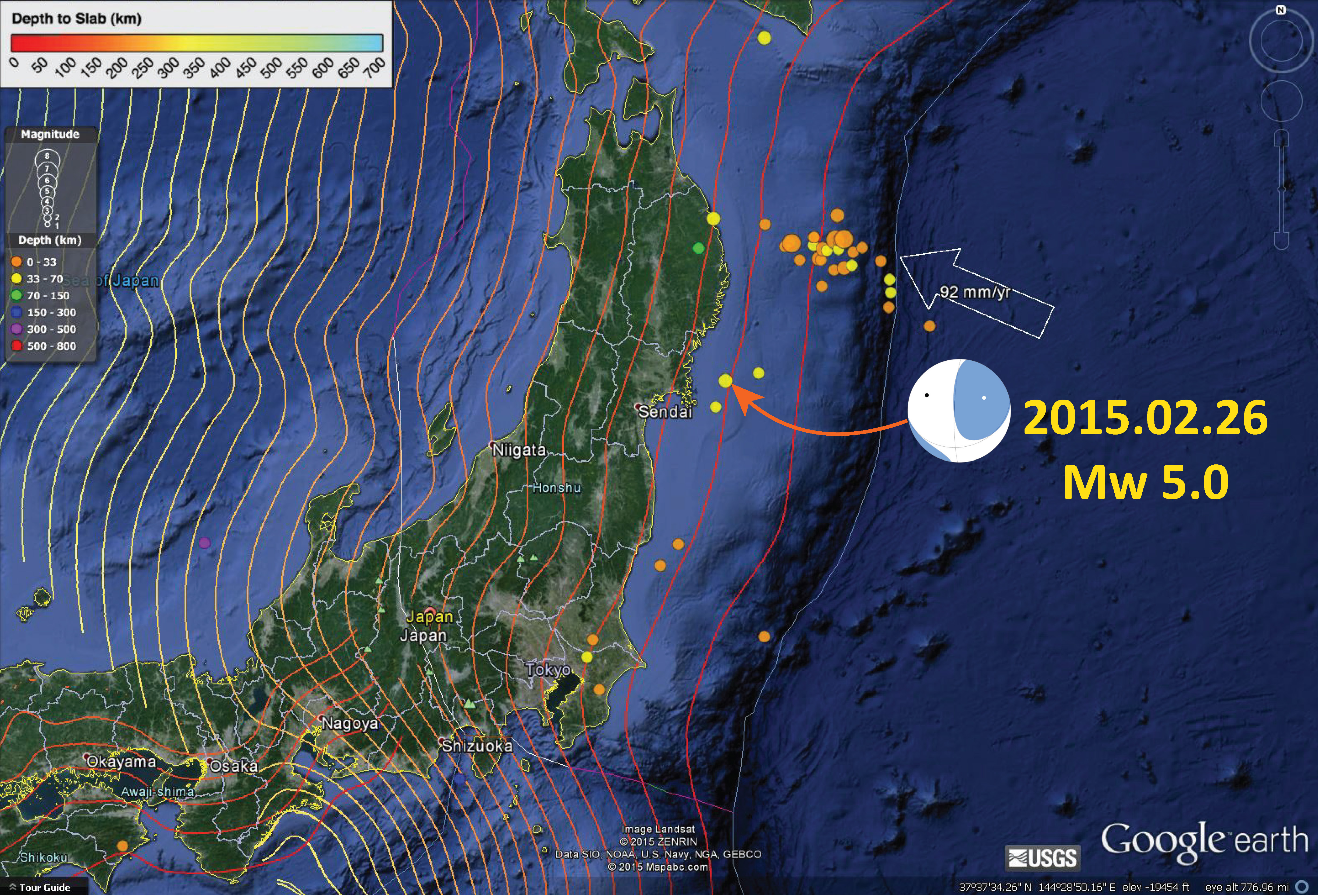
Still on that WNW trend. Hmmm?
not this new one…