There have been a swarm of geologists running around Napa taking photos and documenting evidence from the earthquake swarm on Sunday. Here is my first post about this earthquake swarm, with the M 6.0 earthquake being the largest magnitude earthquake.
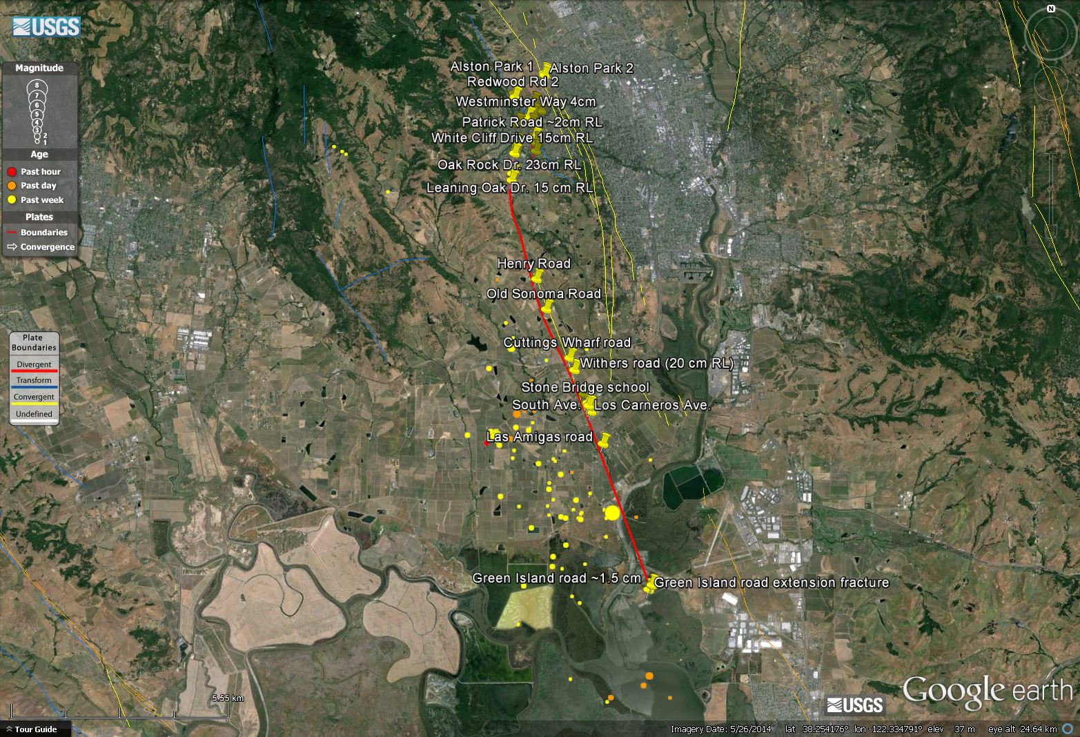
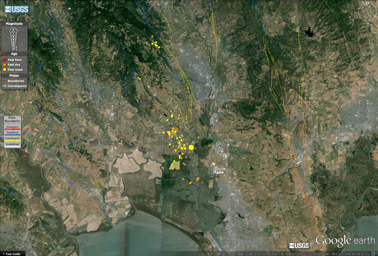
Mike Oskin and his students have been diligent in their reporting. Most of their observations have been posted to Oskin’s twitter account. Here is a google earth kmz file that Oskin posted to his twitter feed. They followed the surface trace of the fault, which is represented by the red line. There are notes and photos that are documented by yellow push pin icons. Here is a map with the epicenters of the swarm and the Oskin kmz observations overlain. Download the kmz to see the photos.
Here is the channel 2 photo database of damage.
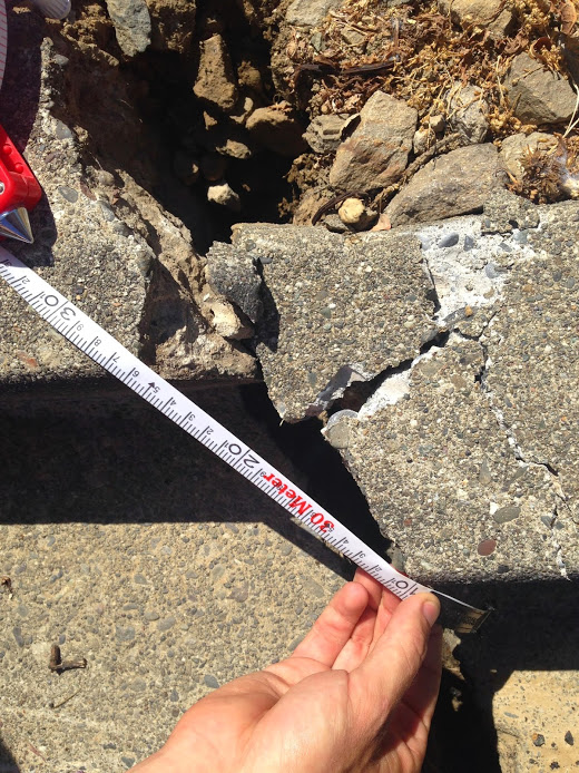
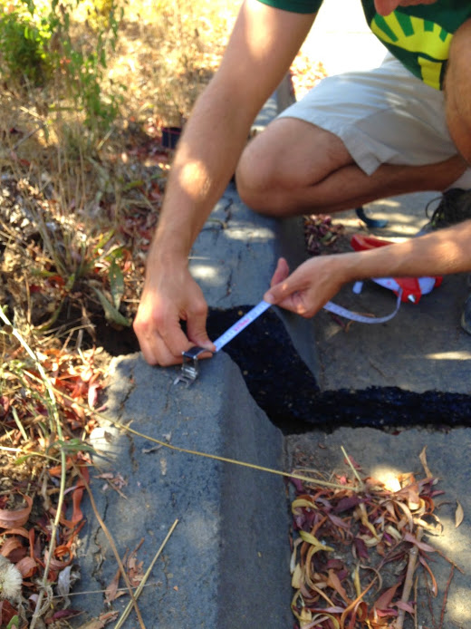
Here I post a couple of the photos taken by Alex Moran. Many of them have Chad Trexler in them for scale. These are both posted on Oskin’s kmz file.
White Cliff Drive: Offset curb with tape measure for scale. Photo by Alex Morelan.
23 cm right lateral along Oak Rock Dr. Photo by Alex Morelan.
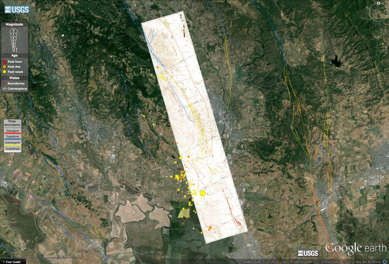
Here is an updated map showing all the aftershocks as of today at noon local time.
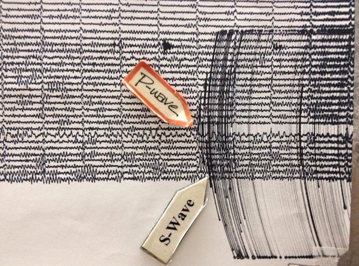
Here is a photo (Lori Dengler) of the seismograph as recorded in Van Matre Hall at Humboldt State University, Dept. of Geology.
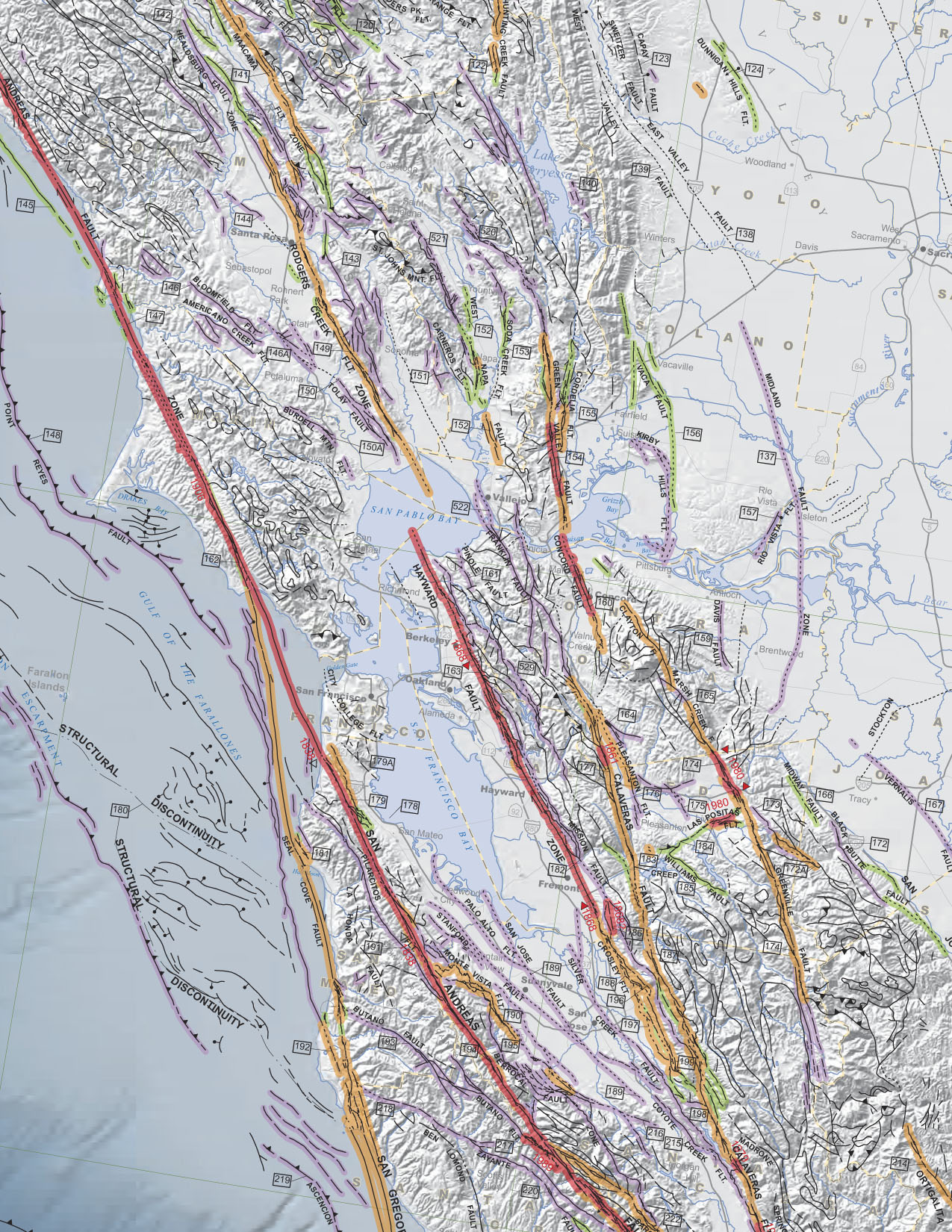
This is a map from the California Geological Survey that shows the faults in the region.
Here is a kmz file of a map produced by Wesling and Hanson as part of their USGS NEHRP final report. Here is a map showing their map underlain by the USGS faults and the epicenter plots.
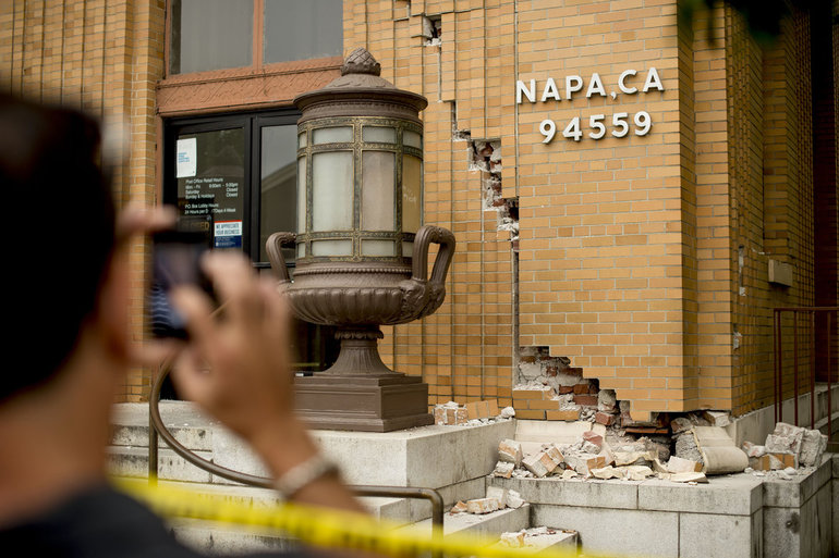
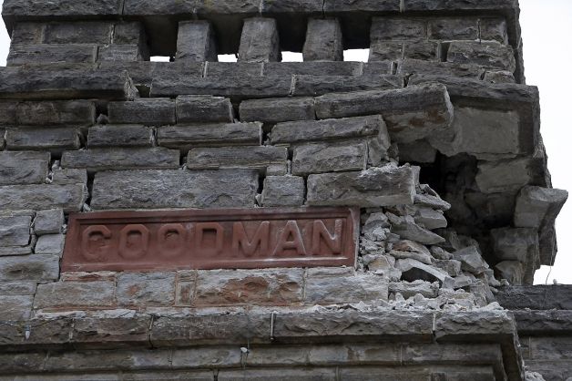
Here is a photo from the AP:
Here is a photo from SFGate:
Thanks. You should have titled this “Here Is.” ;-)
I’ve totally dropped the ball on postings for this EQ!! I’m so glad you are on top of it!!