- 2020-03-25 02:49:21 (UTC)
- 48.986°N 157.693°E
- 56.7 km depth
Interactive Map 
Regional Information Felt Report - Tell Us! 000005Responses Contribute to citizen science. Please tell us about your experience.
- Did You Feel It?
IVmmi 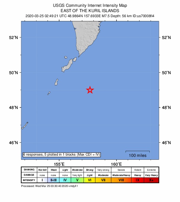
Community Internet Intensity Map Origin - Review Status
- REVIEWED
- Magnitude
- 7.5 mww
- Depth
- 56.7 km
- Time
- 2020-03-25 02:49:21 UTC
Moment Tensor Fault Plane Solution Tsunami 
U.S. Tsunami Warning System To view any current tsunami advisories for this and other events please visit https://www.tsunami.gov.
View Nearby Seismicity - Time Range

± Three Weeks - Search Radius

250.0 km - Magnitude Range

≥ 4.0