- 2019-06-24 01:05:29 (UTC)
- 2.776°S 138.568°E
- 28.0 km depth
Interactive Map 
Regional Information Felt Report - Tell Us! 000007Responses Contribute to citizen science. Please tell us about your experience.
- Did You Feel It?
VIImmi 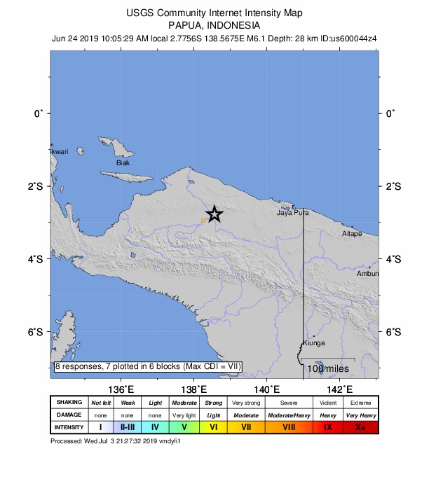
Community Internet Intensity Map - ShakeMap
VImmi 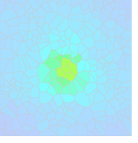
Estimated Intensity Map - PAGER
GREEN 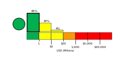
Estimated Economic Losses 
Estimated Fatalities Ground Failure - Landslide Estimate
Little or no area affected
Little or no population exposed
- Liquefaction Estimate
Limited area affected
Little or no population exposed
Origin - Review Status
- REVIEWED
- Magnitude
- 6.1 mww
- Depth
- 28.0 km
- Time
- 2019-06-24 01:05:29 UTC
Moment Tensor Fault Plane Solution Tsunami 
U.S. Tsunami Warning System To view any current tsunami advisories for this and other events please visit https://www.tsunami.gov.
View Nearby Seismicity - Time Range

± Three Weeks - Search Radius

250.0 km - Magnitude Range

≥ 3.0