
- 2018-11-19 20:18:42 (UTC)
- 32.207°N 115.254°W
- 11.0 km depth
Interactive Map 
Regional Information Felt Report - Tell Us! 000514Responses Contribute to citizen science. Please tell us about your experience.
- Did You Feel It?
VImmi 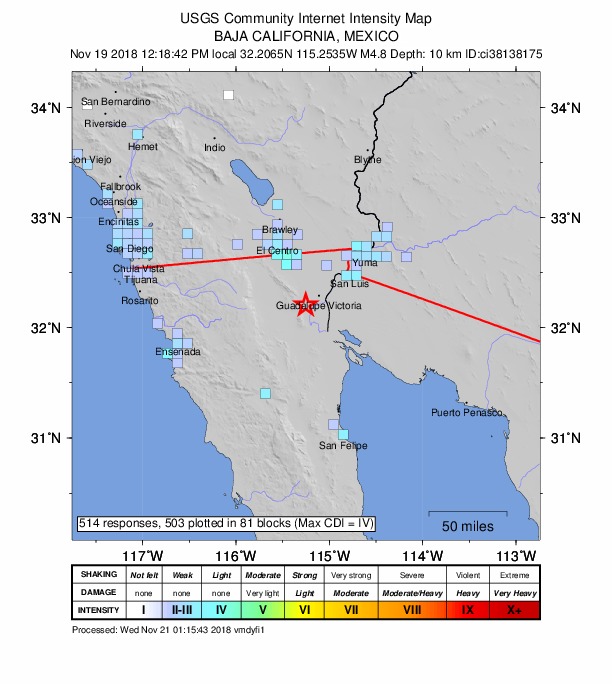
Community Internet Intensity Map - ShakeMap
VIImmi 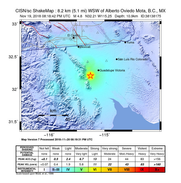
Estimated Intensity Map - PAGER
GREEN 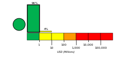
Estimated Economic Losses 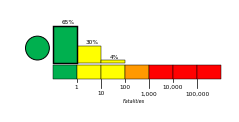
Estimated Fatalities Origin - Review Status
- REVIEWED
- Magnitude
- 4.8 mw
- Depth
- 11.0 km
- Time
- 2018-11-19 20:18:42 UTC
Moment Tensor Fault Plane Solution Tsunami 
U.S. Tsunami Warning System To view any current tsunami advisories for this and other events please visit https://www.tsunami.gov.
View Nearby Seismicity - Time Range

± Three Weeks - Search Radius

250.0 km - Magnitude Range

≥ 1.0