M 6.2 - 94km SW of Kokopo, Papua New Guinea
- 2018-10-10 22:00:35 (UTC)
- 4.957°S 151.668°E
- 124.3 km depth
Interactive Map 
Regional Information Felt Report - Tell Us! 000000Responses Contribute to citizen science. Please tell us about your experience.
- Estimated Intensity
Vmmi - Perceived Shaking
- Moderate
- Potential Damage
- Very light
- PAGER
GREEN 
Estimated Economic Losses 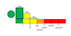
Estimated Fatalities Ground Failure - Landslides
Little or no area affected
Little or no population exposed
- Liquefaction
Little or no area affected
Little or no population exposed
Origin - Review Status
- REVIEWED
- Magnitude
- 6.2 mww
- Depth
- 124.3 km
- Time
- 2018-10-10 22:00:35 UTC
Moment Tensor Fault Plane Solution Tsunami 
U.S. Tsunami Warning System To view any current tsunami advisories for this and other events please visit https://www.tsunami.gov.
View Nearby Seismicity - Time Range

± Three Weeks - Search Radius

250.0 km - Magnitude Range

≥ 3.0