

Crustal Deformation Observed by Synthetic Aperture Radar (SAR)
Released: Mar. 1, 2018, Japanese version of this page
Summary
A large earthquake (Mw 7.5, USGS) occurred in
Papua New Guinea on February 25, 2018 (UTC). To measure the crustal
deformation caused by this earthquake, we applied interferometric
analysis using ALOS-2/PALSAR-2 data.
Results obtained from the data analysis are summarized as follows.
* Note that the result is possibly updated with further elaborated analyses.
Results obtained from the data analysis are summarized as follows.
- Significant crustal deformation has been detected in an area with the length of ~170 km in NW-SE direction, including the epicenter, consistent with aftershock locations (USGS).
- The largest displacement has been observed around Lake Kutubu, ~70km ESE of the epicenter, with the amount of > 70 cm toward the satellite (uplift and/or westward).
- The observed displacement pattern is consistent with a focal mechanism estimated from seismic waves.
* Note that the result is possibly updated with further elaborated analyses.
SAR Interferograms
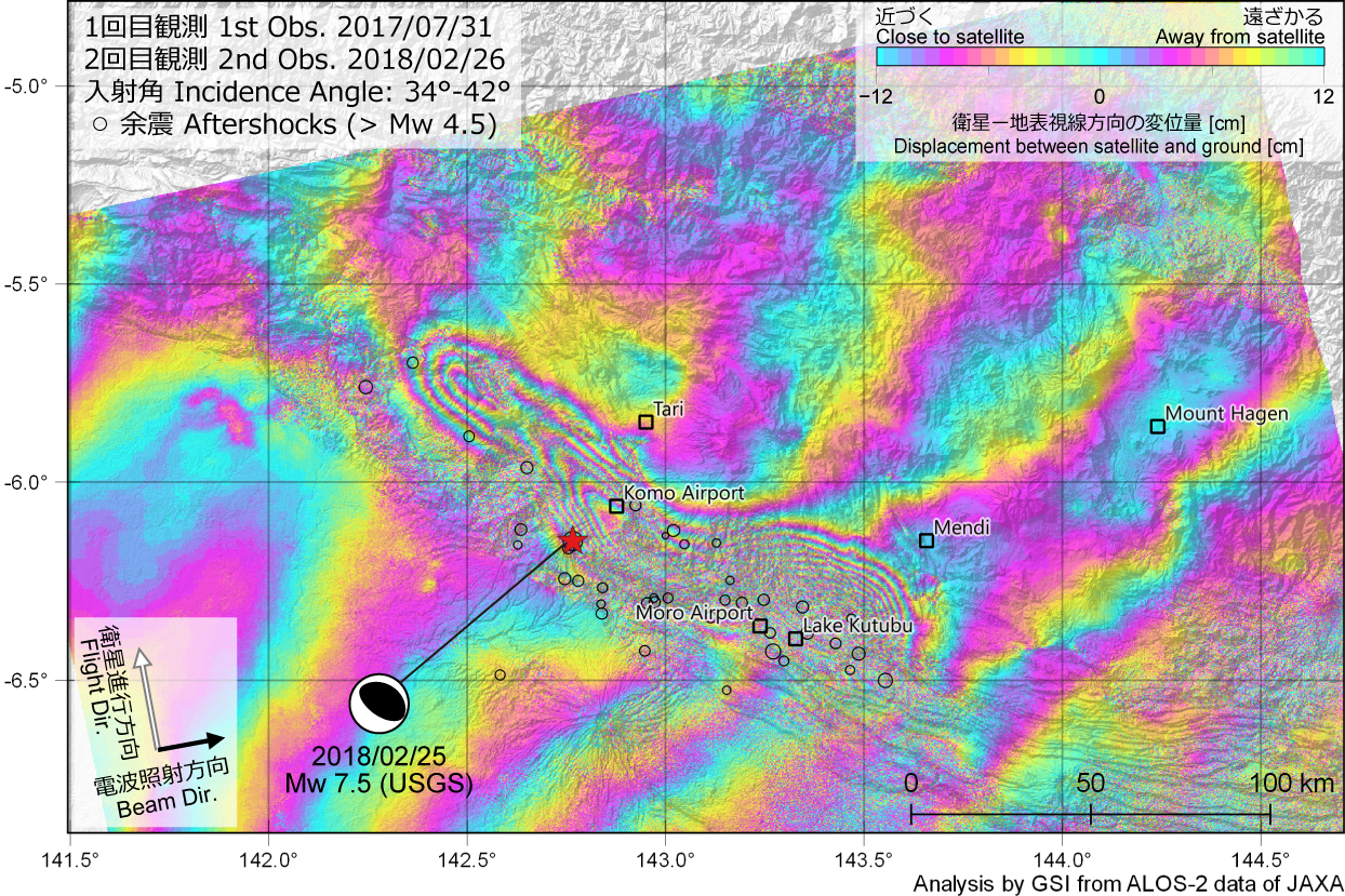
Fig.1 Ascending SAR interferogram [PNG: 2.0MB]
*Note that this result may be affected by ionospheric noises.
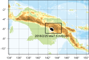
Area of interest
| Fig. # |
Date | Time (UTC) |
Flight Dir. |
Beam Dir. |
Obs. Mode*1 |
Incidence Angle (around epicenter) |
Bperp | KMZ |
|---|---|---|---|---|---|---|---|---|
| 1 | 2017/07/31 2018/02/26 |
14:46 | Asc. | Right | W-W | 34°-42° | +75 m | 3.8MB |
*1 W: ScanSAR (Normal)
(cf. ALOS-2 Project / PALSAR-2 (JAXA))
Analysis by GSI from ALOS-2 data of JAXA.
These results were obtained through the activity of the SAR analysis working group of the Coordinating Committee for Earthquake Prediction.
The 2018 Papua New Guinea Earthquake
| Date-Time | February 25, 2018, 17:44 (UTC) |
|---|---|
| Hypocenter Location |
6.149°N, 142.766°E, Depth: 35.0 km (USGS, as of March 1, 2018) |
| Magnitude | Mw=7.5 (USGS, as of March 1, 2018) |
Satellite
ALOS-2 (Advanced Land Observing Satellite 2) launched by Japan Aerospace Exploration Agency on May 24, 2014
Copyrights and Credits
Copyright. Geospatial Information Authority of Japan. ALL RIGHTS RESERVED.
We welcome links from your website to this website. When using materials on this website, we ask that proper credit be given.
We welcome links from your website to this website. When using materials on this website, we ask that proper credit be given.
Contact
YARAI Hiroshi : Head of Division
MORISHITA Yu : Chief Researcher
MORISHITA Yu : Chief Researcher
