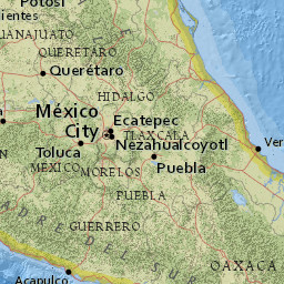
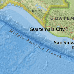
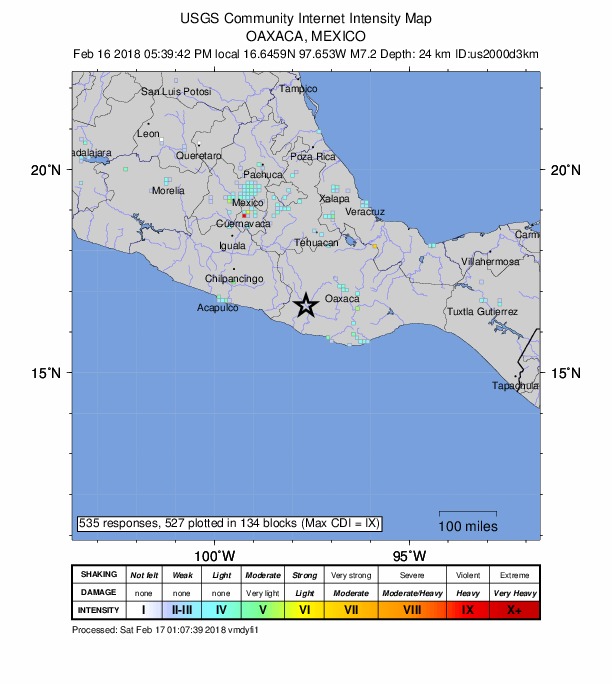
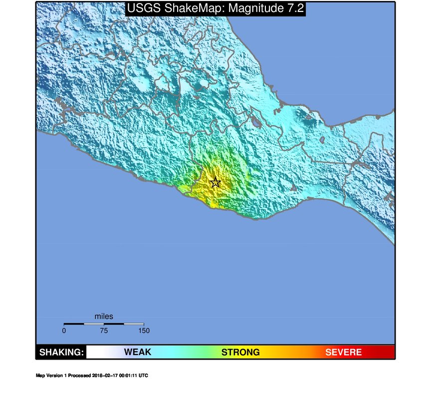
The February 16, 2018, M 7.2 earthquake in Oaxaca, Mexico, occurred as a
result of shallow thrust faulting on or near the plate boundary between
the Cocos and North America plates. The depth and focal mechanism
solutions of the event are consistent with its occurrence on the
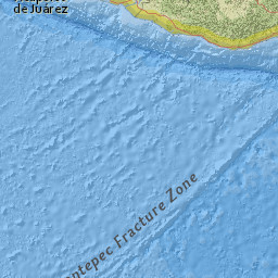
subduction zone interface between these plates, approximately 90 km
northeast of the Middle America Trench, where the Cocos plate begins its
descent into the mantle beneath Mexico. In the region of this
earthquake, the Cocos plate moves approximately northeastward at a rate
of 60 mm/yr.
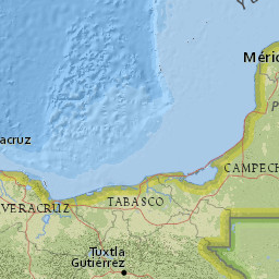
Historically, several significant earthquakes have occurred along the
southern coast of Mexico. In 1932, a M 8.4 thrust earthquake struck in
the region of Jalisco, several hundred kilometers to the northwest of
the February 16th event. On October 9, 1995, a M 8.0 earthquake struck
in the Colima-Jalisco region, resulting in at least 49 fatalities and
leaving 1,000 people homeless. The deadliest nearby earthquake occurred
on September 19, 1985, in the Michoacan region 500 km to the northwest
of the February 16th event. This M 8.0 earthquake resulted in at least
9,500 fatalities, injured about 30,000 people, and left 100,000 people
homeless. In 2003, a M 7.6 earthquake in Colima, Mexico, 680 km to the
northwest of the March 20th event, resulted in 29 fatalities, destroyed
more than 2,000 homes and left more than 10,000 people homeless. In
March 2012, a M 7.4 earthquake 60 km to the northwest of the February
16, 2018 event killed 2 and injured 11 in the Oaxaca region. The
hypocenter of the September 8th, 2017, M 8.2 earthquake offshore Chiapas
is located 440 km southwest of today’s earthquake. That event caused At
least 78 fatalities and 250 injuries in Oaxaca, and a further 16 deaths
in Chiapas. Eleven days later, a M 7.1 earthquake struck closer to
Mexico City, 230 km northeast of today’s earthquake, resulting in over
300 fatalities and significant damage in Mexico City and the surrounding
region.


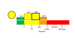
 Estimated Fatalities