
M6.2 - Prince Edward Islands region 2014-11-17 16:52:46 UTC

 Google Earth KML
Summary
General


.jpg)
.jpg)
.jpg)
.jpg)


.png)
.png)
.png)
.png)


Depth: 9.4km (5.8mi)
Event Time
- 2014-11-17 16:52:46 UTC
- 2014-11-17 18:52:46 UTC+02:00 at epicenter
- 2014-11-17 08:52:46 UTC-08:00 system time
Location
46.392°S 33.794°E depth=9.4km (5.9mi)
Nearby Cities
- 307km (191mi) W of Marion Island, Prince Edward Islands
- 1537km (955mi) SSE of Port Alfred, South Africa
- 1550km (963mi) SSE of Port Elizabeth, South Africa
- 1562km (971mi) SSE of Jeffrey's Bay, South Africa
- 1973km (1226mi) SSE of Maseru, Lesotho
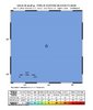
ShakeMap
Instrumental Intensity

PGA (%g)

PGV (cm/s)
PSA 0.3s (%g)
PSA 1.0s (%g)
PSA 3.0s (%g)
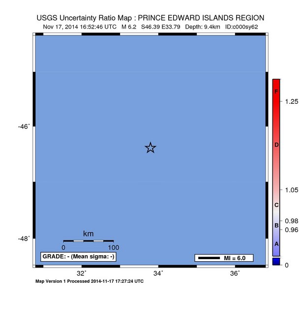
Uncertainty
Station List
Did You Feel It? Tell Us!
Tell Us!
Did you feel this earthquake? Tell Us!
Intensity Maps

Scientific
Summary
Preferred Location Parameters
| Parameter | Value | Uncertainty |
|---|---|---|
| Magnitude | 6.2 mwb | ± 0.05 |
| Location | 46.392°S, 33.794°E | Not Specified |
| Depth | 9.4 km | ± 2.6 km |
| Number of Stations Used | Not Specified | |
| Number of Phases Used | 118 | |
| Minimum Distance | 1388.6 km (12.47°) | |
| Travel Time Residual | 0.80 sec | |
| Azimuthal Gap | 19° | |
| Review Status | MANUAL | |
| Event ID | usc000sy62 |
Moment Tensor
US Mwb
Contributed Solutions
Seismic Network Preferred Location & Magnitude
Select a contributor to view their contributed data.
| Contributor | Event ID | Time | Magnitude | Latitude | Longitude | Depth | Status |
|---|---|---|---|---|---|---|---|
| us | usc000sy62 | 16:52:46 | 6.2 mwb | 46.392°S | 33.794°E | 9.4 km | MANUAL |
Event ID: usc000sy62
Data shown in the tables below and to the right are the preferred earthquake source parameters from the seismic network highlighted above. The authoritative earthquake location & magnitude is always 1st in the list of contributing networks. Clicking on a different earthquake solution will result in a change in the listed source parameters. Each contribution may include multiple estimates of magnitude and/or other source parameters. The preferred magnitude and magnitude type for the currently selected solution will be displayed in the “Selected Network Solution” table to the right.
Each contribution may also include corresponding station arrival time and magnitude observations, which were used to compute the earthquake source parameters. Not all seismic networks provide a full suite of observations or earthquake source parameters.
Selected Network Solution
| Parameter | Value | Uncertainty |
|---|---|---|
| Magnitude | 6.2 mwb | ± 0.054 |
| Location | 46.392°S, 33.794°E | ± undefined km |
| Depth | 9.43 km | Not Specified |
| Origin Time (UTC) | 2014-11-17 16:52:46.790 | |
| Number of Stations Used | Not Specified | |
| Number of Phases Used | 118 | |
| Minimum Distance | 1388.6 km (12.47°) | |
| Travel Time Residual | 0.80 sec | |
| Azimuthal Gap | 19° | |
| Review Status | MANUAL | |
| Event ID | usc000sy62 | |
| Data Source | us |
Seismic Network Magnitudes
Source | Type | Magnitude | Error | Number of Stations |
|---|---|---|---|---|
| us | mb | 5.8 | 0.049 | 157 |
| us | Ms_20 | 5.7 | 0.137 | 12 |
| us | Mwb | 6.2 | 0.054 | 33 |
+Phase Arrival Times
+Seismic Network Magnitude Parameters
Moment Tensor
Contributed Moment Tensors
| Type | Magnitude | Depth | NP1 | NP2 | Author | Catalog | Contributor | |
|---|---|---|---|---|---|---|---|---|
| Mwb | 6.2 | 3.0 km | 15°, 72°, 157° | 112°, 68°, 19° | us | us |
Body-wave Moment Tensor (Mwb)
Moment magnitude derived from a moment tensor inversion of long-period (~10 - 100 s) body-waves (P-, SH- ) at teleseismic distances (~30 to ~90 degrees).
- Moment
- 2.89e+18 N-m
- Magnitude
- 6.2
- Percent DC
- 37%
- Depth
- 3.0 km
- Updated
- 2014-11-17 17:27:00 UTC
- Author
- us
- Catalog
- Contributor
- us
- Code
- us_c000sy62_mwb
Principal Axes
| Axis | Value | Plunge | Azimuth |
|---|---|---|---|
| T | 3.268 | 28° | 332° |
| N | -1.029 | 61° | 158° |
| P | -2.239 | 2° | 64° |
Nodal Planes
| Plane | Strike | Dip | Rake |
|---|---|---|---|
| NP1 | 15° | 72° | 157° |
| NP2 | 112° | 68° | 19° |
The figure above shows a visual representation of the style of faulting (focal mechanism) derived from the estimated moment tensor. Shaded areas show quadrants of the focal sphere in which the P-wave first-motions are away from the source, and unshaded areas show quadrants in which the P-wave first-motions are toward the source. The dots represent the axis of maximum compressional strain (in black, called the "P-axis") and the axis of maximum extensional strain (in white, called the "T-axis") resulting from the earthquake.
Additional Content
Earthquake XML (Quakeml)
Downloads
All Downloads
| Product | Title | Links | ID |
|---|---|---|---|
| dyfi (Preferred) (US) | DYFI City Map | usc000sy62 | |
| moment-tensor (Preferred) (US) | Earthquake XML (Quakeml) | usc000sy62 | |
| origin (Preferred) (US) | Earthquake XML (Quakeml) | usc000sy62 | |
| phase-data (Preferred) (US) | Earthquake XML (Quakeml) | usc000sy62 | |
| shakemap (Preferred) (US) | XML Grids | usc000sy62 | |
| shakemap (Preferred) (US) | Rock Grid | usc000sy62 | |
| shakemap (Preferred) (US) | Uncertainty Grid | usc000sy62 | |
| shakemap (Preferred) (US) | Text Grids | usc000sy62 | |
| shakemap (Preferred) (US) | KML File | usc000sy62 | |
| shakemap (Preferred) (US) | Event KMZ File | usc000sy62 | |
| shakemap (Preferred) (US) | Epicenter KMZ File | usc000sy62 | |
| shakemap (Preferred) (US) | Intensity Overlay KMZ File | usc000sy62 | |
| shakemap (Preferred) (US) | Intensity Polygons KMZ | usc000sy62 | |
| shakemap (Preferred) (US) | GIS Files | usc000sy62 | |
| shakemap (Preferred) (US) | HAZUS Data | usc000sy62 | |
| shakemap (Preferred) (US) | ESRI Raster Files | usc000sy62 | |
| shakemap (Preferred) (US) | Station Lists | usc000sy62 | |
| shakemap (Preferred) (US) | Metadata | usc000sy62 | |
| shakemap (Preferred) (US) | Supplemental Information | usc000sy62 | |
| shakemap (Preferred) (US) | TV Info Sheet | usc000sy62 | |
| shakemap (Preferred) (US) | Intensity Map | usc000sy62 | |
| shakemap (Preferred) (US) | PGA Map | usc000sy62 | |
| shakemap (Preferred) (US) | PGV Map | usc000sy62 | |
| shakemap (Preferred) (US) | PSA03 Map | usc000sy62 | |
| shakemap (Preferred) (US) | PSA10 Map | usc000sy62 | |
| shakemap (Preferred) (US) | PSA30 Map | usc000sy62 | |
| shakemap (Preferred) (US) | TV Map | usc000sy62 | |
| shakemap (Preferred) (US) | Bare TV Map | usc000sy62 | |
| shakemap (Preferred) (US) | Uncertainty Map | usc000sy62 | |
| shakemap (Preferred) (US) | Intensity Contours | usc000sy62 | |
| shakemap (Preferred) (US) | PGA Contours | usc000sy62 | |
| shakemap (Preferred) (US) | PGV Contours | usc000sy62 | |
| shakemap (Preferred) (US) | PSA03 Contours | usc000sy62 | |
| shakemap (Preferred) (US) | PSA10 Contours | usc000sy62 | |
| shakemap (Preferred) (US) | PSA30 Contours | usc000sy62 |
The use of EQXML formatted data is temporary. This data will be changing to QuakeML v1.2RC3 format.
