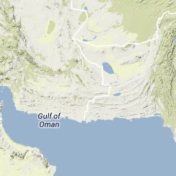
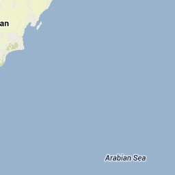
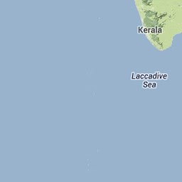
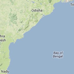
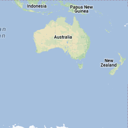
On 24 September a shallow M7.7 earthquake rattled Pakistan. At least 300 people died and thousands of houses, most of them adobe, collapsed in Balochistan Province. The quake was felt as far away as Muscat (Oman) and New Delhi (India). Epicentral intensities reached up to IX. The earthquake appeared to be a strike slip event. Soon the media reported on an amazing effect of the quake – in roughly 400 km distance a new island appeared few hundred meters off Gwadar.

USGS shake map (source: USGS)
USGS reports on a maximum fault slip of ~13 m of the EQ and ~150 km rupture length, which in my opinion is a relatively large amount for this magnitude.

Slip distribution (source: USGS)
The new island of course caught almost all the attention. It is reported to be “18 meters high, 30 meters wide and 76 meters long” (National Post). The island is named Zalzala Jazeera and will most likely soon be washed into the sea, but it already has its own wikipedia article. Almost everyone agrees that a mud volcano was activated or created by the earthquake – since the island is a few hundred kilometers away from the epicentre, coseismic uplift can be ruled out. Witnesses also report water bubbles containing an inflammable gas and dead fish, which supports the mud volcano theory.
Unusual observations
From the video the island appears rather solid and not very muddy. Other mud volcanos such as Lusi produce more liquid material. Even things like shear planes and cracks are visible on some photographs and people walk across it, so ‘mud’ might not be the right term.
Other things are strange, too. The location is far away from the earthquake epicentre and I guess it must be questioned if the seismic shock really triggered the rise of the island. Can liquefaction have played a role? Then I guess we would have seen liquefaction onshore in the Gwadar area, too. Plus, wouldn’t we have this phenomenon more often then? With closer but smaller earthquakes?
Mud volcanos as Earthquake Environmental Effects (EEEs)?
It is known that such mud volcanoes can be triggered by earthquakes. Similar effects have been observed after recent quakes in Pakistan in 1999 and 2010. Manga et al. (2009) provide a summary on earthquake triggering of mud volcanoes. In 1945, a M8.1 earthquake occurred at the Makran subduction zone off Pakistan and caused a tsunami that led to widespread devastation in the Gulf of Oman. It also created new islands. In a recent paper, we reviewed the impact of the 1945 Makran tsunami along the coastlines of the Arabian Sea (Northern Indian Ocean). From historic source we learned that “two islands appeared offshore, 180 miles west of Karachi as a consequence of the earthquake. Sondhi (1947) investigated the islands in January 1946. Here, a detailed account of four new islands in front of the Makran coast is given. These islands were composed of pale bluish grey clay as well as grey mudstone blocks, encrusted with marine organism. Sondhi (1947) describes the island in Gwadar west bay as 180*150 m in size with an oblong shape in a water depth of 7 m. The highest point was 7.6 m. The author refers to the second island (Hingol Island) as circular in shape, initially 180 m across and 7 m high. Gas eruptions were noticed in the vicinity of the island. Two more islands appeared in the Ormara west bay, 16 km offshore. The western island was initially 6 – 9 m high and 1.2 km long, the eastern island 18 -30 m high and 1.5 – 2.5 km long. Gas eruptions close to the islands were noticed. Sondhi(1947) further reports that a spectacular great fifi re, “thousands of feet high”, was caused by ignition of large volume of gas near Hinglaj. Pasni and Ormara were completely destroyed, Gwadar badly shaken (Sondhi 1947).” (Hoffmann et al., 2013). The 1945 islands look pretty much like our 2013 one:

In 1945, an island was created following a M8.1 earthquake – looks pretty much like the recent example. (Image source: RAF)

The island created by the 1945 M8.1 Makran Earthquake. Note the structural pattern. This doesn’tlook like mud at all. (Source: RAF)
So, earthquake triggering of mud volcanoes might be categorized as an earthquake environmental effect in the future, but further research is needed:
- Is there a clear distance-intensity/magnitude relationship?
- Is this a regional phenomenon only? We only know of EQ triggered mud volcanoes in areas where mud volcanoes have been known before. This might work for Azerbaijan and Pakistan, but likely not for Ohio…
- Does the size of the mud volcano correlate with earthquake magnitude, peak ground acceleration (PGA), shaking duration etc.?
- Does a sedimentological record of mud volcanoes allow to conclude on paleo-earthquakes?
Until now we have no news about other EEEs like primary surface ruptures, hydrological anomalies or other effects, but I am sure a local survey would be successful. Until then I’ll follow the news and see how the island is washed back into the sea.
References
- Hoffmann, G., Rupprechter, M., Al Balushi, N., Grützner, C. & Reicherter, K. 2013: The impact of the 1945 Makran tsunami along the coastlines of the Arabian Sea (Northern Indian Ocean) – a review. Zeitschrift für Geomorphologie. DOI:10.1127/0372-8854/2013/S-00134
- Manga, M., Brumm, M. & Rudolph, M.L. 2009. Earthquake triggering of mud volcanoes. Marine and Petroleum Geology 26, 1785-1798.
- Snead, R.E. 1964. Active Mud Volcanoes of Baluchistan, West Pakistan. Geographical Review 54-4, 546-560.
- Sondhi, V. P. 1947: The makran earthquake, 28th November 1945, The birth of new islands. Ind. Minerals 1: 147-154.


, Aachen/Germany")