- 2007-11-16 03:13:00 (UTC)
- 2.312°S 77.838°W
- 122.9 km depth
Interactive Map 
Regional Information Felt Report - Tell Us! 000171Responses Contribute to citizen science. Please tell us about your experience.
- Did You Feel It?
VIImmi 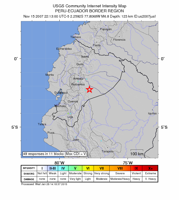
Community Internet Intensity Map - ShakeMap
VImmi 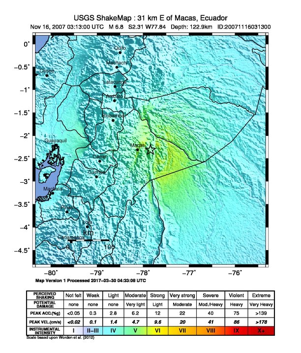
Estimated Intensity Map Origin - Review Status
- REVIEWED
- Magnitude
- 6.8 mwc
- Depth
- 122.9 km
- Time
- 2007-11-16 03:13:00 UTC
Moment Tensor Fault Plane Solution View Nearby Seismicity - Time Range

± Three Weeks - Search Radius

250.0 km - Magnitude Range

≥ 3.0